Article

Failure and Collapse of Ancient Agricultural Stone Terraces: On-Site Effects on Soil and Vegetation

1
Dead Sea and Arava Science Center, Masada 86900, Israel
2
Soil Erosion Research Station, Ministry of Agriculture and Rural Development, Bet Dagan 50250, Israel
*
Author to whom correspondence should be addressed.
Water 2018, 10(10), 1400; https://doi.org/10.3390/w10101400
Submission received: 26 August 2018 / Revised: 30 September 2018 / Accepted: 6 October 2018 / Published: 9 October 2018
(This article belongs to the Special Issue Ecohydrologic Feedbacks between Vegetation, Soil, and Climate)

Abstract

:
Ancient agricultural stone terraces, dated to the Roman and Byzantine ages, are prevalent across the Negev drylands of Southern Israel. The goal of these structures was to reduce hydrological connectivity by harvesting water runoff and controlling soil erosion, thus allowing cultivation of cereals. Land abandonment and the lack of maintenance have led to the failure and collapse of many of these stone terraces. The objective of this study was to assess the effect of failure and collapse of terraces on the on-site (on-field) geo-ecosystem functioning, as determined by vegetation cover and soil quality parameters. This was achieved by studying vegetal and soil properties in shrubby vegetation patches and inter-shrub spaces of intact-terrace plots and collapsed-terrace plots, as well as in the surrounding ‘natural’ lands. Mean cover of both shrubby and herbaceous vegetation was highest in intact terraces, intermediate in ‘natural’ lands, and lowest in collapsed terraces. The overall soil quality followed the same trend as the vegetation cover. Additionally, this study shows that the anthropogenic impact on geo-ecosystem functioning can be either beneficial or detrimental. While well maintained stone terraces benefit the soil and vegetation, abandoned and unmaintained terraces may result in accelerated soil erosion and land degradation.

1. Introduction

Ancient agricultural stone terraces are widespread around the Mediterranean Basin [1]. While the terraces were installed over a wide range of historical periods, many have been dated to the Roman (63 BCE–324 CE) and Byzantine (324–638 CE) ages. The terraces were constructed by laying down stone lines on the surface of hillslopes or across the width of dry channel beds [2]. Over time, the gradual addition of stone layers—necessary to keep the stones’ upper rim above the aggrading field surface—has led to the formation of walls. Many times, these multilayer constructions were built with a cross-section staircase shape, which simultaneously provided the structure with greater strength and allowed gradual cascading of excess water, preventing undercutting and erosion [3]. Upon rainstorms and flood events, the terraces enable on-site retention of large amounts of runoff water. Over time, sediment trapping to a considerable thickness in a terrace’s upstream/upslope side allows pedogenic processes to take place. In channels, the terraces enable the stream’s gradient diminishing and bed widening [2], while in hillslopes, the terraces cause surface leveling [4]. Both in channels and hillslopes, the terraces enable the widening of agricultural plots [2]. Overall, the terraces reduce hydrological connectivity [4,5], with the resultant increase in the conservation of water and soil, and rise in agricultural productivity [6,7,8].
Several studies have revealed a wealth of Roman and Byzantine runoff harvesting agricultural systems across the Negev drylands. For example, Bruins [6] reported the occurrence of thousands of agricultural stone terraces across the Negev, of which most are in the arid part of the region. Ore and Bruins [3] found that compared to non-modified stream channels, which have experienced erosion and desertification, the terraced channels have faced soil aggradation and buildup. Wieler et al. [9], found strong relations between landforms that are defined with a high runoff coefficient and ancient runoff harvesting systems located next to them.
Agricultural land abandonment has been extensively reported in different parts of the world. Overall, the abandonment of such lands is expected to improve geo-ecosystem functioning because soil is no longer disturbed by tillage. Over time, the better soil structure improves hydraulic conductivity and water holding capacity, allowing the restoration of native vegetation in the former agricultural lands [5]. Furthermore, abandonment of agricultural lands has been reported to increase the sequestration of organic carbon in soil, resulting in improved soil quality [10]. Yet, it is also acknowledged that under certain conditions, abandonment of agricultural lands could impose adverse ecological impacts and risk the provision of ecosystem services, due to the decrease in heterogeneity of landscapes, loss of biodiversity [11], and the invasion of exotic plant species [12].
Across the Negev drylands, the agricultural runoff harvesting systems were abandoned in the 7th century CE, upon the cease in effectiveness of the Byzantine rule across the region. Measurements during the second half of the 20th century revealed that the mean erosion rate across the region was 3.6 mm century−1 (54 Mg km−2 year−1) in small watersheds, and 4.6 mm century−1 (70 Mg km−2 year−1) in large watersheds, demonstrating tolerable rates of soil loss. At the same time, in large watersheds with gully incision and headcutting processes, the mean erosion rate was reported to rise to 7.6–12.6 mm century−1 (115–180 Mg km−2 year−1), exemplifying the importance of well-functioning runoff control means [13]. Indeed, the abandonment of stone-terraced agricultural lands might have a detrimental impact on the on-site conservation of water and soil. This is because maintenance and repairing of terraces has ceased [14,15,16]. Such adverse impacts were reported for abandoned terraced fields in the Peruvian Andes [17], Northern and Southeast Spain [5,18], Northwest Crete [19], Northern, Central, and Southern Italy [20,21], and Southern Israel [22]. The focus of these studies was to determine the impact of terrace collapse on surface processes of overland water flow and soil erosion on multiple spatial scales. However, these studies only scantly investigated the on-site impact on geo-ecosystem functioning, as determined by site-specific key properties of soil and vegetation.
The objective of this study was to assess the on-site (on-field) impact of failure and the collapse of stone terraces on the geo-ecosystem functioning of ancient, terraced agricultural lands in the hinterland of the Roman/Byzantine city of Avdat, in the arid Negev of Southern Israel. This was investigated by studying vegetation cover and key soil properties in ancient agricultural plots with collapsed terraces, when compared to plots with intact terraces, as well as in control, or ‘natural’, plots. The study hypothesis was that terracing improves geo-ecosystem functioning in this water-limited environment. However, it was also hypothesized that geo-ecosystem functioning of collapsed-terrace plots is degraded, even compared with that of surrounding ‘natural’ lands.

2. Materials and Methods

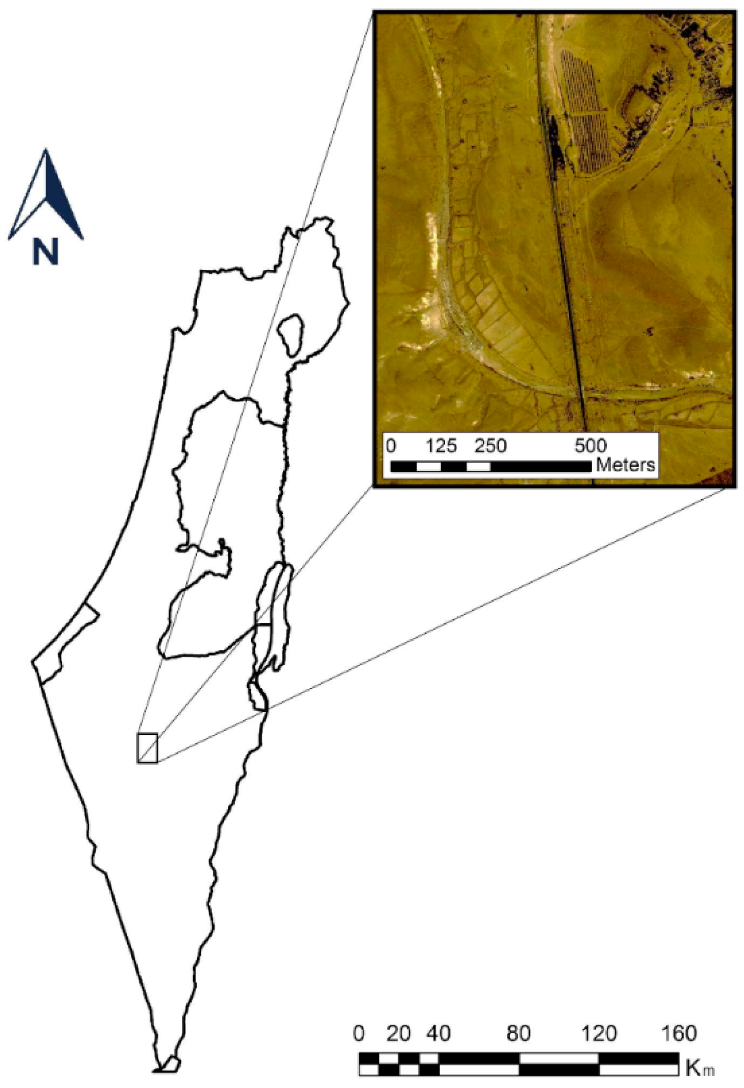
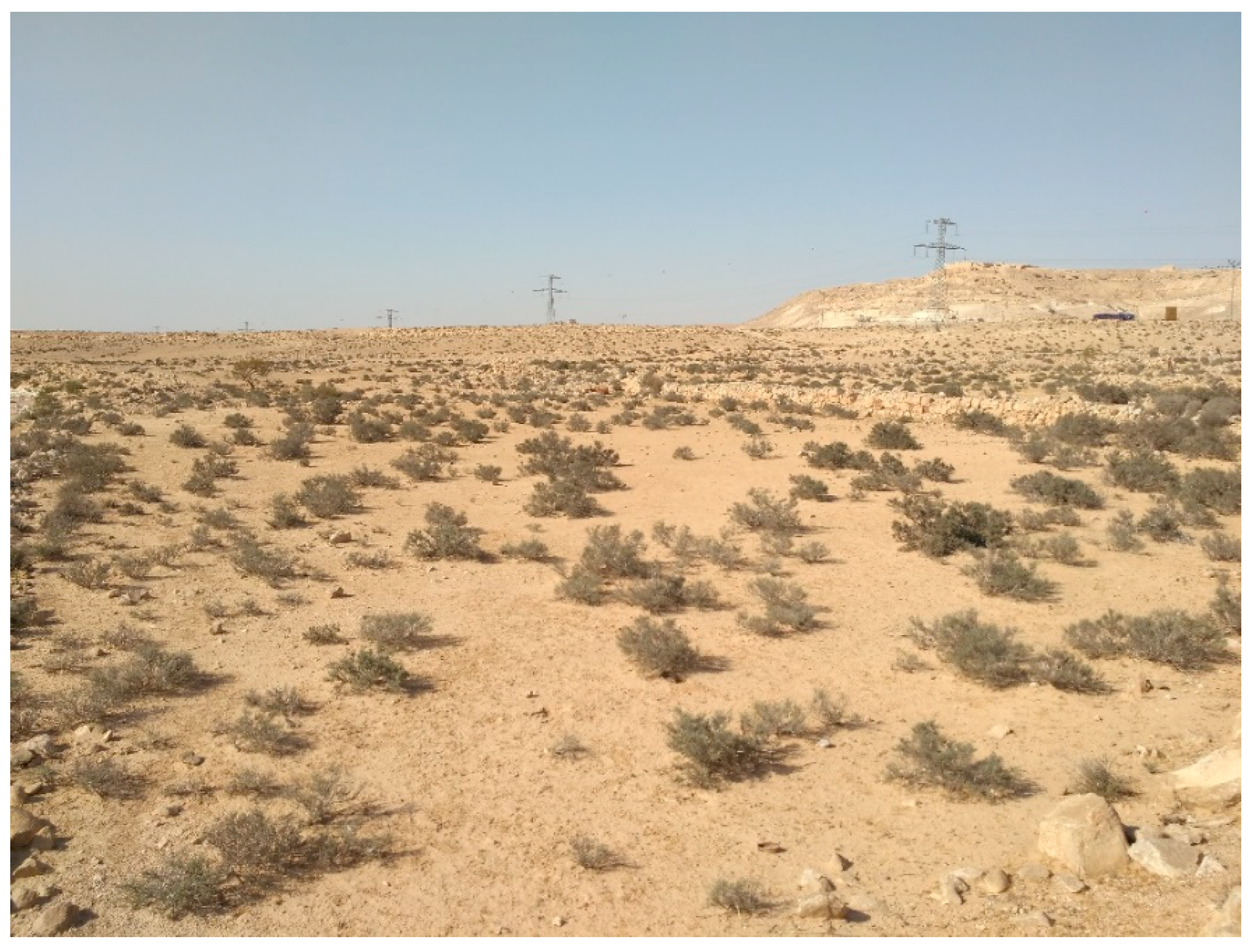
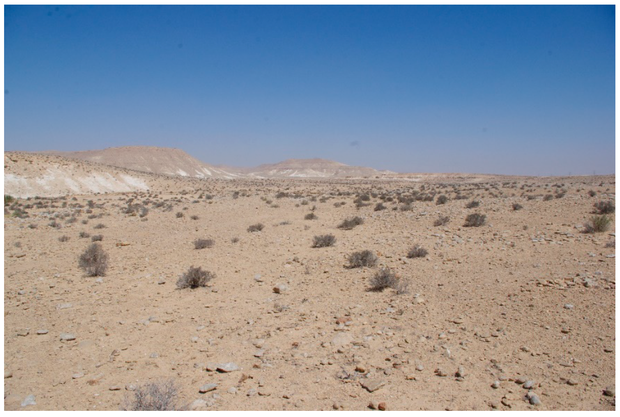
2.1. Regional Settings

The study site, located in the arid Central Negev, is in the hinterland of Avdat (30.78° N, 34.76° E, 540 m.a.s.l.: Figure 1), an ancient Roman/Byzantine city. The prevailing lithology is the Avedat Group’s Matred Formation [23], as well as Nezer Formation of Late Turonian Age, which is characterized by well-bedded lithographic limestone and minor chalk layers. The natural jointing pattern and thickness of the hard micritic limestone layers make the Nezer Formation stones suitable for construction. Additionally, Turanian rocks of the Shivta Formation, consisting of poorly bedded calcarenitic limestone, are exposed along the lower part of the hillslopes [2]. The dominant topography is rolling hills and wide valleys. The soil is classified as Calcic xerosol, with a loamy texture. The region’s climate is arid, with mean daily temperatures of 9 °C and 24 °C in the coldest (January) and warmest (July) months, respectively, and mean relative humidity ranging between 58% and 43%, respectively [24]. The mean annual precipitation is ~90 mm, with high inter-annual variability. The mean potential evapotranspiration is ~1750 mm annually [25]. Across the Avdat site, ancient agricultural terraced fields exist in a ~25 km2 gross land area (including inter-terraced land spaces, ‘natural’ hillslopes, and dry riverbeds). The patchy vegetation cover on the hillslopes is composed of xerophytic subshrubs and chamaephytes, and a sparse cover of annual herbaceous plants. The dominant shrub species is Haloxylon scoparium Pomel.

2.2. Plot Delineation and Field Work

An aerial survey across the Avdat hinterlands revealed dozens of ancient terraced fields. The stone-made terraces are multilayered, forming agricultural plots of multiple sizes, usually ranging between 0.05 and 0.2 ha. While some of the stone terraces are entirely intact, others have partially failed or collapsed. Four blocks were delineated for the study, each containing three 30 × 30 m plots, one for each of the following land-uses: an agricultural plot with an undamaged stone terrace at its downslope edge (Figure 2), an agricultural plot with a partially collapsed stone terrace at its downslope edge (Figure 3), and an adjacent ‘natural’ plot (Figure 4). All plots were situated on the same geomorphic unit—i.e., on a backslope inclining between 3° and 5°. Distances between adjacent blocks were at least 100 m.
Mapping of plots was conducted at the peak of the growing season (March) in 2017. In each plot, the ground surface cover was mapped along three 20 m longitudinal transects. This was conducted using the line-point intercept method [26], at 25 cm intervals. The various types of surface cover mapped included shrubs (vitality and species), herbaceous vegetation, plant litter, rock fragments and their position (i.e., partially embedded in the soil or resting on the ground surface), exposed soil, and other. The number of transects (n) was: 3 transects × 3 plots × 4 blocks = 36.
Following mapping, soil depth was assessed in three randomly selected inter-shrub spots by drilling down to the underling rock layer in each plot (using a manual driller: Eijkelkamp©, the Netherlands). Then, for each plot, soil from a depth of 0–10 cm was sampled from three randomly selected shrubby patches and their adjacent inter-shrub spaces. Each sample included a ~300 mL bag, which was transferred to the laboratory for the analysis of a range of soil characteristics. To assess relative microbial abundance, additional soil samples were collected in sterile 50 mL tubes and kept in an ice chest. The number of soil samples (for each of these two sets) was: 3 samples × 2 microhabitats (shrubby patches and inter-shrub spaces) × 3 plots (land-uses) × 4 blocks = 72.
In March 2018, additional soil samples were obtained for measuring mesofaunal abundance. From each plot, four samples were obtained: two from underneath a shrub canopy, and two from the inter-shrub spaces. The samples, 100 mL each, were taken from a depth of 10–20 cm. The number of samples taken was: 2 samples × 2 microhabitats × 3 plots × 4 blocks = 48.

2.3. Laboratory Analyses

The soil samples were air-dried and analyzed in the laboratory. The characteristics examined included hygroscopic moisture content [27], pH [28], calcium carbonate content (with a calcimeter: [29]), and stable aggregate content (using an aggregate stability apparatus: Eijkelkamp®, Giesbeek, the Netherlands). The clay dispersion index was analyzed by placing a 3–5 mm soil aggregate in a plate with distilled water, and observing the rate of cloudiness (milkiness) after 10 and 120 min. The clay dispersion index was scored as follows: 0 for no cloudiness; 1 for slight cloudiness; 2 for moderate cloudiness; 3 for strong cloudiness; and 4 for complete cloudiness (modified from: [30]). Particulate organic matter content was analyzed by dispersing soil in sodium hexametaphosphate and sieving it through 2000 and 53 μm sieves [31]. Then, after the fumigation of the 53–2000 μm fraction with diluted hydrochloric acid [32], the organic matter content was determined using the loss-on-ignition method [33]. The results were then divided by 1.724 to calculate particulate organic carbon.
To determine relative microbial abundance, roots, stones, floral, and faunal materials were removed from the soil. The remaining sample was homogenized and stored at −80 °C for eight hours. Then, 0.6 g of soil was subjected to DNA extraction using DNeasy PowerSoil HTP 96 Kit (Qiagen©, Hilden, Germany). Upon extraction, the 16 ribosomal DNA subunit (16S rDNA) resembling of bacterial abundance was performed in triplicate with a 7500 real time polymerase chain reaction (qPCR: Applied Biosystems©, Foster City, CA, USA), using florescent dye (SYBR) as follows: 5 µL of DNA template, 10 µL of PerfeCta SYBR Green FastMix, Low ROX (Quanta BioSciences©, Beverly, MA, USA); 2 µL of 250 nM forward F341 (5′-CCT ACG GGA GGC AGC AG-3′) and reverse R519 (5′-GWA TTA CCG CKG CTG-3′) primers [34]; and 3 µL PCR free molecular grade water (Sigma©, Israel) as per the manufacture protocol (Quanta BioSciences©, Beverly, MA, USA). The soil samples’ 16S rDNA standard was used to quantify the number of fragments [34].
The soil mesofauna were extracted using a Berlese–Tullgren funnel, in which heat from a lamp caused the arthropods to escape and eventually fall into a solution of 75% alcohol and 25% glycerine (by volume) [35]. The mesofauna were identified by class for miriapods (Diplopoda, Chilopoda, Symphyla, and Pauropoda) and order for insects (Chelicerata and Crustacea). The specimens belonging to each taxon were then counted and separated into biological forms.

2.4. Statistical Analysis

The data were analyzed by the split-plot type Analysis of Variance (ANOVA), with the general linear model (GLM) procedure of the Statistical Analysis Software (SAS) [36]. For the ground surface cover and the rock fragment content of the soil, factors in the model included land-use (2 df) and block within land-use (8 df; error term for plot). For the soil characteristics, the analysis included land-use and block as the main plots, and micro-habitat as the sub-plot. Factors in this model were: land-use (2 df), block within land-use (8 df; error term for plot), micro-habitat (1 df), and the interaction between land-use × micro-habitat (2 df). Statistically significant interactions were subjected to further ANOVA with the SLICE command of PROC GLM. Separation of means was conducted using Tukey’s HSD at the 0.05 probability level. Pearson correlation coefficients were calculated to examine the correlations between each pair of variables. To calculate correlations of soil properties with mesofaunal abundance, data were bulked and then analyzed for the plot level.

3. Results and Discussion

3.1. Ground Surface Cover and Implications for Surface Processes

Vegetation productivity in drylands is related to the soil-water status [37]. Therefore, the significantly and almost tenfold higher value for mean cover by the predominant shrub species (H. scoparium) in intact-terrace plots, compared to collapsed-terrace plots (Table 1), is attributed to the effective harvest of runoff water in the former, compared to the leaking of runoff water through gaps in the plots’ downslope terraces in the latter. Furthermore, mean cover of this species was over twice as high in intact-terrace plots than in ‘natural’ lands. Additional shrub species occurred in ‘natural’ lands (Zygophyllum dumosum Boiss) and intact-terrace plots (Artemisia herba-alba Asso) only (Table 1), but these were scarce and not significantly affected by land-use. The mean total cover of shrubby vegetation in intact-terrace plots was twice as high as in ‘natural’ lands, and almost ten times higher than in collapsed-terrace plots (Table 1). Mean cover of dead shrubs was marginal in all three land-uses. To some extent, our results accord with García-Ruiz and Lana-Renault [38], who reviewed numerous studies from the Mediterranean region of Europe and found that terraced land abandonment had led to the encroachment of trees and shrubs. This effect was attributed to the deep profile of soil in the terraced lands, which provided improved habitat conditions for these plant life-forms. Yet, while in relatively moist regions (e.g., Mediterranean biomes) this process might result in a considerable expansion of woody vegetation, with over 60% cover [39] or even close to 100% cover of the abandoned agricultural plots [38], the extent of woody vegetation in dryer regions, such as the arid central Negev, is much moderate.
Regardless, the fourfold higher total shrub cover in the ‘natural’ lands compared to collapsed-terrace plots (Table 1), could be attributed to greater geodiversity in the latter. This was evidenced by the shallower soil and higher stoniness of ‘natural’ lands compared to collapsed-terrace plots. As recently shown for shrublands of the semi-arid northern Negev, these features of geodiversity increase the redistribution of soil-water, resulting in greater water availability for shrubs [40].
In addition to its direct effect on the ecosystem’s net primary productivity (NPP), shrubby vegetation regulates surface hydrology through several interrelated processes. The first of these is the combined effect of the shrub shoot (through interception: [41]) and root (through infiltration: [42]), which decreases the amount of water available for runoff generation. Second, the related geo-ecological processes of shrubby vegetation, which increases surface roughness and soil macro-porosity, and causes a decrease in runoff velocity and quantity [43]. Therefore, it is suggested that the comparatively high shrubby vegetation cover in the intact-terrace plots has generated a chain of positive feedbacks, which sustain and even improve geo-ecosystem functioning. This is consistent with Stavi et al. [44], who demonstrated the important geo-ecological roles played by shrubs, which sustain dryland functioning.
Moreover, it is proposed that in collapsed-terrace plots, the extremely sparse cover of shrubby vegetation does not play an effective role in restraining runoff generation, resulting in high velocity and quantity of overland water flow. Considering the topographic and pedogenic conditions, these processes could generate concentrated water flow, resulting in rill formation. This conforms with our field observations, revealing at least one rill (or mini gully) which broke through the downslope terrace in each of the collapsed-terrace plots.
Overall, herbaceous vegetation cover was low, but was nonetheless significantly affected by land-use, following the trend: intact-terrace plots > ‘natural’ lands > collapsed-terrace plots (with zero herbaceous vegetation cover in the latter). Somewhat similar to the effect shrubby vegetation has on hydrological processes, herbaceous vegetation was also reported to increase surface roughness and improve soil formation and structural stability, resulting in restrained overland water flow [45]. Furthermore, the mean cover of plant litter in intact-terrace plots was significantly and almost threefold greater than in ‘natural’ lands, and 25-fold greater than in collapsed-terrace plots. Plant litter has been known to stimulate microbial activity [46], which in turn increases macro-aggregate formation and stability [47], thus decreasing the formation of sealed mechanical crusts and reducing runoff generation.
The mean cover of rock fragments, whether partially embedded in the soil or resting on the ground surface, differed significantly between the three land-uses, and followed the trend: ‘natural’ lands > collapsed-terrace plots > intact-terrace plots. While partially embedded rock fragments increase the development of surface seal and thus increase the runoff ratio [48], resting rock fragments increase on-site water infiltration, lowering overland flow generation [49]. The similar cover percentage of the two types of rock fragments within each of the three land-uses, suggests that their overall impact on net surface processes (i.e., the combined effects of runoff and infiltration) at the plot-scale was not very prominent.

3.2. Land-Use and Terrace-State Effect

Despite the non-availability of soil-water for vegetation uptake at the hygroscopic level, this moisture level positively indicates the physical quality of soil [50]. Therefore, the mean hygroscopic soil-water content, which followed the trend: intact-terrace plots > collapsed-terrace plots > ‘natural’ lands (Table 2), could indicate that the overall soil conditions follow the same order. The better habitat conditions in the intact-terrace plots than those in the collapsed-terrace plots is in accordance with Arnáez et al. [4], who found that in Mediterranean areas, runoff coefficient from well-maintained terraced fields is 10–25%, as opposed to that from abandoned terraced fields, which stands at 20–40%.
This agrees with the soil depth, which was found to be 43.7 ± 2.7 cm in intact-terrace plots, 30.1 ± 2.5 cm in collapsed-terrace plots, and only 9.9 ± 1.0 cm in ‘natural’ lands. The very shallow soil layer in the ‘natural’ lands highlights the effectiveness of agricultural terracing in effectively increasing soil thickness. This accords with previous studies, which highlighted the thickening of sediment layer where terraces are in a good state [2,3], as opposed to the thinning of this layer where terraces are in bad shape [51]. Regardless, as shown in previous studies, the shallow soil layer in the ‘natural’ lands is attributed to the long-term combined effect of natural factors (cease in past deposition of wind-transported Saharan-originated loess after the Late Pleistocene: [52]) and historic-to-present anthropogenic misuse (overgrazing: [22]).
The effective harvest of runoff water is expected to increase leaching of calcium carbonate from the uppermost soil layer to deeper layers [53]. In this study, this was evidenced by 6% lower calcium carbonate content in the soil of intact-terrace plots compared to collapsed-terrace plots. At the same time, mean calcium carbonate content in ‘natural’ lands was 12% lower than in intact-terrace plots (Table 2), suggesting the accumulation of calcium carbonate in terraced lands. The slightly but significantly lower soil pH in intact-terrace plots compared to both collapsed-terrace plots and ‘natural’ lands (Table 2) indicates the potential of runoff harvesting terraces to mitigate soil alkalinity of calcareous soils, further emphasizing their effectiveness for improving soil quality.
The 54% greater mean aggregate stability in intact-terrace plots compared to collapsed-terrace plots indicates considerably higher physical soil quality, and lower susceptibility to erosional processes. Despite not being significantly different, mean aggregate stability in collapsed-terrace plots was 9% lower than in ‘natural’ lands, demonstrating the comparatively degraded state of the former. Regardless, the 41% greater mean aggregate stability in intact-terrace plots compared to ‘natural’ lands (Table 2), concurs with results obtained by Cerdà et al. [54], who reported for the Sierra de Enguera in Eastern Spain that stable aggregate content was much higher in soil of abandoned agricultural terraces than that in non-terraced and degraded lands. This finding also agrees with the clay dispersion index, which was ~20% smaller in the intact-terrace plots compared to both ‘natural’ lands and collapsed-terrace plots (Table 2). This index has been acknowledged to be inversely related with pools of organic carbon in soil [55], and therefore, consistent with this study’s results. At the same time, this effect could also be attributed to aggregate cementing by calcium carbonate, which prevents the dispersion of clays from their surface [56].
The mean content of particulate organic carbon was significantly affected by land-use and terrace state, and followed the trend: ‘natural’ lands > intact-terrace plots > collapsed-terrace plots. This organic carbon fraction is highly prone to the spatial redistribution by surface processes [57,58]. Therefore, the 15% lower content of particulate organic carbon in collapsed-terrace plots compared to intact-terrace plots is attributed to its loss through erosional processes. The positive and significant correlation between particulate organic carbon and both soil hygroscopic moisture (r = 0.70; p = 0.0001) and soil aggregate stability (r = 0.69; p = 0.0001), further demonstrate the positive effect of the former on overall soil quality.
To some extent, these results explain the terrace-state effect on the mean value of relative microbial abundance, which was 77% greater in the intact-terrace plots than in the collapsed-terrace plots, and indicate considerably better biological quality of soil in the former [59]. However, this, as well as the slightly (and non-significantly) greater mean relative microbial abundance under collapsed-terrace plots compared to ‘natural’ lands, do not accord with the trend of particulate organic carbon. Furthermore, the results obtained for particulate organic carbon do not accord with the opposite trend recorded for mesofaunal abundance, with the slightly (and non-significantly) greater mean value for collapsed-terrace plots than for intact-terrace plots (Table 2). This inconsistency is further demonstrated by the positive and significant correlation (r = 0.54; p = 0.0001) between hygroscopic soil moisture and mesofaunal abundance.

3.3. Micro-Habitat Effect

Mean values for soil hygroscopic moisture content were similar in the two microhabitats. However, mean values for aggregate stability and relative microbial abundance were twofold and one-and-a-half fold greater, respectively, in the shrubby patches than that in the inter-shrub spaces, and an opposite trend was recorded for the clay dispersion index (Table 3). The effect micro-habitat had on these soil characteristics was attributed to the continuous accumulation of organic residues under the canopy of shrubs, either through on-site defoliation [60], trapping of runoff-floated, or wind-transported organic residues [61]. This trend accorded with the data obtained on particulate organic carbon, which was 39% greater in the shrubby patches than in the inter-shrub spaces (Table 3).
In addition, our results revealed significantly lower mean soil pH values in the shrubby patches than that in the intershrub spaces (Table 3), concurring with other studies which showed that, due to weakly acidic functional groups such as carboxyl and phenol, organic matter acts as a pH buffer [62,63]. Also, the significantly and 51% greater mean relative microbial abundance, and over threefold greater mean mesofaunal abundance, in the shrubby patches compared to the intershrub spaces (Table 3), accord with previous studies, which showed that accumulation of organic residues under vegetation canopy stimulates microbial activity [46] and mesofaunal biomass [64]. Over time, these processes further improve soil structure formation and stability in the shrubby patches [47].
The effect of the interaction between land-use and microhabitat was not significant for most of the studied soil characteristics. However, two exceptions were recorded for this effect. One was the mean particulate organic carbon content, which followed the trend: intact-terrace plots × shrubby patches ≈ collapsed-terrace plots × shrubby patches ≈ ‘natural’ land × shrubby patches ≈ ‘natural’ land × inter-shrub spaces > intact-terrace plots × inter-shrub spaces > collapsed-terrace plots × inter-shrub spaces (Table 4). The substantial mean percentage cover of inter-shrub spaces (86–99%: Table 1) and the extremely low mean particulate organic carbon content in the last combination (39–58% lower than these in the other combinations), demonstrate the extreme state of degradation in the collapsed-terrace plots. The second exception was mean mesofaunal abundance, which followed the trend: collapsed-terrace plots × shrubby patches > intact-terrace plots × shrubby patches > ‘natural’ land × shrubby patches ≈ intact-terrace plots × inter-shrub spaces > collapsed-terrace plots × inter-shrub spaces ≈ ‘natural’ land × inter-shrub spaces (Table 4). Therefore, results of this interaction for the mesofaunal abundance do not fully accord with these of the particulate organic carbon.

3.4. Data Integration and General Implications

It is assumed that ‘natural’ lands have not existed in the eastern Mediterranean Basin for millennia, as open, uncultivated lands have been prone to grazing by livestock [65]. Also, it may be assumed that throughout history, some of the world’s communal or publicly owned grazing lands have been misused or overexploited, leading to the decline of pasture and gradual degradation of soil resources (see: [66]). Therefore, the state of the ‘natural’ lands in our study is presumed to be degraded compared to their full potential.
Our results show much greater NPP in intact-terrace plots than that in ‘natural’ lands. Additionally, despite some exceptions, overall soil quality in intact-terrace plots was generally better than in ‘natural’ lands. Therefore, the obtained results accord with the study hypothesis. Also, soil characteristics in the collapsed-terrace plots were generally degraded compared to that in the ‘natural’ lands. Furthermore, the fourfold greater NPP in ‘natural’ lands compared to that in collapsed-terrace plots demonstrates the extreme state of degradation of the latter land-use. Therefore, the results of this study show that the overall anthropogenic impact on geo-ecosystem functioning in dryland environments could be either beneficial or detrimental. Practically, the results suggest that while stone terraces are well maintained, they can improve geo-ecosystem functioning compared to ‘natural’ lands. However, once agricultural lands are abandoned, unmaintained stone terraces may accelerate soil erosion and land degradation processes. To some extent, our findings accord with Brandolini [20], who reported that crumbling terraces increase the frequency and magnitude of landslides and debris flows in the mountainous region of northern Italy. In addition to these processes, piping can also be associated with terrace collapse [4,38]. This is in accordance with Tarolli et al. [21], who reviewed the topic of terraced agricultural lands, and reported that their neglect often leads to processes of mass movement, such as landslides and slope failure. In a review study by García-Ruiz and Lana-Renault [38], it was emphasized that these processes are more frequent in concave hillslopes, and particularly in their lower parts, where water tends to accumulate and soil becomes saturated. Additionally, the same study stressed that in events where mass movement takes place, land restoration becomes impossible. This consists with Arnáez et al. [4], who found that the soil erosion rate for stone-terraced fields with gullies, pipes, or mass movement is two order of magnitude greater than that for fields with good-shaped terraces, being > 100 Mg ha−1 year−1 and ~ 1–3 Mg ha−1 year−1, respectively.
In addition to the adverse effect of non-regulated livestock grazing in the long run, the very low cover of herbaceous vegetation across the study region could also be attributed to the long-term drought scenario occurring since the turn of the 21st century [25]. According to climate forecasts, in the coming decades, the low-to-mid latitudes are going to experience an increase in the extent, duration, and frequency of droughts [67], along with an increase in the magnitude of devastating rainstorms [68], with resultant accelerated land degradation processes. It is emphasized that awareness of the maintenance of ancient stone terraces for contemporary runoff harvesting agriculture should be promoted to increase public actions on this issue. However, construction, maintenance, and repairing of stone terraces require considerable manpower investments [38]. Therefore, wherever possible, central authorities should support and subsidize these actions. This would be particularly relevant for degraded drylands in less developed regions that are inhabited with deprived populations suffering from poverty and malnutrition [69]. One way or another, the case-specific conditions of our study site, such as the combination of physical conditions, vegetation community, and long-term regime of livestock grazing, might be perceived as a limitation for fully applying its insights to other regions around the world. Therefore, additional studies are needed to verify the validity of results obtained in this study for other parts of the world, where the collapse and failure of ancient stone terraces has taken place.

4. Conclusions

Agricultural stone terraces, established during the Roman and Byzantine ages in extensive lands across the Negev drylands, were intended to conserve water and soil, thus enabling cereal cropping. Over time, however, agricultural land abandonment and lack of maintenance have led to the failure and collapse of many terraces. This study shows that vegetation cover and soil quality were generally greater in intact-terrace plots than that in the surrounding ‘natural’ lands. At the same time, these variables were generally degraded in collapsed-terrace plots compared to ‘natural’ lands. These results demonstrate the potential of the anthropogenic factor to either positively or negatively affecting geo-ecosystem functioning in dryland environments.
Forecasted climatic changes, particularly in the low-to-mid latitudes, with the anticipated aggravating droughts on the one hand, and increase in extreme rainstorms on the other, highlight the importance of adequate maintenance of ancient runoff harvesting systems. Alongside controlling soil erosion and reversing land degradation processes, this would increase the extent of agricultural lands at present. Moreover, if these systems are neglected, accelerated land degradation processes can be expected.

Author Contributions

I.S., T.R., E.A., and E.G. designed the study, collected the vegetation data, and analyzed it, reviewed literature, and drafted the manuscript. I.S. analyzed the soil samples and conducted the statistical analysis. A.A.-A. analyzed the soil microbial community. T.R. extracted and analyzed the soil mesofauna.

Funding

The study was funded by the Israel Science Foundation (ISF) grant number 964/14.

Acknowledgments

The authors are grateful to two anonymous reviewers, whose comments allowed for the considerable improvement of the manuscript.

Conflicts of Interest

The authors declare no conflict of interest. The founding sponsors had no role in the design of the study, in the collection, analyses, or interpretation of data, in the writing of the manuscript, nor in the decision to publish the results.

References

  1. Vetter, T.; Reiger, A.K.; Nicolay, A. Disconnected runoff contributing areas: Evidence provided by ancient watershed management systems in arid north-eastern Marmarica (NW-Egypt). Geomorphology 2014, 212, 41–57. [Google Scholar] [CrossRef]
  2. Bruins, H.J. Desert Environment and Agriculture in the Central Negev and Kasech-Barnea during Historical Times. 1986. Available online: http://edepot.wur.nl/201460 (accessed on 8 October 2018).
  3. Ore, G.; Bruins, H.J. Design features of ancient agricultural terrace walls in the Negev desert: Human-made geodiversity. Land Degrad. Dev. 2012, 23, 409–418. [Google Scholar] [CrossRef]
  4. Arnáez, J.; Lana-Renault, N.; Lasanta, T.; Ruiz-Flaño, P.; Castroviejo, J. Effects of farming terraces on hydrological and geomorphological processes. A review. Catena 2015, 128, 122–134. [Google Scholar] [CrossRef] [Green Version]
  5. Lana-Renault, N.; López-Vicente, M.; Oranjuren, R.; Ángel Llorente, J.; Ruiz-Flaño, P.; Arnáez, J. Changes in hydrological connectivity due to vegetation recovery and wall collapse in abandoned terraced fields. Geophys. Res. Abstr. 2017, 19, 6878. [Google Scholar]
  6. Bruins, H.J. Ancient desert agriculture in the Negev and climate-zone boundary changes during average, wet and drought years. J. Arid. Environ. 2012, 86, 28–42. [Google Scholar] [CrossRef]
  7. Haiman, M. Dating the agricultural terraces in the southern Levantine deserts—The spatial-contextual argument. J. Arid. Environ. 2012, 86, 43–49. [Google Scholar] [CrossRef]
  8. Wei, W.; Chen, D.; Wang, L.; Daryanto, S.; Chen, L.; Yu, Y.; Lu, Y.; Sun, G.; Feng, T. Global synthesis of the classifications, distributions, benefits and issues of terracing. Earth Sci. Rev. 2016, 159, 388–403. [Google Scholar] [CrossRef] [Green Version]
  9. Wieler, N.; Avni, Y.; Rosensaft, M.; Olsvig-Whittaker, L. Variations in hillslope runoff as detected using geological strata coupled with vegetation patterns–Implications on spatially distributed desert runoff agriculture. J. Landsc. Ecol. 2017, 10, 189–212. [Google Scholar]
  10. Wertebach, T.M.; Holzel, N.; Kampf, I.; Yurtaev, A.; Tupitsin, S.; Kiehl, K.; Kamp, J.; Kleinebecker, T. Soil carbon sequestration due to post-Soviet cropland abandonment: Estimates from a large-scale soil organic carbon field inventory. Glob. Chang. Biol. 2017, 23, 3729–3741. [Google Scholar] [CrossRef] [PubMed]
  11. Rey Benayas, J.M.; Martins, A.; Nicolau, J.M.; Schulz, J.J. Abandonment of agricultural land: An overview of drivers and consequences. CAB Rev. Perspect. Agric. Vet. Sci. Nutr. Nat. Resour. 2007, 2, 1–14. [Google Scholar] [CrossRef]
  12. Calinger, K.; Calhoon, E.; Chang, H.; Whitacre, J.; Wenzel, J.; Comita, L.; Queenborough, S. Historic mining and agriculture as indicators of occurrence and abundance of widespread invasive plant species. PLoS ONE 2015, 10, e012816. [Google Scholar] [CrossRef] [PubMed]
  13. Shanan, L. Runoff, erosion, and the sustainability of ancient irrigation systems in the Central Negev desert. In The Hydrology-Geomorphology Interface: Rainfall, Floods, Sedimentation, Land Use; IAHS Press: Wallingford, UK, 2001. [Google Scholar]
  14. Agnoletti, M.; Conti, L.; Frezza, L.; Monti, M.; Santoro, A. Features analysis of dry stone walls of Tuscany (Italy). Sustainability 2015, 7, 13887–13903. [Google Scholar] [CrossRef]
  15. Incze, J.; Novák, T.J. Identification of extent, topographic characteristics and land abandonment process of vineyard terraces in the Tokaj-Hegyalja wine region between 1784 and 2010. J. Maps 2016, 12, 507–513. [Google Scholar] [CrossRef] [Green Version]
  16. Chapagain, T.; Raizada, M.N. Agronomic challenges and opportunities for smallholder terrace agriculture in developing countries. Front. Plant Sci. 2017, 8, 331. [Google Scholar] [CrossRef] [PubMed]
  17. Inbar, M.; Llerena, C.A. Erosion processes in high mountain agricultural terraces in Peru. Mt. Res. Dev. 2000, 20, 72–79. [Google Scholar] [CrossRef]
  18. Lesschen, J.P.; Cammeraat, L.H.; Nieman, T. Erosion and terrace failure due to agricultural land abandonment in a semi-arid environment. Earth Surf. Proc. Land. 2008, 33, 1574–1584. [Google Scholar] [CrossRef]
  19. Boix, C.; Calvo, A.; Imeson, A.C.; Schoorl, J.M.; Soto, S.; Tiemessen, I.R. Properties and erosional response of soils in a degraded ecosystem in Crete (Greece). Environ. Monit. Assess. 1995, 37, 79–92. [Google Scholar] [CrossRef] [PubMed]
  20. Brandolini, P. The outstanding terraced landscape of the Cinque Terre Coastal Slopes (Eastern Liguria). In Landscapes and Landforms of Italy; Soldati, M., Marchetti, M., Eds.; Springer: Berlin/Heidelberg, Germany, 2017. [Google Scholar]
  21. Tarolli, P.; Preti, F.; Romano, N. Terraced landscapes: From an old best practice to a potential hazard for soil degradation due to land abandonment. Anthropocene 2014, 6, 10–25. [Google Scholar] [CrossRef]
  22. Avni, Y.; Porat, N.; Plakht, J.; Avni, G. Geomorphologic changes leading to natural desertification processes versus anthropogenic land conservation in an arid environment, the Negev Highlands, Israel. Geomorphology 2006, 82, 177–200. [Google Scholar] [CrossRef]
  23. Avni, Y.; Weiler, N. Geological Map of Israel 1:50,000. Sde Boqer Sheet 18–IV; Geological Survey of Israel: Jerusalem, Israel, 2013.
  24. Bitan, A.; Rubin, S. Climatic Atlas of Israel for Physical and Environmental Planning and Design, 3rd ed.; Ramot Press: Tel Aviv, Israel, 1991. [Google Scholar]
  25. Israel Meteorological Service Website. Available online: http://www.ims.gov.il/IMSENG/All_Tahazit/homepage.htm (accessed on 8 October 2018).
  26. Herrick, J.E.; Van Zee, J.W.; Havstad, K.M.; Burkett, L.M.; Whitford, W.G. Monitoring Manual for Grassland, Shrubland and Savanna Ecosystems. Volume I: Quick Start; USDA-ARS Jornada Experimental Range: Las Cruces, NM, USA, 2005. [Google Scholar]
  27. Gardner, W.G. Water content. In Methods of Soil Analysis; Black, C.A., Ed.; American Society of Agronomy: Madison, WI, USA, 1965. [Google Scholar]
  28. McLean, E.O. Soil pH and lime requirements. In Methods of Soil Analysis, Part 2: Chemical and Microbiological Properties; Page, A.L., Ed.; American Society of Agronomy: Madison, WI, USA, 1982. [Google Scholar]
  29. Loeppert, R.H.; Suarez, D.L. Carbonate and gypsum. In Methods of Soil Analysis, Part 3 Chemical Methods; Sparks, D.L., Page, A.L., Helmke, P.A., Loeppert, R.H., Soltanpour, P.N., Tabatabai, M.A., Johnson, C.T., Sumner, M.E., Eds.; Soil Science Society of America: Madison, WI, USA, 1996; Volume 5. [Google Scholar]
  30. USDA-NRCS. Dispersive Clay Soils. EFH Notice 210-WI-62. Available online: https://prod.nrcs.usda.gov/Internet/FSE_DOCUMENTS/nrcs142p2_024606.pdf (accessed on 8 October 2018).
  31. Cambardella, C.A.; Elliott, E.T. Particulate soil organic matter across a grassland cultivation sequence. Soil Sci. Soc. Am. J. 1992, 56, 777–783. [Google Scholar] [CrossRef]
  32. Harris, D.; Horwáth, W.R.; van Kessel, C. Acid fumigation of soils to remove carbonates prior to total organic carbon or CARBON-13 isotopic analysis. Soil Sci. Soc. Am. J. 2000, 65, 1853–1856. [Google Scholar] [CrossRef]
  33. Nelson, D.W.; Sommers, L.E. Total carbon, organic carbon, and organic matter. In Methods of Soil Analysis, Part 2; American Society of Agronomy: Madison, WI, USA, 1996. [Google Scholar]
  34. Bachar, A.; Al-Ashhab, A.; Soares, M.I.M.; Sklarz, M.Y.; Angel, R.; Ungar, E.D.; Gillor, O. Soil microbial abundance and diversity along a low precipitation gradient. Microb. Ecol. 2010, 60, 453–461. [Google Scholar] [CrossRef] [PubMed]
  35. Firbank, L.G.; Bertora, C.; Blankman, D.; Delle Vedove, G.; Frenzel, M.; Grignani, C.; Groner, E.; Kertész, M.; Krab, E.J.; Matteucci, G.; et al. Towards the co-ordination of terrestrial ecosystem protocols across European research infrastructures. Ecol. Evol. 2017, 7, 3967–3975. [Google Scholar] [CrossRef] [PubMed]
  36. SAS Institute. SAS/STAT User’s Guide. Version 6, 4th ed.; SAS Institute: Cary, NC, USA, 1990. [Google Scholar]
  37. Ratzmann, G.; Gangkofner, U.; Tietjen, B.; Fenshol, R. Dryland vegetation functional response to altered rainfall amounts and variability derived from satellite time series data. Remote Sens. 2016, 8, 1026. [Google Scholar] [CrossRef]
  38. García-Ruiz, J.M.; Lana-Renault, N. Hydrological and erosive consequences of farmland abandonment in Europe, with special reference to the Mediterranean region—A review. Agric. Ecosyst. Environ. 2011, 140, 317–338. [Google Scholar] [CrossRef]
  39. Koulouri, M.; Giourga, C. Land abandonment and slope gradient as key factors of soil erosion in Mediterranean terraced lands. Catena 2007, 69, 274–281. [Google Scholar] [CrossRef]
  40. Stavi, I.; Rachmilevitch, S.; Hjazin, A.; Yizhaq, H. Geodiversity decreases shrub mortality and increases ecosystem tolerance to droughts and climate change. Earth Surf. Proc. Land. 2018, 43, 2808–2817. [Google Scholar] [CrossRef]
  41. Tromble, J.M. Water interception by two arid land shrubs. J. Arid Environ. 1988, 15, 65–70. [Google Scholar] [CrossRef]
  42. Hofmann, L.; Ries, R.E. Relationship of soil and plant characteristics to erosion and runoff on pasture and range. J. Soil Water Conserv. 1991, 46, 143–147. [Google Scholar]
  43. Tongway, D.J.; Ludwig, J.A. The conservation of water and nutrients within landcapes. In Landscape Ecology Function and Management; Ludwig, J.A., Tongway, D.J., Freudenberger, D., Noble, J., Hodgkinson, K., Eds.; CSIRO Publishing: Collingwood, Australia, 2003; pp. 13–22. [Google Scholar]
  44. Stavi, I.; Lavee, H.; Ungar, E.D.; Sarah, P. Eco-geomorphic feedbacks in semi-arid rangelands: A review. Pedosphere 2009, 19, 217–229. [Google Scholar] [CrossRef]
  45. Puigdefábregas, J. The role of vegetation patterns in structuring runoff and sediment fluxes in drylands. Earth Surf. Proc. Land. 2005, 30, 133–147. [Google Scholar] [CrossRef]
  46. Diedhiou-Sall, S.; Dossa, E.L.; Diedhiou, I.; Badiane, A.N.; Assigbetse, K.B.; Samba, S.A.N.; Khouma, M.; Sene, M.; Dick, R.P. Microbiology and macrofaunal activity in soil beneath shrub canopies during residue decomposition in agroecosystems of the Sahel. Soil Sci. Soc. Am. J. 2013, 77, 501–511. [Google Scholar] [CrossRef]
  47. Larney, F.J.; Angers, D.A. The role of organic amendments in soil reclamation: A review. Can. J. Soil Sci. 2012, 92, 19–38. [Google Scholar] [CrossRef] [Green Version]
  48. Poesen, J.; Ingelmo-Sanchez, F. Runoff and sediment yield from topsoils with different porosity as affected by rock fragment cover and position. Catena 1992, 19, 451–474. [Google Scholar] [CrossRef]
  49. Lavee, H.; Poesen, J. Overland flow generation and continuity on stone-covered soil surface. Hydrol. Processes 1991, 5, 345–360. [Google Scholar] [CrossRef]
  50. Stavi, I.; Argaman, E.; Zaady, E. Positive impact of moderate stubble grazing on soil quality and organic carbon pool in dryland wheat agro-pastoral systems. Catena 2016, 146, 94–99. [Google Scholar] [CrossRef]
  51. Morgan, R.P.C. Soil Erosion and Conservation, 3rd ed.; Blackwell Publishing: Malden, MA, USA, 2005. [Google Scholar]
  52. Crouvi, O.; Amit, R.; Enzel, Y.; Gillespie, A.R. Active sand seas and the formation of desert loess. Quat. Sci. Rev. 2010, 29, 2087–2098. [Google Scholar] [CrossRef]
  53. Zwikel, S. Spatial Patterns of Soil Properties Which Affect Water Regime (Rainfall Overland Flow Relationships) in Eco-Geomorphic Systems along a Climatic Transect, from the Negev Highlands to the Galilee Mountains. Ph.D. Thesis, Bar-Ilan University, Ramat Gan, Israel, 2004. [Google Scholar]
  54. Cerdà, A.; Burguet, M.; Keesstra, S.; Prosdocimi, M.; Di Prima, S.; Brevik, E.; Novara, A.; Jordan, A.; Tarolli, P. The impact of agriculture terraces on soil organic matter, aggregate stability, water repellency and bulk density. A study in abandoned and active farms in the Sierra de Enguera, Eastern Spain. Geophys. Res. Abstr. 2016, 25, 288–296. [Google Scholar]
  55. Oades, J.M. Soil organic matter and structural stability: Mechanisms and implications for management. Plant Soil 1984, 76, 319–337. [Google Scholar] [CrossRef]
  56. Amézketa, E. Soil aggregate stability: A review. J. Sustain. Agric. 1999, 14, 83–151. [Google Scholar] [CrossRef]
  57. Smith, J.C.; Galy, A.; Hovius, N.; Tye, A.M.; Turowski, J.M.; Schleppi, P. Runoff-driven export of particulate organic carbon from soil in temperate forested uplands. Earth Planet. Sci. Lett. 2013, 365, 198–208. [Google Scholar] [CrossRef] [Green Version]
  58. Wang, X.; Cammeraat, E.L.H.; Romeijn, P.; Kalbitz, K. Soil organic carbon redistribution by water erosion—The role of CO2 emissions for the carbon budget. PLoS ONE 2014, 9, e96299. [Google Scholar] [CrossRef] [PubMed]
  59. Hermans, S.M.; Buckley, H.L.; Case, B.S.; Curran-Cournane, F.; Taylor, M.; Lear, G. Bacteria as emerging indicators of soil conditions. Appl. Environ. Microbiol. 2017, 83, e02826-16. [Google Scholar] [CrossRef] [PubMed]
  60. Karim, B.; Mukhtar, A.; Mukhtar, H.; Makshoof, A. Effect of the canopy cover on the organic and inorganic content of soil in Cholistan Desert. Pak. J. Bot. 2009, 41, 2387–2395. [Google Scholar]
  61. Todd, S.D. Re-Vegetation and Rehabilitation Plan. 2013. Available online: https://www.erm.com/contentassets/ef51f6123d3d436bb2e3c5207b971595/sub-appendices/appendix-c.pdf (accessed on 8 October 2018).
  62. Aitken, R.L. Relationships between extractable Al, selected soil properties, pH buffer capacity and lime requirement in some acidic Queensland soils. Aust. J. Soil Res. 1992, 30, 119–130. [Google Scholar] [CrossRef]
  63. Bloom, P.R. Soil pH and pH buffering. In Handbook of Soil Science; Sumner, M.E., Ed.; CRC Press: Boca Raton, FL, USA, 2000. [Google Scholar]
  64. Costantini, E.A.C.; Branquinho, C.; Nunes, A.; Schwilch, G.; Stavi, I.; Valdecantos, A.; Zucca, C. Soil indicators to assess the effectiveness of restoration strategies in dryland ecosystems. Solid Earth 2016, 7, 397–414. [Google Scholar] [CrossRef] [Green Version]
  65. Pearse, C.K. Grazing in the Middle East: Past, present, and future. J. Range Manag. 1971, 24, 13–16. [Google Scholar] [CrossRef]
  66. Hardin, G. The tragedy of the commons. Science 1968, 162, 1243–1248. [Google Scholar] [CrossRef] [PubMed]
  67. Seneviratne, S.I.; Nicholls, N.; Easterling, D.; Goodess, C.M.; Kanae, S.; Kossin, J.; Luo, Y.; Marengo, J.; McInnes, K.; Rahimi, M.; et al. Changes in climate extremes and their impacts on the natural physical environment. In Managing the Risks of Extreme Events and Disasters to Advance Climate Change Adaptation; A Special Report of Working Groups I and II of the Intergovernmental Panel on Climate Change (IPCC); Field, C.B., Barros, V., Stocker, T.F., Qin, D., Dokken, D.J., Ebi, K.L., Mastrandrea, M.D., Mach, K.J., Plattner, G.K., Allen, S.K., et al., Eds.; Cambridge University Press: Cambridge, UK, 2012; pp. 109–230. [Google Scholar]
  68. Ummenhofer, C.C.; Meehl, G.A. Extreme weather and climate events with ecological relevance: A review. Philos. Trans. R. Soc. B 2017, 372, 20160135. [Google Scholar] [CrossRef] [PubMed]
  69. Thematic Group on Sustainable Agriculture and Food Systems of the Sustainable Development Solutions Network. Solutions for Sustainable Agriculture and Food Systems—Technical Report for the Post-2015 Development Agenda. 2013. Available online: http://unsdsn.org/wp-content/uploads/2014/02/130919-TG07-Agriculture-Report-WEB.pdf (accessed on 8 October 2018).
Figure 1. Map of Israel; research area enlarged.
Water 10 01400 g001
Figure 2. An intact-terrace plot; downslope view. Photo taken by E. Groner, on summer 2017.
Water 10 01400 g002
Figure 3. A collapsed-terrace plot; downslope view. Photo taken by E. Groner, on summer 2017.
Water 10 01400 g003
Figure 4. ‘Natural’ land; downslope view. Photo taken by I. Stavi, on summer 2017.
Water 10 01400 g004
Table 1. Land-use effect on ground surface cover (%).
p ValueEntire TerracesCollapsed TerracesNatural Land
Haloxylon scoparium<0.000113.4 a (2.0)1.4 b (0.6)5.2 b (0.8)
Zygophyllum dumosum0.15410.0 a (0.0)0.0 a (0.0)0.7 a (0.5)
Artemisia herba-alba0.21940.4 a (0.3)0.0 a (0.0)0.0 a (0.0)
Total shrub cover<0.000110.3 a (1.7)1.1 c (0.5)4.8 b (0.7)
Herbaceous vegetation0.0022.0 a (0.6)0.0 b (0.0)0.6 b (0.3)
Plant litter0.00195.0 a (1.3)0.2 b (0.2)1.8 b (0.4)
Partially-embedded rock fragments<0.00011.8 c (0.6)11.8 b (3.4)29.8 a (1.8)
Resting rock fragments<0.00010.9 c (0.3)8.1 b (2.7)36.0 a (1.3)
Exposed soil<0.000175.8 a (2.3)78.2 a (5.8)25.9 b (1.6)
Other0.2210.7 a (0.2)0.3 a (0.1)0.0 a (0.0)
Notes: Bold p value indicates a significant effect. Means within the same row followed by a different letter differ at the 0.05 probability level according to Tukey’s Honestly Significant Difference (HSD). Numbers within parentheses are standard error of the means.
Table 2. Land-use and terrace-state effect on soil characteristics.
p ValueEntire TerracesCollapsed TerracesNatural Land
Gravimetric SM (%)0.02232.5 a (0.2)2.1 ab (0.2)1.8 b (0.1)
Calcium carbonate (%)<0.000137.7 b (0.7)40.3 a (1.0)33.1 c (0.8)
pH0.0148.0 b (0.1)8.2 a (0.1)8.2 a (0.1)
Aggregate stability (%)0.004124.8 a (2.7)16.1 b (2.5)17.6 b (2.1)
Clay dispersion index0.04512.71 b (0.29)3.42 a (0.24)3.41 a (0.22)
Particulate organic carbon (g kg−1)0.02825.5 ab (0.7)4.7 b (1.0)6.3 a (0.4)
Relative microbial abundance
(16S rDNA fragment number g−1)
<0.0001
-
2.52 × 10⁸ a
(1.59 × 10⁷)
1.42 × 10⁸ b
(2.42 × 10⁷)
1.37 × 10⁸ b
(2.29 × 10⁷)
Mesofaunal abundance (#)0.015823.1 ab (5.5)26.9 a (8.2)10.3 b (2.4)
Notes: Bold p value indicates a significant effect. Means within the same row followed by a different letter differ at the 0.05 probability level according to Tukey’s Honestly Significant Difference (HSD). Numbers within parentheses are standard error of the means.
Table 3. Micro-habitat effect on soil characteristics.
p ValueShrubby PatchesInter-Shrub Spaces
Gravimetric SM (%)0.65822.1 a (0.2)2.2 a (0.1)
Calcium carbonate (%)0.47337.3 a (0.8)36.8 a (0.9)
pH<0.00018.0 b (0.1)8.3 a (0.1)
Aggregate stability (%)<0.000125.9 a (2.0)13.1 b (1.4)
Clay dispersion index0.00092.72 b (0.23)3.64 a (0.14)
Particulate organic carbon (g kg−1)0.00186.4 a (0.3)4.6 b (0.7)
Relative microbial abundance
(16S rDNA fragment number g−1)
<0.0001
-
2.13 × 10⁸ a
(2.19 × 10⁷)
1.41 × 10⁸ b
(1.51 × 10⁷)
Mesofaunal abundance (#)<0.000131.0 a (5.3)9.1 b (1.9)
Notes: Bold p value indicates a significant effect. Means within the same row followed by a different letter differ at the 0.05 probability level according to Tukey’s Honestly Significant Difference (HSD). Numbers within parentheses are standard error of the means.
Table 4. Effect of the interaction land-use × micro-habitat on soil characteristics.
Particulate Organic Carbon (g kg−1)Mesofaunal Abundance
p Value0.00880.024
Entire terraces × shrubby patches6.3 a (0.7)30.8 ab (9.3)
Entire terraces × inter-shrub spaces4.6 ab (1.0)13.4 bc (4.1)
Collapsed terraces × shrubby patches6.6 a (0.3)47.1 a (6.4)
Collapsed terraces × inter-shrub spaces2.8 b (1.0)6.6 c (1.5)
Natural land × shrubby patches6.2 a (0.6)15.3 bc (3.3)
Natural land × inter-shrub spaces6.4 a (0.5)5.3 c (0.4)
Notes: Bold p value indicates a significant effect. Means within the same column followed by a different letter differ at the 0.05 probability level according to Tukey’s Honestly Significant Difference (HSD). Numbers within parentheses are standard error of the means. Only significant correlations are presented.

