Rapid Mangrove Forest Loss and Nipa Palm (Nypa fruticans) Expansion in the Niger Delta, 2007–2017


Abstract
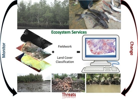
1. Introduction
- Compare the two different types of land cover classification in estimating mangrove area;
- Estimate the extent of mangrove and Nipa Palm and;
- Detect and report the change of mangrove and Nipa Palm area between 2007 and 2017.
2. Materials and Methods
2.1. Study Area
2.2. Field Data and Sampling Strategy
2.3. Earth Observation (EO) Data
2.3.1. Digital Elevation Model (DEM)
2.3.2. Synthetic Aperture Radar (SAR)
2.3.3. Landsat Data
2.4. Image Processing
2.4.1. Synthetic Aperture Radar (SAR)
2.4.2. Landsat Data
2.4.3. Texture Measure
2.4.4. Layer Stacking
2.5. Supervised Classification
- 3 SAR bands + SRTM DEM;
- 6 Landsat bands + SRTM DEM;
- a combination of both Landsat and SAR data + SRTM DEM;
- a combination of SRTM DEM, SAR, Landsat and texture measures using 3 × 3;
- a combination of SRTM DEM, SAR, Landsat and texture measures using 7 × 7.
- Linear Kernel type, Penalty Parameter (100).
- Linear Kernel type, Penalty Parameter (50).
- Radial Basis Function (RBF) Kernel Type, Gamma in Kernel Function (0.032), Penalty Parameter (100).
- Polynomial Kernel Type, Gamma in Kernel Function (0.032), Penalty Parameter (100).
- In order to carry out a change detection analysis, we classified the same set of data for both years, 2007 and 2017.
2.6. Accuracy Assessment
2.7. Change Detection
3. Results
3.1. Accuracy Assessment
3.2. Classification Results
3.3. Change Detection of Mangrove and Nipa Area
3.4. Comparison with Global Mangrove Datasets
4. Discussion
4.1. Comparison of Classifier Performance
4.2. Current Mangrove and Nipa Palm Extent
4.3. Change Detection
4.4. Caveats and Limitations
5. Conclusions
Author Contributions
Funding
Acknowledgments
Conflicts of Interest
Appendix A

| Ground Truth (Pixels) | |||||||
| Class | surface water | agricultural land | rain forest | mangrove forest | Nipa Palm | built up areas | Total |
| Unclassified | 0 | 0 | 0 | 0 | 0 | 0 | 0 |
| surface water | 2404 | 1 | 6 | 104 | 26 | 21 | 2562 |
| agricultural land | 0 | 2822 | 70 | 2 | 0 | 1 | 2895 |
| rain forest | 38 | 15 | 2081 | 252 | 0 | 25 | 2411 |
| mangrove forest | 110 | 0 | 113 | 3050 | 16 | 1 | 3290 |
| Nipa Palm | 2 | 0 | 1 | 43 | 20 | 0 | 66 |
| built up areas | 8 | 26 | 67 | 2 | 0 | 1905 | 2008 |
| Total | 2562 | 2864 | 2338 | 3453 | 62 | 1953 | 13,232 |
| Ground Truth (Percent) | |||||||
| Class | surface water | agricultural land | rain forest | mangrove forest | Nipa Palm | built up areas | Total |
| Unclassified | 0 | 0 | 0 | 0 | 0 | 0 | 0 |
| surface water | 93.83 | 0.03 | 0.26 | 3.01 | 41.94 | 1.08 | 19.36 |
| agricultural land | 0 | 98.53 | 2.99 | 0.06 | 0 | 0.05 | 21.88 |
| rain forest | 1.48 | 0.52 | 89.01 | 7.3 | 0 | 1.28 | 18.22 |
| mangrove forest | 4.29 | 0 | 4.83 | 88.33 | 25.81 | 0.05 | 24.86 |
| Nipa Palm | 0.08 | 0 | 0.04 | 1.25 | 32.26 | 0 | 0.5 |
| built up areas | 0.31 | 0.91 | 2.87 | 0.06 | 0 | 97.54 | 15.18 |
| Total | 100 | 100 | 100 | 100 | 100 | 100 | 100 |
| Ground Truth (Pixels) | |||||||
| Class | surface water | agricultural land | rain forest | mangrove forest | Nipa Palm | built up areas | Total |
| Unclassified | 0 | 0 | 0 | 0 | 0 | 0 | 0 |
| surface water | 2068 | 0 | 0 | 0 | 0 | 0 | 2068 |
| agricultural land | 16 | 2836 | 628 | 99 | 0 | 192 | 3771 |
| rain forest | 17 | 1 | 1312 | 103 | 0 | 3 | 1436 |
| mangrove forest | 158 | 1 | 315 | 2231 | 0 | 8 | 2713 |
| Nipa Palm | 265 | 0 | 10 | 1006 | 62 | 17 | 1360 |
| built up areas | 38 | 26 | 73 | 14 | 0 | 1733 | 1884 |
| Total | 2562 | 2864 | 2338 | 3453 | 62 | 1953 | 13,232 |
| Ground Truth (Percent) | |||||||
| Class | surface water | agricultural land | rain forest | mangrove forest | Nipa Palm | built up areas | Total |
| Unclassified | 0 | 0 | 0 | 0 | 0 | 0 | 0 |
| surface water | 80.72 | 0 | 0 | 0 | 0 | 0 | 15.63 |
| agricultural land | 0.62 | 99.02 | 26.86 | 2.87 | 0 | 9.83 | 28.5 |
| rain forest | 0.66 | 0.03 | 56.12 | 2.98 | 0 | 0.15 | 10.85 |
| mangrove forest | 6.17 | 0.03 | 13.47 | 64.61 | 0 | 0.41 | 20.5 |
| Nipa Palm | 10.34 | 0 | 0.43 | 29.13 | 100 | 0.87 | 10.28 |
| built up areas | 1.48 | 0.91 | 3.12 | 0.41 | 0 | 88.74 | 14.24 |
| Total | 100 | 100 | 100 | 100 | 100 | 100 | 100 |
References
- Lugo, A.E.; Medina, E.; Wang, Y. Mangrove Forests. Encycl. Nat. Resour. Land 2014, 343–352. [Google Scholar] [CrossRef]
- Bouillon, S.; Borges, A.V.; Castañeda-Moya, E.; Diele, K.; Dittmar, T.; Duke, N.; Kristensen, E.; Lee, S.Y.; Marchand, C.; Middelburg, J.J.; et al. Mangrove production and carbon sinks: A revision of global budget estimates. Glob. Biogeochem. Cycles 2008, 22, 12. [Google Scholar] [CrossRef]
- Kauffman, J.B.; Heider, C.; Cole, T.G.; Dwire, K.A.; Donato, D.C. Ecosystem Carbon Stocks of Micronesian Mangrove Forests. Wetlands 2011, 31, 343–352. [Google Scholar] [CrossRef]
- Mcleod, E.; Salm, R.V. Managing Mangroves for Resilience to Climate Change; World Conservation Union (IUCN): Gland, Switzerland, 2006; Volume 64, ISBN 9782831709536. [Google Scholar]
- Karmaker, S. Study of Mangrove Biomass, Net Primary Production & Species Distribution using Optical & Microwave Remote Sensing Data. Ph.D. Thesis, Indian Institute of Remote Sensing, Dehradun, India, 2006. [Google Scholar]
- Richards, D.; Friess, D.A. Rates and drivers of mangrove deforestation in Southeast Asia, 2000–2012. Proc. Natl. Acad. Sci. USA 2015, 113, 344–349. [Google Scholar] [CrossRef] [PubMed]
- Akanni, A.; Onwuteaka, J.; Uwagbae, M.; Mulwa, R.; Elegbede, I.O. The Values of Mangrove Ecosystem Services in the Niger Delta Region of Nigeria. In The Political Ecology of Oil and Gas Activities in the Nigerian Aquatic Ecosystem; Elsevier BV: Amsterdam, The Netherlands, 2018; pp. 387–437. [Google Scholar]
- Hamdan, O.; Aziz, H.K.; Hasmadi, I.M. L-band ALOS PALSAR for biomass estimation of Matang Mangroves, Malaysia. Remote Sens. Environ. 2014, 155, 69–78. [Google Scholar] [CrossRef]
- Spalding, M.; Blasco, F.; Field, C. World Mangrove Atlas, Version 3; Routledge: Okinawa, Japan, 1997. [Google Scholar]
- Giri, C.; Ochieng, E.; Tieszen, L.L.; Zhu, Z.; Singh, A.; Loveland, T.; Mašek, J.; Duke, N. Status and distribution of mangrove forests of the world using earth observation satellite data. Glob. Ecol. Biogeogr. 2010, 20, 154–159. [Google Scholar] [CrossRef]
- Bunting, P.; Rosenqvist, A.; Lucas, R.; Rebelo, L.-M.; Hilarides, L.; Thomas, N.; Hardy, A.; Itoh, T.; Shimada, M.; Finlayson, C. (Max) The Global Mangrove Watch—A New 2010 Global Baseline of Mangrove Extent. Remote Sens. 2018, 10, 1669. [Google Scholar] [CrossRef]
- Worthington, T.; Spalding, M. Mangrove Restoration Potential A Global Map Highlighting A Critical Opportunity Critical Opportunity; Cambridge University: Cambridge, UK, 2018; p. 36. [Google Scholar]
- Thomas, N.; Lucas, R.; Bunting, P.; Hardy, A.; Rosenqvist, Å.; Simard, M. Distribution and drivers of global mangrove forest change, 1996–2010. PLoS ONE 2017, 12, e0179302. [Google Scholar] [CrossRef]
- Thomas, N.; Bunting, P.; Lucas, R.; Hardy, A.; Rosenqvist, A.; Fatoyinbo, T.L. Mapping Mangrove Extent and Change: A Globally Applicable Approach. Remote Sens. 2018, 10, 1466. [Google Scholar] [CrossRef]
- Food and Agriculture and Organization The world’s mangrove 1980–2005. FAO For. Pap. 2007, 153, 89.
- NDDC Niger Delta Region Land and People. In Niger Delta Regional Development Masterplan; Printing Development Company Limited: Port Harcourt, Nigeria, 2006; pp. 48–99.
- Omoregie, U. Nigeria’s Petroleum Sector and GDP: The Missing Oil Refining Link. J. Adv. Econ. Financ. 2019, 4, 4. [Google Scholar] [CrossRef]
- Adekola, O.; Mitchell, G. The Niger Delta wetlands: Threats to ecosystem services, their importance to dependent communities and possible management measures. Int. J. Biodivers. Sci. Ecosyst. Serv. Manag. 2011, 7, 50–68. [Google Scholar] [CrossRef]
- Ndidi, C.; Okonkwo, P.; Kumar, L.; Taylor, S. The Niger Delta wetland ecosystem: What threatens it and why should we protect it? Afr. J. Environ. Sci. Technol. 2015, 9, 451–463. [Google Scholar]
- Mmom, P.C.; Arokoyu, S.B. Mangrove forest depletion, biodiversity loss and traditional resources management practices in the Niger Delta, Nigeria. Res. J. Appl. Sci. Eng. Technol. 2010, 2, 28–34. [Google Scholar]
- Numbere, M.M.A.O. Mangrove Habitat Loss and the Need for the Establishment of Conservation and Protected Areas in the Niger Delta, Nigeria. In Habitats of the World—Biodiversity and Threats; IntechOpen: Rijeka, Croatia, 2019; p. 13. [Google Scholar]
- Hawthorne, T.L.; Elmore, V.; Strong, A.; Bennett-Martin, P.; Finnie, J.; Parkman, J.; Harris, T.; Singh, J.; Edwards, L.; Reed, P. Mapping non-native invasive species and accessibility in an urban forest: A case study of participatory mapping and citizen science in Atlanta, Georgia. Appl. Geogr. 2015, 56, 187–198. [Google Scholar] [CrossRef]
- Ukpong, I.E. Nypa fruticans Invasion and the Integrity of Mangrove Ecosystem Functioning in the Marginal Estuaries of South Eastern Nigeria. In Frontiers in Environmental Research and Sustainable Environment in the 21st Century; Gbadegesin, A., Orimoogunje, O.O.I., Fashae, O.A., Eds.; Ibadan University Press Publishing House: Ibadan, Nigeria, 2015; pp. 1–13. [Google Scholar]
- Okugbo, O.T.; Usunobun, U.; Adegbegi, J.A.; Okiemien, C.O. A review of Nipa Palm as a renewable energy source in Nigeria. Res. J. Appl. Sci. Eng. Technol. 2012, 4, 2367–2371. [Google Scholar]
- UNEP. Environmental Assessment of Ogoniland; UNEP: Athens, Greece, 2011; ISBN 9789280731309. [Google Scholar]
- Isebor, C.E.; Ajayi, T.O.; Anyanwu, A. The Incidence of Nypa fruticans (WURMB) and It’s Impact on Fisheries Production in the Niger Delta Mangrove Ecosystem. In Proceedings of the 16th Annual Conference of the Fisheries Society of Nigeria (FISON), Maiduguri, Nigeria, 4–9 November 2001; pp. 13–16. [Google Scholar]
- Langeveld, J.W.A.; Delany, S. The Impact of Oil Exploration, Extraction and Transport on Mangrove Vegetation and Carbon Stocks in Nigeria. Amsterdam, 2014. Available online: http://biomassresearch.eu/?mdocs-file=249 (accessed on 24 April 2016).
- Hossain, F.; Islam, A. Utilization of Mangrove Forest Plant: Nipa Palm (Nypa fruticans Wurmb.). Am. J. Agric. For. 2015, 3, 156. [Google Scholar] [CrossRef]
- Tsuji, K.; Sebastian, L.S.; Ghazalli, M.N.F.; Ariffin, Z.; Nordin, M.S.; Khaidizar, M.I.; Dulloo, M.E. Biological and ethnobotanical characteristics of Nipa Palm (Nypa fructicans wurmb.): A review. Sains Malays. 2011, 40, 1407–1412. [Google Scholar]
- Bioresources Development and Conservation Programme (BDCP). Assessment of Control Measures for Nypa Palm Infestation in Nigeria; Bioresources Development and Conservation Programme (BDCP): Vienna, Austria, 2007. [Google Scholar]
- Myint, S.W.; Giri, C.P.; Wang, L.; Zhu, Z.; Gillette, S.C. Identifying Mangrove Species and Their Surrounding Land Use and Land Cover Classes Using an Object-Oriented Approach with a Lacunarity Spatial Measure. GIScience Remote Sens. 2008, 45, 188–208. [Google Scholar] [CrossRef]
- Lucas, R.M.; Mitchell, A.L.; Armston, J. Measurement of forest above ground biomass using active and passive remote sensing at large (country and continental) scales. For. Rep. Rev. 2015, 1, 162–177. [Google Scholar]
- Fatoyinbo, T.E.; Armstrong, A.H. Remote Characterization of Biomass Measurements: Case Study of Mangrove Forests. In Biomass; Momba, M.N.B., Ed.; Books on Demand: Norderstedt, Germay, 2010; pp. 65–78. ISBN 9789533071138. [Google Scholar]
- Fatoyinbo, T.; Simard, M. Remote Sensing of Mangrove Structure and Biomass. Work. Trop. Wetl. Ecosyst. Indones. Sci. Needs to Address Clim. Chang. Adapt. Mitigation. Sanur Beach Hotel. Bali 11–14th April; NASA Jet Propulsion Laboratory: Pasadena, CA, USA, 2011; p. 5.
- Li, X.; Yeh, A.; Liu, K.; Wang, S. Inventory of mangrove wetlands in the Pearl River Estuary of China using remote sensing. J. Geogr. Sci. 2006, 16, 155–164. [Google Scholar] [CrossRef]
- Lucas, R.; Mitchell, A.L.; Rosenqvist, A.; Proisy, C.; Melius, A.; Ticehurst, C. The potential of L-band SAR for quantifying mangrove characteristics and change: Case studies from the tropics. Aquat. Conserv. Mar. Freshw. Ecosyst. 2007, 17, 245–264. [Google Scholar] [CrossRef]
- Japan Aerospace Exploration Agency. Kyoto & Carbon Initiative. Available online: https://www.eorc.jaxa.jp/ALOS/en/top/kyoto_top.htm (accessed on 18 July 2018).
- Green, E.P.; Clark, C.D.; Mumby, P.J.; Edwards, A.J.; Ellis, A.C. Remote sensing techniques for mangrove mapping. Int. J. Remote Sens. 1998, 19, 935–956. [Google Scholar] [CrossRef]
- Joshi, N.; Baumann, M.; Ehammer, A.; Fensholt, R.; Grogan, K.; Hostert, P.; Jepsen, M.R.; Kuemmerle, T.; Meyfroidt, P.; Mitchard, E.T.A.; et al. A Review of the Application of Optical and Radar Remote Sensing Data Fusion to Land Use Mapping and Monitoring. Remote Sens. 2016, 8, 70. [Google Scholar] [CrossRef]
- Mathur, A.; Foody, G.M. Land cover classification by support vector machine: Towards efficient training. In Proceedings of the 2004 IEEE International Geoscience and Remote Sensing Symposium Proceedings, Anchorage, AK, USA, 20–24 September 2004; pp. 742–744. [Google Scholar] [CrossRef]
- Deilmai, B.R.; Bin Ahmad, B.; Zabihi, H. Comparison of two Classification methods (MLC and SVM) to extract land use and land cover in Johor Malaysia. IOP Conf. Series Earth Environ. Sci. 2014, 20, 12052. [Google Scholar] [CrossRef]
- Madanguit, C.J.G.; Oñez, P.J.L.; Tan, H.G.; Villanueva, M.D.; Ordaneza, J.E.; Aurelio, R.M.; Novero, A.U. Application of Support Vector Machine (SVM) and Quick Unbiased Efficient Statistical Tree (QUEST) Algorithms on Mangrove and Agricultural Resource Mapping using LiDAR Data Sets. Int. J. Appl. Environ. Sci. 2017, 12, 973–6077. [Google Scholar]
- Huang, C.; Davis, L.S.; Townshend, J.R.G. An assessment of support vector machines for land cover classification. Int. J. Remote Sens. 2002, 23, 725–749. [Google Scholar] [CrossRef]
- Heumann, B.W. An Object-Based Classification of Mangroves Using a Hybrid Decision Tree—Support Vector Machine Approach. Remote Sens. 2011, 3, 2440–2460. [Google Scholar] [CrossRef]
- Szuster, B.W.; Chen, Q.; Borger, M. A comparison of classification techniques to support land cover and land use analysis in tropical coastal zones. Appl. Geogr. 2011, 31, 525–532. [Google Scholar] [CrossRef]
- David, L.C.; Ballado, A.J. Mapping mangrove forest from LiDAR data using object-based image analysis and Support Vector Machine: The case of Calatagan, Batangas. In Proceedings of the 2015 International Conference on Humanoid, Nanotechnology, Information Technology, Communication and Control, Environment and Management (HNICEM), Cebu City, Philippines, 9–12 December 2015; pp. 1–5. [Google Scholar] [CrossRef]
- Heumann, B.W. Satellite remote sensing of mangrove forests: Recent advances and future opportunities. Prog. Phys. Geogr. Earth Environ. 2011, 35, 87–108. [Google Scholar] [CrossRef]
- Bradley, B.A. Accuracy assessment of mixed land cover using a GIS-designed sampling scheme. Int. J. Remote Sens. 2009, 30, 3515–3529. [Google Scholar] [CrossRef]
- James, G.; Adegoke, J.O.; Saba, E.; Nwilo, P.; Akinyede, J. Satellite-Based Assessment of the Extent and Changes in the Mangrove Ecosystem of the Niger Delta. Mar. Geodesy 2007, 30, 249–267. [Google Scholar] [CrossRef]
- Fatoyinbo, T.L.; Simard, M. Height and biomass of mangroves in Africa from ICESat/GLAS and SRTM. Int. J. Remote Sens. 2012, 34, 668–681. [Google Scholar] [CrossRef]
- Bisgin, H.; Bera, T.; Ding, H.; Semey, H.G.; Wu, L.; Liu, Z.; Barnes, A.E.; Langley, D.A.; Pava-Ripoll, M.; Vyas, H.J.; et al. Comparing SVM and ANN based Machine Learning Methods for Species Identification of Food Contaminating Beetles. Sci. Rep. 2018, 8, 6532. [Google Scholar] [CrossRef] [PubMed]
- Ukpong, I. Soil-vegetation interrelationships of mangrove swamps as revealed by multivariate analyses. Geoderma 1994, 64, 167–181. [Google Scholar] [CrossRef]
- Ukpong, I.E. Gradient analysis in mangrove swamp forests. Trop. Ecol. 2000, 41, 25–32. [Google Scholar]
- Ukpong, I.E. Ecological classification of Nigerian mangroves using soil nutrient gradient analysis. Wetl. Ecol. Manag. 2000, 8, 263–272. [Google Scholar] [CrossRef]
- Aduloju, A.A.; Okwechime, I. Oil and Human Security Challenges in the Nigeria’s Niger Delta. Critique 2016, 44, 505–525. [Google Scholar] [CrossRef]
- Farr, T.G.; Rosen, P.A.; Caro, E.; Crippen, R.; Duren, R.; Hensley, S.; Kobrick, M.; Paller, M.; Rodríguez, E.; Roth, L.; et al. The Shuttle Radar Topography Mission. Rev. Geophys. 2007, 45, 45. [Google Scholar] [CrossRef]
- SRTM. The Shuttle Radar Topography Mission (SRTM) Collection User Guide. 2015; pp. 1–17. Available online: https://lpdaac.usgs.gov/documents/179/SRTM_User_Guide_V3.pdf (accessed on 11 July 2019).
- USGS Shuttle Radar Topography Mission. 1 Arc Second. Glob. L. Cover Facil. Univ. Maryland, Coll. Park. Maryland, Febr. 2000. 2004, Scenes: n0; USGS: Lawrence, KS, USA, 2004.
- Japan Aerospace Exploration Agency. ALOS-2 Overview. Available online: https://www.eorc.jaxa.jp/ALOS-2/en/about/overview.htm (accessed on 18 July 2018).
- Japan Aerospace Exploration Agency. JAXA|Advanced Land Observing Satellite-2 (ALOS-2). Available online: http://www.jaxa.jp/projects/sat/alos2/index_e.html (accessed on 18 July 2018).
- Shimada, M.; Ohtaki, T. Generating Large-Scale High-Quality SAR Mosaic Datasets: Application to PALSAR Data for Global Monitoring. IEEE J. Sel. Top. Appl. Earth Obs. Remote Sens. 2010, 3, 637–656. [Google Scholar] [CrossRef]
- Gorelick, N.; Hancher, M.; Dixon, M.; Ilyushchenko, S.; Thau, D.; Moore, R. Google Earth Engine: Planetary-scale geospatial analysis for everyone. Remote Sens. Environ. 2017, 202, 18–27. [Google Scholar] [CrossRef]
- Exelis Visual Information Solutions; L3Harris Geospatial: Boulder, CO, USA, 2010.
- QGIS Development Team. QGIS Geographic Information System. Open Source Geospatial Foundation Project: 2018. Available online: https://qgis.org/en/site/ (accessed on 9 September 2018).
- Google Earth Pro 2018. Available online: https://www.google.co.uk/earth/download/gep/agree.html (accessed on 9 September 2018).
- ESRI ArcGIS Desktop: Release 10; Environmental Systems Research Institute: Redlands, CA, USA, 2011; Available online: http://www.esri.com/ (accessed on 9 September 2018).
- Hansen, M.C.; Potapov, P.V.; Moore, R.; Hancher, M.; Turubanova, S.A.; Tyukavina, A. High-Resolution Global Maps of 21st-Century Forest Cover Change. Science 2013, 342, 850–853. [Google Scholar] [CrossRef] [PubMed]
- Shimada, M.; Isoguchi, O.; Tadono, T.; Isono, K. PALSAR Radiometric and Geometric Calibration. IEEE Trans. Geosci. Remote Sens. 2009, 47, 3915–3932. [Google Scholar] [CrossRef]
- Dewantoro, M.D.R.; Farda, N.M. ALOS PALSAR Image for Landcover Classification Using Pulse Coupled Neural Network (PCNN). Int. J. Adv. Res. Comput. Eng. 2012, 1, 289–294. [Google Scholar]
- Lopes, A.; Touzi, R.; Nezry, E. Adaptive speckle filters and scene heterogeneity. IEEE Trans. Geosci. Remote Sens. 1990, 28, 992–1000. [Google Scholar] [CrossRef]
- PCI Geomatics Radar Enhanced Lee Filter. Available online: http://www.pcigeomatics.com/geomatica-help/concepts/orthoengine_c/chapter_825.html (accessed on 22 May 2016).
- Lee, J.-S. Digital Image Enhancement and Noise Filtering by Use of Local Statistics. IEEE Trans. Pattern Anal. Mach. Intell. 1980, 2, 165–168. [Google Scholar] [CrossRef] [PubMed]
- Nanda, M.A.; Seminar, K.B.; Nandika, D.; Maddu, A. A Comparison Study of Kernel Functions in the Support Vector Machine and Its Application for Termite Detection. Information 2018, 9, 5. [Google Scholar] [CrossRef]
- Karatzoglou, A.; Meyer, D.; Hornik, K. Support Vector Algorithm in R. J. Stat. Softw. 2006, 15, 1–28. [Google Scholar] [CrossRef]
- Yang, X. Parameterizing Support Vector Machines for Land Cover Classification. Photogramm. Eng. Remote Sens. 2011, 77, 27–37. [Google Scholar] [CrossRef]
- Congalton, R.G. A review of assessing the accuracy of classifications of remotely sensed data. Remote Sens. Environ. 1991, 37, 35–46. [Google Scholar] [CrossRef]
- Olofsson, P.; Foody, G.M.; Herold, M.; Stehman, S.V.; Woodcock, C.E.; Wulder, M.A. Good practices for estimating area and assessing accuracy of land change. Remote Sens. Environ. 2014, 148, 42–57. [Google Scholar] [CrossRef]
- Hughes, R.H.; Hughes, J.S. A Directory of African Wetlands, 34th ed.; IUCN: Gland, Switzerland; Cambridge, UK; UNEP: Nairobi, Kenya; WCMC: Cambridge, UK, 1992. [Google Scholar]
- Krauss, K.W.; Friess, D.A. World Atlas of Mangroves. Wetlands 2011, 31, 1003–1005. [Google Scholar] [CrossRef]
- Dahdouh-Guebas, F. World Atlas of Mangroves: Mark Spalding, Mami Kainuma and Lorna Collins (eds). Hum. Ecol. 2010, 39, 107–109. [Google Scholar] [CrossRef]
- Schlitzer, R. Ocean Data View. 2018. Available online: https://data.unep-wcmc.org/ (accessed on 20 November 2018).
- Hamilton, S.E.; Casey, D. Creation of a high spatio-temporal resolution global database of continuous mangrove forest cover for the 21st century (CGMFC-21). Glob. Ecol. Biogeogr. 2016, 25, 729–738. [Google Scholar] [CrossRef]
- Kavzoglu, T.; Colkesen, I. A kernel functions analysis for support vector machines for land cover classification. Int. J. Appl. Earth Obs. Geoinf. 2009, 11, 352–359. [Google Scholar] [CrossRef]
- Chance, C.M.; Coops, N.C.; Plowright, A.A.; Tooke, T.R.; Christen, A.; Aven, N. Invasive Shrub Mapping in an Urban Environment from Hyperspectral and LiDAR-Derived Attributes. Front. Plant Sci. 2016, 7, 1528. [Google Scholar] [CrossRef] [PubMed]
- Wang, L. Invasive Species Spread Mapping Using Multi-Resolution Remote Sensing Data. Int. Arch. Photogramm. Remote Sens. Spat. Inf. Sci. 2008, 37, 135–142. [Google Scholar]
- Wang, C.; Liu, H.-Y.; Zhang, Y.; Li, Y.-F. Classification of land-cover types in muddy tidal flat wetlands using remote sensing data. J. Appl. Remote Sens. 2014, 7, 73457. [Google Scholar] [CrossRef]
- Lu, D.; Hetrick, S.; Moran, E. Land Cover Classification in a Complex Urban-Rural Landscape with QuickBird Imagery. Photogramm. Eng. Remote Sens. 2010, 76, 1159–1168. [Google Scholar] [CrossRef] [PubMed]
- Liu, M.; Li, H.; Li, L.; Man, W.; Jia, M.; Wang, Z.; Lu, C. Monitoring the Invasion of Spartina alterniflora Using Multi-source High-resolution Imagery in the Zhangjiang Estuary, China. Remote Sens. 2017, 9, 539. [Google Scholar] [CrossRef]
- Suyadi; Gao, J.; Lundquist, C.J.; Schwendenmann, L. Land-based and climatic stressors of mangrove cover change in the Auckland Region, New Zealand. Aquat. Conserv. Mar. Freshw. Ecosyst. 2019, 29, 1466–1483. [Google Scholar] [CrossRef]
- Udoidiong, O.M.; Ekwu, A.O. Nipa palm (Nypa fruticans wurmb) and the intertidal epibenthic macrofauna east of the imo river estuary, Nigeria. World Appl. Sci. J. 2011, 14, 1320–1330. [Google Scholar]
- Twumasi, Y.A.; Merem, E.C. GIS and Remote Sensing Applications in the Assessment of Change within a Coastal Environment in the Niger Delta Region of Nigeria. Int. J. Environ. Res. Public Health 2006, 3, 98–106. [Google Scholar] [CrossRef] [PubMed]
- Ayanlade, A. Remote Sensing of Environmental Change in the Niger Delta, Nigeria; King’s College London, University of London: London, UK, 2014. [Google Scholar]


| No | Class Name | Description 1 | Training Pixels (2017) | Testing Pixels (2017) | Training Pixels (2007) | Testing Pixels (2007) |
|---|---|---|---|---|---|---|
| 1 | Mangrove Forests | Mangrove forests located in intertidal regions strictly vegetated with red (Rhizophora spp.), black (Avicennia germinans) or white (Laguncularia racemosa) mangrove species. | 25,522 | 3453 | 31,956 | 4842 |
| 2 | Nipa palm | Nipa Palm stands within mangrove forests or along the fringes. | 751 | 62 | 103 | 53 |
| 3 | Terra firma forests | All other forested vegetation, palm plantations and evergreen forests | 257,398 | 2338 | 252,798 | 4172 |
| 4 | Surface water | All areas with open water including coastal waters. | 249,912 | 2562 | 249,983 | 3216 |
| 5 | Built up regions | Developed land with constructed structures including industries, residential area, roads | 2931 | 1953 | 52,341 | 5876 |
| 6 | Agricultural land | Cultivated land, pastures, other herbaceous vegetation, parks | 2864 | 2864 | 68,329 | 5777 |
| Data | Date | Bands | Texture Measures |
|---|---|---|---|
| SRTM DEM | 2000 | Elevation | - |
| ALOS PALSAR | 2007, 2017 | HH, HV, HV:HH | data range, mean and variance |
| Landsat 7 | 2005–2007, 2015–2017 | 1 (blue), 2 (green), 3 (red), 4 (Near Infrared), 5 (Short-wave Infrared 1) and 7 (Short-wave Infrared 2) | data range, mean |
| Year | Classification Type (Number of Bands) | Kernel Type | Penalty Parameter | Overall Accuracy | Accuracy | Surface Water | Agricultural Land | Rain Forest | Mangrove Forest | Nipa Palm | Built Up Areas |
|---|---|---|---|---|---|---|---|---|---|---|---|
| 2017 | ML (4) | _ | _ | 44.4% | PA | 76 | 57 | 10 | 38 | 92 | 36 |
| UA | 99 | 69 | 76 | 39 | 1 | 65 | |||||
| (7) | _ | _ | 66.8% | PA | 83 | 94 | 13 | 55 | 98 | 92 | |
| UA | 99 | 94 | 92 | 48 | 3 | 89 | |||||
| (10) | _ | _ | 67.4% | PA | 81 | 97 | 15 | 53 | 100 | 92 | |
| UA | 100 | 88 | 97 | 51 | 3 | 89 | |||||
| (31 3 × 3 Occurrence Matrix) | _ | _ | 77.0% | PA | 81 | 99 | 56 | 65 | 100 | 89 | |
| UA | 100 | 75 | 91 | 82 | 5 | 92 | |||||
| (31 7 × 7 Occurrence Matrix) | _ | _ | 76.9% | PA | 79 | 100 | 50 | 62 | 100 | 98 | |
| UA | 100 | 82 | 99 | 79 | 4 | 88 | |||||
| SVM (31) | Linear | 100 | 93.0% | PA | 94 | 98 | 89 | 90 | 13 | 98 | |
| UA | 94 | 97 | 87 | 92 | 33 | 95 | |||||
| 50 | 92.5% | PA | 94 | 98 | 89 | 90 | 5 | 98 | |||
| UA | 93 | 98 | 87 | 91 | 33 | 95 | |||||
| RBF | 100 | 92.9% | PA | 94 | 99 | 89 | 89 | 32 | 98 | ||
| UA | 94 | 98 | 86 | 93 | 30 | 95 | |||||
| Polynomial | 100 | 92.8% | PA | 94 | 99 | 89 | 88 | 32 | 98 | ||
| UA | 94 | 97 | 86 | 93 | 30 | 95 | |||||
| 2007 | SVM (31) | RBF | 100 | 93.4% | PA | 99 | 94 | 82 | 97 | 42 | 95 |
| UA | 96 | 95 | 98 | 85 | 63 | 95 | |||||
| Polynomial | 100 | 93.4% | PA | 99 | 94 | 82 | 97 | 38 | 95 | ||
| UA | 96 | 95 | 98 | 85 | 65 | 95 |
| Ground Truth (Pixels) | |||||||
| Class | Surface Water | Agricultural Land | Rain Forest | Mangrove Forest | Nipa Palm | Built Up Areas | Total |
| Unclassified | 0 | 0 | 0 | 0 | 0 | 0 | 0 |
| surface water | 2408 | 1 | 5 | 98 | 25 | 20 | 2557 |
| agricultural land | 0 | 2821 | 67 | 2 | 0 | 2 | 2892 |
| rain forest | 38 | 15 | 2085 | 252 | 0 | 24 | 2414 |
| mangrove forest | 106 | 0 | 113 | 3057 | 17 | 1 | 3294 |
| Nipa Palm | 2 | 0 | 2 | 42 | 20 | 0 | 66 |
| built up areas | 8 | 27 | 66 | 2 | 0 | 1906 | 2009 |
| Total | 2562 | 2864 | 2338 | 3453 | 62 | 1953 | 13,232 |
| Ground Truth (Percent) | |||||||
| Class | Surface Water | Agricultural Land | Rain Forest | Mangrove Forest | Nipa Palm | Built Up Areas | Total |
| Unclassified | 0 | 0 | 0 | 0 | 0 | 0 | 0 |
| surface water | 93.99 | 0.03 | 0.21 | 2.84 | 40.32 | 1.02 | 19.32 |
| agricultural land | 0 | 98.5 | 2.87 | 0.06 | 0 | 0.1 | 21.86 |
| rain forest | 1.48 | 0.52 | 89.18 | 7.3 | 0 | 1.23 | 18.24 |
| mangrove forest | 4.14 | 0 | 4.83 | 88.53 | 27.42 | 0.05 | 24.89 |
| Nipa Palm | 0.08 | 0 | 0.09 | 1.22 | 32.26 | 0 | 0.5 |
| built up areas | 0.31 | 0.94 | 2.82 | 0.06 | 0 | 97.59 | 15.18 |
| Total | 100 | 100 | 100 | 100 | 100 | 100 | 100 |
| Ground Truth (Pixels) | |||||||
| Class | Surface Water | Agricultural Land | Rain Forest | Mangrove Forest | Nipa Palm | Built Up Areas | Total |
| Unclassified | 0 | 0 | 0 | 0 | 0 | 0 | 0 |
| surface water | 3175 | 1 | 0 | 83 | 14 | 25 | 3298 |
| agricultural land | 3 | 5419 | 35 | 1 | 1 | 226 | 5685 |
| rain forest | 16 | 31 | 3440 | 31 | 0 | 1 | 3,519 |
| mangrove forest | 18 | 59 | 696 | 4701 | 13 | 23 | 5510 |
| Nipa Palm | 0 | 0 | 0 | 13 | 22 | 0 | 35 |
| built up areas | 4 | 267 | 1 | 13 | 3 | 5601 | 5889 |
| Total | 3216 | 5777 | 4172 | 4842 | 53 | 5876 | 23,936 |
| Ground Truth (Percent) | |||||||
| Class | Surface Water | Agricultural Land | Rain Forest | Mangrove Forest | Nipa Palm | Built Up Areas | Total |
| Unclassified | 0 | 0 | 0 | 0 | 0 | 0 | 0 |
| surface water | 98.73 | 0.02 | 0.00 | 1.71 | 26.42 | 0.43 | 13.78 |
| agricultural land | 0.09 | 93.80 | 0.84 | 0.02 | 1.89 | 3.85 | 23.75 |
| rain forest | 0.50 | 0.54 | 82.45 | 0.64 | 0.00 | 0.02 | 14.70 |
| mangrove forest | 0.56 | 1.02 | 16.68 | 97.09 | 24.53 | 0.39 | 23.02 |
| Nipa Palm | 0.00 | 0.00 | 0.00 | 0.27 | 41.51 | 0.00 | 0.15 |
| built up areas | 0.12 | 4.62 | 0.02 | 0.27 | 5.66 | 95.32 | 24.60 |
| Total | 100 | 100 | 100 | 100 | 100.00 | 100 | 100 |
| Land Cover Classes | 2007 | 2017 | 2017–2007 | |||
|---|---|---|---|---|---|---|
| Area (ha) | Area (%) | Area (ha) | Area (%) | Change (ha) | Change (%) | |
| Agricultural land | 2,173,317 (2,158,427–2,189,005) | 34.11 | 2,417,929 (2,401,778–2,434,080) | 37.9 | −244,213 (212,773–275,653) | 11 (10–13) |
| Tropical Forest | 2,889,083 (2,872,245–2,905,921) | 45.35 | 2,549,919 (2,511,832–2,588,006) | 40.0 | 339,164 (284,239–394,089) | −12 (10–14) |
| Mangrove forest | 911,548 (895,781–927,315) | 14.31 | 801,774 (766,987–836,561) | 12.6 | 109,774 (59,221–160,327) | −12 (7–17) |
| Nipa palm | 1441 (0–5742) | 0.02 | 11,444 (4101–18,787) | 0.2 | −10,003 (−1641–18,787) | 694 (−29–1304) |
| Built up areas | 394,985 (382,299–407,671) | 6.21 | 593,759 (580,375–607,143) | 9.3 | −198,774 (172,704–224,844) | 50 (45–55) |
| Nigerian State | Mangrove Area (ha) | Nipa Palm Area (ha) | ||||
|---|---|---|---|---|---|---|
| 2017 | 2007 | Change (%) | 2017 | 2007 | Change (%) | |
| Akwa Ibom | 27,853 | 31,888 | −4034 (−13) | 2414 | 429 | 1986 (463) |
| Bayelsa | 239,881 | 284,840 | −44,960 (−16) | 1225 | 167 | 1059 (635) |
| Cross River | 24,478 | 28,154 | −3676 (−13) | 514 | 269 | 245 (91) |
| Delta | 238,697 | 290,797 | −52,100 (−18) | 2930 | 322 | 2608 (809) |
| Rivers | 236,234 | 252,468 | −16,234 (−6) | 3746 | 86 | 3660 (4263) |
| Coastal Division | Mangrove Area (ha) | Nipa Area (ha) | ||||
|---|---|---|---|---|---|---|
| 2017 | 2007 | Change (%) | 2017 | 2007 | Change (%) | |
| Cross River Estuary | 48,680 | 52,866 | −4187 (−8) | 2911 | 669 | 2242 (335) |
| Niger Delta basin | 722,321 | 844,187 | −121,867 (−14) | 8256 | 634 | 7622 (1203) |
| This Study | GMW 2010 | Giri et al. 2011 | Spalding et al. 2010 | |
|---|---|---|---|---|
| Mangrove Area (ha) | 801,774 (766,987–836,561) | 695,800 | 622,373 | 713,000 |
| Date/range | 2017 | 2010 | 1997–2000 | 1999–2003 |
© 2020 by the authors. Licensee MDPI, Basel, Switzerland. This article is an open access article distributed under the terms and conditions of the Creative Commons Attribution (CC BY) license (http://creativecommons.org/licenses/by/4.0/).
Share and Cite
Nwobi, C.; Williams, M.; Mitchard, E.T.A. Rapid Mangrove Forest Loss and Nipa Palm (Nypa fruticans) Expansion in the Niger Delta, 2007–2017. Remote Sens. 2020, 12, 2344. https://doi.org/10.3390/rs12142344
Nwobi C, Williams M, Mitchard ETA. Rapid Mangrove Forest Loss and Nipa Palm (Nypa fruticans) Expansion in the Niger Delta, 2007–2017. Remote Sensing. 2020; 12(14):2344. https://doi.org/10.3390/rs12142344
Chicago/Turabian StyleNwobi, Chukwuebuka, Mathew Williams, and Edward T. A. Mitchard. 2020. "Rapid Mangrove Forest Loss and Nipa Palm (Nypa fruticans) Expansion in the Niger Delta, 2007–2017" Remote Sensing 12, no. 14: 2344. https://doi.org/10.3390/rs12142344
APA StyleNwobi, C., Williams, M., & Mitchard, E. T. A. (2020). Rapid Mangrove Forest Loss and Nipa Palm (Nypa fruticans) Expansion in the Niger Delta, 2007–2017. Remote Sensing, 12(14), 2344. https://doi.org/10.3390/rs12142344