
Citizen Science in Sweden’s Stigmatized Neighborhoods

 and
and
Abstract
:1. Introduction
Young men who, instead of taking advantage of the opportunity to study, work and live a good life, choose to sell drugs, or challenge the municipality’s monopoly on violence will face the full force of the law. If they need to be locked up, so be it. However, if they want to choose a new path and return to society, they are welcome back[26] (p. 8).
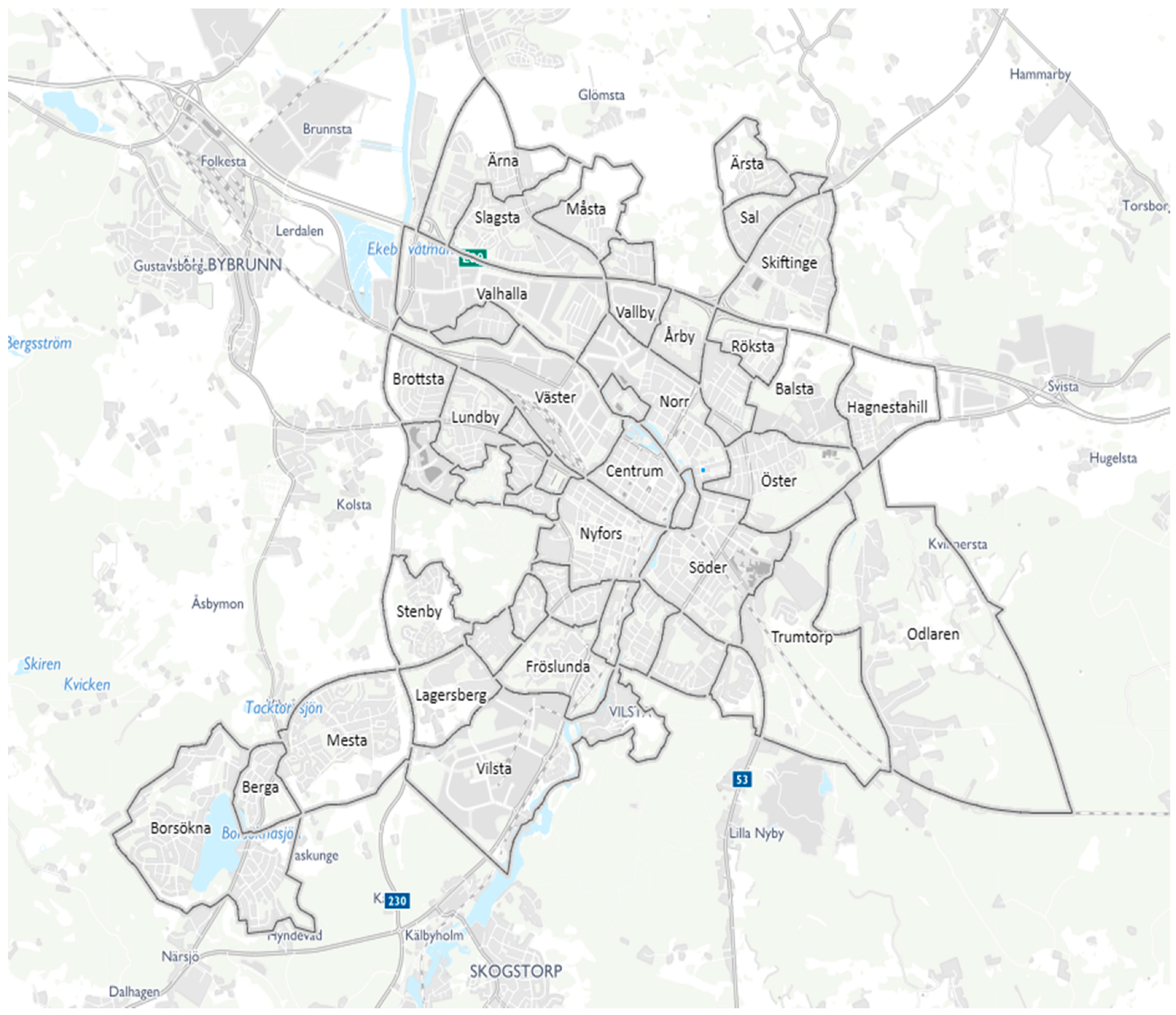
1.1. Eskilstuna and Its Stigmatized Neighborhoods
1.2. Depicting Two Swedish City Suburbs
1.3. Theoretical Implications of Citizen Science
In response to spatial defamation, residents engage in strategies of mutual distancing and lateral denigration; they retreat into the private sphere of the family; and they exit from the neighbourhood (whenever they have the option).
2. Choice of Citizen Science Technique for Data Collection
- Using the Discovery Tool, young males collected data consisting of their self-rated community influence, barriers and facilitators that they perceived lead to either a bad or a good social and physical context, as well as their reflections on the collected data. Thereafter, all photos were reviewed together with a project researcher where the citizen scientists had the opportunity to reflect on their documentation and share additional information for 10–30 min (September to December 2018).
- Researchers analyzed the data and categorized it collectively (January to March 2019).
- Researchers arranged a “citizen science poster presentation” at Mälardalen University’s annual Political Science Day on the 8 April in 2019. They also presented citizen scientists’ pictures to local politicians and bureaucrats in the local government’s Special Committee on Segregation on the 7 May 2019 as a basis for a dialogue on how to improve the situation of residents in Fröslunda and Skiftinge.
3. Results
3.1. The Political Character and Public Perception of Fröslunda and Skiftinge
3.2. Fröslunda and Skiftinge in the Public’s Perception
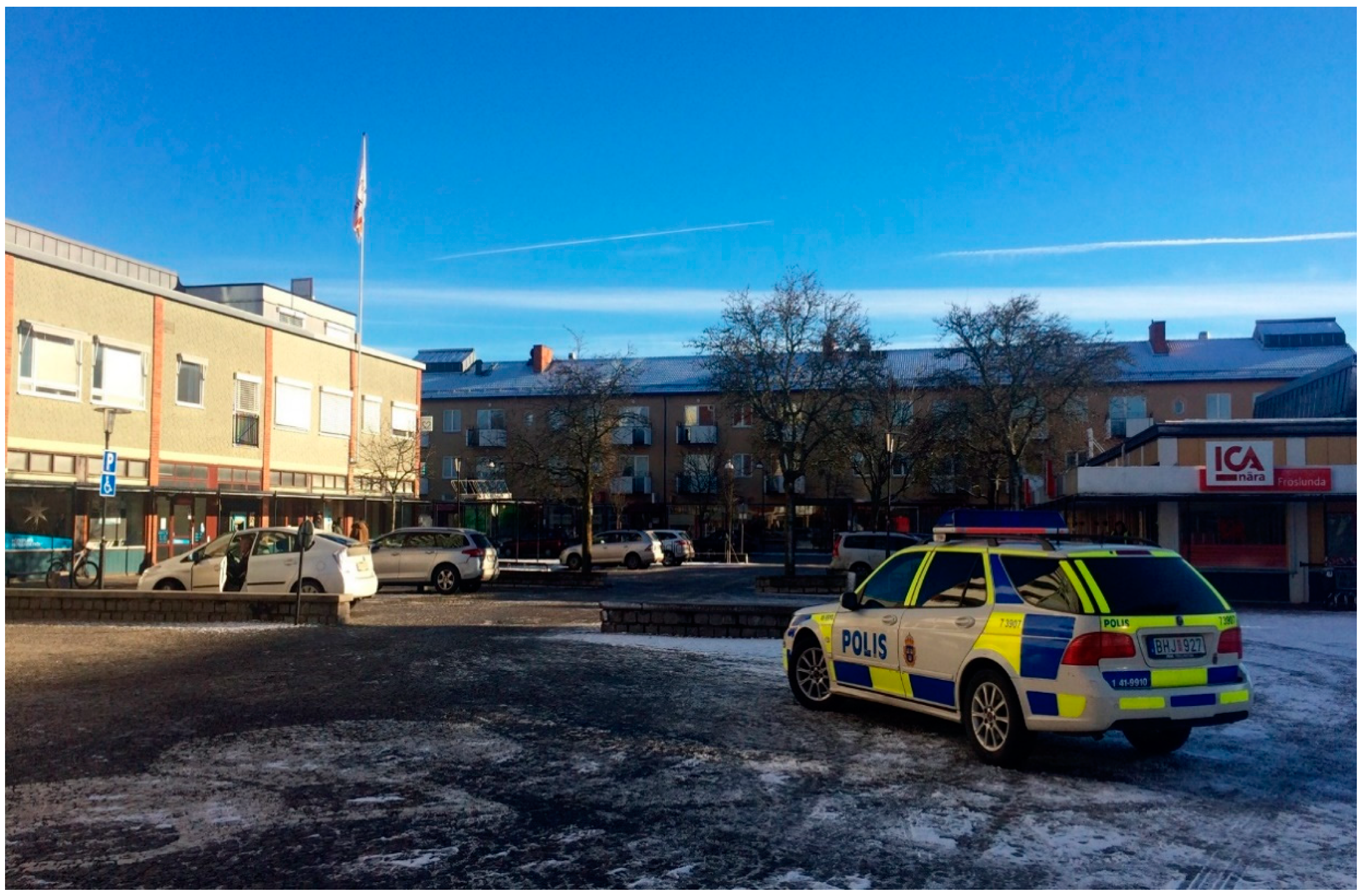
… increased targeted police surveillance of criminals and drug-dealing in combination with an expanded camera surveillance … The police are building a new and modern police station and the municipality is pushing through plans for the construction of a new detention centre …[26] (pp. 9–10).
Drug-dealers and people that create insecurity will be banished to allow residents to retake their neighbourhoods. This will be accomplished by cooperating with local commerce and the police. We also want an increased investment in security guards, especially in those neighbourhoods where the need is greatest[26] (p. 9).
3.3. The Social Neighborhood from Within
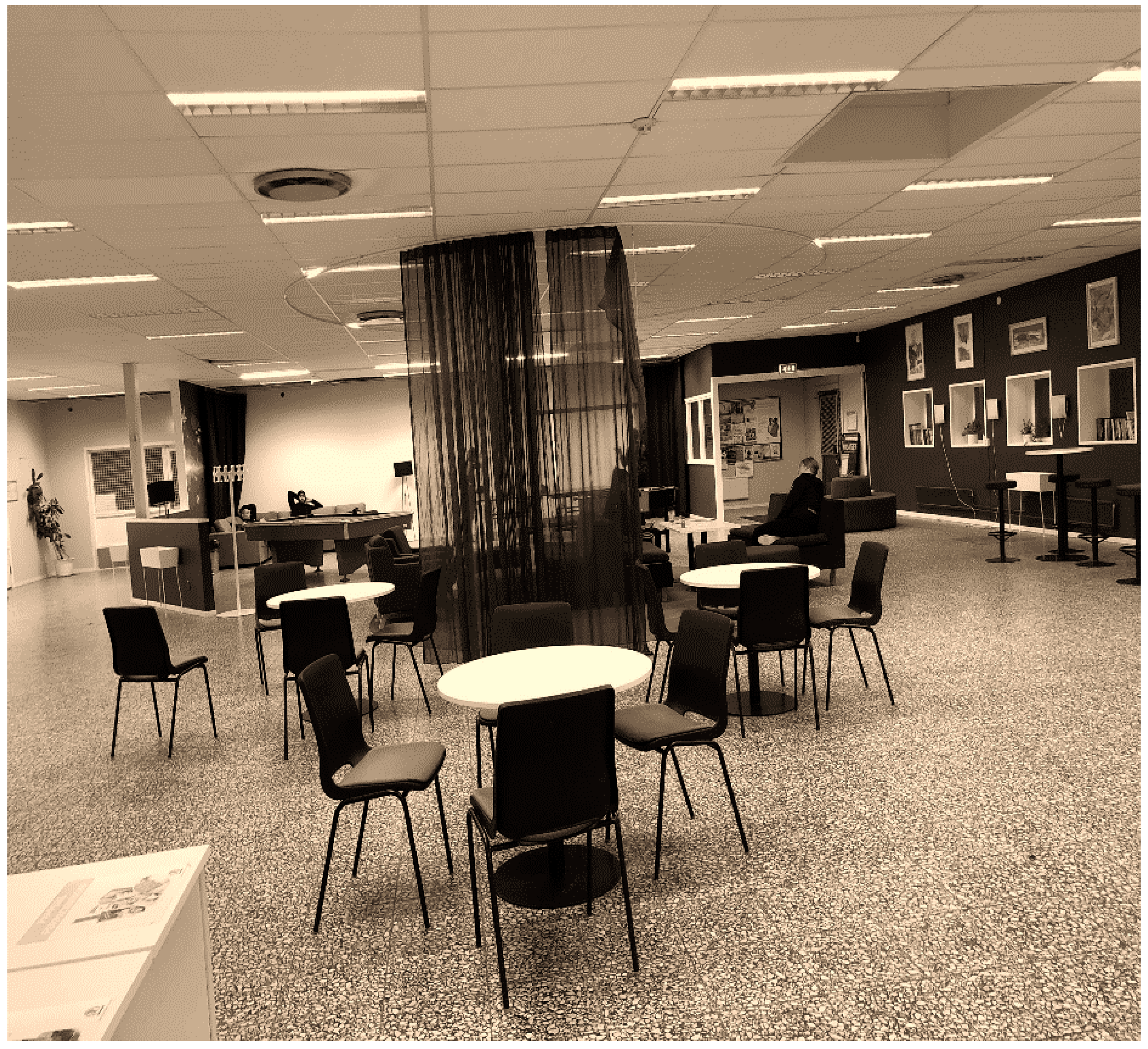
Palatzet [the local youth club] is the best place around. Many young people come here instead of going down the “wrong road”. We learn a lot here; we learn how to meet others(Authors’ translation: see Figure 6).
When we play in the football court older boys come and take over, they steal our ball too. They are bigger than us, like 20 years old or so and they smoke weed in front of us. We do not want them here(Authors’ translation; Figure 7).
I do not like this place because of peer pressure, older boys smoke and do illegal stuff here and I do not like that. So that’s negative(Authors’ translation; Figure 8).
3.4. The Physical Neighborhood from Within
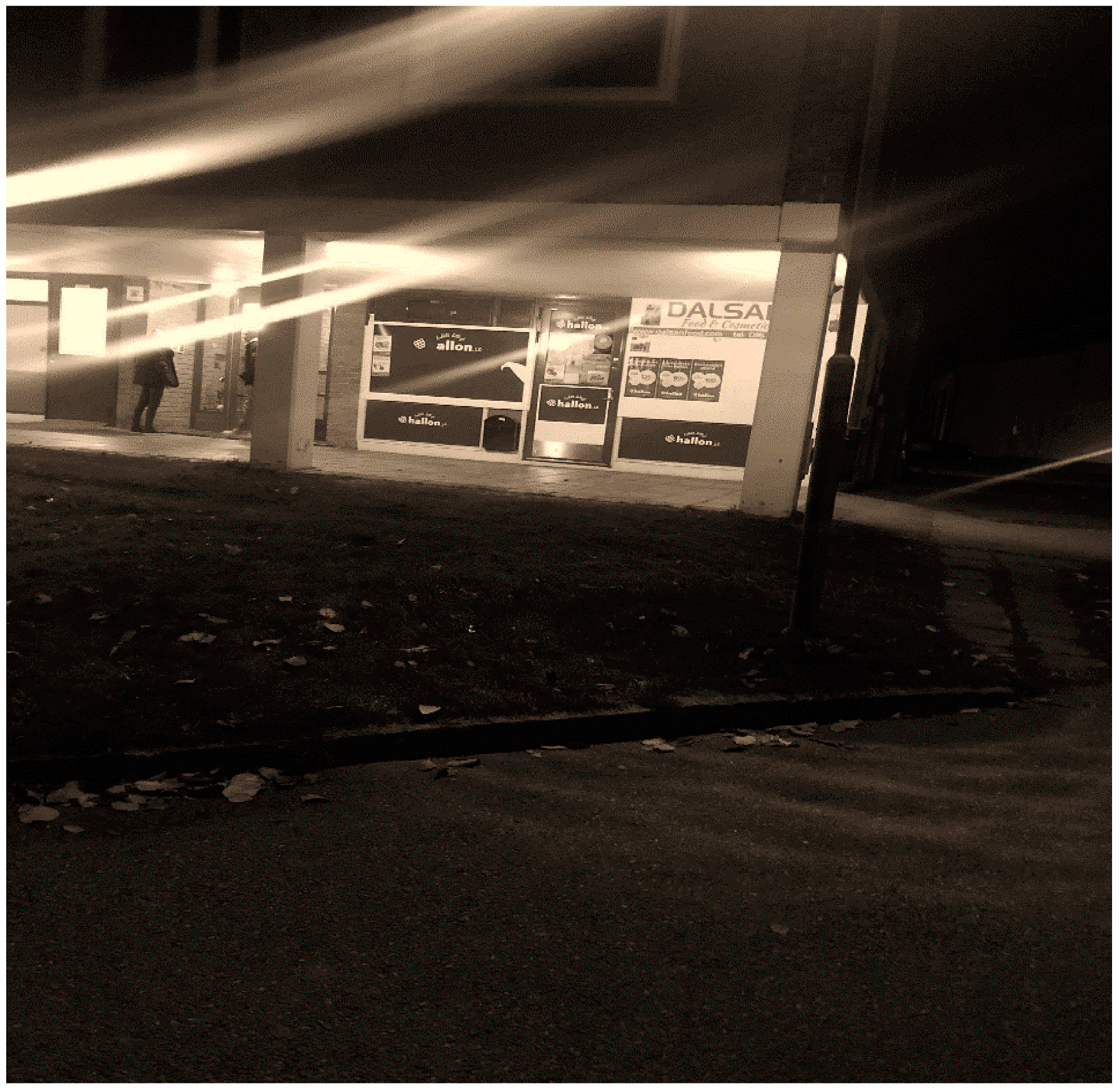
In this shop, we usually buy things after we play football; it is cool. It is the closest shop, and it is very cheap; it is a good shop. It is a very good place here
At the court we play football, and it feels good, very positive. Anyone can come here and play any time they want. We also come here to socialize. It feels great here(Authors’ translation; Figure 10).
I think the football court is very good. I have been playing here all summer. I think it is better to build a bigger court here. There are too many of us, and we cannot play more than five aside … Therefore, I think they should make it much bigger(Authors’ translation; Figure 10).
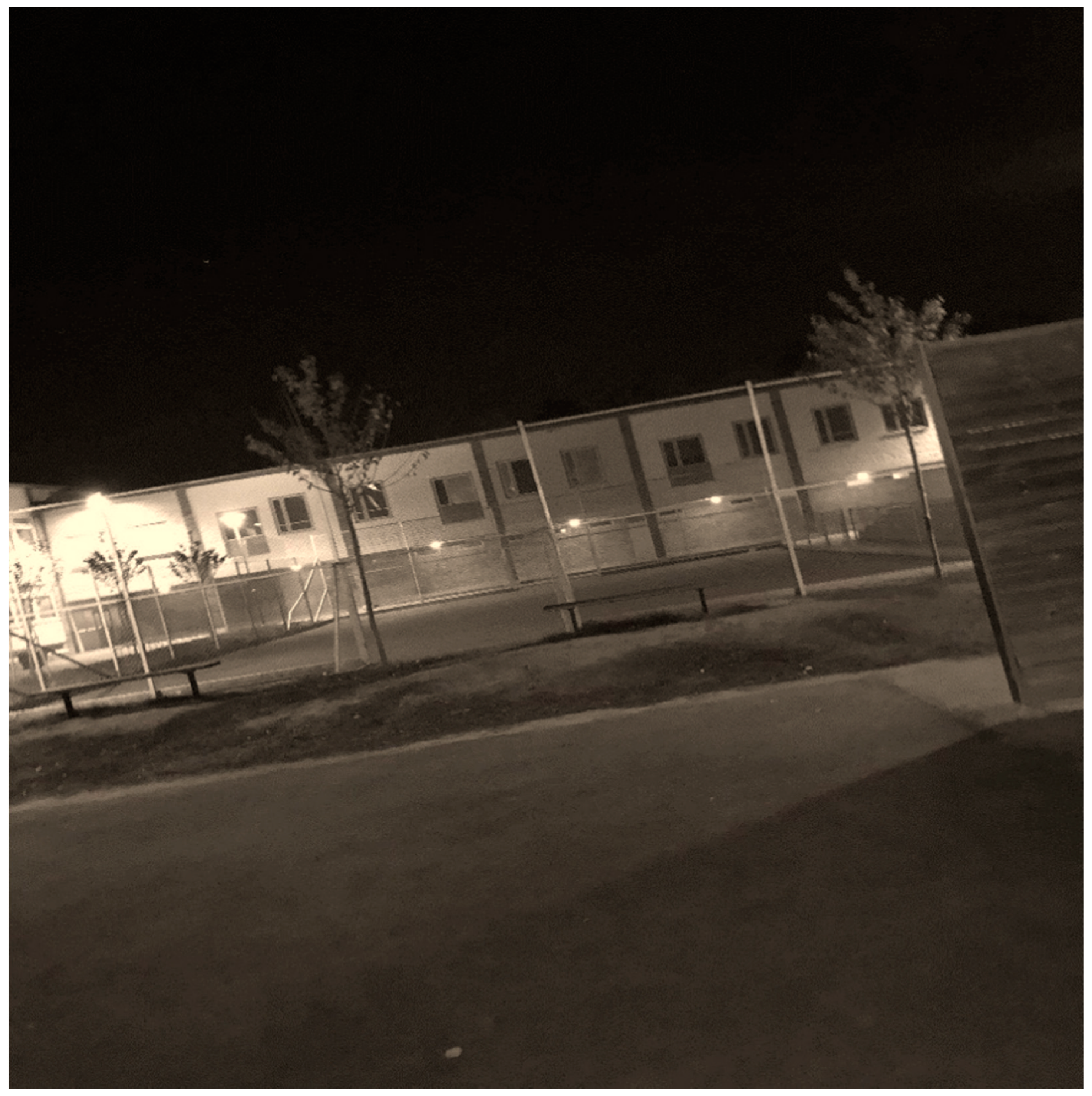
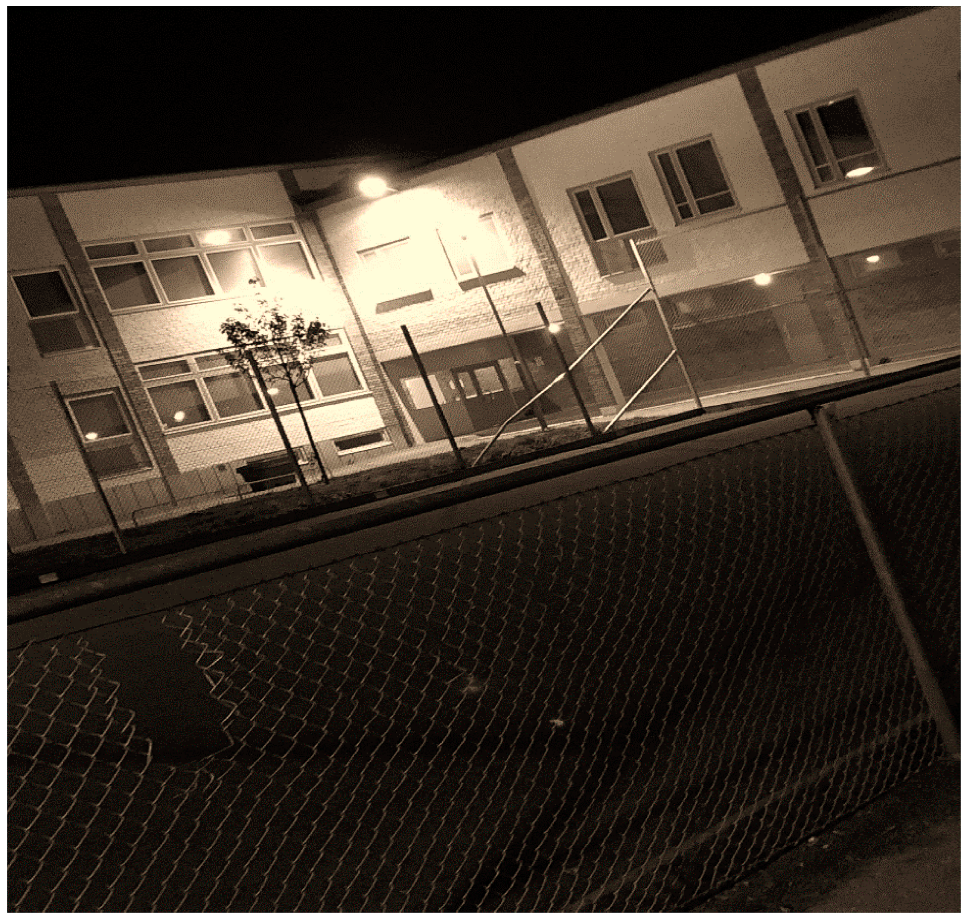
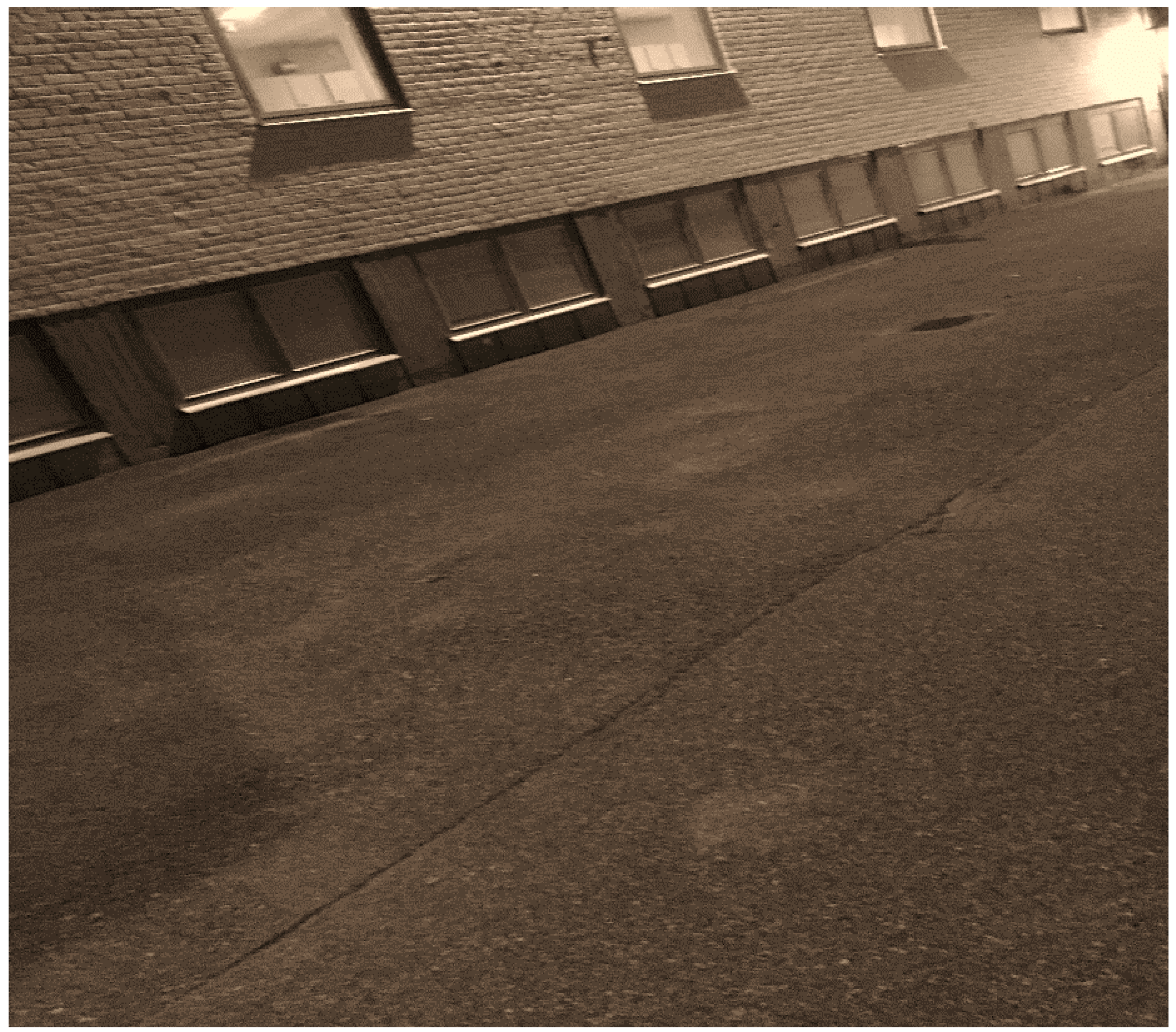
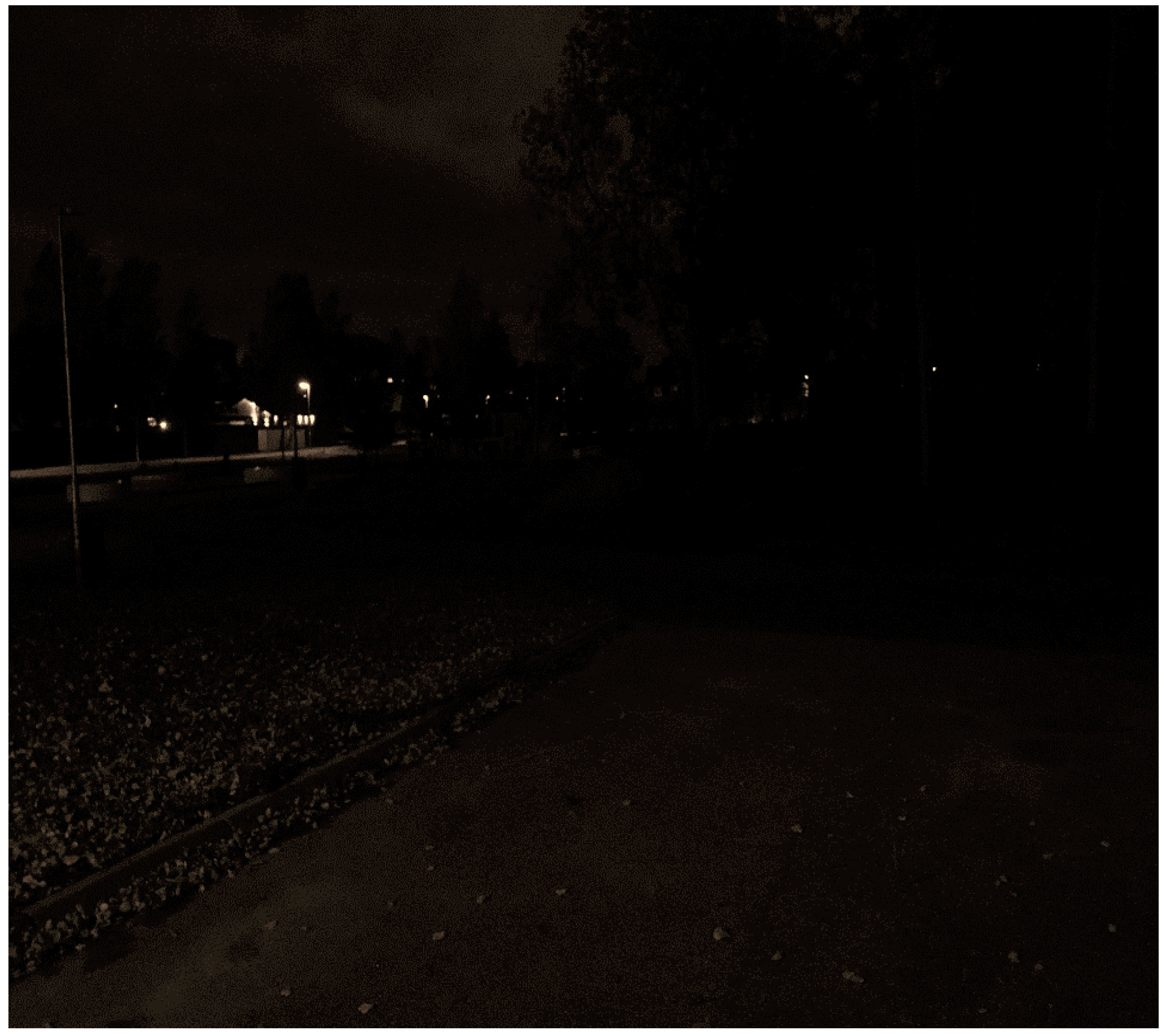
Here at the playground, there is hardly any illumination. There are many streetlights, but few of them work. Children and families passing by here feel insecure, including me(Authors’ translation; Figure 11).
3.5. The Social and Political Impact of Citizen Science
4. Discussion and Conclusions
Author Contributions
Funding
Institutional Review Board Statement
Informed Consent Statement
Data Availability Statement
Acknowledgments
Conflicts of Interest
References
- Andersson, R.; Bråmå, Å. The Stockholm Estates: A Tale of the Importance of Initial Conditions, Macroeconomic Dependencies, Tenure and Immigration. In Housing Estates in Europe: Poverty, Ethnic Segregation and Policy Challenges; Open Access Urban Book Series; Springer: Cham, Switzerland, 2018; pp. 361–387. [Google Scholar]
- Andersson, R.; Musterd, S.; Galster, G. Port-of-Entry Neighbourhood and its Effects on the Economic Success of Refugees in Sweden. Int. Migr. Rev. 2019, 53, 671–705. [Google Scholar] [CrossRef] [Green Version]
- Fell, T.; Guziana, B.; Elander, I. Klass, rumslig segregation och livskvalitet i två svenska städer. Statsvetensk. Tidskr. 2019, 121, 65–93. [Google Scholar]
- Gustavsson, E.; Elander, I. Sustainability potential of a redevelopment initiative in Swedish public housing: The ambiguous role of residents’ participation and place identity. Prog. Plan. 2016, 103, 1–25. [Google Scholar] [CrossRef]
- Rydenstam, T.; Fell, T.; Buli, B.G.; King, A.C.; Bälter, K. Using citizen science to understand the prerequisites for physical activity among adolescents in low socioeconomic status neighborhoods-The NESLA study. Health Place 2020, 65, 102387. [Google Scholar] [CrossRef] [PubMed]
- Thörn, C.; Holgersson, H. Revisiting the urban frontier through the case of New Kvillebäcken, Gothenburg. City 2016, 20, 663–684. [Google Scholar] [CrossRef]
- Ekholm, D.; Dahlstedt, M. Forming the association-like organisation: On civil society, welfare provision and sport as a means of social inclusion. Int. J. Sociol. Leis. 2019, 2, 219–238. [Google Scholar] [CrossRef] [Green Version]
- Wacquant, L.; Slater, T.; Pereira, V.B. Territorial Stigmatization in Action. Environ. Plan. A Econ. Space 2014, 46, 1270–1280. [Google Scholar] [CrossRef]
- Wacquant, L. Ghettos and Anti-Ghettos: An Anatomy of the New Urban Poverty. Thesis Elev. 2008, 94, 113–118. [Google Scholar] [CrossRef] [Green Version]
- Moczek, N.; Voigt-Heucke, S.L.; Mortega, K.G.; Fabó Cartas, C.; Knobloch, J. A Self-Assessment of European Citizen Science Projects on Their Contribution to the UN Sustainable Development Goals (SDGs). Sustainability 2021, 13, 1774. [Google Scholar] [CrossRef]
- Echeverria, A.; Ariz, I.; Moreno, J.; Peralta, J.; Gonzalez, E.M. Learning Plant Biodiversity in Nature: The Use of the Citizen–Science Platform iNaturalist as a Collaborative Tool in Secondary Education. Sustainability 2021, 13, 735. [Google Scholar] [CrossRef]
- Kocman, D.; Števanec, T.; Novak, R.; Kranjec, N. Citizen Science as Part of the Primary School Curriculum: A Case Study of a Technical Day on the Topic of Noise and Health. Sustainability 2020, 12, 10213. [Google Scholar] [CrossRef]
- Koffler, S.; Barbiéri, C.; Ghilardi-Lopes, N.P.; Leocadio, J.N.; Albertini, B.; Francoy, T.M.; Saraiva, A.M. A Buzz for Sustainability and Conservation: The Growing Potential of Citizen Science Studies on Bees. Sustainability 2021, 13, 959. [Google Scholar] [CrossRef]
- Veeckman, C.; Temmerman, L. Urban Living Labs and Citizen Science: From Innovation and Science towards Policy Impacts. Sustainability 2021, 13, 526. [Google Scholar] [CrossRef]
- Wuebben, D.; Romero-Luis, J.; Gertrudix, M. Citizen Science and Citizen Energy Communities: A Systematic Review and Potential Alliances for SDGs. Sustainability 2020, 12, 10096. [Google Scholar] [CrossRef]
- Doron, G.M. The Dead Zone and the Architecture of Transgression. City 2000, 4, 247–263. [Google Scholar] [CrossRef]
- Crang, M. Urban morphology and the shaping of the transmissable city. City 2000, 4, 303–315. [Google Scholar] [CrossRef]
- Wacquant, L. Urban Outcasts: A Comparative Sociology of Advanced Marginality, 1st ed.; Polity: Cambridge, UK, 2008; pp. 1–360. [Google Scholar]
- Larsen, T.S.; Delica, K.N. The production of territorial stigmatisation. City 2019, 23, 540–563. [Google Scholar] [CrossRef]
- Lister, R.; Smith, N.; Middleton, S.; Cox, L. Young People Talk about Citizenship: Empirical Perspectives on Theoretical and Political Debates. Citizsh. Stud. 2003, 7, 235–253. [Google Scholar] [CrossRef]
- Winter, S.J.; Goldman Rosas, L.; Padilla Romero, P.; Sheats, J.L.; Buman, M.P.; Baker, C.; King, A.C. Using Citizen Scientists to Gather, Analyze, and Disseminate Information About Neighborhood Features That Affect Active Living. J. Immigr. Minority Health 2016, 18, 1126–1138. [Google Scholar] [CrossRef] [Green Version]
- Lister, R. Inclusive Citizenship: Realizing the Potential. Citizsh. Stud. 2007, 11, 49–61. [Google Scholar] [CrossRef]
- The Swedish Police. Kriminell Påverkan i Lokalsamhället: En Lägesbild för Utvecklingen i Utsatta Områden; Nationella Operativa Avdelning (NOA), Underrättelseenheten: Stockholm, Sweden, 2019; pp. 1–9. [Google Scholar]
- Jensen, S.Q.; Christensen, A.D. Territorial stigmatization and local belonging. City 2012, 16, 77–89. [Google Scholar] [CrossRef]
- Urban, S. Integration och Grannskap: Hur Kan Staden Hålla Samman? Studentlitteratur: Lund, Sweden, 2018; pp. 1–131. [Google Scholar]
- Eskilstuna Municipality. Annual Plan for the Eskilstuna Municipality Group: Agreed on by the City Council on the 26th of November 2020; Service Administration Communication: Eskilstuna, Sweden, 2021; pp. 1–67. [Google Scholar]
- Statistics Sweden. Swedish and Foreign-Born Population by Region, Age and Sex: Year 2000–2020. Available online: http://www.statistikdatabasen.scb.se/pxweb/en/ssd/START__BE__BE0101__BE0101E/InrUtrFoddaRegAlKon/ (accessed on 24 June 2021).
- Edgren-Schori, M. Social Exclusion: En Kunskapsöversikt Och Begreppsanalys. Ph.D. Thesis, Akademitryck, Stockholm, Sweden, 2000; pp. 1–238. [Google Scholar]
- Bickford, S. Constructing Inequality: City Spaces and the Architecture of Citizenship. Political Theory 2000, 28, 355–376. [Google Scholar] [CrossRef]
- Burke Wood, P. Citizenship, Activism and the City: The Invisible and the Impossible; Routledge: London, UK, 2017; pp. 1–136. [Google Scholar]
- Gilbert, L.; Phillips, C. Practices of Urban Environmental Citizenships: Rights to the City and Rights to Nature in Toronto. Citizsh. Stud. 2003, 7, 313–330. [Google Scholar] [CrossRef]
- Driskell, D.; Fox, C.; Kudva, N. Growing up in the New New York: Youth Space, Citizenship, and Community Change in a Hyperglobal City. Environ. Plan. A Econ. Space 2008, 40, 2831–2844. [Google Scholar] [CrossRef]
- Young, I.M. Residential segregation and differentiated citizenship. Citizsh. Stud. 1999, 3, 237–252. [Google Scholar] [CrossRef]
- van Steden, R.; van Caem, B.; Boutellier, H. The ‘hidden strength’ of active citizenship: The involvement of local residents in public safety projects. Criminol. Crim. Justice 2011, 11, 433–450. [Google Scholar] [CrossRef] [Green Version]
- Putnam, R. Our Kids. The American Dream in Crisis; Simon & Schuster: New York, NY, USA, 2015; pp. 1–400. [Google Scholar]
- Hinckson, E.; Schneider, M.; Winter, S.J.; Stone, E.; Puhan, M.; Stathi, A.; Porter, M.; Garneder, P.; Lopes dos Santos, D.; King, A.C. Citizen science applied to building healthier community environments: Advancing the field through shared construct and measurement development. Int. J. Behav. Nutr. Phys. Act. 2017, 14, 133. [Google Scholar] [CrossRef] [PubMed] [Green Version]
- King, A.C.; Winter, S.J.; Chrisinger, B.W.; Hua, J.; Banchoff, A.W. Maximizing the promise of citizen science to advance health and prevent disease. Prev. Med. 2019, 119, 44–47. [Google Scholar] [CrossRef] [PubMed]
- Dahrendorf, R. The Modern Social Conflict. An Essay on the Politics of Liberty; University of California Press: Berkely, CA, USA, 1988; pp. 1–237. [Google Scholar]
- Heisler, B.S. A comparative perspective on the underclass. Theory Soc. 1991, 20, 455–483. [Google Scholar] [CrossRef]
- Statistics Sweden. Elected Candidates in the Election to the Riksdag by Sex, Foreign/Swedish Background and Those Who Left office. Number and Percent. Term of Office 2002-2006-2014-2018. Available online: https://www.statistikdatabasen.scb.se/pxweb/en/ssd/START__ME__ME0107__ME0107C/ME0107T42/ (accessed on 24 June 2021).
- Eskilstuna Kurrien. Eskilstuna Kurrien Archive. Available online: https://ekuriren.se/sok?searchText=Skiftinge (accessed on 28 June 2021).
- Eskilstuna Kurrien. Övervakningskameror Sätts in Mot Brott i Skiftinge. Available online: https://ekuriren.se/artikel/overvakningskameror-satts-in-mot-brott-i-skiftinge/4lq68o1j (accessed on 21 October 2020).
- Eskilstuna Kurrien. Brand på Pizzeria i Skiftinge Misstänks Vara Anlagd. Available online: https://ekuriren.se/artikel/brand-pa-pizzeria-i-skiftinge-misstanks-vara-anlagd/lqnnxypl (accessed on 17 December 2020).
- Eskilstuna Kurrien. Polis Frias, Mulade och Släpade Misstänkt i Snön. Available online: https://ekuriren.se/artikel/polis-frias--mulade-och-slapade-misstankt-i-snon/r96zo65r (accessed on 8 February 2021).
- Eskilstuna Kurrien. Grovt Misshandlad Flydde in på ICA Maxi. Available online: https://ekuriren.se/artikel/grovt-misshandlad-flydde-in-pa-ica-maxi/jpk51gmr (accessed on 10 March 2021).
- Eskilstuna Kurrien. Hotade Polis–”du är Färdig–du är Slut”. Available online: https://ekuriren.se/artikel/hotade-polis-du-ar-fardig---du-ar-slut/lwpknn1r (accessed on 10 April 2021).
- Eskilstuna Kurrien. 16 Bränder på 90 Minuter–Polis och Räddningstjänst Överösta av Larm. Available online: https://ekuriren.se/artikel/16-brander-pa-90-minuter--polis-och-raddningstjanst-overosta-av-larm/jv9gqwel (accessed on 16 May 2021).
- Falk, A. Skiftingebon: ”Många Äldre Stannar Hellre Hemma”. Available online: https://www.svt.se/nyheter/lokalt/sormland/manga-aldre-stannar-hellre-hemma (accessed on 30 June 2020).
- Kay, T.; Bradbury, S. Youth sport volunteering: Developing social capital? Sport Educ. Soc. 2009, 14, 121–140. [Google Scholar] [CrossRef] [Green Version]
- Bracy, N.L.; Millstein, R.A.; Carlsson, J.A. Is the relationship between the built environment and physical activity moderated by perceptions of crime and safety? Int. J. Nutr. Phys. Act. 2014, 11, 1–13. [Google Scholar] [CrossRef] [Green Version]
- Markowitz, F.E.; Bellair, P.E.; Liska, A.E.; Liu, J. Extending social disorganization theory: Modeling the relationships between cohesion, disorder, and fear. Criminology 2001, 39, 293–319. [Google Scholar] [CrossRef]
- Schreck, C.J.; Miller, J.M. Sources of Fear of Crime at School. J. Sch. Violence 2003, 2, 57–79. [Google Scholar] [CrossRef]
- Mason, P.; Kearns, A.; Livingston, M. “Safe Going”: The influence of crime rates and perceived crime and safety on walking in deprived neighbourhoods. Soc. Sci. Med. 2013, 91, 15–24. [Google Scholar] [CrossRef] [PubMed]
- Foster, S.; Wood, L.; Christian, H.; Knuiman, M.; Giles-Corti, B. Planning safer suburbs: Do changes in the built environment influence residents’ perceptions of crime risk? Soc. Sci. Med. 2013, 97, 87–94. [Google Scholar] [CrossRef] [PubMed]
- Peña-García, A.; Hurtado, A.; Aguilar-Luzón, M.C. Impact of public lighting on pedestrians’ perception of safety and well-being. Saf. Sci. 2015, 78, 142–148. [Google Scholar] [CrossRef]
- Carver, A.; Timperio, A.; Crawford, D. Playing it safe: The influence of neighbourhood safety on children’s physical activity. A review. Health Place 2008, 14, 217–227. [Google Scholar] [CrossRef] [PubMed]
- Altschuler, A.; Somkin, C.P.; Adler, N.E. Local services and amenities, neighborhood social capital, and health. Soc. Sci. Med. 2004, 59, 1219–1229. [Google Scholar] [CrossRef]
- Skinner, J.; Zakus, D.H.; Cowell, J. Development through Sport: Building Social Capital in Disadvantaged Communities. Sport Manag. Rev. 2008, 11, 253–275. [Google Scholar] [CrossRef] [Green Version]
- Leyden, K.M. Social capital and the built environment: The importance of walkable neighborhoods. Am. J. Public Health 2003, 93, 1546–1551. [Google Scholar] [CrossRef] [PubMed]
- Anderson, A.A.; Williams, E.; Long, M.; Carter, E.; Volckens, J. Organizationally based citizen science: Considerations for implementation. J. Sci. Commun. 2020, 19, 1–11. [Google Scholar] [CrossRef]
- Swedish Television. Fotbollsplanen Viktig ”Möjliggörare” i Utsatta Områden. Available online: https://www.svt.se/nyheter/lokalt/vastmanland/fotbollsplanen-viktig-mojliggorare-i-utsatta-omraden-enligt-ungdomarna-sjalva (accessed on 8 July 2019).
- King, A.C.; Odunitan-Wayas, F.A.; Chaudhury, M.; Rubio, M.A.; Baiocchi, M.; Kolbe-Alexander, T.; Montes, F.; Bahcoff, A.; Sarmiento, O.l.; Bälter, K.; et al. Community-Based Approaches to Reducing Health Inequities and Fostering Environmental Justice through Global Youth-Engaged Citizen Science. Int. J. Environ. Res. Public Health 2021, 18, 892. [Google Scholar] [CrossRef]
- King, A.C.; King, D.K.; Banchoff, A.; Solomonov, S.; Ben Natan, O.; Hua, J.; Gardiner, P.; Goldman Rosas, L.; Rodriguez Espinosa, P.; Winter, S.J.; et al. Employing Participatory Citizen Science Methods to Promote Age-Friendly Environments Worldwide. Int. J. Environ. Res. Public Health 2020, 17, 1541. [Google Scholar] [CrossRef] [PubMed] [Green Version]
- Odunitan-Wayas, F.A.; Hamann, N.; Sinyanya, N.A.; King, A.C.; Banchoff, A.; Winter, S.J.; Hendriks, S.; Okop, K.J.; Lambert, E.V. A citizen science approach to determine perceived barriers and promoters of physical activity in a low-income South African community. Glob. Public Health 2020, 15, 749–762. [Google Scholar] [CrossRef] [PubMed]
- Chavis, D.M.; Wandersman, A. Sense of community in the urban environment: A catalyst for participation and community development. Am. J. Community Psychol. 1990, 18, 55–81. [Google Scholar] [CrossRef]
- Tisdale, S.; Pitt-Catsuphes, M. Linking Social Environments With the Well-being of Adolescents in Dual-Earner and Single Working Parent Families. Youth Soc. 2011, 44, 118–140. [Google Scholar] [CrossRef]
- Wacquant, L. Urban Desolation and Symbolic Denigration in the Hyperghetto. Soc. Psychol. Q. 2010, 73, 215–219. [Google Scholar] [CrossRef]


| Skiftinge | Fröslunda | Eskilstuna | ||||
|---|---|---|---|---|---|---|
| N | % | N | % | N | % | |
| Population by origin of birth (2017) | ||||||
| Born in Sweden | 1766 | 37 | 2805 | 37 | 69,294 | 66 |
| Foreign background 1 | 3071 | 63 | 4805 | 63 | 35,415 | 34 |
| All | 4837 | 100 | 7610 | 100 | 104,709 | 100 |
| Education (2017) | ||||||
| Lower Secondary | 630 | 24 | 1304 | 33 | 8965 | 16 |
| Upper Secondary | 1210 | 47 | 1758 | 44 | 28,806 | 50 |
| Tertiary | 732 | 28 | 941 | 24 | 19,333 | 34 |
| All | 2572 | 100 | 4003 | 100 | 57,104 | 100 |
| Income (2016) | ||||||
| Annual mean income of labor | 74 | 63 | 100 | |||
| Population | Swedish Citizenship | Voter Turnout | ||
|---|---|---|---|---|
| Skiftinge | N | % | % | % |
| 4837 | 5 | 42 | 72 | |
| Fröslunda | 7610 | 7 | 26 | 70 |
| Both Places | 12,447 | 12 | 33 | 71 |
| Eskilstuna | 104,709 | 100 | 72 | 85 |
| Agree | Neutral | Disagree | Total | |
|---|---|---|---|---|
| Skiftinge | 3 (28) | 4 (36) | 4 (36) | 11 (100) |
| Fröslunda | 8 (67) | 1 (8) | 3 (25) | 12 (100) |
| Total | 11 (48) | 5 (22) | 7 (30) | 23 (100) |
| Perception | ||||||
|---|---|---|---|---|---|---|
| Coded Elements | Total | Facilitator | Barrier | |||
| N | % | N | % | N | % | |
| Youth club | 4 | 80 | 4 | 80 | 0 | 0 |
| Gangs of men | 1 | 20 | 0 | 0 | 1 | 20 |
| Crime | 0 | 0 | 0 | 0 | 0 | 0 |
| Total | 5 | 100 | 4 | 80 | 1 | 20 |
| Perception | ||||||
|---|---|---|---|---|---|---|
| Coded Elements | Total | Facilitator | Barrier | |||
| N | % | N | % | N | % | |
| Youth club | 7 | 46 | 7 | 46 | 0 | 0 |
| Gangs of men | 4 | 27 | 0 | 0 | 4 | 27 |
| Crime | 4 | 27 | 0 | 0 | 4 | 27 |
| Total | 15 | 100 | 7 | 46 | 8 | 54 |
| Perception | ||||||
|---|---|---|---|---|---|---|
| Coded Elements | Total | Facilitator | Barrier | |||
| N | % | N | % | N | % | |
| Amenities | 14 | 29 | 13 | 27 | 1 | 2 |
| Sport facilities | 6 | 13 | 6 | 12 | 0 | 0 |
| Parks, playground/outdoor gym | 8 | 17 | 7 | 15 | 1 | 2 |
| Street lighting | 11 | 23 | 3 | 6 | 8 | 17 |
| Parking spaces | 5 | 10 | 4 | 8 | 1 | 2 |
| Aesthetics | 2 | 4 | 1 | 2 | 1 | 2 |
| Bike and walkability | 2 | 4 | 2 | 4 | 0 | 0 |
| Public transport | 0 | 0 | 0 | 0 | 0 | 0 |
| Total | 48 | 100 | 36 | 74 | 12 | 26 |
| Perception | ||||||
|---|---|---|---|---|---|---|
| CodedElements | Total | Facilitator | Barrier | |||
| N | % | N | % | N | % | |
| Amenities | 16 | 33 | 15 | 30 | 1 | 2 |
| Sportfacilities | 16 | 33 | 16 | 33 | 0 | 0 |
| Parks, playground/outdoorgym | 13 | 26 | 13 | 26 | 0 | 0 |
| Streetlighting | 1 | 2 | 1 | 2 | 0 | 0 |
| Parkingspaces | 0 | 0 | 0 | 0 | 0 | 0 |
| Aesthetics | 2 | 4 | 2 | 4 | 0 | 0 |
| Bikeandwalkability | 0 | 0 | 0 | 0 | 0 | 0 |
| Publictransport | 1 | 2 | 1 | 2 | 0 | 0 |
| Total | 49 | 100 | 48 | 98 | 1 | 2 |
Publisher’s Note: MDPI stays neutral with regard to jurisdictional claims in published maps and institutional affiliations. |
© 2021 by the authors. Licensee MDPI, Basel, Switzerland. This article is an open access article distributed under the terms and conditions of the Creative Commons Attribution (CC BY) license (https://creativecommons.org/licenses/by/4.0/).
Share and Cite
Fell, T.; Rydenstam, T.; Buli, B.G.; King, A.C.; Bälter, K. Citizen Science in Sweden’s Stigmatized Neighborhoods. Sustainability 2021, 13, 10205. https://doi.org/10.3390/su131810205
Fell T, Rydenstam T, Buli BG, King AC, Bälter K. Citizen Science in Sweden’s Stigmatized Neighborhoods. Sustainability. 2021; 13(18):10205. https://doi.org/10.3390/su131810205
Chicago/Turabian StyleFell, Terence, Tove Rydenstam, Benti Geleta Buli, Abby C. King, and Katarina Bälter. 2021. "Citizen Science in Sweden’s Stigmatized Neighborhoods" Sustainability 13, no. 18: 10205. https://doi.org/10.3390/su131810205
APA StyleFell, T., Rydenstam, T., Buli, B. G., King, A. C., & Bälter, K. (2021). Citizen Science in Sweden’s Stigmatized Neighborhoods. Sustainability, 13(18), 10205. https://doi.org/10.3390/su131810205