Article

Study on Forest Extraction and Ecological Network Construction of Remote Sensing Images Combined with Dynamic Large Kernel Convolution

1
School of Geomatics, Liaoning Technical University, Fuxin 123000, China
2
School of Architectural Engineering, Dalian University of Technology City Institute, Dalian 116600, China
3
Dalian Huangbohai Marine Surveying Data Information Co., Ltd., Dalian 116000, China
*
Author to whom correspondence should be addressed.
Forests 2025, 16(8), 1342; https://doi.org/10.3390/f16081342
Submission received: 12 July 2025 / Revised: 6 August 2025 / Accepted: 11 August 2025 / Published: 18 August 2025
(This article belongs to the Special Issue Long-Term Monitoring and Driving Forces of Forest Cover)

Abstract

As an important input parameter of the ecological network, the accuracy and detail with which forest cover is extracted directly constrain the accuracy of forest ecological network construction. The development of medium- and high-resolution remote sensing technology has provided an opportunity to obtain accurate and high-resolution forest coverage data. As forests have diverse contours and complex scenes on remote sensing images, a model of them will be disturbed by the natural distribution characteristics of complex forests, which in turn will affect the extraction accuracy. In this study, we first constructed a rather large, complex, diverse, and scene-rich forest extraction dataset based on Sentinel-2 multispectral images, comprising 20,962 labeled images with a spatial resolution of 10 m, in a manually and accurately labeled manner. At the same time, this paper proposes the Dynamic Large Kernel Segformer and conducts forest extraction experiments in Liaoning Province, China. We then used forest coverage as an input parameter and classified the forest landscape patterns in the study area using a landscape spatial pattern characterization method, based on which a forest ecological network was constructed. The results show that the Dynamic Large Kernel Segformer obtains 80.58% IoU, 89.29% precision, 88.63% recall, and a 88.96% F1 Score in extraction accuracy, which is 4.02% higher than that of the Segformer network, and achieves large-scale forest extraction in the study area. The forest area in Liaoning Province increased during the 5-year period from 2019 to 2023. With respect to the overall spatial pattern change, the Core area of Liaoning Province saw an increase in 2019–2023, and the overall quality of the forest landscape improved. Finally, we constructed the forest ecological network for Liaoning Province in 2023, which consists of ecological sources, ecological nodes, and ecological corridors based on circuit theory. This method can be used to extract large areas of forest based on remote sensing images, which is helpful for constructing forest ecological networks and achieving coordinated regional, ecological, and economic development.

1. Introduction

As a fundamental element for maintaining biodiversity, guaranteeing ecological security, and providing ecosystem services, forests are an irreplaceable strategic cornerstone role in the process of ecological civilization construction [1]. They are an important part of maintaining biodiversity and building a modern ecological governance system [2]. At present, ecological restoration of China’s land-space has progressed to the core task of building an ecological civilization, the essence of which is to realize synergistic benefits between ecological integrity and economic efficiency by constructing an ecological security pattern [3]. Due to the varied temporal and spatial distribution of forests and their heterogeneous nature, the traditional forest land extraction methods represented by forestry surveys and visual interpretation of remote sensing data have low efficiency and cannot meet the needs of large-scale forest monitoring and data updating [4].
With the rapid development of multispectral, hyperspectral, and synthetic aperture radar (SAR) and other remote sensing technologies, the dynamic monitoring of forest resources has been transformed from traditional visual interpretation to automation and quantitative analysis [5]. In recent years, vegetation spectral indices and supervised classification methods based on machine learning have been widely applied and extensively studied, with the objective of extracting forests from remote sensing imagery [6]. However, the above methods have problems, such as limited applicable areas, difficult index construction, and the significant influence of diverse forest features in the natural state, which makes them difficult to apply to large-scale forest extraction [7,8]. Deep learning methods, represented by CNNs and transformers, constitute a significant branch of machine learning and have been more widely and thoroughly applied and explored in the field of computer vision [9,10].
In recent years, the Segformer model has attracted significant attention owing to its exceptional competence in extracting global image features. Compared with traditional deep convolutional neural networks, Segformer demonstrates superior capabilities in modeling long-range dependencies, parallel computing, multi-scale feature representation, and positional encoding processing [11]. However, due to the characteristics of forests in remote sensing imagery, such as unstable contours and irregular shapes, as well as the interference from the complex natural distribution characteristics of forests, deep learning-driven target segmentation methods that rely on target contours as primary features still have significant room for improvement in terms of accuracy when applied to forest extraction tasks in natural-state remote sensing imagery [12].
Large kernel convolution is able to directly capture complete object contours and contextual relationships, because it has a large receptive field to cover distant regions in the image. It avoids the need for standard convolution to acquire global features with reduced resolution through multiple layers of downsampling. In target extraction tasks that focus on image resolution, such as remote sensing images, large kernel convolution can effectively avoid the boundary blurring caused by the layer-by-layer transfer of small convolution kernels of standard convolution. However, the increase in convolution kernels leads to a significant increase in the computational volume of the model, and an excessive number of parameters easily lead to model overfitting problems, as well as a high demand for computing power. To address this issue, dynamic large kernel convolution, combining large receptive fields and dynamic weight allocation, has been proposed. It can adaptively generate dynamic convolution kernel parameters based on the input image features. On this basis, dynamic large kernel convolution only performs dense computations on feature regions while using sparse sampling or dilation strategies for the remaining regions, effectively addressing the issue of excessive parameter counts in large kernel convolution [13].
Therefore, the primary contribution of this study is the construction of a forest extraction dataset based on Sentinel-2 satellite imagery; it is worth noting that this dataset has a considerable size, as well as rich scene diversity, in order to cope with the potential overfitting risk of dynamic large kernel convolution. Based on this, this paper proposes a forest extraction model (Dynamic Large Kernel Segformer) for remote sensing images that combines Segformer with dynamic large kernel convolution. First, based on the combination of the Segformer model and dynamic large kernel convolution, a multi-scale feature characterization ability, anti-boundary blurring ability, and multi-head self-attention mechanism are organically fused. The fused Dynamic Large Kernel Segformer model can more quickly and accurately localize and extract multi-scale and irregular target features, which in turn improves the accuracy of the deep learning model for forest extraction from remote sensing images. Based on the Dynamic Large Kernel Segformer, we can accurately extract the large-scale forest coverage within the research area. Then, based on morphological spatial pattern analysis (MSPA), the forest cover of the study area in 2023 was studied in the context of forest landscape patterns. Finally, in circuit theory, the random walk of charges resembles the characteristics of biological movement more closely, enabling effective simulation of ecological flow processes and revealing the selection mechanisms of biological migration paths. This makes it possible to conduct precise analyses of the actual sizes, core nodes, and importance weights of ecological corridors, providing a theoretical basis for optimizing ecological safety patterns. Therefore, in this study, we integrated the spatial patterns of forest landscapes within the study area with circuit theory principles, minimum cumulative resistance modeling, and the Linkage Mapper connectivity tool to construct a forest ecological network. This method utilizes the distribution characteristics of forest landscape patterns to guide network construction. The main contributions of this study are as follows: (1) We developed a large-scale forest extraction model for remote sensing images for forests with diverse contours and complex scenes on remote sensing images by combining the Segformer with dynamic large kernel convolution (Dynamic Large Kernel Segformer), in order to achieve accurate extraction of forest coverage in a wide range of areas and provide input parameters for forest landscape pattern analysis and ecological network construction. (2) We combined the results of forest landscape pattern classification based on MSPA with ecological network theory and analyzed the forest conditions in Liaoning Province, China, in 2019 and 2023 from the perspectives of spatiotemporal changes and landscape pattern changes. At the same time, we constructed an ecological network for the study area to identify important ecological sources, ecological nodes, and ecological corridors within the study area, which is conducive to ecological protection in this region.
The subsequent sections of this paper are structured as follows: Section 2 details the study area and data preparation processes. Section 3 expounds the construction method of the remote sensing image forest extraction model (Dynamic Large Kernel Segformer), combining Segformer with dynamic large kernel convolution, MSPA, and ecological network theory. Section 4 reports the research results, evaluating the forest extraction accuracy of the proposed Dynamic Large Kernel Segformer, using Segformer as the comparison algorithm. Section 5 conducts two additional experiments based on the research results. The first experiment, presented in Section 5.1, analyzes changes in forest area and landscape pattern classification in the study area. The second experiment builds the 2023 forest ecological network for the study area based on the first experiment. Finally, the limitations of our research are summarized. Section 6 presents our conclusions.

2. Study Area and Data

2.1. Overview of the Study Area

Liaoning Province (38°43′–43°26′ N, 118°53′–125°46′ E) is located in the southern part of northeastern China, bordering the Yellow Sea and the Bohai Sea in the south, Hebei in the southwest, Inner Mongolia in the northwest, Jilin in the northeast, and North Korea across the Yalu River in the southeast. Liaoning Province consists of mountains, hills, and plains. The climate is a temperate, continental monsoon climate. There is a wide range of forest types in Liaoning, including coniferous forests, broadleaf forests, and mixed coniferous and broadleaf forests [14]. The dense forests in the mountainous areas of the Liaodong Peninsula in southern Liaoning Province act as huge ecological barriers and play a key role in protecting soil, conserving water, and regulating the climate. Therefore, studying forest changes and forest ecological networks in Liaoning Province, China, will contribute to biodiversity conservation and species migration in the region.

2.2. Research Data

Sentinel-2 imagery acquired in 2019 and 2023 served as the data foundation for analyzing the spatiotemporal dynamics of forest land distribution and landscape patterns within the study area, as well as for constructing the forest ecological network for 2023. Sentinel-2, consisting of Sentinel-2 A and Sentinel-2 B, is a constellation of satellites carrying a multispectral imaging sensor, developed and operated by the European Space Agency (ESA), which offers openly accessible and freely available data (https://dataspace.copernicus.eu/). The spatial resolutions of the images are 10 m, 20 m, and 60 m. In our study, we selected red-, green-, and blue-band images with a resolution of 10 m. All data are remote sensing data, collected during the vegetation growing season (June to August) with cloud cover < 10%, and underwent preprocessing such as geometric and atmospheric correction [15].

2.3. Experimental Data

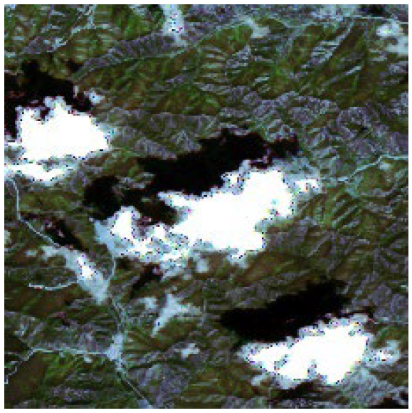
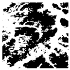
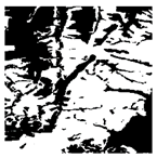
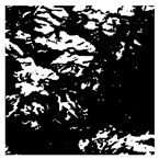
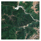
Forest resources predominantly occur in topographically complex regions, particularly mountainous and hilly areas, where remote sensing data acquisition is subject to multiple confounding factors. These include variable solar illumination conditions; terrain-induced shadow effects; intermittent cloud contamination; and heterogeneous background interference from mixed land covers. Consequently, forest features in remotely sensed imagery exhibit pronounced spatial heterogeneity and substantial intraclass spectral variability, presenting significant challenges for accurate classification and monitoring [16,17,18]. In this study, based on the data constructed in previous work [19], we systematically integrated the key interference factors, such as light intensity variation, canopy depression, cloud/fog noise interference, and crop spectral confusion, and constructed an optical remote sensing thematic dataset to be used for high-precision forest identification by utilizing the Sentinel-2 multispectral imagery with a long time series and wide-area coverage of northeastern China. The dataset was constructed using Sentinel-2 multispectral images (with a spatial resolution of 10 m). The samples were prepared by labelme, a professional labeling platform, and a total of 20,962 standard samples of 512 × 512 pixels were generated, including 16,962 positive samples with forest labeling and 4000 negative samples without forest. According to the benchmark ratio (0.8:0.1:0.1) established in the literature [20], the dataset was divided into three independent subsets: the training set, the validation set, and the test set; the specific sample distribution is shown in Table 1. The images are Sentinel-2 10 m resolution color images consisting of red, green, and blue bands, with white areas in the sample labels as the background and black areas as forested areas.

3. Research Methods

Our research process is shown in Figure 1. First, we constructed forest extraction datasets based on large-scale, multi-year Sentinel-2 images. Second, we used these datasets to train the Dynamic Large Kernel Segformer. After obtaining the optimal training weights, we extracted the forest coverage area from the input Sentinel-2 images covering Liaoning Province. Further, we classified the forest landscape patterns in Liaoning Province based on MSPA. Finally, we constructed the ecological network of the study area based on the classification results.

3.1. Dynamic Large Kernel Convolution

The dynamic large kernel convolution chosen in this study was proposed by Yang et al. [21]. The goal is to avoid excessive computational loads in 3D segmentation tasks. To achieve this, Yang et al. used two slightly smaller dynamic large kernels to achieve the same effective receptive field as large kernel convolutions. In our study, in order to match the dynamic large kernel convolution with the objective of extracting forests from remote sensing imagery, we improved on Yang et al.’s method. The overall structure of the dynamic large kernel convolution proposed in this paper is shown in Figure 2.
As illustrated in Figure 2, X is the input feature, and X1 and X2 are the feature mappings extracted in X after convolution with two large kernels of 5 × 5 and 7 × 7 [22]. In this study, we used two convolutional layers with large kernels, 5 × 5 and 7 × 7. The purpose of this was to make the contextual information recursively aggregated within the receptive field, which in turn allowed the effective receptive field to be incrementally larger. In addition, features extracted within a larger receptive field contribute more significantly to the output, which allows dynamic large kernel convolution to capture finer and more informative features. First, dynamic large kernel convolution applies average and maximum pooling from cascading features along the channel, and the global spatial relationships of these local features are efficiently extracted. A 7 × 7 convolutional layer is then utilized to mediate information interactions among diverse spatial descriptors, with a subsequent Sigmoid activation producing dynamically derived weights (W1, W2) to modulate features X1 and X2, as defined by Equation (1).
W 1 ; W 2 = S i g m o i d ( C o n v 7 × 7 ( W a v g ; W m a p )
The features of the different macronuclei are adaptively selected by calibrating them using these selection values. Finally, a residual connection is applied, as shown in Equation (2).
X = W 1 X 1 W 2 X 2 + X

3.2. Dynamic Large Kernel Segformer Forest Extraction Modeling

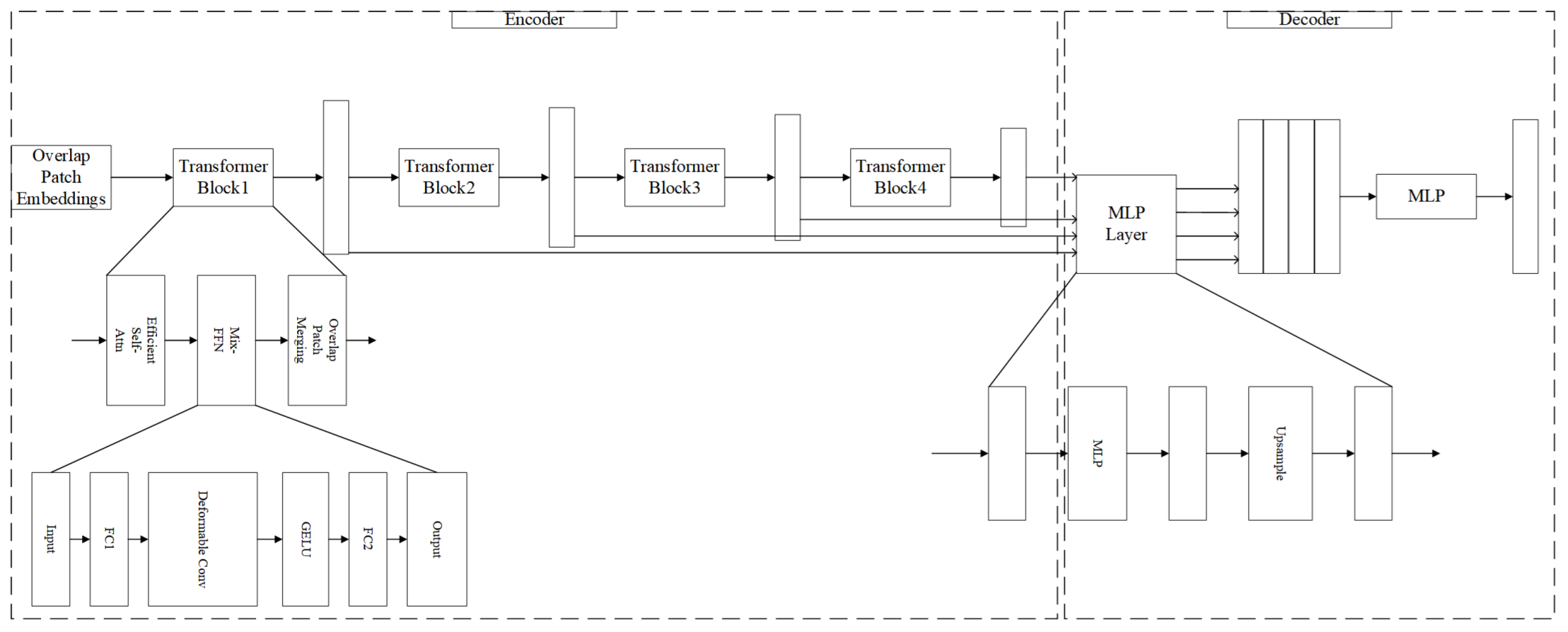
Since being developed, the Segformer network architecture has been widely used in target extraction tasks based on remote sensing images. The Segformer network has difficulty with effectively capturing global image features, which means that there is still some room for improvement of this network in terms of the details of feature extraction from remote sensing images [23]. In order to accurately extracts forests based on remote sensing imagery with medium-to-high spatial resolution, we designed a forest extraction model, the Dynamic Large Kernel Segformer, which integrates dynamic large kernel convolution and the Segformer network architecture, as shown in Figure 3. To enhance the model’s adaptability to Multi-scale features of forest targets, we used dynamic large kernel to replace the 3 × 3 standard convolutional layers instead of the original Segformer encoder. Compared with standard convolution, which needs to obtain global information by stacking multiple layers and downsampling to reduce the resolution, dynamic large kernel convolution enables the network to focus on the global information of the forest in the remotely sensed image through a larger convolution kernel while maintaining a certain resolution, in order to cope with the details of the forest contours in the remotely sensed image more effectively. In the decoder part, Segformer still adopts a lightweight pure multilayer perceptron (MLP) decoder structure, which directly aggregates the features from different layers of the encoder. This structure significantly reduces the model parameters, making the model easier to train and deploy. Meanwhile, integrating the hierarchical feature fusion strategy into this decoder effectively improves the feature representation capability.

3.3. Morphological Spatial Pattern Analysis (MSPA)

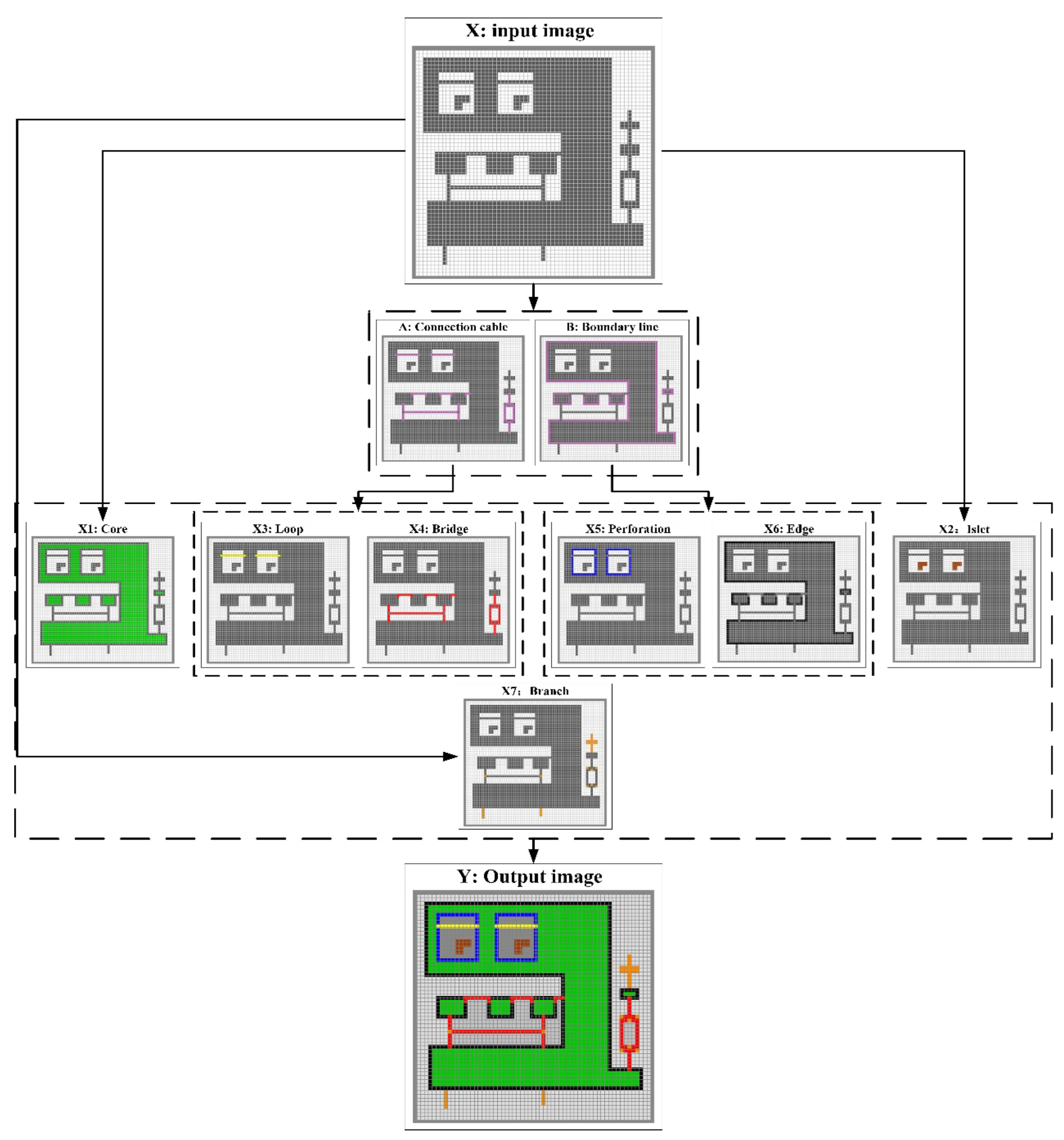
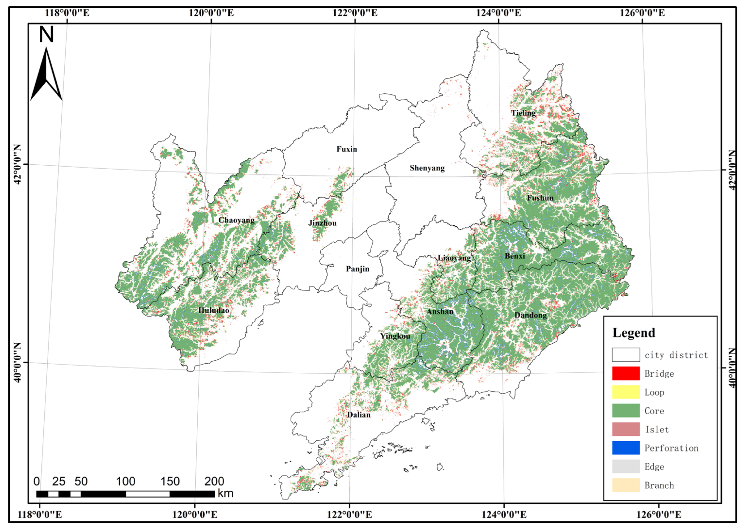
Morphological spatial pattern analysis (MSPA) is a specialized image processing technique that quantitatively characterizes spatial configurations within rasterized land use/cover data through mathematical morphology operations [24,25]. In this study, we implemented an 8-neighborhood moving window algorithm to decompose the binary foreground (forest cover) into seven mutually exclusive landscape element categories: Core, Islet, Perforation, Edge, Loop, Bridge, and Branch (Figure 4). This segmentation enables the systematic classification of forest landscape types based on their geometric properties and topological relationships. The MSPA-derived metrics provide critical insights into structural connectivity, fragmentation patterns, and potential ecological corridors at the regional scale [19].

3.4. Ecological Network Theory

In this study, we used Circuitscape software (4.0.5) and circuit theory frameworks [26] for the identification of potential ecological corridors between ecological sources by integrating this approach with the minimum cumulative resistance (MCR) and Linkage Mapper tool sets in ArcGIS (10.2). After important ecological corridors were determined, ecological pinch points were extracted, and ecological obstacle areas were identified. Finally, an ecological network system consisting of ecological obstacle zones, ecological pinch points, and ecological corridors was constructed.
(1)
Circuit Theory
Circuit theory was originally applied to the analysis of electronic circuits but was subsequently introduced into the field of ecology to assess the connectivity of ecosystems. In this approach, ecosystems are modeled as circuit networks, where the geospatial units are used as network nodes and the ecological pathways correspond to connecting paths. The erratic diffusion of species and ecological flows within an ecosystem can be mapped by modeling the random paths of electrons in an electric current, where the movement of electrons represents the activity of species or ecological flows, and the landscape structure is viewed as a conductive medium. This modeling approach can efficiently generate visual representations of ecological connectivity or quickly locate obstacle areas in the landscape. Its core value lies in the identification of the key landscape connectivity elements that are essential for maintaining overall connectivity, thus providing a scientific basis for ecological conservation planning.
(2)
Minimum Cumulative Resistance
The minimum cumulative resistance (MCR) was initially researched and proposed by Knaapen and other scholars [27]. Yu et al. [28] improved the model by integrating it with the cost distance tool in ArcGIS software, in order to explore the key locations and node areas in the landscape patterns. This integrated method has been widely used in ecological research, providing important technical support for ecological landscape analysis [29].
MCR = f j = n i = m D i j R i
where MCR stands for the minimum cumulative resistance value; f is an unknown positive function, which indicates the positive correlation that exists between the resistance value and the ecological process; Dij refers to the spatial distance from the ecological source site j to any grid cell i in space; and Ri denotes the value of resistance that grid cell i exerts on the movement of the ecological process [30].
(3)
Linkage Mapper Analysis
The Linkage Mapper toolset (2.0) has wide applicability in wildlife habitat landscape connectivity studies. In this study, the toolset was applied to accomplish three core tasks: Firstly, the Linkage Mapper module was employed for extracting the ecological corridor network within the study area. Secondly, The Barrier Mapper and Pinchpoint Mapper modules were then used to identify the ecological barriers and pinch points, respectively [31]. Thirdly, the toolset was used to extract adjacent ecological source sites (resource-based nodes), generate minimum cumulative cost paths through weighted distance surface calculations, and form a visualized ecological corridor map after standardization. This analysis method based on spatial resistance surfaces can achieve quantitative identification and visual representation of ecological corridors by quantifying the connectivity costs between different habitats. Using this method can clearly reveal the role of each grid cell on the connectivity between source sites; meanwhile, it can also clarify whether each corridor plays a hindering or facilitating role in the connectivity status between source sites [32].

3.5. Accuracy Evaluation Indicators

To reliably measure the effectiveness of the forest dynamic extraction method for remote sensing images, we adopted a deep learning-based performance evaluation system [32] to verify the accuracy of the proposed Dynamic Large Kernel Segformer model. Specifically, the test set results extracted by the Dynamic Large Kernel Segformer model were compared with the sample labels on a pixel-by-pixel basis. In this paper, we adopt four generic performance metrics for quantitative evaluation [33,34,35], namely, precision, recall, Intersection over Union (IoU), and F1 Score, which are mathematically defined in Equations (4) to (7), respectively. It should be emphasized that the Intersection over Union (IoU) characterizes the ratio of the area of the intersection region in relation to the area of the concatenation region between the model extraction results and the baseline labels in the same image in the pixel space. The improvement in the value range of this indicator directly reflects the improvement in the model’s spatial recognition results on the test set to match the real land class distribution.
P r e c i s i o n = T P T P + F P
R e c a l l = T P T P + F N
I o U = T P T P + F P + F N
F 1 = 2 × P r e c i s i o n × R e c a l l P r e c i s i o n + R e c a l l

4. Experimental Studies and Analyses

4.1. Model Training

In this study, the proposed Dynamic Large Kernel Segformer architecture was trained using the aforementioned forest extraction training set, and the Segformer architecture was chosen as the benchmark comparison model [36,37]. The cumulative training time for the Dynamic Large Kernel Segformer model was 17.7 h. In our experiment, the epoch was set to 100, the batch size was set to 4, and the initial learning rate was set to 1 × 10⁻⁶. The experiment showed that the model reached its optimal parameter state in the 89th training cycle, at which point the train loss was 0.091 and the val loss was 0.112.

4.2. Experimental Findings

In this study, we evaluated the reliability of the proposed method for forest recognition in a non-homogeneous environment at a Sentinel-2 10 m resolution based on 1696 forest test samples, which were fine-tuned by experts on the forest dataset. To validate the model effectiveness, the Segformer architecture and Dynamic Large Kernel Segformer model were employed to perform forest feature extraction on the test set images, and the expert-annotated baseline labels of the homologous images were used as the truth value reference. The statistical mean values of the four performance metrics for both groups of methods were finally derived (see Table 2 for details).
As shown in Table 2, for the 1696 Sentinel-2 test images containing forest targets, the comparative extraction experiments between the Dynamic Large Kernel Segformer proposed in this paper and the Segformer architecture show that the Dynamic Large Kernel Segformer model systematically outperforms the Segformer architecture in terms of precision rate, recall rate, IoU, and F1 Score (the four key precision indexes).
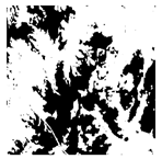
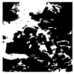
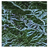
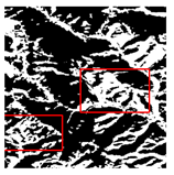
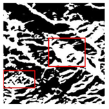
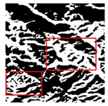
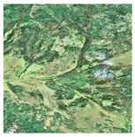
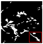
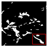
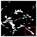
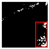
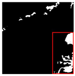
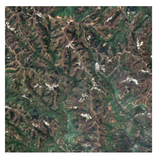
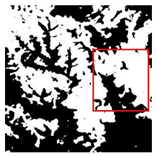
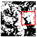
Especially in terms of forest edge structure restoration, the Dynamic Large Kernel Segformer shows a more complete spatial feature capture capability, effectively achieving highly robust recognition of multi-scale forest elements. Table 3 presents a visualized comparison of the forest extraction results. It is worth noting that the red boxes in this table indicate the main areas of difference between the forest extraction methods. Our experiments showed that the fused Dynamic Large Kernel Segformer model can extract forest coverage more accurately and efficiently than the original Segformer network, especially exhibiting higher robustness to complex background interference and forest target deformation.

5. Discussion

For this section, we conducted an analysis of forest changes in the study area from 2019 to 2023 based on the experimental results presented in Section 5.1. This analysis consists of two parts: changes in forest cover and changes in landscape patterns, obtained using MSPA. The second experiment, presented in Section 5.2, involved constructing a forest ecological network for the study area in 2023 based on ecological network theory, using the forest landscape pattern classification as a foundation.

5.1. Spatiotemporal Change in Forest Land in Liaoning Province

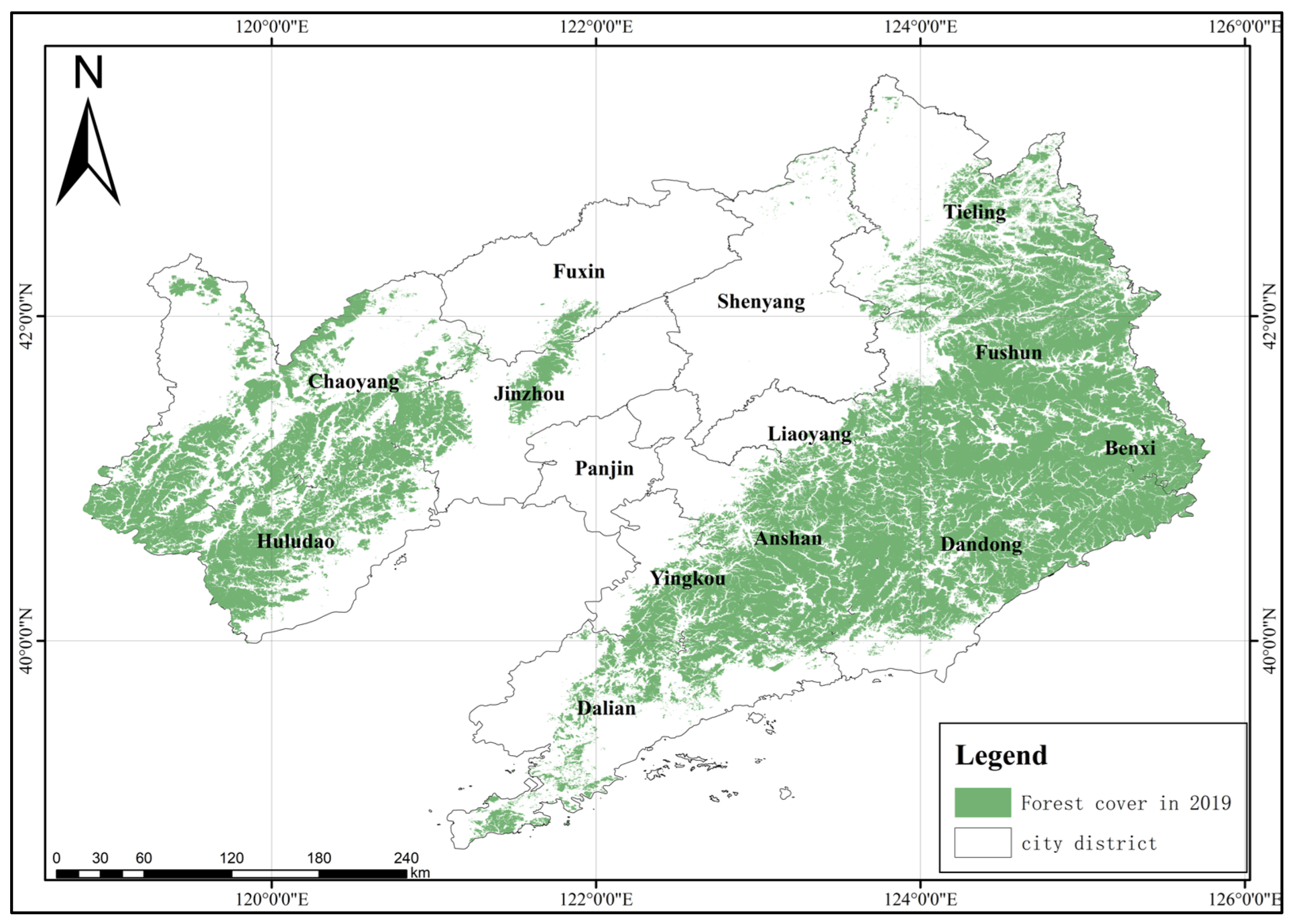
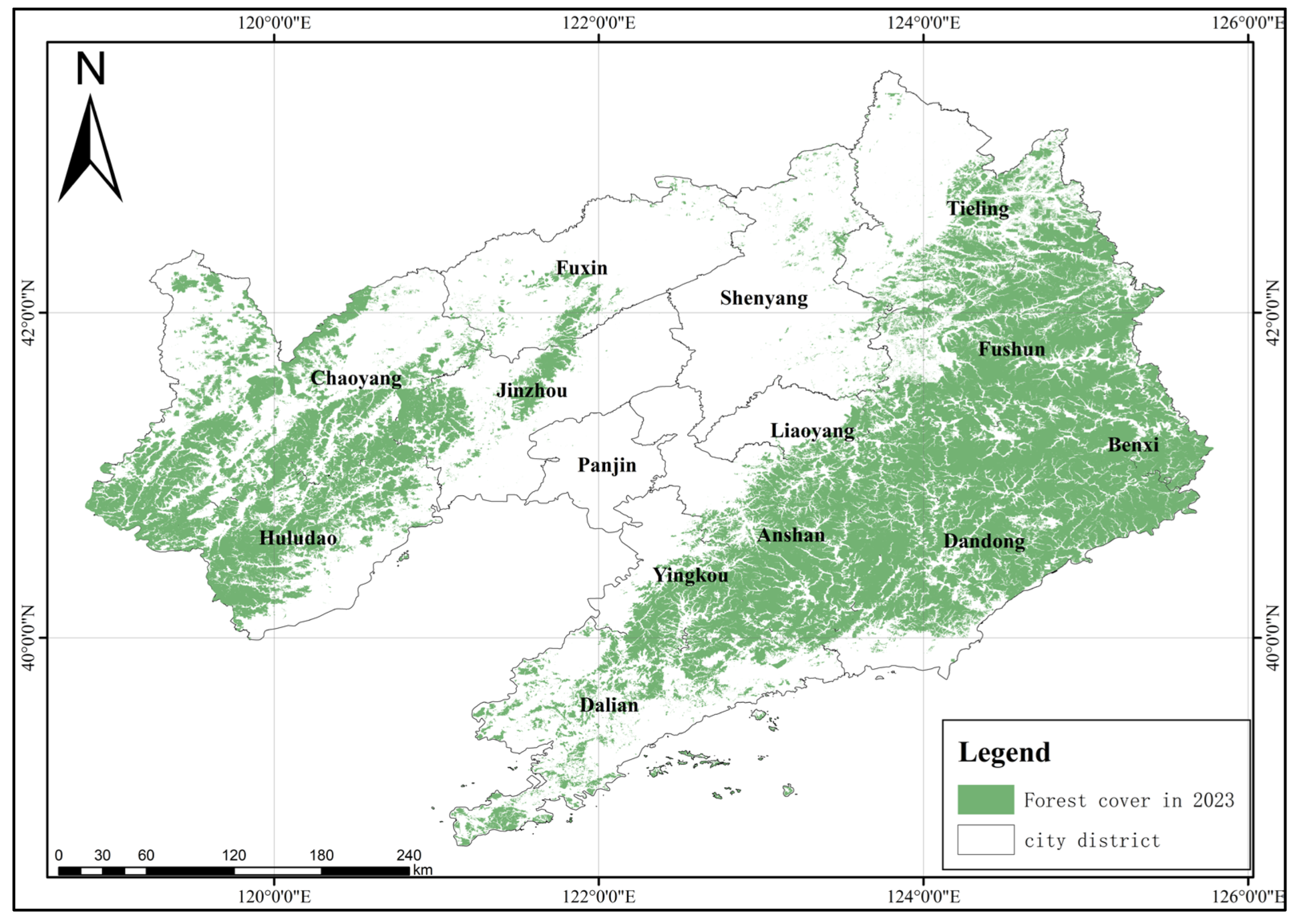
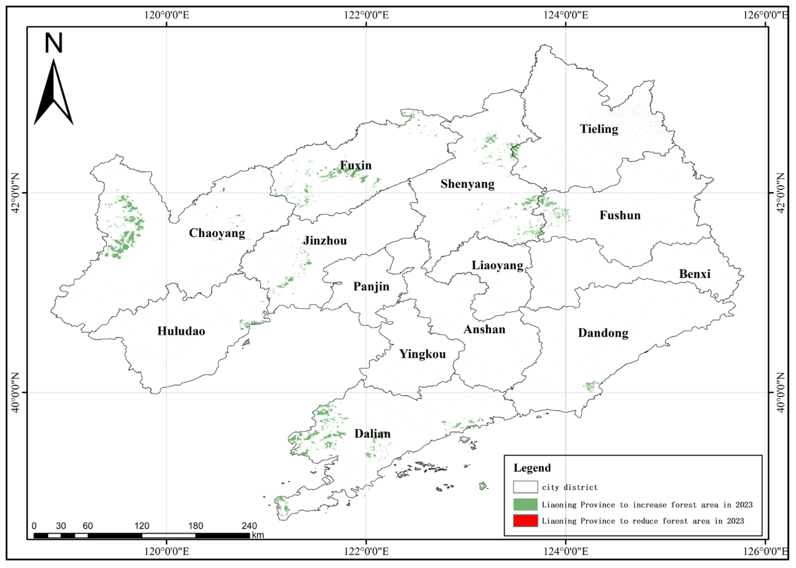
We extracted the forest coverage of our study area in Liaoning Province between 2019 and 2023 based on Sentinel-2 images covering the province, as shown in Figure 5 and Figure 6. On this basis, Figure 7 shows the spatial changes in forest coverage over these five years.
Figure 5 illustrates that the spatial configuration of forest land in Liaoning Province is uneven, showing a strip-like distribution, with forest land being more common in the west and east of the province.
This distribution is the result of the coupling effect of topography, climate, and socioeconomic development in Liaoning Province. In addition, along the temporal dimension, the continuous improvement in forest land coverage in Liaoning Province from 2019 to 2023 reflects the effectiveness of the continuous implementation of ecological protection policies, such as natural forest protection, shelterbelt construction, mining site restoration, and urban greening. This change has also been driven by economic structural adjustments, such as the green transformation of industry, eco-industry development, and the population’s ecological demands [38,39,40]. Along the spatial dimension, the eastern cities in the mountainous areas have maintained their forest resources through strict protection measures, as well as due to the low development intensity and ecological economic model; the central cities have expanded their forest land through balanced ecological restoration in the context of economic development and population agglomeration; and the western and coastal cities have implemented ecosystem restoration projects. The synergistic pattern of water conservation in the east, improvement of urban and rural ecology in the central area, windbreak and sand stabilization in the west, and restoration of wetlands along the coast has optimized the spatial pattern of forest lands in the entire region and significantly enhanced the ecological function as a whole, achieving a dynamic balance between economy, population, and ecological protection [39,41].
On the basis of obtaining the forest land area and spatiotemporal changes to it from 2019 to 2023 in Liaoning Province, classification of the forest types in Liaoning Province was performed using the MSPA method. Thereby, we were able to obtain the changes in seven MSPA forest landscape types—Bridge, Loop, Core, Islet, Perforation, Edge, and Branch—in Liaoning Province from 2019 to 2023, as shown in Figure 8 and Figure 9. In terms of forest land area, it can be seen that this area increased in Liaoning Province during the 5-year period from 2019 to 2023. The specific changes are shown in Table 4. From 2019 to 2023, the forest Perforation landscape in the study area decreased significantly, while the Core, Edge, and Bridge areas increased significantly. Looking at overall spatial pattern changes, the forest coverage area in the Core region of Liaoning Province increased between 2019 and 2023. The degree of contiguity of the Core in the eastern mountainous areas was further strengthened, and the central, western, and coastal regions promoted the expansion of the Core through ecological restoration projects. These areas became the main force for optimizing the landscape pattern of forested landscapes and played a main supporting role in the enhancement of the regional ecological service functions. By 2023, Branch landscapes were more densely distributed along rivers and roads, while Bridge landscapes built ecological corridors between the different Core areas, significantly improving the connectivity between them, thus promoting material exchange and species flow and enhancing ecosystem vitality. In 2019, Islet and Perforation landscapes were mostly apparent due to factors such as human-made development or limitations due to natural condition, which affected the integrity of the landscape pattern. In 2023, through large-scale afforestation, greening, and ecological restoration efforts, small isolated forest areas showed a trend of expanding toward their surroundings, with the area of Islet landscapes increasing and Perforation landscapes being filled by newly afforested areas. This effectively improved the issue of landscape fragmentation and enhanced the overall quality of forest landscapes.

5.2. Forest Ecological Network Construction

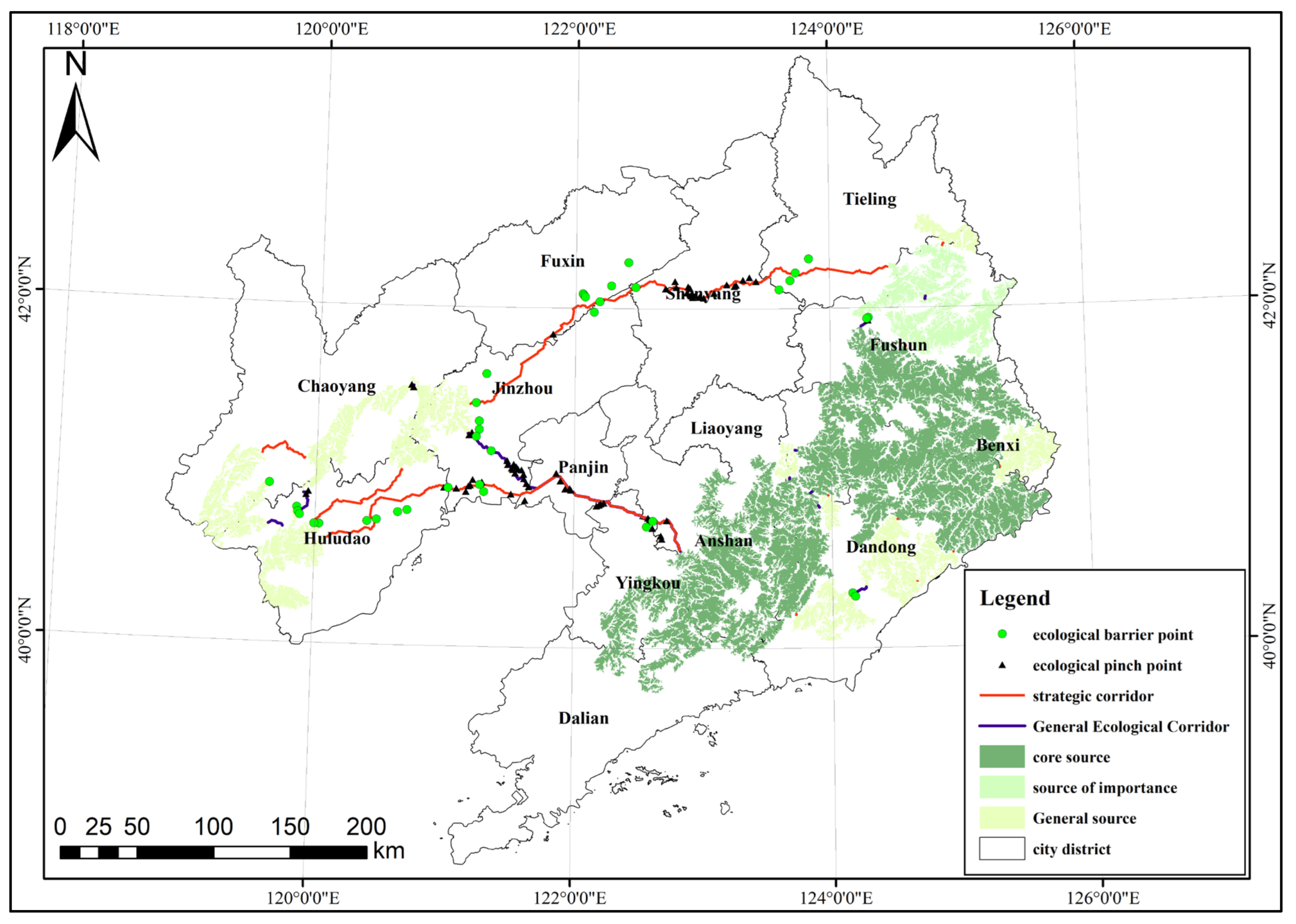
In this section, based on the above forest landscape pattern distribution results and combined with ecological network theory, we constructed a set of experiments and established the 2023 forest ecological network for Liaoning Province. Specifically, the network includes ecological source sites [42,43], ecological corridors [26,44], and ecological nodes [45,46], as shown in Figure 10.
(1)
Ecological sources: Ecological sources are the core carriers of ecosystems and play a decisive role in maintaining biodiversity and guaranteeing the habitat and reproduction of species. They usually need to have a certain scale to support stable ecological processes. In this study, ecological source areas were delineated according to the significance of regional ecological services and habitat quality and identified from the dimensions of connectivity and importance. By analyzing the data on vegetation cover, species distribution, ecological service function, and landscape patterns, we identified 15 ecological source sites in Liaoning Province, which are the Core areas of biological habitats with high ecological integrity and species richness. In total, 216 potential source sites were identified, which provide a direction of expansion for the subsequent ecological conservation and rehabilitation and help improve the stability of the regional ecosystem.
(2)
Ecological corridors: Ecological corridors are linear/belt-shaped ecological patches connecting ecological source areas. They are the core part of ecosystem connectivity, with the key functions of species migration, energy flow, and material circulation. In this study, we used circuit theory, the synthesized topography, land use, ecological resistance, and other factors to simulate the movement paths of ecological flow and identified a total of 23 ecological corridors. Among these, 12 important corridors are spatially distributed across the northeastern and central parts of Liaoning Province, connecting the core ecological sources, with a high density of ecological flows and dominating the regional ecological connectivity, while 11 general corridors assist in improving the ecological network. The centralized distribution of the corridors in the northeast and central part of the study area not only reflects the characteristics of the regional ecological source layout but also highlights the active nature of the ecological process in the region, which is of great significance in promoting biological migration and maintaining ecological balance.
(3)
Ecological nodes: The key ecological nodes in this study consisted of 65 ecological pinch points and 37 ecological barrier points. The ecological pinch points are located within the ecological corridors, which are key channels of ecological flow, but due to the high resistance value of the periphery, they are easily impacted by human activities and become a “bottleneck” for biological migration. The ecological obstacle points are mostly located in the central and western parts of the study area and affected by the factors of land use and transportation networks, forming a barrier to ecological flow and hindering the ecological balance. Together, the two types of nodes affect the connectivity and stability of the ecological network, and their precise identification provides important guidance to optimize the ecological network and enhance the ecosystem function, which is the core concern of ecological protection and restoration.

5.3. Study Limitations and Directions for Future Research

In this work, to obtain accurate forest coverage based on remote sensing imagery, we constructed a forest extraction dataset with 20,962 data samples for deep learning model training. It is worth noting that this forest extraction dataset is quite rich in intraclass diversity, in addition to its large sample size, in order to cope with the potential overfitting of the deep learning model, as well as to improve the robustness of the model. Then, we proposed a deep learning model (Dynamic Large Kernel Segformer) that is suitable for forest extraction from remote sensing images and completed training and accuracy verification on the above-mentioned dataset. Although the Dynamic Large Kernel Segformer can accurately extract forest coverage, the method still has some limitations. Although we have fully considered factors such as forest canopy closure, cloud and fog interference, and farmland similarity interference based on our previous research, the study area is mostly mountainous, and some parts are located in coastal areas. To a certain extent, a thick cloud cover still obscures the ground, resulting in low forest extraction accuracy. In our future research, we will consider utilizing the penetrative ability of SAR images to achieve more accurate extraction of forest land coverage. Furthermore, the influence of the optical image spatial resolution on the accuracy of forest land extraction warrants careful consideration. In subsequent research phases, we plan to incorporate high-resolution satellite imagery to validate and refine our extraction methodology. It is worth noting that due to the data limitation of Sentinel-2, less than 10 years of forest land change analysis could be carried out for our study area. Owing to the limited space–time variability of forests, the contribution of lower-resolution historical Landsat imagery should not be neglected in the study of forest land changes in long time series.

6. Conclusions

In this paper, Liaoning Province of China was taken as a study area, and based on previous studies, we utilized multi-year Sentinel-2 10m resolution multispectral satellite remote sensing images covering the northeastern region of China; we expanded the forest extraction dataset, which has a total of 20,962 data samples and effectively takes the intraclass diversity of the data into account. Based on this, we developed the Dynamic Large Kernel Segformer model to address the complex and variable characteristics of forests in remote sensing images. This model has a large receptive field, enabling it to better capture the global features of forests in images. Our results show that the Dynamic Large Kernel Segformer model achieves an accuracy rate of 89.285%, a recall rate of 88.632%, an IoU of 80.579%, and an F1 Score of 88.96%. Further, forest distribution maps of Liaoning Province for 2019 and 2023 were derived using the Dynamic Large Kernel Segformer, and the temporal dynamics of forest landscape patterns during the study period were quantified via the MSPA method. Finally, based on the forest landscape pattern for Liaoning Province in 2023, a forest ecological network for Liaoning Province in 2023 was constructed using circuit theory. The findings demonstrate that the forest area in Liaoning Province expanded between 2019 and 2023. Regarding the overall spatial pattern change, the Core area of Liaoning Province saw an increase in 2019–2023, and the overall quality of the forest landscape improved. The forest ecological network for Liaoning Province in 2023, which consists of ecological sources, ecological nodes, and ecological corridors, provides a data basis for ecological governance and planning in relation to forests in the region.

Author Contributions

Conceptualization, F.W. and F.Y.; methodology, F.W. and F.Y.; software, F.W.; validation, F.W.; writing—original draft preparation, F.W.; writing—review and editing, F.W., F.Y. and X.C.; visualization, F.W. and Y.Y.; project administration, F.W. and F.Y.; funding acquisition, F.Y. All authors have read and agreed to the published version of the manuscript.

Funding

This work was supported in part by the National Natural Science Foundation of China under grant 50604009, the Education Department Project of Liaoning Province (LJ2020JCL006), and the Key Laboratory of Land Satellite Remote Sensing Application, Ministry of Natural Resources of the People’s Republic of China (KLSMNR-202107).

Data Availability Statement

The original data presented in the study are openly available from the European Space Agency at [https://dataspace.copernicus.eu/].

Acknowledgments

We are very grateful to all the reviewers, institutions, and researchers for their help and advice on our work.

Conflicts of Interest

Author Yang Ye was employed by the Dalian Huangbohai Marine Surveying Data Information Co., Ltd. The remaining authors declare that the research was conducted in the absence of any commercial or financial relationships that could be construed as a potential conflict of interest.

References

  1. Watson, J.E.M.; Evans, T.; Venter, O.; Williams, B.; Tulloch, A.; Stewart, C.; Thompson, I.; Ray, J.C.; Murray, K.; Salazar, A.; et al. The exceptional value of intact forest ecosystems. Nat. Ecol. Evol. 2018, 2, 599–610. [Google Scholar] [CrossRef]
  2. Díaz, S.; Pascual, U.; Stenseke, M.; Martín-López, B.; Watson, R.T.; Molnár, Z.; Hill, R.; Chan, K.M.A.; Baste, I.A.; Brauman, K.A.; et al. Assessing nature’s contributions to people. Science 2018, 359, 270–272. [Google Scholar] [CrossRef]
  3. Bryan, B.A.; Gao, L.; Ye, Y.; Sun, X.; Connor, J.D.; Crossman, N.D.; Stafford-Smith, M.; Wu, J.; He, C.; Yu, D.; et al. China’s response to a national land-system sustainability emergency. Nature 2018, 559, 193–204. [Google Scholar] [CrossRef]
  4. Zhu, Z.; Wulder, M.A.; Roy, D.P.; Woodcock, C.E.; Hansen, M.C.; Radeloff, V.C.; Healey, S.P.; Schaaf, C.; Hostert, P.; Strobl, P.; et al. Benefits of the free and open Landsat data policy. Remote Sens. Environ. 2019, 224, 382–385. [Google Scholar] [CrossRef]
  5. Gorelick, N.; Hancher, M.; Dixon, M.; Ilyushchenko, S.; Thau, D.; Moore, R. Google Earth Engine: Planetary-scale geospatial analysis for everyone. Remote Sens. Environ. 2017, 202, 18–27. [Google Scholar] [CrossRef]
  6. Miteva, D.A.; Loucks, C.J.; Pattanayak, S.K. Social and environmental impacts of forest management certification in Indonesia. PLoS ONE 2015, 10, e0129675. [Google Scholar] [CrossRef] [PubMed]
  7. Ma, H.; Zhao, W.; Li, F.; Yan, H.; Liu, Y. Study on Remote Sensing Image Classification of Oasis Area Based on ENVI Deep Learning. Pol. J. Environ. Stud. 2023, 32, 2231–2242. [Google Scholar] [CrossRef] [PubMed]
  8. Javed, A.; Kim, T.; Lee, C.; Oh, J.; Han, Y. Deep learning-based detection of urban forest cover change along with overall urban changes using very-high-resolution satellite images. Remote Sens. 2023, 15, 4285. [Google Scholar] [CrossRef]
  9. Zhang, L.; Zhang, L.; Du, B. Deep learning for remote sensing data: A technical tutorial on the state of the art. IEEE Geosci. Remote Sens. Mag. 2016, 4, 22–40. [Google Scholar] [CrossRef]
  10. Feng, H.; Li, Q.; Wang, W.; Bashir, A.K.; Singh, A.K.; Xu, J.; Fang, K. Security of target recognition for UAV forestry remote sensing based on multi-source data fusion transformer framework. Inf. Fusion 2024, 112, 102555. [Google Scholar] [CrossRef]
  11. Xie, E.; Wang, W.; Yu, Z.; Anandkumar, A.; Alvarez, J.M.; Luo, P. SegFormer: Simple and efficient design for semantic segmentation with transformers. Adv. Neural Inf. Process. Syst. 2021, 34, 12077–12090. [Google Scholar]
  12. Hamdi, Z.M.; Brandmeier, M.; Straub, C. Forest damage assessment using deep learning on high resolution remote sensing data. Remote Sens. 2019, 11, 1976. [Google Scholar] [CrossRef]
  13. Hou, J.; Guo, Z.; Wu, Y.; Diao, W.; Xu, T. BSNet: Dynamic hybrid gradient convolution based boundary-sensitive network for remote sensing image segmentation. IEEE Trans. Geosci. Remote Sens. 2022, 60, 5624022. [Google Scholar] [CrossRef]
  14. Hościło, A.; Lewandowska, A. Mapping forest type and tree species on a regional scale using multi-temporal Sentinel-2 data. Remote Sens. 2019, 11, 929. [Google Scholar] [CrossRef]
  15. Main-Knorn, M.; Pflug, B.; Louis, J.; Debaecker, V.; Müller-Wilm, U.; Gascon, F. Sen2Cor for sentinel-2. In Proceedings of the Image and Signal Processing for Remote Sensing XXIII, Warsaw, Poland, 11–13 September 2017; SPIE: Bellingham, WA, USA, 2017; Volume 10427, pp. 37–48. [Google Scholar]
  16. Wakulińska, M.; Marcinkowska-Ochtyra, A. Multi-temporal sentinel-2 data in classification of mountain vegetation. Remote Sens. 2020, 12, 2696. [Google Scholar] [CrossRef]
  17. Borsoi, R.A.; Imbiriba, T.; Bermudez, J.C.M.; Richard, C.; Chanussot, J.; Drumetz, L.; Tourneret, J.-Y.; Zare, A.; Jutten, C. Spectral variability in hyperspectral data unmixing: A comprehensive review. IEEE Geosci. Remote Sens. Mag. 2021, 9, 223–270. [Google Scholar] [CrossRef]
  18. Liu, X.; Frey, J.; Munteanu, C.; Still, N.; Koch, B. Mapping tree species diversity in temperate montane forests using Sentinel-1 and Sentinel-2 imagery and topography data. Remote Sens. Environ. 2023, 292, 113576. [Google Scholar] [CrossRef]
  19. Wang, F.; Yang, F.; Wang, Z. A Study on the Evolution of Forest Landscape Patterns in the Fuxin Region of China Combining SC-UNet and Spatial Pattern Perspectives. Sustainability 2024, 16, 7067. [Google Scholar] [CrossRef]
  20. Mitchard, E.T.A.; Saatchi, S.S.; White, L.J.T.; Abernethy, K.A.; Jeffery, K.J.; Lewis, S.L.; Collins, M.; Lefsky, M.A.; Leal, M.E.; Woodhouse, I.H.; et al. Mapping tropical forest biomass with radar and spaceborne LiDAR in Lopé National Park, Gabon: Overcoming problems of high biomass and persistent cloud. Biogeosciences 2012, 9, 179–191. [Google Scholar] [CrossRef]
  21. Yang, J.; Qiu, P.; Zhang, Y.; Marcus, D.S.; Sotiras, A. D-net: Dynamic large kernel with dynamic feature fusion for volumetric medical image segmentation. arXiv 2024, arXiv:2403.10674. [Google Scholar] [CrossRef]
  22. Yang, M.; Yu, K.; Zhang, C.; Li, Z.; Yang, K. Denseaspp for semantic segmentation in street scenes. In Proceedings of the IEEE Conference on Computer Vision and Pattern Recognition, Salt Lake City, UT, USA, 18–23 June 2018; pp. 3684–3692. [Google Scholar]
  23. Li, Y.; Hou, Q.; Zheng, Z.; Cheng, M.M.; Yang, J.; Li, X. Large selective kernel network for remote sensing object detection. In Proceedings of the IEEE/CVF International Conference on Computer Vision, Paris, France, 1–6 October 2023; pp. 16794–16805. [Google Scholar]
  24. Ye, H.; Yang, Z.; Xu, X. Ecological Corridors Analysis Based on MSPA and MCR Model—A Case Study of the Tomur World Natural Heritage Region. Sustainability 2020, 12, 959. [Google Scholar] [CrossRef]
  25. Vogt, P.; Riitters, K.H.; Iwanowski, M.; Estreguil, C.; Kozak, J.; Soille, P. Mapping landscape corridors. Ecol. Indic. 2007, 7, 481–488. [Google Scholar] [CrossRef]
  26. Dickson, B.G.; Albano, C.M.; Anantharaman, R.; Beier, P.; Fargione, J.; Graves, T.A.; Gray, M.E.; Hall, K.R.; Lawler, J.J.; Leonard, P.B.; et al. Circuit-theory applications to connectivity science and conservation. Conserv. Biol. 2019, 33, 239–249. [Google Scholar] [CrossRef]
  27. Knaapen, J.P.; Scheffer, M.; Harms, B. Estimating habitat isolation in landscape planning. Landsc. Urban Plan. 1992, 23, 1–16. [Google Scholar] [CrossRef]
  28. Yu, K. Based on nature, let nature do the work: The basis of territorial spatial planning and ecological restoration. Landsc. Archit. 2020, 8, 6–9. [Google Scholar]
  29. Yang, L.; Suo, M.; Gao, S.; Jiao, H. Construction of an ecological network based on an integrated approach and circuit theory: A case study of Panzhou in Guizhou Province. Sustainability 2022, 14, 9136. [Google Scholar] [CrossRef]
  30. Branco, P.; Segurado, P.; Santos, J.M.; Ferreira, M.T.; Strecker, A. Prioritizing barrier removal to improve functional connectivity of rivers. J. Appl. Ecol. 2014, 51, 1197–1206. [Google Scholar] [CrossRef]
  31. Wei, H.; Zhu, H.; Chen, J.; Jiao, H.; Li, P.; Xiong, L. Construction and optimization of ecological security pattern in the loess plateau of China based on the minimum cumulative resistance (MCR) model. Remote Sens. 2022, 14, 5906. [Google Scholar] [CrossRef]
  32. McRae, B.H.; Hall, S.A.; Beier, P.; Theobald, D.M.; Merenlender, A.M. Where to restore ecological connectivity Detecting barriers and quantifying restoration benefits. PLoS ONE 2012, 7, e52604. [Google Scholar] [CrossRef]
  33. Su, T.; Zhang, S. Local and global evaluation for remote sensing image segmentation. ISPRS J. Photogramm. Remote Sens. 2017, 130, 256–276. [Google Scholar] [CrossRef]
  34. Rezatofighi, H.; Tsoi, N.; Gwak, J.Y.; Sadeghian, A.; Reid, I.; Savarese, S. Generalized intersection over union: A metric and a loss for bounding box regression. In Proceedings of the IEEE/CVF Conference on Computer Vision and Pattern Recognition, Long Beach, CA, USA, 15–20 June 2019; pp. 658–666. [Google Scholar]
  35. Hossin, M.; Sulaiman, M.N. A review on evaluation metrics for data classification evaluations. Int. J. Data Min. Knowl. Manag. Process 2015, 5, 1–11. [Google Scholar]
  36. Shallue, C.J.; Lee, J.; Antognini, J.; Sohl-Dickstein, J.; Frostig, R.; Dahl, G.E. Measuring the effects of data parallelism on neural network training. J. Mach. Learn. Res. 2019, 20, 1–49. [Google Scholar]
  37. Smith, L.N. A disciplined approach to neural network hyper-parameters: Part 1—Learning rate, batch size, momentum, and weight decay. arXiv 2018, arXiv:1803.09820. [Google Scholar]
  38. Wang, C.; Sun, G.; Dang, L. Identifying ecological red lines: A case study of the coast in Liaoning Province. Sustainability 2015, 7, 9461–9477. [Google Scholar] [CrossRef]
  39. Han, J.; Dong, Y.; Ren, Z.; Du, Y.; Wang, C.; Jia, G.; Zhang, P.; Guo, Y. Remarkable effects of urbanization on forest landscape multifunctionality in urban peripheries: Evidence from Liaoyuan City in Northeast China. Forests 2021, 12, 1779. [Google Scholar] [CrossRef]
  40. Li, H.; Mao, D.; Li, X.; Wang, Z.; Jia, M.; Huang, X.; Xiao, Y.; Xiang, H. Understanding the contrasting effects of policy-driven ecosystem conservation projects in northeastern China. Ecol. Indic. 2022, 135, 108578. [Google Scholar] [CrossRef]
  41. Chen, H.; Tian, G.; Wu, J.; Sun, L.; Yang, J. Coordinated Development of Forests and Society: Insights and Lessons from Natural Forest Restoration and Regional Development in China. Forests 2024, 15, 1702. [Google Scholar] [CrossRef]
  42. Peng, J.; Yang, Y.; Liu, Y.; Hu, Y.N.; Du, Y.Y.; Meersmans, J.; Qiu, S.J. Linking ecosystem services and circuit theory to identify ecological security patterns. Sci. Total Environ. 2018, 644, 781–790. [Google Scholar] [CrossRef]
  43. Albert, C.H.; Rayfield, B.; Dumitru, M.; Gonzalez, A. Applying network theory to prioritize multispecies habitat networks that are robust to climate and land-use change. Conserv. Biol. 2017, 31, 1383–1396. [Google Scholar] [CrossRef]
  44. Lu, Y.; Li, Q.; Wang, Y.; Xu, P. Planning conservation corridors in mountain areas based on integrated conservation planning models: A case study for a giant panda in the Qionglai Mountains. J. Mt. Sci. 2019, 16, 2654–2662. [Google Scholar] [CrossRef]
  45. Baguette, M.; Blanchet, S.; Legrand, D.; Stevens, V.M.; Turlure, C. Individual dispersal, landscape connectivity and ecological networks. Biol. Rev. 2013, 88, 310–326. [Google Scholar] [CrossRef] [PubMed]
  46. Wu, Z.; Cheng, S.; Xu, K.; Qian, Y. Ecological network resilience evaluation and ecological strategic space identification based on complex network theory: A case study of Nanjing city. Ecol. Indic. 2024, 158, 111604. [Google Scholar] [CrossRef]
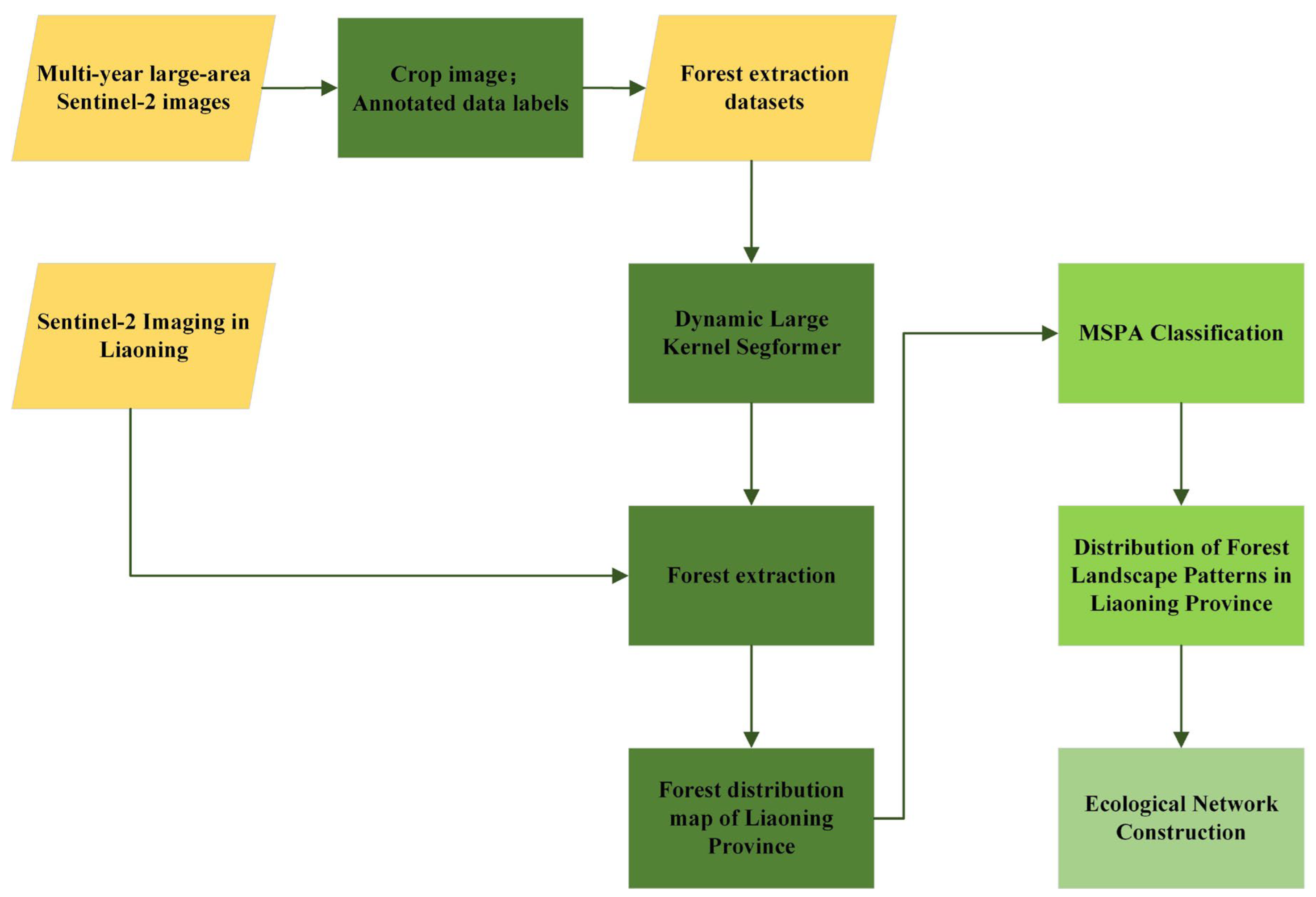
Figure 1. Research flowchart.
Forests 16 01342 g001
Figure 2. Deformable Conv module structure.
Forests 16 01342 g002
Figure 3. Schematic diagram of the Dynamic Large Kernel Segformer model structure.
Forests 16 01342 g003
Figure 4. Computational principle and procedural steps of the morphological spatial pattern analysis (MSPA).
Forests 16 01342 g004
Figure 5. 2019 forest land distribution map of Liaoning Province.
Forests 16 01342 g005
Figure 6. 2023 forest land distribution map of Liaoning Province.
Forests 16 01342 g006
Figure 7. Forest change map of Liaoning Province, 2019–2023.
Forests 16 01342 g007
Figure 8. Spatial distribution of forest landscape patterns in Liaoning Province (2019).
Forests 16 01342 g008
Figure 9. Spatial distribution of forest landscape patterns in Liaoning Province (2023).
Forests 16 01342 g009
Figure 10. Ecological network construction results.
Forests 16 01342 g010
Table 1. Forest extraction datasets from remotely sensed images in different states.
Normal StateStrong LightCropland-Like DisturbanceCloud
Disturbance
Negative Sample
Forests 16 01342 i001Forests 16 01342 i002Forests 16 01342 i003Forests 16 01342 i004Forests 16 01342 i005
Forests 16 01342 i006Forests 16 01342 i007Forests 16 01342 i008Forests 16 01342 i009Forests 16 01342 i010
Forests 16 01342 i011Forests 16 01342 i012Forests 16 01342 i013Forests 16 01342 i014Forests 16 01342 i015
Forests 16 01342 i016Forests 16 01342 i017Forests 16 01342 i018Forests 16 01342 i019Forests 16 01342 i020
Forests 16 01342 i021Forests 16 01342 i022Forests 16 01342 i023Forests 16 01342 i024Forests 16 01342 i025
Forests 16 01342 i026Forests 16 01342 i027Forests 16 01342 i028Forests 16 01342 i029Forests 16 01342 i030
Table 2. Mean values of the results of extraction of forest land from Sentinel-2 imagery.
ModelPrecision (%)Recall (%)IoU (%)F1 (%)
Segformer87.3386.1376.5686.73
Deformable Segformer89.2988.6380.5888.96
Table 3. Results of extraction of forest land from Sentinel-2 imagery.
Remote Sensing
Images
Ground Truth
Labeling
SegformerDeformable
Segformer
Forests 16 01342 i031Forests 16 01342 i032Forests 16 01342 i033Forests 16 01342 i034
Forests 16 01342 i035Forests 16 01342 i036Forests 16 01342 i037Forests 16 01342 i038
Forests 16 01342 i039Forests 16 01342 i040Forests 16 01342 i041Forests 16 01342 i042
Forests 16 01342 i043Forests 16 01342 i044Forests 16 01342 i045Forests 16 01342 i046
Forests 16 01342 i047Forests 16 01342 i048Forests 16 01342 i049Forests 16 01342 i050
Table 4. Statistics on changes in forest landscape patterns in the study area from 2019 to 2023.
Classification2019 (km2)2023 (km2)Change Value (km2)
Branch1556.1541782.0648225.9108
Bridge1897.39082260.0692362.6784
Core40,206.524440,831.3152624.7908
Edge6398.74446837.4836438.7392
Islet744.24961019.5128275.2632
Loop2529.77762783.2176253.44
Perforation1492.38361425.6216−66.762
Disclaimer/Publisher’s Note: The statements, opinions and data contained in all publications are solely those of the individual author(s) and contributor(s) and not of MDPI and/or the editor(s). MDPI and/or the editor(s) disclaim responsibility for any injury to people or property resulting from any ideas, methods, instructions or products referred to in the content.