Article

Analysis of Mediterranean Vegetation Fuel Type Changes Using Multitemporal LiDAR
by
Alba García-Cimarras
1,*,
José Antonio Manzanera
1 and
Rubén Valbuena
2
1
Research Group SILVANET, Universidad Politécnica de Madrid (UPM), ETSI Montes, Forestal y del Medio Natural, 28040 Madrid, Spain
2
Thoday Building, School of Natural Sciences, Bangor University, Bangor LL57 2UW, UK
*
Author to whom correspondence should be addressed.
Forests 2021, 12(3), 335; https://doi.org/10.3390/f12030335
Submission received: 16 December 2020 / Revised: 4 March 2021 / Accepted: 9 March 2021 / Published: 12 March 2021
(This article belongs to the Special Issue Modeling, Measuring, and Mapping Wildland Fuels)

Abstract

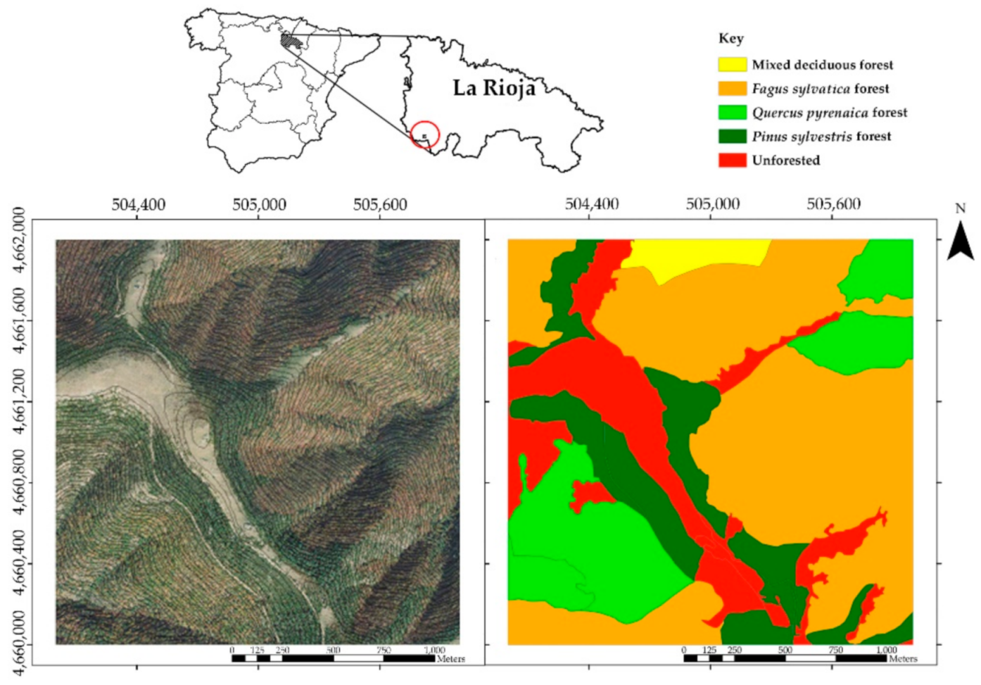
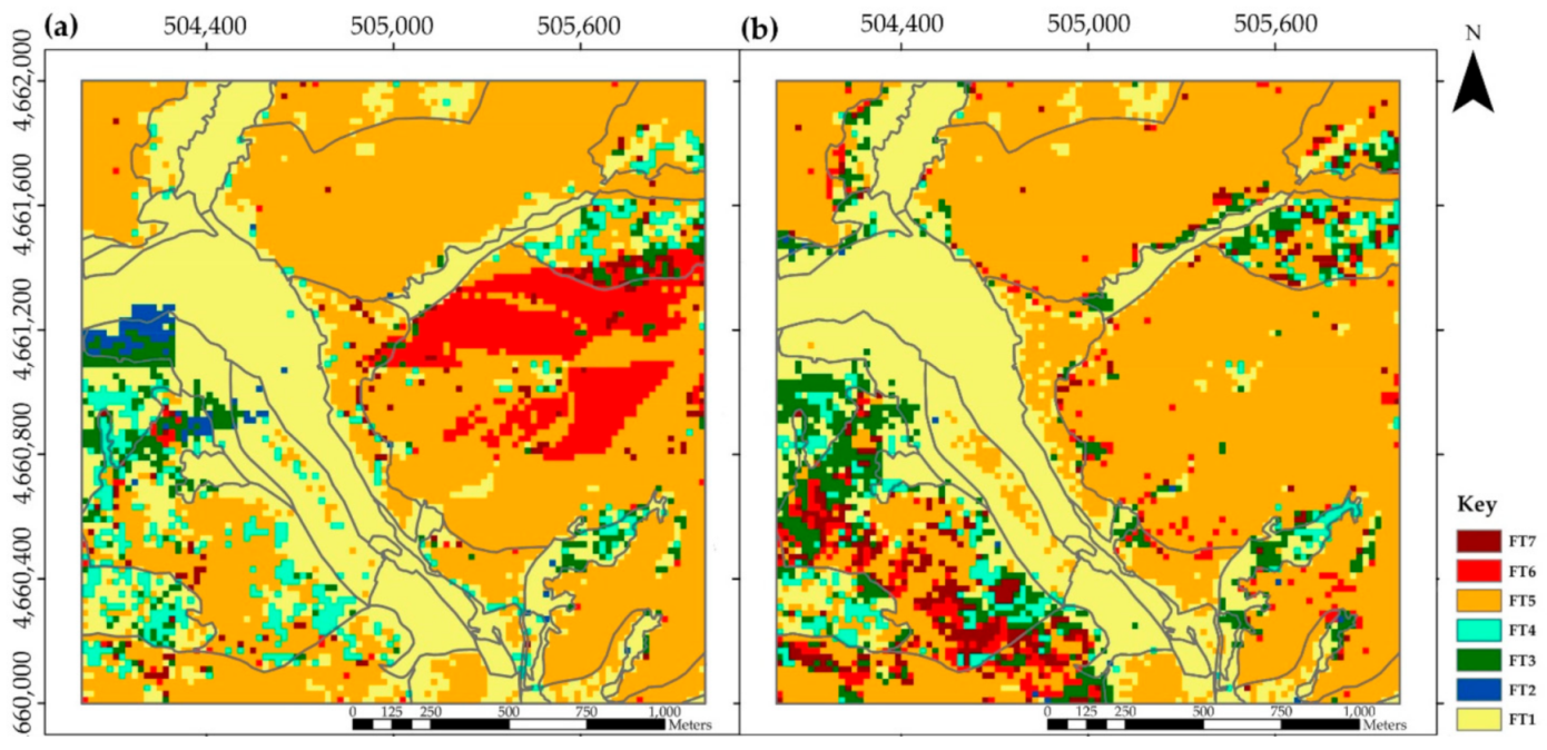
Increasing fire size and severity over the last few decades requires new techniques to accurately assess canopy fuel conditions and change over larger areas. This article presents an analysis on vegetation changes by mapping fuel types (FT) based on conditional rules according to the Prometheus classification system, which typifies the vertical profile of vegetation cover for fuel management and ecological purposes. Using multi-temporal LiDAR from the open-access Spanish national surveying program, we selected a 400 ha area of interest, which was surveyed in 2010 and 2016 with scan densities of 0.5 and 2 pulses·m−2, respectively. FTs were determined from the distribution of LiDAR heights over an area, using grids with a cell size of 20 × 20 m. To validate the classification method, we used a stratified random sampling without replacement of 15 cells per FT and made an independent visual assessment of FT. The overall accuracy obtained was 81.26% with a Kappa coefficient of 0.73. In addition, the relationships among different stand structures and ecological factors such as topographic aspect and forest vegetation cover types were analyzed. Our classification algorithm revealed that stands lacking understory vegetation usually appeared in shady slopes, which were mainly covered by beech stands, whereas sunny areas were preferentially covered by oak stands, where the understory reached greater height thanks to more light availability. Our analysis on FT changes during that 6 year time span revealed potentially hazardous transitions from cleared forests towards a vertical continuum of canopy fuels, where wildfire events would potentially reach tree crowns, especially in oak forests and southern slopes with higher sun exposure for lower fuel moistures and increased flammability. Accurate methods to characterize forest canopy fuels and change over time can help direct forest management activities to priority areas with greater fire hazard. Multi-date canopy fuel information indicated that while some forest types experienced a growth of the shrub layer, others presented an understory decrease. On the other hand, loss of understory was more frequently detected in beech stands; thus, those forests place lower risk of wildfire spread. Our approach was developed using low-density and publicly available datasets and was based on direct canopy fuel measurements from multi-return LiDAR data that can be accurately translated and mapped according to standard fuel type categories that are familiar to land managers.
Keywords: vegetation change; fuel type; fuel models; Prometheus classification system; LiDAR vegetation change; fuel type; fuel models; Prometheus classification system; LiDAR