
Matrix of Architectural Solutions for the Conflict between Transport Infrastructures, Landscape and Urban Habitat along the Mediterranean Coastline: The Case of the Maresme Region in Barcelona, Spain


Abstract
:1. Introduction
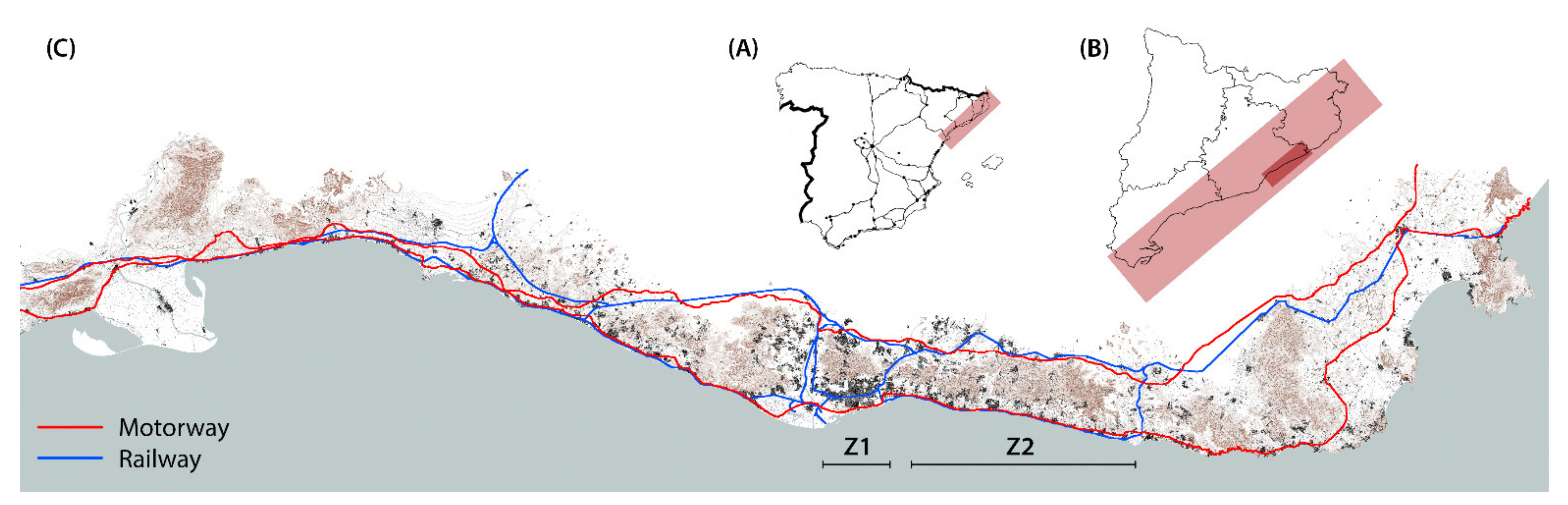
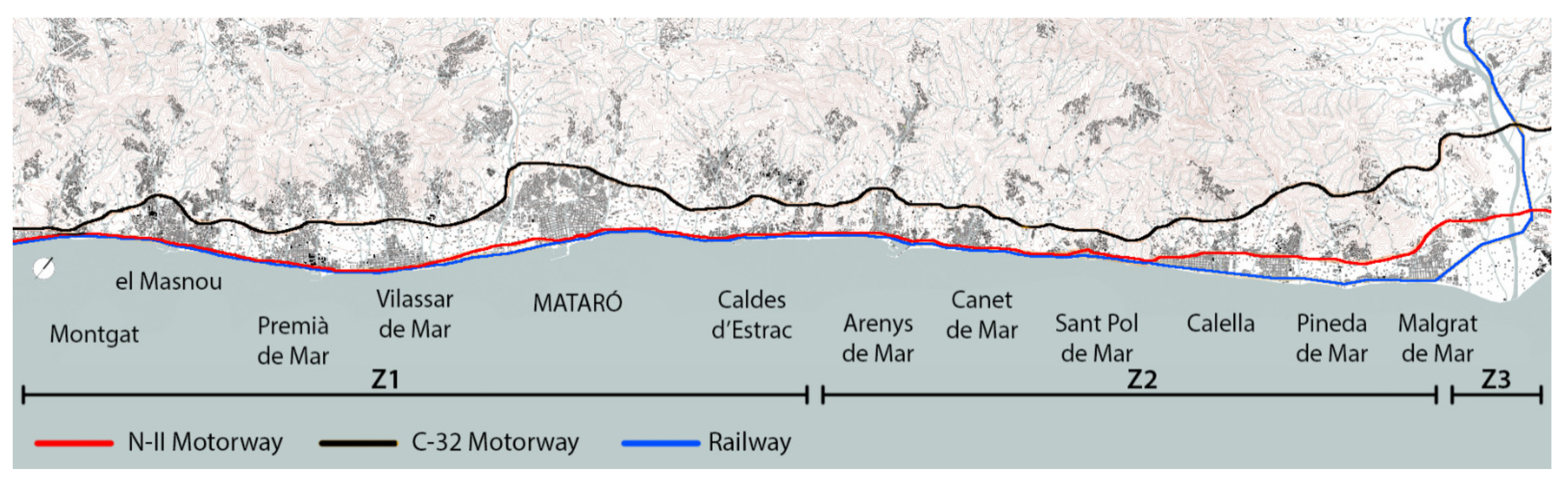
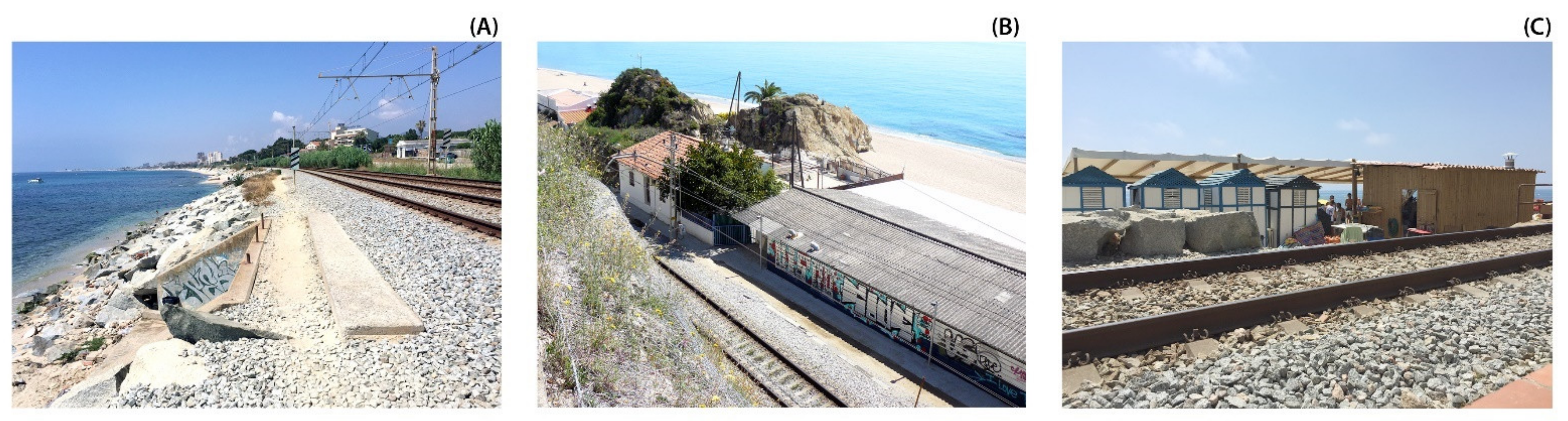
2. Hypothesis, Objectives and Case Study: The Maritime and Urban Landscapes of the Maresme Region
- Freedom of movement: the rationalization of mobility and accessibility, ensuring the continuity of pedestrian routes and road paths; pacification of circulation systems; promotion of sustainable and healthy mobility (cycles and pedestrians) and introduction of new types of transport to diversify and unload its intensity [26].
- Sight continuity: the consideration of long-distance views between urban and coastal landscapes; preservation of the continuity of the horizon from inland and definition of the maritime façade and its appearance from the sea [27].
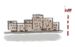
- Compatibility of uses: strengthening the heterogenous character of the littoral; promotion of economic diversity considering existing uses and setting their physical and temporal combination with the new ones and transformation of obsolete buildings and areas with potential for urban regeneration [28].
- Character of place: preservation of historic and natural sites, namely those important for the memory of the place; identification of traditional characteristics related to urban and agricultural structures and the introduction of these activities to the new dynamics of the territory [29].
- Mediterranean culture: the reinforcement of traditional sustainability criteria used by local cultures and following their ways of living and the adoption of the Mediterranean passive systems and materials, including vegetation, to face climate conditions in the design of buildings and public spaces [30].
3. Methodology
3.1. Mediterranean Strategies Methodology
3.1.1. Analysis and Classification of Problematics
3.1.2. Regeneration Projects
3.1.3. Intervention Strategies
3.2. Research Lines’ Definitions
3.2.1. Longitudinal Continuity
3.2.2. Transversal Permeability
3.2.3. Urban Landscape
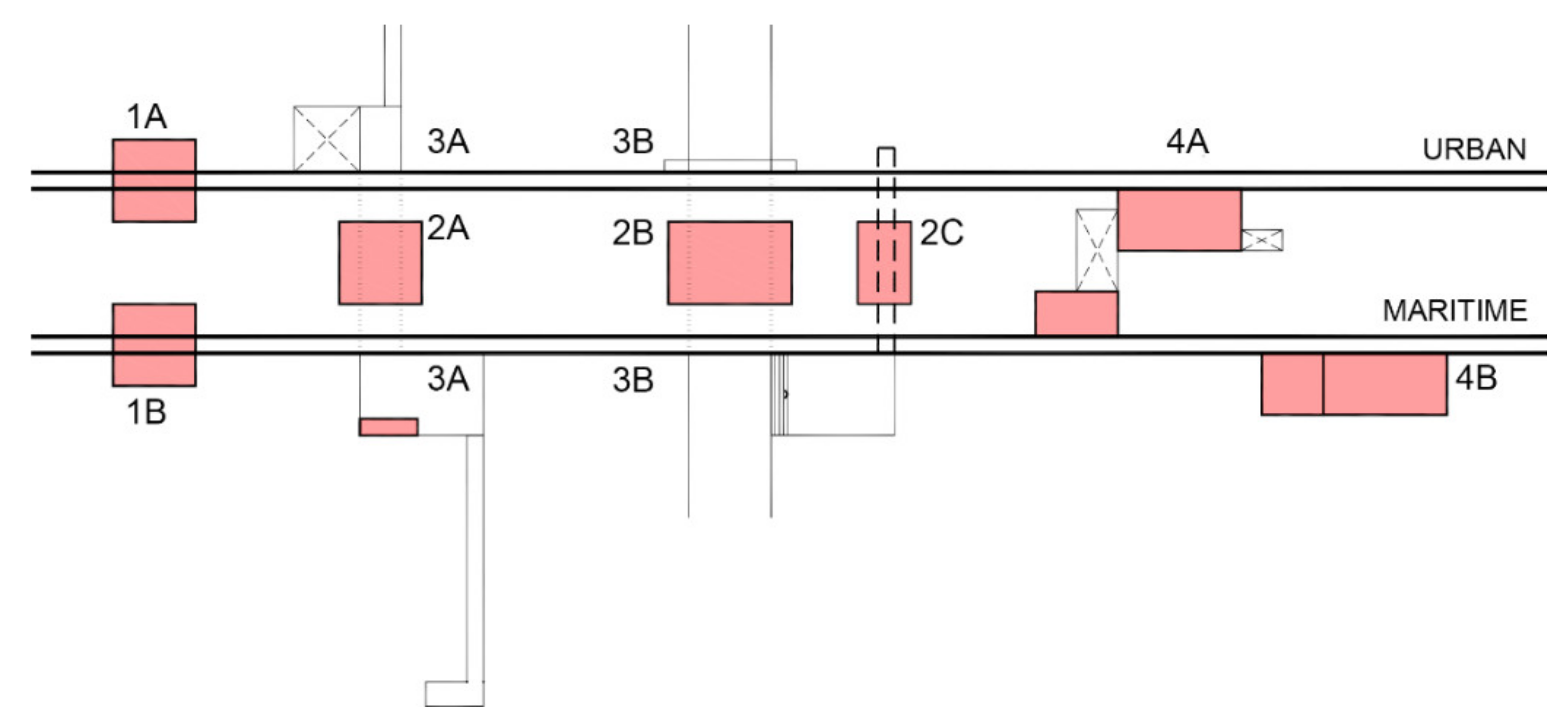
3.3. Setting of Action Variables
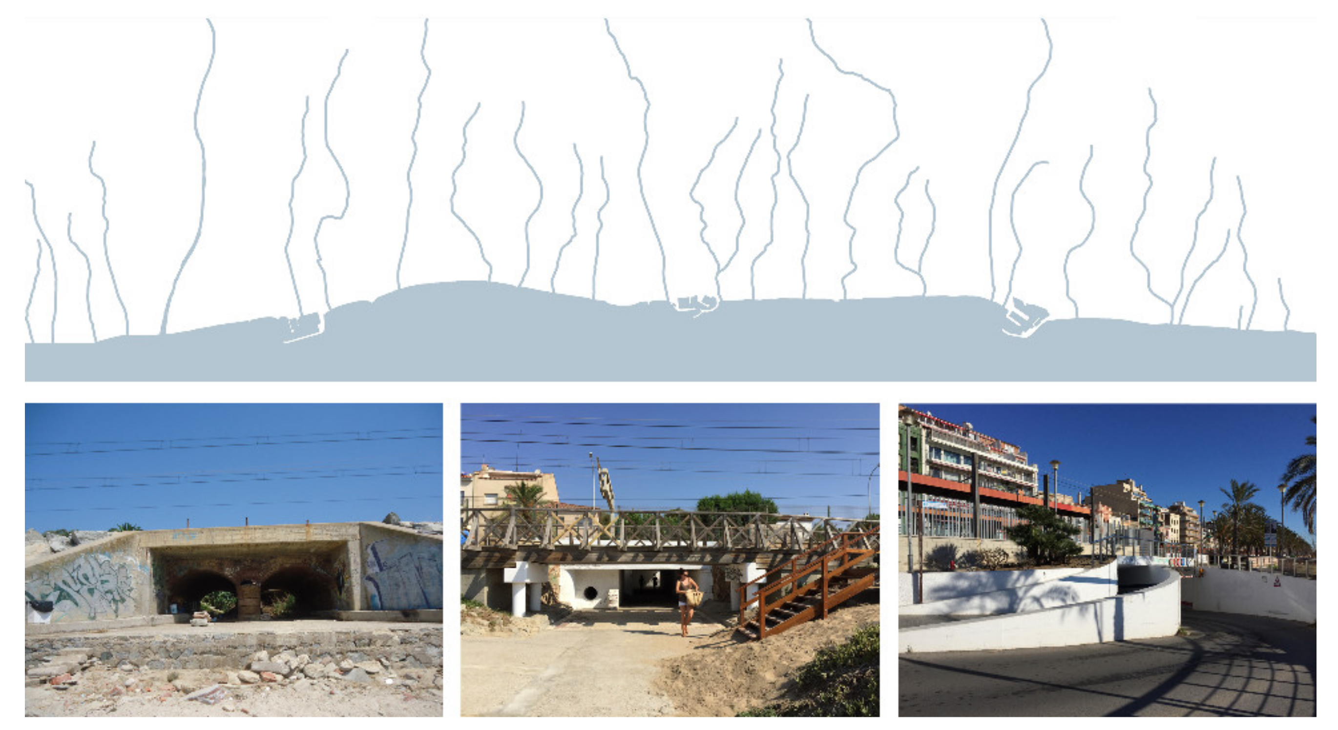
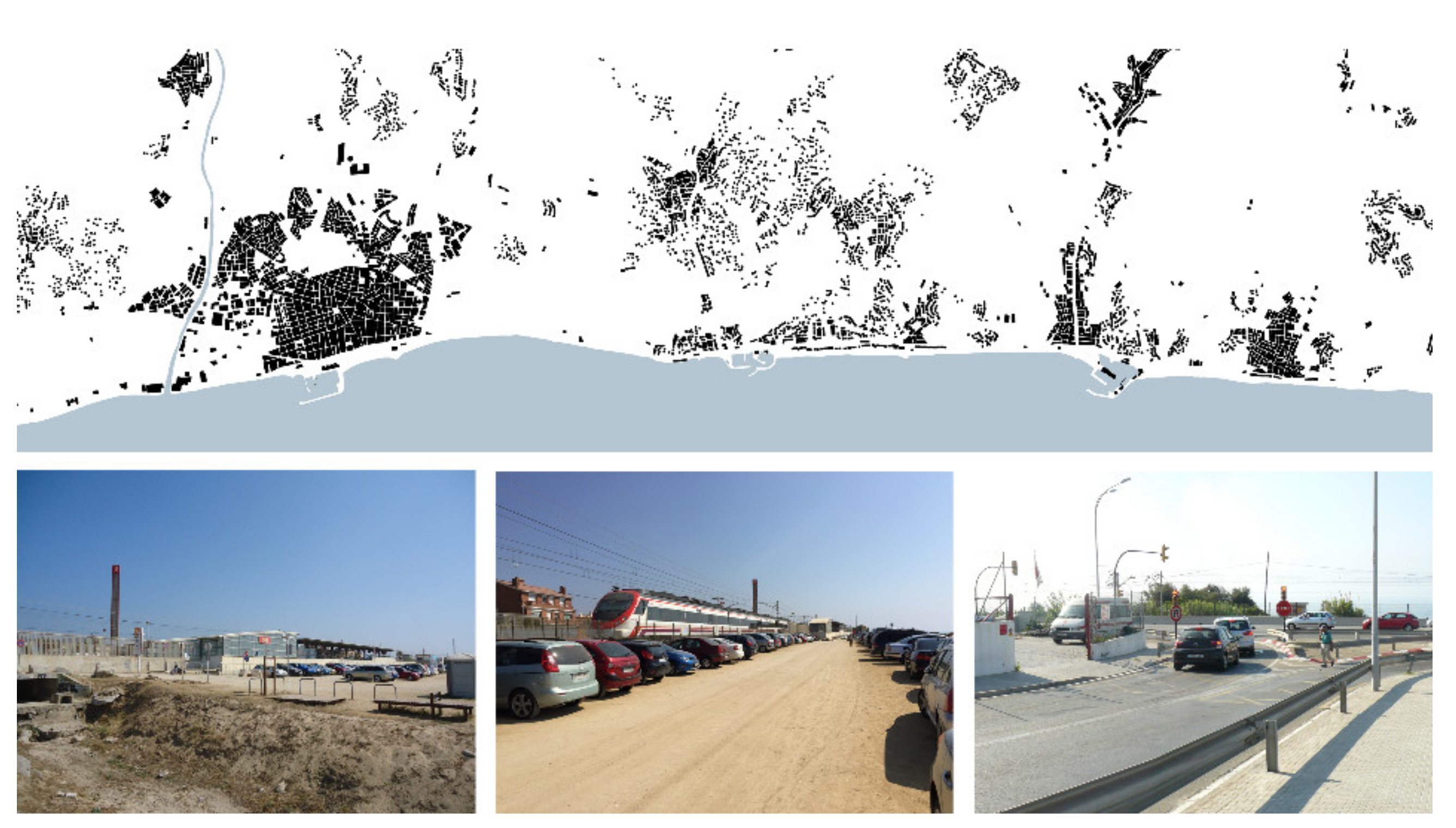
- Variable 1: the typology of occupations in the inner part of the infrastructures in relation to urban settlements and rural areas, considering activities and constructions;
- Variable 2: uses and landscape typologies in the outer part of the infrastructures in relation to the coastline and activities related with the sea, leisure and landscape;
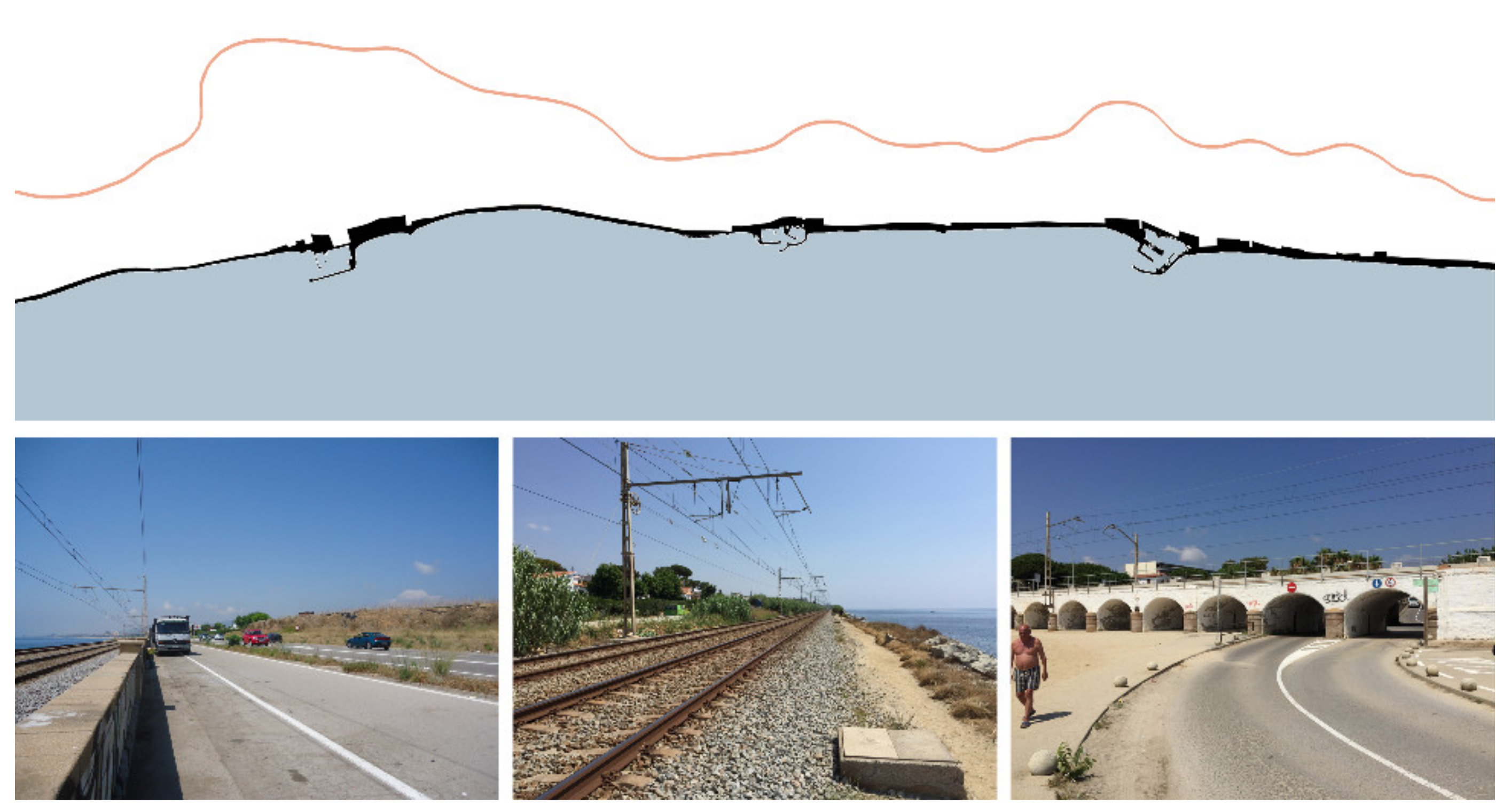
- Variable 3: the topographic difference between both sides of the infrastructures, which is variable along the coastline and defines the conditions for the connection between villages and the sea;
- Variable 4: the distance from the sea and the first line occupied on the inner side of the infrastructures, which is variable along the coastline and defines the relation with the urban habitat from villages toward the sea.
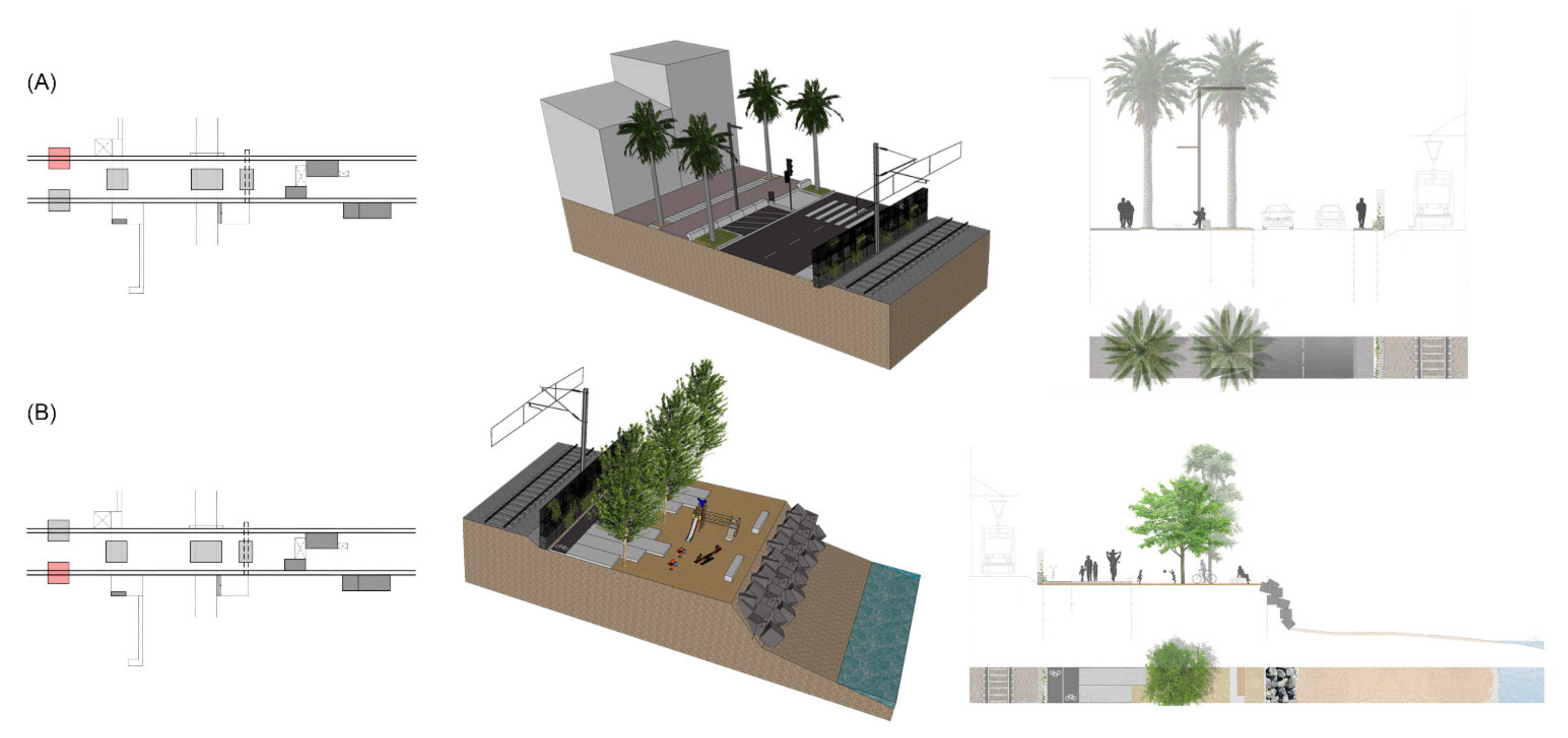
4. Results
4.1. Urban Regeneration Projects
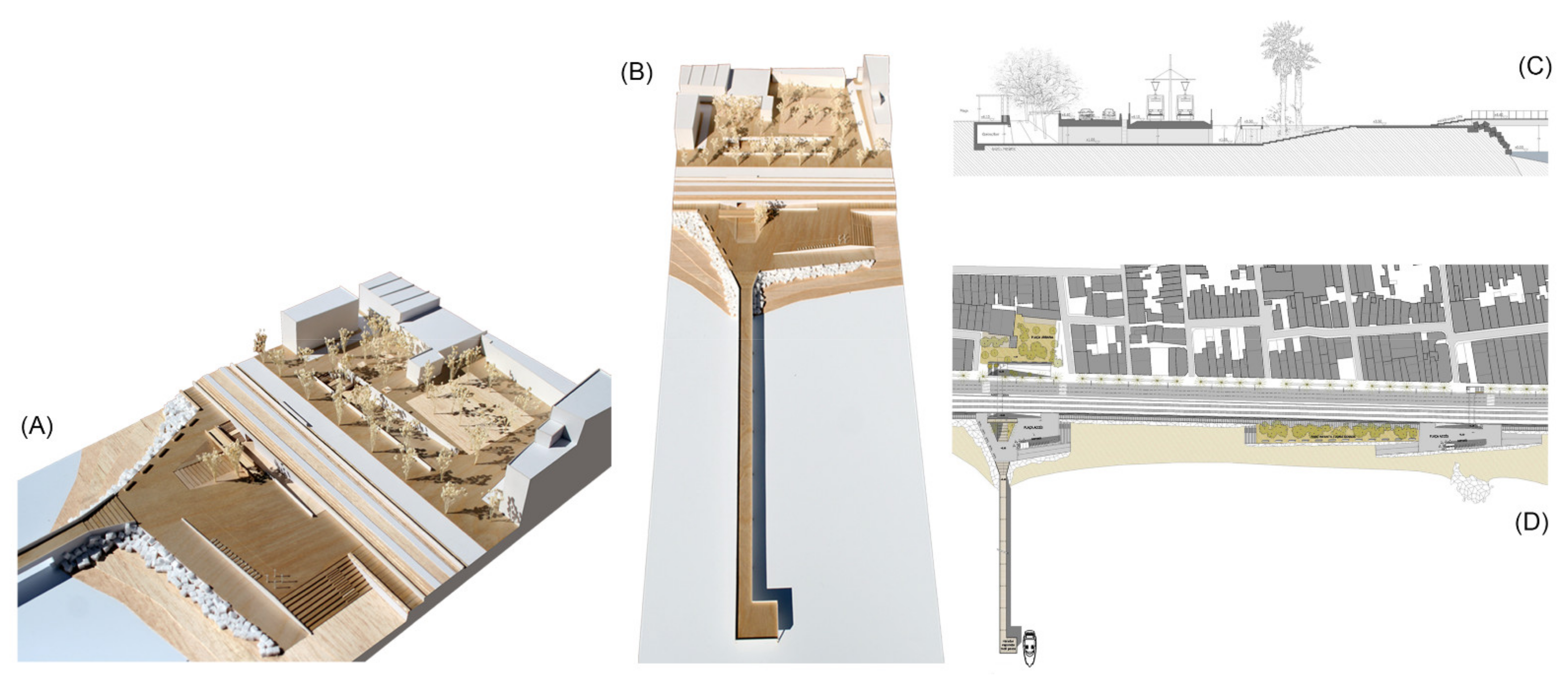
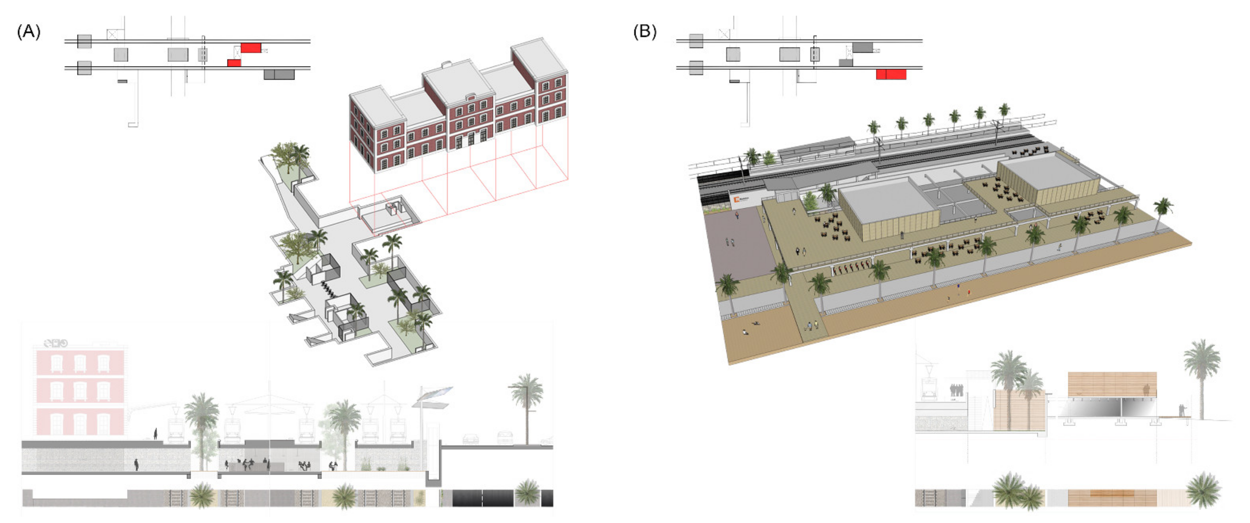
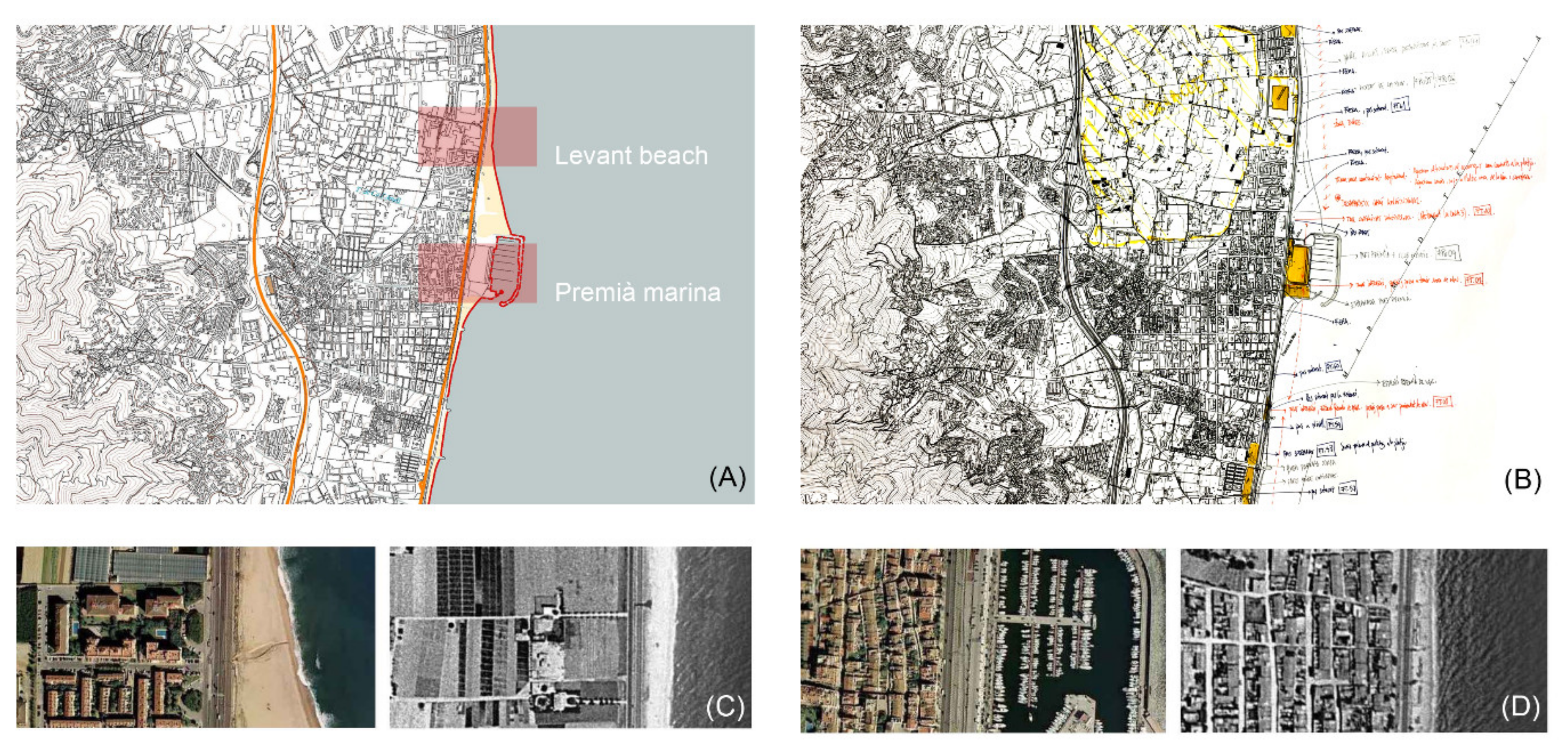
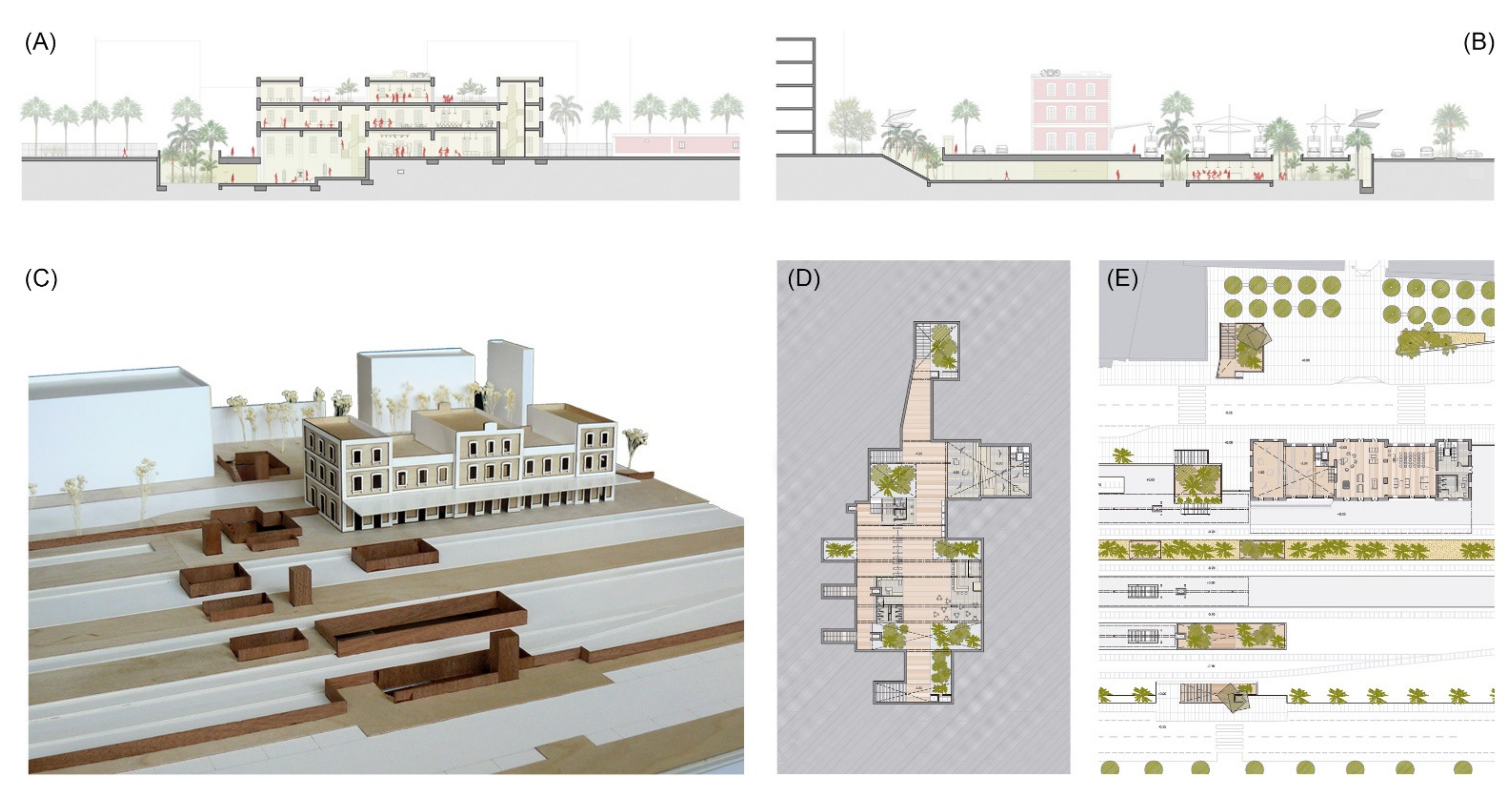
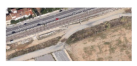
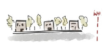
4.1.1. Downtown of Premià de Mar
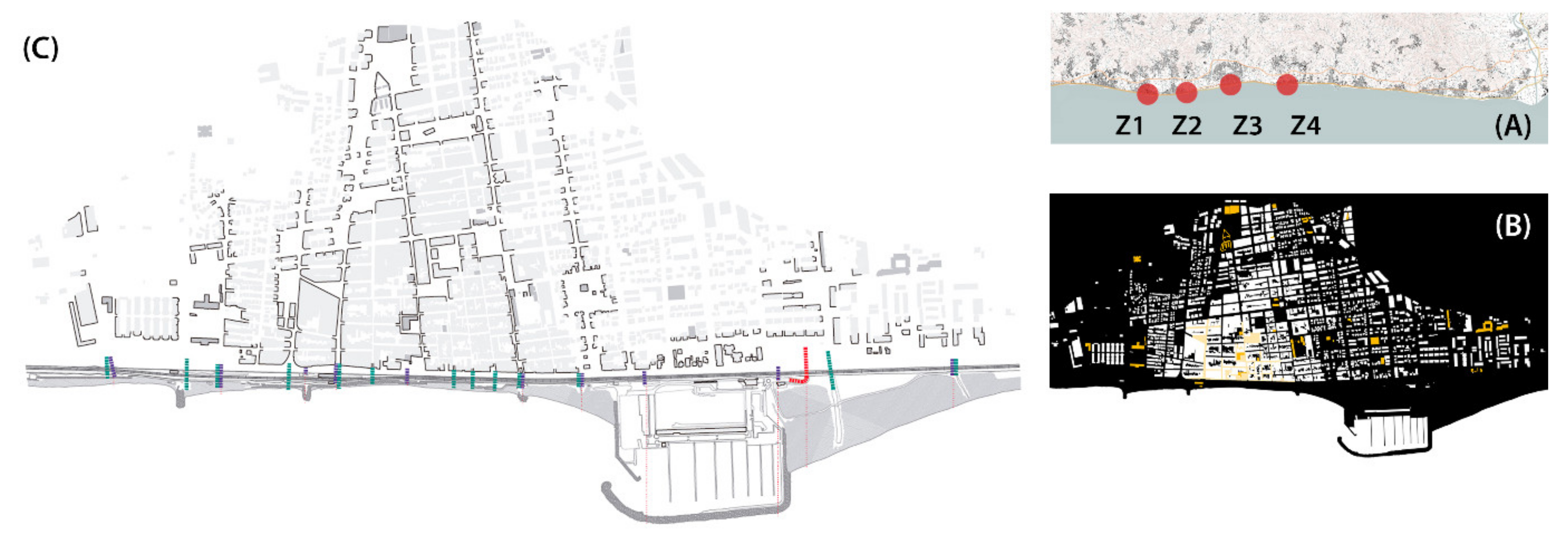
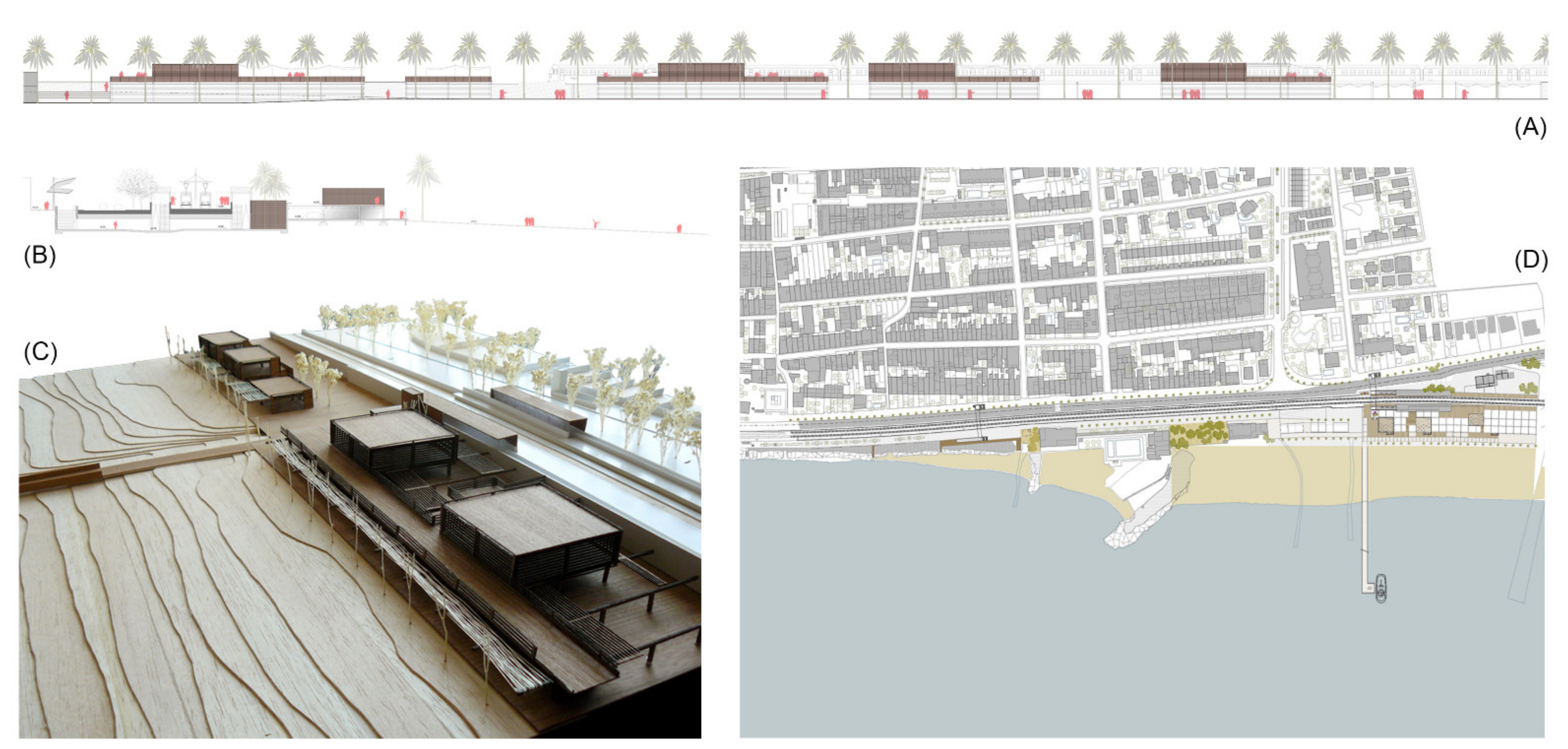
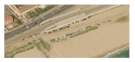
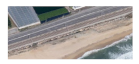
4.1.2. Stop on the Beach of Vilassar-Cabrera
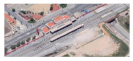
4.1.3. Railway Station of Mataró
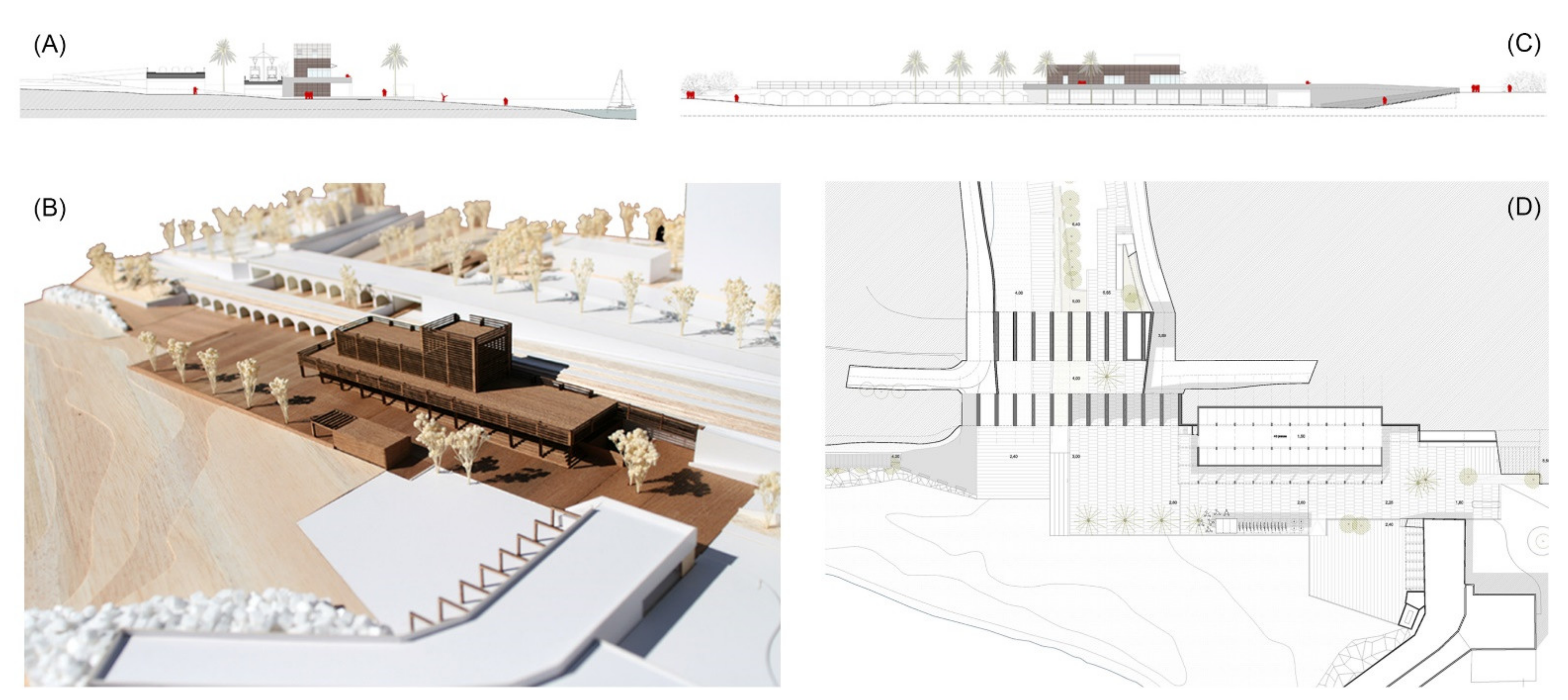
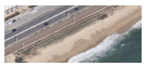
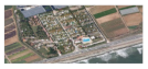
4.1.4. Stream Mouth in Llavaneres
4.2. Intervention Strategies
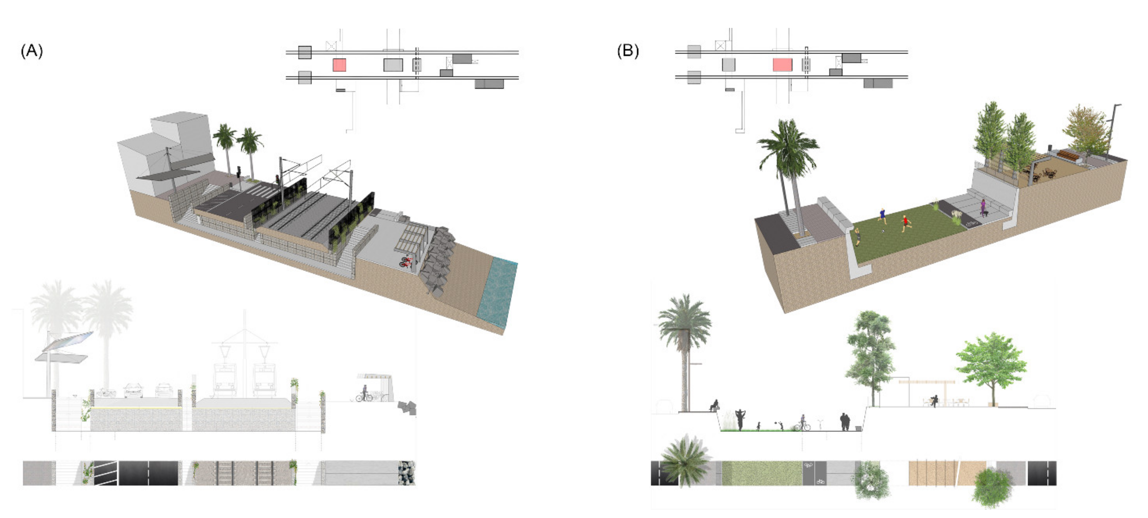
4.2.1. Longitudinal Continuity Strategies
- Reduce the road width, with one lane in each direction and an auxiliary third one;
- Widen and urbanize the urban sidewalks to ease the introduction of large courtyards for better access to underground passages;
- Widen the sidewalk between the N-II road and the railway by getting rid of the concrete protections (New Jerseys), and small courtyards and staircases can provide light and access to underground passages;
- Ensure continuity for pedestrians and bicycles by means of a two-way greenway along the seaside;
- Connect the seafront with the inner side of the infrastructures, with a regular distribution of underground passages at a local scale and green corridors through the main streams at a regional scale;
- Transform railway protections at the seaside (i.e., in contact with the longitudinal greenway) using stone gabions and vegetation;
- Foster longitudinal light mobility with a regular distribution of facilities related to bicycles, beach services and renewable energy generation;
- Promote alternative public transport systems such as bike rentals or ferries between Maresme villages and Barcelona;
- Construction of lightweight docks to protect beaches from sea storms, provide service to ferries and show a new sight of the coast as a leisure and tourism landmark.
4.2.2. Transversal Permeability Strategies
- Transform existing underground passages instead of building new ones;
- Use the most suitable existing passages in relation to flood prevention (i.e., those that are not directly facing a street toward the sea);
- Provide universal accessibility to all underground passages by means of staircases, ramps and elevators;
- Prevent the direct entrance of rainwater by means of massive handrails and topographical modification of access routes to underground passages;
- Improve the ambience of these passages to make them more secure and comfortable by widening them and adding natural light and ventilation, and as the N-II road is reduced, the passages’ lengths will decrease equally;
- Enlarge access paths to underground passages, with two on both sides and one in the middle;
- Use vertical elements in the access points, such as elevators or wind turbines, to create a recognizable landmark repeated regularly along the coast;
- Add regular footbridges related to light constructions to solve high unevenness;
- Offer new uses for the basements of public buildings related to underground passages, such as adding courtyards and vegetation (e.g., station lobbies and access to platforms);
- Modify underground passages for vehicles to move from motorway aesthetics toward a more urban one, with pavement and furniture such as those in public spaces.
4.2.3. Urban Landscape Strategies
- Add new activities to obsolete buildings, parking lodgments and huge commercial complexes in the seafront to highlight them as catalysts for urban regeneration;
- Recognize historic railway stations as part of the collective memory of each place and connect their basements to underground passages, creating activity nodes;
- Open the ground floors of public buildings toward adjacent urban spaces to enhance recognition and active use of these facilities;
- Organize facilities, parking lodgments, stations, commercial areas and beach services by means of lightweight prefabricated constructions that are easy to dismantle;
- Rethink the urban character of nautical clubs and marinas to enhance the continuity of seaside greenways as landmark elements;
- Transform the boundaries of private enclosures (such as campsites, sports fields and nautical clubs) into wide edges with vegetation related to the littoral landscape.
5. Discussion
6. Conclusions
Author Contributions
Funding
Institutional Review Board Statement
Informed Consent Statement
Data Availability Statement
Acknowledgments
Conflicts of Interest
References
- Ferrer, A.; Martínez, A.; Rentería, I.; Terradas, R. Estrategias Mediterráneas; Claret: Barcelona, Spain, 2015; pp. 12–13. [Google Scholar]
- Braudel, F. El Mediterráneo; Espasa Calpe: Madrid, Spain, 1987. [Google Scholar]
- Subbotin, O. Architectural and planning principles of organization and reconstruction of coastal areas. Mater. Sci. Forum 2018, 931, 750–753. [Google Scholar] [CrossRef]
- Martínez, A.; Rueda, C.; Gordon, J.; Ospina, J. Estratègies per a la Regeneració Sostenible D’assentaments Turístics a la Costa Mediterrània. Available online: http://hdl.handle.net/2099.2/3543 (accessed on 7 June 2021).
- Cinelli, I.; Anfuso, G.; Privitera, S.; Pranzini, E. An Overview on Railway Impacts on Coastal Environment and Beach Tourism in Sicily (Italy). Sustainability 2021, 13, 7068. [Google Scholar] [CrossRef]
- Guardiola, F. L’obsessió per Reconciliar la Ciutat Amb el Mar. Available online: https://www.raco.cat/index.php/Espais/article/download/91807/169983 (accessed on 7 June 2021).
- Martínez, A.; Vives, L. Stratégies Méditerranéenes pour la régéneration architectonique du bord de la mer. Classeur. Mare Nostrum 2017, 2, 341. [Google Scholar]
- Gehl Studio San Francisco. Planing by Doing: How Small, Citizen-Powered Projects Inform Large Planning Decisions; Gehl Studio: San Francisco, CA, USA, 2016; p. 2. [Google Scholar]
- Woodroffe, C.; Muray-Wallace, C. Sea-level rise and coastal change: The past as a guide to the future. Quat. Sci. Rev. 2012, 54, 4–11. [Google Scholar] [CrossRef]
- Renteria, I. Intervención en los edificios. In Estrategias Mediterráneas; Claret: Barcelona, Spain, 2015; pp. 102–105. [Google Scholar]
- Gascón, C.; Rovira, T. Pautas de Investigación; Ed. UPC: Barcelona, Spain, 2007. [Google Scholar]
- Ehrenzweig, A. El orden Oculto del Arte. Por el Proceso Creativo; Labor: Barcelona, Spain, 1973. [Google Scholar]
- Heinrichs, D.; Jarass, J. Designing healthy mobility in cities: How urban planning can promote walking and cycling. Bundesgesundheitsbl 2020, 63, 945–952. [Google Scholar] [CrossRef]
- Clopés, J. Efectos de la dinámica litoral inducidos por la actividad humana en áreas urbanizadas: El caso del Maresme (Barcelona). Territoris 2008, 7, 57. [Google Scholar]
- Martí, P.; Mayor, C.; Melgarejo, A. Waterfront landscapes in Spanish cities: Regeneration and urban transformations. WIT Trans. Built. Environ. 2018, 179, 45–56. [Google Scholar]
- Versaci, A.; Cardaci, A. Waterfront di Messina. Maregrosso, cuore della città, tra evoluzione e involuzione. Agribus. Paesaggio Ambiente 2018, 21, 28–35. [Google Scholar]
- Parrinello, G.; Bécot, R. Regional Planning and the Environmental Impact of Coastal Tourism: The Mission Racine for the Redevelopment of Languedoc-Roussillon’s Littoral. Humanities 2019, 8, 13. [Google Scholar] [CrossRef] [Green Version]
- González, M. El Serrallo de Tarragona: De barrio marinero a enclave temático para turistas y visitantes. Arx. d’Etnogr. Catalunya 2011, 11, 115–130. [Google Scholar]
- Gluvačević, D. The power of cultural heritage in tourism-example of the city of Zadar (Croatia). Int. J. Sci. Manag. Tour. 2016, 2, 3–24. [Google Scholar]
- Balaguer, E. Desarrollo Urbanístico y Calidad de Vida en Copenhague: El Caso de Orestad. Master’s Thesis, Universitat Politècnica de Catalunya, Barcelona, Spain, 28 June 2012. [Google Scholar]
- Rosenberg, E. Inventing the seashore: The Tel Aviv-Jaffa promenade. In Contemporary Urban Landscapes of the Middle East; Routledge: London, UK, 2016; pp. 75–97. [Google Scholar]
- Roca, E.; Villares, M.; Oroval, L.; Gabarró, A. Public perception and social network analysis for coastal risk management in Maresme Sud (Barcelona, Catalonia). J. Coast. Conserv. 2015, 19, 693–706. [Google Scholar] [CrossRef] [Green Version]
- Solá-Morales, M. Las Formas del Crecimiento Urbano; Edicions UPC: Barcelona, Spain, 1996. [Google Scholar]
- Busquets, J.; Domingo, M.; Eizaguirre, X.; Moro, A. Les formes Urbanes del Litoral Català; Diputació de Barcelona: Barcelona, Spain, 2003. [Google Scholar]
- Silva, P. Tactical urbanism: Towards an evolutionary cities’ approach? Environ. Plan. B Plan. Des. 2016, 43, 1040–1051. [Google Scholar] [CrossRef]
- Gehl, J.; Gemzoe, L. Nuevos Espacios Urbanos; Gustavo Gili: Barcelona, Spain, 2002; pp. 10–21. [Google Scholar]
- Jacobs, A. Great Streets. ACCESS Magaz. 1993, 1, 23–27. [Google Scholar]
- Jacobs, J. Muerte y Vida de las Grandes Ciudades; Capitán Swing: Madrid, Spain, 2020. [Google Scholar]
- Hernández, J. La resonancia del lugar. Arquitectura contemporánea y contexto. In Arquitectura y Ciudad. La Tradición Moderna Entre la Continuidad y la Ruptura; Arte y Estética: Madrid, Spain, 2007; pp. 12–39. [Google Scholar]
- Goldfinger, M. Arquitectura Popular Mediterránea; Gustavo Gili: Barcelona, Spain, 1993; pp. 8–26. [Google Scholar]
- Cisteró, X.; Camarós, J. Les rierades al Maresme. L’Atzavara 2014, 23, 61–79. [Google Scholar]
- AAVV. Gran Geografía Comarcal de Catalunya. El Vallès i el Maresme; Enciclopèdia Catalana: Barcelona, Spain, 1982; pp. 348–353. [Google Scholar]
- Terribas, A.; Lavin, J. El Desdoblamiento Ferroviario en el Maresme Norte. Available online: http://hdl.handle.net/2099.1/26513 (accessed on 23 July 2021).
- Botey, C.; De Castellarnau, X. La cultura del tren: El ferrocarril Barcelona–Mataró. Trobada d’Entitats de Recerca Local i Comarcal del Maresme. Sessió d’Estudis Mataronins 2019, 13, 217–232. [Google Scholar]
- Alejandre, V. La N-II y sus Precedentes Camineros. Itinerarios Históricos y vías de Comunicación Entre Madrid/Toledo y Zaragoza (de la Antigüedad al siglo XX); Centro de Estudios Bilbilitanos-Institución Fernando el Católico: Calatayud, Spain, 2017; pp. 261–350. [Google Scholar]
- Serra, J.; Bautista, R.; Maia, L.; Montori, C. Sistemas de protección de costas (i): Regeneración de playas. El ejemplo del Maresme (1987–1998). Geogaceta 1998, 25, 187–190. [Google Scholar]
- Biel, M. Mataró: Del Tèxtil a Ciutat del Coneixement. Available online: https://ddd.uab.cat/pub/tfg/2014/125853/TFG_Mireia_Biel_1269002.pdf (accessed on 17 August 2021).
- Gras, F. Anàlisi de L’impacte Socioeconòmic del Turisme: El cas dels dos Maresmes. Bachelor’s Thesis, Facultat de Geografia i Història, Universitat de Barcelona, Barcelona, Spain, 2020. Available online: http://hdl.handle.net/2445/149598 (accessed on 12 June 2021).
- Parcerisas, L.; Marull, J.; Pino, J.; Tello, E.; Coll, F.; Basnou, C. Land use changes, landscape ecology and their socioeconomic driving forces in the Spanish Mediterranean coast (El Maresme County, 1850–2005). Environ. Sci. Policy 2012, 23, 120–132. [Google Scholar] [CrossRef]
- The Catalan Government. Pacte per la Mobilitat Sostenible al Maresme. Public Agreement. Available online: https://web.gencat.cat/ca/actualitat/detall/Pacte-per-la-Mobilitat-Sostenible-al-Maresme (accessed on 15 July 2021).
- VVAA. Catàlegs de Paisatge de Catalunya; Observatori del Paisatge: Barcelona, Spain, 2019. [Google Scholar]
- The Catalan Government. Pla d’Espais d’Interès Natural (PEIN), Regulatory Decret 328/1992. Available online: http://sig.gencat.cat/visors/enaturals.html (accessed on 12 May 2021).
- Sala i Martí, P.; Bretcha, G.; Puigbert, L. La Carretera en el Paisatge; Observatori del Paisatge: Olot, Spain, 2020; Available online: http://www.catpaisatge.net/fitxers/publicacions/carreteres/carreteres.pdf (accessed on 25 July 2021).
- Díaz, J.; Maldonado, A. Transgressive sand bodies on the Maresme continental shelf, western Mediterranean Sea. Mar. Geol. 1990, 91, 53–72. [Google Scholar] [CrossRef]
- Ballesteros, C.; Jiménez, J.A.; Viavattene, C. A multi-component flood risk assessment in the Maresme coast (NW Mediterranean). Nat. Hazards 2018, 90, 265–292. [Google Scholar] [CrossRef] [Green Version]
- Duran, A.M.; Guerra, J.G.; Martín, X.; Piquer, A.P. The Case of “Anis del Mono” Factory. Regenerating Coastal Heritage in Catalonia. Athens J. Mediterr. Stud. 2016, 2, 3. [Google Scholar] [CrossRef]
- Romero, G.; Nadal, J.; Ribas, A. L’impacte del Temporal Glòria al Litoral de l’Alt-Maresme i al Delta de la Tordera. Diagnosis, Aprenentatges i Propostes D’actuació; Academic Study. Master’s Thesis, Universitat Autònoma de Barcelona, Barcelona, Spain, 2020. Màster Universitari en Polítiques i Planificació per a les Ciutats, L’ambient i el Paisatge. Available online: https://ddd.uab.cat/record/236113 (accessed on 10 June 2021).
- Mas, V.; Temes, R.; Serrano, B.; Jiménez, C.; Azulay, M. Research and Development Project, ERAM Estrategias para la Regeneración Sostenible de Asentamientos Turísticos en la Costa Mediterránea; Universitat Politècnica de València: Valencia, Spain, 2015; Available online: https://riunet.upv.es/handle/10251/47918 (accessed on 2 September 2021).
- Van Veelen, P. Adaptive planning for resilient coastal waterfronts: Linking flood risk reduction with urban development in Rotterdam and New York City. In A+BE|Architecture and the Built Environment; TU Delft: Delft, The Netherlands, 2016. [Google Scholar] [CrossRef]
- Gordon, J.; Martin, X.; Peguero, A. El trabajo de campo. In strumento esencial en el proyecto de investigación. In Estrategias Mediterráneas; Claret: Barcelona, Spain, 2015; pp. 100–101. [Google Scholar]
- Institut Cartogràfic i Geològic de Catalunya (ICGC). Available online: https://www.icgc.cat/ (accessed on 28 August 2021).
- Ferrer, A. El dibujo del territorio como forma de conocimiento. In Estrategias Mediterráneas; Claret: Barcelona, Spain, 2015; pp. 80–83. [Google Scholar]
- Martí, C. Las Variaciones de la Identidad. Ensayo Sobre el Tipo en Arquitectura; Fundación Arquia: Barcelona, Spain, 2014. [Google Scholar]
- Martínez, A. Restablecer el carácter del lugar. In Estrategias Mediterráneas; Claret: Barcelona, Spain, 2015; pp. 92–95. [Google Scholar]
- Alexander, C. A Pattern Language: Towns, Buildings, Constructions; Oxford University Press: Oxford, UK, 1977. [Google Scholar]
- Fang, C. Waterfront Landscapes; Design Media Publishing Limited: London, UK, 2011. [Google Scholar]
- Marshall, W.; Duvall, A.; Main, D. Large-scale tactical urbanism: The Denver bike share system. J. Urban. Int. Res. Placemaking Urban Sustain. 2016, 9, 135–147. [Google Scholar] [CrossRef]
- Martínez, A.; de Rentería, I.; Martín, X.; Gordon, J. Estrategias de regeneración del paisaje urbano en el litoral del Maresme (Barcelona). ISUF-H Ciudad. Formas Urbanas Perspect. Transversales 2018, 7, 97. [Google Scholar]
- Martínez-Sala, E. Oportunitats pel pla Territorial del Maresme Davant d’una Reforma Infraestructural Tren-Autopista-N-II. Final Thesis, ETS d’Enginyeria de Camins, Canals i Ports de Barcelona. 2010. Available online: http://hdl.handle.net/2099.1/12609 (accessed on 5 July 2021).
- Dawson, D.; Shaw, J.; Gehrels, W.R. Sea-level rise impacts on transport infrastructure: The notorious case of the coastal railway line at Dawlish, England. J. Transp. Geogr. 2016, 51, 97–109. [Google Scholar] [CrossRef] [Green Version]
- The Catalan Government. La Línia Orbital Ferroviària: Vertebració del Territori Metropolità, Infraestructures Ferroviàries de Catalunya. Available online: https://ifercat.gencat.cat/index.php?contenido=22 (accessed on 28 July 2021).
- El fin del Peaje de la C-32 Transforma el Maresme, Published on 3 October 2020, La Vanguardia. Available online: https://www.lavanguardia.com/local/maresme/20201003/483806389958/fin-peaje-c-32-transforma-maresme.html (accessed on 26 August 2021).
- Garcia-López, M.A. Urban spatial structure, suburbanization and transportation in Barcelona. J. Urban Econ. 2012, 72, 176–190. [Google Scholar] [CrossRef] [Green Version]
- Banister, D. The sustainable mobility paradigm. Transp. Policy 2008, 15, 73–80. [Google Scholar] [CrossRef]
- The Catalan Government. Manual for the Design of Cyclepaths in Catalonia; Departament de Política Territorial i Obres Públiques: Barcelona, Spain, 2008. [Google Scholar]
- Walton, A. Economic Analysis on the Impacts of Climate Change in the Maresme Coast. Bachelor’s Thesis, Universitat Politècnica de Catalunya, Barcelona, Spain, 2016. Available online: http://hdl.handle.net/2117/103223 (accessed on 23 June 2021).
- Rowe, C.; Koetter, F. Ciudad Collage; Gustavo Gili: Barcelona, Spain, 1981; pp. 147–177. [Google Scholar]
- Balletto, G.; Ladu, M.; Milesi, A.; Borruso, G. A Methodological Approach on Disused Public Properties in the 15-Minute City Perspective. Sustainability 2021, 13, 593. [Google Scholar] [CrossRef]
- Sauer, I.; Roca, E.; Villares, M. Beach users’ perceptions of coastal regeneration projects as an adaptation strategy in the western Mediterranean. J. Hosp. Tour. Res. 2019. [Google Scholar] [CrossRef] [Green Version]
- Martinez, C.; Pemjean, R. La línea del agua. El monumento a la Partisana de Carlo Scarpa en Venecia. Rita 2019, 11, 36–44. [Google Scholar] [CrossRef]
- Crane, S. Mediterranean Dialogues. Le Corbusier, Fernand Pouillon and Roland Simounet. In Modern Architecture and the Mediterranean, Vernacular Dialogues and Contested Identities; Lejeune, J., Sabatino, M., Eds.; Routledge: New York, NY, USA, 2009; pp. 95–99. [Google Scholar]
- Muntañola, J. Mind, Land & Society: A New Architecture for a Better Enviroment. Available online: https://upcommons.upc.edu/handle/2099.3/36773 (accessed on 30 May 2021).
- Gastaldi, F.; Camerin, F. El proceso de remodelación del waterfront de Génova y los proyectos de Renzo Piano desde los años 80 hasta el Blue Print. ACE–Archit. City Environ. 2017, 11, 33–64. Available online: http://hdl.handle.net/2117/101730 (accessed on 16 July 2021).
- Austin, G. Case study and sustainability assessment of Bo01, Malmö, Sweden. J. Green Build. 2013, 8, 34–50. [Google Scholar] [CrossRef]
- The Catalan Government. Pla Director Urbanístic del Sistema Costaner (PDUSC), Regulatory DOGC 6722. Available online: https://portaldogc.gencat.cat/utilsEADOP/PDF/6722/1374519.pdf (accessed on 12 May 2021).
- Olgivay, V. Arquitectura y Clima. Manual de Diseño Bioclimático Para Arquitectos y Urbanistas; Gustavo Gili: Barcelona, Spain, 2010. [Google Scholar]
- Rodriguez, G.; Brebbia, C. Coastal Cities and Their Sustainable Future; WIT Press: Southampton, UK, 2015; pp. 125–136. [Google Scholar]
- Urzelai, J.; Arbonés, E. Integración paisajística del TRAM a su paso por Serra Grossa. Arquitectura 2009, 356, 21–27. Available online: https://dialnet.unirioja.es/servlet/articulo?codigo=3006836 (accessed on 6 July 2021).
- Loubes, J.P. Arquitectura Subterránea. Aproximación a un Hábitat Natural; Gustavo Gili: Barcelona, Spain, 1985. [Google Scholar]
- Hoyos, F. El Modelo Barcelona de Espacio Público y Diseño Urbano. Paseo Sant Joan (1979–2011). Master’s Thesis, Universitat de Barcelona, Barcelona, Spain, 2012. [Google Scholar] [CrossRef]
- Batlle, E. El Jardí de la metròpoli al Llobregat = The Metropolis garden on the Llobregat river. Paisea 2013, 1, 68–73. Available online: http://hdl.handle.net/2117/20960 (accessed on 22 June 2021).
- Cornu, R. Les Portefaix et la transformation du port de Marseille. Ann. Midi 1974, 86, 181–201. [Google Scholar] [CrossRef]
- Frantzeskaki, N. Seven lessons for planning nature-based solutions in cities. Environ. Sci. Policy 2019, 93, 101–111. [Google Scholar] [CrossRef]
- Raymond, C.; Frantzeskaki, N.; Kabisch, N.; Berry, P.; Breil, M.; Nita, M.; Calfapietra, C. A framework for assessing and implementing the co-benefits of nature-based solutions in urban areas. Environ. Sci. Policy 2017, 77, 15–24. [Google Scholar] [CrossRef]
- Bote Confia que la Nova Estació de Mataró Será Una Realitat cap al 2026, Published on 21 January 2021, Capgròs. Available online: https://www.capgros.com/actualitat/mataro/bote-confia-nova-estacio-mataro-sera-realitat-cap-2026_801773_102.html (accessed on 19 March 2021).
- La N-II se Pacifica con el fin de Peajes en la C-32, Published on 28 August 2021, El Periódico. Available online: https://www.elperiodico.com/es/economia/20210828/pacificacion-carretera-n-ii-gratuidad-autopistas-catalanas-c-32-12020468 (accessed on 1 September 2021).
- Valente, R.; Stamatopoulos, L.; Donadito, C. Environmental design criteria through Geoindicators for two Mediterranean coastlands. CSE–City Saf. Energy 2014, 2, 63–76. [Google Scholar] [CrossRef]


| Methodology | Analytical Stage | Proposal Stage |
|---|---|---|
| Analysis | (1) Analysis of the territory, history, culture, economy and traditions | (2) Identification and classification of typological problematics |
| Regeneration projects | (3) Selection of representative case studies and context analysis | (4) Proposal of transformation, specific models and solutions and typologies |
| Intervention strategies | (5) Four types of solutions: site, project, construction and climate | (6) Definition of action guidelines for unitarian territorial regeneration |
| Longitudinal Continuity | Transversal Permeability | Urban Landscape |
|---|---|---|
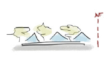
 L1_Parking lodgments |  T1_Beach stream mouths | 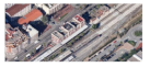 P1_Railway stations |
 L2_Inadequate pavement |  T2_Vehicle underground passage | 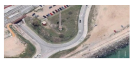 P2_Abandoned factories |
 L3_Seafront not urbanized |  T3_Pedestrian underground ways |  P3_Parking lodgments |
 L4_Streams | 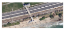 T4_Elevated footbridges | 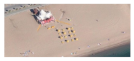 P4_Temporary beach buildings |
 L5_Railway stations |  T5_Railroad crossing | 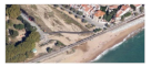 P5_Nautical clubs and facilities |
 L6_Broken pathways | 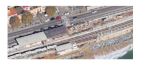 T6_Station underground passages |  P6_Footbridges |
 L7_Vehicle underground passage |  T7_ Pedestrian private passages | 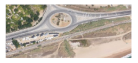 P7_Roundabouts |
 L8_End of pathway | 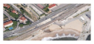 T8_Natural streams |  P8_Marinas |
 L9_Topographic change | 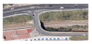 T9_Elevated vehicle passages | 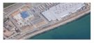 P9_Factories and commercial |
 L10_Seafront facilities | 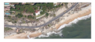 T10_Natural footbridges | 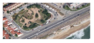 P10_Abandoned urban voids |
 P11_Campsites |
| Variable 1 | Variable 2 | ||
|---|---|---|---|
 V1A_Large urban consolidated | 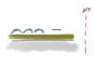 V1F_Crops | 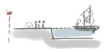 V2A_Marina | 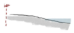 V2F_Beach |
 V1B_Small urban consolidated | 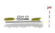 V1G_Transport |  V2B_Fish harbor | 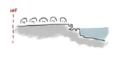 V2G_Parking/Rocks |
 V1C_Isolated urbanconsolidated |  V1H_Leisure nature | 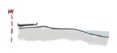 V2C_Seafront/Beach |  V2H_Rocks |
 V1D_Urban campsite |  V2D_Circulations/Parking/Beach | 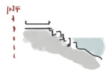 V2I_Seafront/Rocks | |
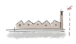 V1E_Industry | 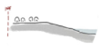 V2E_Parking/Beach | 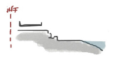 V2J_Seafront/Rock/Beach | |
| Variable 3 | Topographic difference between both sides | ||
| Variable 4 | Distance between inhabited urban front and the beach | ||
| Case Study | Problematics 1 | Variables |
|---|---|---|
| Downtown of Premià de Mar | L3 T1 + T3 P4 + P10 | V1H + V2C + V3 + V4 |
| Stop on the beach of Vilassar-Cabrera | L1 + L3 + L7 T1 + T2 + T3 + T6 P3 + P4 + P5 | V1A + V2D + V3 + V4 |
| Railway station of Mataró | L1 + L5 + L10 T3 + T5 + T6 P1 + P10 | V1B + V2A + V3 + V4 |
| Stream mouth in Llavaneres | L3 + L4 + L7 + L10 T8 + T3 + T2 + T1 P4 + P5 + P10 | V1H + V2C + V3 + V4 |
| Case Studies | Standardized Solutions |
|---|---|
| Downtown of Premià de Mar | 1A + 2A + 3A |
| Stop on the beach of Vilassar-Cabrera | 1A + 2A + 4B |
| Railway station of Mataró | 1A + 2A + 4A |
| Stream mouth in Llavaneres | 1A + 2B + 3B + 3C |
Publisher’s Note: MDPI stays neutral with regard to jurisdictional claims in published maps and institutional affiliations. |
© 2021 by the authors. Licensee MDPI, Basel, Switzerland. This article is an open access article distributed under the terms and conditions of the Creative Commons Attribution (CC BY) license (https://creativecommons.org/licenses/by/4.0/).
Share and Cite
Martínez, A.; Martín, X.; Gordon, J. Matrix of Architectural Solutions for the Conflict between Transport Infrastructures, Landscape and Urban Habitat along the Mediterranean Coastline: The Case of the Maresme Region in Barcelona, Spain. Int. J. Environ. Res. Public Health 2021, 18, 9750. https://doi.org/10.3390/ijerph18189750
Martínez A, Martín X, Gordon J. Matrix of Architectural Solutions for the Conflict between Transport Infrastructures, Landscape and Urban Habitat along the Mediterranean Coastline: The Case of the Maresme Region in Barcelona, Spain. International Journal of Environmental Research and Public Health. 2021; 18(18):9750. https://doi.org/10.3390/ijerph18189750
Chicago/Turabian StyleMartínez, Anna, Xavier Martín, and Jordi Gordon. 2021. "Matrix of Architectural Solutions for the Conflict between Transport Infrastructures, Landscape and Urban Habitat along the Mediterranean Coastline: The Case of the Maresme Region in Barcelona, Spain" International Journal of Environmental Research and Public Health 18, no. 18: 9750. https://doi.org/10.3390/ijerph18189750
APA StyleMartínez, A., Martín, X., & Gordon, J. (2021). Matrix of Architectural Solutions for the Conflict between Transport Infrastructures, Landscape and Urban Habitat along the Mediterranean Coastline: The Case of the Maresme Region in Barcelona, Spain. International Journal of Environmental Research and Public Health, 18(18), 9750. https://doi.org/10.3390/ijerph18189750