1. Introduction
In Pakistan, groundwater has been used for irrigating agriculture for a long time. Earlier, the abstraction of groundwater was made through open wells with the help of rope and buckets, reciprocating pumps, and hand pumps. In Pakistan, for irrigation for agriculture, groundwater is the second-largest source because of arid climatic conditions [
1]. Due to the meeting of fiber and food requirements in Pakistan, the reliance on groundwater has been increasing during the past two decades [
2,
3,
4].
In Pakistan, groundwater is a very important resource because its demand is increasing day by day for agricultural, domestic, and industrial purposes. Across the country, the contribution of groundwater for agriculture purposes is about 60%, for drinking it is 90%, and for industry it is 100% [
5]. As most of the climatic zone of Pakistan is an arid climate zone where average annual rainfall is less than 20 mm and groundwater is limited in these areas [
6]. In the Punjab province of Pakistan, the installation rate of private tubewells has been increasing at the rate of 60% from 1991–2000. In Pakistan, 1.20 million tubewells are installed that have a discharge rate of 0.015–0.56 m³/s, having a depth of 30–85 m and a diameter of 15–30 cm out of this, and almost 86% of tube wells are installed in Punjab province. The groundwater has great importance for the farmers of tail ends of distributaries and watercourses because groundwater supplies are not enough there [
7,
8,
9]. The advances in remote-sensing availability of images and image acquisition are helpful for geoscientists to prepare maps quickly and explore and evaluate the geo-characteristics of any area on the globe.
The investigation of groundwater demand is one of the main components of the management of these resources. Thus, the remote sensing data, one of the latest techniques, was used to determine the crop water requirements and groundwater abstraction need in the study area.
2. Materials and Methods
2.1. Data
This research work was conducted at the canal command area of Dera Ghazi Khan (D.G Khan) canal, located at latitude 29.731° to 29.862° N and longitude 70.314° to 70.487° E. Elevation level of the study area is 129 m (423 ft) above the sea level. The canal network of the D.G. Khan Irrigation zone is 2679.64 miles long, and the command area under cultivation is about 0.84 million ha. The Chashma and Taunsa barrages provide irrigation water to the DG Khan canal.
The hottest month in this area is June, which has a maximum average temperature of 42 °C, and the coldest month is January, which has minimum average temperature of 6 °C. The average annual rainfall of this area is about 236.3 mm/year, having arid climate and erratic rainfall pattern. There are two seasons of crops, Kharif and Rabi. The Kharif season started in winter and is also named after monsoon crops because these crops are cultivated in the monsoon season. Sowing of Kharif crops started in April and harvesting started in October/November. Crops of the Kharif season are cotton, rice, and sugarcane. The Rabi season is sowing in November/December and harvesting in April/May. Major crops of the Rabi season are wheat, mustard, sugarcane, and barley.
2.2. MODIS Satellite Data
The remote sensing data were collected from the source of earth data, and its components were satellites AQUA (MYD13Q1) and TERRA (MOD13Q1), having a resolution of 250 m. The temperature data for the study area were collected from TERRA (MOD11A2), and rainfall data were collected online from weatheronline.com/dera-ghazi-khan for the time duration of 2017–2019. The discharge data of the canal were collected daily from the Punjab Irrigation Department for the time duration of 2017–2019. The MODIS satellite data set were acquired from its two sensors (AQUA and TERRA) and used for further processing. The data downloaded from these products have a difference of 8 days, and each product provides data after every 15 days.
2.3. Selection of Tiles of the Study Area
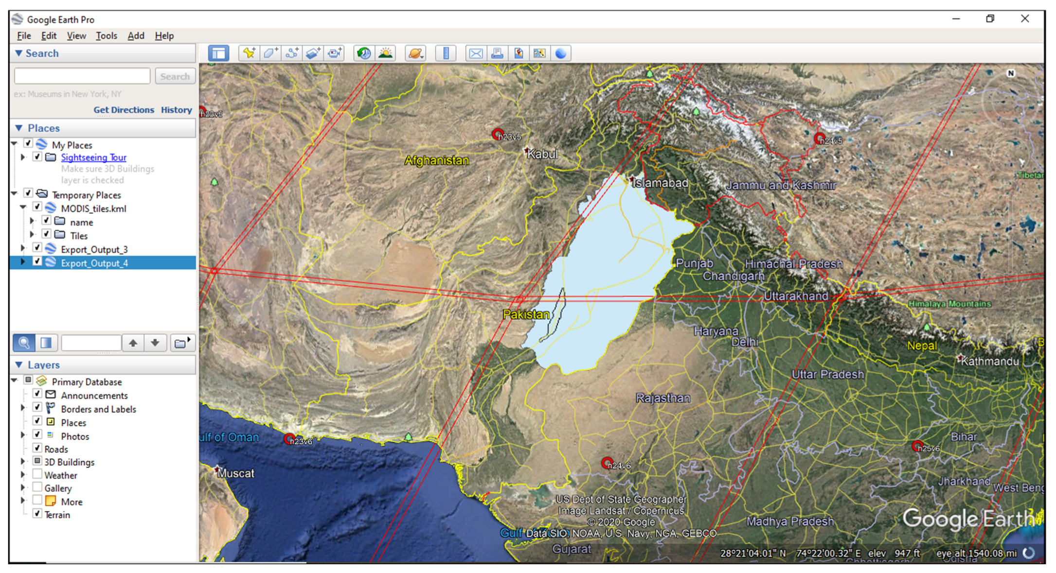
The selection of tiles in MODIS was very important because, in this method, the required tiles were selected in the study area that they lie in. The tiles were viewed from the app Google Earth that created a grid shape in Google Earth software around the globe, which was seen in red lines covering the area.
The interface of MODIS tiles is shown in
Figure 1. The study area lies in horizontal tile h24 and two vertical tiles, v5 and v6. Therefore, the complete study area of research was covered by h24, v5, h24, and v6 tiles. Images through the satellite were easy for the graphical study of an area because tiles cover large areas, and Punjab (Pakistan) was completely covered by 2 tiles.
3. Results and Discussion
3.1. Seasonal Crop Water Requirement
The volume of seasonal crop water requirements for Rabi and Kharif is shown in
Figure 2. The volume of crop water requirement ranged between 353.76 and 353.04 Mm³ (million cubic meter) for the wheat crop during the season 2017–2018 and 2018–2019, respectively. The volume of crop water requirement ranged from 445.42 and 445.1 Mm³ for the sugarcane crop for seasons 2018 and 2019, respectively. It was observed that the crop water requirement was high in 2017–2018 for Rabi and 2018 for Kharif, as compared to 2018–2019 and 2019, respectively.
3.2. Seasonal Groundwater Demand
The groundwater demand was calculated for each cropping season, as shown in
Figure 3. The volume of groundwater demand for Rabi 2017–2018 and 2018–2019 was 642.24 and 661.57 Mm³ and for Kharif 2018, 2019 was 165 and −101.18 Mm³, respectively. The highest value of groundwater was required for season Rabi 2018–2019, and the lowest value for Kharif was in 2018. It was observed that Kharif 2019 showed a negative value in the graph, representing that there was no need for groundwater for this season and that canal water was enough to meet crop water requirements.
4. Conclusions
In this research, AQUA and TERRA remotely sensed datasets were used to determine crop water requirements of the major crops in the study area for the year 2017–2019. The groundwater demand was calculated by subtracting the CWR from the actual canal water supplies. It was found that the seasonal volume of CWRs of wheat and sugarcane for season 2017–2018 were 353.76 and 445.42 Mm³ and for season 2018–2019 were 353 and 445.12 Mm³, respectively. The seasonal volume of CWRs for rice, cotton, and sugarcane for season 2018 were 562.9, 541.8, and 484.5 Mm³, and for season 2019 they were 518.9, 600, and 509 Mm³ respectively. The results showed that volume of groundwater demands for Rabi 2017–2018 and 2018–2019 were 642.24 and 661.57 and for Kharif 2018 was 165 Mm³, respectively. For Kharif 2019, the negative values (−101.18 Mm³) represent the surplus canal water supplies. The groundwater demand in the Rabi season was relatively higher than Kharif season. It is recommended that the maximum number of crops should be observed for a better understanding of the crop water requirements in the area.
Author Contributions
A.S. and M.A. conceptualize the research objectives. M.A., H.U.F. and M.A.A. collected the data. A.S. and Z.M.K. supervised the procedure and method adopted. All the authors contributed to analyzing the results and writing the manuscript. All authors have read and agreed to the published version of the manuscript.
Funding
This research received no external funding.
Institutional Review Board Statement
Not applicable.
Informed Consent Statement
Not applicable.
Data Availability Statement
The data are available upon request from the corresponding author.
Acknowledgments
The authors acknowledge the Department of Agricultural Engineering, Bahauddin Zakariya University, Multan for proving facilities to conduct this research.
Conflicts of Interest
The authors declare no conflict of interest.
References
- Imran, M.A.; Ali, A.; Ashfaq, M.; Hassan, S.; Culas, R.; Ma, C. Impact of Climate Smart Agriculture (CSA) practices on cotton production and livelihood of farmers in Punjab, Pakistan. Sustainability 2018, 10, 2101. [Google Scholar] [CrossRef]
- Ashfaq, A.; Ashraf, M.; Bahzad, A. Spatial and temporal assessment of groundwater behaviour in the Soan Basin of Pakistan. Univ. Eng. Technol. Taxila Tech. J. 2014, 19, 12. [Google Scholar]
- Qureshi, A.S.; McCornick, P.G.; Sarwar, A.; Sharma, B.R. Challenges and prospects of sustainable groundwater management in the Indus Basin, Pakistan. Water Resour. Manag. 2010, 24, 1551–1569. [Google Scholar] [CrossRef]
- Watto, M.A.; Mugera, A.W. Groundwater depletion in the Indus Plains of Pakistan: Imperatives, repercussions and management issues. Int. J. River Basin Manag. 2016, 14, 447–458. [Google Scholar] [CrossRef]
- Hassan, G.Z.; Hassan, F.R. Sustainable use of groundwater for irrigated agriculture: A case study of Punjab, Pakistan. Eur. Water 2017, 57, 475–480. [Google Scholar]
- Jayaram, D. India–Pakistan river water sharing: Prospects for environmental peacebuilding. In Water Management in South Asia; Springer: Cham, Switzerland, 2020; pp. 175–202. [Google Scholar]
- Shakoor, A.; Mahmood Khan, Z.; Arshad, M.; Farid, H.U.; Sultan, M.; Azmat, M.; Hussain, Z. Regional groundwater quality management through hydrogeological modeling in LCC, West Faisalabad, Pakistan. J. Chem. 2017, 2017, 2041648. [Google Scholar] [CrossRef]
- Nagrah, A.; Chaudhry, A.M.; Giordano, M. Collective action in decentralized irrigation systems: Evidence from Pakistan. World Dev. 2016, 84, 282–298. [Google Scholar] [CrossRef]
- Awan, U.K.; Anwar, A.; Ahmad, W.; Hafeez, M. A methodology to estimate equity of canal water and groundwater use at different spatial and temporal scales: A geo-informatics approach. Environ. Earth Sci. 2016, 75, 409. [Google Scholar] [CrossRef]
| Disclaimer/Publisher’s Note: The statements, opinions and data contained in all publications are solely those of the individual author(s) and contributor(s) and not of MDPI and/or the editor(s). MDPI and/or the editor(s) disclaim responsibility for any injury to people or property resulting from any ideas, methods, instructions or products referred to in the content. |
© 2022 by the authors. Licensee MDPI, Basel, Switzerland. This article is an open access article distributed under the terms and conditions of the Creative Commons Attribution (CC BY) license (https://creativecommons.org/licenses/by/4.0/).


 ,
, 


