
Novel Combined Approach of GIS and Electrical Tomography to Identify Marsh/Lake at Kastrouli Late Mycenaean Settlement (Desfina, Greece)


 ,
, 
 , and
, and 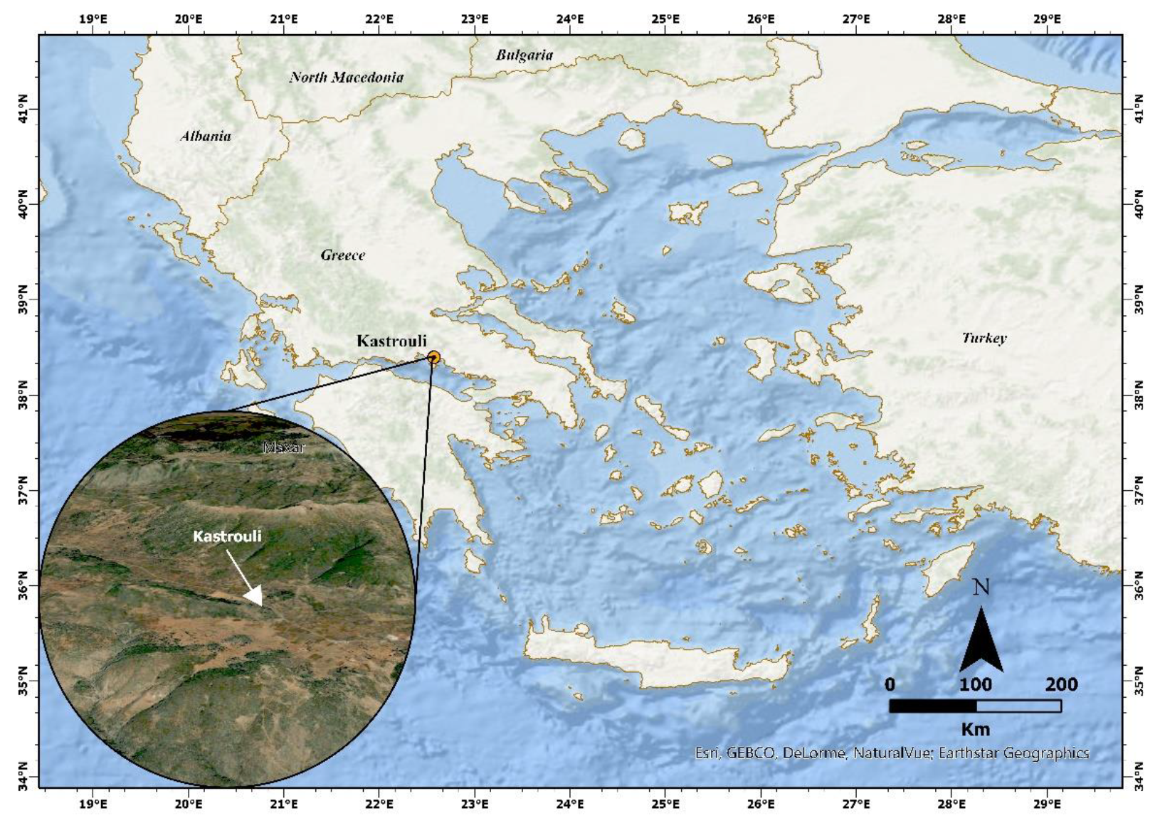
Abstract
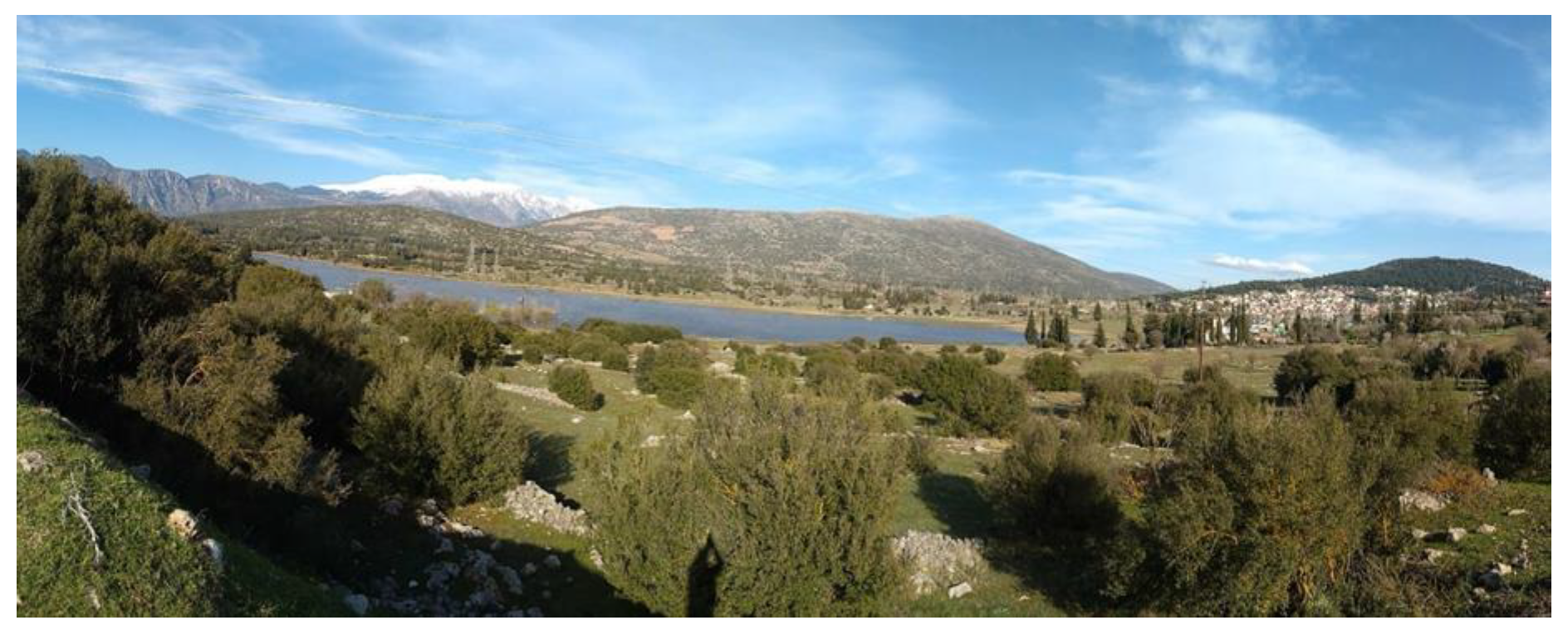
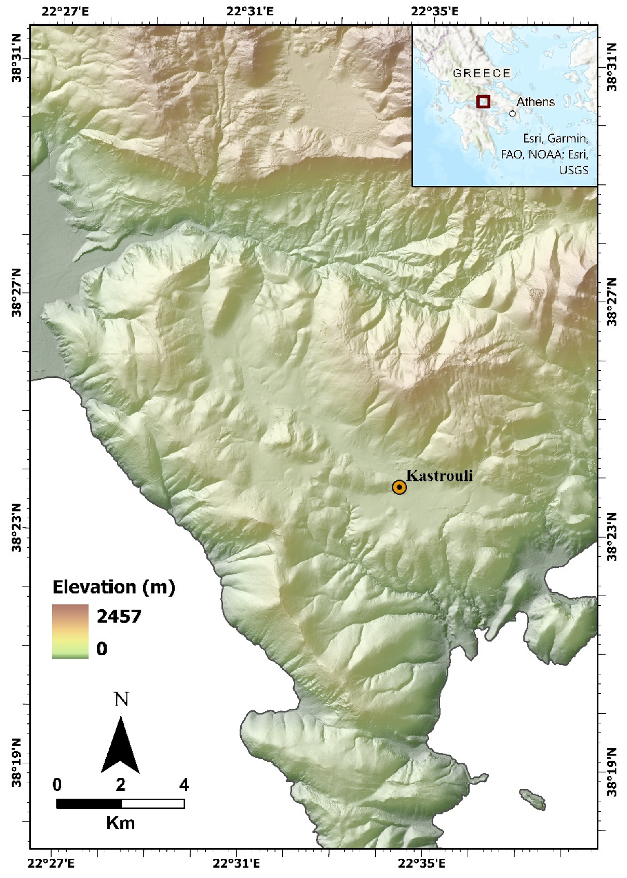
:1. Introduction
2. Methods and Instrumentation
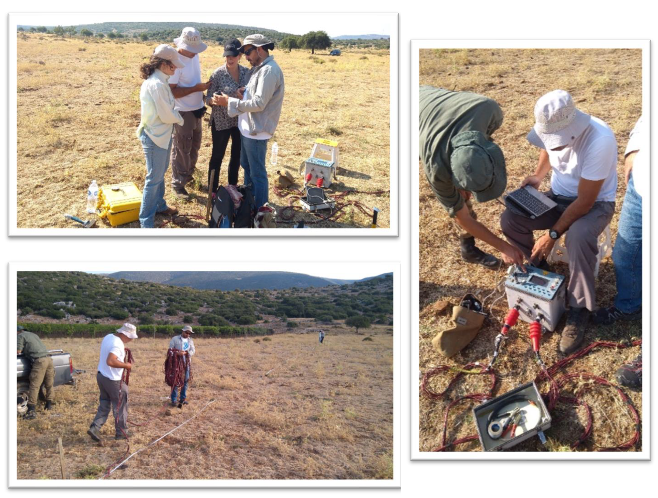
2.1. Electrical Resistivity Tomography (ERT)
2.2. GIS, DEM, and Thematic Maps
3. Results
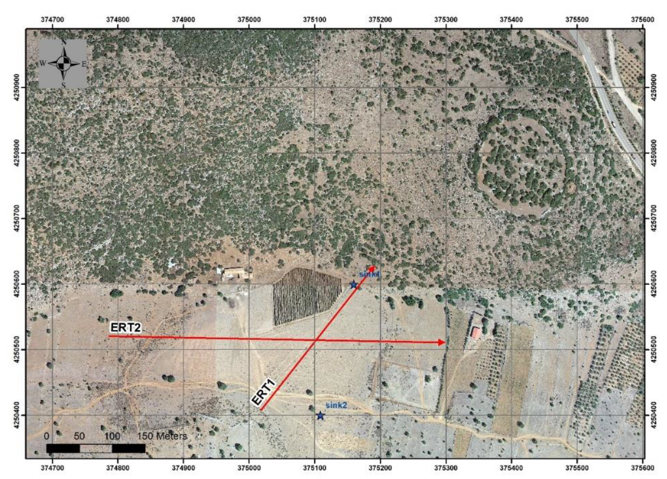
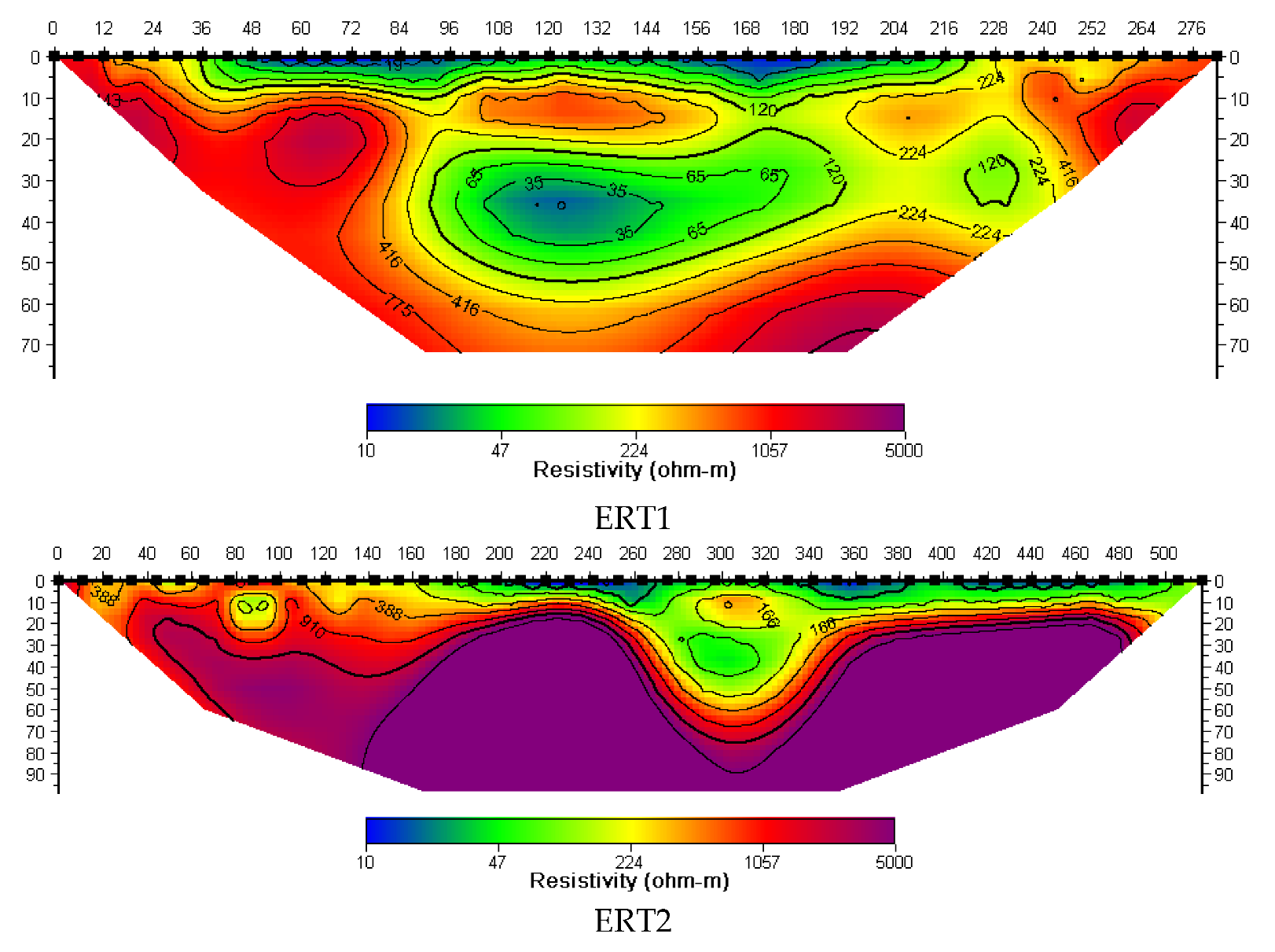
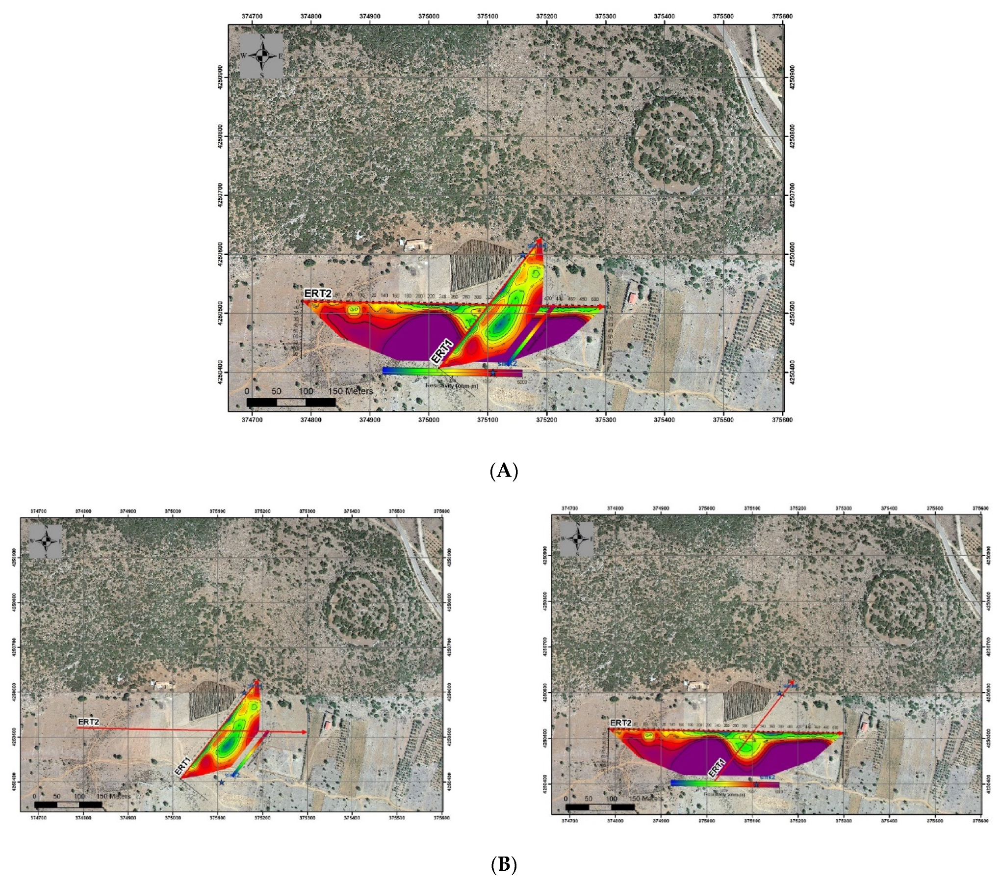
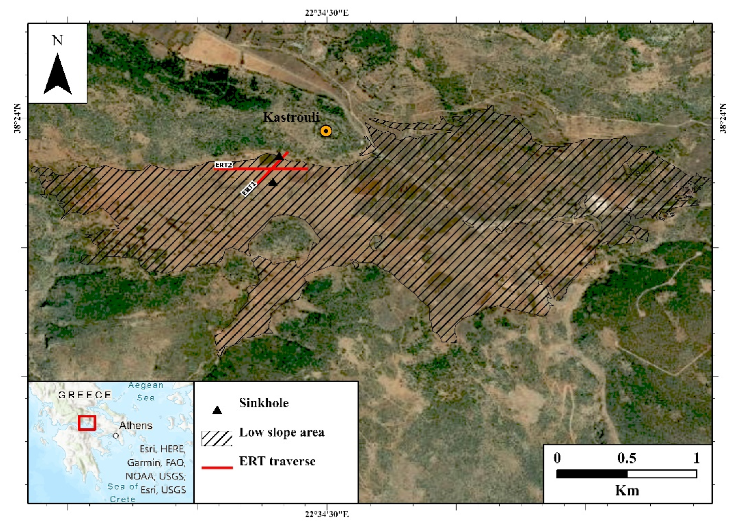
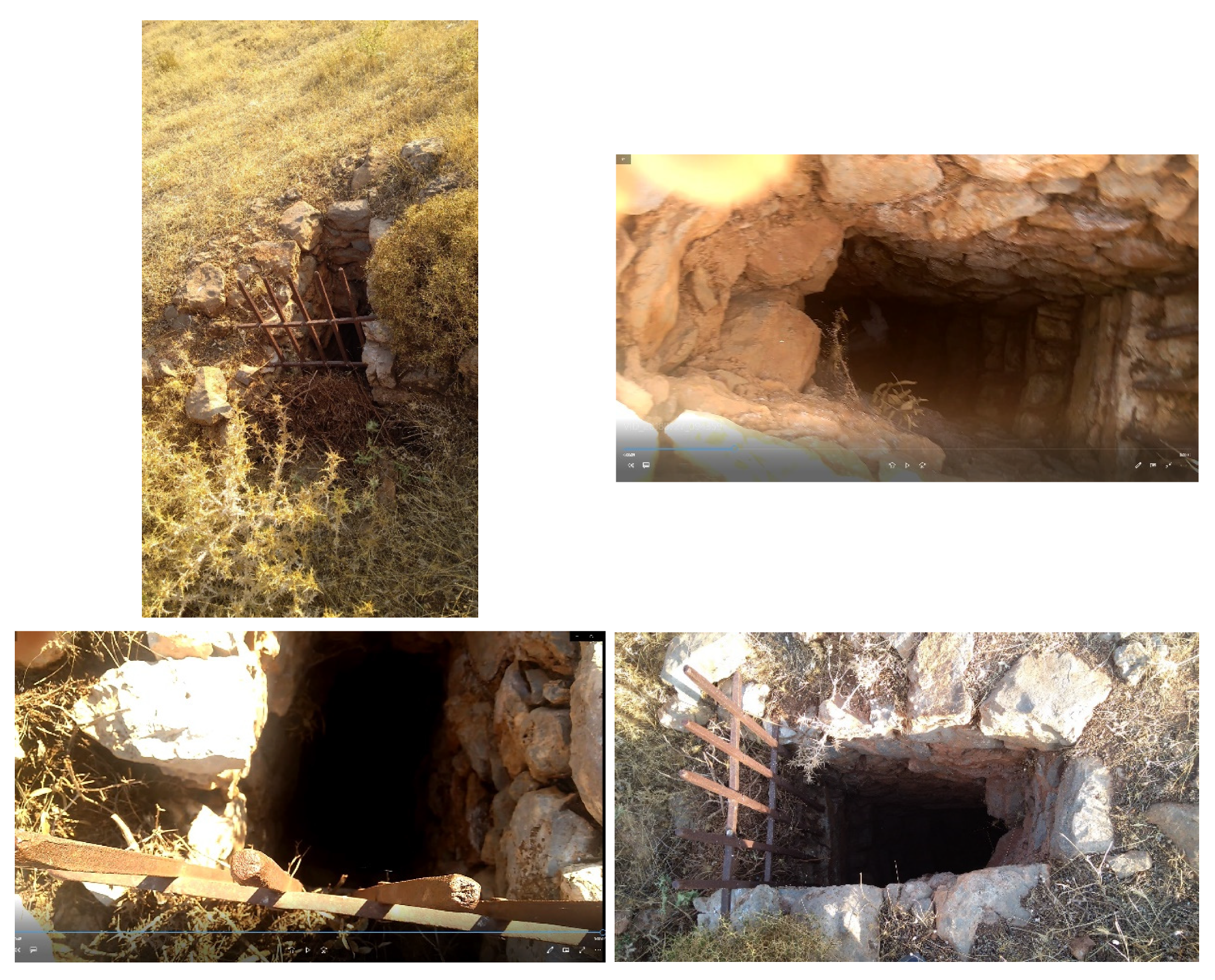
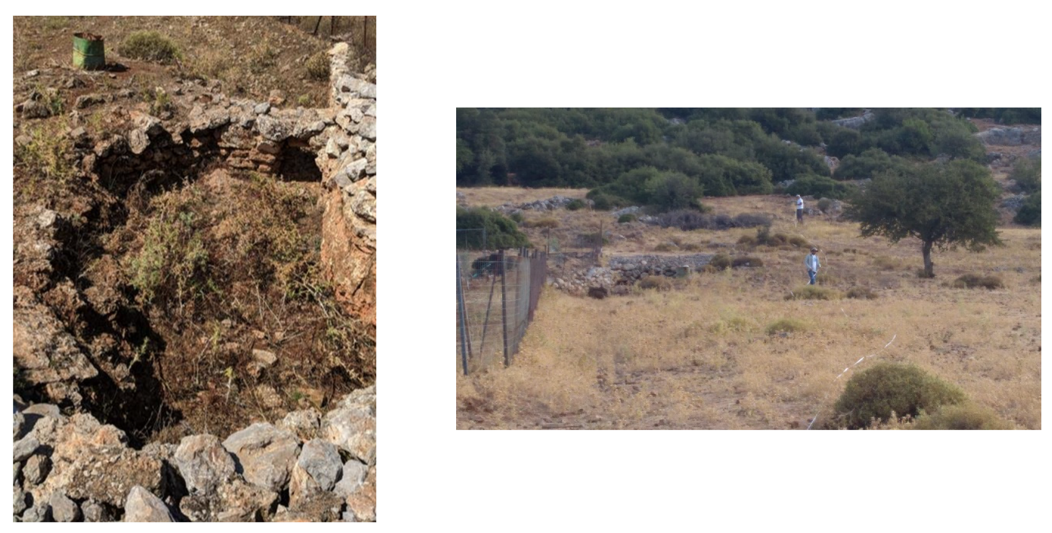
3.1. ERT
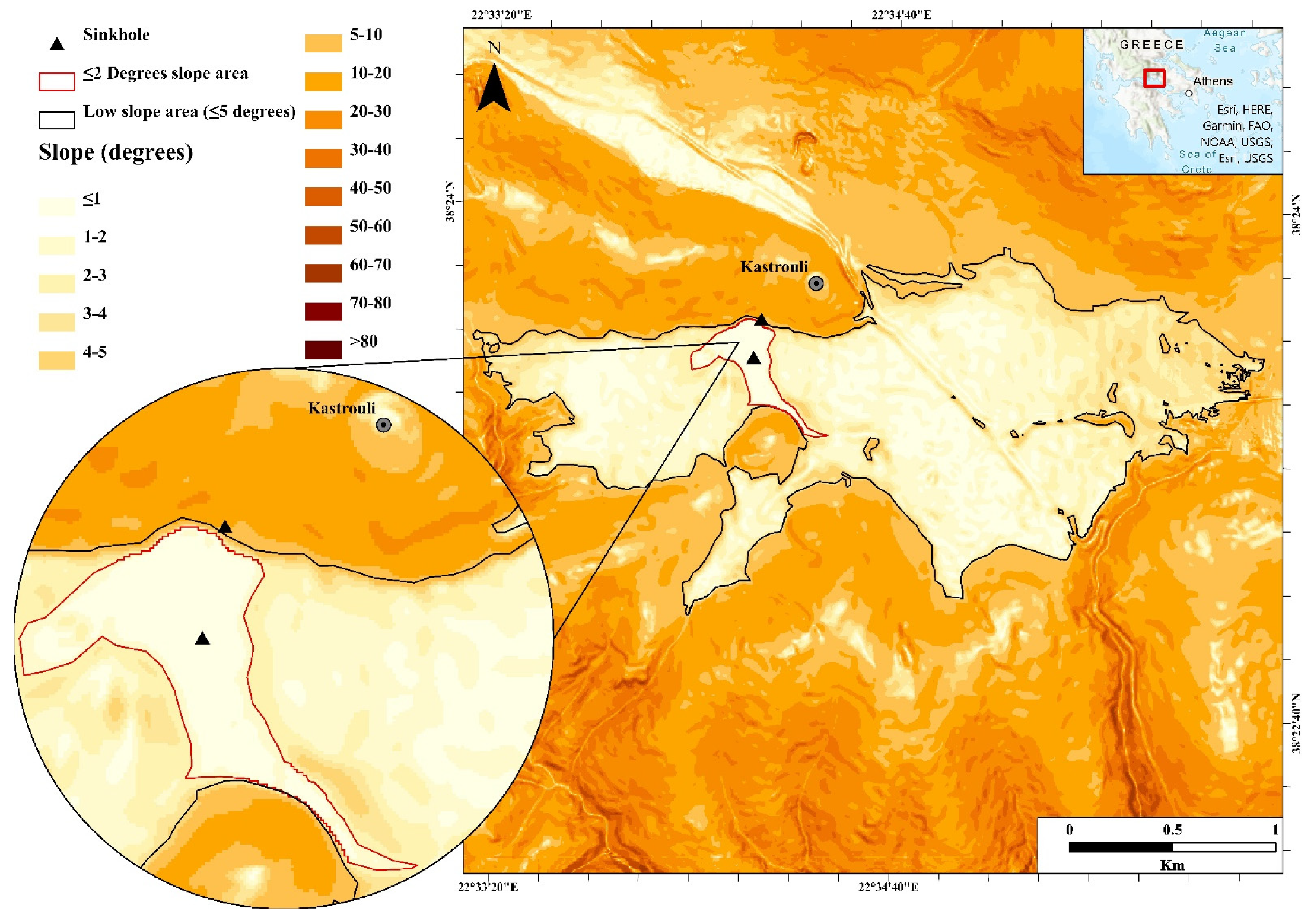
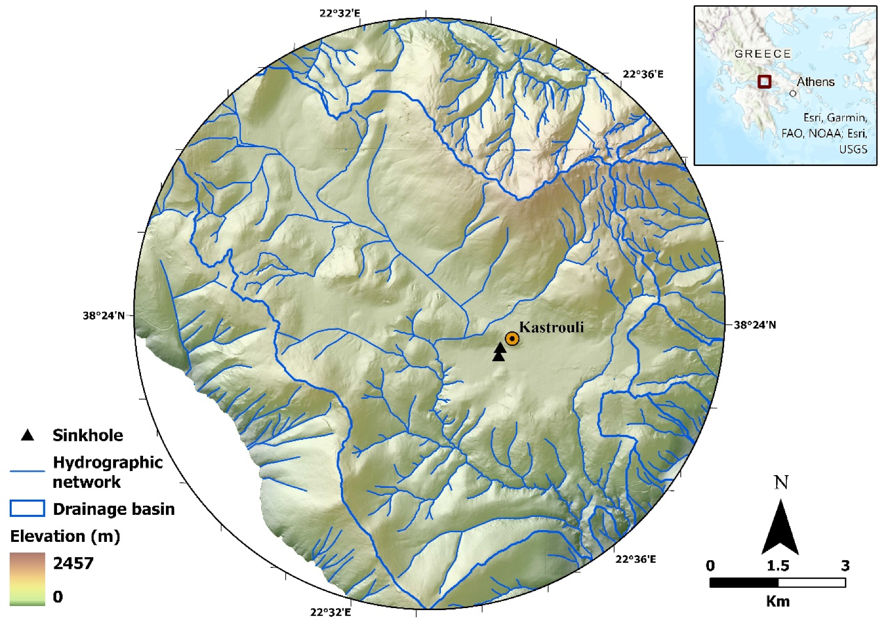
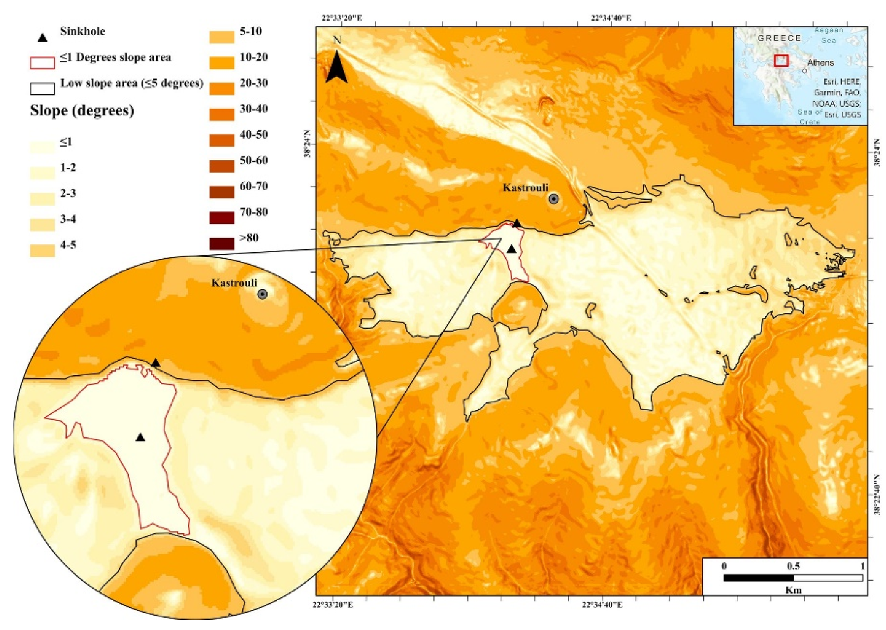
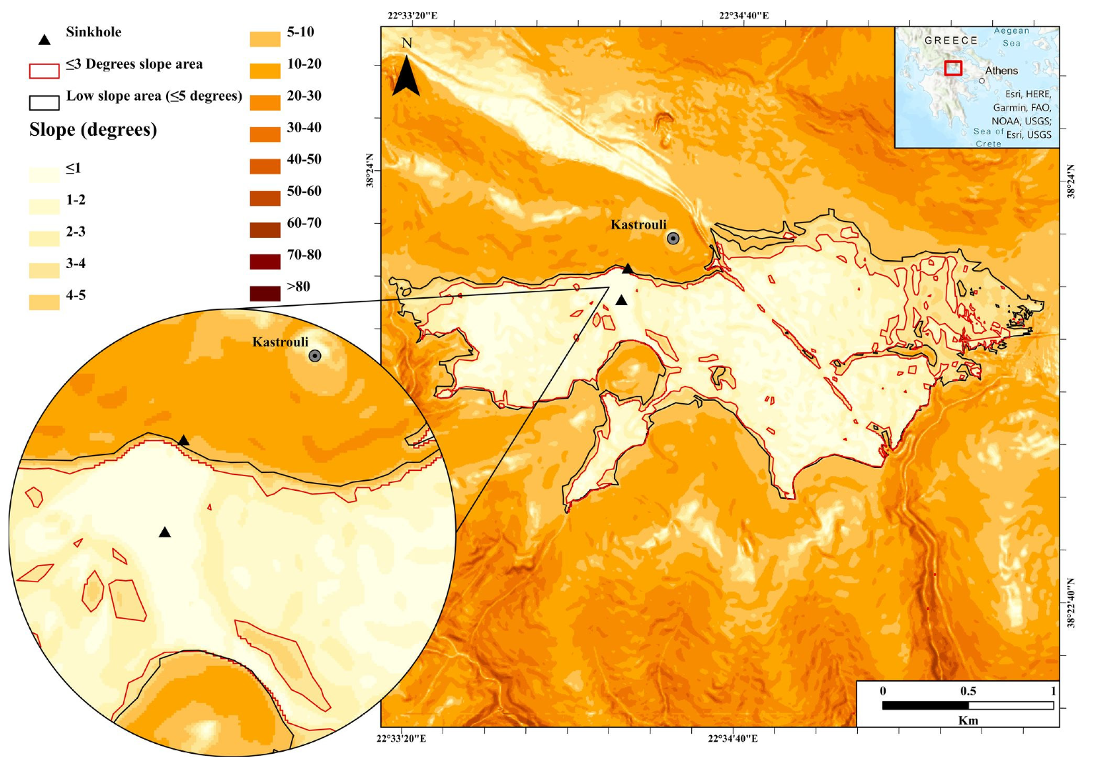
3.2. Slopping via Thematic Maps, GIS, and DEM
4. Discussion
5. Conclusions
Author Contributions
Funding
Institutional Review Board Statement
Informed Consent Statement
Conflicts of Interest
References
- Lisetskii, F.N.; Stolba, V.F.; Pichura, V.I. Late-Holocene palaeoenvironments of Southern Crimea: Soils, soil-climate relationship and human impact. Holocene 2017, 27, 1859–1875. [Google Scholar] [CrossRef] [Green Version]
- Hassan, F.A. Holocene lakes and prehistoric settlements of the Western Faiyum, Egypt. J. Archaeol. Sci. 1986, 13, 483–501. [Google Scholar] [CrossRef]
- Mamassis, N.; Moustakas, S.; Zarkadoulas, N. The operation of ancient reclamation works at Lake Copais in Greece. Water Hist. 2015, 7, 271–287. [Google Scholar] [CrossRef]
- Koutsoyiannis, D.; Angelakis, A. Ancient Greece: Agricultural Hydraulic Works. In Encyclopedia of Water Science; Trimble, S.W., Ed.; CRC Press: Boca Raton, FL, USA, 2007; pp. 24–27. [Google Scholar]
- Viollet, P.-L. Water Engineering in Ancient Civilizations: 5000 Years of History; CRC Press: Boca Raton, FL, USA, 2007; ISBN 9789078046059. [Google Scholar]
- Kountouri, E.; Petrochilos, N.; Liaros, N.; Oikonomou, V.; Koutsoyiannis, D.; Mamassis, N.; Zarkadoulas, N.; Vött, A.; Hadler, H.; Henning, P.; et al. The Mycenaean drainage works of north Kopais, Greece: A new project incorporating surface surveys, geophysical research and excavation. Water Supply 2013, 13, 710–718. [Google Scholar] [CrossRef]
- Kolding, J.; Van Zwieten, P.A.M.; Marttín, F.; Poulain, F. Freshwater Small Pelagic Fish and Their Fisheries in Major African Lakes and Reservoirs in Relation to Food Security and Nutrition; FAO Fisheries and Aquaculture Technical Paper No. 642; Food and Agriculture Organization of the United Nations: Rome, Italy, 2019. [Google Scholar]
- Wilke, T.; Wagner, B.; Van Bocxlaer, B.; Albrecht, C.; Ariztegui, D.; Delicado, D.; Francke, A.; Harzhauser, M.; Hauffe, T.; Holtvoeth, J.; et al. Scientific drilling projects in ancient lakes: Integrating geological and biological histories. Glob. Planet. Change 2016, 143, 118–151. [Google Scholar] [CrossRef] [Green Version]
- O’Sullivan, A. Interpreting the Archaeology of Late Bronze Age Lake Settlements. J. Irish Archaeol. 1997, 8, 115–121. [Google Scholar]
- Hoppenbrock, J.; Bücker, M.; Gallistl, J.; Flores Orozco, A.; de la Paz, C.P.; García García, C.E.; Razo Pérez, J.A.; Buckel, J.; Pérez, L. Evaluation of Lake Sediment Thickness from Water-Borne Electrical Resistivity Tomography Data. Sensors 2021, 21, 8053. [Google Scholar] [CrossRef]
- Valipour, M.; Krasilnikof, J.; Yannopoulos, S.; Kumar, R.; Deng, J.; Roccaro, P.; Mays, L.; Grismer, M.E.; Angelakis, A.N. The Evolution of Agricultural Drainage from the Earliest Times to the Present. Sustainability 2020, 12, 416. [Google Scholar] [CrossRef] [Green Version]
- Kollyropoulos, K.; Antoniou, G.P.; Kalavrouziotis, I.K.; Krasilnikoff, J.A.; Koutsoyiannis, D.; Angelakis, A.N. Hydraulic Characteristics of the Drainage Systems of Ancient Hellenic Theatres: Case Study of the Theatre of Dionysus and Its Implications. J. Irrig. Drain. Eng. 2015, 141, 04015018. [Google Scholar] [CrossRef] [Green Version]
- De Feo, G.; Mays, L.W.; Angelakis, A.N. Water and Wastewater Management Technologies in the Ancient Greek and Roman Civilizations. Treatise Water Sci. 2011, 4, 3–22. [Google Scholar] [CrossRef]
- Mays, L.W. Ancient Water Technologies; Springer: Dordrecht, The Netherlands, 2010; ISBN 9789048186310. [Google Scholar]
- Farinetti, E. A GIS-Based Study for the Reconstruction and Interpretation of the Archaeological Datasets of Ancient Boeotia; Archaeopress: Oxford, UK, 2011. [Google Scholar]
- Sideris, A.; Liritzis, I.; Liss, B.; Howland, M.D.; Levy, T.E. At-risk cultural heritage: New excavations and finds from the Mycenaean site of Kastrouli, Phokis, Greece. Mediterr. Archaeol. Archaeom. 2017, 17, 271–285. [Google Scholar] [CrossRef]
- Liritzis, I.; Polymeris, G.S.; Vafiadou, A.; Sideris, A.; Levy, T.E. Luminescence dating of stone wall, tomb and ceramics of Kastrouli (Phokis, Greece) Late Helladic settlement: Case study. J. Cult. Herit. 2019, 35, 76–85. [Google Scholar] [CrossRef]
- Liritzis, I.; Xanthopoulou, V.; Palamara, E.; Papageorgiou, I.; Iliopoulos, I.; Zacharias, N.; Vafiadou, A.; Karydas, A.G. Characterization and provenance of ceramic artifacts and local clays from Late Mycenaean Kastrouli (Greece) by means of p-XRF screening and statistical analysis. J. Cult. Herit. 2020, 46, 61–81. [Google Scholar] [CrossRef]
- Xanthopoulou, V.; Iliopoulos, I.; Liritzis, I. Mineralogical and Microstructure Analysis for Characterization and Provenance of Ceramic Artifacts from Late Helladic Kastrouli Settlement, Delphi (Central Greece). Geosciences 2021, 11, 36. [Google Scholar] [CrossRef]
- Levy, T.E.; Sideris, T.; Howland, M.; Liss, B.; Tsokas, G.; Stambolidis, A.; Fikos, E.; Vargemezis, G.; Tsourlos, P.; Georgopoulos, A.; et al. At-Risk World Heritage, Cyber, and Marine Archaeology: The Kastrouli–Antikyra Bay Land and Sea Project, Phokis, Greece. In Cyber-Archaeology and Grand Narratives: Digital Technology and Deep-Time Perspectives on Culture Change in the Middle East; Levy, T.E., Jones, I.W.N., Eds.; Springer International Publishing: Cham, Switzerland, 2018; pp. 143–234. ISBN 978-3-319-65693-9. [Google Scholar]
- Cantu, K.; Norris, R.; Papatheodorou, G.; Liritzis, I.; Langgut, D.; Geraga, M.; Levy, T. Anthropogenic Erosion from Hellenistic to Recent Times in the Northern Gulf of Corinth, Greece. In Mediterranean Resilience Collapse and Adaptation in Antique Maritime Societies; Yasur-Landau, A., Gambash, G., Levy, E., Eds.; Equinox eBooks Publishing: Sheffield, UK, 2022. [Google Scholar]
- Liritzis, I. Kastrouli fortified settlement (Desfina, Phokis, Greece): A chronicle of research. Sci. Cult. 2021, 7, 17–32. [Google Scholar] [CrossRef]
- Koh, A.J.; Birney, K.J.; Roy, I.M.; Liritzis, I. The mycenaean citadel and environs of desfina-kastrouli: A transdisciplinary approach to southern phokis. Mediterr. Archaeol. Archaeom. 2020, 20, 47–73. [Google Scholar] [CrossRef]
- Tsourlos, P. Modeling, Interpretation and Inversion of Multielectrode Resistivity Survey Data; University of York: York, UK, 1995. [Google Scholar]
- Tagg, C. Earth Resistances; Pitman Publishing Company: New York, NY, USA, 1964. [Google Scholar]
- McNeill, J. Electromagnetic Terrain Conductivity Measurement at Low Induction Numbers. J. Can. 1980, 2. [Google Scholar]
- Schlumberger, C. Etude sur la Prospection Electrique du Sous-sol; Gauthier-Villars: Paris, France, 1920. [Google Scholar]
- Kim, J. DC2DPro-2D Interpretation System of DC Resistivity Tomography. In User’s Manual and Theory; KIGAM, Korea Institute of Geoscience and Mineral Resources: Daejeon, Korea, 2009. [Google Scholar]
- Coveney, S.; Stewart Fotheringham, A.; Charlton, M.; McCarthy, T. Dual-scale validation of a medium-resolution coastal DEM with terrestrial LiDAR DSM and GPS. Comput. Geosci. 2010, 36, 489–499. [Google Scholar] [CrossRef]
- Schmid, K.A.; Hadley, B.C.; Wijekoon, N. Vertical Accuracy and Use of Topographic LIDAR Data in Coastal Marshes. J. Coast. Res. 2011, 27, 116–132. [Google Scholar] [CrossRef]
- Manfreda, S.; McCabe, M.F.; Miller, P.E.; Lucas, R.; Pajuelo Madrigal, V.; Mallinis, G.; Ben Dor, E.; Helman, D.; Estes, L.; Ciraolo, G.; et al. On the Use of Unmanned Aerial Systems for Environmental Monitoring. Remote Sens. 2018, 10, 641. [Google Scholar] [CrossRef] [Green Version]
- Ford, D.; Williams, P. Karst Hydrogeology. In Karst Hydrogeology and Geomorphology; John Wiley & Sons, Ltd.: Hoboken, NJ, USA, 2007; pp. 103–144. ISBN 9781118684986. [Google Scholar]
- Ford, D.; Williams, P. Analysis of Karst Drainage Systems. In Karst Hydrogeology and Geomorphology; John Wiley & Sons, Ltd.: Hoboken, NJ, USA, 2007; pp. 145–208. ISBN 9781118684986. [Google Scholar]
- Marinos, P.; Rondoyanni, T. The Archaeological Site of Delphi, Greece: A Site Vulnerable to Earthquakes, Rockfalls and Landslides. In Landslides: Risk Analysis and Sustainable Disaster Management; Sassa, K., Fukuoka, H., Wang, F., Wang, G., Eds.; Springer: Berlin/Heidelberg, Germany, 2005; pp. 241–249. ISBN 978-3-540-28680-6. [Google Scholar]
- Celet, P. Quelques aspects de l’hydrogeology des regions calcaires meridionales du Parnasse-Helicon (Grece). Ann Sci. Pays Hell. 1971, 3, 13–16. [Google Scholar]


Publisher’s Note: MDPI stays neutral with regard to jurisdictional claims in published maps and institutional affiliations. |
© 2022 by the authors. Licensee MDPI, Basel, Switzerland. This article is an open access article distributed under the terms and conditions of the Creative Commons Attribution (CC BY) license (https://creativecommons.org/licenses/by/4.0/).
Share and Cite
Liritzis, I.; Evelpidou, N.; Fikos, I.; Stambolidis, A.; Diamanti, N.; Roussari, T.; Tzouxanioti, M.; Louvaris, P.; Tsokas, G.N. Novel Combined Approach of GIS and Electrical Tomography to Identify Marsh/Lake at Kastrouli Late Mycenaean Settlement (Desfina, Greece). Quaternary 2022, 5, 26. https://doi.org/10.3390/quat5020026
Liritzis I, Evelpidou N, Fikos I, Stambolidis A, Diamanti N, Roussari T, Tzouxanioti M, Louvaris P, Tsokas GN. Novel Combined Approach of GIS and Electrical Tomography to Identify Marsh/Lake at Kastrouli Late Mycenaean Settlement (Desfina, Greece). Quaternary. 2022; 5(2):26. https://doi.org/10.3390/quat5020026
Chicago/Turabian StyleLiritzis, Ioannis, Niki Evelpidou, Ilias Fikos, Alexandros Stambolidis, Nectaria Diamanti, Theano Roussari, Maria Tzouxanioti, Prodromos Louvaris, and Gregorios N. Tsokas. 2022. "Novel Combined Approach of GIS and Electrical Tomography to Identify Marsh/Lake at Kastrouli Late Mycenaean Settlement (Desfina, Greece)" Quaternary 5, no. 2: 26. https://doi.org/10.3390/quat5020026
APA StyleLiritzis, I., Evelpidou, N., Fikos, I., Stambolidis, A., Diamanti, N., Roussari, T., Tzouxanioti, M., Louvaris, P., & Tsokas, G. N. (2022). Novel Combined Approach of GIS and Electrical Tomography to Identify Marsh/Lake at Kastrouli Late Mycenaean Settlement (Desfina, Greece). Quaternary, 5(2), 26. https://doi.org/10.3390/quat5020026