Article

Remote Sensing for Water Quality Monitoring—A Case Study for the Marateca Reservoir, Portugal

by
Cristina Alegria
1,2 and
Teresa Albuquerque
1,2,3,*
1
Instituto Politécnico de Castelo Branco, Polytechnic University of Castelo Branco, 6000-084 Castelo Branco, Portugal
2
CERNAS-IPCB—Pólo de Castelo Branco do Centro de Estudos de Recursos Naturais, Ambiente e Sociedade, Unidade de Investigação e Desenvolvimento do Instituto Politécnico de Castelo Branco, 6000-084 Castelo Branco, Portugal
3
Institute of Earth Sciences (IES), University of Évora Pole, 7004-516 Evora, Portugal
*
Author to whom correspondence should be addressed.
Geosciences 2023, 13(9), 259; https://doi.org/10.3390/geosciences13090259

Submission received: 26 July 2023 / Revised: 20 August 2023 / Accepted: 21 August 2023 / Published: 24 August 2023
(This article belongs to the Section Natural Hazards)

Abstract

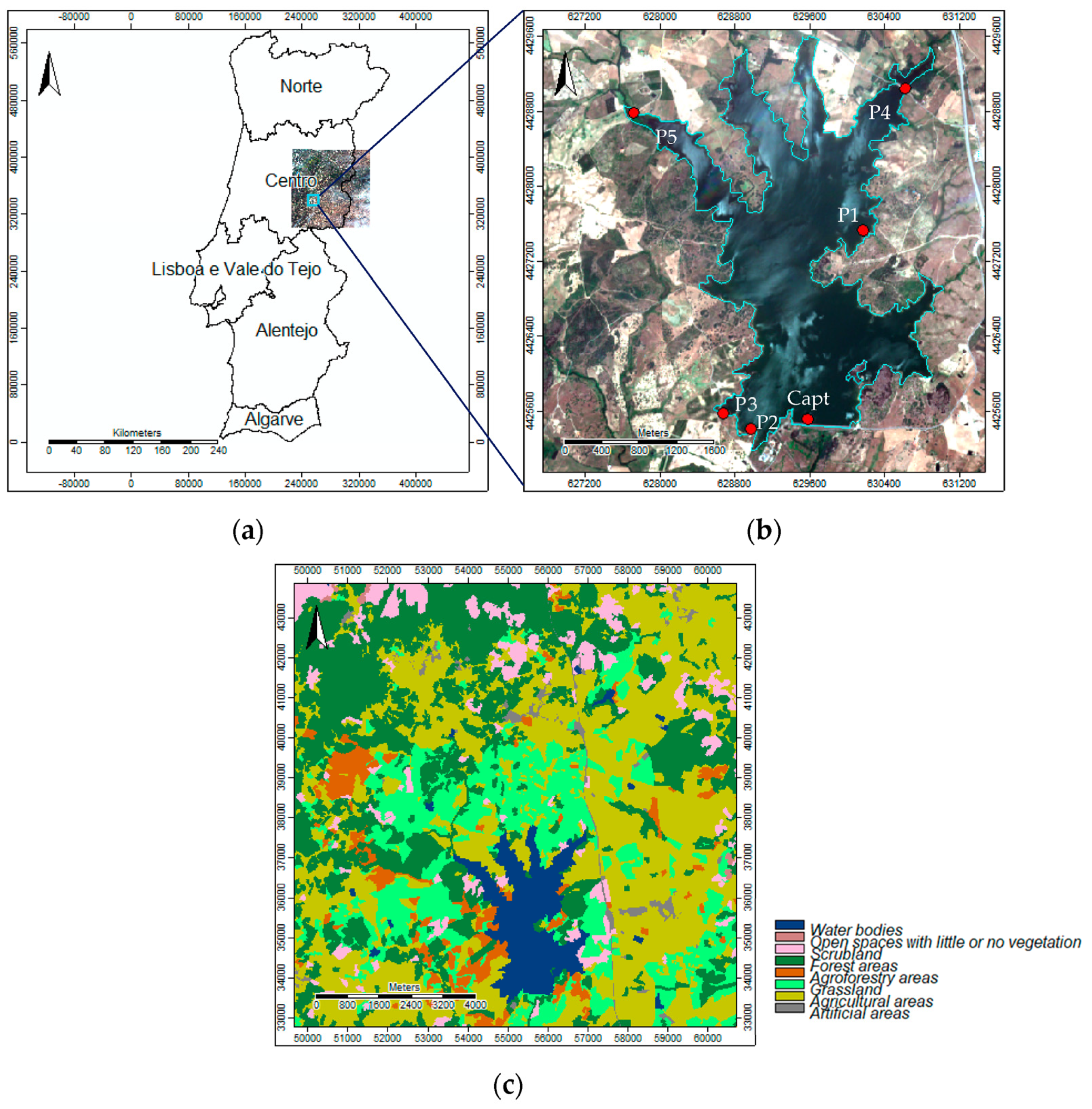
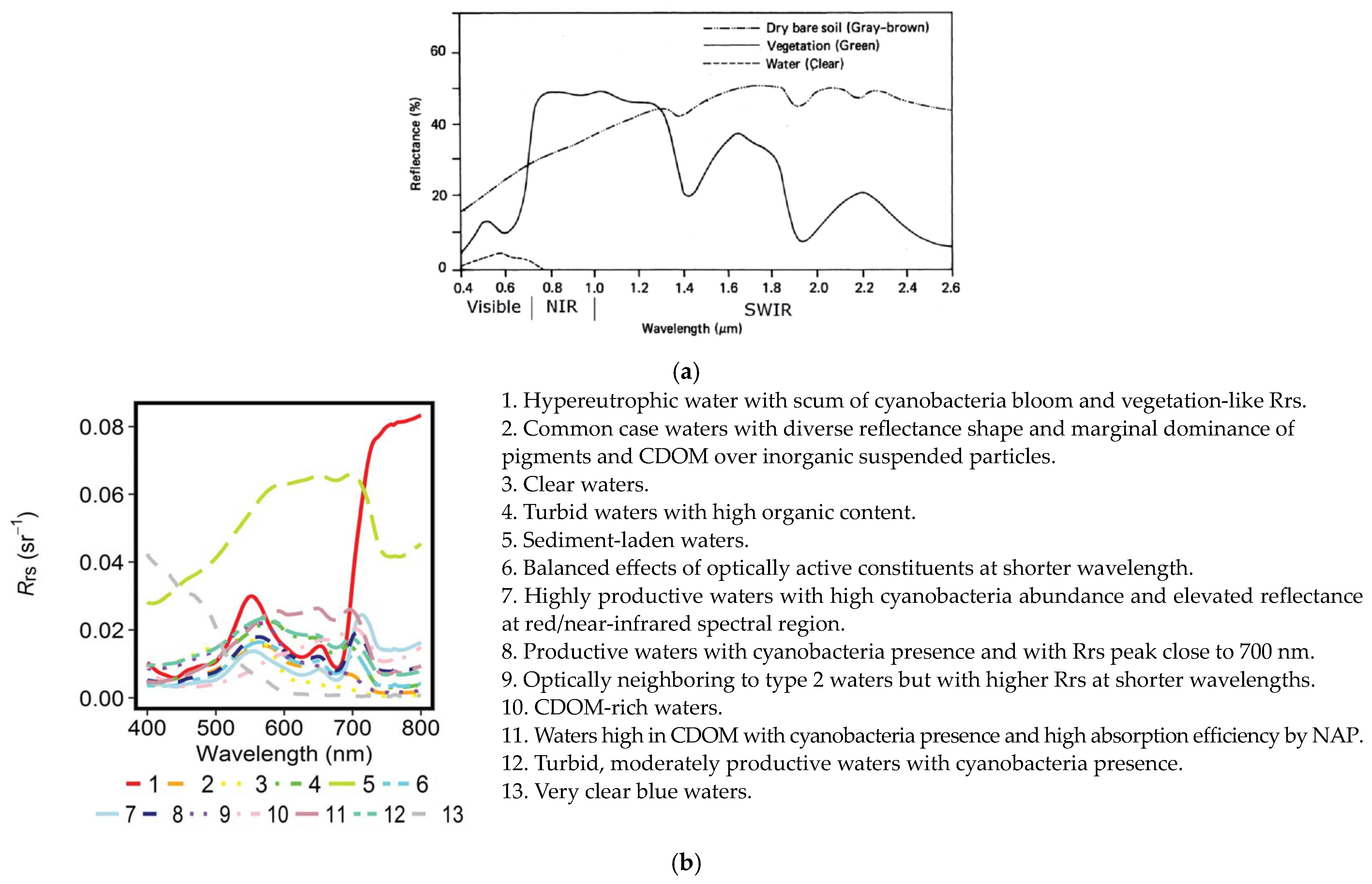
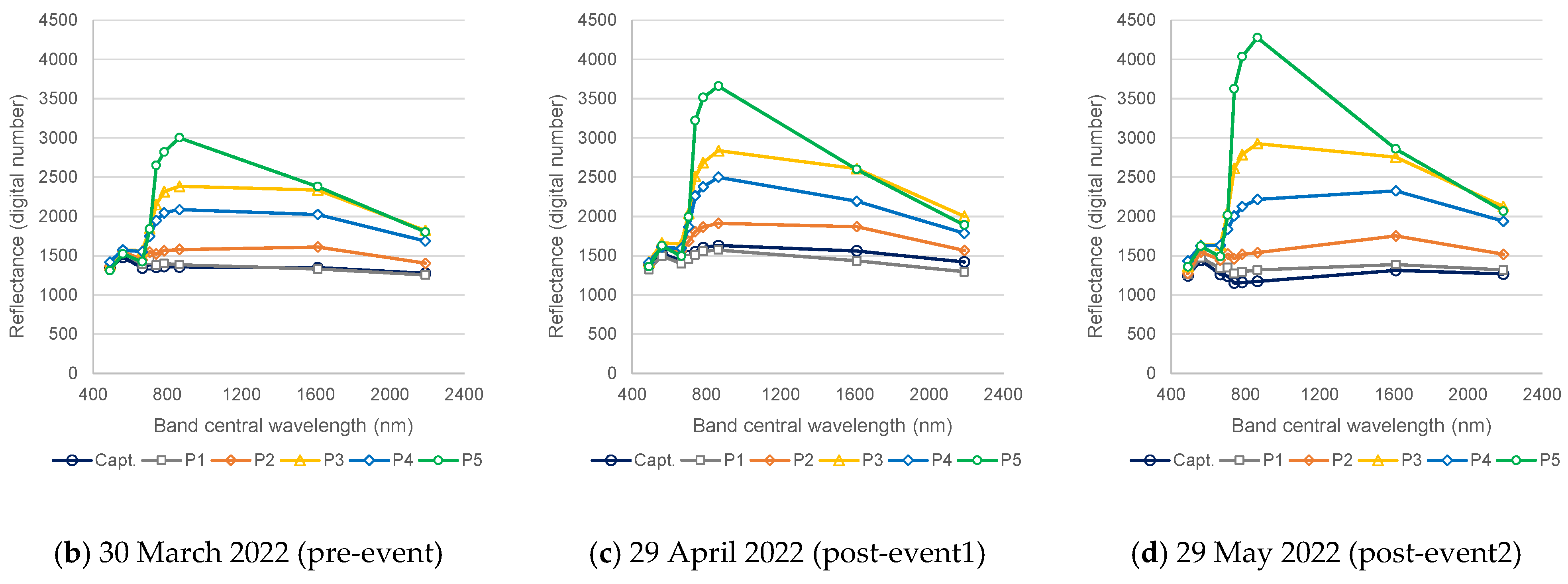
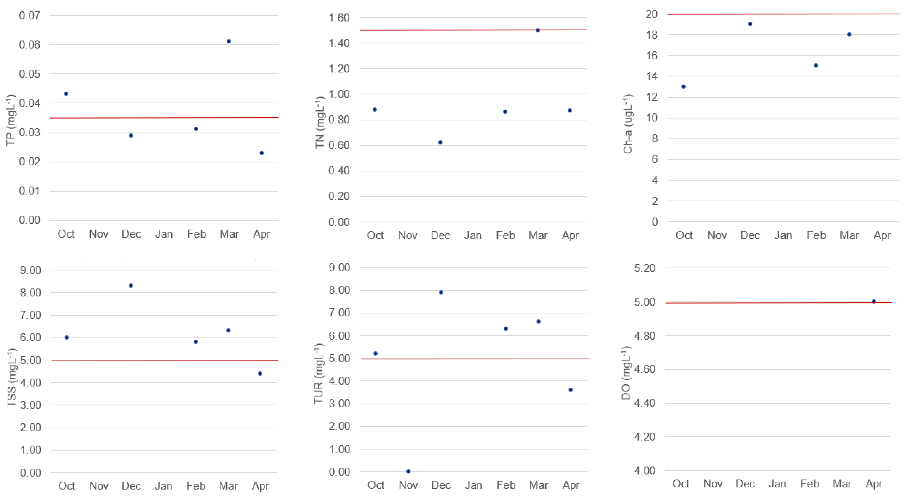
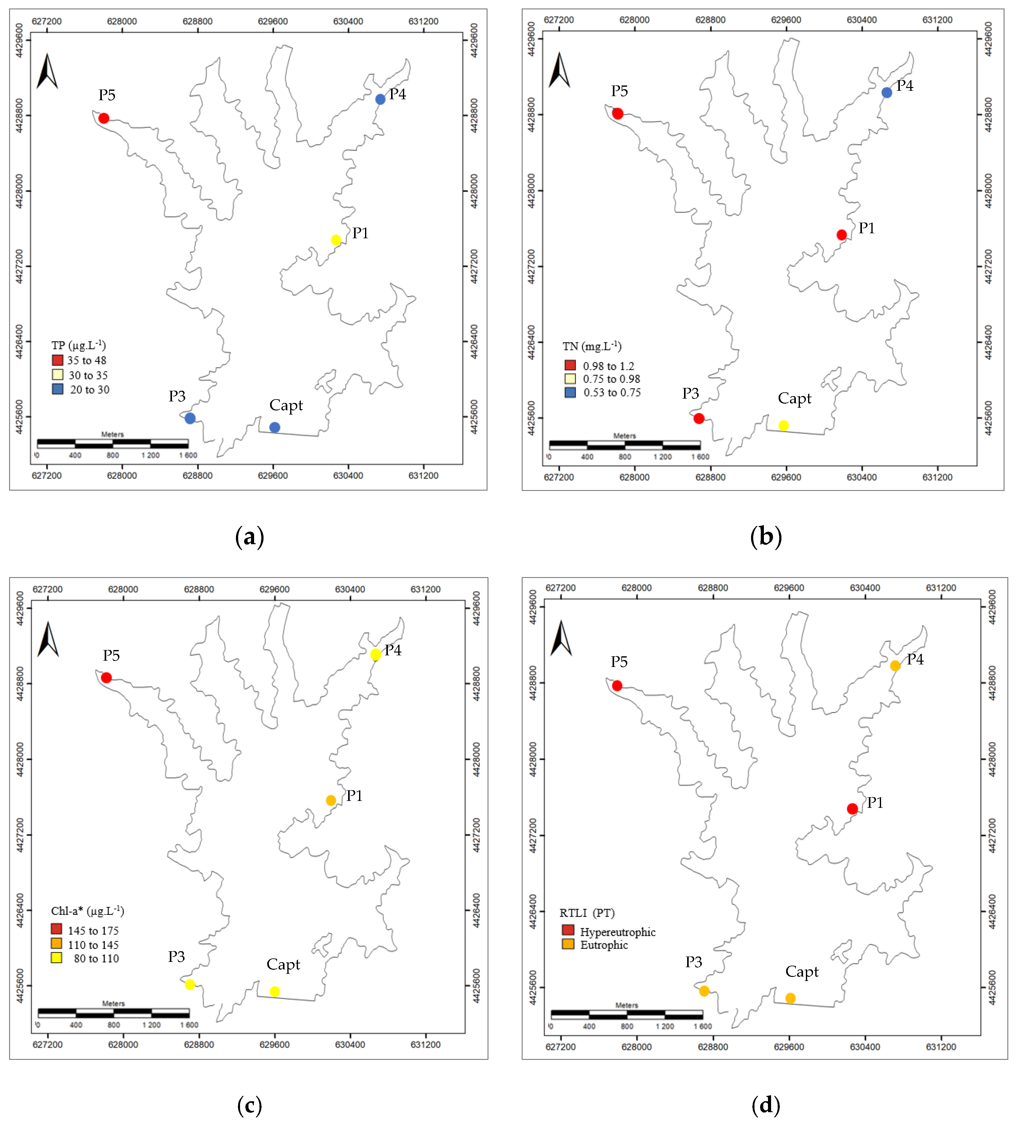
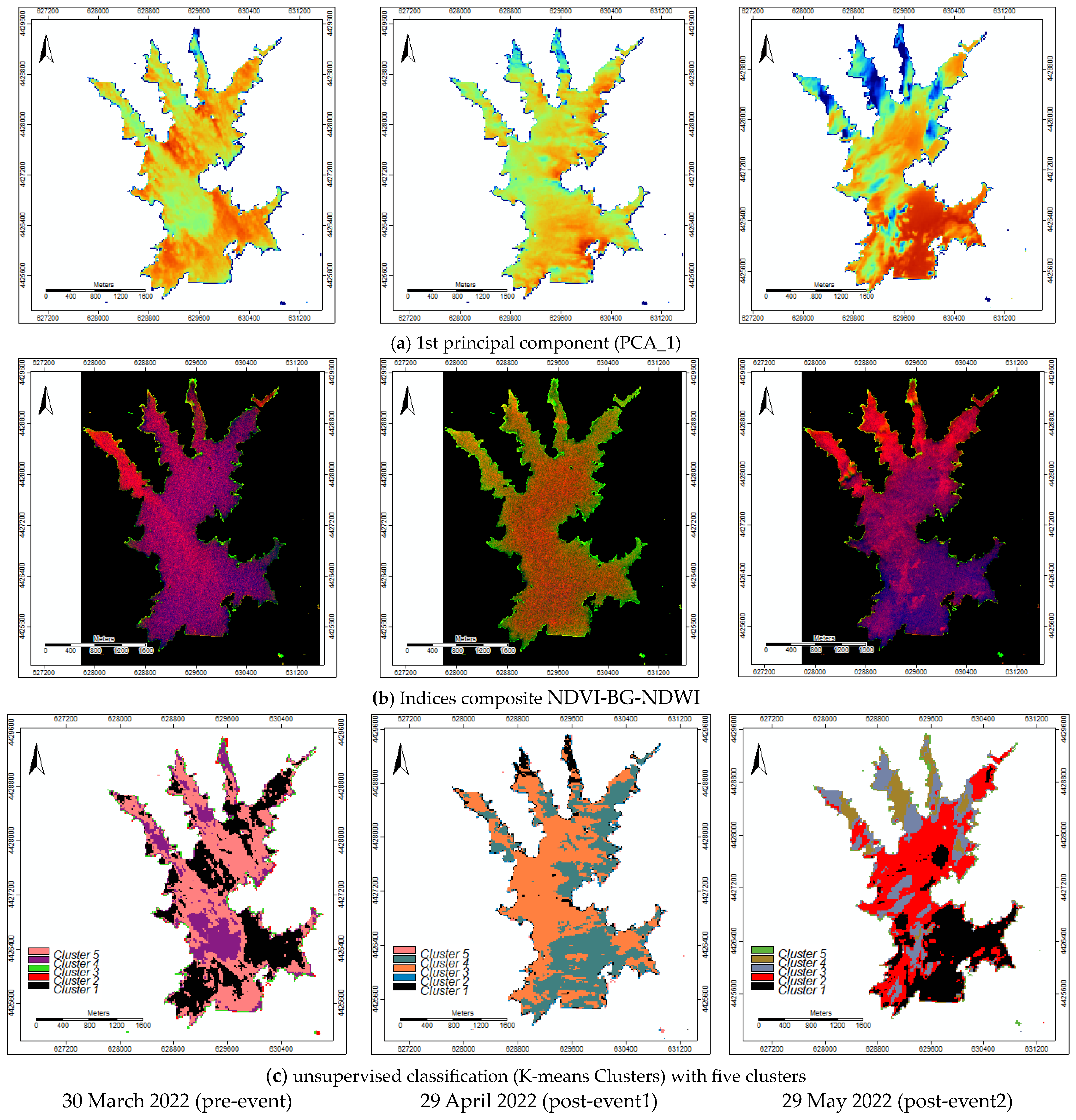
Continuous monitoring of water resources is essential for ensuring sustainable urban water supply. Remote sensing techniques have proven to be valuable in monitoring certain qualitative parameters of water with optical characteristics. This survey was conducted in the Marateca reservoir located in central inland Portugal, after a major event that killed a considerable number of fish. The objectives of the study were as follows: (1) to define a pollution spectral signature specific to the Marateca reservoir that could shed light on the event; (2) to validate the spectral water’s quality characteristics using the data collected in five gauging points; and (3) to model the characteristics of the reservoir water, including its depth, trophic state, and turbidity. The parameters considered for analysis were total phosphorus, total nitrogen, and chlorophyll-a, which were used to calculate a trophic level index. Sentinel-2 imagery was employed to calculate spectral indices and image ratios for specific bands, aiming at the definition of spectral signatures, and to model the water characteristics in the reservoir. The trophic level index acquired from each of the five gauging points was used for validation purposes. The reservoir’s trophic level was classified as hypereutrophic and eutrophic, indicating its sensitivity to contamination. The developed methodological approach can be easily applied to other reservoirs and serves as a crucial decision-making tool for policymakers.
Keywords: trophic level index; spectral indices change; spectral signatures; random forest algorithm trophic level index; spectral indices change; spectral signatures; random forest algorithm