Drones 2023, 7(3), 160; https://doi.org/10.3390/drones7030160 - 25 Feb 2023
Cited by 4 | Viewed by 2312
Abstract
Benefiting from the development of unmanned aerial vehicles (UAVs), the types and number of datasets available for image synthesis have greatly increased. Based on such abundant datasets, many types of virtual scenes can be created and visualized using image synthesis technology before they
[...] Read more.
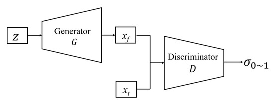
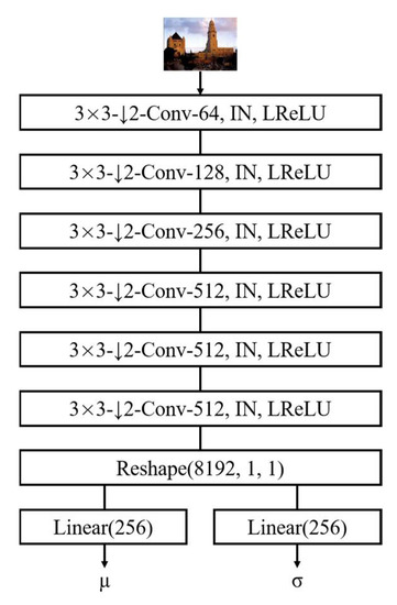
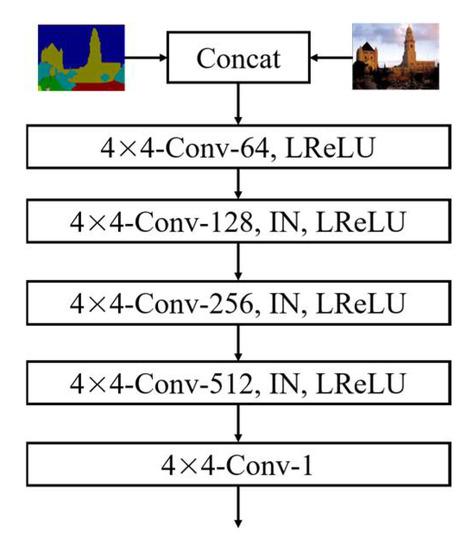
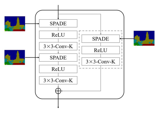
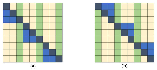
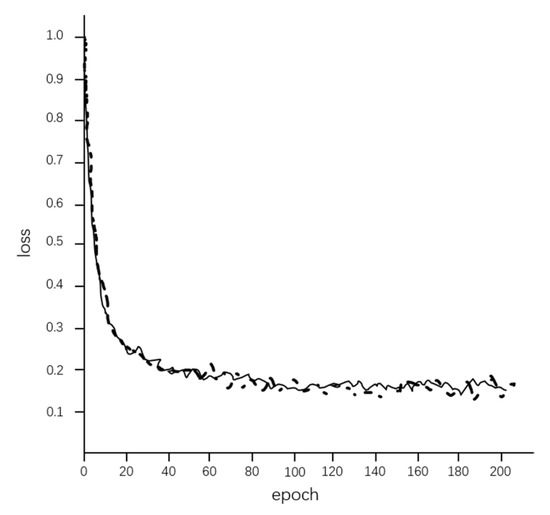
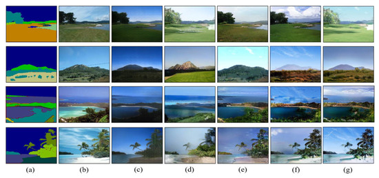
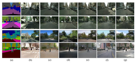
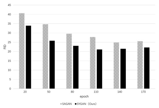
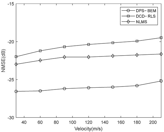
Benefiting from the development of unmanned aerial vehicles (UAVs), the types and number of datasets available for image synthesis have greatly increased. Based on such abundant datasets, many types of virtual scenes can be created and visualized using image synthesis technology before they are implemented in the real world, which can then be used in different applications. To achieve a convenient and fast image synthesis model, there are some common issues such as the blurred semantic information in the normalized layer and the local spatial information of the feature map used only in the generation of images. To solve such problems, an improved image synthesis model, SYGAN, is proposed in this paper, which imports a spatial adaptive normalization module (SPADE) and a sparse attention mechanism YLG on the basis of generative adversarial network (GAN). In the proposed model SYGAN, the utilization of the normalization module SPADE can improve the imaging quality by adjusting the normalization layer with spatially adaptively learned transformations, while the sparsified attention mechanism YLG improves the receptive field of the model and has less computational complexity which saves training time. The experimental results show that the Fréchet Inception Distance (FID) of SYGAN for natural scenes and street scenes are 22.1, 31.2; the Mean Intersection over Union (MIoU) for them are 56.6, 51.4; and the Pixel Accuracy (PA) for them are 86.1, 81.3, respectively. Compared with other models such as CRN, SIMS, pix2pixHD and GauGAN, the proposed image synthesis model SYGAN has better performance and improves computational efficiency.
Full article
(This article belongs to the Special Issue Intelligent Image Processing and Sensing for Drones)
►
Show Figures

Figure 1


