by
Maja Šimunović 1 , Antonija Kulaš 2, Petar Žutinić 2 and Marija Gligora Udovič 2,*
, Antonija Kulaš 2, Petar Žutinić 2 and Marija Gligora Udovič 2,*
1
Paying Agency for Agriculture, Fisheries and Rural Development, 10000 Zagreb, Croatia
2
Department of Biology, Faculty of Science, University of Zagreb, 10000 Zagreb, Croatia
Water 2023, 15(7), 1379; https://doi.org/10.3390/w15071379 - 3 Apr 2023
Cited by 6 | Viewed by 2795
Abstract
Phytoplankton are considered to be one of the most sensitive indicators of the ecological status of lakes. Nowadays, it is essential to recognize the prospects of the molecular approach (eDNA metabarcoding) in phytoplankton community assessments and combine them with the existing traditional microscopy-based
[...] Read more.
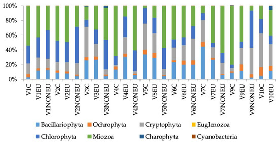
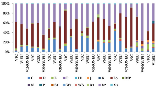
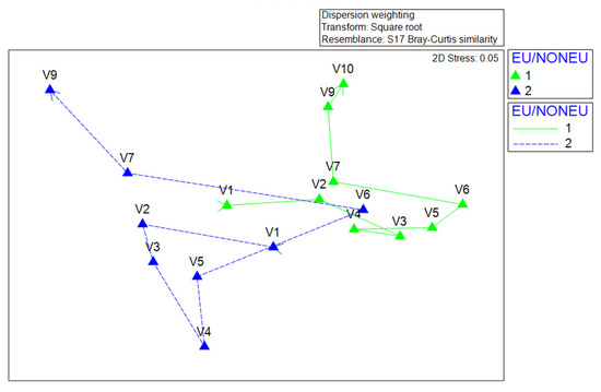
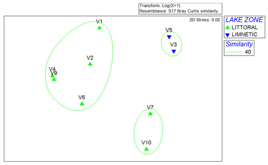
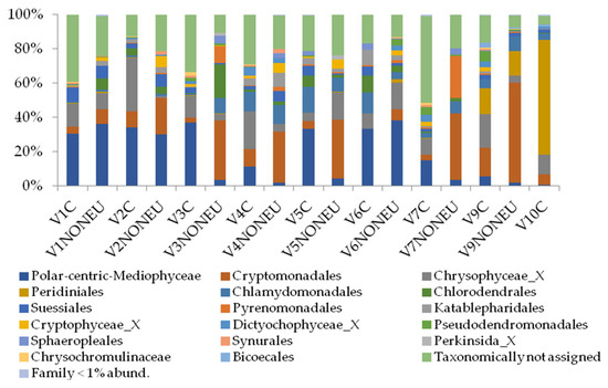
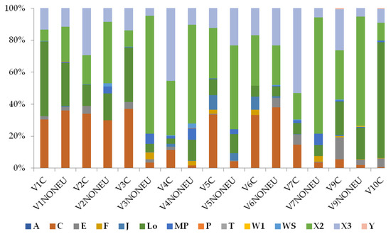
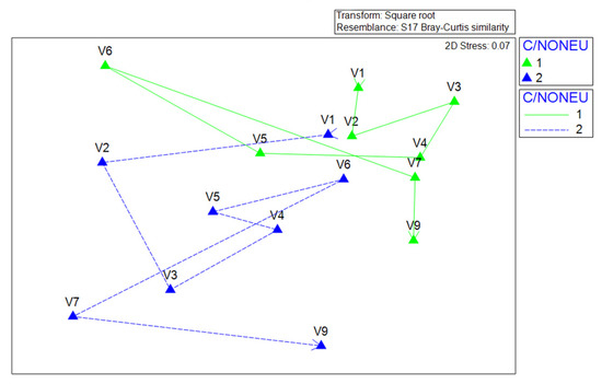
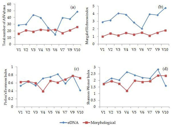
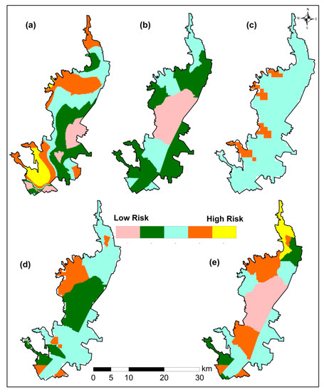
Phytoplankton are considered to be one of the most sensitive indicators of the ecological status of lakes. Nowadays, it is essential to recognize the prospects of the molecular approach (eDNA metabarcoding) in phytoplankton community assessments and combine them with the existing traditional microscopy-based morphological approach before its standardization. In this study, the aim was to characterize the phytoplankton community of a natural karstic lake by combining and comparing the morphological and molecular approach to check the applicability of eDNA metabarcoding as a biomonitoring tool. A total of 51 phytoplankton taxa were found using the morphological approach, whilst the molecular approach discovered 97 ASVs that corresponded to the algal community. The comparability of both approaches in describing phytoplankton communities is evident in the designation of centric diatoms, dinoflagellates and cryptophytes as descriptive taxa. Furthermore, both approaches proved reliable in detecting functional groups (Lo, C, X2, X3) with similar ecological demands. Moreover, the results have shown that euphotic zone samples can be reliably exchanged by composite samples to provide an accurate characterization of phytoplankton communities in the euphotic zone. It was confirmed that eDNA metabarcoding is an applicable tool for biodiversity monitoring of a natural karst lake and should be used as a feasible supplement to traditional microscopy in the phytoplankton community assessments, with regards to the drawbacks of each method.
Full article
(This article belongs to the Special Issue Freshwater Ecosystems—Biodiversity and Protection)
▼
Show Figures
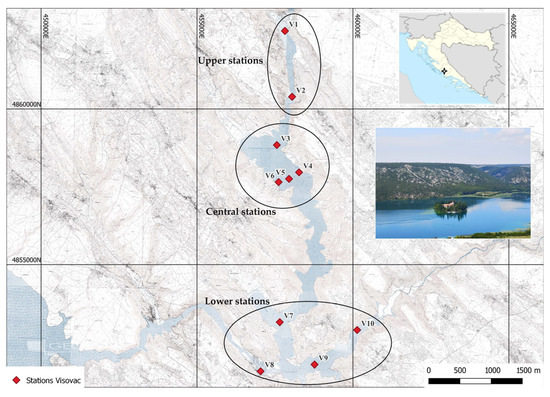
Figure 1


