Next Issue
Volume 7, August
Previous Issue
Volume 7, June


Drones, Volume 7, Issue 7 (July 2023) – 81 articles

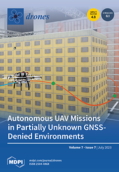
Cover Story (view full-size image): Recent advancements in Micro Aerial Vehicle (MAV) technology have broadened their applications across various fields ranging from agriculture to industry, where MAVs are utilized for data acquisition and monitoring tasks, as well as hazardous operations. However, these systems must provide the operator with autonomous flight capabilities to be effectively deployed in challenging real-world scenarios. We propose a comprehensive framework for autonomous UAV missions in partially unknown GNSS-denied environments. The framework integrates key modules for localization, perception, global planning, local re-planning to avoid obstacles, and a state machine to orchestrate the mission sequence. The system has been validated in simulation and tested in real-world scenarios during an autonomous drone challenge. View this paper
  • Issues are regarded as officially published after their release is announced to the table of contents alert mailing list.
  • You may sign up for e-mail alerts to receive table of contents of newly released issues.
  • PDF is the official format for papers published in both, html and pdf forms. To view the papers in pdf format, click on the "PDF Full-text" link, and use the free Adobe Reader to open them.
Order results
Result details
Section
Select all
Export citation of selected articles as:
13 pages, 1599 KiB  
Article
Simulation of the Effect of Correlated Packet Loss for sUAS Platforms Operating in Non-Line-of-Sight Indoor Environments
by Edwin Meriaux, Jay Weitzen and Adam Norton
Drones 2023, 7(7), 485; https://doi.org/10.3390/drones7070485 - 24 Jul 2023
Viewed by 1048
Abstract
The current state of the art in small Unmanned Aerial System (sUAS) testing and evaluation exists mainly in the realm of outdoor flight. Operating small flying sUAS in constrained indoor or subterranean environments places different constraints on their communication links (control links and [...] Read more.
The current state of the art in small Unmanned Aerial System (sUAS) testing and evaluation exists mainly in the realm of outdoor flight. Operating small flying sUAS in constrained indoor or subterranean environments places different constraints on their communication links (control links and camera/sensor links). Communication loss in these environments is much more severe due to the proximity of obstacles. This paper examines how correlated packet loss (burst errors) occurring on both the control and camera communication links affects the ability of pilots to fly and navigate small sUAS platforms in constrained Non-Line of Sight (NLOS) environments. A software test bench called AirSim, a UAV simulator, allows us to better understand the effects of correlated packet loss on flyability without damaging multiple sUAS units by flight testing. The simulation was designed to support the design of test methodologies for evaluating the robustness of the communication links and to understand performance without damaging flight tests. Throughout the simulations, it is observed how different levels of packet loss affect the pilot and the number of simulated crashes into the obstacles placed through space. The simulations modeled packet loss both on the video link and the control link to display how packet loss affects ability to pilot and control the sUAS. The utility of using a simulated environment rather than flight testing prevents damage to the fragile and expensive drones being used. Full article
(This article belongs to the Special Issue Advances of Unmanned Aerial Vehicle Communication)
Show Figures

Figure 1

32 pages, 20812 KiB  
Article
Digital Twin Development for the Airspace of the Future
by Toufik Souanef, Saba Al-Rubaye, Antonios Tsourdos, Samuel Ayo and Dimitrios Panagiotakopoulos
Drones 2023, 7(7), 484; https://doi.org/10.3390/drones7070484 - 23 Jul 2023
Cited by 3 | Viewed by 2648
Abstract
The UK aviation industry is committed to achieving net zero emissions by 2050 through sustainable measures and one of the key aspects of this effort is the implementation of Unmanned Traffic Management (UTM) systems. These UTM systems play a crucial role in enabling [...] Read more.
The UK aviation industry is committed to achieving net zero emissions by 2050 through sustainable measures and one of the key aspects of this effort is the implementation of Unmanned Traffic Management (UTM) systems. These UTM systems play a crucial role in enabling the safe and efficient integration of unmanned aerial vehicles (UAVs) into the airspace. As part of the Airspace of the Future (AoF) project, the development and implementation of UTM services have been prioritised. This paper aims to create an environment where routine drone services can operate safely and effectively. To facilitate this, a digital twin of the National Beyond Visual Line of Sight Experimentation Corridor has been created. This digital twin serves as a virtual replica of the corridor and allows for the synthetic testing of unmanned traffic management concepts. The implementation of the digital twin involves both simulated and hybrid flights with real drones. Simulated flights allow for the testing and refinement of UTM services in a controlled environment. Hybrid flights, on the other hand, involve the integration of real drones into the airspace to assess their performance and compatibility with the UTM systems. By leveraging the capabilities of UTM systems and utilising the digital twin for testing, the AoF project aims to advance the development of safer and more efficient drone operations. The Experimentation Corridor has been developed to simulate and test concepts related to managing unmanned traffic. The paper provides a detailed account of the implementation of the digital twin for the AoF project, including simulated and hybrid flights involving real drones. Full article
(This article belongs to the Section Drone Communications)
Show Figures

Figure 1

27 pages, 12118 KiB  
Article
Modified Siamese Network Based on Feature Enhancement and Dynamic Template for Low-Light Object Tracking in UAV Videos
by Lifan Sun, Shuaibing Kong, Zhe Yang, Dan Gao and Bo Fan
Drones 2023, 7(7), 483; https://doi.org/10.3390/drones7070483 - 21 Jul 2023
Cited by 1 | Viewed by 1160
Abstract
Unmanned aerial vehicles (UAVs) visual object tracking under low-light conditions serves as a crucial component for applications, such as night surveillance, indoor searches, night combat, and all-weather tracking. However, the majority of the existing tracking algorithms are designed for optimal lighting conditions. In [...] Read more.
Unmanned aerial vehicles (UAVs) visual object tracking under low-light conditions serves as a crucial component for applications, such as night surveillance, indoor searches, night combat, and all-weather tracking. However, the majority of the existing tracking algorithms are designed for optimal lighting conditions. In low-light environments, images captured by UAV typically exhibit reduced contrast, brightness, and a signal-to-noise ratio, which hampers the extraction of target features. Moreover, the target’s appearance in low-light UAV video sequences often changes rapidly, rendering traditional fixed template tracking mechanisms inadequate, and resulting in poor tracker accuracy and robustness. This study introduces a low-light UAV object tracking algorithm (SiamLT) that leverages image feature enhancement and a dynamic template-updating Siamese network. Initially, the algorithm employs an iterative noise filtering framework-enhanced low-light enhancer to boost the features of low-light images prior to feature extraction. This ensures that the extracted features possess more critical target characteristics and minimal background interference information. Subsequently, the fixed template tracking mechanism, which lacks adaptability, is enhanced by dynamically updating the tracking template through the fusion of the reference and base templates. This improves the algorithm’s capacity to address challenges associated with feature changes. Furthermore, the Average Peak-to-Correlation Energy (APCE) is utilized to filter the templates, mitigating interference from low-quality templates. Performance tests were conducted on various low-light UAV video datasets, including UAVDark135, UAVDark70, DarkTrack2021, NAT2021, and NAT2021L. The experimental outcomes substantiate the efficacy of the proposed algorithm in low-light UAV object-tracking tasks. Full article
Show Figures

Figure 1

19 pages, 465 KiB  
Article
Joint Task Offloading and Resource Allocation for Space–Air–Ground Collaborative Network
by Chengli Mei, Cheng Gao, Heng Wang, Yanxia Xing, Ningyao Ju and Bo Hu
Drones 2023, 7(7), 482; https://doi.org/10.3390/drones7070482 - 21 Jul 2023
Viewed by 1324
Abstract
The space–air–ground collaborative network can provide computing service for ground users in remote areas by deploying edge servers on satellites and high-altitude platform (HAP) drones. However, with the growing number of ground devices required to be severed, it becomes imperative to address the [...] Read more.
The space–air–ground collaborative network can provide computing service for ground users in remote areas by deploying edge servers on satellites and high-altitude platform (HAP) drones. However, with the growing number of ground devices required to be severed, it becomes imperative to address the issue of spectrum demand for the HAP drone to meet the access of a large number of users. In addition, the long propagation distance between devices and the HAP drone, and between the HAP drone and LEO satellites, will lead to high data transmission energy consumption. Motivated by these factors, we introduce a space–air–ground collaborative network that employs the non-orthogonal multiple access (NOMA) technique, enabling all ground devices to access the HAP drone. Therefore, all devices can share the same communication spectrum. Furthermore, the HAP drone can process part of the ground devices’ tasks locally, and offload the rest to satellites within the visible range for processing. Based on this system, we formulate a weighted energy consumption minimization problem considering power control, computing frequency allocation, and task-offloading decision. The problem is solved by the proposed low-complexity iterative algorithm. Specifically, the original problem is decomposed into interconnected coupled subproblems using the block coordinate descent (BCD) method. The first subproblem is to optimize power control and computing frequency allocation, which is solved by a convex algorithm after a series of transformations. The second subproblem is to make an optimal task-offloading strategy, and we solve it using the concave–convex procedure (CCP)-based algorithm after penalty-based transformation on binary variables. Simulation results verify the convergence and performance of the proposed iterative algorithm compared with the two benchmark algorithms. Full article
Show Figures

Figure 1

23 pages, 7958 KiB  
Article
Fast Tube-Based Robust Compensation Control for Fixed-Wing UAVs
by Lixin Wang, Sizhuang Zheng, Weijia Wang, Hao Wang, Hailiang Liu and Ting Yue
Drones 2023, 7(7), 481; https://doi.org/10.3390/drones7070481 - 21 Jul 2023
Viewed by 896
Abstract
When considering the robust control of fixed-wing Unmanned Aerial Vehicles (UAVs), a conflict often arises between addressing nonlinearity and meeting fast-solving requirements. In existing studies, the less nonlinear robust control methods have shown significant improvements that parallel computing and dimensionality reduction techniques in [...] Read more.
When considering the robust control of fixed-wing Unmanned Aerial Vehicles (UAVs), a conflict often arises between addressing nonlinearity and meeting fast-solving requirements. In existing studies, the less nonlinear robust control methods have shown significant improvements that parallel computing and dimensionality reduction techniques in real-time applications. In this paper, a nonlinear fast Tube-based Robust Compensation Control (TRCC) for fixed-wing UAVs is proposed to satisfy robustness and fast-solving requirements. Firstly, a solving method for discrete trajectory tubes was proposed to facilitate fast parallel computation. Subsequently, a TRCC algorithm was developed that minimized the trajectory tube to enhance robustness. Additionally, considering the characteristics of fixed-wing UAVs, dimensionality reduction techniques such as decoupling and stepwise approaches are proposed, and a fast TRCC algorithm that incorporates the control reuse method is presented. Finally, simulations verify that the proposed fast TRCC effectively enhances the robustness of UAVs during tracking tasks while satisfying the requirements for fast solving. Full article
Show Figures

Figure 1

22 pages, 785 KiB  
Article
Drone-Assisted Fingerprint Localization Based on Kernel Global Locally Preserving Projection
by Mengxing Pan, Yunfei Li, Weiqiang Tan and Wengen Gao
Drones 2023, 7(7), 480; https://doi.org/10.3390/drones7070480 - 20 Jul 2023
Viewed by 961
Abstract
To improve the limited number of fixed access points (APs) and the inability to dynamically adjust them in fingerprint localization, this paper attempted to use drones to replace these APs. Drones have higher flexibility and accuracy, can hover in different locations, and can [...] Read more.
To improve the limited number of fixed access points (APs) and the inability to dynamically adjust them in fingerprint localization, this paper attempted to use drones to replace these APs. Drones have higher flexibility and accuracy, can hover in different locations, and can adapt to different scenarios and user needs, thereby improving localization accuracy. When performing fingerprint localization, it is often necessary to consider various factors such as environmental complexity, large-scale raw data collection, and signal strength variation. These factors can lead to high-dimensional and complex nonlinear relationships in location fingerprints, thereby greatly affecting localization accuracy. In order to overcome these problems, this paper proposes a kernel global locally preserving projection (KGLPP) algorithm. The algorithm can reduce the dimensionality of location fingerprint data while preserving its most-important structural information, and it combines global and local information to avoid the problem of reduced information and poor dimensionality reduction effects, which may arise from considering only one. In the process of location estimation, an improved weighted k-nearest neighbor (IWKNN) algorithm is adopted to more accurately estimate the target’s position. Unlike the traditional KNN or WKNN algorithms, the IWKNN algorithm can choose the optimal number of nearest neighbors autonomously, perform location estimation and weight calculation based on the actual situation, and thus, obtain more-accurate location estimation results. The experimental results showed that the algorithm outperformed other algorithms in terms of both the average error and localization accuracy. Full article
(This article belongs to the Section Drone Communications)
Show Figures

Figure 1

26 pages, 1277 KiB  
Article
Towards the Designing of Low-Latency SAGIN: Ground-to-UAV Communications over Interference Channel
by Sudhanshu Arya, Jingda Yang and Ying Wang
Drones 2023, 7(7), 479; https://doi.org/10.3390/drones7070479 - 20 Jul 2023
Cited by 7 | Viewed by 1210
Abstract
We present a novel and first-of-its-kind information-theoretic framework for the key design consideration and implementation of a ground-to-unmanned Aerial Vehicle (UAV) (G2U) communication network with an aim to minimize end-to-end transmission delay in the presence of interference in Space-Air-Ground Integrated Networks (SAGIN). To [...] Read more.
We present a novel and first-of-its-kind information-theoretic framework for the key design consideration and implementation of a ground-to-unmanned Aerial Vehicle (UAV) (G2U) communication network with an aim to minimize end-to-end transmission delay in the presence of interference in Space-Air-Ground Integrated Networks (SAGIN). To characterize the transmission delay, we utilize Fano’s inequality and derive the tight upper bound for the capacity for the G2U uplink channel in the presence of interference, noise, and potential jamming. In addition, as a function of the location information of the UAV, a tight lower bound on the transmit power is obtained subject to the reliability constraint and the maximum delay threshold. Furthermore, a relay UAV in the dual-hop relay mode, with amplify-and-forward (AF) protocol, is considered, for which we jointly obtain the optimal positions of the relay and the receiver UAVs in the presence of interference, with straight-line, circular, and helical trajectories as UAV tracing. Interestingly, increasing the power gives a negligible gain in terms of delay minimization, though may greatly enhance the outage performance. Moreover, we prove that there exists an optimal height that minimizes the end-to-end transmission delay in the presence of interference. We show the interesting result of the delay analysis. In particular, it is shown that receiver location and the end-to-end signal-to-noise power ratio play a critical role in end-to-end latency. For instance, with the transmitter location fixed to (0, 0, 0) and the interferer location set to (0, 500 m, 0), the latency generally increases with increasing the receiver’s vertical height (z-axis). With the receiver’s horizontal coordinates, i.e., (xR, yR) set to (0, 0) reducing the receiver’s height from 200 m to 50 m decreases the delay latency (codeword length) by more than 30% for an interference-limited channel. Whereas, for an interference channel with a signal-to-noise power ratio equal to 30 dB, the latency decreases by approximately 2%. The proposed framework can be used in practice by a network controller as a system parameters selection criteria, where among a set of parameters, the parameters leading to the lowest transmission latency can be incorporated into the transmission. The based analysis further set the baseline assessment when applying Command and Control (C2) standards to mission-critical G2U and UAV-to-UAV (U2U) services. Full article
(This article belongs to the Special Issue UAVs Communications for 6G)
Show Figures

Figure 1

31 pages, 5399 KiB  
Review
Towards Safe and Efficient Unmanned Aircraft System Operations: Literature Review of Digital Twins’ Applications and European Union Regulatory Compliance
by Elham Fakhraian, Ivana Semanjski, Silvio Semanjski and El-Houssaine Aghezzaf
Drones 2023, 7(7), 478; https://doi.org/10.3390/drones7070478 - 20 Jul 2023
Cited by 4 | Viewed by 3143
Abstract
Unmanned aerial system/unmanned aircraft system (UAS) operations have increased exponentially in recent years. With the creation of new air mobility concepts, industries use cutting-edge technology to create unmanned aerial vehicles (UAVs) for various applications. Due to the popularity and use of advanced technology [...] Read more.
Unmanned aerial system/unmanned aircraft system (UAS) operations have increased exponentially in recent years. With the creation of new air mobility concepts, industries use cutting-edge technology to create unmanned aerial vehicles (UAVs) for various applications. Due to the popularity and use of advanced technology in this relatively new and rapidly evolving context, a regulatory framework to ensure safe operations is essential. To reflect the several ongoing initiatives and new developments in the domain of European Union (EU) regulatory frameworks at various levels, the increasing needs, developments in, and potential uses of UAVs, particularly in the context of research and innovation, a systematic overview is carried out in this paper. We review the development of UAV regulation in the European Union. The issue of how to implement this new and evolving regulation in UAS operations is also tackled. The digital twin (DT)’s ability to design, build, and analyze procedures makes it one potential way to assist the certification process. DTs are time- and cost-efficient tools to assist the certification process, since they enable engineers to inspect, analyze, and integrate designs as well as express concerns immediately; however, it is fair to state that DT implementation in UASs for certification and regulation is not discussed in-depth in the literature. This paper underlines the significance of UAS DTs in the certification process to provide a solid foundation for future studies. Full article
(This article belongs to the Special Issue Urban Air Mobility (UAM))
Show Figures

Figure 1

27 pages, 7209 KiB  
Article
Analysis and Precision of Light Detection and Ranging Sensors Integrated in Mobile Phones as a Framework for Registration of Ground Control Points for Unmanned Aerial Vehicles in the Scanning Technique for Building Information Modelling in Archaeological Sites
by Juan Moyano, Juan E. Nieto-Julián, María Fernández-Alconchel, Daniela Oreni and Rafael Estévez-Pardal
Drones 2023, 7(7), 477; https://doi.org/10.3390/drones7070477 - 20 Jul 2023
Cited by 1 | Viewed by 1306
Abstract
The protection of heritage sites is one of the keys that our civilisation presents. That is why great efforts have been invested in order to protect and preserve movable and immovable property with a certain historical value, as is the case of archaeological [...] Read more.
The protection of heritage sites is one of the keys that our civilisation presents. That is why great efforts have been invested in order to protect and preserve movable and immovable property with a certain historical value, as is the case of archaeological sites scattered throughout the territory of southern Iberia (Spain) in the form of dolmens and negative structures dug into the ground, constituting a good sample of the megalithic culture in southern Spain. To study, manage and preserve these archaeological monuments, considered a set of cultural assets, various techniques and methodologies are required to facilitate the acquisition of three-dimensional geometric information. The Scan-to-BIM approach has become one of the most up-to-date work exponents to carry out these objectives. The appearance of LiDAR techniques, and recently their incorporation into smartphones through integrated sensors, is revolutionising the world of 3D scanning. However, the precision of these techniques is an issue that has yet to be addressed in the scientific community. That is why this research proposes a framework, through experimental measurement, comparison and knowledge of the limitations of this technology, to know the precision of the use of these smartphones, specifically the iPhone 13 Pro, as a measurement element to establish points of control with the aid of photogrammetry by unmanned aerial vehicles (UAVs) in archaeological sites. The results demonstrate a residual uncertainty of ±5 mm in the capture of GCPs from the mobile phone’s LiDAR light detection and ranging sensor, and there was a deviation of the measurements in a range between 0 and 28 m of distance between the GCPs of (0.021, 0.069) m. Full article
Show Figures

Figure 1

22 pages, 907 KiB  
Article
Partially Observable Mean Field Multi-Agent Reinforcement Learning Based on Graph Attention Network for UAV Swarms
by Min Yang, Guanjun Liu, Ziyuan Zhou and Jiacun Wang
Drones 2023, 7(7), 476; https://doi.org/10.3390/drones7070476 - 20 Jul 2023
Cited by 3 | Viewed by 1642
Abstract
Multiple unmanned aerial vehicles (Multi-UAV) systems have recently demonstrated significant advantages in some real-world scenarios, but the limited communication range of UAVs poses great challenges to multi-UAV collaborative decision-making. By constructing the multi-UAV cooperation problem as a multi-agent system (MAS), the cooperative decision-making [...] Read more.
Multiple unmanned aerial vehicles (Multi-UAV) systems have recently demonstrated significant advantages in some real-world scenarios, but the limited communication range of UAVs poses great challenges to multi-UAV collaborative decision-making. By constructing the multi-UAV cooperation problem as a multi-agent system (MAS), the cooperative decision-making among UAVs can be realized by using multi-agent reinforcement learning (MARL). Following this paradigm, this work focuses on developing partially observable MARL models that capture important information from local observations in order to select effective actions. Previous related studies employ either probability distributions or weighted mean field to update the average actions of neighborhood agents. However, they do not fully consider the feature information of surrounding neighbors, resulting in a local optimum often. In this paper, we propose a novel partially multi-agent reinforcement learning algorithm to remedy this flaw, which is based on graph attention network and partially observable mean field and is named as the GPMF algorithm for short. GPMF uses a graph attention module and a mean field module to describe how an agent is influenced by the actions of other agents at each time step. The graph attention module consists of a graph attention encoder and a differentiable attention mechanism, outputting a dynamic graph to represent the effectiveness of neighborhood agents against central agents. The mean field module approximates the effect of a neighborhood agent on a central agent as the average effect of effective neighborhood agents. Aiming at the typical task scenario of large-scale multi-UAV cooperative roundup, the proposed algorithm is evaluated based on the MAgent framework. Experimental results show that GPMF outperforms baselines including state-of-the-art partially observable mean field reinforcement learning algorithms, providing technical support for large-scale multi-UAV coordination and confrontation tasks in communication-constrained environments. Full article
(This article belongs to the Special Issue Advanced Unmanned System Control and Data Processing)
Show Figures

Figure 1

18 pages, 1101 KiB  
Article
Self-Supervised Representation Learning for Quasi-Simultaneous Arrival Signal Identification Based on Reconnaissance Drones
by Linqing Guo, Mingyang Du, Jingwei Xiong, Zilong Wu and Jifei Pan
Drones 2023, 7(7), 475; https://doi.org/10.3390/drones7070475 - 19 Jul 2023
Cited by 1 | Viewed by 962
Abstract
Reconnaissance unmanned aerial vehicles are specifically designed to estimate parameters and process intercepted signals for the purpose of identifying and locating radars. However, distinguishing quasi-simultaneous arrival signals (QSAS) has become increasingly challenging in complex electromagnetic environments. In order to address the problem, a [...] Read more.
Reconnaissance unmanned aerial vehicles are specifically designed to estimate parameters and process intercepted signals for the purpose of identifying and locating radars. However, distinguishing quasi-simultaneous arrival signals (QSAS) has become increasingly challenging in complex electromagnetic environments. In order to address the problem, a framework for self-supervised deep representation learning is proposed. The framework consists of two phases: (1) pre-train an autoencoder. For learning the unlabeled QSAS representation, the ConvNeXt V2 is trained to extract features from masked time–frequency images and reconstruct the corresponding signal in both time and frequency domains; (2) transfer the learned knowledge. For downstream tasks, encoder layers are frozen, the linear layer is fine-tuned to classify QSAS under few-shot conditions. Experimental results demonstrate that the proposed algorithm can achieve an average recognition accuracy of over 81% with the signal-to-noise ratio in the range of −16∼16 dB. Compared to existing CNN-based and Transformer-based neural networks, the proposed algorithm shortens the time of testing by about 11× and improves accuracy by up to 21.95%. Full article
(This article belongs to the Special Issue AI Based Signal Processing for Drones)
Show Figures

Figure 1

20 pages, 1459 KiB  
Article
Multi-Group Tracking Control for MASs of UAV with a Novel Event-Triggered Scheme
by Can Zhao, Kaibo Shi, Yiqian Tang, Jianying Xiao and Nanrong He
Drones 2023, 7(7), 474; https://doi.org/10.3390/drones7070474 - 18 Jul 2023
Cited by 3 | Viewed by 924
Abstract
The flight control of UAVs can be implemented and theoretically analyzed using multi-agent systems (MASs), and tracking control is one of the important control technologies. This paper studies multi-group tracking control for multi-agent systems of UAV, in which the control scheme combines event-triggered [...] Read more.
The flight control of UAVs can be implemented and theoretically analyzed using multi-agent systems (MASs), and tracking control is one of the important control technologies. This paper studies multi-group tracking control for multi-agent systems of UAV, in which the control scheme combines event-triggered technology and impulsive theory. The advantage of multi-group tracking control lies in its ability to realize multiple groups of tracking targets and make the UAV complete multiple groups of tasks. The tracking control makes use of a novel dynamic event-triggered control (DETC) proposed in this paper, in which it can better regulate and optimize the triggering frequency by adjusting the parameters. Furthermore, several forms of network interference that may affect the safety of UAV tracking control have also been resolved. Lastly, simulations are presented with numerical examples to showcase the efficacy of the proposed tracking control. Full article
(This article belongs to the Special Issue UAV Trajectory Generation, Optimization and Cooperative Control)
Show Figures

Figure 1

21 pages, 1447 KiB  
Article
Diffusion Nonlinear Estimation and Distributed UAV Path Optimization for Target Tracking with Intermittent Measurements and Unknown Cross-Correlations
by Shen Wang, Yinya Li, Guoqing Qi and Andong Sheng
Drones 2023, 7(7), 473; https://doi.org/10.3390/drones7070473 - 18 Jul 2023
Viewed by 959
Abstract
This paper focuses on distributed state estimation (DSE) and unmanned aerial vehicle (UAV) path optimization for target tracking. First, a diffusion cubature Kalman filter with intermittent measurements based on covariance intersection (DCKFI-CI) is proposed, to address state estimation with the existence of detection [...] Read more.
This paper focuses on distributed state estimation (DSE) and unmanned aerial vehicle (UAV) path optimization for target tracking. First, a diffusion cubature Kalman filter with intermittent measurements based on covariance intersection (DCKFI-CI) is proposed, to address state estimation with the existence of detection failure and unknown cross-correlations in the network. Furthermore, an alternative transformation of DCKFI-CI based on the information form is developed utilizing a pseudo measurement matrix. The performance of the proposed DSE algorithm is analyzed using the consistency and the bounded error covariance of the estimate. Additionally, the condition of the bounded error covariance is derived. In order to further improve the tracking performance, a UAV path optimization algorithm is developed by minimizing the sum of the trace of fused error covariance, based on the distributed optimization method. Finally, simulations were conducted to verify the effectiveness of the proposed algorithm. Full article
(This article belongs to the Special Issue Advanced Unmanned System Control and Data Processing)
Show Figures

Figure 1

13 pages, 2630 KiB  
Article
Modulation Recognition of Low-SNR UAV Radar Signals Based on Bispectral Slices and GA-BP Neural Network
by Xuemin Liu, Yaoliang Song, Kuiyu Chen, Shihao Yan, Si Chen and Baihua Shi
Drones 2023, 7(7), 472; https://doi.org/10.3390/drones7070472 - 18 Jul 2023
Cited by 2 | Viewed by 902
Abstract
In this paper, we address the challenge of low recognition rates in existing methods for radar signals from unmanned aerial vehicles (UAV) with low signal-to-noise ratios (SNRs). To overcome this challenge, we propose the utilization of the bispectral slice approach for accurate recognition [...] Read more.
In this paper, we address the challenge of low recognition rates in existing methods for radar signals from unmanned aerial vehicles (UAV) with low signal-to-noise ratios (SNRs). To overcome this challenge, we propose the utilization of the bispectral slice approach for accurate recognition of complex UAV radar signals. Our approach involves extracting the bispectral diagonal slice and the maximum bispectral amplitude horizontal slice from the bispectrum amplitude spectrum of the received UAV radar signal. These slices serve as the basis for subsequent identification by calculating characteristic parameters such as convexity, box dimension, and sparseness. To accomplish the recognition task, we employ a GA-BP neural network. The significant variations observed in the bispectral slices of different signals, along with their robustness against Gaussian noise, contribute to the high separability and stability of the extracted bispectral convexity, bispectral box dimension, and bispectral sparseness. Through simulations involving five radar signals, our proposed method demonstrates superior performance. Remarkably, even under challenging conditions with an SNR as low as −3 dB, the recognition accuracy for the five different radar signals exceeds 90%. Our research aims to enhance the understanding and application of modulation recognition techniques for UAV radar signals, particularly in scenarios with low SNRs. Full article
Show Figures

Figure 1

18 pages, 3743 KiB  
Article
An Efficient Framework for Autonomous UAV Missions in Partially-Unknown GNSS-Denied Environments
by Michael Mugnai, Massimo Teppati Losé, Edwin Paúl Herrera-Alarcón, Gabriele Baris, Massimo Satler and Carlo Alberto Avizzano
Drones 2023, 7(7), 471; https://doi.org/10.3390/drones7070471 - 18 Jul 2023
Cited by 3 | Viewed by 2562
Abstract
Nowadays, multirotors are versatile systems that can be employed in several scenarios, where their increasing autonomy allows them to achieve complex missions without human intervention. This paper presents a framework for autonomous missions with low-cost Unmanned Aerial Vehicles (UAVs) in Global Navigation Satellite [...] Read more.
Nowadays, multirotors are versatile systems that can be employed in several scenarios, where their increasing autonomy allows them to achieve complex missions without human intervention. This paper presents a framework for autonomous missions with low-cost Unmanned Aerial Vehicles (UAVs) in Global Navigation Satellite System-denied (GNSS-denied) environments. This paper presents hardware choices and software modules for localization, perception, global planning, local re-planning for obstacle avoidance, and a state machine to dictate the overall mission sequence. The entire software stack has been designed exploiting the Robot Operating System (ROS) middleware and has been extensively validated in both simulation and real environment tests. The proposed solution can run both in simulation and in real-world scenarios without modification thanks to a small sim-to-real gap with PX4 software-in-the-loop functionality. The overall system has competed successfully in the Leonardo Drone Contest, an annual competition between Italian Universities with a focus on low-level, resilient, and fully autonomous tasks for vision-based UAVs, proving the robustness of the entire system design. Full article
Show Figures

Figure 1

22 pages, 1385 KiB  
Article
RL-Based Detection, Tracking, and Classification of Malicious UAV Swarms through Airborne Cognitive Multibeam Multifunction Phased Array Radar
by Wahab Khawaja, Qasim Yaqoob and Ismail Guvenc
Drones 2023, 7(7), 470; https://doi.org/10.3390/drones7070470 - 16 Jul 2023
Viewed by 1428
Abstract
Detecting, tracking, and classifying unmanned aerial vehicles (UAVs) in a swarm presents significant challenges due to their small and diverse radar cross-sections, multiple flight altitudes, velocities, and close trajectories. To overcome these challenges, adjustments of the radar parameters and/or position of the radar [...] Read more.
Detecting, tracking, and classifying unmanned aerial vehicles (UAVs) in a swarm presents significant challenges due to their small and diverse radar cross-sections, multiple flight altitudes, velocities, and close trajectories. To overcome these challenges, adjustments of the radar parameters and/or position of the radar (for airborne platforms) are often required during runtime. The runtime adjustments help to overcome the anomalies in the detection, tracking, and classification of UAVs. The runtime adjustments are performed either manually or through fixed algorithms, each of which can have its limitations for complex and dynamic scenarios. In this work, we propose the use of multi-agent reinforcement learning (RL) to carry out the runtime adjustment of the radar parameters and position of the radar platform. The radar used in our work is a multibeam multifunction phased array radar (MMPAR) placed onboard UAVs. The simulations show that the cognitive adjustment of the MMPAR parameters and position of the airborne platform using RL helps to overcome anomalies in the detection, tracking, and classification of UAVs in a swarm. A comparison with other artificial intelligence (AI) algorithms shows that RL performs better due to the runtime learning of the environment through rewards. Full article
Show Figures

Figure 1

14 pages, 2954 KiB  
Article
Research on the Endurance Optimisation of Multirotor UAVs for High-Altitude Environments
by Tianyi Qin, Guangyu Zhang, Liying Yang and Yuqing He
Drones 2023, 7(7), 469; https://doi.org/10.3390/drones7070469 - 14 Jul 2023
Viewed by 1649
Abstract
Multirotor UAVs are becoming increasingly important in both civilian and military fields. In the plateau environment, the endurance time of multirotor UAVs is still too short for mission requirements. Thus, the optimisation of the efficiency of the power system is considered to be [...] Read more.
Multirotor UAVs are becoming increasingly important in both civilian and military fields. In the plateau environment, the endurance time of multirotor UAVs is still too short for mission requirements. Thus, the optimisation of the efficiency of the power system is considered to be an effective way to overcome this problem. This paper presents a practical method of power system design to maximise endurance time in a plateau environment. First, the optimal proportion of battery quality is analysed from the perspective of energy consumption of multirotor UAVs. Second, the modelling method of each component of the power system is studied separately. Then, the endurance solution method is given, the multirotor UAV power system is optimised and analysed according to the given design requirements, and the effectiveness and practicability of the method are verified through experiments. Full article
Show Figures

Figure 1

17 pages, 3645 KiB  
Article
Tracking a Maneuvering Object by Indirect Observations with Random Delays
by Alexey Bosov
Drones 2023, 7(7), 468; https://doi.org/10.3390/drones7070468 - 13 Jul 2023
Cited by 1 | Viewed by 866
Abstract
A mathematical model for the target tracking problem is proposed. The model makes it possible to describe conditions when the time for an observer to receive the results of indirect observations of a moving object depends not only on the state of the [...] Read more.
A mathematical model for the target tracking problem is proposed. The model makes it possible to describe conditions when the time for an observer to receive the results of indirect observations of a moving object depends not only on the state of the observation environment but also on the state of the object itself. The source of such a model is the observation process, by stationary means, of an autonomous underwater vehicle, in which the time for obtaining up-to-date data depends on the unknown distance between the object and the observer. As part of the study of the problem, the equations of the optimal Bayesian filter are obtained. But this filter is not possible to implement. For practical purposes, it is proposed to use the conditionally minimax nonlinear filter, which has shown promising results in other complex tracking models. The conditions for the filter’s evaluation and its accuracy characteristics are given. A large-scale numerical experiment illustrating the filter’s operation and the observation system’s features with random delays are described. Full article
Show Figures

Figure 1

22 pages, 19025 KiB  
Article
Flow Structure around a Multicopter Drone: A Computational Fluid Dynamics Analysis for Sensor Placement Considerations
by Mauro Ghirardelli, Stephan T. Kral, Nicolas Carlo Müller, Richard Hann, Etienne Cheynet and Joachim Reuder
Drones 2023, 7(7), 467; https://doi.org/10.3390/drones7070467 - 13 Jul 2023
Cited by 4 | Viewed by 2493
Abstract
This study presents a computational fluid dynamics (CFD) based approach to determine the optimal positioning for an atmospheric turbulence sensor on a rotary-wing uncrewed aerial vehicle (UAV) with X8 configuration. The vertical (zBF) and horizontal (xBF [...] Read more.
This study presents a computational fluid dynamics (CFD) based approach to determine the optimal positioning for an atmospheric turbulence sensor on a rotary-wing uncrewed aerial vehicle (UAV) with X8 configuration. The vertical (zBF) and horizontal (xBF) distances of the sensor to the UAV center to reduce the effect of the propeller-induced flow are investigated by CFD simulations based on the kϵ turbulence model and the actuator disc theory. To ensure a realistic geometric design of the simulations, the tilt angles of a test UAV in flight were measured by flying the drone along a fixed pattern at different constant ground speeds. Based on those measurement results, a corresponding geometry domain was generated for the CFD simulations. Specific emphasis was given to the mesh construction followed by a sensitivity study on the mesh resolution to find a compromise between acceptable simulation accuracy and available computational resources. The final CFD simulations (twelve in total) were performed for four inflow conditions (2.5 m s−1, 5 m s−1, 7.5 m s−1 and 10 m s−1) and three payload configurations (15 kg, 20 kg and 25 kg) of the UAV. The results depend on the inflows and show that the most efficient way to reduce the influence of the propeller-induced flow is mounting the sensor upwind, pointing along the incoming flow direction at xBF varying between 0.46 and 1.66 D, and under the mean plane of the rotors at zBF between 0.01 and 0.7 D. Finally, results are then applied to the possible real-case scenario of a Foxtech D130 carrying a CSAT3B ultrasonic anemometer, that aims to sample wind with mean flows higher than 5 m s−1. The authors propose xBF=1.7 m and zBF=20 cm below the mean rotor plane as a feasible compromise between propeller-induced flow reduction and safety. These results will be used to improve the design of a novel drone-based atmospheric turbulence measurement system, which aims to combine accurate wind and turbulence measurements by a research-grade ultrasonic anemometer with the high mobility and flexibility of UAVs as sensor carriers. Full article
(This article belongs to the Special Issue Weather Impacts on Uncrewed Aircraft)
Show Figures

Figure 1

14 pages, 3536 KiB  
Article
Object Detection in Drone Video with Temporal Attention Gated Recurrent Unit Based on Transformer
by Zihao Zhou, Xianguo Yu and Xiangcheng Chen
Drones 2023, 7(7), 466; https://doi.org/10.3390/drones7070466 - 12 Jul 2023
Cited by 6 | Viewed by 1645
Abstract
Unmanned aerial vehicle (UAV) based object detection plays a pivotal role in civil and military fields. Unfortunately, the problem is more challenging than general visual object detection due to the significant appearance deterioration in images captured by drones. Considering that video contains more [...] Read more.
Unmanned aerial vehicle (UAV) based object detection plays a pivotal role in civil and military fields. Unfortunately, the problem is more challenging than general visual object detection due to the significant appearance deterioration in images captured by drones. Considering that video contains more abundant visual features and motion information, a better idea for UAV based image object detection is to enhance target appearance in reference frame by aggregating the features in neighboring frames. However, simple feature aggregation methods will frequently introduce the interference of background into targets. To solve this problem, we proposed a more effective module, termed Temporal Attention Gated Recurrent Unit (TA-GRU), to extract effective temporal information based on recurrent neural networks and transformers. TA-GRU works as an add-on module to bring existing static object detectors to high performance video object detectors, with negligible extra computational cost. To validate the efficacy of our module, we selected YOLOv7 as baseline and carried out comprehensive experiments on the VisDrone2019-VID dataset. Our TA-GRU empowered YOLOv7 to not only boost the detection accuracy by 5.86% in the mean average precision (mAP) on the challenging VisDrone dataset, but also to reach a running speed of 24 frames per second (fps). Full article
(This article belongs to the Special Issue Multi-UAV Networks)
Show Figures

Figure 1

24 pages, 2326 KiB  
Article
Two-Hop Cooperative Caching and UAVs Deployment Based on Potential Game
by Yuan Bian, Jianbo Hu, Shuo Wang, Yukai Hao, Wenjie Liu and Chaoqi Fu
Drones 2023, 7(7), 465; https://doi.org/10.3390/drones7070465 - 11 Jul 2023
Viewed by 1098
Abstract
This paper explores the joint cache placement and 3D deployment of Unmanned Aerial Vehicle (UAV) groups, utilizing potential game theory and a two-hop UAV cooperative caching mechanism, which could create a tradeoff between latency and coverage. The proposed scheme consists of three parts: [...] Read more.
This paper explores the joint cache placement and 3D deployment of Unmanned Aerial Vehicle (UAV) groups, utilizing potential game theory and a two-hop UAV cooperative caching mechanism, which could create a tradeoff between latency and coverage. The proposed scheme consists of three parts: first, the initial 2D location of UAV groups is determined through K-means, with the optimal altitude based on the UAV coverage radius. Second, to balance the transmission delay and coverage, the MOS (Mean Opinion Score) and coverage are designed to evaluate the performance of UAV-assisted networks. Then, the potential game is modeled, which transfers the optimization problem into the maximization of the whole network utility. The locally coupling effect resulting from action changes among UAVs is considered in the design of the potential game utility function. Moreover, a log-linear learning scheme is applied to solve the problem. Finally, the simulation results verify the superiority of the proposed scheme in terms of the achievable transmission delay and coverage performance compared with two other tested schemes. The coverage ratio is close to 100% when the UAV number is 25, and the user number is 150; in addition, this game outperforms the benchmarks when it comes to maximizing MOS of users. Full article
(This article belongs to the Section Drone Communications)
Show Figures

Figure 1

29 pages, 2585 KiB  
Article
Impact of Wind on eVTOL Operations and Implications for Vertiport Airside Traffic Flows: A Case Study of Hamburg and Munich
by Karolin Schweiger, Reinhard Schmitz and Franz Knabe
Drones 2023, 7(7), 464; https://doi.org/10.3390/drones7070464 - 11 Jul 2023
Cited by 2 | Viewed by 2584
Abstract
This study examines the impact of wind/gust speed conditions on airside traffic flows at vertiports in the context of on-demand urban air mobility based on the Vertidrome Airside Level of Service Framework. A wind-dependent operational concept introducing four wind speed categories with corresponding [...] Read more.
This study examines the impact of wind/gust speed conditions on airside traffic flows at vertiports in the context of on-demand urban air mobility based on the Vertidrome Airside Level of Service Framework. A wind-dependent operational concept introducing four wind speed categories with corresponding wind-dependent separation values is developed and applied in simulation. A decade (2011–2020) of historical METAR wind/gust speed reports are analyzed for a potential vertiport location at Hamburg and Munich airport, and a representative year of wind speed data is selected for each location as simulation input. Both locations experience performance degradation during the first quarter of the simulated year, which contains over 50% of the annual flight cancellations, and exceed wind-operating conditions, especially during midday and early afternoon hours. This study discusses the importance of wind-dependent coordination of flight schedules and analyzes the challenge of determining appropriate wind speed category thresholds. Lower thresholds result in an increased frequency of operationally unfavorable wind/gust conditions. Additional sensitivity analyses are performed to study the effects of wind-dependent separation deltas and wind-(in)dependent scheduling approaches. In conclusion, the presented approach enables planners and operators to make informed decisions about vertiport traffic flow characteristics and performance, vertiport location, and business cases. Full article
(This article belongs to the Special Issue Weather Impacts on Uncrewed Aircraft)
Show Figures

Figure 1

15 pages, 2530 KiB  
Article
Enhancing Data Discretization for Smoother Drone Input Using GAN-Based IMU Data Augmentation
by Dmytro Petrenko, Yurii Kryvenchuk and Vitaliy Yakovyna
Drones 2023, 7(7), 463; https://doi.org/10.3390/drones7070463 - 11 Jul 2023
Cited by 1 | Viewed by 1238
Abstract
This study investigates the use of generative adversarial network (GAN)-based data augmentation to enhance data discretization for smoother drone input. The goal is to improve unmanned aerial vehicles’ (UAVs) performance and maneuverability by incorporating synthetic inertial measurement unit (IMU) data. The GAN model [...] Read more.
This study investigates the use of generative adversarial network (GAN)-based data augmentation to enhance data discretization for smoother drone input. The goal is to improve unmanned aerial vehicles’ (UAVs) performance and maneuverability by incorporating synthetic inertial measurement unit (IMU) data. The GAN model is employed to generate synthetic IMU data that closely resemble real-world IMU measurements. The methodology involves training the GAN model using a dataset of real IMU data and then using the trained model to generate synthetic IMU data. The generated synthetic data are then combined with the real data for data discretization. The resulting improved data discretization is evaluated using statistical metrics and a similarity evaluation. The improved data discretization demonstrates enhanced drone performance in terms of flight stability, control accuracy, and smoothness of movements when compared to standard data discretization methods. These results highlight the potential of GAN-based data augmentation for enhancing data discretization and improving drone performance. The proposition of improved data discretization offers a tangible benefit for the successful integration of Advanced Air Mobility (AAM) systems. Enhancing the accuracy and reliability of data acquisition and processing in UAS makes UAS operations safer and more reliable. This improvement is crucial for achieving the goal of automated and autonomous operations in diverse settlement environments, encompassing multiple mobility modes such as ground and air transportation. Full article
(This article belongs to the Special Issue AAM Integration: Strategic Insights and Goals)
Show Figures

Figure 1

27 pages, 4913 KiB  
Article
Multi-UAV Roundup Inspired by Hierarchical Cognition Consistency Learning Based on an Interaction Mechanism
by Longting Jiang, Ruixuan Wei and Dong Wang
Drones 2023, 7(7), 462; https://doi.org/10.3390/drones7070462 - 11 Jul 2023
Cited by 2 | Viewed by 948
Abstract
This paper is concerned with the problem of multi-UAV roundup inspired by hierarchical cognition consistency learning based on an interaction mechanism. First, a dynamic communication model is constructed to address the interactions among multiple agents. This model includes a simplification of the communication [...] Read more.
This paper is concerned with the problem of multi-UAV roundup inspired by hierarchical cognition consistency learning based on an interaction mechanism. First, a dynamic communication model is constructed to address the interactions among multiple agents. This model includes a simplification of the communication graph relationships and a quantification of information efficiency. Then, a hierarchical cognition consistency learning method is proposed to improve the efficiency and success rate of roundup. At the same time, an opponent graph reasoning network is proposed to address the prediction of targets. Compared with existing multi-agent reinforcement learning (MARL) methods, the method developed in this paper possesses the distinctive feature that target assignment and target prediction are carried out simultaneously. Finally, to verify the effectiveness of the proposed method, we present extensive experiments conducted in the scenario of multi-target roundup. The experimental results show that the proposed architecture outperforms the conventional approach with respect to the roundup success rate and verify the validity of the proposed model. Full article
Show Figures

Figure 1

24 pages, 3751 KiB  
Article
A GPS-Adaptive Spoofing Detection Method for the Small UAV Cluster
by Lianxiao Meng, Long Zhang , Lin Yang and Wu Yang
Drones 2023, 7(7), 461; https://doi.org/10.3390/drones7070461 - 11 Jul 2023
Viewed by 3010
Abstract
The small UAV (unmanned aerial vehicle) cluster has become an important trend in the development of UAVs because it has the advantages of being unmanned, having a small size and low cost, and ability to complete many collaborative tasks. Meanwhile, the problem of [...] Read more.
The small UAV (unmanned aerial vehicle) cluster has become an important trend in the development of UAVs because it has the advantages of being unmanned, having a small size and low cost, and ability to complete many collaborative tasks. Meanwhile, the problem of GPS spoofing attacks faced by submachines has become an urgent security problem for the UAV cluster. In this paper, a GPS-adaptive spoofing detection (ASD) method based on UAV cluster cooperative positioning is proposed to solve the above problem. The specific technical scheme mainly includes two detection mechanisms: the GPS spoofing signal detection (SSD) mechanism based on cluster cooperative positioning and the relative security machine optimal marking (RSOM) mechanism. The SSD mechanism starts when the cluster enters the task state, and it can detect all threats to the cluster caused by one GPS signal spoofing source in the task environment; when the function range of the mechanism is exceeded, that is, there is more than one spoofing source and more than one UAV is attacked by different spoofing sources, the RSOM mechanism is triggered. The ASD algorithm proposed in this work can detect spoofing in a variety of complex GPS spoofing threat environments and is able to ensure the cluster formation and task completion. Moreover, it has the advantages of a lightweight calculation level, strong applicability, and high real-time performance. Full article
(This article belongs to the Special Issue Intelligent Coordination of UAV Swarm Systems)
Show Figures

Figure 1

17 pages, 1265 KiB  
Article
A Decision for Throughput Optimization in UAV-Enabled Emergency Outdoor–Indoor Fairness Communication
by Zinan Guo, Bo Hu and Shanzhi Chen
Drones 2023, 7(7), 460; https://doi.org/10.3390/drones7070460 - 11 Jul 2023
Viewed by 750
Abstract
This paper investigates the throughput optimization strategy in an unmanned aerial vehicle (UAV)-enabled emergency outdoor–indoor fairness communication scenario, with the UAV as a mobile relay station in the air, to provide outdoor–indoor communication services for users inside buildings. The occurrence of severe signal [...] Read more.
This paper investigates the throughput optimization strategy in an unmanned aerial vehicle (UAV)-enabled emergency outdoor–indoor fairness communication scenario, with the UAV as a mobile relay station in the air, to provide outdoor–indoor communication services for users inside buildings. The occurrence of severe signal fading caused by outdoor transmission loss through wall loss as well as indoor transmission loss when the UAV forwards the information to the indoor users reduces the channel gain and degrades the system downlink throughput. To improve the downlink throughput of the system and ensure communication fairness for indoor users, we designed a joint UAV location deployment and resource allocation (JLRO) algorithm that optimized UAV three-dimensional (3D) deployment location, power and bandwidth resource allocation. The simulation results demonstrate the convergence and validity of the proposed JLRO algorithm, as well as its superiority compared to benchmark algorithms. Full article
(This article belongs to the Special Issue Wireless Networks and UAV)
Show Figures

Figure 1

24 pages, 8710 KiB  
Article
QEHLR: A Q-Learning Empowered Highly Dynamic and Latency-Aware Routing Algorithm for Flying Ad-Hoc Networks
by Qiubei Xue, Yang Yang, Jie Yang, Xiaodong Tan, Jie Sun, Gun Li and Yong Chen
Drones 2023, 7(7), 459; https://doi.org/10.3390/drones7070459 - 10 Jul 2023
Cited by 1 | Viewed by 1127
Abstract
With the growing utilization of intelligent unmanned aerial vehicle (UAV) clusters in both military and civilian domains, the routing protocol of flying ad-hoc networks (FANETs) has promised a crucial role in facilitating cluster communication. However, the highly dynamic nature of the network topology, [...] Read more.
With the growing utilization of intelligent unmanned aerial vehicle (UAV) clusters in both military and civilian domains, the routing protocol of flying ad-hoc networks (FANETs) has promised a crucial role in facilitating cluster communication. However, the highly dynamic nature of the network topology, owing to the rapid movement and changing direction of aircraft nodes, as well as frequent accesses and exits from the network, has resulted in an increased interruption rate of FANETs links. While traditional protocols can satisfy basic network service quality (QoS) requirements in mobile ad-hoc networks (MANETs) with relatively fixed topology changes, they may fail to achieve optimal routes and consequently restrict information dissemination in FANETs with topology changes, which ultimately leads to elevated packet loss and delay. This paper undertakes an in-depth investigation of the challenges faced by current routing protocols in high dynamic topology scenarios, such as delay and packet loss. It proposes a Q-learning empowered highly dynamic, and latency-aware routing algorithm for flying ad-hoc networks (QEHLR). Traditional routing algorithms are unable to effectively route packets in highly dynamic FANETs; hence, this paper employs a Q-learning method to learn the link status in the network and effectively select routes through Q-values to avoid connection loss. Additionally, the remaining time of the link or path lifespan is incorporated into the routing protocol to construct the routing table. QEHLR can delete predicted failed links based on network status, thereby reducing packet loss caused by failed route selection. Simulations show that the enhanced algorithm significantly improves the packet transmission rate, which addresses the challenge of routing protocols’ inability to adapt to various mobility scenarios in FANETs with dynamic topology by introducing a calculation factor based on the QEHLR protocol. The experimental results indicate that the improved routing algorithm achieves superior network performance. Full article
(This article belongs to the Section Drone Communications)
Show Figures

Figure 1

22 pages, 5608 KiB  
Article
Omni-Directional Capture for Multi-Drone Based on 3D-Voronoi Tessellation
by Kai Cao, Yang-Quan Chen, Song Gao, Kun Yan, Jiahao Zhang and Di An
Drones 2023, 7(7), 458; https://doi.org/10.3390/drones7070458 - 10 Jul 2023
Viewed by 1318
Abstract
This paper addresses the multi-drone formation capture in three-dimensional (3D) environments. The omni-directional minimum volume (ODMV) 3D-Voronoi diagram algorithm is proposed for the first time to achieve the two goals of (1) forming and keeping a capture and (2) planning the control action [...] Read more.
This paper addresses the multi-drone formation capture in three-dimensional (3D) environments. The omni-directional minimum volume (ODMV) 3D-Voronoi diagram algorithm is proposed for the first time to achieve the two goals of (1) forming and keeping a capture and (2) planning the control action within its safe, collision region for each drone. First, we extend the traditional 2D Voronoi diagram to the 3D environment and use the non-overlapping spatial division property of 3D Voronoi diagram to inherently avoid the collision between drones. Second, we make improvements to the problem of capture angle in our minimum area strategy and propose an omni-directional minimum volume strategy to accomplish the effective capture of a target by constraining the capture angle. Finally, the wolf pack algorithm (WPA) with variable step size is introduced to provide a movement strategy for multi-drone formations. Thus, the proposed ODMV can also achieve dynamic target and multi target capture in environments with obstacles. The Optitrack motion capture system and Crazyflie drones are used to conduct the multi-drone capture experiment. Both simulation and experimental results are included to demonstrated the effectiveness of the proposed ODMV method. Full article
Show Figures

Figure 1

25 pages, 5804 KiB  
Article
Joint Deployment and Coverage Path Planning for Capsule Airports with Multiple Drones
by Weichang Sun, Zhihao Luo, Kuihua Huang and Jianmai Shi
Drones 2023, 7(7), 457; https://doi.org/10.3390/drones7070457 - 9 Jul 2023
Viewed by 1332
Abstract
Due to the advantages of low cost and high flexibility, drones have been applied to urban surveillance, vegetation monitoring, and other fields with the need for coverage of regions. To expand UAVs’ coverage, we designed the Capsule Airport (CA) to recharge and restore [...] Read more.
Due to the advantages of low cost and high flexibility, drones have been applied to urban surveillance, vegetation monitoring, and other fields with the need for coverage of regions. To expand UAVs’ coverage, we designed the Capsule Airport (CA) to recharge and restore drones and provide take-off and landing services. Meanwhile, the combination of drones’ coverage path planning (CPP) and the deployment of CAs is a crucial problem with few relevant studies. We propose a solution approach to the CPP problem based on selecting scanning patterns and trapezoidal decomposition. In addition, we construct a 0–1 integer programming model to minimize the cost of the distance between CAs and the scanning missions. Specifically, a solution approach based on greedy and clustering heuristics is designed to solve this problem. Furthermore, we then develop a local-search-based algorithm with the operators of CA location exchange and drone scanning mission exchange to further optimize the solution. Random instances at different sizes are used to validate the performance of proposed algorithms, through which the sensitivity analysis is conducted with some factors. Finally, a case study based on the Maolichong forest park in Changsha, China, is presented to illustrate the application of the proposed method. Full article
(This article belongs to the Special Issue Advanced Operations Research of Unmanned Aerial Vehicle)
Show Figures

Figure 1

21 pages, 23680 KiB  
Article
FBC-ANet: A Semantic Segmentation Model for UAV Forest Fire Images Combining Boundary Enhancement and Context Awareness
by Lin Zhang, Mingyang Wang, Yunhong Ding, Tingting Wan, Bo Qi and Yutian Pang
Drones 2023, 7(7), 456; https://doi.org/10.3390/drones7070456 - 9 Jul 2023
Cited by 3 | Viewed by 1344
Abstract
Forest fires are one of the most serious natural disasters that threaten forest resources. The early and accurate identification of forest fires is crucial for reducing losses. Compared with satellites and sensors, unmanned aerial vehicles (UAVs) are widely used in forest fire monitoring [...] Read more.
Forest fires are one of the most serious natural disasters that threaten forest resources. The early and accurate identification of forest fires is crucial for reducing losses. Compared with satellites and sensors, unmanned aerial vehicles (UAVs) are widely used in forest fire monitoring tasks due to their flexibility and wide coverage. The key to fire monitoring is to accurately segment the area where the fire is located in the image. However, for early forest fire monitoring, fires captured remotely by UAVs have the characteristics of a small area, irregular contour, and susceptibility to forest cover, making the accurate segmentation of fire areas from images a challenge. This article proposes an FBC-ANet network architecture that integrates boundary enhancement modules and context-aware modules into a lightweight encoder–decoder network. FBC-Anet can extract deep semantic features from images and enhance shallow edge features, thereby achieving an effective segmentation of forest fire areas in the image. The FBC-ANet model uses an Xception network as the backbone of an encoder to extract features of different scales from images. By transforming the extracted deep semantic features through the CIA module, the model’s feature learning ability for fire pixels is enhanced, making feature extraction more robust. FBC-ANet integrates the decoder into the BEM module to enhance the extraction of shallow edge features in images. The experimental results indicate that the FBC-ANet model has a better segmentation performance for small target forest fires compared to the baseline model. The segmentation accuracy on the dataset FLAME is 92.19%, the F1 score is 90.76%, and the IoU reaches 83.08%. This indicates that the FBC-ANet model can indeed extract more valuable features related to fire in the image, thereby better segmenting the fire area from the image. Full article
Show Figures

Figure 1

Previous Issue
Next Issue
Back to TopTop