Next Issue
Volume 9, January
Previous Issue
Volume 8, November


Geosciences, Volume 8, Issue 12 (December 2018) – 71 articles

Cover Story (view full-size image): 
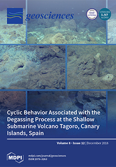
In March 2012, Tagoro, the most recently discovered shallow submarine volcano on the Canary Islands, Spain, became an active hydrothermal system involving a release of heat and gases that produce significant physical–chemical anomalies in the surrounding waters. Our results highlight that the hydrothermal system exhibited stationary cyclic degassing behavior with a strong peak of a 140-min period centered on a significant interval of 130–170 min at 99.9% confidence. Moreover, important physical–chemical anomalies are still present in the interior of the main crater, such as (i) a thermal increase of +2.55 °C, (ii) a salinity decrease of -1.02, (iii) a density decrease of -1.43 (kg∙m−3), and (iv) a pH decrease of -1.25 units. This confirms that, five years after its origin, the submarine volcano Tagoro is still actively in a degassing phase. View this paper
  • Issues are regarded as officially published after their release is announced to the table of contents alert mailing list.
  • You may sign up for e-mail alerts to receive table of contents of newly released issues.
  • PDF is the official format for papers published in both, html and pdf forms. To view the papers in pdf format, click on the "PDF Full-text" link, and use the free Adobe Reader to open them.
Order results
Result details
Section
Select all
Export citation of selected articles as:
34 pages, 7240 KiB  
Review
The New Moon: Major Advances in Lunar Science Enabled by Compositional Remote Sensing from Recent Missions
by Deepak Dhingra
Geosciences 2018, 8(12), 498; https://doi.org/10.3390/geosciences8120498 - 18 Dec 2018
Cited by 11 | Viewed by 8237
Abstract
Volatile-bearing lunar surface and interior, giant magmatic-intrusion-laden near and far side, globally distributed layer of purest anorthosite (PAN) and discovery of Mg-Spinel anorthosite, a new rock type, represent just a sample of the brand new perspectives gained in lunar science in the last [...] Read more.
Volatile-bearing lunar surface and interior, giant magmatic-intrusion-laden near and far side, globally distributed layer of purest anorthosite (PAN) and discovery of Mg-Spinel anorthosite, a new rock type, represent just a sample of the brand new perspectives gained in lunar science in the last decade. An armada of missions sent by multiple nations and sophisticated analyses of the precious lunar samples have led to rapid evolution in the understanding of the Moon, leading to major new findings, including evidence for water in the lunar interior. Fundamental insights have been obtained about impact cratering, the crystallization of the lunar magma ocean and conditions during the origin of the Moon. The implications of this understanding go beyond the Moon and are therefore of key importance in solar system science. These new views of the Moon have challenged the previous understanding in multiple ways and are setting a new paradigm for lunar exploration in the coming decade both for science and resource exploration. Missions from India, China, Japan, South Korea, Russia and several private ventures promise continued exploration of the Moon in the coming years, which will further enrich the understanding of our closest neighbor. The Moon remains a key scientific destination, an active testbed for in-situ resource utilization (ISRU) activities, an outpost to study the universe and a future spaceport for supporting planetary missions. Full article
(This article belongs to the Special Issue Recent Advances in Lunar Studies)
Show Figures

Figure 1

16 pages, 3028 KiB  
Article
High-Resolution Seismic Data Deconvolution by A0 Algorithm
by Fedor Krasnov and Alexander Butorin
Geosciences 2018, 8(12), 497; https://doi.org/10.3390/geosciences8120497 - 18 Dec 2018
Cited by 1 | Viewed by 3887
Abstract
Sparse spikes deconvolution is one of the oldest inverse problems, which is a stylized version of recovery in seismic imaging. The goal of sparse spike deconvolution is to recover an approximation of a given noisy measurement [...] Read more.
Sparse spikes deconvolution is one of the oldest inverse problems, which is a stylized version of recovery in seismic imaging. The goal of sparse spike deconvolution is to recover an approximation of a given noisy measurement T = W r + W 0 . Since the convolution destroys many low and high frequencies, this requires some prior information to regularize the inverse problem. In this paper, the authors continue to study the problem of searching for positions and amplitudes of the reflection coefficients of the medium (SP&ARCM). In previous research, the authors proposed a practical algorithm for solving the inverse problem of obtaining geological information from the seismic trace, which was named A 0 . In the current paper, the authors improved the method of the A 0 algorithm and applied it to the real (non-synthetic) data. Firstly, the authors considered the matrix approach and Differential Evolution approach to the SP&ARCM problem and showed that their efficiency is limited in the case. Secondly, the authors showed that the course to improve the A 0 lays in the direction of optimization with sequential regularization. The authors presented calculations for the accuracy of the A 0 for that case and experimental results of the convergence. The authors also considered different initialization parameters of the optimization process from the point of the acceleration of the convergence. Finally, the authors carried out successful approbation of the algorithm A 0 on synthetic and real data. Further practical development of the algorithm A 0 will be aimed at increasing the robustness of its operation, as well as in application in more complex models of real seismic data. The practical value of the research is to increase the resolving power of the wave field by reducing the contribution of interference, which gives new information for seismic-geological modeling. Full article
(This article belongs to the Special Issue Numerical Methods of Geophysical Fields Inversion)
Show Figures

Figure 1

17 pages, 4550 KiB  
Review
Stratigraphy, Tectonics and Hydrocarbon Habitat of the Abadan Plain Basin: A Geological Review of a Prolific Middle Eastern Hydrocarbon Province
by Vahid Atashbari, Mark Tingay and Khalid Amrouch
Geosciences 2018, 8(12), 496; https://doi.org/10.3390/geosciences8120496 - 17 Dec 2018
Cited by 15 | Viewed by 8414
Abstract
The Abadan Plain Basin is located in the Middle East region which is host to some of the world’s largest oil and gas fields around the Persian Gulf. This basin is a foredeep basin to the southwest of the Zagros Fold-Thrust-Belt, bounded along [...] Read more.
The Abadan Plain Basin is located in the Middle East region which is host to some of the world’s largest oil and gas fields around the Persian Gulf. This basin is a foredeep basin to the southwest of the Zagros Fold-Thrust-Belt, bounded along its northern and eastern margins by the Dezful Embayment. Most of the rocks in this basin have been deposited in a carbonate environment, and existing fractures have made the formations a favourable place for hydrocarbon accumulations. The basin is enriched by oil and, therefore, gas reservoirs are few, and some of the explored reservoirs exhibit significant degrees of overpressure. This paper has compiled several aspects of the Abadan Plain Basin tectonics, structural geology and petroleum systems to provide a better understanding of the opportunities and risks of development activities in this region. In addition to the existing knowledge, this paper provides a basin-wide examination of pore pressure, vertical stress, temperature gradient, and wellbore stability issues. Full article
(This article belongs to the Special Issue Stress Quantification in Sedimentary Basins)
Show Figures

Figure 1

33 pages, 9921 KiB  
Article
Microbial Geochemistry Reflecting Sulfur, Iron, Manganese, and Calcium Sources in the San Diego River Watershed, Southern California USA
by Eleanora I. Robbins, Shannon Quigley-Raymond, Ming Lai and Janae Fried
Geosciences 2018, 8(12), 495; https://doi.org/10.3390/geosciences8120495 - 17 Dec 2018
Viewed by 4449
Abstract
Microbial populations involved in forming the distinctive precipitates of S, Fe, Mn, and Ca in the San Diego River watershed reflect an interplay between the mineralogy of the rocks in the watershed, sparse rainfall, ground- and surface-water anoxia, and runoff of high sulfate, [...] Read more.
Microbial populations involved in forming the distinctive precipitates of S, Fe, Mn, and Ca in the San Diego River watershed reflect an interplay between the mineralogy of the rocks in the watershed, sparse rainfall, ground- and surface-water anoxia, and runoff of high sulfate, treated imported water. In the sparsely developed headwaters, the Temescal Creek tributary emerges from pyrite-bearing metamorphic rocks, and thus exhibits both an oxidized Fe and reduced S. In the middle reaches, the river moves through developed land where treated, imported high sulfate Colorado River water enters from urban runoff. Mast Park surrounded by caliche-bearing sedimentary rocks is a site where marl is precipitating. Cobbles in riffles along the river are coated black with Mn oxide. When the river encounters deep-seated volcanic bedrock, it wells up to precipitate both Fe and Mn oxides at the Old Mission Dam. Then, directly flowing through caliche-laced sedimentary rocks, Birchcreek tributary precipitates tufa. Further downstream at a site under a bridge that blocks sunlight, a sulfuretum sets up when the river is deoxygenated. Such a rich geochemistry results in activity of iron and manganese oxidizing bacteria, sulfur oxidizers and reducers, and cyanobacteria precipitating calcareous marl and tufa. Full article
(This article belongs to the Special Issue Microbial Biomineralization)
Show Figures

Figure 1

23 pages, 2974 KiB  
Article
A Comparative Study of the AHP and TOPSIS Techniques for Dam Site Selection Using GIS: A Case Study of Sistan and Baluchestan Province, Iran
by Ali Jozaghi, Babak Alizadeh, Mohsen Hatami, Ian Flood, Mohammad Khorrami, Nastaran Khodaei and Erfan Ghasemi Tousi
Geosciences 2018, 8(12), 494; https://doi.org/10.3390/geosciences8120494 - 17 Dec 2018
Cited by 116 | Viewed by 15909
Abstract
The application of multiple criteria decision-making (MCDM) techniques in real-life problems has increased in recent years. The need to build advanced decision models with higher capabilities that can support decision-making in a broad spectrum of applications, promotes the integration of MCDM techniques with [...] Read more.
The application of multiple criteria decision-making (MCDM) techniques in real-life problems has increased in recent years. The need to build advanced decision models with higher capabilities that can support decision-making in a broad spectrum of applications, promotes the integration of MCDM techniques with applicable systems, including artificial intelligence, and Geographic Information Systems (GIS). The Analytic Hierarchy Process (AHP) and Technique for Order of Preference by Similarity to Ideal Solution (TOPSIS) are among the most widely adopted MCDM techniques capable of resolving water resources challenges. A critical problem associated with water resource management is dam site selection. This paper presents a comparative analysis of TOPSIS and AHP in the context of decision-making using GIS for dam site selection. The comparison was made based on geographic and water quality criteria. The geographical criteria are geology, land use, sediment, erosion, slope, groundwater, and discharge. The water quality criteria include Soluble Sodium Percentage, Total Dissolved Solid, Potential of Hydrogen, and Electrical Conductivity of water. A ratio estimation procedure was used to determine the weights of these criteria. Both methods were applied for selection of optimal sites for dams in the Sistan and Baluchestan province, Iran. The results show that the TOPSIS method is better suited to the problem of dam site selection for this study area. Actual locations of dams constructed in the area were used to verify the results of both methods. Full article
(This article belongs to the Special Issue Geodesy and Geomatics Engineering)
Show Figures

Figure 1

6 pages, 191 KiB  
Editorial
Geochemical Equilibrium and Processes in Seawater
by Željka Fiket and Goran Kniewald
Geosciences 2018, 8(12), 493; https://doi.org/10.3390/geosciences8120493 - 17 Dec 2018
Viewed by 2263
Abstract
The geochemical equilibrium in seawater must be observed taking into account the chemical and geological, as well as biological, processes. The concept of equilibrium takes into account the composition of the system and the kinetics of the reactions taking place therein. In coastal [...] Read more.
The geochemical equilibrium in seawater must be observed taking into account the chemical and geological, as well as biological, processes. The concept of equilibrium takes into account the composition of the system and the kinetics of the reactions taking place therein. In coastal waters, nutrients and trace elements can be delivered not only through rivers but also through atmospheric input and submarine groundwater discharges. In addition to natural sources, levels of different elements can also be influenced by growing and diverse human activities along coasts. Consequently, the pathways and fate of different environmental chemicals in coastal areas are governed by various factors. The multiparameter approach, combined with different statistical tools, is a well-established way of interpreting their inputs and behaviour in marine systems. Nevertheless, the data for the karst regions, as found in the Mediterranean, are particularly scarce. This Special Issue—Geochemical Equilibrium and Processes in Seawater—of Geosciences gathers five articles on different topics related to water and sediment geochemistry of the coastal karst areas of the Mediterranean, including Slovenia, Croatia and Egypt. The topics included in this Issue refer to (1) geochemistry of sediments in the area of intensive anthropogenic activity; (2) the geochemistry of sediment and biota in a protected area under increasing pressure due to tourist activity; (3) the influence of a thermal power plant on the geochemistry of the surrounding area; (4) the influence of underground water discharges on water quality; and (5) the possibility of monitoring natural and anthropogenic processes in karst systems by using a specific group of elements. Full article
(This article belongs to the Special Issue Geochemical Equilibrium and Processes in Seawater)
21 pages, 11992 KiB  
Article
Landscape Dynamics in the Caspian Lowlands Since the Last Deglaciation Reconstructed From the Pedosedimentary Sequence of Srednaya Akhtuba, Southern Russia
by Marina Lebedeva, Alexander Makeev, Alexey Rusakov, Tatiana Romanis, Tamara Yanina, Redzhep Kurbanov, Pavel Kust and Evgeniy Varlamov
Geosciences 2018, 8(12), 492; https://doi.org/10.3390/geosciences8120492 - 16 Dec 2018
Cited by 17 | Viewed by 3676
Abstract
Surface Kastanozem of the Lower Volga area was first studied as a part of the pedocomplex, with the lower part (148–160 cm) formed in Early Khvalynian Chocolate clays (13–15 ka), the middle part (100–148 cm) in a mixed clay-loess sediment sand, and the [...] Read more.
Surface Kastanozem of the Lower Volga area was first studied as a part of the pedocomplex, with the lower part (148–160 cm) formed in Early Khvalynian Chocolate clays (13–15 ka), the middle part (100–148 cm) in a mixed clay-loess sediment sand, and the upper part (0–100 cm) in loess. This resulted from local aeolian transport, with the source material derived from the rewinding of marine sediments. They are enriched in aggregates of Chocolate clays and glauconitic grains of a fine sand-course silt size and have similar contents of clay minerals. The high salinity of similar types evidences marine genesis for both Chocolate clays and source material for loess sediments. Clay fragments of a sand and silt size are responsible for the heavy texture and high gypsum content of loess. The study of soils with the focus on micromorphology and clay mineralogy allows the identification of the complex character of a shift from marine to sub-areal sedimentation. This shift was accompanied by short breaks in sedimentation, allowing the development of synlithogenic soil horizons of Late Khvalynian, after-Khvanynian, and Boreal time. The features of shallowly buried soil horizons confirm increased aridity after the last deglaciation. Surface Calcic Kastanozem is a full Holocene soil reflecting the present environment. However, it is deeply influenced by shallow buried soil horizons and Chocolate clays. Full article
(This article belongs to the Special Issue The Imprint of Palaeoenvironments on Soils and Palaeosols)
Show Figures

Figure 1

20 pages, 31740 KiB  
Article
The Application of Freely-Available Satellite Imagery for Informing and Complementing Archaeological Fieldwork in the “Black Desert” of North-Eastern Jordan
by Stefan L. Smith and Marie-Laure Chambrade
Geosciences 2018, 8(12), 491; https://doi.org/10.3390/geosciences8120491 - 15 Dec 2018
Cited by 6 | Viewed by 5508
Abstract
Recent developments in the availability of very high-resolution satellite imagery through platforms like GoogleEarth (Google, Santa Clara County, CA, USA) and Bing Maps (Microsoft, Redmond, WA, USA) have greatly opened up the possibilities of their use by researchers. This paper focusses on the [...] Read more.
Recent developments in the availability of very high-resolution satellite imagery through platforms like GoogleEarth (Google, Santa Clara County, CA, USA) and Bing Maps (Microsoft, Redmond, WA, USA) have greatly opened up the possibilities of their use by researchers. This paper focusses on the exclusive use of free remote sensing data by the Western Harra Survey (WHS), an archaeological project investigating the arid “Black Desert” of north-eastern Jordan, a largely impenetrable landscape densely strewn with basalt blocks. The systematic analysis of such data by conducting a holistic satellite survey prior to the commencement of fieldwork allowed for the precise planning of ground surveys, with advanced knowledge of which sites were vehicle-accessible and how to efficiently visit a stratified sample of different site types. By subsequently correlating the obtained ground data with this analysis, it was possible to create a typological seriation of the site forms known as “wheels”, determine that at least two-thirds of sites are within 500 m of valleys or mudflats (highlighting these features’ roles as access routes and resource clusters) and identify numerous anthropogenic paths cleared through the basalt for site access and long-distance travel. These results offer new insights into this underrepresented region and allow for supra-regional comparisons with better investigated areas by a method that is rapid and cost-effective. Full article
Show Figures

Figure 1

16 pages, 4261 KiB  
Article
Time-Space Characterization of Wellbore-Cement Alteration by CO2-Rich Brine
by Maria Garcia-Rios and Philippe Gouze
Geosciences 2018, 8(12), 490; https://doi.org/10.3390/geosciences8120490 - 15 Dec 2018
Cited by 1 | Viewed by 2872
Abstract
The risk of CO2 leakage from damaged wellbore is identified as a critical issue for the feasibility and environmental acceptance of CO2 underground storage. For instance, Portland cement can be altered if flow of CO2-rich water occurs in hydraulic [...] Read more.
The risk of CO2 leakage from damaged wellbore is identified as a critical issue for the feasibility and environmental acceptance of CO2 underground storage. For instance, Portland cement can be altered if flow of CO2-rich water occurs in hydraulic discontinuities such as cement-tubing or cement-caprock interfaces. In this case, the raw cement matrix is altered by diffusion of the solutes. This fact leads to the formation of distinctive alteration fronts indicating the dissolution of portlandite, the formation of a carbonate-rich layer and the decalcification of the calcium silicate hydrate, controlled by the interplay between the reaction kinetics, the diffusion-controlled renewing of the reactants and products, and the changes in the diffusion properties caused by the changes in porosity induced by the dissolution and precipitation mechanisms. In principle, these mass transfers can be easily simulated using diffusion-reaction numerical models. However, the large uncertainties of the parameters characterizing the reaction rates (mainly the kinetic and thermodynamic coefficients and the evolving reactive surface area) and of the porosity-dependent diffusion properties prevent making reliable predictions required for risk assessment. In this paper, we present the results of a set of experiments consisting in the alteration of a holed disk of class-G cement in contact with a CO2-rich brine at reservoir conditions (P = 12 MPa and T = 60 °C) for various durations. This new experimental protocol allows producing time-resolved data for both the spatially distributed mass transfers inside the cement body and the total mass transfers inferred from the boundary conditions mass balance. The experimental results are used to study the effect of the fluid salinity and the pCO2 on the overall reaction efficiency. Experiments at high salinity triggers more portlandite dissolution, thinner carbonate layers, and larger alteration areas than those at low salinity. These features are accompanied with different spatial distribution of the alteration layers resulting from a complex interplay between salinity-controlled dissolution and precipitation mechanisms. Conversely, the effect of the pCO2 is more intuitive: Increasing pCO2 results in increasing the overall alteration rate without modifying the relative distribution of the reaction fronts. Full article
(This article belongs to the Special Issue Geological Storage of Gases as a Tool for Energy Transition)
Show Figures

Figure 1

22 pages, 2556 KiB  
Review
Review of Snow Data Assimilation Methods for Hydrological, Land Surface, Meteorological and Climate Models: Results from a COST HarmoSnow Survey
by Jürgen Helmert, Aynur Şensoy Şorman, Rodolfo Alvarado Montero, Carlo De Michele, Patricia De Rosnay, Marie Dumont, David Christian Finger, Martin Lange, Ghislain Picard, Vera Potopová, Samantha Pullen, Dagrun Vikhamar-Schuler and Ali Nadir Arslan
Geosciences 2018, 8(12), 489; https://doi.org/10.3390/geosciences8120489 - 14 Dec 2018
Cited by 37 | Viewed by 7695
Abstract
The European Cooperation in Science and Technology (COST) Action ES1404 “HarmoSnow”, entitled, “A European network for a harmonized monitoring of snow for the benefit of climate change scenarios, hydrology and numerical weather prediction” (2014-2018) aims to coordinate efforts in Europe to harmonize approaches [...] Read more.
The European Cooperation in Science and Technology (COST) Action ES1404 “HarmoSnow”, entitled, “A European network for a harmonized monitoring of snow for the benefit of climate change scenarios, hydrology and numerical weather prediction” (2014-2018) aims to coordinate efforts in Europe to harmonize approaches to validation, and methodologies of snow measurement practices, instrumentation, algorithms and data assimilation (DA) techniques. One of the key objectives of the action was “Advance the application of snow DA in numerical weather prediction (NWP) and hydrological models and show its benefit for weather and hydrological forecasting as well as other applications.” This paper reviews approaches used for assimilation of snow measurements such as remotely sensed and in situ observations into hydrological, land surface, meteorological and climate models based on a COST HarmoSnow survey exploring the common practices on the use of snow observation data in different modeling environments. The aim is to assess the current situation and understand the diversity of usage of snow observations in DA, forcing, monitoring, validation, or verification within NWP, hydrology, snow and climate models. Based on the responses from the community to the questionnaire and on literature review the status and requirements for the future evolution of conventional snow observations from national networks and satellite products, for data assimilation and model validation are derived and suggestions are formulated towards standardized and improved usage of snow observation data in snow DA. Results of the conducted survey showed that there is a fit between the snow macro-physical variables required for snow DA and those provided by the measurement networks, instruments, and techniques. Data availability and resources to integrate the data in the model environment are identified as the current barriers and limitations for the use of new or upcoming snow data sources. Broadening resources to integrate enhanced snow data would promote the future plans to make use of them in all model environments. Full article
(This article belongs to the Special Issue Remote Sensing of Snow and Its Applications)
Show Figures

Figure 1

19 pages, 4564 KiB  
Article
Alongshore Variability in the Response of a Mixed Sand and Gravel Beach to Bimodal Wave Direction
by John Atkinson and Luciana S. Esteves
Geosciences 2018, 8(12), 488; https://doi.org/10.3390/geosciences8120488 - 14 Dec 2018
Cited by 4 | Viewed by 3379
Abstract
Characterising spatial and temporal variations in coastal behaviour is essential for the management of beach systems. Recent studies have shown that beach response is more complex in coasts subjected to bimodal wave directions. Despite being pervasive at higher latitudes, relatively little is known [...] Read more.
Characterising spatial and temporal variations in coastal behaviour is essential for the management of beach systems. Recent studies have shown that beach response is more complex in coasts subjected to bimodal wave directions. Despite being pervasive at higher latitudes, relatively little is known about the spatial variability in the response of mixed sand and gravel beaches. This work presents evidence that the response of mixed sand and gravel beaches to bimodal wave directions can be highly variable (both in magnitude and direction of change) even within short shoreline stretches. The analyses focused on beach topography data collected between 2009 and 2018 along five cross-shore transects within a 2-km-long shoreline in Suffolk (East England) and offshore wave data recorded at the West Gabbard Smart buoy. The dominant offshore wave direction oscillates between the southwest and the northeast from year to year, and the bimodal beach sediment has modes at 0.35 mm and 16 mm. Analyses were undertaken considering two timeframes: Biannual surveys from January 2009 to February 2018, and more intensive surveying (from seasonal to pre- and post-storm) from July 2016 to March 2018. Results highlighted large differences in beach response even between transects 350 m apart and no clear seasonal pattern of change. Instead, response seemed to depend on a complex interaction between wave power, dominant wave direction, and local settings. Although correlations were identified between indicators of beach change and wave conditions, these varied across transects. Divergence of longshore transport may occur locally, likely influencing the high alongshore variability. Full article
(This article belongs to the Special Issue Coastal Geomorphology)
Show Figures

Figure 1

14 pages, 7010 KiB  
Article
A Weighted Overlay Method for Liquefaction-Related Urban Damage Detection: A Case Study of the 6 September 2018 Hokkaido Eastern Iburi Earthquake, Japan
by Sadra Karimzadeh and Masashi Matsuoka
Geosciences 2018, 8(12), 487; https://doi.org/10.3390/geosciences8120487 - 14 Dec 2018
Cited by 16 | Viewed by 5917
Abstract
We performed interferometric synthetic aperture radar (InSAR) analyses to observe ground displacements and assess damage after the M 6.6 Hokkaido Eastern Iburi earthquake in northern Japan on 6 September 2018. A multitemporal SAR coherence map is extracted from 3-m resolution ascending (track 116) [...] Read more.
We performed interferometric synthetic aperture radar (InSAR) analyses to observe ground displacements and assess damage after the M 6.6 Hokkaido Eastern Iburi earthquake in northern Japan on 6 September 2018. A multitemporal SAR coherence map is extracted from 3-m resolution ascending (track 116) and descending (track 18) ALOS-2 Stripmap datasets to cover the entire affected area. To distinguish damaged buildings associated with liquefaction, three influential parameters from the space-based InSAR results, ground-based LiquickMap (from seismic intensities in Japanese networks) and topographic slope of the study area are considered together in a weighted overlay (WO) analysis, according to prior knowledge of the study area. The WO analysis results in liquefaction potential values that agree with our field survey results. To investigate further, we conducted microtremor measurements at 14 points in Hobetsu, in which the predominant frequency showed a negative correlation with the WO values, especially when drastic coherence decay occurred. Full article
Show Figures

Graphical abstract

13 pages, 1749 KiB  
Article
Interception of Rainfall in Successional Tropical Dry Forests in Brazil and Costa Rica
by Julio César Calvo-Alvarado, César Dionisio Jiménez-Rodríguez, Ana Julieta Calvo-Obando, Mário Marcos do Espírito-Santo and Thiago Gonçalves-Silva
Geosciences 2018, 8(12), 486; https://doi.org/10.3390/geosciences8120486 - 14 Dec 2018
Cited by 12 | Viewed by 4090
Abstract
Tropical dry forests (TDF) are endangered ecosystems characterized by a matrix of successional forest patches with structural differences across the Neotropics. Until now, there have been few studies that analyze the partitioning of rainfall by forest interception in TDF. To contribute to the [...] Read more.
Tropical dry forests (TDF) are endangered ecosystems characterized by a matrix of successional forest patches with structural differences across the Neotropics. Until now, there have been few studies that analyze the partitioning of rainfall by forest interception in TDF. To contribute to the understanding of the TDF impact on the hydrological dynamic at the ecosystem and landscape levels, a rainfall interception study was conducted in Santa Rosa National Park in Costa Rica (SRNP) and in Mata Seca State Park in Brazil (MSSP). In each site, three plots per successional stage were studied. The successional stages were early, intermediate, and late. In each plot the rainfall, throughfall, and stemflow were monitored during one rainy season. The relationship between gross rainfall and water fluxes was evaluated using linear regression models. In general, net rainfall oscillated from 79.3% to 85.4% of gross rainfall in all the plots in MSSP without any trend related to forest succession, due to the effect of a high density of lianas in the intermediate and late stage plots. In SRNP, there was a clear trend of net rainfall among successional stages: 87.5% (early), 73.0% (intermediate), and 63.4% (late). Net rainfall correlated negatively only with plant area index in SRNP (r = −0.755, p < 0.05). This study highlights the need to study rainfall interception in successional stages to estimate net rainfall that reaches the soil. This would provide better hydrological information to understand water balance and water fluxes at the level of forest ecosystems and landscapes. Full article
(This article belongs to the Special Issue Advances in Rainfall and Evaporation Partitioning)
Show Figures

Figure 1

17 pages, 2462 KiB  
Article
Operative Monographies: Development of a New Tool for the Effective Management of Landslide Risks
by Daniele Giordan, Martina Cignetti, Aleksandra Wrzesniak, Paolo Allasia and Davide Bertolo
Geosciences 2018, 8(12), 485; https://doi.org/10.3390/geosciences8120485 - 14 Dec 2018
Cited by 11 | Viewed by 3099
Abstract
Active landslide risk assessment and management are primarily based on the availability of dedicated studies and monitoring activities. The establishment of decision support for the efficient management of active landslides threatening urban areas is a worthwhile contribution. Nowadays, consistent information about major landslide [...] Read more.
Active landslide risk assessment and management are primarily based on the availability of dedicated studies and monitoring activities. The establishment of decision support for the efficient management of active landslides threatening urban areas is a worthwhile contribution. Nowadays, consistent information about major landslide hazards is obtained through an interdisciplinary approach, consisting of field survey data and long-time monitoring, with the creation of a high populated dataset. Nevertheless, the large number and variety of acquired data can generate some criticalities in their management. Data fragmentation and a missing standard format of the data should represent a serious hitch in landslide hazard management. A good organization in a standard format can be a good operative solution. Based on standardized approaches such as the ICAO (International Civil Aviation Organization), we developed a standard document called operative monography. This document summarizes all available information by organizing monitoring data and identifying possible lacks. We tested this approach in the Aosta Valley Region (NW Italy) on five different slow moving landslides monitored for twenty years. The critical analysis of the available dataset modifies a simple sequence of information in a more complex document, adoptable by local and national authorities for a more effective management of active landslides. Full article
(This article belongs to the Special Issue Analysis of the Kinematic Evolution of Active Landslides)
Show Figures

Graphical abstract

19 pages, 3379 KiB  
Article
Generating Observation-Based Snow Depletion Curves for Use in Snow Cover Data Assimilation
by Kristi R. Arsenault and Paul R. Houser
Geosciences 2018, 8(12), 484; https://doi.org/10.3390/geosciences8120484 - 14 Dec 2018
Cited by 7 | Viewed by 4148
Abstract
Snow depletion curves (SDC) are functions that are used to show the relationship between snow covered area and snow depth or water equivalent. Previous snow cover data assimilation (DA) studies have used theoretical SDC models as observation operators to map snow depth to [...] Read more.
Snow depletion curves (SDC) are functions that are used to show the relationship between snow covered area and snow depth or water equivalent. Previous snow cover data assimilation (DA) studies have used theoretical SDC models as observation operators to map snow depth to snow cover fraction (SCF). In this study, a new approach is introduced that uses snow water equivalent (SWE) observations and satellite-based SCF retrievals to derive SDC relationships for use in an Ensemble Kalman filter (EnKF) to assimilate snow cover estimates. A histogram analysis is used to bin the SWE observations, which the corresponding SCF observations are then averaged within, helping to constrain the amount of data dispersion across different temporal and regional conditions. Logarithmic functions are linearly regressed with the binned average values, for two U.S. mountainous states: Colorado and Washington. The SDC-based logarithmic functions are used as EnKF observation operators, and the satellite-based SCF estimates are assimilated into a land surface model. Assimilating satellite-based SCF estimates with the observation-based SDC shows a reduction in SWE-related RMSE values compared to the model-based SDC functions. In addition, observation-based SDC functions were derived for different intra-annual and physiographic conditions, and landcover and elevation bands. Lower SWE-based RMSE values are also found with many of these categorical observation-based SDC EnKF experiments. All assimilation experiments perform better than the open-loop runs, except for the Washington region’s 2004–2005 snow season, which was a major drought year that was difficult to capture with the ensembles and observations. Full article
(This article belongs to the Special Issue Remote Sensing of Snow and Its Applications)
Show Figures

Figure 1

14 pages, 1012 KiB  
Article
Sequestering Atmospheric CO2 Inorganically: A Solution for Malaysia’s CO2 Emission
by M. Ehsan Jorat, Maniruzzaman A. Aziz, Aminaton Marto, Nabilah Zaini, Siti Norafida Jusoh and David A.C. Manning
Geosciences 2018, 8(12), 483; https://doi.org/10.3390/geosciences8120483 - 14 Dec 2018
Cited by 12 | Viewed by 6282
Abstract
Malaysia is anticipating an increase of 68.86% in CO2 emission in 2020, compared with the 2000 baseline, reaching 285.73 million tonnes. A major contributor to Malaysia’s CO2 emissions is coal-fired electricity power plants, responsible for 43.4% of the overall emissions. Malaysia’s [...] Read more.
Malaysia is anticipating an increase of 68.86% in CO2 emission in 2020, compared with the 2000 baseline, reaching 285.73 million tonnes. A major contributor to Malaysia’s CO2 emissions is coal-fired electricity power plants, responsible for 43.4% of the overall emissions. Malaysia’s forest soil offers organic sequestration of 15 tonnes of CO2 ha−1·year−1. Unlike organic CO2 sequestration in soil, inorganic sequestration of CO2 through mineral carbonation, once formed, is considered as a permanent sink. Inorganic CO2 sequestration in Malaysia has not been extensively studied, and the country’s potential for using the technique for atmospheric CO2 removal is undefined. In addition, Malaysia produces a significant amount of solid waste annually and, of that, demolition concrete waste, basalt quarry fine, and fly and bottom ashes are calcium-rich materials suitable for inorganic CO2 sequestration. This project introduces a potential solution for sequestering atmospheric CO2 inorganically for Malaysia. If lands associated to future developments in Malaysia are designed for inorganic CO2 sequestration using demolition concrete waste, basalt quarry fine, and fly and bottom ashes, 597,465 tonnes of CO2 can be captured annually adding a potential annual economic benefit of €4,700,000. Full article
(This article belongs to the Special Issue Carbon Sequestration)
Show Figures

Figure 1

16 pages, 7529 KiB  
Article
Emergency Flood Control: Practice-Oriented Test Series for the Use of Sandbag Replacement Systems
by Christopher Massolle, Lena Lankenau and Bärbel Koppe
Geosciences 2018, 8(12), 482; https://doi.org/10.3390/geosciences8120482 - 13 Dec 2018
Cited by 4 | Viewed by 5945
Abstract
In operational flood defense, it is common practice to use sandbag systems. However, their installation is time-consuming as well as material- and labor-intensive. Sandbag replacement systems (SBRSs) can be installed in significantly shorter time and with less effort. However, owing to the lack [...] Read more.
In operational flood defense, it is common practice to use sandbag systems. However, their installation is time-consuming as well as material- and labor-intensive. Sandbag replacement systems (SBRSs) can be installed in significantly shorter time and with less effort. However, owing to the lack of confidence in their functionality, they are only used to a limited extent. Testing and certifying such innovative systems according to defined criteria is supportive in promoting their use in flood defense. In order to test SBRSs and as a first step toward systematic tests, the Institute for Hydraulic and Coastal Engineering of the Bremen University of Applied Sciences, Germany (IWA) has set up a test facility in which defined test series can be carried out with different SBRSs on an underlying surface of turf. The focus of the test series is on installation time, possible water head, system stability, and seepage rates when in use. A conventional sandbag dam was used as reference in order to compare the test results with the different SBRSs. Test series show that damming with SBRSs has a clear advantage over the use of sandbags in terms of the time it takes to put them in place and comparable values of seepage rates and water heads. In order to professionally promote the spread of SBRSs in operational flood protection, it is recommended to introduce the certification of SBRSs, since they are technical systems whose functional capability must be proven before their use in an emergency. Together with existing international certification schemes, the test series that were carried out deliver a basis for developing a specific testing scheme for SBRSs. Full article
(This article belongs to the Special Issue River, Urban, and Coastal Flood Risk)
Show Figures

Figure 1

15 pages, 9101 KiB  
Article
Implementation of a Fracture Modeling Strategy Based on Georadar Survey in a Large Area of Limestone Quarry Bench
by Mohamed Elkarmoty, Francesco Tinti, Sara Kasmaeeyazdi, Fabio Giannino, Stefano Bonduà and Roberto Bruno
Geosciences 2018, 8(12), 481; https://doi.org/10.3390/geosciences8120481 - 13 Dec 2018
Cited by 13 | Viewed by 3872
Abstract
Rock mass fractures adversely affect the cutting of commercial-size blocks and cause rock material loss in ornamental stone quarries. In order to obtain a reliable evaluation and an optimized production of ornamental stone deposits, it is fundamental to detect fractures in a non-destructive [...] Read more.
Rock mass fractures adversely affect the cutting of commercial-size blocks and cause rock material loss in ornamental stone quarries. In order to obtain a reliable evaluation and an optimized production of ornamental stone deposits, it is fundamental to detect fractures in a non-destructive manner identifying them through 3D deterministic modeling. In this study, a recently published fracture modeling strategy, based on Ground Penetrating Radar (GPR) survey was implemented on a large area of bench (27.0 m × 65.0 m) in a limestone quarry in Italy. The survey was done using a dual-frequency GPR system (250 MHz and 700 MHz). The objective of this work was to investigate the large-scale applicability of the mentioned fracture model for future consideration in quarrying optimization studies. Only the 700 MHz radargrams were considered for the fracture modeling, as they provided a higher resolution than the 250 MHz radargrams and a penetration depth of about 4.0 m. The bulk dielectric constant of the rock mass of the bench was estimated by averaging the velocities obtained from fitting the hyperbolic diffractions of fractures at different depths. The model showed that fractures from the same family set can have noticeable spatial variations. The results allowed us to roughly estimate the sizes of the blocks exploitable from the different rock layers of the quarry bench. Full article
(This article belongs to the Section Geophysics)
Show Figures

Graphical abstract

20 pages, 27989 KiB  
Article
Terraced Iron Formations: Biogeochemical Processes Contributing to Microbial Biomineralization and Microfossil Preservation
by Jeremiah Shuster, Maria Angelica Rea, Barbara Etschmann, Joël Brugger and Frank Reith
Geosciences 2018, 8(12), 480; https://doi.org/10.3390/geosciences8120480 - 13 Dec 2018
Cited by 5 | Viewed by 3855
Abstract
Terraced iron formations (TIFs) are laminated structures that cover square meter-size areas on the surface of weathered bench faces and tailings piles at the Mount Morgan mine, which is a non-operational open pit mine located in Queensland, Australia. Sampled TIFs were analyzed using [...] Read more.
Terraced iron formations (TIFs) are laminated structures that cover square meter-size areas on the surface of weathered bench faces and tailings piles at the Mount Morgan mine, which is a non-operational open pit mine located in Queensland, Australia. Sampled TIFs were analyzed using molecular and microanalytical techniques to assess the bacterial communities that likely contributed to the development of these structures. The bacterial community from the TIFs was more diverse compared to the tailings on which the TIFs had formed. The detection of both chemolithotrophic iron-oxidizing bacteria, i.e., Acidithiobacillus ferrooxidans and Mariprofundus ferrooxydans, and iron-reducing bacteria, i.e., Acidobacterium capsulatum, suggests that iron oxidation/reduction are continuous processes occurring within the TIFs. Acidophilic, iron-oxidizing bacteria were enriched from the TIFs. High-resolution electron microscopy was used to characterize iron biomineralization, i.e., the association of cells with iron oxyhydroxide mineral precipitates, which served as an analog for identifying the structural microfossils of individual cells as well as biofilms within iron oxyhydroxide laminations—i.e., alternating layers containing schwertmannite (Fe16O16(OH)12(SO4)2) and goethite (FeO(OH)). Kinetic modeling estimated that it would take between 0.25–2.28 years to form approximately one gram of schwertmannite as a lamination over a one-m2 surface, thereby contributing to TIF development. This length of time could correspond with seasonable rainfall or greater than average annual rainfall. In either case, the presence of water is critical for sustaining microbial activity, and subsequently iron oxyhydroxide mineral precipitation. The TIFs from the Mount Morgan mine also contain laminations of gypsum (CaSO·2H2O) alternating with iron oxyhydroxide laminations. These gypsum laminations likely represented drier periods of the year, in which millimeter-size gypsum crystals presumably precipitated as water gradually evaporated. Interestingly, gypsum acted as a substrate for the attachment of cells and the growth of biofilms that eventually became mineralized within schwertmannite and goethite. The dissolution and reprecipitation of gypsum suggest that microenvironments with circumneutral pH conditions could exist within TIFs, thereby supporting iron oxidation under circumneutral pH conditions. In conclusion, this study highlights the relationship between microbes for the development of TIFs and also provides interpretations of biogeochemical processes contributing to the preservation of bacterial cells and entire biofilms under acidic conditions. Full article
(This article belongs to the Special Issue Microbial Biomineralization)
Show Figures

Figure 1

20 pages, 7343 KiB  
Article
High Resolution Drone Surveying of the Pista Geoglyph in Palpa, Peru
by Karel Pavelka, Jaroslav Šedina and Eva Matoušková
Geosciences 2018, 8(12), 479; https://doi.org/10.3390/geosciences8120479 - 13 Dec 2018
Cited by 14 | Viewed by 5558
Abstract
Currently, satellite images can be used to document historical or archaeological sites in areas that are distant, dangerous, or expensive to visit, and they can be used instead of basic fieldwork in several cases. Nowadays, they have final resolution on 35–50 cm, which [...] Read more.
Currently, satellite images can be used to document historical or archaeological sites in areas that are distant, dangerous, or expensive to visit, and they can be used instead of basic fieldwork in several cases. Nowadays, they have final resolution on 35–50 cm, which can be limited for searching of fine structures. Results using the analysis of very high resolution (VHR) satellite data and super resolution data from drone on an object nearby Palpa, Peru are discussed in this article. This study is a part of Nasca project focused on using satellite data for documentation and the analysis of the famous geoglyphs in Peru near Palpa and Nasca, and partially on the documentation of other historical objects. The use of drone shows advantages of this technology to achieve high resolution object documentation and analysis, which provide new details. The documented site was the “Pista” geoglyph. Discovering of unknown geoglyphs (a bird, a guinea pig, and other small drawings) was quite significant in the area of the well-known geoglyph. The new data shows many other details, unseen from the surface or from the satellite imagery, and provides the basis for updating current knowledge and theories about the use and construction of geoglyphs. Full article
Show Figures

Figure 1

17 pages, 2032 KiB  
Article
Microbiological Study of Yamal Lakes: A Key to Understanding the Evolution of Gas Emission Craters
by Alexander Savvichev, Marina Leibman, Vitaly Kadnikov, Anna Kallistova, Nikolai Pimenov, Nikolai Ravin, Yury Dvornikov and Artem Khomutov
Geosciences 2018, 8(12), 478; https://doi.org/10.3390/geosciences8120478 - 13 Dec 2018
Cited by 10 | Viewed by 4342
Abstract
Although gas emission craters (GECs) are actively investigated, the question of which landforms result from GECs remains open. The evolution of GECs includes the filling of deep hollows with atmospheric precipitation and deposits from their retreating walls, so that the final stage of [...] Read more.
Although gas emission craters (GECs) are actively investigated, the question of which landforms result from GECs remains open. The evolution of GECs includes the filling of deep hollows with atmospheric precipitation and deposits from their retreating walls, so that the final stage of gas emission crater (GEC) lake development does not differ from that of any other lakes. Microbial activity and diversity may be indicators that make it possible to distinguish GEC lakes from other exogenous lakes. This work aimed at a comparison of the activity and diversity of microbial communities in young GEC lakes and mature background lakes of Central Yamal by using a radiotracer analysis and high-throughput sequencing of the 16S rRNA genes. The radiotracer analysis revealed slow-flowing microbial processes as expected for the cold climate of the study area. GEC lakes differed from background ones by slow rates of anaerobic processes (methanogenesis, sulfate reduction) as well as by a low abundance and diversity of methanogens. Other methane cycle micro-organisms (aerobic and anaerobic methanotrophs) were similar in all studied lakes and represented by Methylobacter and ANME 2d; the rates of methane oxidation were also similar. Actinobacteria, Bacteroidetes, Betaproteobacteria, and Acidobacteria were predominant in both lake types. Thus, GEC lakes may be identified by their scarce methanogenic population. Full article
(This article belongs to the Special Issue Gas and Gas Hydrate in Permafrost)
Show Figures

Figure 1

9 pages, 1090 KiB  
Editorial
Charting the Course for Future Developments in Marine Geomorphometry: An Introduction to the Special Issue
by Vanessa Lucieer, Vincent Lecours and Margaret F. J. Dolan
Geosciences 2018, 8(12), 477; https://doi.org/10.3390/geosciences8120477 - 13 Dec 2018
Cited by 16 | Viewed by 3780
Abstract
The use of spatial analytical techniques for describing and classifying seafloor terrain has become increasingly widespread in recent years, facilitated by a combination of improved mapping technologies and computer power and the common use of Geographic Information Systems. Considering that the seafloor represents [...] Read more.
The use of spatial analytical techniques for describing and classifying seafloor terrain has become increasingly widespread in recent years, facilitated by a combination of improved mapping technologies and computer power and the common use of Geographic Information Systems. Considering that the seafloor represents 71% of the surface of our planet, this is an important step towards understanding the Earth in its entirety. Bathymetric mapping systems, spanning a variety of sensors, have now developed to a point where the data they provide are able to capture seabed morphology at multiple scales, opening up the possibility of linking these data to oceanic, geological, and ecological processes. Applications of marine geomorphometry have now moved beyond the simple adoption of techniques developed for terrestrial studies. Whilst some former challenges have been largely resolved, we find new challenges constantly emerging from novel technology and applications. As increasing volumes of bathymetric data are acquired across the entire ocean floor at scales relevant to marine geosciences, resource assessment, and biodiversity evaluation, the scientific community needs to balance the influx of high-resolution data with robust quantitative processing and analysis techniques. This will allow marine geomorphometry to become more widely recognized as a sub-discipline of geomorphometry as well as to begin to tread its own path to meet the specific challenges that are associated with seabed mapping. This special issue brings together a collection of research articles that reflect the types of studies that are helping to chart the course for the future of marine geomorphometry. Full article
(This article belongs to the Special Issue Marine Geomorphometry)
Show Figures

Figure 1

19 pages, 5506 KiB  
Article
Modeling and Imaging of Multiscale Geological Media: Exploding Reflection Revisited
by Evgeny Landa, Galina Reshetova and Vladimir Tcheverda
Geosciences 2018, 8(12), 476; https://doi.org/10.3390/geosciences8120476 - 12 Dec 2018
Cited by 6 | Viewed by 2787
Abstract
Computation of Common Middle Point seismic sections and their subsequent time migration and diffraction imaging provides very important knowledge about the internal structure of 3D heterogeneous geological media and are key elements for successive geological interpretation. Full-scale numerical simulation, that computes all single [...] Read more.
Computation of Common Middle Point seismic sections and their subsequent time migration and diffraction imaging provides very important knowledge about the internal structure of 3D heterogeneous geological media and are key elements for successive geological interpretation. Full-scale numerical simulation, that computes all single shot seismograms, provides a full understanding of how the features of the image reflect the properties of the subsurface prototype. Unfortunately, this kind of simulations of 3D seismic surveys for realistic geological media needs huge computer resources, especially for simulation of seismic waves’ propagation through multiscale media like cavernous fractured reservoirs. Really, we need to combine smooth overburden with microstructure of reservoirs, which forces us to use locally refined grids. However, to resolve realistic statements with huge multi-shot/multi-offset acquisitions it is still not enough to provide reasonable needs of computing resources. Therefore, we propose to model 3D Common Middle Point seismic cubes directly, rather than shot-by-shot simulation with subsequent stacking. To do that we modify the well-known "exploding reflectors principle" for 3D heterogeneous multiscale media by use of the finite-difference technique on the base of grids locally refined in time and space. We develop scalable parallel software, which needs reasonable computational costs to simulate realistic models and acquisition. Numerical results for simulation of Common Middle Points sections and their time migration are presented and discussed. Full article
(This article belongs to the Special Issue Numerical Methods of Geophysical Fields Inversion)
Show Figures

Figure 1

2 pages, 154 KiB  
Editorial
Editorial for Quantitative Geomorphology Special Issue
by Dario Gioia
Geosciences 2018, 8(12), 475; https://doi.org/10.3390/geosciences8120475 - 12 Dec 2018
Viewed by 1974
Abstract
In recent years, DEM- and GIS-supported analysis of landscape has become an important research field in many geomorphological applications, which aim to model surface processes in a variety of geomorphic environments and at different spatial and temporal scales. [...] Full article
(This article belongs to the Special Issue Quantitative Geomorphology)
35 pages, 37397 KiB  
Article
The Influence of Thermal Differences and Variation of Cl–F–OH Ratios on Cu-Ni-PGE Mineralization in the Contact Aureole of the South Kawishiwi Intrusion, Duluth Complex
by Zsolt Benkó, Aberra Mogessie, Ferenc Molnár, Steven A. Hauck, Mark J. Severson and Karl Ettinger
Geosciences 2018, 8(12), 474; https://doi.org/10.3390/geosciences8120474 - 12 Dec 2018
Cited by 3 | Viewed by 3540
Abstract
In the contact metamorphic aureole of the Duluth Complex, Cu-Ni-PGE mineralization occurs locally up to 100 m from the intrusion-footwall contact (Spruce Road area), whereas elsewhere (Dunka Pit deposit) the footwall granite and metapelite (Serpentine deposit) are barren. This study aimed to understand [...] Read more.
In the contact metamorphic aureole of the Duluth Complex, Cu-Ni-PGE mineralization occurs locally up to 100 m from the intrusion-footwall contact (Spruce Road area), whereas elsewhere (Dunka Pit deposit) the footwall granite and metapelite (Serpentine deposit) are barren. This study aimed to understand the effect of temperature and halogen fugacity variations on the presence or absence of mineralization in these footwall units. The mafic mineral assemblages, two-pyroxene, titanium-in-quartz, and biotite-apatite thermometers indicate that temperatures could be as high as 920 °C in the mineralized areas of the footwall, whereas the maximum temperature was lower by about 100 °C in the unmineralized part of the intrusion. Variation of the halogen concentrations and fugacities was monitored with the analysis of halogen concentrations in biotite and apatite. Fluorine and chlorine concentrations in biotite increase as a function of the distance from contact in the mineralized drill core and decrease in the unmineralized zones. Chlorine concentrations in apatite increase parallel with the distance from contact in the mineralized zones, whereas fluorine concentrations show only minor variation. Concentrations of these elements may have had subtle effect on the partial melting in the footwall units and indirectly facilitated the infiltration of the sulfide liquid into the footwall. Full article
(This article belongs to the Special Issue Magmatic-Hydrothermal Ore Deposits)
Show Figures

Figure 1

22 pages, 7865 KiB  
Article
Holocene Environmental and Anthropogenic Changes of Soils and Vegetation in the Central Russian Upland: The Case Study in the “Belogorie” Natural Reserve
by Yury Chendev, Olga Khokhlova, Elena Ponomarenko, Ekaterina Ershova, Alexander Alexandrovskiy and Tatyana Myakshina
Geosciences 2018, 8(12), 473; https://doi.org/10.3390/geosciences8120473 - 12 Dec 2018
Cited by 7 | Viewed by 3313
Abstract
Several episodes of past afforestation were reconstructed in a grassland area of the Yamskaya Steppe site within the “Belgorie” natural reserve on the Central-Russian Upland. The pedological, palinological, pedoanthracological, and phytolith analyses were applied for studying paleosols buried under artificial and natural mounds, [...] Read more.
Several episodes of past afforestation were reconstructed in a grassland area of the Yamskaya Steppe site within the “Belgorie” natural reserve on the Central-Russian Upland. The pedological, palinological, pedoanthracological, and phytolith analyses were applied for studying paleosols buried under artificial and natural mounds, colluvial fan deposits in gullies, and closed depressions on watersheds. The watershed area was covered by the forest vegetation until 6000 years BP, as indicated by palinological spectra in the paleosol of this age. The Bk horizon of the Chernozemic paleosol buried under a burial mound of the Bronze Age (4630 ± 180 years BP) contained Fe-lamellae indicative of the preceded forest phase of soil formation. Micro-depressions within the local watershed contained charcoal-cored iron-manganese concretions with the radiocarbon age varying from 6055 ± 20 to 6155 ± 20 years BP. This age marked a deforestation of the area after large-scale fires. From that time on, the watershed was dominated by the grassland vegetation. The next phase of afforestation was recorded in the beginning of the Subboreal period of Holocene (4600 BP), but the forest appeared to be limited to gullies. Starting with the Subboreal period, the anthropogenic impact on the landscape became apparent. Full article
(This article belongs to the Special Issue The Imprint of Palaeoenvironments on Soils and Palaeosols)
Show Figures

Figure 1

18 pages, 5806 KiB  
Article
A Simplified Approach to Assess the Soil Saturation Degree and Stability of a Representative Slope Affected by Shallow Landslides in Oltrepò Pavese (Italy)
by Massimiliano Bordoni, Roberto Valentino, Claudia Meisina, Marco Bittelli and Silvia Chersich
Geosciences 2018, 8(12), 472; https://doi.org/10.3390/geosciences8120472 - 12 Dec 2018
Cited by 12 | Viewed by 3265
Abstract
The identification of the triggering mechanism of rainfall-induced, shallow landslides requires a complete understanding of the hydro-mechanical response of soil, which can be represented through the trends of the degree of soil saturation. In this paper, multiple annual cycles of soil saturation obtained [...] Read more.
The identification of the triggering mechanism of rainfall-induced, shallow landslides requires a complete understanding of the hydro-mechanical response of soil, which can be represented through the trends of the degree of soil saturation. In this paper, multiple annual cycles of soil saturation obtained through field monitoring were used to validate an empirical model based on climate data. Both field measurements and model outputs were used to conduct simplified slope stability analysis to evaluate the model chain capability in predicting the temporal occurrence of shallow failures. Field data were collected on a testsite slope located in Oltrepò Pavese (Northern Italy), where a shallow landslide occurred during the monitoring period. The experimental trends of the degree of saturation at various depths in the soil profile were compared with the calculated values and showed good agreement. Landslide triggering is reached when the soil is completely saturated. Both measured and modeled trends of soil saturation correctly identified the triggering time of the shallow landslide and the depth of the sliding surface, 1.0 m below the ground surface, in the test slope. The obtained results indicated the possibility of extending this approach for theassessment of the initiation time and the depth of shallow landslides, particularly for preliminary susceptibility evaluations, based on widely available climate data. Full article
Show Figures

Graphical abstract

20 pages, 5041 KiB  
Article
Effects of Phosphorus in Growth Media on Biomineralization and Cell Surface Properties of Marine Cyanobacteria Synechococcus
by Carlos Paulo, Janice P. L. Kenney, Per Persson and Maria Dittrich
Geosciences 2018, 8(12), 471; https://doi.org/10.3390/geosciences8120471 - 11 Dec 2018
Cited by 16 | Viewed by 4807
Abstract
Through geological time, cyanobacterial picoplankton have impacted the global carbon cycle by sequestrating CO2 and forming authigenic carbonate minerals. Various studies have emphasized the cyanobacterial cell envelopes as nucleation sites for calcium carbonate formation. Little is known, however, about how environmental conditions [...] Read more.
Through geological time, cyanobacterial picoplankton have impacted the global carbon cycle by sequestrating CO2 and forming authigenic carbonate minerals. Various studies have emphasized the cyanobacterial cell envelopes as nucleation sites for calcium carbonate formation. Little is known, however, about how environmental conditions (e.g., nutrient content) trigger a cell surface and its properties and, consequently, influence biomineralization. Our study aims to understand how phosphorus (P) concentration impacts the properties of cell surfaces and cell–mineral interactions. Changes to the surface properties of marine Synechococcus strains grown under various P conditions were characterized by potentiometric titrations, X-ray photoelectron spectroscopy (XPS), and tip-enhanced Raman spectroscopy (TERS). Biomineralization experiments were performed using cyanobacterial cells, which were grown under different P concentrations and exposed to solutions slightly oversaturated with respect to calcium carbonate. We observed the changes induced by different P conditions in the macromolecular composition of the cyanobacteria cell envelope and its consequences for biomineralization. The modified properties of cell surfaces were linked to carbonate precipitation rates and mineral morphology from biomineralization experiments. Our analysis shows that the increase of phosphoryl groups and surface charge, as well as the relative proportion of polysaccharides and proteins, can impact carbonate precipitation by picocyanobacteria. Full article
(This article belongs to the Special Issue Microbial Biomineralization)
Show Figures

Figure 1

18 pages, 3310 KiB  
Article
The Role of Hydraulic Connectivity and Management on Soil Aggregate Size and Stability in the Clear Creek Watershed, Iowa
by Kenneth M. Wacha, A. N. Thanos Papanicolaou, Christos P. Giannopoulos, Benjamin K. Abban, Christopher G. Wilson, Shengnan Zhou, Jerry L. Hatfield, Timothy R. Filley and Tingyu Hou
Geosciences 2018, 8(12), 470; https://doi.org/10.3390/geosciences8120470 - 11 Dec 2018
Cited by 18 | Viewed by 3379
Abstract
The role of tillage practices on soil aggregate properties has been mainly addressed at the pedon scale (i.e., soilscape scale) by treating landscape elements as disconnected. However, there is observed heterogeneity in aggregate properties along flowpaths, suggesting that landscape scale hydraulic processes are [...] Read more.
The role of tillage practices on soil aggregate properties has been mainly addressed at the pedon scale (i.e., soilscape scale) by treating landscape elements as disconnected. However, there is observed heterogeneity in aggregate properties along flowpaths, suggesting that landscape scale hydraulic processes are also important. This study examines this supposition using field, laboratory and modeling analysis to assess aggregate size and stability along flowpaths under different management conditions: (1) tillage-induced abrasion effects on aggregate size were evaluated with the dry mean weight diameter (DMWD); (2) raindrop impact effects were evaluated with small macroaggregate stability (SMAGGSTAB) using rainfall simulators; and (3) these aggregate proxies were studied in the context of connectivity through the excess bed shear stress (δ), quantified using a physically-based landscape model. DMWD and SMAGGSTAB decreased along the flowpaths for all managements, and a negative correspondence between the proxies and δ was observed. δ captured roughness effects on connectivity along the flowpaths: highest connectivity was noted for parallel-ridge-till flowpaths, where δ ranged from 0–8.2 Pa, and lowest connectivity for contour-ridge-till flowpaths, where δ ranged from 0–1.1 Pa. High tillage intensity likely led to an increase in aggregate susceptibility to hydraulic forcing, reflected in the higher gradients of aggregate size and stability trendlines with respect to δ. Finally, a linear relationship between DMWD and SMAGGSTAB was established. Full article
(This article belongs to the Special Issue Mechanics of Erosion: Process Response to Change)
Show Figures

Figure 1

18 pages, 13752 KiB  
Article
Detectability of Repeated Airborne Laser Scanning for Mountain Landslide Monitoring
by Lin Xiong, Guoquan Wang, Yan Bao, Xin Zhou, Xiaohan Sun and Ruibin Zhao
Geosciences 2018, 8(12), 469; https://doi.org/10.3390/geosciences8120469 - 10 Dec 2018
Cited by 8 | Viewed by 3778
Abstract
Multi-temporal airborne laser scanning (ALS) surveys have become a prime consideration for detecting landslide movements and evaluating landslide risk in mountain areas. The minimum elevation change (or detectability) that can be detected by repeated ALS surveys has become a critical threshold for landslide [...] Read more.
Multi-temporal airborne laser scanning (ALS) surveys have become a prime consideration for detecting landslide movements and evaluating landslide risk in mountain areas. The minimum elevation change (or detectability) that can be detected by repeated ALS surveys has become a critical threshold for landslide researchers and engineers to decide if ALS is a capable tool for detecting targeted landslides and arranging the minimum time span between two scans if ALS is a choice. The National Center for Airborne Laser Mapping (NCALM) at the University of Houston conducted three repeated ALS surveys at the Slumgullion landslide site in Colorado, U.S. over one week in July of 2015. These repeated ALS surveys provide valuable datasets for evaluating the vertical detectability of multi-temporal ALS surveys in a typical mountain area. According to this study, the difference of digital elevation models (DDEM) derived from ALS has the ability of detecting a minimum elevation change of 5 cm over flatter and moderately rugged terrain areas (slope < 20 degrees) and a minimum of a 10-cm elevation change over rugged terrain areas (20 degrees < slope < 40 degrees). However, the DDEM values over highly rugged terrain areas (slope > 40 degrees), such as cliff and landslide scarps, should be interpolated with caution. Global Navigation Satellite Systems (GNSS) and Terrestrial Laser Scanning (TLS) surveys were also performed at the middle portion of the landslide area for assessing the accuracy of ALS datasets. The accuracy of ALS varies from approximately one decimeter (~10 cm) to one foot (~30 cm) depending on the roughness of terrain surface and vegetation coverage (point density). The detectability and accuracy estimates of ALS measurements obtained from the case study could be used as a reference for estimating the performance of modern ALS in mountain areas with similar topography and vegetation coverage. Full article
(This article belongs to the Special Issue Mountain Landslides: Monitoring, Modeling, and Mitigation)
Show Figures

Figure 1

Previous Issue
Next Issue
Back to TopTop