Artificial Intelligence, Machine Learning and Digital Innovation in Water Management

A special issue of Water (ISSN 2073-4441). This special issue belongs to the section "New Sensors, New Technologies and Machine Learning in Water Sciences".

Deadline for manuscript submissions: closed (20 September 2023) | Viewed by 18625

Special Issue Editor


E-Mail Website
Guest Editor
Department of Water Engineering and Hydraulic Structures, Faculty of Civil Engineering, Semnan University, Semnan, Iran
Interests: water resource management and planning; soft computing models; climate changes; uncertainty modeling; artificial intelligence models

Special Issue Information

Dear Colleagues,

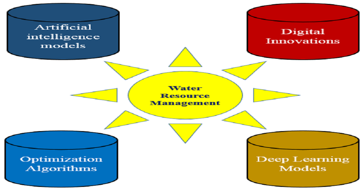
Today, water resource management is one of the most important topics for decision-makers, modelers, and policymakers. The management of water resources involves complex and nonlinear problems. Robust tools are required for solving and modeling optimization and simulation problems. Digital innovations, optimization algorithms, and artificial intelligence are robust models for managing and planning water resources. These models can be used to solve multidimensional problems with many constraints and objective functions. Machine learning and artificial intelligence models are useful tools for assessing the impacts of climate change on water resources. These tools can be integrated with remote sensing and geographic information systems (GIS) for planning and managing water resources.

The current Special Issue addresses the mentioned problems based on the following goals. However, the Special Issue is not limited to these topics. 

  • The application of artificial intelligence models and digital innovations for managing and monitoring water resources.
  • The application of artificial intelligence models and digital innovations for predicting meteorological and agricultural parameters.
  • Utilization of deep learning models for predicting natural hazards.
  • Applying artificial intelligence models and digital innovations for predicting hydrological variables under climate change conditions.
  • Spatial and temporal modeling of meteorological parameters using artificial intelligence models and digital innovations.
  • Utilization of artificial intelligence models and digital innovations for solving complex problems in hydraulic engineering.
  • The application of optimization algorithms for solving complex and nonlinear problems in water resource management.
  • Utilization of optimization algorithms for optimal operation of dam reservoirs.
  • The application of deep learning models and remote sensing for predicting hydrological variables .
  • Quantifying uncertainty using machine learning models.
  • Developing digital innovations for managing urban water systems.
  • The application of ensemble models using the outputs of machine learning models for predicting hydrological variables.
  • Stochastic environmental research and risk assessment using artificial intelligence models.
  • Predicting climate patterns using artificial intelligence

Dr. Mohammad Ehteram
Guest Editor

Manuscript Submission Information

Manuscripts should be submitted online at www.mdpi.com by registering and logging in to this website. Once you are registered, click here to go to the submission form. Manuscripts can be submitted until the deadline. All submissions that pass pre-check are peer-reviewed. Accepted papers will be published continuously in the journal (as soon as accepted) and will be listed together on the special issue website. Research articles, review articles as well as short communications are invited. For planned papers, a title and short abstract (about 100 words) can be sent to the Editorial Office for announcement on this website.

Submitted manuscripts should not have been published previously, nor be under consideration for publication elsewhere (except conference proceedings papers). All manuscripts are thoroughly refereed through a single-blind peer-review process. A guide for authors and other relevant information for submission of manuscripts is available on the Instructions for Authors page. Water is an international peer-reviewed open access semimonthly journal published by MDPI.

Please visit the Instructions for Authors page before submitting a manuscript. The Article Processing Charge (APC) for publication in this open access journal is 2600 CHF (Swiss Francs). Submitted papers should be well formatted and use good English. Authors may use MDPI's English editing service prior to publication or during author revisions.

Keywords

  • artificial intelligence models
  • digital innovations
  • hydrological simulations
  • meteorological predictions
  • optimization algorithms
  • deep learning models
  • natural hazard
  • hydraulic problems
  • irrigation and agriculture management

Published Papers (11 papers)

Order results
Result details
Select all
Export citation of selected articles as:

Research

30 pages, 6444 KiB  
Article
A Developed Multiple Linear Regression (MLR) Model for Monthly Groundwater Level Prediction
by Mohammad Ehteram and Fatemeh Barzegari Banadkooki
Water 2023, 15(22), 3940; https://doi.org/10.3390/w15223940 - 11 Nov 2023
Viewed by 1373
Abstract
Groundwater level (GLW) prediction is essential for monitoring water resources. Our study introduces a novel model called convolutional neural network (CNN)–long short-term memory neural network (LSTM)–Multiple linear regression (MLR) for groundwater level prediction. We combine two deep learning models with the MLR model [...] Read more.
Groundwater level (GLW) prediction is essential for monitoring water resources. Our study introduces a novel model called convolutional neural network (CNN)–long short-term memory neural network (LSTM)–Multiple linear regression (MLR) for groundwater level prediction. We combine two deep learning models with the MLR model to predict GWL and overcome the limitations of the MLR model. The current paper has several innovations. Our study develops an advanced hybrid model for predicting groundwater levels (GWLs). The study also presents a novel feature selection method for selecting optimal input scenarios. Finally, an advanced method is developed to examine the impact of inputs and model parameters on output uncertainty. The current paper introduces the gannet optimization algorithm (GOA) for choosing the optimal input scenario. A CNN-LSTM-MLR model (CLM), CNN, LSTM, MLR model, CNN-MLR model (CNM), LSTM-MLR model (LSM), and CNN-LSTM model (CNL) were built to predict one-month-ahead GWLs using climate data and lagged GWL data. Output uncertainty was also decomposed into parameter uncertainty (PU) and input uncertainty (IU) using the analysis of variance (ANOVA) method. Based on our findings, the CLM model can successfully predict GWLs, reduce the uncertainty of CNN, LSTM, and MLR models, and extract spatial and temporal features. Based on the study’s findings, the combination of linear models and deep learning models can improve the performance of linear models in predicting outcomes. The GOA method can also contribute to feature selection and input selection. The study findings indicated that the CLM model improved the training Nash–Sutcliffe efficiency coefficient (NSE) of the CNL, LSM, CNM, LSTM, CNN, and MLR models by 6.12%, 9.12%, 12%, 18%, 22%, and 30%, respectively. The width intervals (WIs) of the CLM, CNL, LSM, and CNM models were 0.03, 0.04, 0.07, and, 0.12, respectively, based on IU. The WIs of the CLM, CNL, LSM, and CNM models were 0.05, 0.06, 0.09, and 0.14, respectively, based on PU. Our study proposes the CLM model as a reliable model for predicting GWLs in different basins. Full article
Show Figures

Figure 1

16 pages, 11055 KiB  
Article
Development of Water-Wheel Tail Measurement System Based on Image Projective Transformation
by Xin-Ting Chen, Chien-Sheng Liu and Jung-Hong Yen
Water 2023, 15(22), 3889; https://doi.org/10.3390/w15223889 - 8 Nov 2023
Viewed by 1212
Abstract
Fishery is vital for Taiwan’s economy, and over 40% of the fishery products come from aquaculture. Traditional aquaculture relies on the visual observation of a water-wheel tail length to assess water quality. However, the aging population, lack of young labor, and difficulty in [...] Read more.
Fishery is vital for Taiwan’s economy, and over 40% of the fishery products come from aquaculture. Traditional aquaculture relies on the visual observation of a water-wheel tail length to assess water quality. However, the aging population, lack of young labor, and difficulty in passing down experience pose challenges. There is currently no systematic method to determine the correlation between the water quality and water-wheel tail length, and adjustments are made based on visual inspection, relying heavily on experience without substantial data for transmission. To address the challenge, a precise and efficient water quality control system is proposed. This study proposes a water-wheel tail length measurement system that corrects input images through image projective transformation to obtain the transformed coordinates. By utilizing known conditions of the water-wheel, such as the length of the base, the actual water-wheel tail length is deduced based on proportional relationships. Validated with two different calibration boards, the projective transformation performance of specification A is found to be better, with an average error percentage of less than 0.25%. Data augmentation techniques are employed to increase the quantity and diversity of the dataset, and the YOLO v8 deep learning model is trained to recognize water-wheel tail features. The model achieves a maximum mAP50 value of 0.99013 and a maximum mAP50-95 value of 0.885. The experimental results show that the proposed water-wheel tail length measurement system can be used feasibly to measure water-wheel tail length in fish farms. Full article
Show Figures

Figure 1

18 pages, 4800 KiB  
Article
Empowering Greenhouse Cultivation: Dynamic Factors and Machine Learning Unite for Advanced Microclimate Prediction
by Wei Sun and Fi-John Chang
Water 2023, 15(20), 3548; https://doi.org/10.3390/w15203548 - 11 Oct 2023
Cited by 1 | Viewed by 1184
Abstract
Climate change has led to more frequent extreme weather events such as heatwaves, droughts, and storms, which significantly impact agriculture, causing crop damage. Greenhouse cultivation not only provides a manageable environment that protects crops from external weather conditions and pests but also requires [...] Read more.
Climate change has led to more frequent extreme weather events such as heatwaves, droughts, and storms, which significantly impact agriculture, causing crop damage. Greenhouse cultivation not only provides a manageable environment that protects crops from external weather conditions and pests but also requires precise microclimate control. However, greenhouse microclimates are complex since various heat transfer mechanisms would be difficult to model properly. This study proposes an innovative hybrid model (DF-RF-ANN), which seamlessly fuses three components: the dynamic factor (DF) model to extract unobserved factors, the random forest (RF) to identify key input factors, and a backpropagation neural network (BPNN) to predict greenhouse microclimate, including internal temperature, relative humidity, photosynthetically active radiation, and carbon dioxide. The proposed model utilized gridded meteorological big data and was applied to a greenhouse in Taichung, Taiwan. Two comparative models were configured using the BPNN and the Long short-term memory neural network (LSTM). The results demonstrate that DF-RF-ANN effectively captures the trends of the observations and generates predictions much closer to the observations compared to LSTM and BPNN. The proposed DF-RF-ANN model hits a milestone in multi-horizon and multi-factor microclimate predictions and offers a cost-effective and easily accessible approach. This approach could be particularly beneficial for small-scale farmers to make the best use of resources under extreme climatic events for contributing to sustainable development goals (SDGs) and the transition towards a green economy. Full article
Show Figures

Figure 1

17 pages, 2714 KiB  
Article
Spatiotemporal Characterization of Drought Magnitude, Severity, and Return Period at Various Time Scales in the Hyderabad Karnataka Region of India
by Rahul Patil, Basavaraj Shivanagouda Polisgowdar, Santosha Rathod, Nirmala Bandumula, Ivan Mustac, Gejjela Venkataravanappa Srinivasa Reddy, Vijaya Wali, Umapathy Satishkumar, Satyanarayana Rao, Anil Kumar and Gabrijel Ondrasek
Water 2023, 15(13), 2483; https://doi.org/10.3390/w15132483 - 6 Jul 2023
Cited by 4 | Viewed by 1594
Abstract
Global climate change is anticipated to have a profound impact on drought occurrences, leading to detrimental consequences for the environment, socioeconomic relations, and ecosystem services. In order to evaluate the extent of drought impact, a comprehensive study was conducted in the Hyderabad–Karnataka region, [...] Read more.
Global climate change is anticipated to have a profound impact on drought occurrences, leading to detrimental consequences for the environment, socioeconomic relations, and ecosystem services. In order to evaluate the extent of drought impact, a comprehensive study was conducted in the Hyderabad–Karnataka region, India. Precipitation data from 31 stations spanning a 50-year period (1967–2017) were analyzed using the standardized precipitation index (SPI) based on gamma distribution. The findings reveal that approximately 15% of the assessed years of experienced drought conditions, with a range of influence between 41% and 76% under SPI_3, and between 43% and 72% under SPI_6. Examining the timescale magnitude frequency provided insights into variations in the severity of drought events across different locations and timescales. Notably, the Ballari (−8.77), Chitapur (−8.22), and Aland (−7.40) regions exhibited the most significant magnitudes of drought events for SPI_3 with a 5-year return period. The heightened risk of recurrent droughts in the study area emphasizes the necessity of integrating SPI in decision-making processes, as such integration can markedly contribute to the development of reliable and sustainable long-term water management strategies at regional and national levels. Full article
Show Figures

Figure 1

18 pages, 3901 KiB  
Article
LI-DWT- and PD-FC-MSPCNN-Based Small-Target Localization Method for Floating Garbage on Water Surfaces
by Ping Ai, Long Ma and Baijing Wu
Water 2023, 15(12), 2302; https://doi.org/10.3390/w15122302 - 20 Jun 2023
Cited by 1 | Viewed by 1104
Abstract
Typically, the process of visual tracking and position prediction of floating garbage on water surfaces is significantly affected by illumination, water waves, or complex backgrounds, consequently lowering the localization accuracy of small targets. Herein, we propose a small-target localization method based on the [...] Read more.
Typically, the process of visual tracking and position prediction of floating garbage on water surfaces is significantly affected by illumination, water waves, or complex backgrounds, consequently lowering the localization accuracy of small targets. Herein, we propose a small-target localization method based on the neurobiological phenomenon of lateral inhibition (LI), discrete wavelet transform (DWT), and a parameter-designed fire-controlled modified simplified pulse-coupled neural network (PD-FC-MSPCNN) to track water-floating garbage floating. First, a network simulating LI is fused with the DWT to derive a denoising preprocessing algorithm that effectively reduces the interference of image noise and enhances target edge features. Subsequently, a new PD-FC-MSPCNN network is developed to improve the image segmentation accuracy, and an adaptive fine-tuned dynamic threshold magnitude parameter V and auxiliary parameter P are newly designed, while eliminating the link strength parameter. Finally, a multiscale morphological filtering postprocessing algorithm is developed to connect the edge contour breakpoints of segmented targets, smoothen the segmentation results, and improve the localization accuracy. An effective computer vision technology approach is adopted for the accurate localization and intelligent monitoring of water-floating garbage. The experimental results demonstrate that the proposed method outperforms other methods in terms of the overall comprehensive evaluation indexes, suggesting higher accuracy and reliability. Full article
Show Figures

Figure 1

29 pages, 12283 KiB  
Article
Mapping the Environmental Vulnerability of a Lagoon Using Fuzzy Logic and the AHP Method
by Clebson Pautz, Alexandre Rosa dos Santos, Jéferson Luiz Ferrari, Plinio Antonio Guerra Filho, Sustanis Horn Kunz, Henrique Machado Dias, Taís Rizzo Moreira, Rita de Cássia Freire Carvalho, Vinícius Duarte Nader Mardeni, Elaine Cordeiro dos Santos and Larissa Marin Scaramussa
Water 2023, 15(11), 2102; https://doi.org/10.3390/w15112102 - 1 Jun 2023
Viewed by 1534
Abstract
Environmental vulnerability refers to the susceptibility of a region to damage when it is subjected to natural or anthropogenic actions. The assessment of environmental vulnerability in lakes is an important tool to assist managers in planning and intervening for sustainable production and environmental [...] Read more.
Environmental vulnerability refers to the susceptibility of a region to damage when it is subjected to natural or anthropogenic actions. The assessment of environmental vulnerability in lakes is an important tool to assist managers in planning and intervening for sustainable production and environmental preservation. The combination of geotechnologies, fuzzy logic and the analytic hierarchy process (AHP) has been applied by professionals and researchers to improve the work and research conducted in various areas and environments. In this context, the objective of this work was to map the environmental vulnerability of a lake and its surroundings through fuzzy logic and the AHP method. The study area comprises the Juparanã Lagoon Drainage Surface (JLDS), Espírito Santo state, Brazil. A survey of the physical characteristics of the watershed (drainage surface) that feeds the Juparanã Lagoon was carried out and also of the land use of this surface. To achieve the proposed objectives, the following methodological steps were implemented: (a) delimitation of watersheds, (b) spatialization of Permanent Preservation Areas (APP) based on the Brazilian Forestry Code (Law nº 12,651/2012), (c) application of logic fuzzy and AHP to spatialize the environmental vulnerability and (d) application of an evaluation of environmental vulnerability to the Preservation Areas (APP). Environmental vulnerability was modeled using Euclidean distance analysis, fuzzy logic and the AHP method, as proposed by Saaty (1977). For the development of this work, geotechnologies were used, with special emphasis on the use of the free software QGIS. The analysis revealed that 31.20%, 32.86% and 20.93% of the JLDS have very high, high and medium vulnerability, respectively. The evaluation of the environmental vulnerability of the APP showed that there is protection in the APP of the JLDS at rates of 47.35%, 34.05% and 14.5% for very high, high and medium vulnerability classes, respectively. The difficulties encountered were related to the lack of studies in the area of environmental vulnerability with a particular focus on lagoons. Here, for the first time, we perform a photointerpretation of the surroundings of Juparanã Lagoon. An important improvement measure would be the application of a temporal analysis to assess the dynamics of environmental vulnerability over time, considering socioeconomic, climatic and environmental changes. This would provide a more complete understanding of the distribution of environmental vulnerability in the study area. The methodology can be adapted to consider different scales of analysis, from local to regional, national and global scales, to assess environmental vulnerability at various scopes and levels of complexity. It can also be adapted to include local communities and governments. Full article
Show Figures

Figure 1

18 pages, 3021 KiB  
Article
Pipeline-Burst Detection on Imbalanced Data for Water Supply Networks
by Hongjin Wang, Tao Liu and Lingxi Zhang
Water 2023, 15(9), 1662; https://doi.org/10.3390/w15091662 - 24 Apr 2023
Cited by 1 | Viewed by 1421
Abstract
Data-driven methods based on samples from a supervisory control and data acquisition system have been widely applied in water-supply-network burst detection to save unexpected economic and labor costs. However, the class imbalance problem in actual on-site monitoring needs to be revised to improve [...] Read more.
Data-driven methods based on samples from a supervisory control and data acquisition system have been widely applied in water-supply-network burst detection to save unexpected economic and labor costs. However, the class imbalance problem in actual on-site monitoring needs to be revised to improve the performance of data-driven methods. In this study, we proposed a domain adaptation method to generate minor-category samples (pipeline-burst samples in general) of arbitrary pipe networks utilizing theoretical hydraulic models. The proposed method transferred pipeline-burst data generated from a random water supply network with theoretical hydraulic models to an actual imbalanced dataset. Accordingly, we established a machine learning model exploring a mapping matrix between two domains for minority-category data transfer. The experimental validation first verified the effectiveness and reliability of the proposed method between two customized water supply networks in terms of their bust recognition accuracy, model parameter sensitivity and time efficiency. Then, an actual monitoring dataset from a working water supply network was used to prove the suitability and compatibility of the proposed method. A bust-point location method was also provided based on the detection results of pipeline-bursting events. The validations show the superiority of our proposed approach for the imbalance data problem in pipe burst detection. Full article
Show Figures

Figure 1

22 pages, 5414 KiB  
Article
A Comparative Analysis of Multiple Machine Learning Methods for Flood Routing in the Yangtze River
by Liwei Zhou and Ling Kang
Water 2023, 15(8), 1556; https://doi.org/10.3390/w15081556 - 15 Apr 2023
Cited by 4 | Viewed by 2015
Abstract
Obtaining more accurate flood information downstream of a reservoir is crucial for guiding reservoir regulation and reducing the occurrence of flood disasters. In this paper, six popular ML models, including the support vector regression (SVR), Gaussian process regression (GPR), random forest regression (RFR), [...] Read more.
Obtaining more accurate flood information downstream of a reservoir is crucial for guiding reservoir regulation and reducing the occurrence of flood disasters. In this paper, six popular ML models, including the support vector regression (SVR), Gaussian process regression (GPR), random forest regression (RFR), multilayer perceptron (MLP), long short-term memory (LSTM) and gated recurrent unit (GRU) models, were selected and compared for their effectiveness in flood routing of two complicated reaches located at the upper and middle main stream of the Yangtze River. The results suggested that the performance of the MLP, LSTM and GRU models all gradually improved and then slightly decreased as the time lag increased. Furthermore, the MLP, LSTM and GRU models outperformed the SVR, GPR and RFR models, and the GRU model demonstrated superior performance across a range of efficiency criteria, including mean absolute percentage error (MAPE), root mean square error (RMSE), Nash–Sutcliffe efficiency coefficient (NSE), Taylor skill score (TSS) and Kling–Gupta efficiency (KGE). Specifically, the GRU model achieved reductions in MAPE and RMSE of at least 7.66% and 3.80% in the first case study and reductions of 19.51% and 11.76% in the second case study. The paper indicated that the GRU model was the most appropriate choice for flood routing in the Yangtze River. Full article
Show Figures

Figure 1

30 pages, 16316 KiB  
Article
Uncertainty Assessment of WinSRFR Furrow Irrigation Simulation Model Using the GLUE Framework under Variability in Geometry Cross Section, Infiltration, and Roughness Parameters
by Akram Seifi, Soudabeh Golestani Kermani, Amir Mosavi and Fatemeh Soroush
Water 2023, 15(6), 1250; https://doi.org/10.3390/w15061250 - 22 Mar 2023
Cited by 1 | Viewed by 1634
Abstract
Quantitatively analyzing models’ uncertainty is essential for agricultural models due to the effect of inputs parameters and processes on increasing models’ uncertainties. The main aim of the current study was to explore the influence of input parameter uncertainty on the output of the [...] Read more.
Quantitatively analyzing models’ uncertainty is essential for agricultural models due to the effect of inputs parameters and processes on increasing models’ uncertainties. The main aim of the current study was to explore the influence of input parameter uncertainty on the output of the well-known surface irrigation software model of WinSRFR. The generalized likelihood uncertainty estimation (GLUE) framework was used to explicitly evaluate the uncertainty model of WinSRFR. The epistemic uncertainties of WinSRFR furrow irrigation simulations, including the advance front curve, flow depth hydrograph, and runoff hydrograph, were assessed in response to change key input parameters related to the Kostiakov–Lewis infiltration function, Manning’s roughness coefficient, and the geometry cross section. Three likelihood measures of Nash–Sutcliffe efficiency (NSE), percentage bias (PBIAS), and the coefficient of determination (R2) were used in GLUE analysis for selecting behavioral estimations of the model outputs. The uncertainty of the WinSRFR model was investigated under two furrow irrigation system conditions, closed end and open end. The results showed the likelihood measures considerably influence the width of uncertainty bounds. WinSRFR outputs have high uncertainty for cross section parameters relative to soil infiltration and roughness parameters. Parameters of soil infiltration and roughness coefficient play an important role in reducing the uncertainty bound width and number of observations, especially by filtering non-behavioral data using likelihood measures. The simulation errors of advance front curve and runoff hydrograph outputs with a PBIAS function were relatively lower and stable compared with other those of the likelihood functions. The 95% prediction uncertainties (95PPU) of the advance front curve were calculated to be 87.5% in both close-ended and open-ended conditions whereas, it was 91.18% for the runoff hydrograph in the open-ended condition. Additionally, the NSE likelihood function more explicitly determined the uncertainty related to flow depth hydrograph estimations. The outputs of the model showed more uncertainty and instability in response to variability in soil infiltration parameters than the roughness coefficient did. Therefore, applying accurate field methods and equipment and proper measurements of soil infiltration is recommended. The results highlight the importance of accurately monitoring and determining model input parameters to access a suitable level of WinSRFR uncertainty. In conclusion, considering and analyzing the uncertainty of input parameters of WinSRFR models is critical and could provide a reference to obtain realistic and stable furrow irrigation simulations. Full article
Show Figures

Figure 1

13 pages, 6198 KiB  
Article
The Effect of Multi-Source DEM Accuracy on the Optimal Catchment Area Threshold
by Honggang Wu, Xueying Liu, Qiang Li, Xiujun Hu and Hongbo Li
Water 2023, 15(1), 209; https://doi.org/10.3390/w15010209 - 3 Jan 2023
Cited by 3 | Viewed by 1789
Abstract
This study attempts to investigate the relationship between the accuracy of different Digital Elevation Model (DEM) and fractal dimension D and to solve the problem of determining the optimal catchment area threshold in plain watersheds. In this study, the fractal dimensions of the [...] Read more.
This study attempts to investigate the relationship between the accuracy of different Digital Elevation Model (DEM) and fractal dimension D and to solve the problem of determining the optimal catchment area threshold in plain watersheds. In this study, the fractal dimensions of the Shuttle Radar Topographic Survey Digital Elevation Model (SRTM) V4.1 DEM, Hydrology 1K (HYDRO1K) DEM, and Advanced Spaceborne Thermal Emission and Reflection Radiometer Global Digital Elevation Model (ASTER GDEM) with 90 m horizontal resolution and 30 m ASTER GDEM were calculated using the box dimension method, and the relationship between the horizontal resolution and accuracy of three data sources and fractal dimension D was studied. The optimal catchment area threshold in the study area was determined. The response of river network similarity and topographic features to DEM accuracy was explored, and the optimal catchment area threshold for the study area was verified. The result shows that, with the increase in the catchment area threshold, the fractal dimension D shows three stages of rapid decline, gentle fluctuation, and tend to 1. Compared with the horizontal resolution of DEM, the vertical accuracy has more influence on the fractal dimension D. The fractal dimension D accuracy increases with the increase in the vertical accuracy of DEM. The main order of influence of the three data sources is SRTM V4.1 DEM > ASTER GDEM > HYDRO1K DEM. The fractal dimension of the digital river network extracted by SRTM V4.1 DEM is 1.0245, the same as the fractal dimension of the actual river network. The optimal catchment area threshold of the study area is 4.05 km2, which has the highest coincidence with the actual river network. In summary, using the SRTM V4.1 DEM as the DEM data source is feasible to determine the optimal catchment area threshold in plain watersheds. Full article
Show Figures

Figure 1

20 pages, 4024 KiB  
Article
Saturated Hydraulic Conductivity Estimation Using Artificial Intelligence Techniques: A Case Study for Calcareous Alluvial Soils in a Semi-Arid Region
by Sevim Seda Yamaç, Hamza Negiş, Cevdet Şeker, Azhar M. Memon, Bedri Kurtuluş, Mladen Todorovic and Gadir Alomair
Water 2022, 14(23), 3875; https://doi.org/10.3390/w14233875 - 27 Nov 2022
Cited by 3 | Viewed by 2277
Abstract
The direct estimation of soil hydraulic conductivity (Ks) requires expensive laboratory measurement to present adequately soil properties in an area of interest. Moreover, the estimation process is labor and time-intensive due to the difficulties of collecting the soil samples from the field. Hence, [...] Read more.
The direct estimation of soil hydraulic conductivity (Ks) requires expensive laboratory measurement to present adequately soil properties in an area of interest. Moreover, the estimation process is labor and time-intensive due to the difficulties of collecting the soil samples from the field. Hence, innovative methods, such as machine learning techniques, can be an alternative to estimate Ks. This might facilitate agricultural water and nutrient management which has an impact on food and water security. In this spirit, the study presents neural-network-based models (artificial neural network (ANN), deep learning (DL)), tree-based (decision tree (DT), and random forest (RF)) to estimate Ks using eight combinations of soil data under calcareous alluvial soils in a semi-arid region. The combinations consisted of soil data such as clay, silt, sand, porosity, effective porosity, field capacity, permanent wilting point, bulk density, and organic carbon contents. The results compared with the well-established model showed that all the models had satisfactory results for the estimation of Ks, where ANN7 with soil inputs of sand, silt, clay, permanent wilting point, field capacity, and bulk density values showed the best performance with mean absolute error (MAE) of 2.401 mm h−1, root means square error (RMSE) of 3.096 mm h−1, coefficient of determination (R2) of 0.940, and correlation coefficient (CC) of 0.970. Therefore, the ANN could be suggested among the neural-network-based models. Otherwise, RF could also be used for the estimation of Ks among the tree-based models. Full article
Show Figures

Figure 1

Back to TopTop