1
School of Information and Communication Engineering, University of Electronic Science and Technology of China, Chengdu 611731, China
2
Institute of Remote-Sensing Satellite, China Academy of Space Technology, Beijing 100094, China
Remote Sens. 2022, 14(13), 3178; https://doi.org/10.3390/rs14133178 - 1 Jul 2022
Cited by 9 | Viewed by 2669
Abstract
▼
Show Figures
The low-earth-orbit synthetic aperture radar (SAR) can achieve enhanced remote-sensing capabilities by exploiting the large-scale and long-duration beam coverage of a geosynchronous (GEO) SAR illuminator. Different bistatic imaging modes can be implemented by the steering of an antenna beam onboard the LEO receiver,
[...] Read more.
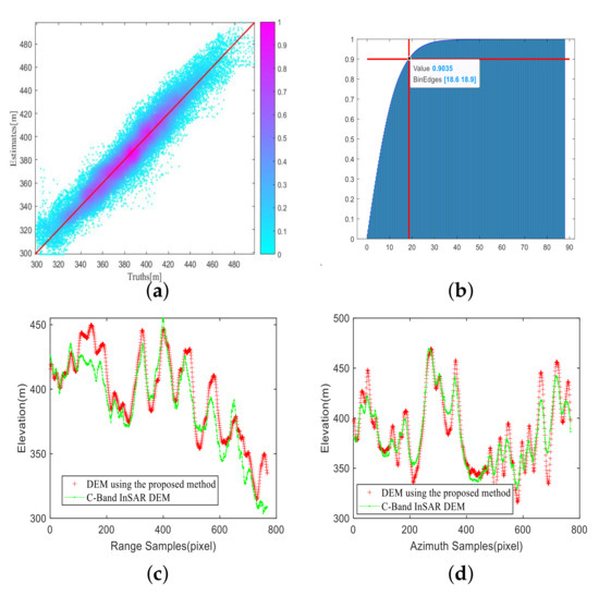
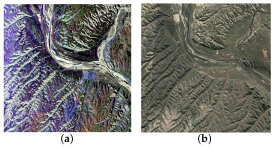
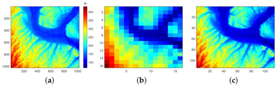
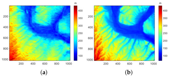
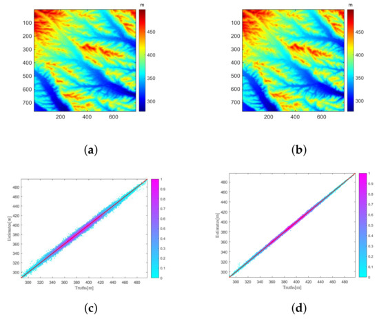
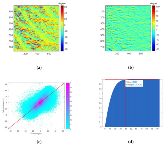
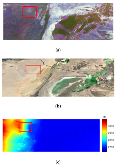
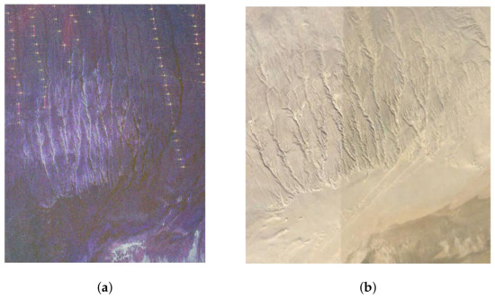
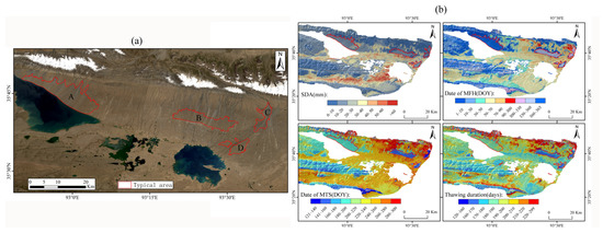
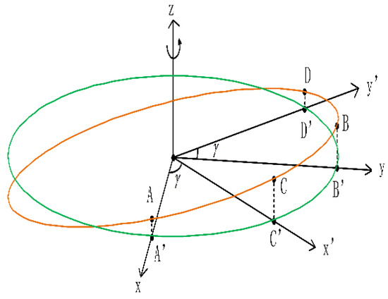
The low-earth-orbit synthetic aperture radar (SAR) can achieve enhanced remote-sensing capabilities by exploiting the large-scale and long-duration beam coverage of a geosynchronous (GEO) SAR illuminator. Different bistatic imaging modes can be implemented by the steering of an antenna beam onboard the LEO receiver, such as high-resolution sliding-spotlight mode. In this paper, the accurate focusing of GEO-LEO bistatic SAR (GEO-LEO BiSAR) in sliding-spotlight mode is investigated. First, the two major problems of the accurate bistatic range model, i.e., curved trajectory within long integration time and ‘stop-and-go’ assumption error, for sliding-spotlight GEO-LEO BiSAR are analyzed. Then, a novel bistatic range model based on equivalent circular orbit trajectory is proposed to accurately represent the range history of GEO-LEO BiSAR in sliding-spotlight mode. Based on the proposed range model, a frequency-domain imaging method is put forward. First, a modified two-step preprocessing method is implemented to remove the Doppler aliasing caused by azimuth variance of Doppler centroid and beam steering. Then, an azimuth trajectory scaling is formulated to remove the azimuth variance of motion parameters due to curved trajectory. A modified frequency-domain imaging method is derived to eliminate the 2-D spatial variance and achieve accurate focusing of the echo data. Finally, imaging results and analysis on both simulated data and real data from an equivalent BiSAR experiment validate the effectiveness of the proposed method.
Full article

Figure 1


