Next Issue
Volume 6, March
Previous Issue
Volume 5, September


Climate, Volume 5, Issue 4 (December 2017) – 22 articles

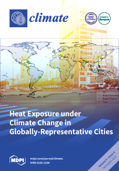
Cover Story (view full-size image): We quantified increases in monthly mean temperatures for 246 globally-representative cities in the Sustainable Healthy Urban Environments (SHUE) database using 18 global climate models. Under a high greenhouse gas emissions scenario, temperature increases in all cities exceeded 2 °C in the hottest month of the year by 2100 (relative to 2017), with some cities experiencing increases of greater than 7 °C. Temperature increases were largest in cities of mid to high latitude, in humid temperate and dry climate regions, and in cities with large seasonal variation in temperature. The large increases in the mean temperatures of the hottest month will present substantial challenges to climate change adaptation and health protection in urban areas. View this paper
  • Issues are regarded as officially published after their release is announced to the table of contents alert mailing list.
  • You may sign up for e-mail alerts to receive table of contents of newly released issues.
  • PDF is the official format for papers published in both, html and pdf forms. To view the papers in pdf format, click on the "PDF Full-text" link, and use the free Adobe Reader to open them.
Order results
Result details
Section
Select all
Export citation of selected articles as:
3876 KiB  
Article
Determination of the Surface and Canopy Urban Heat Island in Athens Central Zone Using Advanced Monitoring
by Chrissa Georgakis and Mattheos Santamouris
Climate 2017, 5(4), 97; https://doi.org/10.3390/cli5040097 - 20 Dec 2017
Cited by 23 | Viewed by 4403
Abstract
The present study aims to present all the findings of micro-climate measurements that were performed by the University of Athens in the center of Athens, during the summer period. The extended experimental campaign aimed to collect thermal and air flow measurements, in different [...] Read more.
The present study aims to present all the findings of micro-climate measurements that were performed by the University of Athens in the center of Athens, during the summer period. The extended experimental campaign aimed to collect thermal and air flow measurements, in different measuring points along a main street in the city center, in order to estimate the surface and canopy heat island intensity. In this work, the methodology of collecting the data, the experimental procedure, the equipment used, and lastly, the results are being presented. Comparison with the meteorological conditions that are recorded in the National Observatory of Athens, for the same period, lead to important conclusions about the local microclimate in the center of Athens and specifically the magnitude of the heat island effect. Particularly, in the denser area of the city after midday, air temperature increases reaching values up to 5 degrees higher than the one recorded in the suburban area. On the contrary, early in the morning the air temperature of the “green area” of the city was found to be lower up to 2 degrees than the corresponding in the suburban area. Full article
Show Figures

Figure 1

10273 KiB  
Article
Relation between Short-Term and Long-Term Variations of Precipitation
by Klemens Hocke
Climate 2017, 5(4), 96; https://doi.org/10.3390/cli5040096 - 14 Dec 2017
Cited by 2 | Viewed by 3549
Abstract
It is often stated that short-term precipitation of synoptical weather is related to trends or interannual variations of precipitation. We analyzed nine long-term series of daily precipitation values of the Global Historical Climatology Network (GHCN-D V2.0). Generally, the mean amplitude of short-term variations [...] Read more.
It is often stated that short-term precipitation of synoptical weather is related to trends or interannual variations of precipitation. We analyzed nine long-term series of daily precipitation values of the Global Historical Climatology Network (GHCN-D V2.0). Generally, the mean amplitude of short-term variations increases (decreases) if there is a positive (negative) interannual anomaly of precipitation, respectively. In all cases, the amplitude of the short-term variations (periods < 10 days) clearly correlates with the long-term variations (periods > 1.5 years) of precipitation. The correlation coefficient is between 0.7 and 0.95 at periods <8 days. For Kukuihaele (Hawaii), the correlation maximizes at a period of about 14 days. In the other cases, the maximum of the correlation is reached at periods <5 days. Full article
(This article belongs to the Special Issue Decadal Variability and Predictability of Climate)
Show Figures

Figure 1

391 KiB  
Review
An Overview of Mitigation and Adaptation Needs and Strategies for the Livestock Sector
by Yuquan W. Zhang, Bruce A. McCarl and Jason P. H. Jones
Climate 2017, 5(4), 95; https://doi.org/10.3390/cli5040095 - 13 Dec 2017
Cited by 27 | Viewed by 15231
Abstract
The livestock sector is vulnerable to climate change and related policy in two ways. First, livestock production and performance are directly impacted by climate with many projected effects being negative. Second, the sector may need to alter operations to limit the effects of [...] Read more.
The livestock sector is vulnerable to climate change and related policy in two ways. First, livestock production and performance are directly impacted by climate with many projected effects being negative. Second, the sector may need to alter operations to limit the effects of climate change through adaptation and mitigation. Potential adaptation strategies involve land use decisions, animal feeding changes, genetic manipulation and alterations in species and/or breeds. In terms of mitigation, livestock is a substantial contributor to global non-CO2 greenhouse gas emissions. Mitigation opportunities involve altered land use for grazing and feed production, feeding practices, manure treatment and herd size reduction. In addition, strengthening institutions that promote markets and trade, as well as local support programs can help both mitigation and adaptation. Previous literature has summarized the options available to individual producers. This overview extends the literature by including sector-level response as well as the relationships between adaptation and mitigation activities. Full article
(This article belongs to the Special Issue Strategies for Climate Mitigation and Adaptation in Agriculture)
Show Figures

Figure 1

528 KiB  
Article
Trend of Outbreak of Thermal Illness Patients Based on Temperature 2002–2013 in Korea
by Jungeun Kim, Kyoung Jun Song, Ki Jeong Hong and Young Sun Ro
Climate 2017, 5(4), 94; https://doi.org/10.3390/cli5040094 - 13 Dec 2017
Cited by 6 | Viewed by 3791
Abstract
Climate change can have serious impacts on human health, resulting in increased healthcare utilization. Many studies on the relationship between mortality and temperature exist, but few studies focus on heat related outbreaks. Our objective was to verify the relationship between ambient temperature and [...] Read more.
Climate change can have serious impacts on human health, resulting in increased healthcare utilization. Many studies on the relationship between mortality and temperature exist, but few studies focus on heat related outbreaks. Our objective was to verify the relationship between ambient temperature and heat related illnesses during the summer months. This study analyzed the National Health Insurance Service (NHIS) database. Patients with an ICD-10 code T67 (Effects of Heat and Light) presenting between May and September were included. Generalized additive models (GAM) were used to determine the association between ambient temperature and heat related illnesses including differences by region and patient age. A total of 335,759 patients with heat related illnesses were identified from 2002 to 2013. The number of heat related illnesses increased from 14,994 in 2002 to 29,332 in 2013. For every 1 °C increase in the daily temperature above 29.5 °C, the number of patients with heat related illnesses also increased (RR 1.060; 95% CI, 1.059 to 1.061). In addition, a higher association between temperature and outbreaks of heat related to elderly patients (RR 1.084; 95% CI, 1.081 to 1.086) and rural patients (RR 1.229; 95% CI, 1.208 to 1.251) was identified. The association between the daily maximum temperature and outbreaks of heat related illness is identified. The number of patients with heat related illnesses increased over the years and was especially noted in elderly and rural patients. Full article
(This article belongs to the Special Issue Decadal Variability and Predictability of Climate)
Show Figures

Figure 1

4907 KiB  
Article
The Challenge of Urban Heat Exposure under Climate Change: An Analysis of Cities in the Sustainable Healthy Urban Environments (SHUE) Database
by James Milner, Colin Harpham, Jonathon Taylor, Mike Davies, Corinne Le Quéré, Andy Haines and Paul Wilkinson
Climate 2017, 5(4), 93; https://doi.org/10.3390/cli5040093 - 13 Dec 2017
Cited by 10 | Viewed by 6211
Abstract
The so far largely unabated emissions of greenhouse gases (GHGs) are expected to increase global temperatures substantially over this century. We quantify the patterns of increases for 246 globally-representative cities in the Sustainable Healthy Urban Environments (SHUE) database. We used an ensemble of [...] Read more.
The so far largely unabated emissions of greenhouse gases (GHGs) are expected to increase global temperatures substantially over this century. We quantify the patterns of increases for 246 globally-representative cities in the Sustainable Healthy Urban Environments (SHUE) database. We used an ensemble of 18 global climate models (GCMs) run under a low (RCP2.6) and high (RCP8.5) emissions scenario to estimate the increase in monthly mean temperatures by 2050 and 2100 based on 30-year averages. Model simulations were from the Coupled Model Inter-comparison Project Phase 5 (CMIP5). Annual mean temperature increases were 0.93 degrees Celsius by 2050 and 1.10 degrees Celsius by 2100 under RCP2.6, and 1.27 and 4.15 degrees Celsius under RCP8.5, but with substantial city-to-city variation. By 2100, under RCP2.6 no city exceeds an increase in Tmean > 2 degrees Celsius (relative to a 2017 baseline), while all do under RCP8.5, some with increases in Tmean close to, or even greater than, 7 degrees Celsius. The increases were greatest in cities of mid to high latitude, in humid temperate and dry climate regions, and with large seasonal variation in temperature. Cities are likely to experience large increases in hottest month mean temperatures under high GHG emissions trajectories, which will often present substantial challenges to adaptation and health protection. Full article
(This article belongs to the Special Issue Urban Climate, Air Pollution, and Public Health)
Show Figures

Figure 1

7004 KiB  
Article
Assessing Radiometric Stability of the 17-Plus-Year TRMM Microwave Imager 1B11 Version-8 (GPM05) Brightness Temperature Product
by Ruiyao Chen, Faisal Alquaied and W. Linwood Jones
Climate 2017, 5(4), 92; https://doi.org/10.3390/cli5040092 - 07 Dec 2017
Cited by 3 | Viewed by 3588
Abstract
The NASA Tropical Rainfall Measuring Mission (TRMM) Microwave Imager (TMI) has produced a 17-plus-year time-series of calibrated microwave radiances that have remarkable value for investigating the effects of the Earth’s climate change over the tropics. Recently, the Global Precipitation Measurement (GPM) Inter-Satellite Radiometric [...] Read more.
The NASA Tropical Rainfall Measuring Mission (TRMM) Microwave Imager (TMI) has produced a 17-plus-year time-series of calibrated microwave radiances that have remarkable value for investigating the effects of the Earth’s climate change over the tropics. Recently, the Global Precipitation Measurement (GPM) Inter-Satellite Radiometric Calibration (XCAL) Working Group have performed various calibration and corrections that yielded the legacy TMI 1B11 Version 8 (also called GPM05) brightness temperature product, which will be released in late 2017 by the NASA Precipitation Processing System. Since TMI served as the radiometric transfer standard for the TRMM constellation microwave radiometer sensors, it is important to document its accuracy. In this paper, the various improvements applied to TMI 1B11 V8 are summarized, and the radiometric calibration stability is evaluated by comparisons with a radiative transfer model and by XCAL evaluations with the Global Precipitation Measuring Microwave Imager during their 13-month overlap period. Evaluation methods will be described and results will be presented, which demonstrate that TMI has achieved a radiometric stability level of a few deciKelvin over almost two decades. Full article
Show Figures

Figure 1

2277 KiB  
Article
Intensity of Urban Heat Islands in Tropical and Temperate Climates
by Margarete Cristiane de Costa Trindade Amorim and Vincent Dubreuil
Climate 2017, 5(4), 91; https://doi.org/10.3390/cli5040091 - 03 Dec 2017
Cited by 32 | Viewed by 5733
Abstract
Nowadays, most of the Earth’s population lives in urban areas. The replacement of vegetation by buildings and the general soil sealing, associated with human activity, lead to a rise in cities temperature, resulting in the formation of urban heat islands. This article aims [...] Read more.
Nowadays, most of the Earth’s population lives in urban areas. The replacement of vegetation by buildings and the general soil sealing, associated with human activity, lead to a rise in cities temperature, resulting in the formation of urban heat islands. This article aims to evaluate the intensity and the hourly maintenance of the atmospheric heat islands in two climates: one tropical (Presidente Prudente, Brazil) and one temperate (Rennes, France) throughout 2016. For this, air temperature and hourly averages were measured and calculated using both a HOBO datalogger (U23-002—protected under the same RS3 brand) and weather stations Davis Vantage PRO 2. The daily evolution of the heat islands presented characteristics that varied according to the hours and seasons of the year. For both Rennes and Presidente Prudente, the largest magnitudes occurred overnight, being more greatly expressed in the tropical environment and during the driest months (winter in the tropical city and summer in the temperate one). The variability of synoptic conditions from one month to another also leads to a great heterogeneity of UHI intensity throughout the year. Full article
(This article belongs to the Special Issue Studies and Perspectives of Climatology in Brazil)
Show Figures

Figure 1

10473 KiB  
Article
Comparison of Satellite Rainfall Estimates and Rain Gauge Measurements in Italy, and Impact on Landslide Modeling
by Mauro Rossi, Dalia Kirschbaum, Daniela Valigi, Alessandro Cesare Mondini and Fausto Guzzetti
Climate 2017, 5(4), 90; https://doi.org/10.3390/cli5040090 - 03 Dec 2017
Cited by 28 | Viewed by 10982
Abstract
Landslides can be triggered by intense or prolonged rainfall. Rain gauge measurements are commonly used to predict landslides even if satellite rainfall estimates are available. Recent research focuses on the comparison of satellite estimates and gauge measurements. The rain gauge data from the [...] Read more.
Landslides can be triggered by intense or prolonged rainfall. Rain gauge measurements are commonly used to predict landslides even if satellite rainfall estimates are available. Recent research focuses on the comparison of satellite estimates and gauge measurements. The rain gauge data from the Italian network (collected in the system database “Verifica Rischio Frana”, VRF) are compared with the National Aeronautics and Space Administration (NASA) Tropical Rainfall Measuring Mission (TRMM) products. For the purpose, we couple point gauge and satellite rainfall estimates at individual grid cells, evaluating the correlation between gauge and satellite data in different morpho-climatological conditions. We then analyze the statistical distributions of both rainfall data types and the rainfall events derived from them. Results show that satellite data underestimates ground data, with the largest differences in mountainous areas. Power-law models, are more appropriate to correlate gauge and satellite data. The gauge and satellite-based products exhibit different statistical distributions and the rainfall events derived from them differ. In conclusion, satellite rainfall cannot be directly compared with ground data, requiring local investigation to account for specific morpho-climatological settings. Results suggest that satellite data can be used for forecasting landslides, only performing a local scaling between satellite and ground data. Full article
Show Figures

Figure 1

985 KiB  
Article
Analysis of Farmer’s Choices for Climate Change Adaptation Practices in South-Western Uganda, 1980–2009
by Alex Zizinga, Richard Y. M. Kangalawe, Andrew Ainslie, Moses M. Tenywa, Jackson Majaliwa, Naome Jones Saronga and Esther E. Amoako
Climate 2017, 5(4), 89; https://doi.org/10.3390/cli5040089 - 02 Dec 2017
Cited by 25 | Viewed by 7611
Abstract
Climate change is a serious threat to the livelihoods of rural communities, particularly in mountainous areas because they are very sensitive to such changes. In this study, we assessed the household determinants to climate change adaptation drawing from a case study of agricultural [...] Read more.
Climate change is a serious threat to the livelihoods of rural communities, particularly in mountainous areas because they are very sensitive to such changes. In this study, we assessed the household determinants to climate change adaptation drawing from a case study of agricultural adaptation in the Mount Rwenzori area of South Western Uganda. The study identified the major adaptation practices that are adopted by farmers to cope with the impacts of climate change and using available on-farm technologies. A total of 143 smallholder farmers were sampled and interviewed using field based questionnaires, field observations, and key informant interviews. Data was cleaned, entered and analysed using SPSS and Stata software for descriptive statistics. Thereafter, a Multinomial logistic regression model was used to assess the drivers of farmers’ choice for adaptation practices, factors influencing the choice of adaptation, and barriers. The major adaptation practices that were identified included; use of different crop varieties, tree planting, soil and water conservation, early and late planting, and furrow irrigation. Discrete choice model results indicated the age of the household head, experience in farming, household size, climate change shocks, land size, use of agricultural inputs, landscape position (location), and crop yield varied significantly (p > 0.05), which influenced farmers’ choice of climate change adaptation practices. The main barriers to adaptation included inadequate information on adaptation methods and financial constraints, leading us to conclude that contextual adaptation practices are more desirable for adoption to farmers. Adapting to climate change needs support from government and other stakeholders, however the implementation is more successful when appropriate and suitable choices are employed. Full article
(This article belongs to the Special Issue Climate Impacts and Resilience in the Developing World)
Show Figures

Figure 1

4015 KiB  
Article
The Role of Climate in the Collapse of the Maya Civilization: A Bibliometric Analysis of the Scientific Discourse
by Werner Marx, Robin Haunschild and Lutz Bornmann
Climate 2017, 5(4), 88; https://doi.org/10.3390/cli5040088 - 30 Nov 2017
Cited by 11 | Viewed by 10494
Abstract
This bibliometric analysis deals with research on the collapse of the Maya civilization—a research topic with a long-lasting history, which has been boosted significantly by recent paleoclimatic research. The study is based on a publication set of 433 papers published between 1923 and [...] Read more.
This bibliometric analysis deals with research on the collapse of the Maya civilization—a research topic with a long-lasting history, which has been boosted significantly by recent paleoclimatic research. The study is based on a publication set of 433 papers published between 1923 and 2016. The publications covered by the Web of Science (WoS) show a significant increase since 1990, reaching about 30 papers per year at present. The results show that the current discourse on the collapse of the Maya civilization is focused on the role of climate as a major factor for the demise of this ancient civilization. The bibliometric analyses also reveal that (1) paleoclimatic records become numerous and are increasingly better dated; (2) the explanatory power of the records has been significantly increased by analyzing samples from regions closer to the relevant Maya sites; and (3) interdisciplinary cooperation of the humanities (archeology, anthropology, history) with natural sciences disciplines (geoscience, ecology, paleoclimatology, meteorology) seems to be highly promising. The collapse of the Maya civilization is a good example of how natural sciences entered research in the humanities and social sciences (anthropology, archeology, history) and boosted research (and solutions) around long-discussed, but unsolved questions. Full article
Show Figures

Figure 1

1603 KiB  
Article
Demonstrating the Effect of Forage Source on the Carbon Footprint of a Canadian Dairy Farm Using Whole-Systems Analysis and the Holos Model: Alfalfa Silage vs. Corn Silage
by Shannan M. Little, Chaouki Benchaar, H. Henry Janzen, Roland Kröbel, Emma J. McGeough and Karen A. Beauchemin
Climate 2017, 5(4), 87; https://doi.org/10.3390/cli5040087 - 24 Nov 2017
Cited by 28 | Viewed by 8476
Abstract
Before recommending a feeding strategy for greenhouse gas (GHG) mitigation, it is important to conduct a holistic assessment of all related emissions, including from those arising from feed production, digestion of these feeds, managing the resulting manure, and other on-farm production processes and [...] Read more.
Before recommending a feeding strategy for greenhouse gas (GHG) mitigation, it is important to conduct a holistic assessment of all related emissions, including from those arising from feed production, digestion of these feeds, managing the resulting manure, and other on-farm production processes and inputs. Using a whole-systems approach, the Holos model, and experimentally measured data, this study compares the effects of alfalfa silage- versus corn silage-based diets on GHG estimates in a simulated Canadian dairy production system. When all emissions and sources are accounted for, the differences between the two forage systems in terms of overall net GHG emissions were minimal. Utilizing the functional units of milk, meat, and total energy in food products generated by the system, the comparison demonstrates very little difference between the two silage production systems. However, the corn silage system generated 8% fewer emissions per kg of protein in food products as compared to the alfalfa silage system. Exploratory analysis of the impact of the two silage systems on soil carbon showed alfalfa silage has greater potential to store carbon in the soil. This study reinforces the need to utilize a whole-systems approach to investigate the interrelated effects of management choices. Reported GHG reduction factors cannot be simply combined additively because the interwoven effects of management choices cascade through the entire system, sometimes with counter-intuitive outcomes. It is necessary to apply this whole-systems approach before implementing changes in management intended to reduce GHG emissions and improve sustainability. Full article
(This article belongs to the Special Issue Strategies for Climate Mitigation and Adaptation in Agriculture)
Show Figures

Figure 1

2716 KiB  
Article
A Statistical Analysis of the Relationship between Brown Haze and Surface Air Pollution Levels on Respiratory Hospital Admissions in Auckland, New Zealand
by Kim Natasha Dirks, James Scarfe, Nicholas Philip Talbot, Roger Marshall and Jennifer Anne Salmond
Climate 2017, 5(4), 86; https://doi.org/10.3390/cli5040086 - 23 Nov 2017
Cited by 9 | Viewed by 4589
Abstract
Eleven years of hospital admissions data for Auckland, New Zealand for respiratory conditions are analyzed using a Poisson regression modelling approach, incorporating a spline function to represent time, based on a detailed record of haze events and surface air pollution levels over an [...] Read more.
Eleven years of hospital admissions data for Auckland, New Zealand for respiratory conditions are analyzed using a Poisson regression modelling approach, incorporating a spline function to represent time, based on a detailed record of haze events and surface air pollution levels over an eleven-year period, taking into account the daily average temperature and humidity, the day of the week, holidays and trends over time. NO2 was the only pollutant to show a statistically significant increase (p = 0.009) on the day of the haze event for the general population. Ambient concentrations of CO, NO and NO2 were significantly associated with admissions with an 11-day lag period for the 0–14 year age group and a 5–7 day lag period for the 65+ year age group. A 3-day lag period was found for the 15–64 year age group for CO, NO and PM10. Finally, the incidence of brown haze was linked to significant increases in hospital admissions. A lag period of 5 days was recorded between haze and subsequent increases in admissions for the 0–14 year age group and the 65+ group and an 11-day lag for the 15–64 year age group. The results provide the first statistical link between Auckland brown haze events, surface air pollution and respiratory health. Medical institutions and practitioners could benefit from improved capacity to predict Auckland’s brown haze events in order prepare for the likely increases in respiratory admissions over the days ahead. Full article
(This article belongs to the Special Issue Urban Climate, Air Pollution, and Public Health)
Show Figures

Figure 1

17129 KiB  
Article
The Role of Social Networks in Agricultural Adaptation to Climate Change: Implications for Sustainable Agriculture in Pakistan
by Muhammad Abid, Grace Ngaruiya, Jürgen Scheffran and Farhad Zulfiqar
Climate 2017, 5(4), 85; https://doi.org/10.3390/cli5040085 - 23 Nov 2017
Cited by 60 | Viewed by 12153
Abstract
Incorporating adaptation into subsistence farming systems is an important strategy to reduce damages related to climate change and to protect livelihoods in developing countries. Using a dataset of 450 farm households collected from three agro-ecological zones, this study examines rural networks, assesses farm-level [...] Read more.
Incorporating adaptation into subsistence farming systems is an important strategy to reduce damages related to climate change and to protect livelihoods in developing countries. Using a dataset of 450 farm households collected from three agro-ecological zones, this study examines rural networks, assesses farm-level institutional support and documents any existing structural gaps on climate change adaptation in the agricultural sector of Pakistan. For this purpose, a social network analysis method is used. The study findings reveal that farmers reported a decrease in crop production and increase in pests and diseases due to climate change. Further, changing crop varieties, sowing dates, input mixes and planting trees are the key measures adopted by farmers. Lack of information, finances and resources are the key adaptation constraints. The study findings show that only 28% and 13% of the respondents do not have access to financial services and climate adaptation knowledge, respectively. Support to farmers mainly consists of marketing information and farm equipment from community-based organizations, while private institutions offer weather forecasting services. Public institutions are poorly represented in the network analysis. We also found that extension services are key institutions in the climate adaptation network, while agricultural credits, post-harvest services and marketing of produce were dominant but weakly connected in the financial support network. We also found that with an increase in the provision of services at the farm level, farmers not only adapt more but also move from low-cost and short-term measures to advanced measures. This study proposes an integrated framework to improve the stakeholders’ networking through different kind of partnerships and better adaptation to climate change. Full article
(This article belongs to the Special Issue Strategies for Climate Mitigation and Adaptation in Agriculture)
Show Figures

Figure 1

40621 KiB  
Article
Cluster Analysis of Monthly Precipitation over the Western Maritime Continent under Climate Change
by Saurabh K Singh, Edmond Yat-Man Lo and Xiaosheng Qin
Climate 2017, 5(4), 84; https://doi.org/10.3390/cli5040084 - 08 Nov 2017
Cited by 6 | Viewed by 8727
Abstract
Changes in climate because of global warming during the 20th and 21st centuries have a direct impact on the hydrological cycle as driven by precipitation. However, studying precipitation over the Western Maritime Continent (WMC) is a great challenge, as the WMC has a [...] Read more.
Changes in climate because of global warming during the 20th and 21st centuries have a direct impact on the hydrological cycle as driven by precipitation. However, studying precipitation over the Western Maritime Continent (WMC) is a great challenge, as the WMC has a complex topography and weather system. Understanding changes in precipitation patterns and their groupings is an important aspect of planning mitigation measures to minimize flood and drought risk as well as of understanding the redistribution of precipitation arising from climate change. This paper employs Ward’s hierarchical clustering on regional climate model (RCM)-simulated monthly precipitation gridded data over 42 approximately evenly distributed grid stations from the years 2030 to 2060. The aim was to investigate spatial and temporal groupings over the four major landmasses in the WMC and to compare these with historical precipitation groupings. The results showed that the four large-scale islands of Java, Sumatra, Peninsular Malaysia and Borneo would experience a significant spatial redistribution of precipitation over the years 2030 to 2060, as compared to historical patterns from 1980 to 2005. The spatial groups were also compared for two future forcing scenarios, representative concentration pathways (RCPs) 4.5 and 8.5, and different groupings over the Borneo region were observed. Full article
(This article belongs to the Special Issue Modified Hydrological Cycle under Global Warming)
Show Figures

Figure 1

4794 KiB  
Article
Deconstructing Global Temperature Anomalies: An Hypothesis
by Norman C. Treloar
Climate 2017, 5(4), 83; https://doi.org/10.3390/cli5040083 - 06 Nov 2017
Cited by 5 | Viewed by 5727
Abstract
This paper evaluates contributions to global temperature anomalies from greenhouse gas concentrations and from a source of natural variability. There is no accepted causation for the apparent interrelationships between multidecadal oscillations and regime changes in atmospheric circulation, upwelling, and the slowdowns in global [...] Read more.
This paper evaluates contributions to global temperature anomalies from greenhouse gas concentrations and from a source of natural variability. There is no accepted causation for the apparent interrelationships between multidecadal oscillations and regime changes in atmospheric circulation, upwelling, and the slowdowns in global surface temperatures associated with a ~60-year oscillation. Exogenous tidal forcing is hypothesized as a major causal agent for these elements, with orthogonal components in tidal forcing generating zonal and meridional regime-dependent processes in the climate system. Climate oscillations are simulated at quasi-biennial to multidecadal timescales by tidal periodicities determined by close approaches of new or full moon to the earth. Subtracting a tidal analog of the ~60-year oscillation from global mean surface temperatures reveals an exponential component comparable with greenhouse gas emission scenarios, and which is responsible for almost 90% or contemporary global temperature increases. Residual subdecadal temperature anomalies correlate with the subdecadal variability of evolved carbon dioxide (CO2), ENSO activity and tidal components, and indicate a causal sequence from tidal forcing to greenhouse gas (GHG) release to temperature increase. Tidal periodicities can all be expressed in terms of four fundamental frequencies. Because of the potential importance of this formulation, tests are urged using general circulation models. Full article
Show Figures

Figure 1

12471 KiB  
Article
Investigation of the Spatio-Temporal Variations in Atmosphere Thickness Pattern of Iran and the Middle East with Special Focus on Precipitation in Iran
by Iman Rousta, Mehdi Doostkamian, Allah Morad Taherian, Esmaeil Haghighi, Hamid Reza Ghafarian Malamiri and Haraldur Ólafsson
Climate 2017, 5(4), 82; https://doi.org/10.3390/cli5040082 - 01 Nov 2017
Cited by 23 | Viewed by 6038
Abstract
In this study, Geopotential Height (between 500 and 1000 hPa) and precipitation data were obtained from the NCEP/NCAR and IRIMO (Iran Meteorological Organization) for 60 years (1950–2010), respectively. Descriptive features of Atmospheric Thickness (hereafter AT) were calculated and analyzed by using the Mann-Kendall [...] Read more.
In this study, Geopotential Height (between 500 and 1000 hPa) and precipitation data were obtained from the NCEP/NCAR and IRIMO (Iran Meteorological Organization) for 60 years (1950–2010), respectively. Descriptive features of Atmospheric Thickness (hereafter AT) were calculated and analyzed by using the Mann-Kendall method. The results showed that the maximum AT was recorded in summer because of the dominance of the dynamic, hot subtropical high pressure. Furthermore, upper latitudes experienced more variations in terms of AT. The trend of variations showed that AT has significantly increased in recent years. Further, Saudi Arabia and the Red Sea experienced a more measurable increase in AT. On the other hand, AT had a declining trend over northern parts of Iraq and Iran, but it failed to be statistically considerable. The trend of AT had numerous variations over western parts of Iran, northwestern parts of Iraq, central and eastern parts of Turkey, and a large area of Syria. AT analysis of Iran’s precipitations showed that patterns in the Sea Level Pressure were caused by East Mediterranean, Sudan, and Saudi Arabia low pressures and the high pressures that were located in Europe and Kazakhstan. In addition, in upper-air (500 Hpa), the patterns were influenced by high Mediterranean trough and blocking phenomenon that come from higher latitudes. Full article
(This article belongs to the Special Issue Decadal Variability and Predictability of Climate)
Show Figures

Figure 1

3441 KiB  
Article
Observed Regional Climate Variability during the Last 50 Years in Reindeer Herding Cooperatives of Finnish Fell Lapland
by Élise Lépy and Leena Pasanen
Climate 2017, 5(4), 81; https://doi.org/10.3390/cli5040081 - 16 Oct 2017
Cited by 13 | Viewed by 4903
Abstract
In Finnish Lapland, reindeer herders’ activity is strongly dependent on the surrounding natural environment, which is directly exposed to environmental changes and climatic variations. By assessing whether there is any evidence of change in climate in Fell Lapland over the last 50 years, [...] Read more.
In Finnish Lapland, reindeer herders’ activity is strongly dependent on the surrounding natural environment, which is directly exposed to environmental changes and climatic variations. By assessing whether there is any evidence of change in climate in Fell Lapland over the last 50 years, this paper attempts to link global climatic trends with local conditions and respond to the need of information at the local level. It aims at assessing the changes in temperature, precipitation and snow cover at a regional and local scale, as well as determining the climatic trends for the period 1960–2011. Statistical methods were used to conduct analyses of the regional homogeneity, the annual and seasonal variability, and the cold intensity. The results show that the regional climate is not homogeneous and differences exist between locations. Nevertheless, it can be concluded that, in general, a warming trend is discernible for the period 1960–2011, frost and thaw cycles slightly increase, and variations in mean temperatures are more important in the winter. Precipitation is more variable according to the site but, in general, precipitation is increasing with time, especially in the winter, and the snow cover does not seem to contain any discernible trend. Full article
Show Figures

Graphical abstract

1991 KiB  
Article
Air Pollution and Human Health in Kolkata, India: A Case Study
by Md. Senaul Haque and R. B. Singh
Climate 2017, 5(4), 77; https://doi.org/10.3390/cli5040077 - 12 Oct 2017
Cited by 56 | Viewed by 46197
Abstract
Urban air quality in most megacities has been found to be critical and Kolkata Metropolitan City is no exception to this. An analysis of ambient air quality in Kolkata was done by applying the Exceedance Factor (EF) method, where the presence of listed [...] Read more.
Urban air quality in most megacities has been found to be critical and Kolkata Metropolitan City is no exception to this. An analysis of ambient air quality in Kolkata was done by applying the Exceedance Factor (EF) method, where the presence of listed pollutants’ (RPM, SPM, NO2, and SO2) annual average concentration are classified into four different categories; namely critical, high, moderate, and low pollution. Out of a total of 17 ambient air quality monitoring stations operating in Kolkata, five fall under the critical category, and the remaining 12 locations fall under the high category of NO2 concentration, while for RPM, four record critical, and 13 come under the high pollution category. The causes towards the high concentration of pollutants in the form of NO2 and RPM have been identified in earlier studies as vehicular emission (51.4%), followed by industrial sources (24.5%) and dust particles (21.1%). Later, a health assessment was undertaken with a structured questionnaire at some nearby dispensaries which fall under areas with different ambient air pollution levels. Three dispensaries have been surveyed with 100 participants. It shows that respondents with respiratory diseases (85.1%) have outnumbered waterborne diseases (14.9%) and include acute respiratory infections (ARI) (60%), chronic obstructive pulmonary diseases (COPD) (7.8%), upper track respiratory infection (UTRI) (1.2%), Influenza (12.7%), and acid fast bacillus (AFB) (3.4%). Although the pollution level has been recorded as critical, only 39.3% of the respondents have felt that outdoor (air) pollution has affected their health. Full article
(This article belongs to the Special Issue Urban Climate, Air Pollution, and Public Health)
Show Figures

Figure 1

288 KiB  
Review
The Impact of Climate Change on Biodiversity in Nepal: Current Knowledge, Lacunae, and Opportunities
by Aishwarya Bhattacharjee, José D. Anadón, David J. Lohman, Tenzing Doleck, Tarendra Lakhankar, Bharat Babu Shrestha, Praseed Thapa, Durga Devkota, Sundar Tiwari, Ajay Jha, Mohan Siwakoti, Naba R. Devkota, Pramod K. Jha and Nir Y. Krakauer
Climate 2017, 5(4), 80; https://doi.org/10.3390/cli5040080 - 11 Oct 2017
Cited by 38 | Viewed by 15511
Abstract
Nepal has an extreme altitudinal range from 60–8850 m with heterogeneous topography and distinct climatic zones. The country is considered a biodiversity hotspot, with nearly a quarter of the land area located in protected areas. Nepal and the surrounding Himalayan region are particularly [...] Read more.
Nepal has an extreme altitudinal range from 60–8850 m with heterogeneous topography and distinct climatic zones. The country is considered a biodiversity hotspot, with nearly a quarter of the land area located in protected areas. Nepal and the surrounding Himalayan region are particularly vulnerable to climate change because of their abrupt ecological and climatic transitions. Tens of millions of people rely on the region’s ecosystem services, and observed and modeled warming trends predict increased climate extremes in the Himalayas. To study the ecological impacts of climate change in Nepal and inform adaptation planning, we review the literature on past, present, and predicted future climatic changes and their impacts on ecological diversity in Nepal. We found few studies focusing on organisms, while research on species and communities was more common. Most studies document or predict species range shifts and changes in community composition. Results of these few investigations highlight major lacunae in research regarding the effects of changing climate on species comprising the Himalayan biota. Further empirical work is needed at all levels of biological organization to build on information regarding direct ecological impacts of climatic changes in the region. Countries face an ever-increasing threat of climate change, and Nepal has strong physiographic, elevational, and climatic gradients that could provide a useful model for studying the effects of climate change on a mountainous, and highly biodiverse, area. Full article
(This article belongs to the Special Issue Climate Impacts and Resilience in the Developing World)
8060 KiB  
Article
Comparative Study of Monsoon Rainfall Variability over India and the Odisha State
by K C Gouda, Sanjeeb Kumar Sahoo, Payoshni Samantray and Himesh Shivappa
Climate 2017, 5(4), 79; https://doi.org/10.3390/cli5040079 - 10 Oct 2017
Cited by 14 | Viewed by 13741
Abstract
Indian summer monsoon (ISM) plays an important role in the weather and climate system over India. The rainfall during monsoon season controls many sectors from agriculture, food, energy, and water, to the management of disasters. Being a coastal province on the eastern side [...] Read more.
Indian summer monsoon (ISM) plays an important role in the weather and climate system over India. The rainfall during monsoon season controls many sectors from agriculture, food, energy, and water, to the management of disasters. Being a coastal province on the eastern side of India, Odisha is one of the most important states affected by the monsoon rainfall and associated hydro-meteorological systems. The variability of monsoon rainfall is highly unpredictable at multiple scales both in space and time. In this study, the monsoon variability over the state of Odisha is studied using the daily gridded rainfall data from India Meteorological Department (IMD). A comparative analysis of the behaviour of monsoon rainfall at a larger scale (India), regional scale (Odisha), and sub-regional scale (zones of Odisha) is carried out in terms of the seasonal cycle of monsoon rainfall and its interannual variability. It is seen that there is no synchronization in the seasonal monsoon category (normal/excess/deficit) when analysed over large (India) and regional (Odisha) scales. The impact of El Niño, La Niña, and the Indian Ocean Dipole (IOD) on the monsoon rainfall at both scales (large scale and regional scale) is analysed and compared. The results show that the impact is much more for rainfall over India, but it has no such relation with the rainfall over Odisha. It is also observed that there is a positive (negative) relation of the IOD with the seasonal monsoon rainfall variability over Odisha (India). The correlation between the IAV of monsoon rainfall between the large scale and regional scale was found to be 0.46 with a phase synchronization of 63%. IAV on a sub-regional scale is also presented. Full article
(This article belongs to the Special Issue Climate Impacts and Resilience in the Developing World)
Show Figures

Figure 1

1746 KiB  
Article
The Uncertain Role of Biogenic VOC for Boundary-Layer Ozone Concentration: Example Investigation of Emissions from Two Forest Types with a Box Model
by Boris Bonn, Jürgen Kreuzwieser, Felicitas Sander, Rasoul Yousefpour, Tommaso Baggio and Oladeinde Adewale
Climate 2017, 5(4), 78; https://doi.org/10.3390/cli5040078 - 06 Oct 2017
Cited by 10 | Viewed by 5955
Abstract
High levels of air pollution including ground level ozone significantly reduce humans’ life expectancy and cause forest damage and decreased tree growth. The French Vosges and the German Black Forest are regions well-known for having the highest tropospheric ozone concentrations at remote forested [...] Read more.
High levels of air pollution including ground level ozone significantly reduce humans’ life expectancy and cause forest damage and decreased tree growth. The French Vosges and the German Black Forest are regions well-known for having the highest tropospheric ozone concentrations at remote forested sites in Central Europe. This box model study investigates the sensitivity of atmospheric chemistry calculations of derived ozone on differently resolved forest tree composition and volatile organic compound emissions. Representative conditions were chosen for the Upper Rhine area including the Alsatian Vosges/France and the Black Forest/Germany during summer. This study aims to answer the following question: What level of input detail for Alsace and Black Forest tree mixtures is required to accurately simulate ozone formation? While the French forest in Alsace—e.g., in the Vosges—emits isoprene to a substantially higher extent than the forest at the German site, total monoterpene emissions at the two sites are rather similar. However, the individual monoterpene structures, and therefore their reactivity, differs. This causes a higher ozone production rate for Vosges forest mixture conditions than for Black Forest tree mixtures at identical NOx levels, with the difference increasing with temperature. The difference in ozone formation is analyzed in detail and the short-comings of reduced descriptions are discussed. The outcome serves as a to-do-list to allow accurate future ozone predictions influenced by the climate adaptation of forests and the change in forest species composition. Full article
(This article belongs to the Special Issue Modeling Interactions Among Atmosphere, Hydrosphere, and Biosphere)
Show Figures

Figure 1

7141 KiB  
Article
The Relationship between Atmospheric Carbon Dioxide Concentration and Global Temperature for the Last 425 Million Years
by W. Jackson Davis
Climate 2017, 5(4), 76; https://doi.org/10.3390/cli5040076 - 29 Sep 2017
Cited by 33 | Viewed by 67546
Abstract
Assessing human impacts on climate and biodiversity requires an understanding of the relationship between the concentration of carbon dioxide (CO2) in the Earth’s atmosphere and global temperature (T). Here I explore this relationship empirically using comprehensive, recently-compiled databases of stable-isotope proxies [...] Read more.
Assessing human impacts on climate and biodiversity requires an understanding of the relationship between the concentration of carbon dioxide (CO2) in the Earth’s atmosphere and global temperature (T). Here I explore this relationship empirically using comprehensive, recently-compiled databases of stable-isotope proxies from the Phanerozoic Eon (~540 to 0 years before the present) and through complementary modeling using the atmospheric absorption/transmittance code MODTRAN. Atmospheric CO2 concentration is correlated weakly but negatively with linearly-detrended T proxies over the last 425 million years. Of 68 correlation coefficients (half non-parametric) between CO2 and T proxies encompassing all known major Phanerozoic climate transitions, 77.9% are non-discernible (p > 0.05) and 60.0% of discernible correlations are negative. Marginal radiative forcing (ΔRFCO2), the change in forcing at the top of the troposphere associated with a unit increase in atmospheric CO2 concentration, was computed using MODTRAN. The correlation between ΔRFCO2 and linearly-detrended T across the Phanerozoic Eon is positive and discernible, but only 2.6% of variance in T is attributable to variance in ΔRFCO2. Of 68 correlation coefficients (half non-parametric) between ΔRFCO2 and T proxies encompassing all known major Phanerozoic climate transitions, 75.0% are non-discernible and 41.2% of discernible correlations are negative. Spectral analysis, auto- and cross-correlation show that proxies for T, atmospheric CO2 concentration and ΔRFCO2 oscillate across the Phanerozoic, and cycles of CO2 and ΔRFCO2 are antiphasic. A prominent 15 million-year CO2 cycle coincides closely with identified mass extinctions of the past, suggesting a pressing need for research on the relationship between CO2, biodiversity extinction, and related carbon policies. This study demonstrates that changes in atmospheric CO2 concentration did not cause temperature change in the ancient climate. Full article
Show Figures

Figure 1

Previous Issue
Next Issue
Back to TopTop