Water 2022, 14(7), 1149; https://doi.org/10.3390/w14071149 - 2 Apr 2022
Cited by 2 | Viewed by 3049
Abstract
Most old urban areas of China have a dense population, severely indurated underlying surface, and highly developed underground space. Those increase the waterlogging risk and obstruct the stormwater management in old urban areas. To propose an appropriate engineering strategy for low impact development
[...] Read more.
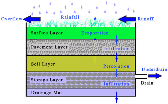
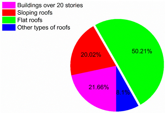
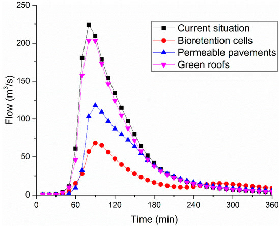
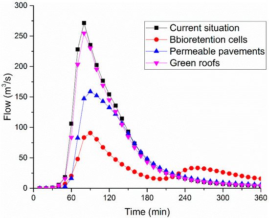
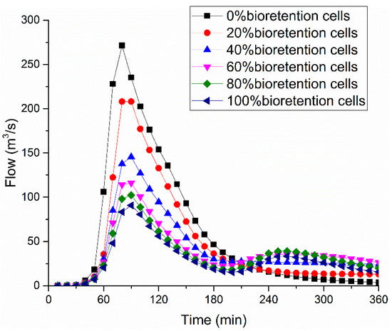
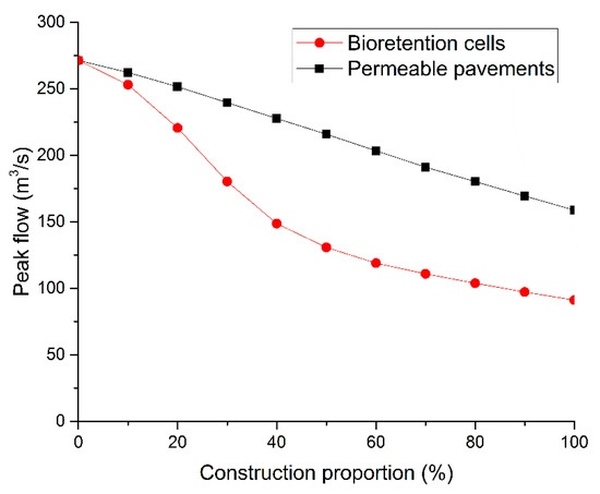
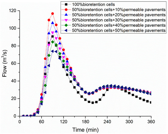
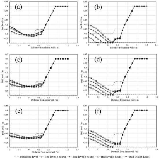
Most old urban areas of China have a dense population, severely indurated underlying surface, and highly developed underground space. Those increase the waterlogging risk and obstruct the stormwater management in old urban areas. To propose an appropriate engineering strategy for low impact development (LID) transformation in an urban area, a simulation was carried out by storm water management model (SWMM) in this project. Bioretention cells, permeable pavements, and green roofs were selected according to the study area surface. Runoff control performance of single LID control and combined schemes were compared. Results illustrate that only 50.21% of roofs can build green roofs in urban areas with dense populations, and the runoff control performance of green roofs is unsatisfactory, while bioretention cells and permeable pavements can effectively mitigate runoff caused by storms with a recurrence period less than 10 years, and combined LID controls can obtain better runoff control performance with less construction area. Those outcomes screened out the LID controls suitable for application in densely populated old urban areas and put forward reasonable engineering practice strategies. This study provides guidance and reference for the LID transformation in the densely populated old urban area.
Full article
(This article belongs to the Topic Hydrological Modeling and Engineering: Managing Risk and Uncertainties)
►
Show Figures
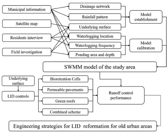
Figure 1


