Atmosphere 2021, 12(5), 609; https://doi.org/10.3390/atmos12050609 - 7 May 2021
Cited by 17 | Viewed by 4919
Abstract
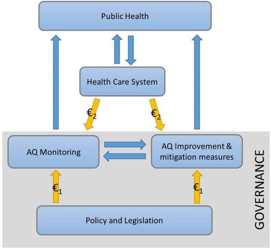
Lima is considered one of the cities with the highest air pollution in Latin America. Institutions such as DIGESA, PROTRANSPORTE and SENAMHI are in charge of permanently monitoring air quality; therefore, the air quality visualization system must manage large amounts of data of
[...] Read more.
Lima is considered one of the cities with the highest air pollution in Latin America. Institutions such as DIGESA, PROTRANSPORTE and SENAMHI are in charge of permanently monitoring air quality; therefore, the air quality visualization system must manage large amounts of data of different concentrations. In this study, a spatio-temporal visualization approach was developed for the exploration of data of the PMμ g/m
(This article belongs to the Section Air Quality)
►
Show Figures

Figure 1


