Next Issue
Volume 16, May-1
Previous Issue
Volume 16, April-1
 
 
remotesensing-logo

Journal Browser

Journal Browser

Remote Sens., Volume 16, Issue 8 (April-2 2024) – 166 articles

Cover Story (view full-size image): 
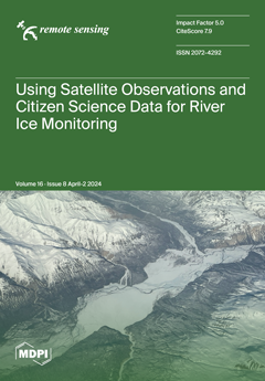
The integration of multi-satellite remote sensing and citizen science observations sets the stage for advanced monitoring of river ice dynamics in Alaska. This study leverages the Google Earth Engine platform to enhance the timeliness and accuracy of river ice observations, especially during critical freeze-up and breakup periods. By incorporating both high-resolution optical and radar data, our approach significantly improves the monitoring and analysis of river ice conditions. Furthermore, the inclusion of citizen science data provides essential ground-truth insights, notably enhancing the validation and interpretation of remote sensing products. Together, these methodologies not only refine ice monitoring technologies but also deepen our understanding of ice-induced hazards. View this paper
  • Issues are regarded as officially published after their release is announced to the table of contents alert mailing list.
  • You may sign up for e-mail alerts to receive table of contents of newly released issues.
  • PDF is the official format for papers published in both, html and pdf forms. To view the papers in pdf format, click on the "PDF Full-text" link, and use the free Adobe Reader to open them.
Order results
Result details
Section
Select all
Export citation of selected articles as:
17 pages, 7239 KiB  
Article
Focusing Algorithm of Range Profile for Plasma-Sheath-Enveloped Target
by Fangfang Shen, Xuyang Chen, Bowen Bai, Yanming Liu, Xiaoping Li and Zherui Zhang
Remote Sens. 2024, 16(8), 1475; https://doi.org/10.3390/rs16081475 - 22 Apr 2024
Viewed by 383
Abstract
In this paper, a one-dimensional (1-D) range profile of the hypersonic target enveloped by a plasma sheath is investigated. Firstly, the non-uniform property of the plasma sheath is studied and its impact on the wideband electromagnetic (EM) wave is analyzed. A wideband radar [...] Read more.
In this paper, a one-dimensional (1-D) range profile of the hypersonic target enveloped by a plasma sheath is investigated. Firstly, the non-uniform property of the plasma sheath is studied and its impact on the wideband electromagnetic (EM) wave is analyzed. A wideband radar echo model for the plasma-sheath-enveloped hypersonic target is constructed. Then, by exploiting the relationship among the incident depth, reflection intensity, and plasma velocity, it reveals that distinct scatter points in various areas of the target will suffer from varying reflection intensity and coupled velocity, leading to severe defocusing in the range profile. To tackle this issue, a novel focusing algorithm combing the Fractional Fourier Transform (FRFT) with the CLEAN technique is developed, which independently calculates the coupled plasma velocity and compensates for the phase error via a series of iterative procedures. Finally, the influence of the plasma sheath on the 1-D range profile and the effectiveness of the proposed focusing algorithm are validated through simulations. Full article
Show Figures

Figure 1

22 pages, 24080 KiB  
Article
Kinematic and Dynamic Structure of the 18 May 2020 Squall Line over South Korea
by Wishnu Agum Swastiko, Chia-Lun Tsai, Seung Hee Kim and GyuWon Lee
Remote Sens. 2024, 16(8), 1474; https://doi.org/10.3390/rs16081474 - 22 Apr 2024
Viewed by 306
Abstract
The diagonal squall line that passed through the Korean Peninsula on the 18 May 2020 was examined using wind data retrieved from multiple Doppler radar synthesis focusing on its kinematic and dynamic aspects. The low-level jet, along with warm and moist air in [...] Read more.
The diagonal squall line that passed through the Korean Peninsula on the 18 May 2020 was examined using wind data retrieved from multiple Doppler radar synthesis focusing on its kinematic and dynamic aspects. The low-level jet, along with warm and moist air in the lower level, served as the primary source of moisture supply during the initiation and formation process. The presence of a cold pool accompanying the squall line played a role in retaining moisture at the surface. As the squall line approached the Korean Peninsula, the convective bands in the northern segment (NS) and southern segment (SS) of the squall line exhibited distinct evolutionary patterns. The vertical wind shear in the NS area was more pronounced compared to that in the SS. The ascending inflow associated with the tilted updraft in the NS reached an altitude of 7 km, whereas it was only up to 4 km in the SS. The difference was caused by the strong descending rear flow, which obstructed the ascending inflow and let to significant updraft in the SS. Full article
(This article belongs to the Section Atmospheric Remote Sensing)
Show Figures

Figure 1

19 pages, 6152 KiB  
Article
Wind Profile Reconstruction Based on Convolutional Neural Network for Incoherent Doppler Wind LiDAR
by Jiawei Li, Chong Chen, Yuli Han, Tingdi Chen, Xianghui Xue, Hengjia Liu, Shuhua Zhang, Jing Yang and Dongsong Sun
Remote Sens. 2024, 16(8), 1473; https://doi.org/10.3390/rs16081473 - 22 Apr 2024
Viewed by 350
Abstract
The rapid development of artificial intelligence (AI) and deep learning has revolutionized the field of data analysis in recent years, including signal data acquired by remote sensors. Light Detection and Ranging (LiDAR) technology is widely used in atmospheric research for measuring various atmospheric [...] Read more.
The rapid development of artificial intelligence (AI) and deep learning has revolutionized the field of data analysis in recent years, including signal data acquired by remote sensors. Light Detection and Ranging (LiDAR) technology is widely used in atmospheric research for measuring various atmospheric parameters. Wind measurement using LiDAR data has traditionally relied on the spectral centroid (SC) algorithm. However, this approach has limitations in handling LiDAR data, particularly in low signal-to-noise ratio (SNR) regions. To overcome these limitations, this study leverages the capabilities of customized deep-learning techniques to achieve accurate wind profile reconstruction. The study uses datasets obtained from the European Centre for Medium Weather Forecasting (ECMWF) Reanalysis v5 (ERA5) and the mobile Incoherent Doppler LiDAR (ICDL) system constructed by the University of Science and Technology of China. We present a simulation-based approach for generating wind profiles from the statistical data and the associated theoretical calculations. Whereafter, our team constructed a convolutional neural network (CNN) model based on the U-Net architecture to replace the SC algorithm for LiDAR data post-processing. The CNN-generated results are evaluated and compared with the SC results and the ERA5 data. This study highlights the potential of deep learning-based techniques in atmospheric research and their ability to provide more accurate and reliable results. Full article
Show Figures

Graphical abstract

21 pages, 2170 KiB  
Article
ITS Efficiency Analysis for Multi-Target Tracking in a Clutter Environment
by Zvonko Radosavljević, Dejan Ivković and Branko Kovačević
Remote Sens. 2024, 16(8), 1471; https://doi.org/10.3390/rs16081471 - 22 Apr 2024
Viewed by 297
Abstract
The Integrated Track Splitting (ITS) is a multi-scan algorithm for target tracking in a cluttered environment. The ITS filter models each track as a set of mutually exclusive components, usually in the form of a Gaussian Mixture. The purpose of this research is [...] Read more.
The Integrated Track Splitting (ITS) is a multi-scan algorithm for target tracking in a cluttered environment. The ITS filter models each track as a set of mutually exclusive components, usually in the form of a Gaussian Mixture. The purpose of this research is to determine the limits of the ‘endurance’ of target tracking of the known ITS algorithm by analyzing the impact of target detection probability. The state estimate and the a-posteriori probability of component existence are computed recursively from the target existence probability, which may be used as a track quality measure for false track discrimination (FTD). The target existence probability is also calculated and used for track maintenance and track output. This article investigates the limits of the effectiveness of ITS multi-target tracking using the method of theoretical determination of the dependence of the measurements likelihood ratio on reliable detection and then practical experimental testing. Numerical simulations of the practical application of the proposed model were performed in various probabilities of target detection and dense clutter environments. Additionally, the effectiveness of the proposed algorithm in combination with filters for various types of maneuvers using Interacting Multiple Model ITS (IMMITS) algorithms was comparatively analyzed. The extensive numerical simulation (which assumes both straight and maneuvering targets) has shown which target tracking limits can be performed within different target detection probabilities and clutter densities. The simulations confirmed the derived theoretical limits of the tracking efficiency of the ITS algorithm up to a detection probability of 0.6, and compared to the IMMITS algorithm up to 0.4 in the case of target maneuvers and dense clutter environments. Full article
Show Figures

Figure 1

19 pages, 6517 KiB  
Article
Concept of Spaceborne Ocean Microwave Dual-Function Integrated Sensor for Wind and Wave Measurement
by Hang Li, Wenkang Liu, Guangcai Sun, Changhong Chen, Mengdao Xing, Zhenhua Zhang and Jie Zhang
Remote Sens. 2024, 16(8), 1472; https://doi.org/10.3390/rs16081472 - 21 Apr 2024
Viewed by 338
Abstract
Dedicated to synchronously acquiring large-area, high-precision, and multi-scale ocean wind and wave information, a novel concept of a spaceborne ocean microwave dual-function integrated sensor is proposed in this paper. It integrates the functions of a scatterometer and SAR by sharing a single phased-array [...] Read more.
Dedicated to synchronously acquiring large-area, high-precision, and multi-scale ocean wind and wave information, a novel concept of a spaceborne ocean microwave dual-function integrated sensor is proposed in this paper. It integrates the functions of a scatterometer and SAR by sharing a single phased-array antenna. An overview of the scientific requirements and motivations for the sensor are outlined firstly. In order to fulfill the observation requirements of both the functions, the constraints on the system parameters such as frequency, antenna size, and incidence angle are analyzed. Then, the selection principles of these parameters are discussed within the limitations of antenna area, bandwidth, available time, and cost. Additionally, the constraints on the time sequence of transmitting and receiving pulses are derived to ensure that there is no conflict when the two functions operate simultaneously. Subsequently, a method for jointly designing the pulse repetition frequency (PRF) of both the functions is introduced, along with zebra maps to verify its effectiveness. At the end of the paper, the system and performance parameters of the sensor are given for further insight into it. Full article
(This article belongs to the Special Issue Remote Sensing Applications in Ocean Observation II)
Show Figures

Figure 1

22 pages, 8344 KiB  
Article
Impact Analysis and Compensation Methods of Frequency Synchronization Errors in Distributed Geosynchronous Synthetic Aperture Radar
by Xiaoying Sun, Leping Chen, Zhengquan Zhou, Huagui Du and Xiaotao Huang
Remote Sens. 2024, 16(8), 1470; https://doi.org/10.3390/rs16081470 - 21 Apr 2024
Viewed by 286
Abstract
Frequency synchronization error, as one of the inevitable technical challenges in distributed synthetic aperture radar (SAR), has different impacts on different SAR systems. Multi-monostatic SAR is a typical distributed configuration where frequency synchronization errors are tiny in distributed airborne and low earth orbit [...] Read more.
Frequency synchronization error, as one of the inevitable technical challenges in distributed synthetic aperture radar (SAR), has different impacts on different SAR systems. Multi-monostatic SAR is a typical distributed configuration where frequency synchronization errors are tiny in distributed airborne and low earth orbit (LEO) SAR systems. However, due to the long time delay and long synthetic aperture time, the imaging performance of a multi-monostatic geosynchronous (GEO) SAR system is affected by frequency oscillator errors. In this paper, to investigate the frequency synchronization problem in this configuration, we firstly model the echo signals with the frequency synchronization errors, which can be divided into fixed frequency errors and random phase noise. Secondly, we talk about the impacts of the two kinds of errors on imaging performance. To solve the problem, we thirdly propose an autofocus back-projection (ABP) algorithm, which adopts the coordinate descent method and iteratively adjusts the phase error estimation until the image reaches its maximum sharpness. Based on the characteristics of the frequency synchronization errors, we further propose the Node ABP (NABP) algorithm, which greatly reduces the amount of storage and computation compared to the ABP algorithm. Finally, simulations are carried out to validate the effectiveness of the ABP and NABP algorithms. Full article
Show Figures

Figure 1

17 pages, 1665 KiB  
Article
Impacts of the Sudden Stratospheric Warming on Equatorial Plasma Bubbles: Suppression of EPBs and Quasi-6-Day Oscillations
by Ercha Aa, Nicholas M. Pedatella and Guiping Liu
Remote Sens. 2024, 16(8), 1469; https://doi.org/10.3390/rs16081469 - 21 Apr 2024
Viewed by 272
Abstract
This study investigates the day-to-day variability of equatorial plasma bubbles (EPBs) over the Atlantic–American region and their connections to atmospheric planetary waves during the sudden stratospheric warming (SSW) event of 2021. The investigation is conducted on the basis of the GOLD (Global Observations [...] Read more.
This study investigates the day-to-day variability of equatorial plasma bubbles (EPBs) over the Atlantic–American region and their connections to atmospheric planetary waves during the sudden stratospheric warming (SSW) event of 2021. The investigation is conducted on the basis of the GOLD (Global Observations of the Limb and Disk) observations, the ICON (Ionospheric Connection Explorer) neutral wind dataset, ionosonde measurements, and simulations from the WACCM-X (Whole Atmosphere Community Climate Model with thermosphere–ionosphere eXtension). We found that the intensity of EPBs was notably reduced by 35% during the SSW compared with the non-SSW period. Furthermore, GOLD observations and ionosonde data show that significant quasi-6-day oscillation (Q6DO) was observed in both the intensity of EPBs and the localized growth rate of Rayleigh–Taylor (R-T) instability during the 2021 SSW event. The analysis of WACCM-X simulations and ICON neutral winds reveals that the Q6DO pattern coincided with an amplification of the quasi-6-day wave (Q6DW) in WACCM-X simulations and noticeable ∼6-day periodicity in ICON zonal winds. The combination of these multi-instrument observations and numerical simulations demonstrates that certain planetary waves like the Q6DW can significantly influence the day-to-day variability of EPBs, especially during the SSW period, through modulating the strength of prereversal enhancement and the growth rate of R-T instability via the wind-driven dynamo. These findings provide novel insights into the connection between atmospheric planetary waves and ionospheric EPBs. Full article
Show Figures

Figure 1

17 pages, 13321 KiB  
Article
AIDER: Aircraft Icing Potential Area DEtection in Real-Time Using 3-Dimensional Radar and Atmospheric Variables
by Yura Kim, Bo-Young Ye and Mi-Kyung Suk
Remote Sens. 2024, 16(8), 1468; https://doi.org/10.3390/rs16081468 - 21 Apr 2024
Viewed by 338
Abstract
Aircraft icing refers to the accumulation of ice on the surface and components of an aircraft when supercooled water droplets collide with the aircraft above freezing levels (at altitudes at which the temperature is below 0 °C), which requires vigilant monitoring to avert [...] Read more.
Aircraft icing refers to the accumulation of ice on the surface and components of an aircraft when supercooled water droplets collide with the aircraft above freezing levels (at altitudes at which the temperature is below 0 °C), which requires vigilant monitoring to avert aviation accidents attributable to icing. In response to this imperative, the Weather Radar Center (WRC) of the Korea Meteorological Administration (KMA) has developed a real-time icing detection algorithm. We utilized 3D dual-polarimetric radar variables, 3D atmospheric variables, and aircraft icing data and statistically analyzed these variables within the icing areas determined by aircraft icing data from 2018–2022. An algorithm capable of detecting icing potential areas (icing potential) was formulated by applying these characteristics. Employing this detection algorithm enabled the classification of icing potential into three stages: precipitation, icing caution, and icing warning. The algorithm was validated, demonstrating a notable performance with a probability of detection value of 0.88. The algorithm was applied to three distinct icing cases under varying environmental conditions—frontal, stratiform, and cumuliform clouds—thereby offering real-time observable icing potential across the entire Korean Peninsula. Full article
(This article belongs to the Special Issue Synergetic Remote Sensing of Clouds and Precipitation II)
Show Figures

Figure 1

17 pages, 5075 KiB  
Article
CNN-BiLSTM: A Novel Deep Learning Model for Near-Real-Time Daily Wildfire Spread Prediction
by Mohammad Marjani, Masoud Mahdianpari and Fariba Mohammadimanesh
Remote Sens. 2024, 16(8), 1467; https://doi.org/10.3390/rs16081467 - 20 Apr 2024
Viewed by 604
Abstract
Wildfires significantly threaten ecosystems and human lives, necessitating effective prediction models for the management of this destructive phenomenon. This study integrates Convolutional Neural Network (CNN) and Bidirectional Long Short-Term Memory (BiLSTM) modules to develop a novel deep learning model called CNN-BiLSTM for near-real-time [...] Read more.
Wildfires significantly threaten ecosystems and human lives, necessitating effective prediction models for the management of this destructive phenomenon. This study integrates Convolutional Neural Network (CNN) and Bidirectional Long Short-Term Memory (BiLSTM) modules to develop a novel deep learning model called CNN-BiLSTM for near-real-time wildfire spread prediction to capture spatial and temporal patterns. This study uses the Visible Infrared Imaging Radiometer Suite (VIIRS) active fire product and a wide range of environmental variables, including topography, land cover, temperature, NDVI, wind informaiton, precipitation, soil moisture, and runoff to train the CNN-BiLSTM model. A comprehensive exploration of parameter configurations and settings was conducted to optimize the model’s performance. The evaluation results and their comparison with benchmark models, such as a Long Short-Term Memory (LSTM) and CNN-LSTM models, demonstrate the effectiveness of the CNN-BiLSTM model with IoU of F1 Score of 0.58 and 0.73 for validation and training sets, respectively. This innovative approach offers a promising avenue for enhancing wildfire management efforts through its capacity for near-real-time prediction, marking a significant step forward in mitigating the impact of wildfires. Full article
Show Figures

Figure 1

25 pages, 5704 KiB  
Article
A Metadata-Enhanced Deep Learning Method for Sea Surface Height and Mesoscale Eddy Prediction
by Rongjie Zhu, Biao Song, Zhongfeng Qiu and Yuan Tian
Remote Sens. 2024, 16(8), 1466; https://doi.org/10.3390/rs16081466 - 20 Apr 2024
Viewed by 372
Abstract
Predicting the mesoscale eddies in the ocean is crucial for advancing our understanding of the ocean and climate systems. Establishing spatio-temporal correlation among input data is a significant challenge in mesoscale eddy prediction tasks, especially for deep learning techniques. In this paper, we [...] Read more.
Predicting the mesoscale eddies in the ocean is crucial for advancing our understanding of the ocean and climate systems. Establishing spatio-temporal correlation among input data is a significant challenge in mesoscale eddy prediction tasks, especially for deep learning techniques. In this paper, we first present a deep learning solution based on a video prediction model to capture the spatio-temporal correlation and predict future sea surface height data accurately. To enhance the performance of the model, we introduced a novel metadata embedding module that utilizes neural networks to fuse remote sensing metadata with input data, resulting in increased accuracy. To the best of our knowledge, our model outperforms the state-of-the-art method for predicting sea level anomalies. Consequently, a mesoscale eddy detection algorithm will be applied to the predicted sea surface height data to generate mesoscale eddies in future. The proposed solution achieves competitive results, indicating that the prediction error for the eddy center position is 5.6 km for a 3-day prediction and 13.6 km for a 7-day prediction. Full article
Show Figures

Figure 1

15 pages, 40498 KiB  
Technical Note
Diapiric Structures in the Tinto River Estuary (SW Spain) Caused by Artificial Load of an Industrial Stockpile
by Juan A. Morales, Berta M. Carro, José Borrego, Antonio J. Diosdado, María Eugenia Aguilar and Miguel A. González
Remote Sens. 2024, 16(8), 1465; https://doi.org/10.3390/rs16081465 - 20 Apr 2024
Viewed by 888
Abstract
The mouth of the Tinto River is located on the southwest coast of the Iberian Peninsula in the northwest of the Gulf of Cadiz. The river flows into an estuarine system shared with the Odiel River, commonly known as the “Ría de Huelva”. [...] Read more.
The mouth of the Tinto River is located on the southwest coast of the Iberian Peninsula in the northwest of the Gulf of Cadiz. The river flows into an estuarine system shared with the Odiel River, commonly known as the “Ría de Huelva”. In the 1960s, a wide area of ancient salt marshes was transformed by a stockpile of industrial wastes of phosphogypsum, reaching a height of 35 m above the level of the salt marsh at its highest point. Two surveys using high-resolution seismic reflection in conjunction with a parametric profiler were carried out in 2016 and 2018. The purpose of these geophysical studies was the realization of a 3D model of the sedimentary units constituting the most recent filling of the estuary. The records present abundant extrusion structures located on the margins of the waste stockpiles, which break the visible stratification of the surficial units of the estuary. In some sectors, these structures have reached the estuarine surface and have, therefore, a morphological expression on the estuarine floor. The origin of these structures is interpreted as a vertical escape of fluidized sediments from lower units caused by overpressure from stacking. Full article
(This article belongs to the Special Issue Advances in Remote Sensing in Coastal Geomorphology (Third Edition))
Show Figures

Figure 1

19 pages, 11541 KiB  
Article
Integrating Optical and SAR Time Series Images for Unsupervised Domain Adaptive Crop Mapping
by Luwei Feng, Dawei Gui, Shanshan Han, Tianqi Qiu and Yumiao Wang
Remote Sens. 2024, 16(8), 1464; https://doi.org/10.3390/rs16081464 - 20 Apr 2024
Viewed by 433
Abstract
Accurate crop mapping is crucial for ensuring food security. Recently, many studies have developed diverse crop mapping models based on deep learning. However, these models generally rely on a large amount of labeled crop samples to investigate the intricate relationship between the crop [...] Read more.
Accurate crop mapping is crucial for ensuring food security. Recently, many studies have developed diverse crop mapping models based on deep learning. However, these models generally rely on a large amount of labeled crop samples to investigate the intricate relationship between the crop types of the samples and the corresponding remote sensing features. Moreover, their efficacy is often compromised when applied to other areas owing to the disparities between source and target data. To address this issue, a new multi-modal deep adaptation crop classification network (MDACCN) was proposed in this study. Specifically, MDACCN synergistically exploits time series optical and SAR images using a middle fusion strategy to achieve good classification capacity. Additionally, local maximum mean discrepancy (LMMD) is embedded into the model to measure and decrease domain discrepancies between source and target domains. As a result, a well-trained model in a source domain can still maintain satisfactory accuracy when applied to a target domain. In the training process, MDACCN incorporates the labeled samples from a source domain and unlabeled samples from a target domain. When it comes to the inference process, only unlabeled samples of the target domain are required. To assess the validity of the proposed model, Arkansas State in the United States was chosen as the source domain, and Heilongjiang Province in China was selected as the target domain. Supervised deep learning and traditional machine learning models were chosen as comparison models. The results indicated that the MDACCN achieved inspiring performance in the target domain, surpassing other models with overall accuracy, Kappa, and a macro-averaged F1 score of 0.878, 0.810, and 0.746, respectively. In addition, the crop-type maps produced by the MDACCN exhibited greater consistency with the reference maps. Moreover, the integration of optical and SAR features exhibited a substantial improvement of the model in the target domain compared with using single-modal features. This study indicated the considerable potential of combining multi-modal remote sensing data and an unsupervised domain adaptive approach to provide reliable crop distribution information in areas where labeled samples are missing. Full article
Show Figures

Figure 1

20 pages, 6258 KiB  
Article
Locating and Grading of Lidar-Observed Aircraft Wake Vortex Based on Convolutional Neural Networks
by Xinyu Zhang, Hongwei Zhang, Qichao Wang, Xiaoying Liu, Shouxin Liu, Rongchuan Zhang, Rongzhong Li and Songhua Wu
Remote Sens. 2024, 16(8), 1463; https://doi.org/10.3390/rs16081463 - 20 Apr 2024
Viewed by 298
Abstract
Aircraft wake vortices are serious threats to aviation safety. The Pulsed Coherent Doppler Lidar (PCDL) has been widely used in the observation of aircraft wake vortices due to its advantages of high spatial-temporal resolution and high precision. However, the post-processing algorithms require significant [...] Read more.
Aircraft wake vortices are serious threats to aviation safety. The Pulsed Coherent Doppler Lidar (PCDL) has been widely used in the observation of aircraft wake vortices due to its advantages of high spatial-temporal resolution and high precision. However, the post-processing algorithms require significant computing resources, which cannot achieve the real-time detection of a wake vortex (WV). This paper presents an improved Convolutional Neural Network (CNN) method for WV locating and grading based on PCDL data to avoid the influence of unstable ambient wind fields on the localization and classification results of WV. Typical WV cases are selected for analysis, and the WV locating and grading models are validated on different test sets. The consistency of the analytical algorithm and the CNN algorithm is verified. The results indicate that the improved CNN method achieves satisfactory recognition accuracy with higher efficiency and better robustness, especially in the case of strong turbulence, where the CNN method recognizes the wake vortex while the analytical method cannot. The improved CNN method is expected to be applied to optimize the current aircraft spacing criteria, which is promising in terms of aviation safety and economic benefit improvement. Full article
(This article belongs to the Special Issue Computer Vision-Based Methods and Tools in Remote Sensing)
Show Figures

Figure 1

24 pages, 9639 KiB  
Article
A Novel Semantic Content-Based Retrieval System for Hyperspectral Remote Sensing Imagery
by Fatih Ömrüuzun, Yasemin Yardımcı Çetin, Uğur Murat Leloğlu and Begüm Demir
Remote Sens. 2024, 16(8), 1462; https://doi.org/10.3390/rs16081462 - 20 Apr 2024
Viewed by 532
Abstract
With the growing use of hyperspectral remote sensing payloads, there has been a significant increase in the number of hyperspectral remote sensing image archives, leading to a massive amount of collected data. This highlights the need for an efficient content-based hyperspectral image retrieval [...] Read more.
With the growing use of hyperspectral remote sensing payloads, there has been a significant increase in the number of hyperspectral remote sensing image archives, leading to a massive amount of collected data. This highlights the need for an efficient content-based hyperspectral image retrieval (CBHIR) system to manage and enable better use of hyperspectral remote-sensing image archives. Conventional CBHIR systems characterize each image by a set of endmembers and then perform image retrieval based on pairwise distance measures. Such an approach significantly increases the computational complexity of the retrieval, mainly when the diversity of materials is high. Those systems also have difficulties in retrieving images containing particular materials with extremely low abundance compared to other materials, which leads to describing image content with inappropriate and/or insufficient spectral features. In this article, a novel CBHIR system to define global hyperspectral image representations based on a semantic approach to differentiate foreground and background image content for different retrieval scenarios is introduced to address these issues. The experiments conducted on a new benchmark archive of multi-label hyperspectral images, which is first introduced in this study, validate the retrieval accuracy and effectiveness of the proposed system. Comparative performance analysis with the state-of-the-art CBHIR systems demonstrates that modeling hyperspectral image content with foreground and background vocabularies has a positive effect on retrieval performance. Full article
Show Figures

Figure 1

20 pages, 9422 KiB  
Article
Impact of Wildfires on Land Surface Cold Season Climate in the Northern High-Latitudes: A Study on Changes in Vegetation, Snow Dynamics, Albedo, and Radiative Forcing
by Melissa Linares and Wenge Ni-Meister
Remote Sens. 2024, 16(8), 1461; https://doi.org/10.3390/rs16081461 - 20 Apr 2024
Viewed by 372
Abstract
Anthropogenic climate change is increasing the occurrence of wildfires, especially in northern high latitudes, leading to a shift in land surface climate. This study aims to determine the predominant climatic effects of fires in boreal forests to assess their impact on vegetation composition, [...] Read more.
Anthropogenic climate change is increasing the occurrence of wildfires, especially in northern high latitudes, leading to a shift in land surface climate. This study aims to determine the predominant climatic effects of fires in boreal forests to assess their impact on vegetation composition, surface albedo, and snow dynamics. The influence of fire-induced changes on Earth’s radiative forcing is investigated, while considering variations in burn severity and postfire vegetation structure. Six burn sites are explored in central Alaska’s boreal region, alongside six control sites, by utilizing Moderate Resolution Imaging Spectroradiometer (MODIS)-derived albedo, Leaf Area Index (LAI), snowmelt timing data, AmeriFlux radiation, National Land Cover Database (NLCD) land cover, and Monitoring Trends in Burn Severity (MTBS) data. Key findings reveal significant postfire shifts in land cover at each site, mainly from high- to low-stature vegetation. A continuous increase in postfire surface albedo and negative surface shortwave forcing was noted even after 12 years postfire, particularly during the spring and at high-severity burn areas. Results indicate that the cooling effect from increased albedo during the snow season may surpass the warming effects of earlier snowmelt. The overall climate impact of fires depends on burn severity and vegetation composition. Full article
(This article belongs to the Special Issue Remote Sensing of Solar Radiation Absorbed by Land Surfaces)
Show Figures

Figure 1

21 pages, 10230 KiB  
Article
A Super-Resolution Reconstruction Model for Remote Sensing Image Based on Generative Adversarial Networks
by Wenyi Hu, Lei Ju, Yujia Du and Yuxia Li
Remote Sens. 2024, 16(8), 1460; https://doi.org/10.3390/rs16081460 - 20 Apr 2024
Viewed by 350
Abstract
In current times, reconstruction of remote sensing images using super-resolution is a prominent topic of study. Remote sensing data have a complex spatial distribution. Compared with natural pictures, remote sensing pictures often contain subtler and more complicated information. Most super-resolution reconstruction algorithms cannot [...] Read more.
In current times, reconstruction of remote sensing images using super-resolution is a prominent topic of study. Remote sensing data have a complex spatial distribution. Compared with natural pictures, remote sensing pictures often contain subtler and more complicated information. Most super-resolution reconstruction algorithms cannot restore all the information contained in remote sensing images when reconstructing them. The content of some areas in the reconstructed images may be too smooth, and some areas may even have color changes, resulting in lower quality reconstructed images. In response to the problems presenting in current reconstruction algorithms about super-resolution, this article proposes the SRGAN-MSAM-DRC model (SRGAN model with multi-scale attention mechanism and dense residual connection). This model roots in generative adversarial networks and incorporates multi-scale attention mechanisms and dense residual connections into the generator. Furthermore, residual blocks are incorporated into the discriminator. We use some remote sensing image datasets of real-world data to evaluate this model, and the results indicate the SRGAN-MSAM-DRC model has shown enhancements in three evaluation metrics for reconstructed images about super-resolution. Compared to the basic SRGAN model, the SSIM (structural similarity), PSNR (peak signal-to-noise ratio), and IE (image entropy) increase by 5.0%, 4.0%, and 4.1%, respectively. From the results, we know the quality of the reconstructed images of remote sensing using the SRGAN-MSAM-DRC model is better than basic SRGAN model, and verifies that the model has good applicability and performance in reconstruction of remote sensing images using super-resolution. Full article
Show Figures

Graphical abstract

25 pages, 5011 KiB  
Article
A Sparse SAR Imaging Method for Low-Oversampled Staggered Mode via Compound Regularization
by Mingqian Liu, Jie Pan, Jinbiao Zhu, Zhengchao Chen, Bingchen Zhang and Yirong Wu
Remote Sens. 2024, 16(8), 1459; https://doi.org/10.3390/rs16081459 - 20 Apr 2024
Viewed by 270
Abstract
High-resolution wide-swath (HRWS) imaging is the research focus of the modern spaceborne synthetic-aperture radar (SAR) imaging field, with significant relevance and vast application potential. Staggered SAR, as an innovative imaging system, mitigates blind areas across the entire swath by periodically altering the radar [...] Read more.
High-resolution wide-swath (HRWS) imaging is the research focus of the modern spaceborne synthetic-aperture radar (SAR) imaging field, with significant relevance and vast application potential. Staggered SAR, as an innovative imaging system, mitigates blind areas across the entire swath by periodically altering the radar pulse repetition interval (PRI), thereby extending the swath width to multiples of that achievable by conventional systems. However, the staggered mode introduces inherent challenges, such as nonuniform azimuth sampling and echo data loss, leading to azimuth ambiguities and substantially impacting image quality. This paper proposes a sparse SAR imaging method for the low-oversampled staggered mode via compound regularization. The proposed method not only effectively suppresses azimuth ambiguities arising from nonuniform sampling without necessitating the restoration of missing echo data, but also incorporates total variation (TV) regularization into the sparse reconstruction model. This enhances the accurate reconstruction of distributed targets within the scene. The efficacy of the proposed method is substantiated through simulations and real data experiments from spaceborne missions. Full article
(This article belongs to the Special Issue Spaceborne High-Resolution SAR Imaging)
Show Figures

Figure 1

31 pages, 25541 KiB  
Article
Estimation of Small-Stream Water Surface Elevation Using UAV Photogrammetry and Deep Learning
by Radosław Szostak, Marcin Pietroń, Przemysław Wachniew, Mirosław Zimnoch and Paweł Ćwiąkała
Remote Sens. 2024, 16(8), 1458; https://doi.org/10.3390/rs16081458 - 20 Apr 2024
Viewed by 343
Abstract
Unmanned aerial vehicle (UAV) photogrammetry allows the generation of orthophoto and digital surface model (DSM) rasters of terrain. However, DSMs of water bodies mapped using this technique often reveal distortions in the water surface, thereby impeding the accurate sampling of water surface elevation [...] Read more.
Unmanned aerial vehicle (UAV) photogrammetry allows the generation of orthophoto and digital surface model (DSM) rasters of terrain. However, DSMs of water bodies mapped using this technique often reveal distortions in the water surface, thereby impeding the accurate sampling of water surface elevation (WSE) from DSMs. This study investigates the capability of deep neural networks to accommodate the aforementioned perturbations and effectively estimate WSE from photogrammetric rasters. Convolutional neural networks (CNNs) were employed for this purpose. Two regression approaches utilizing CNNs were explored: direct regression employing an encoder and a solution based on prediction of the weight mask by an autoencoder architecture, subsequently used to sample values from the photogrammetric DSM. The dataset employed in this study comprises data collected from five case studies of small lowland streams in Poland and Denmark, consisting of 322 DSM and orthophoto raster samples. A grid search was employed to identify the optimal combination of encoder, mask generation architecture, and batch size among multiple candidates. Solutions were evaluated using two cross-validation methods: stratified k-fold cross-validation, where validation subsets maintained the same proportion of samples from all case studies, and leave-one-case-out cross-validation, where the validation dataset originates entirely from a single case study, and the training set consists of samples from other case studies. Depending on the case study and the level of validation strictness, the proposed solution achieved a root mean square error (RMSE) ranging between 2 cm and 16 cm. The proposed method outperforms methods based on the straightforward sampling of photogrammetric DSM, achieving, on average, an 84% lower RMSE for stratified cross-validation and a 62% lower RMSE for all-in-case-out cross-validation. By utilizing data from other research, the proposed solution was compared on the same case study with other UAV-based methods. For that benchmark case study, the proposed solution achieved an RMSE score of 5.9 cm for all-in-case-out cross-validation and 3.5 cm for stratified cross-validation, which is close to the result achieved by the radar-based method (RMSE of 3 cm), which is considered the most accurate method available. The proposed solution is characterized by a high degree of explainability and generalization. Full article
Show Figures

Figure 1

16 pages, 24606 KiB  
Article
Estimation of Co-Seismic Surface Deformation Induced by 24 September 2019 Mirpur, Pakistan Earthquake along an Active Blind Fault Using Sentinel-1 TOPS Interferometry
by Muhammad Ali, Gilda Schirinzi, Zeeshan Afzal, Alessandra Budillon, Muhammad Saleem Mughal, Sajid Hussain and Giampaolo Ferraioli
Remote Sens. 2024, 16(8), 1457; https://doi.org/10.3390/rs16081457 - 20 Apr 2024
Viewed by 390
Abstract
Surface deformation caused by an earthquake is very important to study for a better understanding of the development of geological structures and seismic hazards in an active tectonic area. In this study, we estimated the surface deformation due to an earthquake along an [...] Read more.
Surface deformation caused by an earthquake is very important to study for a better understanding of the development of geological structures and seismic hazards in an active tectonic area. In this study, we estimated the surface deformation due to an earthquake along an active blind fault using Sentinel-1 SAR data. On 24 September 2019, an earthquake with 5.6 Mw and 10 km depth stroke near Mirpur, Pakistan. The Mirpur area was highly affected by this earthquake with a huge collapse and the death of 34 people. This study aims to estimate the surface deformation associated with this earthquake in Mirpur and adjacent areas. The interferometric synthetic aperture radar (InSAR) technique was applied to study earthquake-induced surface motion. InSAR data consisting of nine Sentinel-1A SAR images from 11 August 2019 to 22 October 2019 was used to investigate the pre-, co- and post-seismic deformation trends. Time series investigation revealed that there was no significant deformation in the pre-seismic time. In the co-seismic time, strong displacement was observed and in post-seismic results, small displacements were seen due to 4.4 and 3.2 Mw aftershocks. Burst overlap interferometry and offset-tracking analysis were used for more sensitive measurements in the along-track direction. Comprehensive 3D displacement was mapped with the combination of LOS and along-track offset deformation. The major outcome of our results was the confirmation of the existence of a previously unpublished blind fault in Mirpur. Previously, this fault line was triggered during the 2005 earthquake and then it was activated on 24 September 2019. Additionally, we presented the co-seismically induced rockslides and some secondary faulting evidence, most of which occurred along or close to the pre-existing blind faults. The study area already faces many problems due to natural hazards where additional surface deformations, particularly because of the earthquake with activated blind fault, have increased its vulnerability. Full article
(This article belongs to the Special Issue Monitoring Geohazard from Synthetic Aperture Radar Interferometry)
Show Figures

Figure 1

19 pages, 8487 KiB  
Article
MRFA-Net: Multi-Scale Receptive Feature Aggregation Network for Cloud and Shadow Detection
by Jianxiang Wang, Yuanlu Li, Xiaoting Fan, Xin Zhou and Mingxuan Wu
Remote Sens. 2024, 16(8), 1456; https://doi.org/10.3390/rs16081456 - 20 Apr 2024
Viewed by 258
Abstract
The effective segmentation of clouds and cloud shadows is crucial for surface feature extraction, climate monitoring, and atmospheric correction, but it remains a critical challenge in remote sensing image processing. Cloud features are intricate, with varied distributions and unclear boundaries, making accurate extraction [...] Read more.
The effective segmentation of clouds and cloud shadows is crucial for surface feature extraction, climate monitoring, and atmospheric correction, but it remains a critical challenge in remote sensing image processing. Cloud features are intricate, with varied distributions and unclear boundaries, making accurate extraction difficult, with only a few networks addressing this challenge. To tackle these issues, we introduce a multi-scale receptive field aggregation network (MRFA-Net). The MRFA-Net comprises an MRFA-Encoder and MRFA-Decoder. Within the encoder, the net includes the asymmetric feature extractor module (AFEM) and multi-scale attention, which capture diverse local features and enhance contextual semantic understanding, respectively. The MRFA-Decoder includes the multi-path decoder module (MDM) for blending features and the global feature refinement module (GFRM) for optimizing information via learnable matrix decomposition. Experimental results demonstrate that our model excelled in generalization and segmentation performance when addressing various complex backgrounds and different category detections, exhibiting advantages in terms of parameter efficiency and computational complexity, with the MRFA-Net achieving a mean intersection over union (MIoU) of 94.12% on our custom Cloud and Shadow dataset, and 87.54% on the open-source HRC_WHU dataset, outperforming other models by at least 0.53% and 0.62%. The proposed model demonstrates applicability in practical scenarios where features are difficult to distinguish. Full article
Show Figures

Figure 1

24 pages, 8058 KiB  
Article
Spatiotemporal Analysis of Drought Characteristics and Their Impact on Vegetation and Crop Production in Rwanda
by Schadrack Niyonsenga, Anwar Eziz, Alishir Kurban, Xiuliang Yuan, Edovia Dufatanye Umwali, Hossein Azadi, Egide Hakorimana, Adeline Umugwaneza, Gift Donu Fidelis, Justin Nsanzabaganwa and Vincent Nzabarinda
Remote Sens. 2024, 16(8), 1455; https://doi.org/10.3390/rs16081455 - 20 Apr 2024
Viewed by 368
Abstract
In recent years, Rwanda, especially its Eastern Province, has been contending with water shortages, primarily due to prolonged dry spells and restricted water sources. This situation poses a substantial threat to the country’s agriculture-based economy and food security. The impact may escalate with [...] Read more.
In recent years, Rwanda, especially its Eastern Province, has been contending with water shortages, primarily due to prolonged dry spells and restricted water sources. This situation poses a substantial threat to the country’s agriculture-based economy and food security. The impact may escalate with climate change, exacerbating the frequency and severity of droughts. However, there is a lack of comprehensive spatiotemporal analysis of meteorological and agricultural droughts, which is an urgent need for a nationwide assessment of the drought’s impact on vegetation and agriculture. Therefore, the study aimed to identify meteorological and agricultural droughts by employing the Standardized Precipitation Evapotranspiration Index (SPEI) and the Vegetation Health Index (VHI). VHI comprises the Vegetation Condition Index (VCI) and the Temperature Condition Index (TCI), both derived from the Normalized Difference Vegetation Index (NDVI) and Land Surface Temperature (LST). This study analyzed data from 31 meteorological stations spanning from 1983 to 2020, as well as remote sensing indices from 2001 to 2020, to assess the spatiotemporal patterns, characteristics, and adverse impact of droughts on vegetation and agriculture. The results showed that the years 2003, 2004, 2005, 2006, 2013, 2014, 2015, 2016, and 2017 were the most prolonged and severe for both meteorological and agricultural droughts, especially in the Southern Province and Eastern Province. These extremely dry conditions led to a decline in both vegetation and crop production in the country. It is recommended that policymakers engage in proactive drought mitigation activities, address climate change, and enforce water resource management policies in Rwanda. These actions are crucial to decreasing the risk of drought and its negative impact on both vegetation and crop production in Rwanda. Full article
(This article belongs to the Special Issue Satellite-Based Climate Change and Sustainability Studies)
Show Figures

Graphical abstract

23 pages, 11818 KiB  
Article
GIS and Machine Learning Models Target Dynamic Settlement Patterns and Their Driving Mechanisms from the Neolithic to Bronze Age in the Northeastern Tibetan Plateau
by Gang Li, Jiajia Dong, Minglu Che, Xin Wang, Jing Fan and Guanghui Dong
Remote Sens. 2024, 16(8), 1454; https://doi.org/10.3390/rs16081454 - 19 Apr 2024
Viewed by 415
Abstract
Traditional GIS-based statistical models are intended to extrapolate patterns of settlements and their interactions with the environment. They contribute significantly to our knowledge of past human–land relationships. Yet, these models are often criticized for their empiricism, lopsided specific factors, and for overlooking the [...] Read more.
Traditional GIS-based statistical models are intended to extrapolate patterns of settlements and their interactions with the environment. They contribute significantly to our knowledge of past human–land relationships. Yet, these models are often criticized for their empiricism, lopsided specific factors, and for overlooking the synergy between variables. Though largely untested, machine learning and artificial intelligence methods have the potential to overcome these shortcomings comprehensively and objectively. The northeastern Tibetan Plateau (NETP) is characterized by diverse environments and significant changes to the social system from the Neolithic to Bronze Age. In this study, this area serves as a representative case for assessing the complex relationships between settlement locations and geographic environments, taking full advantages of these new models. We have explored a novel modeling case by employing GIS and random forests to consider multiple factors, including terrain, vegetation, soil, climate, hydrology, and land suitability, to construct classification models identifying environmental variation across different cultural periods. The model exhibited strong performance and a high archaeological prediction value. Potential living maps were generated for each cultural stage, revealing distinct environmental selection strategies from the Neolithic to Bronze Age. The key environmental parameters of elevation, climate, soil erosion, and cultivated land suitability were calculated with high weights, influencing human environmental decisions synergistically. Furthermore, we conducted a quantitative analysis of temporal dynamics in climate and subsistence to understand driving mechanisms behind environmental strategies. These findings suggest that past human environmental strategies were based on the comprehensive consideration of various factors, coupled with their social economic scenario. Such subsistence-oriented activities supported human beings in overcoming elevation limitation, and thus allowed them to inhabit wider pastoral areas. This study showcases the potential of machine learning in predicting archaeological probabilities and in interpreting the environmental influence on settlement patterns. Full article
(This article belongs to the Section Environmental Remote Sensing)
Show Figures

Figure 1

19 pages, 3220 KiB  
Article
Time–Frequency Signal Integrity Monitoring Algorithm Based on Temperature Compensation Frequency Bias Combination Model
by Yu Guo, Zongnan Li, Hang Gong, Jing Peng and Gang Ou
Remote Sens. 2024, 16(8), 1453; https://doi.org/10.3390/rs16081453 - 19 Apr 2024
Viewed by 237
Abstract
To ensure the long-term stable and uninterrupted service of satellite navigation systems, the robustness and reliability of time–frequency systems are crucial. Integrity monitoring is an effective method to enhance the robustness and reliability of time–frequency systems. Time–frequency signals are fundamental for integrity monitoring, [...] Read more.
To ensure the long-term stable and uninterrupted service of satellite navigation systems, the robustness and reliability of time–frequency systems are crucial. Integrity monitoring is an effective method to enhance the robustness and reliability of time–frequency systems. Time–frequency signals are fundamental for integrity monitoring, with their time differences and frequency biases serving as essential indicators. These indicators are influenced by the inherent characteristics of the time–frequency signals, as well as the links and equipment they traverse. Meanwhile, existing research primarily focuses on only monitoring the integrity of the time–frequency signals’ output by the atomic clock group, neglecting the integrity monitoring of the time–frequency signals generated and distributed by the time–frequency signal generation and distribution subsystem. This paper introduces a time–frequency signal integrity monitoring algorithm based on the temperature compensation frequency bias combination model. By analyzing the characteristics of time difference measurements, constructing the temperature compensation frequency bias combination model, and extracting and monitoring noise and frequency bias features from the time difference measurements, the algorithm achieves comprehensive time–frequency signal integrity monitoring. Experimental results demonstrate that the algorithm can effectively detect, identify, and alert users to time–frequency signal faults. Additionally, the model and the integrity monitoring parameters developed in this paper exhibit high adaptability, making them directly applicable to the integrity monitoring of time–frequency signals across various links. Compared with traditional monitoring algorithms, the algorithm proposed in this paper greatly improves the effectiveness, adaptability, and real-time performance of time–frequency signal integrity monitoring. Full article
Show Figures

Graphical abstract

19 pages, 10542 KiB  
Article
InSAR Digital Elevation Model Void-Filling Method Based on Incorporating Elevation Outlier Detection
by Zhi Hu, Rong Gui, Jun Hu, Haiqiang Fu, Yibo Yuan, Kun Jiang and Liqun Liu
Remote Sens. 2024, 16(8), 1452; https://doi.org/10.3390/rs16081452 - 19 Apr 2024
Viewed by 270
Abstract
Accurate and complete digital elevation models (DEMs) play an important fundamental role in geospatial analysis, supporting various engineering applications, human activities, and scientific research. Interferometric synthetic aperture radar (InSAR) plays an increasingly important role in DEM generation. Nonetheless, owing to its inherent characteristics, [...] Read more.
Accurate and complete digital elevation models (DEMs) play an important fundamental role in geospatial analysis, supporting various engineering applications, human activities, and scientific research. Interferometric synthetic aperture radar (InSAR) plays an increasingly important role in DEM generation. Nonetheless, owing to its inherent characteristics, gaps often appear in regions marked by significant topographical fluctuations, necessitating an extra void-filling process. Traditional void-filling methods have operated directly on preexisting data, succeeding in relatively flat terrain. When facing mountainous regions, there will always be gross errors in elevation values. Regrettably, conventional methods have often disregarded this vital consideration. To this end, this research proposes a DEM void-filling method based on incorporating elevation outlier detection. It accounts for the detection and removal of elevation outliers, thereby mitigating the shortcomings of existing methods and ensuring robust DEM restoration in mountainous terrains. Experiments were conducted to validate the method applicability using TanDEM-X data from Sichuan, China, Hebei, China, and Oregon, America. The results underscore the superiority of the proposed method. Three traditional methods are selected for comparison. The proposed method has different degrees of improvement in filling accuracy, depending on the void status of the local terrain. Compared with the delta surface fill (DSF) method, the root mean squared error (RMSE) of the filling results has improved by 7.87% to 51.87%. The qualitative and quantitative experiments demonstrate that the proposed method is promising for large-scale DEM void-filling tasks. Full article
Show Figures

Graphical abstract

19 pages, 20471 KiB  
Article
Combining Multitemporal Optical and Radar Satellite Data for Mapping the Tatra Mountains Non-Forest Plant Communities
by Marcin Kluczek, Bogdan Zagajewski and Marlena Kycko
Remote Sens. 2024, 16(8), 1451; https://doi.org/10.3390/rs16081451 - 19 Apr 2024
Viewed by 326
Abstract
Climate change is significantly affecting mountain plant communities, causing dynamic alterations in species composition as well as spatial distribution. This raises the need for constant monitoring. The Tatra Mountains are the highest range of the Carpathians which are considered biodiversity hotspots in Central [...] Read more.
Climate change is significantly affecting mountain plant communities, causing dynamic alterations in species composition as well as spatial distribution. This raises the need for constant monitoring. The Tatra Mountains are the highest range of the Carpathians which are considered biodiversity hotspots in Central Europe. For this purpose, microwave Sentinel-1 and optical multi-temporal Sentinel-2 data, topographic derivatives, and iterative machine learning methods incorporating classifiers random forest (RF), support vector machines (SVMs), and XGBoost (XGB) were used for the identification of thirteen non-forest plant communities (various types of alpine grasslands, shrublands, herbaceous heaths, mountain hay meadows, rocks, and scree communities). Different scenarios were tested to identify the most important variables, retrieval periods, and spectral bands. The overall accuracy results for the individual algorithms reached RF (0.83–0.96), SVM (0.87–0.93), and lower results for XGBoost (0.69–0.82). The best combination, which included a fusion of Sentinel-1, Sentinel-2, and topographic data, achieved F1-scores for classes in the range of 0.73–0.97 (RF) and 0.66–0.95 (SVM). The inclusion of topographic variables resulted in an improvement in F1-scores for Sentinel-2 data by one–four percent points and Sentinel-1 data by 1%–9%. For spectral bands, the Sentinel-2 10 m resolution bands B4, B3, and B2 showed the highest mean decrease accuracy. The final result is the first comprehensive map of non-forest vegetation for the Tatra Mountains area. Full article
(This article belongs to the Special Issue Remote Sensing for Mountain Ecosystems II)
Show Figures

Graphical abstract

21 pages, 3492 KiB  
Article
GLUENet: An Efficient Network for Remote Sensing Image Dehazing with Gated Linear Units and Efficient Channel Attention
by Jiahao Fang, Xing Wang, Yujie Li, Xuefeng Zhang, Bingxian Zhang and Martin Gade
Remote Sens. 2024, 16(8), 1450; https://doi.org/10.3390/rs16081450 - 19 Apr 2024
Viewed by 323
Abstract
Dehazing individual remote sensing (RS) images is an effective approach to enhance the quality of hazy remote sensing imagery. However, current dehazing methods exhibit substantial systemic and computational complexity. Such complexity not only hampers the straightforward analysis and comparison of these methods but [...] Read more.
Dehazing individual remote sensing (RS) images is an effective approach to enhance the quality of hazy remote sensing imagery. However, current dehazing methods exhibit substantial systemic and computational complexity. Such complexity not only hampers the straightforward analysis and comparison of these methods but also undermines their practical effectiveness on actual data, attributed to the overtraining and overfitting of model parameters. To mitigate these issues, we introduce a novel dehazing network for non-uniformly hazy RS images: GLUENet, designed for both lightweightness and computational efficiency. Our approach commences with the implementation of the classical U-Net, integrated with both local and global residuals, establishing a robust base for the extraction of multi-scale information. Subsequently, we construct basic convolutional blocks using gated linear units and efficient channel attention, incorporating depth-separable convolutional layers to efficiently aggregate spatial information and transform features. Additionally, we introduce a fusion block based on efficient channel attention, facilitating the fusion of information from different stages in both encoding and decoding to enhance the recovery of texture details. GLUENet’s efficacy was evaluated using both synthetic and real remote sensing dehazing datasets, providing a comprehensive assessment of its performance. The experimental results demonstrate that GLUENet’s performance is on par with state-of-the-art (SOTA) methods and surpasses the SOTA methods on our proposed real remote sensing dataset. Our method on the real remote sensing dehazing dataset has an improvement of 0.31 dB for the PSNR metric and 0.13 for the SSIM metric, and the number of parameters and computations of the model are much lower than the optimal method. Full article
(This article belongs to the Section AI Remote Sensing)
Show Figures

Figure 1

22 pages, 10413 KiB  
Article
Bridging Domains and Resolutions: Deep Learning-Based Land Cover Mapping without Matched Labels
by Shuyi Cao, Yubin Tang, Enping Yan, Jiawei Jiang and Dengkui Mo
Remote Sens. 2024, 16(8), 1449; https://doi.org/10.3390/rs16081449 - 19 Apr 2024
Viewed by 314
Abstract
High-resolution land cover mapping is crucial in various disciplines but is often hindered by the lack of accurately matched labels. Our study introduces an innovative deep learning methodology for effective land cover mapping, independent of matched labels. The approach comprises three main components: [...] Read more.
High-resolution land cover mapping is crucial in various disciplines but is often hindered by the lack of accurately matched labels. Our study introduces an innovative deep learning methodology for effective land cover mapping, independent of matched labels. The approach comprises three main components: (1) An advanced fully convolutional neural network, augmented with super-resolution features, to refine labels; (2) The application of an instance-batch normalization network (IBN), leveraging these enhanced labels from the source domain, to generate 2-m resolution land cover maps for test sites in the target domain; (3) Noise assessment tests to evaluate the impact of varying noise levels on the model’s mapping accuracy using external labels. The model achieved an overall accuracy of 83.40% in the target domain using endogenous super-resolution labels. In contrast, employing exogenous, high-precision labels from the National Land Cover Database in the source domain led to a notable accuracy increase of 2.55%, reaching 85.48%. This improvement highlights the model’s enhanced generalizability and performance during domain shifts, attributed significantly to the IBN layer. Our findings reveal that, despite the absence of native high-precision labels, the utilization of high-quality external labels can substantially benefit the development of precise land cover mapping, underscoring their potential in scenarios with unmatched labels. Full article
Show Figures

Graphical abstract

25 pages, 7434 KiB  
Article
Properties of Cirrus Cloud Observed over Koror, Palau (7.3°N, 134.5°E), in Tropical Western Pacific Region
by Xiaoyu Sun, Christoph Ritter, Katrin Müller, Mathias Palm, Denghui Ji, Wilfried Ruhe, Ingo Beninga, Sharon Patris and Justus Notholt
Remote Sens. 2024, 16(8), 1448; https://doi.org/10.3390/rs16081448 - 19 Apr 2024
Viewed by 327
Abstract
This study presented an analysis of the geometric and optical properties of cirrus clouds with data produced by Compact Cloud-Aerosol Lidar (ComCAL) over Koror, Palau (7.3°N, 134.5°E), in the Tropical Western Pacific region. The lidar measurement dataset covers April 2018 to May 2019 [...] Read more.
This study presented an analysis of the geometric and optical properties of cirrus clouds with data produced by Compact Cloud-Aerosol Lidar (ComCAL) over Koror, Palau (7.3°N, 134.5°E), in the Tropical Western Pacific region. The lidar measurement dataset covers April 2018 to May 2019 and includes data collected during March, July and August 2022. The results show that cirrus clouds occur approximately 47.9% of the lidar sampling time, predominantly between altitudes of 15 and 18 km. Seasonal variations in cirrus top height closely align with those of the cold point tropopause. Most cirrus clouds exhibit low cloud optical depth (COD < 0.1), with an annual mean depolarization ratio of 31 ± 19%. Convective-forming cirrus clouds during the summer monsoon season exhibit a larger size by notably lower values in terms of color ratio. Extremely thin cirrus clouds (COD < 0.005) constituting 1.6% of total cirrus occurrences are frequently observed at 1–2 km above the cold point, particularly during winter and summer, suggesting significant stratosphere–troposphere exchange. The coldest and highest tropopause over Palau is persistent during winter, and related to the pathway of tropospheric air entering the stratosphere through the cold trap. In summer, the extremely thin cirrus above the cold point is likely correlated with equatorial Kelvin waves induced by western Pacific monsoon convection. Full article
(This article belongs to the Section Atmospheric Remote Sensing)
Show Figures

Figure 1

16 pages, 7922 KiB  
Article
Canopy-Level Spectral Variation and Classification of Diverse Crop Species with Fine Spatial Resolution Imaging Spectroscopy
by Jie Dai, Marcel König, Elahe Jamalinia, Kelly L. Hondula, Nicholas R. Vaughn, Joseph Heckler and Gregory P. Asner
Remote Sens. 2024, 16(8), 1447; https://doi.org/10.3390/rs16081447 - 19 Apr 2024
Viewed by 369
Abstract
With the increasing availability and volume of remote sensing data, imaging spectroscopy is an expanding tool for agricultural studies. One of the fundamental applications in agricultural research is crop mapping and classification. Previous studies have mostly focused at local to regional scales, and [...] Read more.
With the increasing availability and volume of remote sensing data, imaging spectroscopy is an expanding tool for agricultural studies. One of the fundamental applications in agricultural research is crop mapping and classification. Previous studies have mostly focused at local to regional scales, and classifications were usually performed for a limited number of crop types. Leveraging fine spatial resolution (60 cm) imaging spectroscopy data collected by the Global Airborne Observatory (GAO), we investigated canopy-level spectral variations in 16 crop species from different agricultural regions in the U.S. Inter-specific differences were quantified through principal component analysis (PCA) of crop spectra and their Euclidean distances in the PC space. We also classified the crop species using support vector machines (SVM), demonstrating high classification accuracy with a test kappa of 0.97. A separate test with an independent dataset also returned high accuracy (kappa = 0.95). Classification using full reflectance spectral data (320 bands) and selected optimal wavebands from the literature resulted in similar classification accuracies. We demonstrated that classification involving diverse crop species is achievable, and we encourage further testing based on moderate spatial resolution imaging spectrometer data. Full article
Show Figures

Figure 1

17 pages, 10714 KiB  
Article
Characterization of River Width Measurement Capability by Space Borne GNSS-Reflectometry
by April Warnock, Christopher S. Ruf and Arie L. Knoll
Remote Sens. 2024, 16(8), 1446; https://doi.org/10.3390/rs16081446 - 19 Apr 2024
Viewed by 282
Abstract
In recent years, Global Navigation Satellite System reflectometry (GNSS-R) has been explored as a methodology for inland water body characterization. However, thorough characterization of the sensitivity and behavior of the GNSS-R signal to inland water bodies is still needed to progress this area [...] Read more.
In recent years, Global Navigation Satellite System reflectometry (GNSS-R) has been explored as a methodology for inland water body characterization. However, thorough characterization of the sensitivity and behavior of the GNSS-R signal to inland water bodies is still needed to progress this area of research. In this paper, we characterize the uncertainty associated with Cyclone Global Navigation Satellite System (CYGNSS) measurements on the determination of river width. The characterization study uses simulated data from a forward model that accurately simulates CYGNSS observations of mixed water/land scenes. The accuracy of the forward model is demonstrated by comparisons to actual observations of known water body shapes made at particular measurement geometries. Simulated CYGNSS data are generated over a range of synthetic scenes modeling a straight river subreach, and the results are analyzed to determine a predictive relationship between the peak SNR measured over the river subreaches and the river widths. An uncertainty analysis conducted using this predictive relationship indicates that, for simplistic river scenes, the SNR over the river is predictive of the river width to within +/−5 m. The presence of clutter (surrounding water bodies) within ~500 m of a river causes perturbations in the SNR measured over the river, which can render the river width retrievals unreliable. The results of this study indicate that, for isolated, straight rivers, GNSS-R data are able to measure river widths as narrow as 160 m with ~3% error. Full article
(This article belongs to the Special Issue Modeling, Processing and Analysis of Microwave Remote Sensing Data)
Show Figures

Graphical abstract

Previous Issue
Next Issue
Back to TopTop