Remote Sens. 2023, 15(3), 621; https://doi.org/10.3390/rs15030621 - 20 Jan 2023
Cited by 16 | Viewed by 3746
Abstract
With the development of deep learning, convolutional neural networks (CNNs) have been successfully applied in the field of change detection in heterogeneous remote sensing (RS) images and achieved remarkable results. However, most of the existing methods of heterogeneous RS image change detection only
[...] Read more.
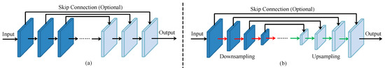
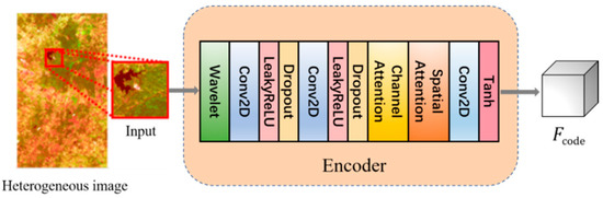
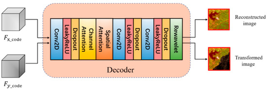
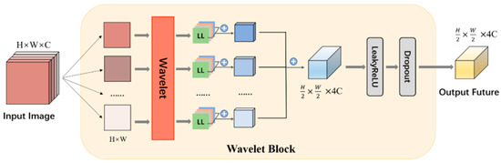
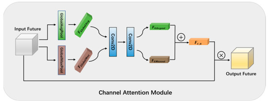
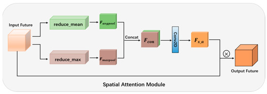
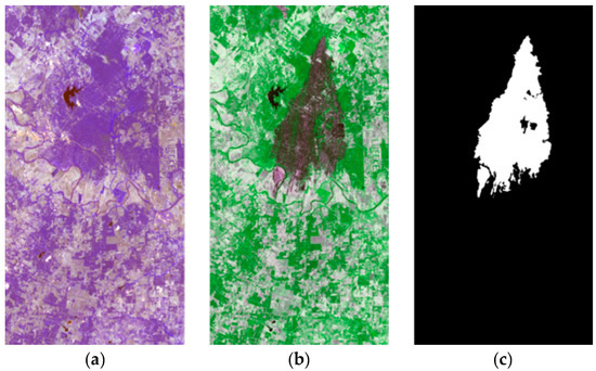
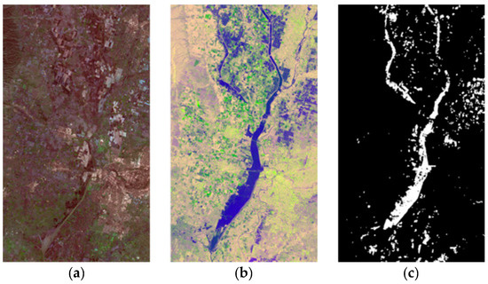
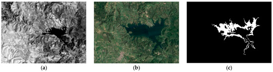
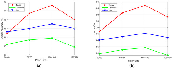
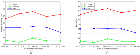
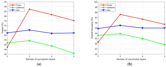
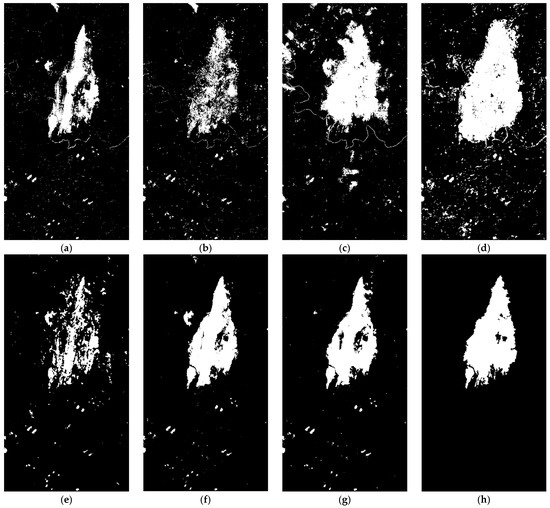
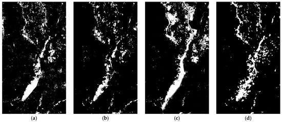
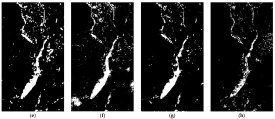
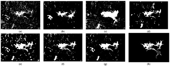
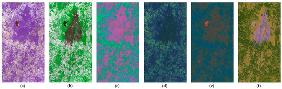
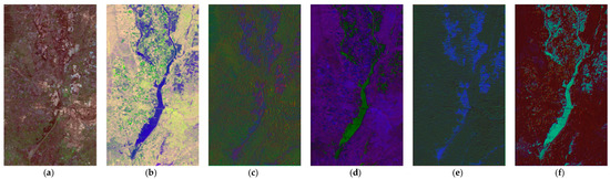
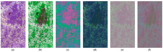
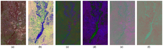
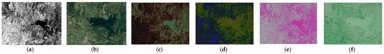
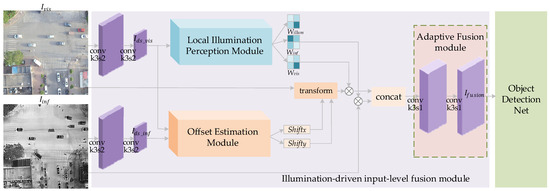
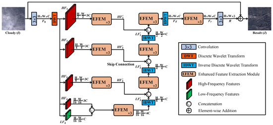
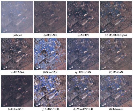
With the development of deep learning, convolutional neural networks (CNNs) have been successfully applied in the field of change detection in heterogeneous remote sensing (RS) images and achieved remarkable results. However, most of the existing methods of heterogeneous RS image change detection only extract deep features to realize the whole image transformation and ignore the description of the topological structure composed of the image texture, edge, and direction information. The occurrence of change often means that the topological structure of the ground object has changed. As a result, these algorithms severely limit the performance of change detection. To solve these problems, this paper proposes a new topology-coupling-based heterogeneous RS image change detection network (TSCNet). TSCNet transforms the feature space of heterogeneous images using an encoder–decoder structure and introduces wavelet transform, channel, and spatial attention mechanisms. The wavelet transform can obtain the details of each direction of the image and effectively capture the image’s texture features. Unnecessary features are suppressed by allocating more weight to areas of interest via channels and spatial attention mechanisms. As a result of the organic combination of a wavelet, channel attention mechanism, and spatial attention mechanism, the network can focus on the texture information of interest while suppressing the difference of images from different domains. On this basis, a bitemporal heterogeneous RS image change detection method based on the TSCNet framework is proposed. The experimental results on three public heterogeneous RS image change detection datasets demonstrate that the proposed change detection framework achieves significant improvements over the state-of-the-art methods.
Full article
(This article belongs to the Special Issue Image Change Detection Research in Remote Sensing)
►
Show Figures
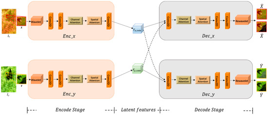
Figure 1


