Remote Sens. 2021, 13(18), 3596; https://doi.org/10.3390/rs13183596 - 9 Sep 2021
Cited by 9 | Viewed by 3378
Abstract
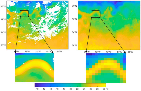
The height of the stable boundary layer (SBL), known as the nocturnal boundary layer height, is controlled by numerous factors of different natures. The SBL height defines the state of atmospheric turbulence and describes the diffusion capacity of the atmosphere. Therefore, it is
[...] Read more.
The height of the stable boundary layer (SBL), known as the nocturnal boundary layer height, is controlled by numerous factors of different natures. The SBL height defines the state of atmospheric turbulence and describes the diffusion capacity of the atmosphere. Therefore, it is unsurprising that many alternative (sometimes contradictory) formulations for the SBL height have been proposed to date, and no consensus has been achieved. In our study, we propose an iterative algorithm to determine the SBL height
(This article belongs to the Section Atmospheric Remote Sensing)
►
Show Figures

Figure 1


