Next Issue
Volume 3, December
Previous Issue
Volume 3, June


Urban Sci., Volume 3, Issue 3 (September 2019) – 35 articles

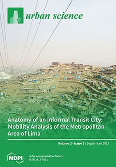
Cover Story (view full-size image): Most dense, rapidly motorizing cities suffer from severe congestion, poor public transport, and difficult conditions for walking and cycling. This paper takes Lima, Peru, as a prime example of this global urban problem, providing a detailed anatomy of its passenger transport problems. It traces the planning and transport history of the city, which explain how it arrived at this situation, and outlines its current major problems. Lima is placed in a global context by quantitatively comparing it to other world cities and examining its strengths and weaknesses regarding mobility. The paper details the strategies the region needs to follow to develop a more functional, equitable, and attractive transport system. The results provide important information for other cities with similar problems and hope for a way forward. View this paper
  • Issues are regarded as officially published after their release is announced to the table of contents alert mailing list.
  • You may sign up for e-mail alerts to receive table of contents of newly released issues.
  • PDF is the official format for papers published in both, html and pdf forms. To view the papers in pdf format, click on the "PDF Full-text" link, and use the free Adobe Reader to open them.
Order results
Result details
Select all
Export citation of selected articles as:
25 pages, 2736 KiB  
Article
A Machine Learning Approach to Study the Relationship between Features of the Urban Environment and Street Value
by Alessandro Venerandi, Giovanni Fusco, Andrea Tettamanzi and David Emsellem
Urban Sci. 2019, 3(3), 100; https://doi.org/10.3390/urbansci3030100 - 14 Sep 2019
Cited by 4 | Viewed by 4719
Abstract
Understanding what aspects of the urban environment are associated with better socioeconomic/liveability outcomes is a long standing research topic. Several quantitative studies have investigated such relationships. However, most of such works analysed single correlations, thus failing to obtain a more complete picture of [...] Read more.
Understanding what aspects of the urban environment are associated with better socioeconomic/liveability outcomes is a long standing research topic. Several quantitative studies have investigated such relationships. However, most of such works analysed single correlations, thus failing to obtain a more complete picture of how the urban environment can contribute to explain the observed phenomena. More recently, multivariate models have been suggested. However, they use a limited set of metrics, propose a coarse spatial unit of analysis, and assume linearity and independence among regressors. In this paper, we propose a quantitative methodology to study the relationship between a more comprehensive set of metrics of the urban environment and the valorisation of street segments that handles non-linearity and possible interactions among variables, through the use of Machine Learning (ML). The proposed methodology was tested on the French Riviera and outputs show a moderate predictive capacity (i.e., adjusted R 2 = 0.75 ) and insightful explanations on the nuanced relationships between selected features of the urban environment and street values. These findings are clearly location specific; however, the methodology is replicable and can thus inspire future research of this kind in different geographic contexts. Full article
Show Figures

Figure 1

14 pages, 4807 KiB  
Article
Pathogenic Leptospira in Commensal Small Mammals from the Extensively Urbanized Coastal Benin
by Gualbert Houéménou, Philippe Gauthier, Jonas Etougbétché, Sylvestre Badou, Henri-Joël Dossou, David Agossou, Mathieu Picardeau and Gauthier Dobigny
Urban Sci. 2019, 3(3), 99; https://doi.org/10.3390/urbansci3030099 - 06 Sep 2019
Cited by 11 | Viewed by 3320
Abstract
Leptospirosis is caused by spirochete bacteria of the genus Leptospira that affect one million and kill 60,000 persons annually in the world, who get infected through environmental mammal-excreted (notably rodent) pathogens. Using qPCR and DNA sequencing approaches, we here examine Leptospira occurrence and [...] Read more.
Leptospirosis is caused by spirochete bacteria of the genus Leptospira that affect one million and kill 60,000 persons annually in the world, who get infected through environmental mammal-excreted (notably rodent) pathogens. Using qPCR and DNA sequencing approaches, we here examine Leptospira occurrence and diversity in 971 commensal small mammals in urban and peri-urban habitats from south Benin, where socio-environmental conditions are favorable for human contamination. Prevalence reached 12.9% on average, but showed very important variations in both space and time, thus pointing toward a role of local processes in the maintenance and circulation of rodent-borne leptospires in the area. Prevalence peaks may occur during or one month after moderate (100–200 mm) monthly rainfall, suggesting that rodent-borne leptospires may be more prevalent when standing waters are present, but not at their highest levels (i.e., floods). However, this pattern will have to be confirmed through proper diachronic analysis. Finally, an incomplete but significant host-specificity was observed, with L. kirschneri retrieved only in African shrews, and the invasive Rattus norvegicus and the native Mastomys natalensis preferentially infected by L. interrogans and L. borgpeterseni, respectively. Our study highlights the urgent need for investigations on human leptospirosis in the extensively urbanized Abidjan–Lagos corridor. Full article
Show Figures

Figure 1

18 pages, 454 KiB  
Article
Sequent Occupance and Toponymy in Singapore: The Diachronic and Synchronic Development of Urban Place Names
by Francesco Cavallaro, Francesco Perono Cacciafoco and Zhi Xuan Tan
Urban Sci. 2019, 3(3), 98; https://doi.org/10.3390/urbansci3030098 - 03 Sep 2019
Cited by 8 | Viewed by 9680
Abstract
This paper is aimed at investigating the applicability of the notion of Sequent Occupance to the Singapore context. Sequent Occupance as a phenomenon in Human Geography was first theorized by Derwent Whittlesey in 1929 in order to describe the current cultural landscape of [...] Read more.
This paper is aimed at investigating the applicability of the notion of Sequent Occupance to the Singapore context. Sequent Occupance as a phenomenon in Human Geography was first theorized by Derwent Whittlesey in 1929 in order to describe the current cultural landscape of a region as a combination of all the people which have ‘sequentially’ occupied that region from the past to the present. According to the Sequence Occupance Theory, the cultural imprint of each civilization is never completely lost and its traces can be seen to the present day. This is a historical phenomenon that occurs in the same region or space, but at different times. Sequent Occupance regards each region as a pattern of many cultural layers laid upon each other, where each layer can be attributed to a particular civilization or culture, which overlaps the ones before it. Singapore, with its multilingual and multicultural context and with its colonial past, is a very important test-bed for Sequence Occupance approaches both in the fields of Historical Toponomastics and Human Geography. This paper aims to apply the notion of Sequence Occupance to the study of Singapore Toponomastics with a focus on Odonymy and Micro-Toponyms. The study discusses the notion of Sequent Occupance in Singapore in the light of several local Toponyms, trying to ascertain if this concept can be applied to the diachronic and synchronic development of the Urban Toponymy of the Lion City. The article also highlights historical processes in the “making” of the multi-layered Singapore society. Full article
(This article belongs to the Special Issue Urban Place Names: Political, Economic, and Cultural Dimensions)
10 pages, 2873 KiB  
Article
The Network of Protected Areas (NPA) as an Instrument to Implement Cross-Border Public Services
by Maria Coronato and Maria Prezioso
Urban Sci. 2019, 3(3), 97; https://doi.org/10.3390/urbansci3030097 - 03 Sep 2019
Cited by 3 | Viewed by 3777
Abstract
Polycentric development, territorial cohesion, and territorial diversity are some of the main principles supported at the European level for reducing regional disparities and for making territories more resilient and diversified, which strengthens the competitiveness of Europe in the global economy. This research article, [...] Read more.
Polycentric development, territorial cohesion, and territorial diversity are some of the main principles supported at the European level for reducing regional disparities and for making territories more resilient and diversified, which strengthens the competitiveness of Europe in the global economy. This research article, starting from the final results of the ESPON Linking Networks of Protected Areas to Territorial Development (LinkPAs) project, considers that the protected areas (PAs) are a territorial unit able to connect—in a polycentric approach—the different territorial aspects (economic, social, environmental) present in an area to implement cross-border public services (CPS) to share in a larger territorial context through a network of protected areas (NPA). Toward this aim, this paper suggests applying the NPA management model developed in the ESPON LinkPAs project to CPS to assess if a soft governance mechanism is able to efficiently and sustainably manage the CPS. Full article
(This article belongs to the Special Issue Nature & Culture for Cities and Territories)
Show Figures

Figure 1

20 pages, 4548 KiB  
Article
Living Structure Down to Earth and Up to Heaven: Christopher Alexander
by Bin Jiang
Urban Sci. 2019, 3(3), 96; https://doi.org/10.3390/urbansci3030096 - 29 Aug 2019
Cited by 24 | Viewed by 11113
Abstract
Discovered by Christopher Alexander, living structure is a physical phenomenon, through which the quality of the built environment or artifacts can be judged objectively. It has two distinguishing properties just like a tree: “Far more small things than large ones” across all scales [...] Read more.
Discovered by Christopher Alexander, living structure is a physical phenomenon, through which the quality of the built environment or artifacts can be judged objectively. It has two distinguishing properties just like a tree: “Far more small things than large ones” across all scales from the smallest to the largest, and “more or less similar things” on each scale. As a physical phenomenon, and mathematical concept, living structure is essentially empirical, discovered and developed from miniscule observation in nature- and human-made things, and it affects our daily lives in some practical ways, such as where to put a table or a flower vase in a room, helping us to make beautiful things and environments. Living structure is not only empirical, but also philosophical and visionary, enabling us to see the world and space in more meaningful ways. This paper is intended to defend living structure as a physical phenomenon, and a mathematical concept, clarifying some common questions and misgivings surrounding Alexander’s design thoughts, such as the objective or structural nature of beauty, building styles advocated by Alexander, and mysterious nature of his concepts. For this purpose, we first illustrate living structure—essentially organized complexity, as advocated by the late Jane Jacobs (1916–2006)—that is governed by two fundamental laws (scaling law and Tobler’s law), and generated in some step by step fashion by two design principles (differentiation and adaptation) through the 15 structural properties. We then verify why living structure is primarily empirical, drawing evidence from Alexander’s own work, as well as our case studies applied to the Earth’s surface including cities, streets, and buildings, and two logos. Before reaching conclusions, we concentrate on the most mysterious part of Alexander’s work—the luminous ground or the hypothesized “I”—as a substance that pervasively exists everywhere, in space and matter including our bodies, in order to make better sense of living structure in our minds. Full article
Show Figures

Figure 1

15 pages, 11401 KiB  
Case Report
Built Cultural Heritage Recording and Evaluation in the Traditional Settlement of Siatista in Greece: Functional and Institutional Proposals for Conservation
by Eleni G. Linaki
Urban Sci. 2019, 3(3), 95; https://doi.org/10.3390/urbansci3030095 - 26 Aug 2019
Viewed by 3623
Abstract
This case report explores the town of Siatista (located in the Western Macedonia Region—Greece), which is designated as a “traditional settlement”. The paper argues that, despite the relevant legislation that designated 400 settlements in Greece as “traditional settlements” and put them under protection, [...] Read more.
This case report explores the town of Siatista (located in the Western Macedonia Region—Greece), which is designated as a “traditional settlement”. The paper argues that, despite the relevant legislation that designated 400 settlements in Greece as “traditional settlements” and put them under protection, Siatista has no delimited traditional section. Through the years, new house typologies, demolitions, and alterations of its urban form have appeared, and Siatista has lost its identity. Having as an ultimate goal to identify proper planning guidelines and regulations for the preservation of Siatista’s built heritage, the methodology used in the paper includes the following steps: (a) recording and codification of the key legislation for the protection of Siatista, including the official urban plans (and their revisions); (b) identification and mapping of the urban form and spatial characteristics of Siatista (existing land uses, house typology, etc.); (c) identification of the alterations of the urban form and the demolitions, mainly with the use of aerial photos (1960–2014); and (d) creation of a map presenting the remaining built heritage per degree of evaluation. Following the analysis of the existing situation and the identification of the key challenges, the paper ends by defining and delimitating the well-preserved section of the town (proposing stricter rules and regulations for its preservation). Full article
(This article belongs to the Special Issue Nature & Culture for Cities and Territories)
Show Figures

Figure 1

16 pages, 1546 KiB  
Review
Urban Green Spaces and Their Need in Cities of Rapidly Urbanizing India: A Review
by Manish Ramaiah and Ram Avtar
Urban Sci. 2019, 3(3), 94; https://doi.org/10.3390/urbansci3030094 - 25 Aug 2019
Cited by 80 | Viewed by 15607
Abstract
Urbanization offers several opportunities for the growth of economic, social, and technology sectors, offering benefits to society in terms of better living and healthcare facilities, as well as employment opportunities. However, some major downsides of urbanization are overcrowding and environmental degradation. In order [...] Read more.
Urbanization offers several opportunities for the growth of economic, social, and technology sectors, offering benefits to society in terms of better living and healthcare facilities, as well as employment opportunities. However, some major downsides of urbanization are overcrowding and environmental degradation. In order to realize sustainable and environmentally friendly urbanization, there is an urgent need for comprehensive land use planning and of urban settlements by giving due consideration to create and sustain urban green spaces (UGS) such as parks, gardens, roadside vegetation, etc. UGS play a vital role in reducing air pollution, mitigating climate change, and providing various ecosystem services. UGS are being deteriorated substantially due to booming urbanization in developing countries such as India. This review is focused on highlighting the many challenges in creating and maintaining UGS in the Indian context. It is a compilation of available reports on problems linked with poor land use and/or planning of urban settlements. The challenges associated with the management and maintenance of UGS are described. The poor and irregular watering of many existing UGS is one of the major issues among several others requiring immediate attention to resolve the problem of deteriorating UGS in some cities of India. As the groundwater resources are rapidly depleting because of ever increasing water demand, UGS are being dispensed with poor and irregular watering resulting in their deterioration. A list of possible solutions and prospects of UGS in cities aiming to become smart cities soon are discussed in this review. Efficient wastewater treatment and a non-potable reuse system are possible solutions for better prospects of UGS, and therefore, optimism of better cities with low to null urban heat island effect. Full article
Show Figures

Figure 1

12 pages, 2744 KiB  
Article
Evaluating Urban Odor with Field Olfactometry in Camden, NJ
by Jennifer Kitson, Monica Leiva, Zachary Christman and Pamela Dalton
Urban Sci. 2019, 3(3), 93; https://doi.org/10.3390/urbansci3030093 - 18 Aug 2019
Cited by 9 | Viewed by 4764
Abstract
Odor annoyance negatively impacts residents of communities adjacent to persistent nuisance industries. These residents, often with a high percentage of minority or otherwise marginalized residents, experience subjective and objective impacts on health and well-being; yet, reliable methods for quantifying and categorizing odors have [...] Read more.
Odor annoyance negatively impacts residents of communities adjacent to persistent nuisance industries. These residents, often with a high percentage of minority or otherwise marginalized residents, experience subjective and objective impacts on health and well-being; yet, reliable methods for quantifying and categorizing odors have been elusive. Field olfactometry is integral to the study of odor annoyance experienced by communities as it includes both qualitative (human perception) and quantitative (intensity measurement) dimensions of human odor experience and has been employed by municipalities in the U.S. to evaluate odor pollution levels. Cartographic visualization of odor data recorded using a field olfactometer offers further opportunity to evaluate potential patterns of odor annoyance, yet the use of field olfactometry and geographic information systems have not been frequently employed by geographers. By employing a mixed-methods approach to evaluate odor pollution, this study addresses the environmental justice context by quantifying and categorizing the presence of odor pollution in Waterfront South, a neighborhood in Camden, NJ previously identified for its disproportionate malodor burden. This study offers support to mixed methods research and the need for monitoring subjective and objective impacts in communities with compounding odor nuisance industries. Full article
Show Figures

Figure 1

15 pages, 26504 KiB  
Article
The Traditional Enjoyment of Noted Natural Places in Urban South Korea
by Eunbyul Park, Akio Shimomura, Kiyotatsu Yamamoto and Kazuhiko W. Nakamura
Urban Sci. 2019, 3(3), 92; https://doi.org/10.3390/urbansci3030092 - 16 Aug 2019
Viewed by 2987
Abstract
Records indicate the existence of noted natural places, where several people from various classes used to enjoy the natural environment in a part of present-day city of Seoul during the Korean Dynasties period. This study aimed to clarify the traditional methods of enjoying [...] Read more.
Records indicate the existence of noted natural places, where several people from various classes used to enjoy the natural environment in a part of present-day city of Seoul during the Korean Dynasties period. This study aimed to clarify the traditional methods of enjoying noted natural places in South Korea’s urban areas by classifying the relationship between the method of enjoyment and the locations of the noted natural places, including their geomorphological features. Literature analysis was employed, and 29 noted natural places were extracted from the descriptions and pictures of old documents. The results revealed that six types of scenery—plants and mountain streams—were enjoyed and the ways of enjoying were classified into 15 subtypes. Additionally, the methods of enjoyment were related to five types of geomorphological features, including mountain streams and rivers, high grounds, etc. In conclusion, it was determined that a combination of scenery and geomorphological features determined the methods of enjoying noted natural places. Knowledge on the relationship between traditional methods of enjoyment and location types is considered to provide important findings to provide urban citizens with various methods of enjoyment and more effectively develop and utilize urban green spaces. Full article
Show Figures

Figure 1

35 pages, 1238 KiB  
Concept Paper
City Data Plan: The Conceptualisation of a Policy Instrument for Data Governance in Smart Cities
by Lucia Lupi
Urban Sci. 2019, 3(3), 91; https://doi.org/10.3390/urbansci3030091 - 13 Aug 2019
Cited by 6 | Viewed by 6975
Abstract
This paper presents the conceptualisation of the City Data Plan, a data governance policy instrument intended to connect the production and use of urban data in a comprehensive and evolutive long-term strategy aligned with city development goals. The concept of the City Data [...] Read more.
This paper presents the conceptualisation of the City Data Plan, a data governance policy instrument intended to connect the production and use of urban data in a comprehensive and evolutive long-term strategy aligned with city development goals. The concept of the City Data Plan had been elaborated by taking into account current issues related to privacy and manipulation of data in smart city. The methodological approach adopted to define the nature of a City Data Plan is grounded on the conceptual and empirical parallelism with corporate data governance plans and general urban plans, respectively aimed to regulate decision-making powers and actions on data in enterprise contexts, and the interests of local stakeholders in the access and use of urban resources. The result of this analytic process is the formulation of the outline of a City Data Plan as a data governance policy instrument to support the iterative negotiation between the instances of data producers and data users for instantiating shared smart city visions. The conceptualisation of the City Data Plan includes a description of the multi-stakeholder organisational structures for the city data governance, cooperation protocols and decision areas, responsibilities assignments, components of the plan and its implementation mechanisms. Full article
Show Figures

Figure 1

22 pages, 3142 KiB  
Article
Decentralisation Versus Territorial Inequality: A Comparative Review of English City Region Policy Discourse
by Carina Schneider and Clémentine Cottineau
Urban Sci. 2019, 3(3), 90; https://doi.org/10.3390/urbansci3030090 - 09 Aug 2019
Cited by 12 | Viewed by 6735
Abstract
The most recent English attempts at decentralisation take the shape of the city region devolution policy agenda. Decentralisation claims to empower localities and address regional growth imbalances, while creating a variety of new temporary and selective fiscal and geographic arrangements in policy-making that [...] Read more.
The most recent English attempts at decentralisation take the shape of the city region devolution policy agenda. Decentralisation claims to empower localities and address regional growth imbalances, while creating a variety of new temporary and selective fiscal and geographic arrangements in policy-making that have the potential to create the opposite effect. This paper focuses on the relationship between decentralisation and territorial inequalities through the analysis of strategic discourse of six ‘devolved authorities’. A quantitative, qualitative, and comparative approach to this question complements the traditional insights obtained from in-depth case study analysis using actors’ interviews. It focuses on city regions’ official discourse of self-conceptualisation and marketization, and thereby highlights the wider policy and regional theory context of their production to frame the structural factors impacting the rewriting of city regional space. By doing so, we find a number of issues with the current decentralisation approach in competing priorities between localities, an over-reliance on agglomeration economies and urban competition, potential mismatches in scales of policy decision-making and delivery, and challenges regarding inequalities in a post-Brexit England. Full article
Show Figures

Figure 1

13 pages, 5341 KiB  
Article
Mapping the Sound Environment of Andorra and Escaldes-Engordany by Means of a 3D City Model Platform
by Rosa Ma Alsina-Pagès, Marc Vilella, Marc Pons and Robert Garcia Almazan
Urban Sci. 2019, 3(3), 89; https://doi.org/10.3390/urbansci3030089 - 09 Aug 2019
Cited by 1 | Viewed by 3771
Abstract
In the new paradigm of the smart cities world, public opinion is one of the most important issues in the new conception of urban space and its corresponding regulations. The data collection in terms of environmental noise cannot only be related to the [...] Read more.
In the new paradigm of the smart cities world, public opinion is one of the most important issues in the new conception of urban space and its corresponding regulations. The data collection in terms of environmental noise cannot only be related to the value of the equivalent noise level L A e q of the places of interest. According to WHO reports, the different types of noise (traffic, anthropomorphic, industrial, and others) have different effects on citizens; the focus of this study is to use the identification of noise sources and their single impacts on background urban noise to develop a visualization tool that can represent all this information in real time. This work used a 3D model platform to visualize the acoustic measurements recorded at three strategic positions over the country by means of a sound map. This was a pilot project in terms of noise source identification. The visualization method presented in this work supports the understanding of the data collected and helps the space-time interpretation of the events. In the study of soundscape, it is essential not only to have the information of the events that have occurred, but also to have the relations established between them and their location. The platform visualizes the measured noise and differentiates four types of noise, the equivalent acoustic level measured and the salience of the event with respect to background noise by means of the calculation of SNR (Signal-to-Noise), providing better data both in terms of quantity and quality and allowing policy-makers to make better-informed decisions on how to minimize the impact of environmental noise on people. Full article
(This article belongs to the Collection Urban Acoustic Environments)
Show Figures

Figure 1

21 pages, 1258 KiB  
Article
Effects of Urban Development Praxis on Economic Inequality in Latin American Cities
by Gustavo Alberto Cadenas Delascio, Luis E. Hernández-Ponce and Gerardo L. Febres
Urban Sci. 2019, 3(3), 88; https://doi.org/10.3390/urbansci3030088 - 05 Aug 2019
Cited by 3 | Viewed by 3350
Abstract
In a highly and rapidly urbanized world, the effect of the action of urban development is determinant for the physical, social, and economic conditions of its citizens, among which is inequality. It is even more crucial for developing regions such as Latin America [...] Read more.
In a highly and rapidly urbanized world, the effect of the action of urban development is determinant for the physical, social, and economic conditions of its citizens, among which is inequality. It is even more crucial for developing regions such as Latin America on which this research is conducted. Therefore, the focus of the investigation was to determine the existence of significant statistical relationships between urban development and economic inequality in the region. For this purpose, it was sought to define urban development from the perspective of the praxis of multilateral organizations measured by indicators of extensive use among them. A hierarchical multiple linear regression model was built with six urban development variables predictors of the Gini coefficient as an indicator of economic inequality, in which data of 49 Latin American cities was used. The application of the method allowed us to discover a stochastic behavior of interaction between those multidimensional systems and confirmed the statistical relation. The research allows having a tool for the formulation of public policies that seek to strengthen local governance, promote community organization and participation, and assert urban planning as an agent for concerted efforts to achieve common goals. Full article
Show Figures

Graphical abstract

20 pages, 7631 KiB  
Article
Using Twitter to Analyze the Effect of Hurricanes on Human Mobility Patterns
by Ahmed Ahmouda, Hartwig H. Hochmair and Sreten Cvetojevic
Urban Sci. 2019, 3(3), 87; https://doi.org/10.3390/urbansci3030087 - 03 Aug 2019
Cited by 21 | Viewed by 4741
Abstract
Understanding human mobility patterns becomes essential in crisis management and response. This study analyzes the effect of two hurricanes in the United States on human mobility patterns, more specifically on trip distance (displacement), radius of gyration, and mean square displacement, using Twitter data. [...] Read more.
Understanding human mobility patterns becomes essential in crisis management and response. This study analyzes the effect of two hurricanes in the United States on human mobility patterns, more specifically on trip distance (displacement), radius of gyration, and mean square displacement, using Twitter data. The study examines three geographical regions which include urbanized areas (Houston, Texas; Miami-Dade County, Florida) and both rural and urbanized areas (North and South Carolina) affected by hurricanes Matthew (2016) and Harvey (2017). Comparison of movement patterns before, during, and after each hurricane shows that displacement and activity space decreased during the events in the regions. Part of this decline can be potentially tied to observed lower tweet numbers around supply facilities during hurricanes, when many of them are closed, as well as to numerous flooded and blocked roads reported in the affected regions. Furthermore, it is shown that displacement patterns can be modeled through a truncated power-law before, during, and after the analyzed hurricanes, which demonstrates the resilience of human mobility behavior in this regard. Analysis of hashtag use in the three study areas indicates that Twitter contributors post about the events primarily during the hurricane landfall and to some extent also during hurricane preparation. This increase in hurricane-related Twitter topics and decrease in activity space provides a tie between changed travel behavior in affected areas and user perception of hurricanes in the Twitter community. Overall, this study adds to the body of knowledge that connects human mobility to natural crises at the local level. It suggests that governmental and rescue operations need to respond to and be prepared for reduced mobility of residents in affected regions during natural crisis events. Full article
Show Figures

Figure 1

15 pages, 253 KiB  
Article
Green and Blue Infrastructure in Darwin; Carbon Economies and the Social and Cultural Dimensions of Valuing Urban Mangroves in Australia
by Jennifer Atchison
Urban Sci. 2019, 3(3), 86; https://doi.org/10.3390/urbansci3030086 - 31 Jul 2019
Cited by 3 | Viewed by 3714
Abstract
Darwin’s mangrove ecosystems, some of the most extensive and biodiverse in the world, are part of the urban fabric in the tropical north of Australia but they are also clearly at risk from the current scale and pace of development. Climate motivated market-based [...] Read more.
Darwin’s mangrove ecosystems, some of the most extensive and biodiverse in the world, are part of the urban fabric in the tropical north of Australia but they are also clearly at risk from the current scale and pace of development. Climate motivated market-based responses, the so-called ‘new-carbon economies’, are one prominent approach to thinking differently about the value of living infrastructure and how it might provide for and improve liveability. In the Australian context, there are recent efforts to promote mangrove ecosystems as blue infrastructure, specifically as blue carbon, but also little recognition or valuation of them as green or urban infrastructure. Drawing on observational and qualitative analysis of semi-structured interviews, this study examines how key stakeholders in Darwin frame and understand mangroves in relation to the urban, and how they are anticipating and responding to governance efforts to frame mangroves and pay for their carbon sequestration and storage services as blue carbon. The push for large infrastructure development and an expanding urban footprint, present serious challenges for mangrove protection, and the study evidences both denial and complacency in this regard. However, although the concept of blue carbon is already taking effect in some circles, it was not viewed as straightforward or as appropriate by all study participants and may very well work in practice to exclude groups within the community. Both clear governance problems, as well as unrecognized and vernacular community connections to mangroves in Darwin, indicate that there are ongoing conceptual and empirical challenges to be considered in recognizing and valuing mangroves as part of urban life. Full article
(This article belongs to the Special Issue Urban Green Infrastructure)
28 pages, 17798 KiB  
Article
Parametric Study on Determining Optimum Shading Techniques for Urban High-Rise Dwellings
by Shorouk Omar Elshiwihy and Hassam Nasarullah Chaudhry
Urban Sci. 2019, 3(3), 85; https://doi.org/10.3390/urbansci3030085 - 30 Jul 2019
Cited by 4 | Viewed by 5257
Abstract
Shading techniques constitute one of the most passive, beneficial strategies for reducing energy consumption in urban dwellings. Shading affects many factors, for example, the solar gains and radiations falling on the façade, which are considered the most significant in increasing the cooling energy [...] Read more.
Shading techniques constitute one of the most passive, beneficial strategies for reducing energy consumption in urban dwellings. Shading affects many factors, for example, the solar gains and radiations falling on the façade, which are considered the most significant in increasing the cooling energy demand in hot climates. This paper conducts a parametric study on external and internal shading devices and establishes their impact on energy consumption, daylight levels, and ventilation. The work was conducted using Integrated Environmental Simulation Virtual Environment (IES-VE) and Computational Fluid Dynamics (CFD) numerical methods. The results revealed that optimised shading can influence savings in terms of energy and cooling, in addition to the enhancement of daylighting and reduction of glare. After studying all these factors associated with the different shading techniques investigated, the findings revealed that all shades affect the energy, daylight and ventilation parameters positively. However, despite all external and internal shadings showing improvements, the egg crate shade was determined as that which provided the optimum energy saving, while enhancing daylight and improving natural ventilation for a sustainable building design. Full article
Show Figures

Figure 1

18 pages, 6485 KiB  
Conference Report
Microclimate of Urban Canopy Layer and Outdoor Thermal Comfort: A Case Study in Pavlou Mela, Thessaloniki
by Ioanna Skoufali and Alessandra Battisti
Urban Sci. 2019, 3(3), 84; https://doi.org/10.3390/urbansci3030084 - 30 Jul 2019
Cited by 2 | Viewed by 3652
Abstract
The present study is based on the assumption that the urban heat island (UHI) mitigation appears compelling and urgent in dense cities. To the above thematic area, recent redevelopmental interventions of open space for the microclimatic improvement and thermal comfort have been made [...] Read more.
The present study is based on the assumption that the urban heat island (UHI) mitigation appears compelling and urgent in dense cities. To the above thematic area, recent redevelopmental interventions of open space for the microclimatic improvement and thermal comfort have been made through national and international programs at neighborhood scale (local area). One of these recovery processes is the case study of Pavlou Mela in the Greek context, which in the present discussion, focuses on the microspecific investigation through quantitative analysis of the eleven points distributed in the area of the intervention, extrapolating comparative considerations of different configurative factors post-operam. The results of this analysis tend: (i) To identify the degree of accuracy of the two most applied software packages in the scientific community (ENVImet Pro and Rayman Pro) through microclimatic parameters, namely air temperature (Ta) and surface temperature (Ts) comparing them with in-situ measurements; (ii) to evaluate the thermal sensation of man correlated with the mean radiant temperature (Tmrt) by verifying the actual improvement of thermal comfort outdoor with the index, physiologically equivalent temperature (PET). Full article
Show Figures

Figure 1

17 pages, 3019 KiB  
Article
Understanding Cumulative Hazards in a Rustbelt City: Integrating GIS, Archaeology, and Spatial History
by Dan Trepal and Don Lafreniere
Urban Sci. 2019, 3(3), 83; https://doi.org/10.3390/urbansci3030083 - 30 Jul 2019
Cited by 8 | Viewed by 5209
Abstract
We combine the Historical Spatial Data Infrastructure (HSDI) concept developed within spatial history with elements of archaeological predictive modeling to demonstrate a novel GIS-based landscape model for identifying the persistence of historically-generated industrial hazards in postindustrial cities. This historical big data approach draws [...] Read more.
We combine the Historical Spatial Data Infrastructure (HSDI) concept developed within spatial history with elements of archaeological predictive modeling to demonstrate a novel GIS-based landscape model for identifying the persistence of historically-generated industrial hazards in postindustrial cities. This historical big data approach draws on over a century of both historical and modern spatial big data to project the presence of specific persistent historical hazards across a city. This research improves on previous attempts to understand the origins and persistence of historical pollution hazards, and our final model augments traditional archaeological approaches to site prospection and analysis. This study also demonstrates how models based on the historical record, such as the HSDI, complement existing approaches to identifying postindustrial sites that require remediation. Our approach links the work of archaeologists more closely to other researchers and to municipal decision makers, permitting closer cooperation between those involved in archaeology, heritage, urban redevelopment, and environmental sustainability activities in postindustrial cities. Full article
Show Figures

Figure 1

25 pages, 1606 KiB  
Article
Determinants of Transport Mode Choice for Non-Commuting Trips: The Roles of Transport, Land Use and Socio-Demographic Characteristics
by Sheila Convery and Brendan Williams
Urban Sci. 2019, 3(3), 82; https://doi.org/10.3390/urbansci3030082 - 29 Jul 2019
Cited by 7 | Viewed by 3966
Abstract
Despite rapid changes in vehicle technology and the expansion of IT-based mobility solutions, travel habits must be changed to address the environmental and health implications of increasing car dependency. A significant amount of research focuses on commuting, which comprises the largest share of [...] Read more.
Despite rapid changes in vehicle technology and the expansion of IT-based mobility solutions, travel habits must be changed to address the environmental and health implications of increasing car dependency. A significant amount of research focuses on commuting, which comprises the largest share of annual vehicle miles travelled. However, non-work trips are also significant, especially when considering trip frequency. Using empirical data (N = 1298) from an urban-rural region and bivariate statistical analysis, the relationship between the land use–transport configuration (6 types) and travel behaviour patterns is examined for 14 non-work destinations. The land use characterisation used in this research includes an updated means of representing a land use mix. By defining the typologies of land use and transport for use in the analysis, the findings can be directed towards contrasting area types in the region. A strong statistically significant association between the land use–transport configuration and mode-share for 14 non-work journey purposes is found. Using regression modelling, income and car ownership are identified as key influences on travel behaviour patterns. The results of both analyses show that, for non-work trips, the transport–land use relationship is as important as key socio-demographic indicators. However, the results for reductions in car travel are relatively small for the area typologies outside the inner-city core. This indicates that efforts to provide alternatives to car travel in order to mitigate car dependency should be prioritised in these outer urban areas. Appropriate management of spatial structure for non-work activity types such that active mode use is possible is essential. This will resolve some of the important environmental and health impacts of car dependency. Full article
Show Figures

Figure 1

20 pages, 5010 KiB  
Article
Landscape as Connecting Link of Nature and Culture: Spatial Planning Policy Implications in Greece
by Stella Sofia Kyvelou and Anestis Gourgiotis
Urban Sci. 2019, 3(3), 81; https://doi.org/10.3390/urbansci3030081 - 27 Jul 2019
Cited by 19 | Viewed by 5084
Abstract
The research paper investigates the diverse understandings of “landscape”, along with demonstrating the modes of contribution of the European Landscape Convention (ELC) of the Council of Europe (CE) in influencing national spatial planning systems. The paper, interested in considering the efficiency of landscape [...] Read more.
The research paper investigates the diverse understandings of “landscape”, along with demonstrating the modes of contribution of the European Landscape Convention (ELC) of the Council of Europe (CE) in influencing national spatial planning systems. The paper, interested in considering the efficiency of landscape policy from a territorial perspective, briefly outlines the perception and understanding of landscape as connecting link of nature and culture and conducts a literature review with the aim to support the prospect of a «European model of landscape planning». Lastly, it critically examines the approach to landscape planning and management by the Greek state, revealing the catalytic role of the Council of Europe (CE) in activating the dimension of landscape in Greece, in a mutualistic perspective between environmental policy and spatial planning, mainly through strategic spatial planning tools (i.e., the Regional Spatial Plans, RSPs). The results point out that (a) the ELC gave new impetus to spatial planning in Greece, providing the tool to manage and coordinate landscape policy, positively influencing the evolving spatial planning paradigm; (b) the decentralized approach adopted, identified landscapes of particular value at a regional level, so as to be given priority in terms of the implementation of coordinated governance arrangements and management actions. However, the implementation of landscape policy continues to rely on the underlying spatial planning level (Local Spatial Plans, Special Spatial Plans) and a general conclusion is that both on land and on sea, it depends on the incorporation of evolutionary trends in planning including an evolutionary perspective for landscape itself, viewed as a complex social-ecological system. Full article
(This article belongs to the Special Issue Nature & Culture for Cities and Territories)
Show Figures

Figure 1

14 pages, 253 KiB  
Article
Testing the Spatial Assimilation Model on Black Ethnic Immigrant Locational Outcomes within Mature and Developing Suburbs
by Grigoris Argeros
Urban Sci. 2019, 3(3), 80; https://doi.org/10.3390/urbansci3030080 - 26 Jul 2019
Viewed by 3388
Abstract
This study investigates black ethnic immigrant group differences in residential outcomes between developing and mature suburbs. It evaluates the extent to which foreign-born black ethnic groups’ socioeconomic status (SES) and acculturation characteristics agree with the outlines of the spatial assimilation model. Binomial logistic [...] Read more.
This study investigates black ethnic immigrant group differences in residential outcomes between developing and mature suburbs. It evaluates the extent to which foreign-born black ethnic groups’ socioeconomic status (SES) and acculturation characteristics agree with the outlines of the spatial assimilation model. Binomial logistic regression models are calculated, using data from the 2012–2016 IPUMS ACS, to examine the impact of place of birth/nativity status, SES, acculturation, family/household characteristics, and region on residence in developing versus mature suburbs within U.S. metropolitan areas. The results reveal mixed results for the expectations of the spatial assimilation model. On the one hand, and in agreement with the spatial assimilation model, residence in mature and developing suburbs is a function of increments in household income and educational levels. On the other hand, the multivariate results reveal suburban type residential outcomes that vary by place of birth and nativity status. The effects of acculturation also reveal findings that diverge from the expectations of the spatial assimilation model. Full article
14 pages, 1405 KiB  
Article
The Cultural Legacy of a Major Event: A Case Study of the 2008 European Capital of Culture, Liverpool
by Yi-De Liu
Urban Sci. 2019, 3(3), 79; https://doi.org/10.3390/urbansci3030079 - 26 Jul 2019
Cited by 3 | Viewed by 4667
Abstract
Cultural legacy is a relatively neglected theme in event and sustainability studies, compared to economic or physical legacies with solid evidence. This article focuses on the experience of Liverpool as the 2008 European Capital of Culture. An evaluation ten years on can provide [...] Read more.
Cultural legacy is a relatively neglected theme in event and sustainability studies, compared to economic or physical legacies with solid evidence. This article focuses on the experience of Liverpool as the 2008 European Capital of Culture. An evaluation ten years on can provide the basis for research on the long-term cultural legacy of a major event, as well as how to achieve sustainability through legacy planning. Five dimensions of cultural legacy are explored, including: Cultural agency and strategies, cultural network, cultural provision, cultural engagement, and cultural image. The results of the study show that the spill-over effect of culture can be achieved through thorough legacy planning. The most important lesson learned from Liverpool is to integrate the event into the city’s long-term and culture-led development, which yields a healthy and productive cultural climate. Full article
(This article belongs to the Special Issue Mega Events and Urban Memory)
Show Figures

Figure 1

15 pages, 357 KiB  
Article
Modelling the Influence of Regional Identity on Human Migration
by Willem R. J. Vermeulen, Debraj Roy and Rick Quax
Urban Sci. 2019, 3(3), 78; https://doi.org/10.3390/urbansci3030078 - 26 Jul 2019
Cited by 5 | Viewed by 4529
Abstract
Human migration involves the relocation of individuals, households or moving groups between geographical locations. Aggregate spatial patterns of movement reflect complex interactions among motivations (such as distance, identity, economic opportunities, etc.) that influence migration behaviour and determine destination choice. Gravity models and radiation [...] Read more.
Human migration involves the relocation of individuals, households or moving groups between geographical locations. Aggregate spatial patterns of movement reflect complex interactions among motivations (such as distance, identity, economic opportunities, etc.) that influence migration behaviour and determine destination choice. Gravity models and radiation models are often used to study different types of migration at various spatial scales. In this paper, we propose that human migration models can be improved by embedding regional identities into the model. We modify the existing human migration gravity model by adding an identity parameter based on three different sets of Dutch identity regions. Through analysis of the Dutch internal migration data between 1996 and 2016, we show that adding the identity parameter has a significant effect on the distance distribution. We find that individuals are more likely to move towards municipalities located within the same identity region. We test the impact of regional identity by comparing randomly spatially clustered and optimised identity regions to show that the effects we attribute to regional identity could not be attributed due to chance. Finally, our finding shows that cultural identity should be taken into account and has broad implications on the practice of modelling human migration patterns at large. We find that people living in Dutch municipalities are 3.89 times as likely to move to a municipality when it is located within the same historic identity region. Including these identity regions in the migration model decreases the deviation of the model by 10.7%. Full article
Show Figures

Figure 1

12 pages, 1904 KiB  
Article
An Analysis of the Efficiency of Local Government Expenditure and the Minimum Efficient Scale in Vietnam
by Shunsuke Sekiguchi
Urban Sci. 2019, 3(3), 77; https://doi.org/10.3390/urbansci3030077 - 24 Jul 2019
Cited by 1 | Viewed by 3818
Abstract
The purposes of this study were to; (i) estimate the efficiency of local government expenditure by province and city in Vietnam, (ii) test if there was a change in the efficiency of local government expenditure with the rapid development of Vietnam, and (iii) [...] Read more.
The purposes of this study were to; (i) estimate the efficiency of local government expenditure by province and city in Vietnam, (ii) test if there was a change in the efficiency of local government expenditure with the rapid development of Vietnam, and (iii) estimate the size of the population that is improving local government expenditures. By using the stochastic frontier cost function method to estimate the cost inefficiency, we found that Vietnam has been improving the efficiency of local government expenditure while achieving rapid economic growth from FY2005 to FY2009. In addition, we simulated a minimum efficient scale (MES) to determine the size of the province population that is improving local government expenditures. We found that the MES in Vietnam is 1,394,859. Full article
(This article belongs to the Special Issue Regional Economic Development)
Show Figures

Figure 1

9 pages, 985 KiB  
Article
Estimating Environmental Contamination and Element Deposition at an Urban Area of Central Italy
by Stefano Loppi, Adelmo Corsini and Luca Paoli
Urban Sci. 2019, 3(3), 76; https://doi.org/10.3390/urbansci3030076 - 23 Jul 2019
Cited by 10 | Viewed by 2685
Abstract
Air quality monitoring in many urban areas is based on sophisticated and costly equipment to check for the respect of environmental quality standards, but capillary monitoring is often not feasible due to economic constraints. In such cases, the use of living organisms may [...] Read more.
Air quality monitoring in many urban areas is based on sophisticated and costly equipment to check for the respect of environmental quality standards, but capillary monitoring is often not feasible due to economic constraints. In such cases, the use of living organisms may be very useful to complement the sparse data obtained by physico-chemical measurements. In this study, the bioaccumulation of selected trace elements (Al, As, Cd, Ce, Cr, Cu, Fe, Ni, Pb, S, Sb, Zn) in lichen samples (Evernia prunastri) transplanted for three months at an urban area of Central Italy was investigated to assess the main environmental contaminants, their sources, and the fluxes of element depositions. The results pinpointed Cu and Sb as the main contaminants and suggested a common origin for these two elements from non-exhaust sources of vehicular traffic, such as brake abrasion. Most study sites were, however, found to be subjected to low or moderate environmental contamination, and the lowest contamination corresponded to the main green areas, confirming the important protective role of urban forests against air pollution. Ranges of estimated mean annual element deposition rates in the study area were similar or lower than those reported for other urban areas. Full article
Show Figures

Figure 1

17 pages, 5193 KiB  
Article
Spatial Analytics Based on Confidential Data for Strategic Planning in Urban Health Departments
by Daniel Yonto, L. Michele Issel and Jean-Claude Thill
Urban Sci. 2019, 3(3), 75; https://doi.org/10.3390/urbansci3030075 - 22 Jul 2019
Cited by 2 | Viewed by 3467
Abstract
Spatial data analytics can detect patterns of clustering of events in small geographies across an urban region. This study presents and demonstrates a robust research design to study the longitudinal stability of spatial clustering with small case numbers per census tract and assess [...] Read more.
Spatial data analytics can detect patterns of clustering of events in small geographies across an urban region. This study presents and demonstrates a robust research design to study the longitudinal stability of spatial clustering with small case numbers per census tract and assess the clustering changes over time across the urban environment to better inform public health policy making at the community level. We argue this analysis enables the greater efficiency of public health departments, while leveraging existing data and preserving citizen personal privacy. Analysis at the census tract level is conducted in Mecklenburg County, North Carolina, on hypertension during pregnancy compiled from 2011–2014 birth certificates. Data were derived from per year and per multi-year moving counts by aggregating spatially to census tracts and then assessed for clustering using global Moran’s I. With evidence of clustering, local indicators of spatial association are calculated to pinpoint hot spots, while time series data identified hot spot changes. Knowledge regarding the geographical distribution of diseases is essential in public health to define strategies that improve the health of populations and quality of life. Our findings support that spatial aggregation at the census tract level contributes to identifying the location of at-risk “hot spot” communities to refine health programs, while temporal windowing reduces random noise effects on spatial clustering patterns. With tight state budgets limiting health departments’ funds, using geographic analytics provides for a targeted and efficient approach to health resource planning. Full article
Show Figures

Figure 1

13 pages, 4290 KiB  
Article
Bike Station Suitability on University Campus Using Origin–Destination Matrix—A Morgan State University Case Study
by Nashid K. Khadem, Md Muhib Kabir, Snehanshu Banerjee and Mansoureh Jeihani
Urban Sci. 2019, 3(3), 74; https://doi.org/10.3390/urbansci3030074 - 21 Jul 2019
Cited by 4 | Viewed by 4146
Abstract
In contemporary times, bike sharing programs are gaining importance as an influential transportation mode in both urban and rural areas. They are also used as a vital transportation mode on university campuses which serve as a healthy and environmentally-friendly transportation system. However, having [...] Read more.
In contemporary times, bike sharing programs are gaining importance as an influential transportation mode in both urban and rural areas. They are also used as a vital transportation mode on university campuses which serve as a healthy and environmentally-friendly transportation system. However, having an appropriate location for a bike station is important, so as to maximize the benefits of the service. This study used an origin–destination (O-D) matrix to identify appropriate bike station locations at the Morgan State University campus. The O-D matrix analysis identifies three locations Cumming Hall/University Health Center, Rawling Hall, and Center for Built Environment and Infrastructure Studies as the most appropriate locations to start a pilot, which will serve most of the campus (students, faculty, staff) and connect them to the maximum number of facilities at Morgan State University. The O-D matrix takes into account the occupancy or population of individual buildings based on enrollment over the past four years, the distance to the center of the campus where maximum facilities including the graduate and undergraduate offices are located, and the frequency of the university shuttle connecting most of the buildings. This methodology can be replicated and used on other university campuses and will help further bike sharing programs. Full article
Show Figures

Figure 1

13 pages, 7351 KiB  
Communication
Revisiting Acoustics Education Using Mobile Devices to Learn Urban Acoustic Environments: Recent Issues on Current Devices and Applications
by Kimihiro Sakagami, Fumiaki Satoh and Akira Omoto
Urban Sci. 2019, 3(3), 73; https://doi.org/10.3390/urbansci3030073 - 17 Jul 2019
Cited by 8 | Viewed by 3640
Abstract
In this paper, we revisit the acoustics education program using mobile devices to better understand urban environments. We begin with a summary of our past projects to demonstrate a model case of the concept. In these projects, the output was mainly supposed to [...] Read more.
In this paper, we revisit the acoustics education program using mobile devices to better understand urban environments. We begin with a summary of our past projects to demonstrate a model case of the concept. In these projects, the output was mainly supposed to be a noise map with measured sound pressure levels (SPLs) and sound spectra. This methodology can obviously be applied to larger-scale urban studies. Including measured sound spectra can be another advantage. Next, current problems in measurement accuracy due to recent device developments are explained and the required examinations are stated. Finally, the accuracy of the current versions of the applications as well as recently available devices are discussed. The results of this study provide information regarding the measurement accuracy of mobile devices, and some suggestions for their practical use are given, which are also useful for additional studies pertaining to the urban acoustic environment. Full article
(This article belongs to the Collection Urban Acoustic Environments)
Show Figures

Figure 1

19 pages, 5097 KiB  
Article
Everyday Use of the City Cemetery: A Study of Environmental Qualities and Perceived Restorativeness in a Scottish Context
by Ka Yan Lai, Iain Scott and Ziwen Sun
Urban Sci. 2019, 3(3), 72; https://doi.org/10.3390/urbansci3030072 - 16 Jul 2019
Cited by 10 | Viewed by 4336
Abstract
As the number of historical urban cemeteries where interment is no longer available continues to grow, the everyday use and restorative benefit of these spaces (beyond commemoration and remembrance) is worthy of further exploration. This study primarily investigates the everyday use of two [...] Read more.
As the number of historical urban cemeteries where interment is no longer available continues to grow, the everyday use and restorative benefit of these spaces (beyond commemoration and remembrance) is worthy of further exploration. This study primarily investigates the everyday use of two historical urban cemeteries in Edinburgh through behavioural observation (N = 185). We also explore further the relationships between cemetery qualities and perceived restorativeness through an interviewer-administered survey (N = 134) and face-to-face interviews (N = 24) at the sites. The survey findings showed that usage and aesthetics in the cemeteries were both significantly and positively associated with various restorative qualities including ‘being away’, ‘fascination’ and ‘compatibility’. The data provided from the interviews and behavioural observations complement the survey findings that the everyday use of urban cemeteries (i.e., using them as an alternative route for pedestrian journeys or simply walking the dog) could facilitate users’ mental restorative process. After controlling for sociodemographic characteristics, provision of facilities (e.g., benches and toilets) was found to have no significant association with any restorative qualities. Using a mixed method approach, this study provides a novel understanding of how the urban population uses, and perceives, old urban cemeteries in contemporary Scotland. Full article
Show Figures

Figure 1

15 pages, 3604 KiB  
Article
A Statistically Rigorous Approach to Experimental Design of Vertical Living Walls for Green Buildings
by Rosmina A. Bustami, Chris Brien, James Ward, Simon Beecham and Robyn Rawlings
Urban Sci. 2019, 3(3), 71; https://doi.org/10.3390/urbansci3030071 - 15 Jul 2019
Cited by 9 | Viewed by 4533
Abstract
Living walls (LW) have been widely proposed as a form of green infrastructure to improve aesthetics, energy consumption, and microclimate in urban environments by adding densely-planted vegetation to the outside walls of buildings. Scientific studies using multiple treatments in a single LW face [...] Read more.
Living walls (LW) have been widely proposed as a form of green infrastructure to improve aesthetics, energy consumption, and microclimate in urban environments by adding densely-planted vegetation to the outside walls of buildings. Scientific studies using multiple treatments in a single LW face challenges due to the close physical proximity of different treatments, particularly the potential for plants above to influence those below. A study on a west-facing LW was undertaken to investigate 36 unique treatments in Adelaide, South Australia, for nine months. The LW comprised combinations of six native plant species, three soil substrates and two irrigation volumes. The LW consisted of 144 modular trays mounted on a wall in a 12 × 12 grid with four replicates of each treatment. The location of each treatment was designed to account for a cascading carry-over effect that may be present when one plant is placed above another. Carry-over effect of the model designed showed mixed results among the plant groups identified. It was also found that long-form plants can significantly shade smaller plants below them. Experimental research into the performance of plants in mixed species LW should consider the carry-over effect to account for this. Full article
Show Figures

Figure 1

Previous Issue
Next Issue
Back to TopTop