Water 2021, 13(19), 2632; https://doi.org/10.3390/w13192632 - 25 Sep 2021
Cited by 20 | Viewed by 3333
Abstract
The present work aims to build a unique hybrid model by combining six fuzzy operator feature selection-based techniques with logistic regression (LR) for producing groundwater potential models (GPMs) utilising high resolution DEM-derived parameters in Saudi Arabia’s Bisha area. The current work focuses exclusively
[...] Read more.
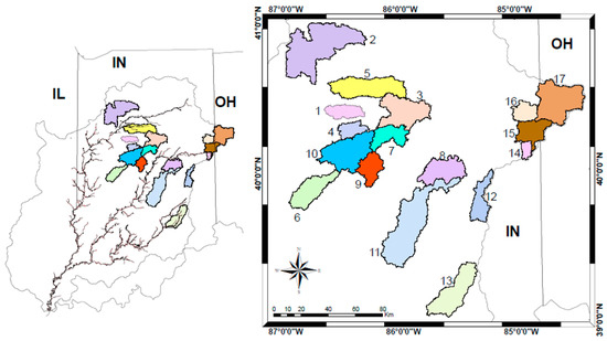
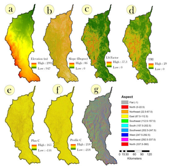
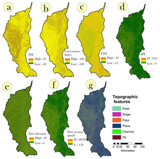
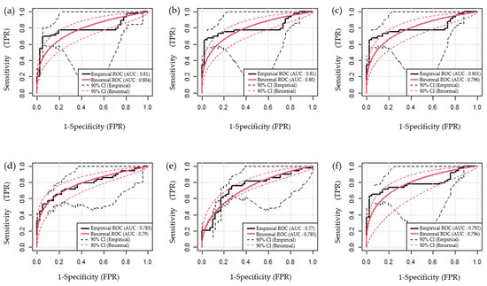
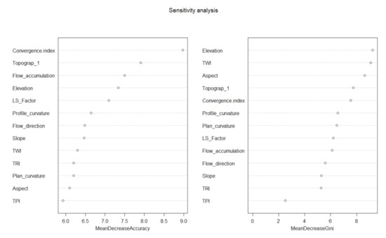
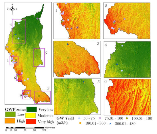
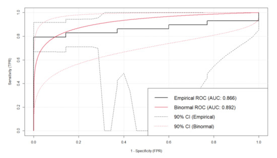
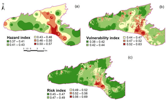
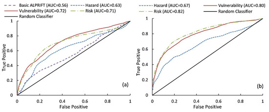
The present work aims to build a unique hybrid model by combining six fuzzy operator feature selection-based techniques with logistic regression (LR) for producing groundwater potential models (GPMs) utilising high resolution DEM-derived parameters in Saudi Arabia’s Bisha area. The current work focuses exclusively on the influence of DEM-derived parameters on GPMs modelling, without considering other variables. AND, OR, GAMMA 0.75, GAMMA 0.8, GAMMA 0.85, and GAMMA 0.9 are six hybrid models based on fuzzy feature selection. The GPMs were validated by using empirical and binormal receiver operating characteristic curves (ROC). An RF-based sensitivity analysis was performed in order to examine the influence of GPM settings. Six hybrid algorithms and one unique hybrid model have predicted 1835–2149 km2 as very high and 3235–4585 km2 as high groundwater potential regions. The AND model (ROCe-AUC: 0.81; ROCb-AUC: 0.804) outperformed the other models based on ROC’s area under curve (AUC). A novel hybrid model was constructed by combining six GPMs (considering as variables) with the LR model. The AUC of ROCe and ROCb revealed that the novel hybrid model outperformed existing fuzzy-based GPMs (ROCe: 0.866; ROCb: 0.892). With DEM-derived parameters, the present work will help to improve the effectiveness of GPMs for developing sustainable groundwater management plans.
Full article
(This article belongs to the Section Hydrogeology)
►
Show Figures
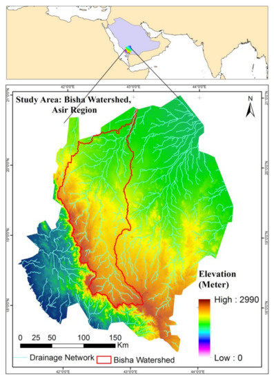
Figure 1


