
-
The Contribution of Malacological Studies to Understanding the Occupation Dynamics of the Prehistoric Site at Colombare di Villa-Negrar di Valpolicella (VR): Preliminary Report on the Remains from Trenches 4 and 15 -
Between Claudius and Trajan: Palaeoenvironmental Evolution of the Imperial Port of Portus (Central Italy)
Journal Description
Quaternary
Quaternary
is an international, peer-reviewed, open access journal that covers all aspects within quaternary science, embracing the whole range of scientific fields related to geological, geographical, biological, physical, chemical, environmental and human sciences. The journal is published bimonthly online by MDPI.
- Open Access — free for readers, with article processing charges (APC) paid by authors or their institutions.
- High Visibility: indexed within Scopus, ESCI (Web of Science), GeoRef, and other databases.
- Journal Rank: CiteScore - Q2 (Earth and Planetary Sciences (miscellaneous))
- Rapid Publication: manuscripts are peer-reviewed and a first decision is provided to authors approximately 26.8 days after submission; acceptance to publication is undertaken in 5.6 days (median values for papers published in this journal in the first half of 2026).
- Recognition of Reviewers: Reviewers whose reports are timely and of high quality receive an APC discount voucher for a future publication in an MDPI journal. Become a reviewer.
- Journal Cluster of Geospatial and Earth Sciences: Remote Sensing, Atmosphere, Geosciences, Climate, Quaternary, Earth, Geographies, Geomatics, Meteorology and Fossil Studies.
Impact Factor:
2.0 (2025);
5-Year Impact Factor:
2.4 (2025)
Latest Articles
Multidecadal Climate Variability During the Dark Ages Cold Period and Medieval Warm Period and Their Driving Mechanisms
Quaternary 2026, 9(5), 61; https://doi.org/10.3390/quat9050061 - 31 Aug 2026
Abstract
The evolution of multidecadal climate variability in the Asian monsoon region across cold-to-warm transitions over the past two millennia remains poorly constrained. Here, we present high-resolution multi-proxy records (δ13C, δ18O, Mg/Ca, Sr/Ca, and Ba/Ca) from stalagmite RY2 in Riyue
[...] Read more.
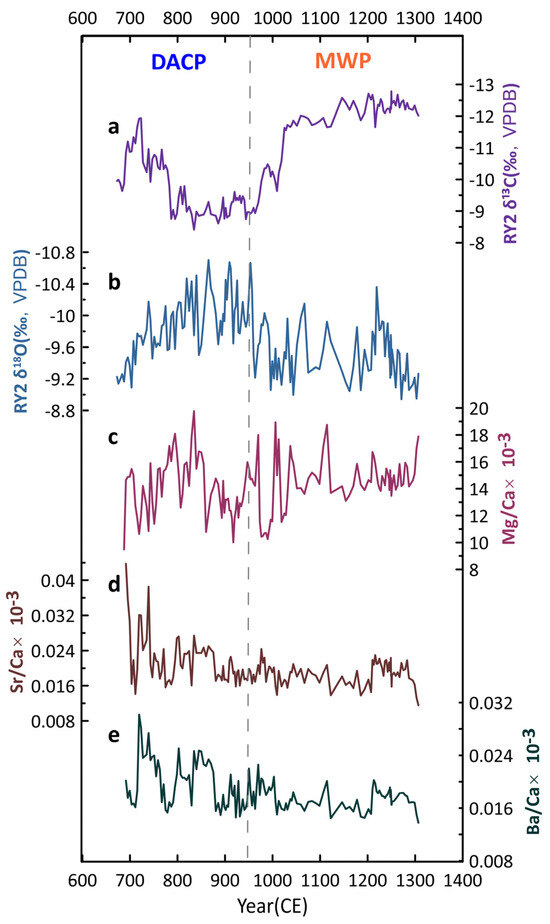
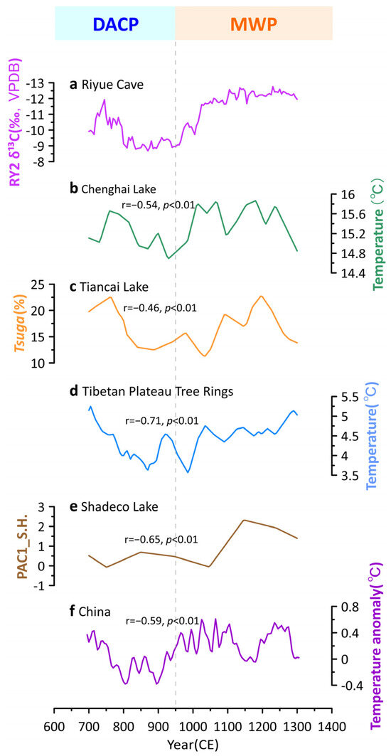
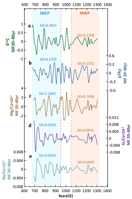
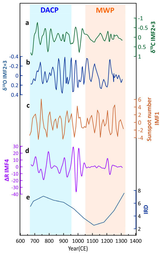
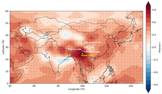
The evolution of multidecadal climate variability in the Asian monsoon region across cold-to-warm transitions over the past two millennia remains poorly constrained. Here, we present high-resolution multi-proxy records (δ13C, δ18O, Mg/Ca, Sr/Ca, and Ba/Ca) from stalagmite RY2 in Riyue Cave, southwestern China, spanning 673–1307 CE, to investigate multidecadal climate variability and its driving mechanisms from the Dark Ages Cold Period (DACP) to the Medieval Warm Period (MWP). Our results indicate that RY2 δ13C mainly reflects temperature-related regional ecosystem changes under the humid monsoonal setting, as supported by significant correlations with independent temperature reconstructions. Furthermore, the RY2 multi-proxy records indicate reduced multidecadal variability from the DACP to the MWP. This decline is statistically robust in the temperature-sensitive δ13C record and in the three trace-element records, whereas the corresponding change in δ18O is weaker and not statistically significant. The observed pattern is consistent with a possible role for enhanced solar variability and greater instability in North Atlantic Ocean sea-ice conditions during the DACP, although the present evidence primarily supports temporal correspondence, and these factors’ relative contributions remain to be quantified.
Full article
(This article belongs to the Special Issue Recent Advances in Multi-Proxy Analysis of Quaternary Sediments for Deciphering Climate Oscillations)
►
Show Figures
Open AccessArticle
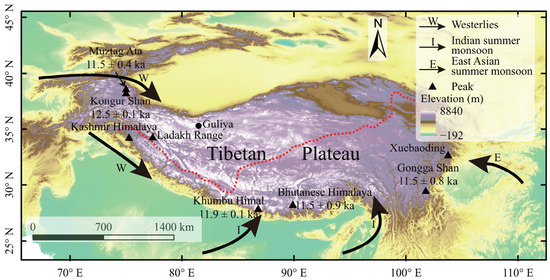
Younger Dryas Glacial Advances on the Tibetan Plateau
by
Hang Cui and Zongmeng Li
Quaternary 2026, 9(4), 60; https://doi.org/10.3390/quat9040060 - 21 Aug 2026
Abstract
►▼
Show Figures
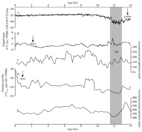
The Younger Dryas (YD) terminated the last glaciation and initiated the Holocene, which was accompanied by widespread glacial advances. Traditional scaling models, production rates, and outlier screening approaches for 10Be exposure dating often yield inconsistent formation ages for the same moraine, hindering
[...] Read more.
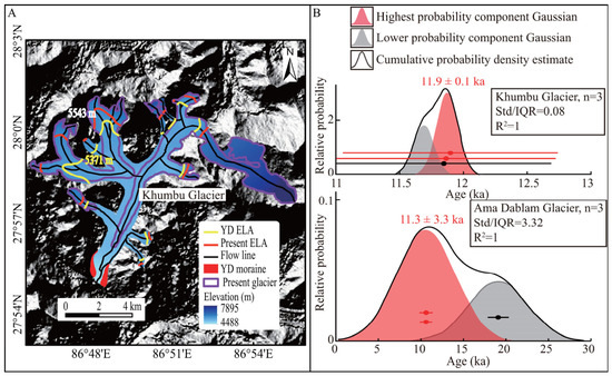
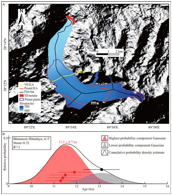
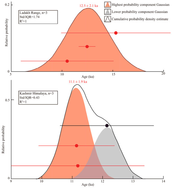
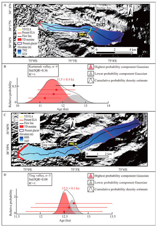
The Younger Dryas (YD) terminated the last glaciation and initiated the Holocene, which was accompanied by widespread glacial advances. Traditional scaling models, production rates, and outlier screening approaches for 10Be exposure dating often yield inconsistent formation ages for the same moraine, hindering a comprehensive understanding of spatiotemporal patterns and climatic controls of YD glaciation across the Tibetan Plateau. In this study, we reprocessed 10Be exposure ages using the Probabilistic Cosmogenic Age Analysis Tool 2.2 (P-CAAT) to constrain YD moraine chronologies. Three glacial events were dated to 12.5 ka, 11.9 ka, and 11.5 ka. Glacier-climate simulations showcased cold dry conditions in the monsoon domain and cold-wet conditions in the westerly domain during the YD. The modelled temperature reductions matched global climatic records. Glacial advances were primarily forced by cooling in monsoon areas, whereas joint cooling and increased precipitation dominated in westerly regions. This study clarifies the temporal characteristics and driving mechanisms of YD glaciation on the plateau, though additional dating information is required for further verification.
Full article

Figure 1
Open AccessArticle
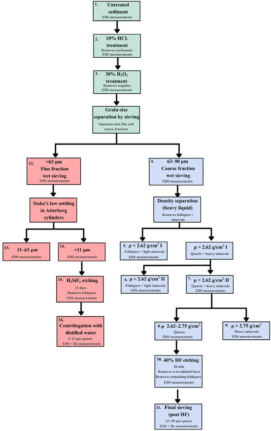
Evaluation of Conventional Quartz Extraction Protocols for Optically Stimulated Luminescence Dating by Scanning Electron Microscopy Coupled with Energy-Dispersive X-Ray Spectroscopy: An Example from Loess Samples
by
Bogdan-Leontin Marti, Șerban-Constantin Grecu, Daniela Brezeanu, Daniela Constantin and Alida Timar
Quaternary 2026, 9(4), 59; https://doi.org/10.3390/quat9040059 - 13 Aug 2026
Abstract
►▼
Show Figures
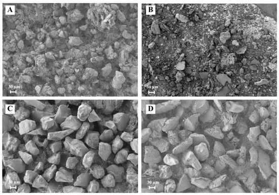
Quartz purity is essential for reliable optically stimulated luminescence (OSL) dating, yet the mineralogical evolution of sediment samples during extraction is rarely documented at each preparation stage. This study uses scanning electron microscopy coupled with energy-dispersive X-ray spectroscopy (SEM-EDS) to characterise two loess
[...] Read more.
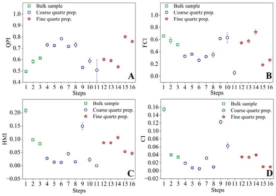
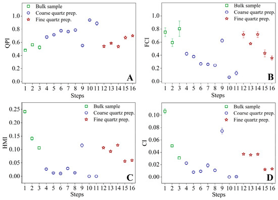
Quartz purity is essential for reliable optically stimulated luminescence (OSL) dating, yet the mineralogical evolution of sediment samples during extraction is rarely documented at each preparation stage. This study uses scanning electron microscopy coupled with energy-dispersive X-ray spectroscopy (SEM-EDS) to characterise two loess samples from the Urluia section, Dobrogea, Romania, across sixteen successive stages of a standard OSL quartz extraction protocol. Four compositional indices—the Quartz Purity Index (QPI), Feldspar Contamination Index (FCI), Heavy Mineral Index (HMI), and Carbonate Index (CI)—are introduced to quantify purification efficiency. Each preparation stage played a different role: HCl treatment primarily removed carbonates, grain-size separation and density fractionation reduced heavy minerals by ~99%, and feldspar removal resulted from the combined effects of density separation and HF etching. Despite identical protocols, two samples collected from stratigraphically adjacent positions showed markedly different HF etching efficiencies, reaching ~94% and ~66% quartz purity, respectively. However, luminescence measurements showed similarly weak feldspar signals in both samples, with intensities substantially lower than the quartz OSL signal. These results demonstrate that purification efficiency cannot be assumed to be uniform across loess samples in Romania and highlight SEM-EDS as a practical quality-control tool for OSL sample preparation.
Full article

Figure 1
Open AccessArticle
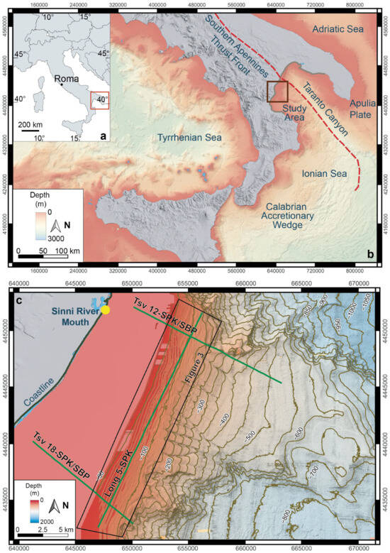
Seafloor Undulations Across the Shelf–Slope Offshore the Sinni River (Ionian Sea, Southern Italy): Depositional, Deformational, or Hybrid Origin?
by
Agostino Meo, Mubashir Mehmood, Giuseppina Rossi and Maria Rosaria Senatore
Quaternary 2026, 9(4), 58; https://doi.org/10.3390/quat9040058 - 7 Aug 2026
Abstract
►▼
Show Figures
Seafloor undulations are common on continental shelves and slopes, but their origin is often difficult to determine because similar ridge-and-trough morphologies may originate from depositional processes, post-depositional deformation, or a combination of both. This study investigates seafloor undulations offshore the Sinni River mouth,
[...] Read more.
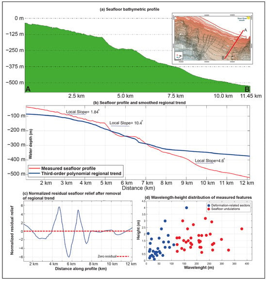
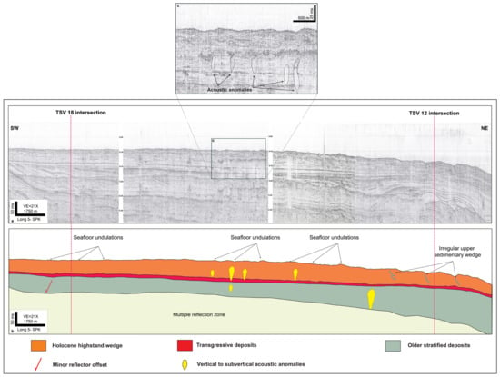
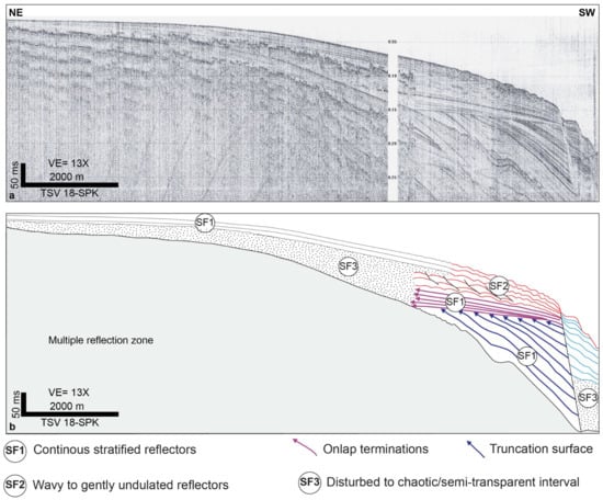
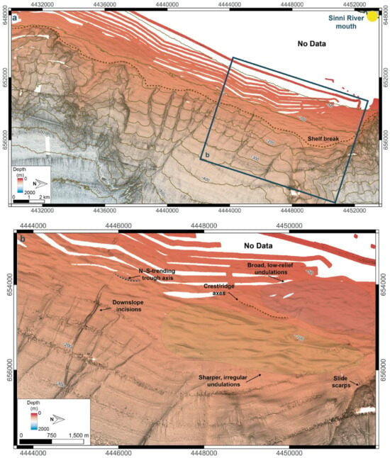
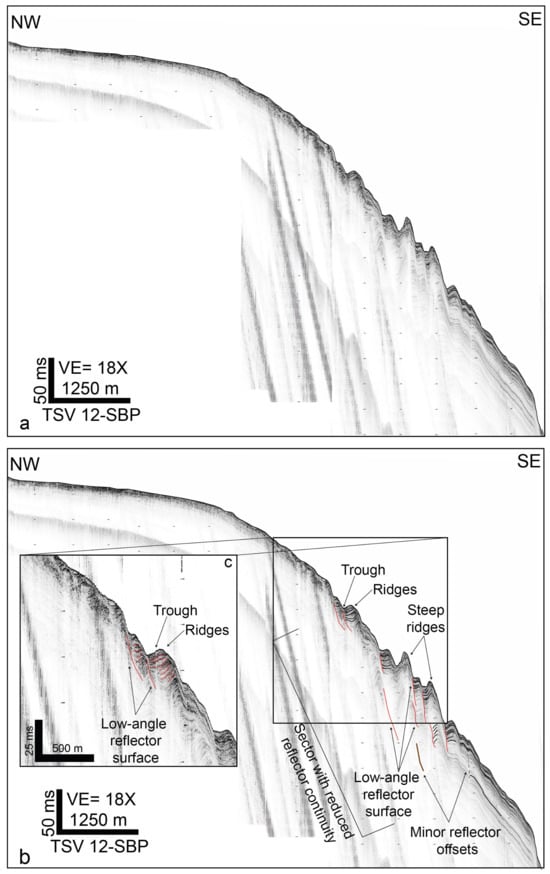
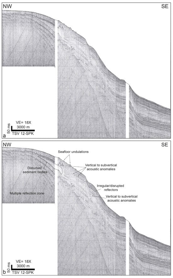
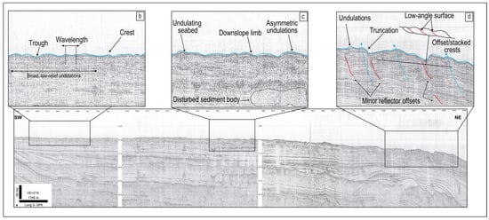
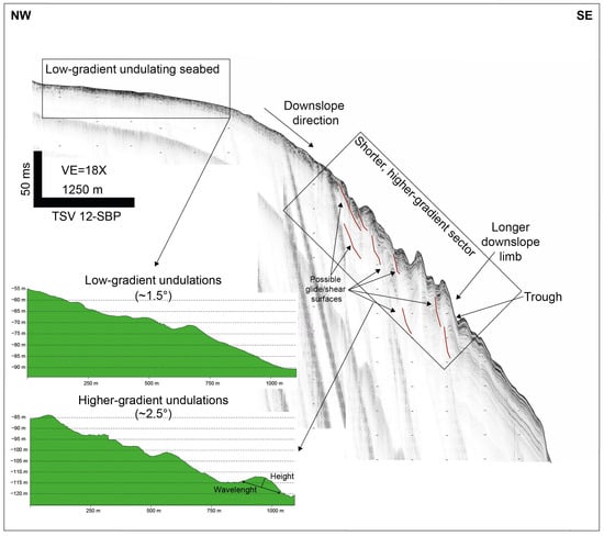
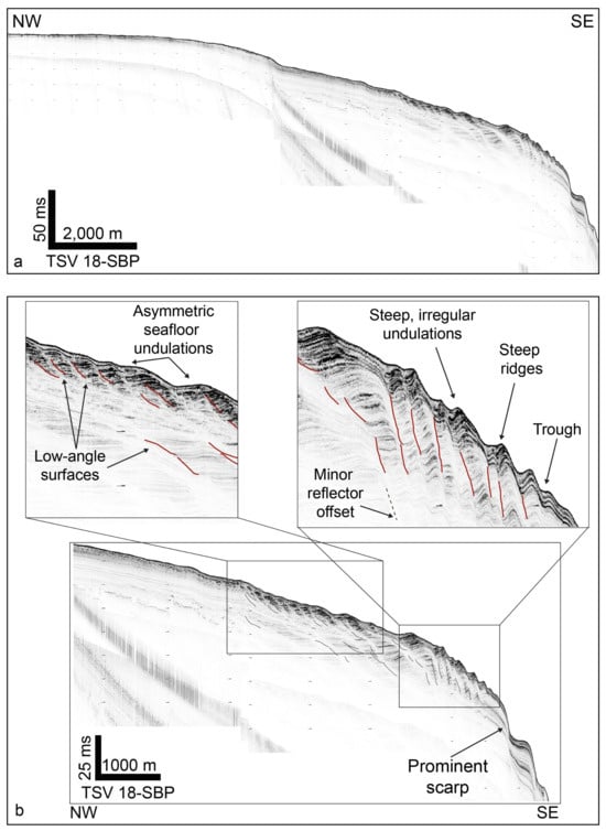
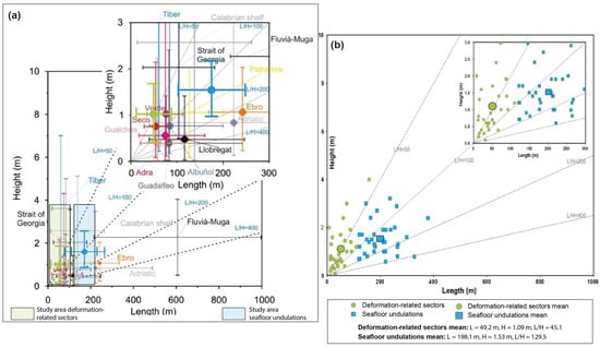
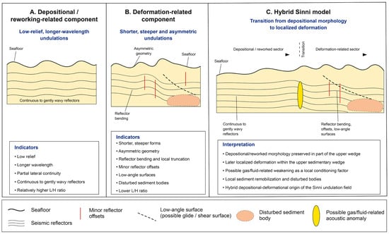
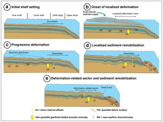
Seafloor undulations are common on continental shelves and slopes, but their origin is often difficult to determine because similar ridge-and-trough morphologies may originate from depositional processes, post-depositional deformation, or a combination of both. This study investigates seafloor undulations offshore the Sinni River mouth, southern Italy, to assess their depositional, deformational, or hybrid origin, using high-resolution bathymetry, sparker seismic profiles, sub-bottom profiler data, and morphometric analysis. Bathymetric data reveal a seaward-deepening shelf-to-slope system affected by submarine canyons, troughs, slide scarps, crests/ridge, and fields of undulated seafloor. Seismic profiles show that the undulations are mainly developed within the shallow sedimentary wedge, where continuous to gently wavy reflectors pass laterally and downslope into sectors characterized by reduced reflector continuity, local reflector bending, minor reflector offsets, low-angle reflector surfaces, disturbed sediment bodies, vertical to subvertical acoustic anomalies, and locally chaotic to semi-transparent seismic facies. Deeper stratified deposits are generally more continuous, indicating that deformation is mainly confined to the upper sedimentary succession. Morphometric analysis of 65 seabed features distinguishes broader seafloor undulations, characterized by longer wavelengths, low relief, and higher L/H ratios, from shorter, steeper deformation-related sectors with lower L/H ratios. The integrated evidence indicates that the Sinni undulation field is best interpreted as a hybrid depositional–deformational system. Broad, low-relief undulations record depositional accumulation and seabed reworking within the upper sedimentary wedge, whereas shorter, steeper, and more asymmetric sectors indicate localized post-depositional deformation, possibly favored by weak fine-grained deposits, gas/fluid-related acoustic disturbance, slope steepening, and local sediment remobilization.
Full article

Figure 1
Open AccessArticle
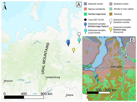
Fire Regime and Permafrost Controls on Vegetation Cover of the Pur–Taz Interfluve During the Early–Middle Holocene, West Siberian Subarctic
by
Nikita Shefer, Rinat Manasypov, Sergey Loiko, Tatiana Blyakharchuk, Lyudmila Shumilovskikh and Oleg S. Pokrovsky
Quaternary 2026, 9(4), 57; https://doi.org/10.3390/quat9040057 - 5 Aug 2026
Abstract
►▼
Show Figures
Western Siberia is one of the largest high-latitude lowland peatland regions on Earth and stores vast amounts of organic carbon in landscapes where vegetation, hydrology and fire are strongly regulated by permafrost. However, the long-term interactions among fire disturbance, permafrost dynamics, peatland development
[...] Read more.
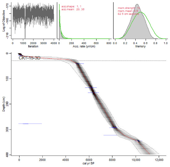
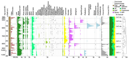
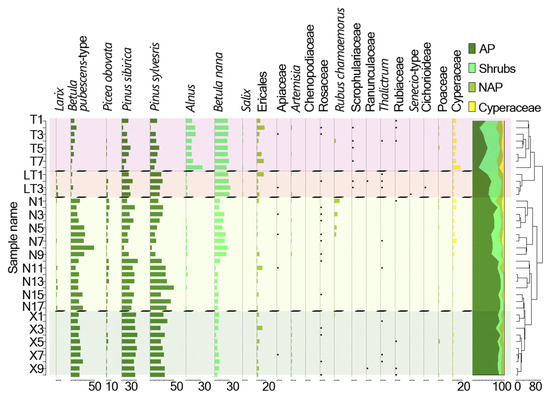
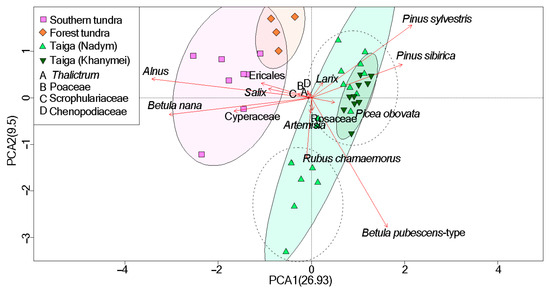
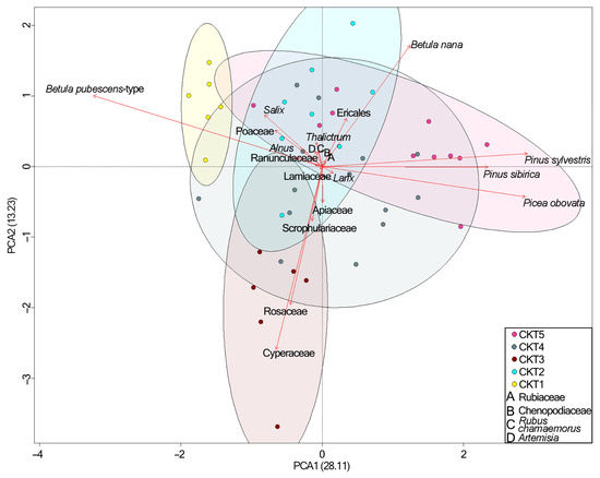
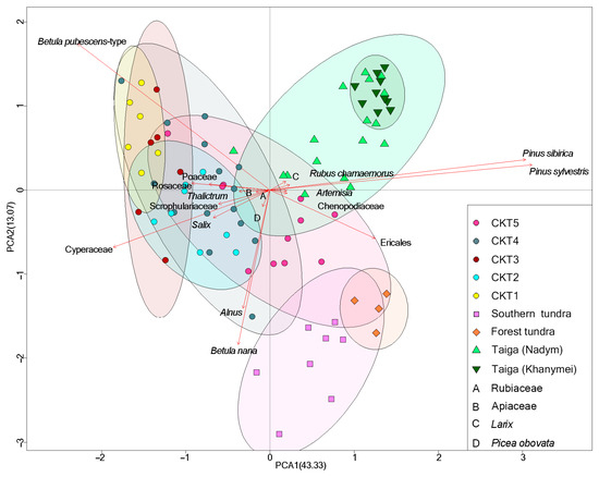
Western Siberia is one of the largest high-latitude lowland peatland regions on Earth and stores vast amounts of organic carbon in landscapes where vegetation, hydrology and fire are strongly regulated by permafrost. However, the long-term interactions among fire disturbance, permafrost dynamics, peatland development and forest–mire vegetation change remain insufficiently resolved. Here, we reconstructed regional vegetation dynamics, local mire succession, permafrost evolution and fire activity in the subarctic Pur–Taz interfluve, Western Siberia, during the Early to Middle Holocene from 11.2 to 4.4 cal kyr BP. The study combines pollen, non-pollen palynomorphs, microcharcoal records, principal component analysis and comparison with modern surface-sample analogues. The record documents a transition from Early Holocene larch–birch forest-tundra with no close modern analogue to increasingly heterogeneous forest–mire and shrub-tundra landscapes. After 9.5 cal kyr BP, Betula pubescens declined and Picea obovata pollen increased, with the strongest spruce signal between ca. 5.5 and 4.7 cal kyr BP. However, this pattern did not necessarily reflect a uniform regional expansion of spruce. Integrated fire reconstruction, based on microcharcoal peaks, Gelasinospora-type and declines in Betula pubescens-type pollen, indicates that recurrent fires after 8.0 cal kyr BP preferentially affected well-drained birch–larch uplands, whereas wetter riparian habitats acted as refugia for spruce. This landscape contrast increased the relative contribution of Picea pollen from fire-protected valleys, producing an apparent, partly artefactual spruce expansion signal. Locally, an open lake present at 11.2 cal kyr BP was transformed into a peatland after ca. 9.7 cal kyr BP. Cooling associated with the 8.2 cal kyr BP event promoted permafrost aggradation and polygonal mire initiation, whereas subsequent thaw and subsidence favoured waterlogging and mesotrophic fen development. Repeated alternation between permafrost aggradation, oligotrophication, degradation and renewed waterlogging culminated in polygonal microrelief by 6.1–5.3 cal kyr BP. These results show that Holocene vegetation change in the Pur–Taz interfluve was not controlled by climate alone, but by spatially heterogeneous feedbacks among permafrost state, peatland hydrology, fire disturbance and pollen-source structure. The West Siberian record provides a palaeoecological analogue for anticipating nonlinear vegetation and fire-regime responses in permafrost lowlands under ongoing Arctic warming.
Full article

Figure 1
Open AccessArticle
Pike Use in Megafauna Hunting and Antipredator Defense: Historical Techniques and Paleolithic Research
by
R. Scott Byram, Kent G. Lightfoot and Jun U. Sunseri
Quaternary 2026, 9(4), 56; https://doi.org/10.3390/quat9040056 - 4 Aug 2026
Abstract
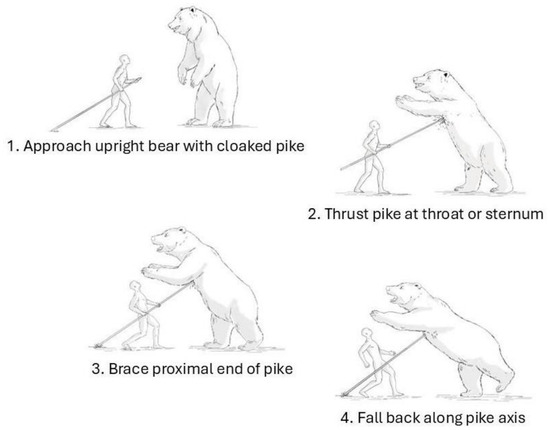
This paper presents a comprehensive assessment of megafauna confrontation using pikes, as recorded in historical accounts and ethnographic studies depicting techniques of hunter-gatherers, pastoralists, colonial hunters and others. In contrast to the two other basic spear types, the lance and the javelin, the
[...] Read more.
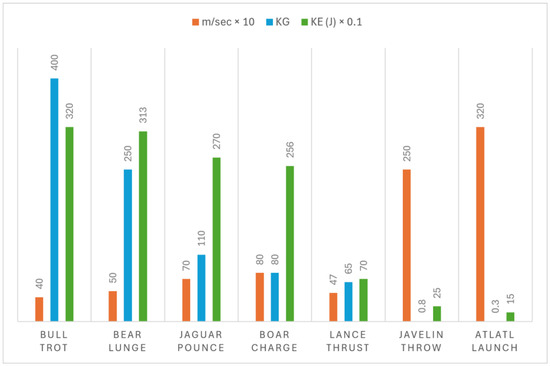
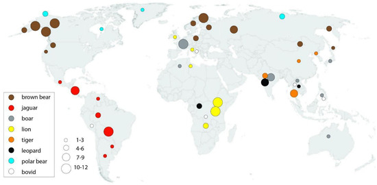
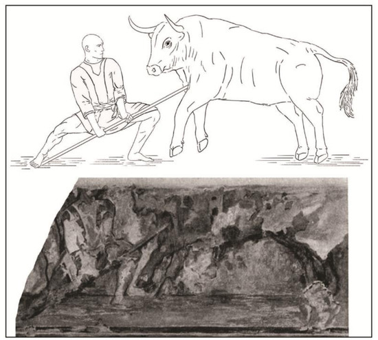
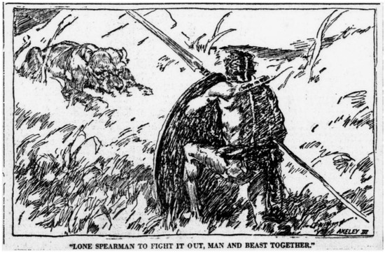
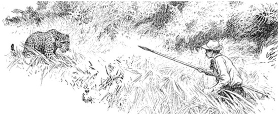
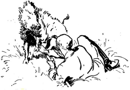
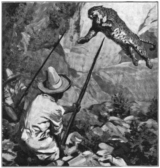
This paper presents a comprehensive assessment of megafauna confrontation using pikes, as recorded in historical accounts and ethnographic studies depicting techniques of hunter-gatherers, pastoralists, colonial hunters and others. In contrast to the two other basic spear types, the lance and the javelin, the impalement force of the pike is derived from the mass and speed of the charging or lunging animal. The historical data demonstrate that pike bracing was a common and fundamental technique used by spear-wielding individuals challenging megafauna, including ursids, pantherids, suids, bovids, and mounted equids, that confront humans aggressively and are not disadvantaged. In hunting, pikes were used most often in situations where the hunter influenced the animal’s behavior to draw a charge, leap or lunge. Braced spears (pikes) were also important for defending against predators and cavalry mounts that attacked in these ways. We examine such variables as animal size, trajectory and momentum, weapon rotation on its base, shaft diameter, frequency of cross bars, and point material (wood, osseous, lithic and metal). Variability in pike use is of significance to numerous archaeological and evolutionary topics that require assessment of human confrontation with Pleistocene megafauna, and approaches to archaeological pike identification are considered.
Full article
(This article belongs to the Special Issue Interdisciplinary Research into Cultural and Biological Transformations in the Paleolithic Period: 2nd Edition)
►▼
Show Figures

Figure 1
Open AccessArticle
Assessing Intraspecific Morphometric Variability in Prehistoric Archaeozoological Samples of Șoimuș-Teleghi (Hunedoara County, Romania)
by
Daniel Ioan Malaxa, Margareta-Simina Stanc, Oana Gâza, Doru Păceșilă, Alexandru Răzvan Petre and Luminița Bejenaru
Quaternary 2026, 9(4), 55; https://doi.org/10.3390/quat9040055 - 31 Jul 2026
Abstract
►▼
Show Figures
This study investigates intraspecific morphometric variability in the archaeozoological assemblages from the multi-period site of Șoimuș-Teleghi (Hunedoara County, Romania), encompassing occupation phases from the Early Neolithic (Starčevo-Criș culture) to the Late Bronze Age. The new AMS radiocarbon dates obtained refine the chronological
[...] Read more.
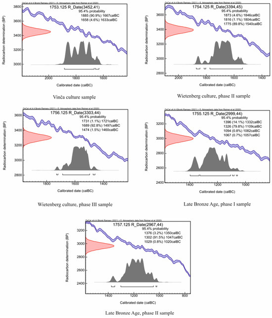
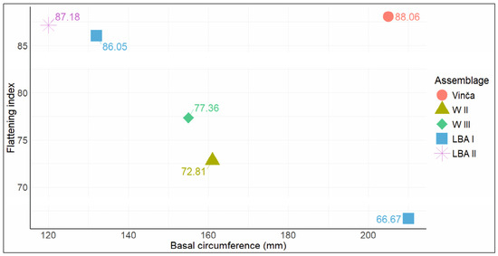
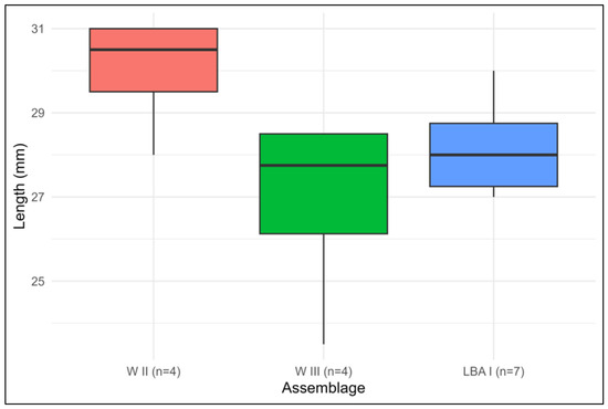
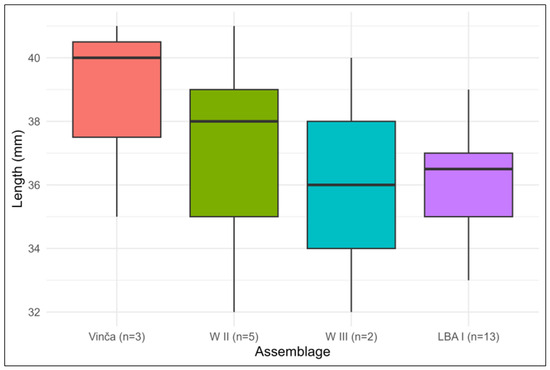
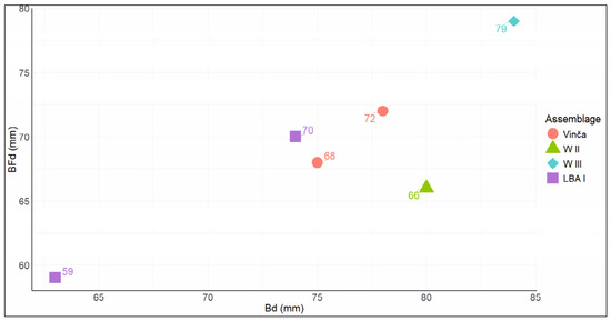
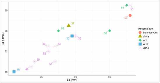
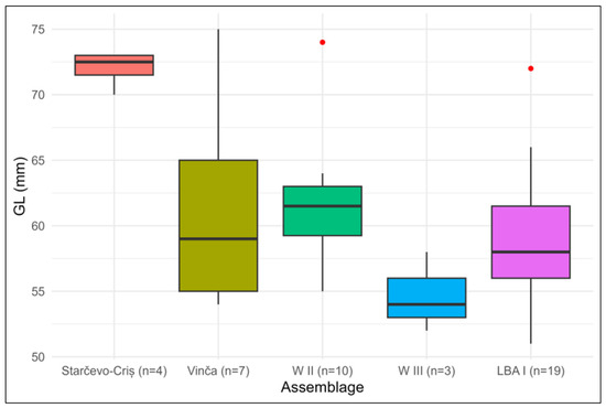
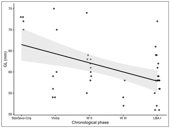
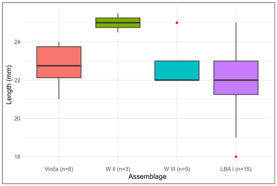
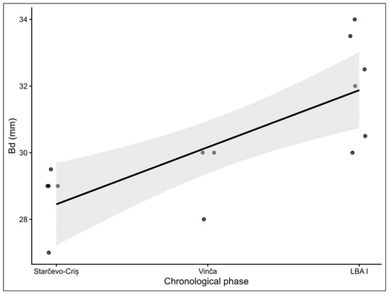
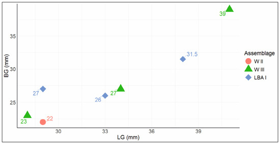
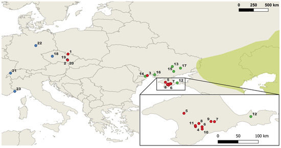
This study investigates intraspecific morphometric variability in the archaeozoological assemblages from the multi-period site of Șoimuș-Teleghi (Hunedoara County, Romania), encompassing occupation phases from the Early Neolithic (Starčevo-Criș culture) to the Late Bronze Age. The new AMS radiocarbon dates obtained refine the chronological framework of the site. The results reveal pronounced morphometric variability in cattle (Bos taurus), with horncore flattening indices, dental dimensions, and postcranial measurements enabling the differentiation of males, females, and probable castrates—the latter suggesting traction-oriented management strategies. A notably large horncore from the Vinča level may indicate hybridisation between domestic cattle and aurochs (Bos primigenius). Sheep (Ovis aries) display an increase in estimated withers height from the Neolithic to the Late Bronze Age, potentially reflecting improved husbandry. The pig (Sus domesticus) scapula scatter plot indicates a female-dominated culling pattern, while postcranial elements suggest relatively robust forelimbs combined with more gracile distal limb segments. Among wild taxa, red deer (Cervus elaphus) and wild boar (Sus scrofa) exhibit clear sexual dimorphism and generally large body sizes, consistent with the selective hunting of prime adult males. Comparative analysis with contemporary assemblages from Transylvania, Banat, and Hungary situates the Șoimuș-Teleghi material within broader regional trends, while highlighting certain distinctive features, particularly the large dimensions of Early Neolithic cattle and the diachronic size increase observed in caprine.
Full article

Figure 1
Open AccessArticle
Elevation-Dependent Phytolith Production in Norway Spruce: Toward a Quaternary “Phytolith Thermometer”
by
Anna F. Filep, Soma Diószegi, Albert Tóth, Botond Buró, Mihály Braun and Zsuzsa Lisztes-Szabó
Quaternary 2026, 9(4), 54; https://doi.org/10.3390/quat9040054 - 27 Jul 2026
Abstract
►▼
Show Figures
Norway spruce (Picea abies [L.] Karst.) is a paleoecologically relevant species in the Northern Hemisphere since the early Holocene. P. abies populations are sensitive to climate fluctuations; Asian treeline species are under nature protection. The thick wax and cuticle layers of spruce
[...] Read more.
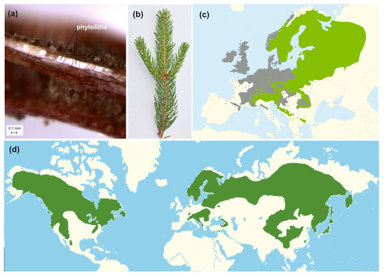
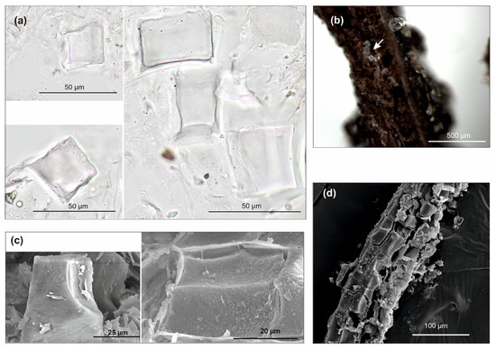
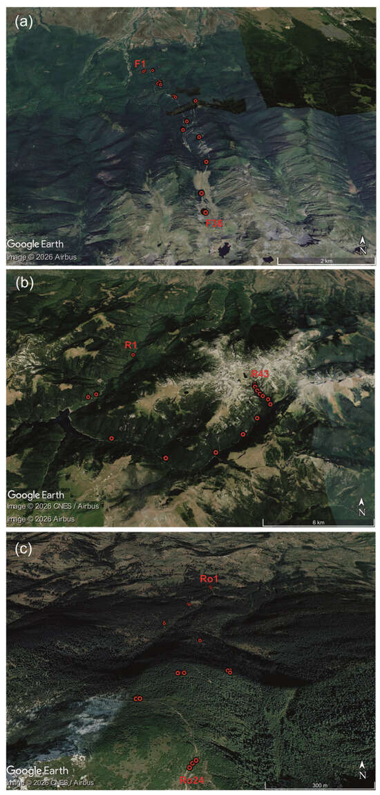
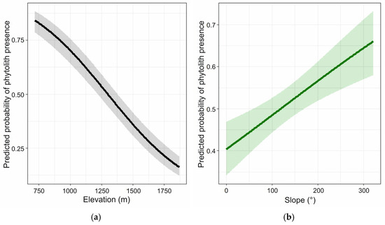
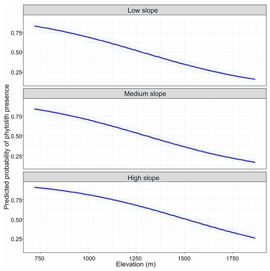
Norway spruce (Picea abies [L.] Karst.) is a paleoecologically relevant species in the Northern Hemisphere since the early Holocene. P. abies populations are sensitive to climate fluctuations; Asian treeline species are under nature protection. The thick wax and cuticle layers of spruce needles enhance their durability, making them frequent in glacial lake and peat bog cores. Their phytoliths are easily recognizable in sedimentary material and can be studied in subfossil tissues. The aim of this study is to assess the applicability of characteristic phytoliths from Norway spruce needles in paleoclimate research. We examined phytolith presence as a function of altitude in plant samples from three Carpathian Mountain ranges. Temperature data loggers were deployed at sampling sites to better characterize the thermal background of phytolith formation. Our results show a decreasing trend in phytolith presence with increasing elevation. The phytoliths formed by the transfusion tissue represent a sensitive type, indicating that spruce needle phytolith production responds to microclimatic variation. These findings are worth further investigation and validation. The study also provides a basis for refining the calculation method, contributing to the development of a potential “phytolith thermometer” for paleoclimatic reconstruction.
Full article

Figure 1
Open AccessReview
Bone Collagen δ13C and δ15N for Palaeodietary Reconstruction: A Critical Review
by
Alireza Koochakzaei and Elmira Mobasher Maghsoud
Quaternary 2026, 9(4), 53; https://doi.org/10.3390/quat9040053 - 20 Jul 2026
Abstract
►▼
Show Figures
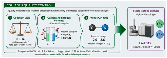
Stable carbon (δ13C) and nitrogen (δ15N) isotope analysis of bone collagen has become a cornerstone method for reconstructing the diets of past populations. This critical review moves beyond the mere presentation of data to examine the theoretical foundations, methodologies,
[...] Read more.
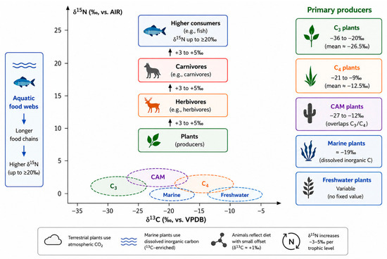
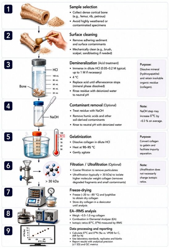
Stable carbon (δ13C) and nitrogen (δ15N) isotope analysis of bone collagen has become a cornerstone method for reconstructing the diets of past populations. This critical review moves beyond the mere presentation of data to examine the theoretical foundations, methodologies, and applications of this approach. The principles of the method are based on isotopic fractionation during photosynthetic pathways (C3, C4, and CAM) and the trophic-level enrichment of 15N, which together enable the differentiation of plant food sources and the identification of consumer trophic position, respectively. The methodology encompasses sampling strategies, challenges posed by diagenesis, collagen extraction protocols, including the Longin method, and quality-control criteria (collagen yield, C:N ratio). Key applications include the reconstruction of baseline diets, the determination of weaning practices, and the identification of social inequalities. However, confounding factors—such as climate-driven variation in baseline nitrogen values, physiological effects (disease, lactation), and the consequences of human activities (manuring)—can complicate interpretation. Future directions include compound-specific amino acid analysis, multi-isotope approaches, and Bayesian modelling. In conclusion, isotopic data require a contextual and interdisciplinary approach to achieve a realistic understanding of diet and socio-cultural dynamics during the Quaternary.
Full article

Figure 1
Open AccessArticle
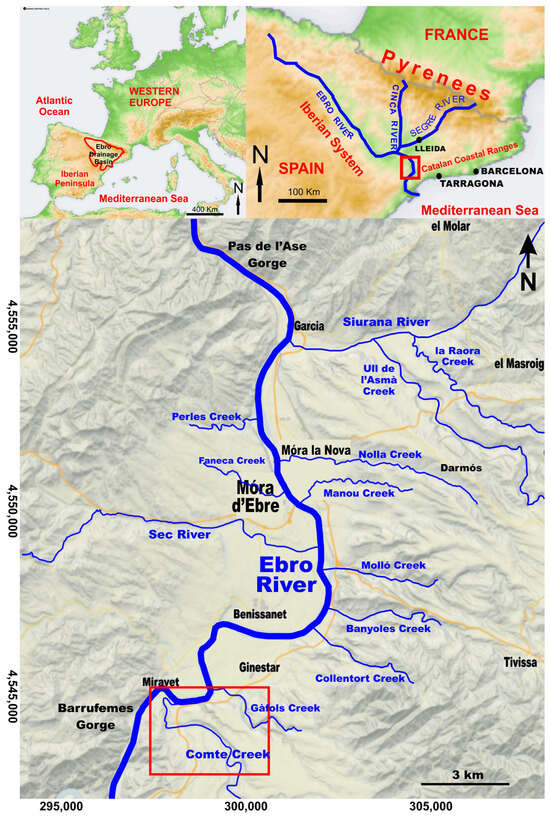
Hydraulic and Sedimentological Reconstruction of a Middle/Late Pleistocene Boundary Superflood (Ebro River, NE Iberian Peninsula)
by
Francesc Xavier Castelltort Aiguabella, Josep Carles Balasch and Frank Preusser
Quaternary 2026, 9(4), 52; https://doi.org/10.3390/quat9040052 - 10 Jul 2026
Abstract
►▼
Show Figures
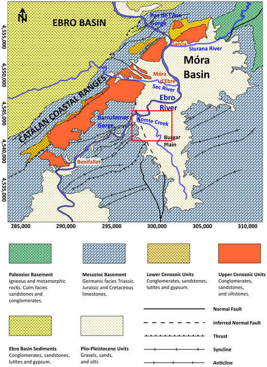
Fluvial superfloods are geomorphologically significant episodes due to their enormous energy and extremely low recurrence in the geological record. Their rarity is particularly notable in areas far from the major continental glacial masses. Hydraulic constrictions in the Lower Ebro River gorges caused the
[...] Read more.
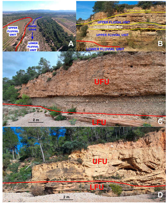
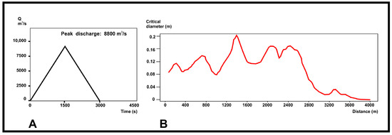
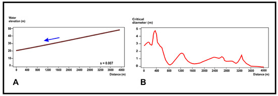
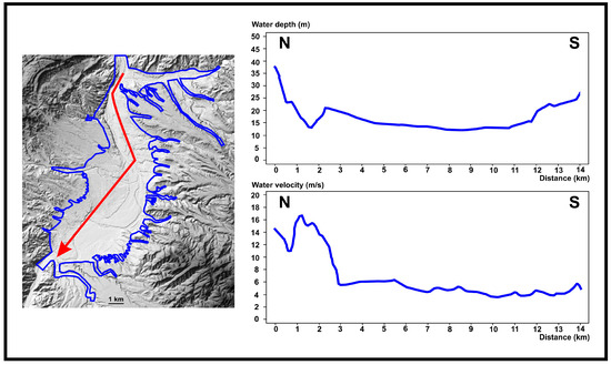
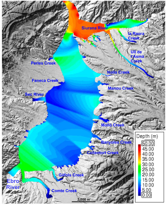
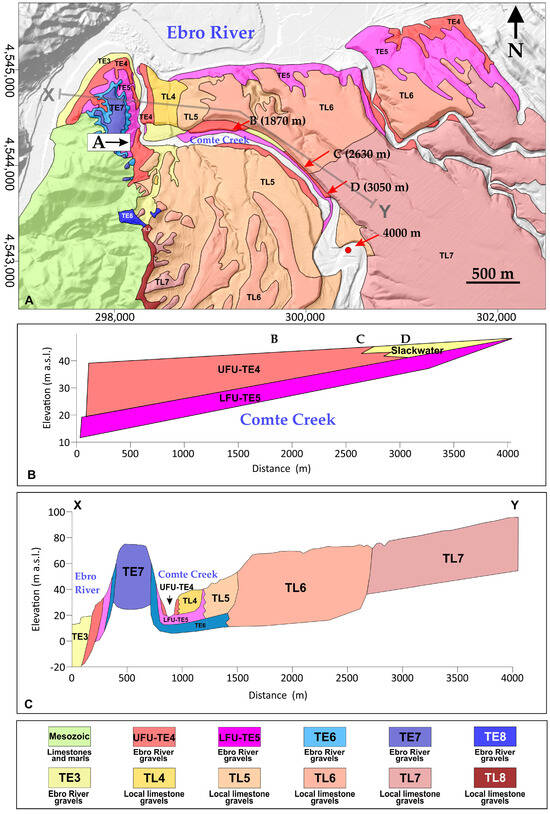
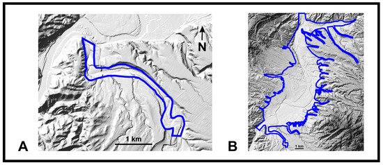
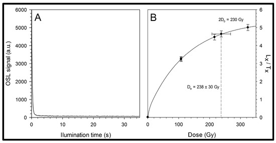
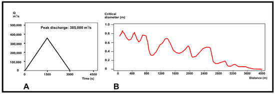
Fluvial superfloods are geomorphologically significant episodes due to their enormous energy and extremely low recurrence in the geological record. Their rarity is particularly notable in areas far from the major continental glacial masses. Hydraulic constrictions in the Lower Ebro River gorges caused the accumulation of fluvial deposits, as floodwaters from the Ebro River were forced upstream into the tributary valleys of the Móra Basin. The most illustrative example is the Comte Creek, where two depositional units of different ages show upstream flood accumulations (extending up to ~4 km) with very high-energy sedimentary structures, followed by downstream reworking during backflow. Two-dimensional hydraulic simulations indicate that peak discharges reaching 385,000 m3·s−1, with water depths of approximately 28 m in the confluence area, would have been required to transport sediments to the observed outcrop positions. Luminescence dating of the slackwater deposits indicates that the formative processes occurred during the latest Middle Pleistocene or the Last Interglacial (Eemian).
Full article

Figure 1
Open AccessArticle
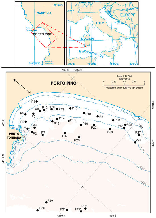
Spatial Variability of Benthic Foraminiferal Communities in a Mediterranean Shoreface–Inner Shelf Setting (Porto Pino, SW Sardinia, Mediterranean Sea)
by
Carla Buosi, Angelo Ibba, Marco Porta, Daniele Trogu and Sandro De Muro
Quaternary 2026, 9(4), 51; https://doi.org/10.3390/quat9040051 - 7 Jul 2026
Abstract
►▼
Show Figures
This study investigates the spatial variability of benthic foraminiferal assemblages across the shoreface–inner shelf transition of the Porto Pino coastal system (SW Sardinia, western Mediterranean). Porto Pino is a microtidal, wave-dominated embayment characterized by an environmental gradient extending from siliciclastic shoreface sands to
[...] Read more.
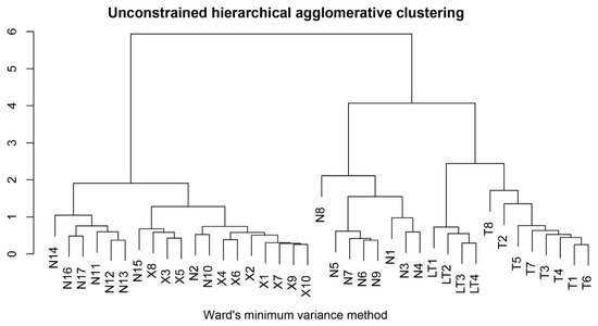
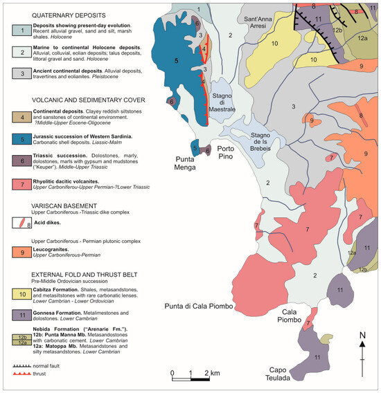
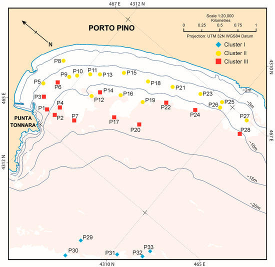
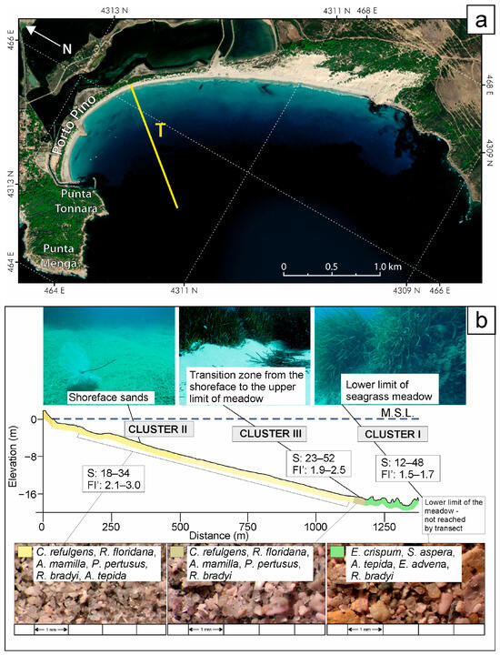
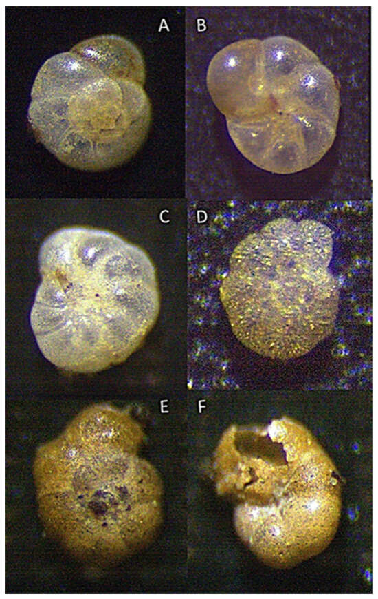
This study investigates the spatial variability of benthic foraminiferal assemblages across the shoreface–inner shelf transition of the Porto Pino coastal system (SW Sardinia, western Mediterranean). Porto Pino is a microtidal, wave-dominated embayment characterized by an environmental gradient extending from siliciclastic shoreface sands to mixed bioclastic sediments associated with the Posidonia oceanica meadow. A total of 33 sediment samples were analyzed for grain size, benthic foraminiferal assemblages, morphotypes and diversity indices. Cluster analysis and Principal Component Analysis (PCA) were used to investigate the spatial variability of the assemblages. Three main benthic foraminiferal assemblages were identified, each corresponding to a distinct benthic habitat: shallow unvegetated shoreface sands, a transitional zone near the upper limit of the P. oceanica meadow, and deeper mixed bioclastic sediments associated with its lower boundary. The distribution of the foraminiferal assemblage reflects the combined influence of hydrodynamic energy, substrate composition, water depth, and proximity to the meadow. Diversity indices indicate generally low-stress environmental conditions, whereas morphotype composition reflects changes in habitat structure and substrate characteristics along the shoreface–inner shelf gradient. These results demonstrate that benthic foraminifera effectively track environmental and sedimentological gradients in Mediterranean embayed systems and highlight their value for environmental reconstructions and biomonitoring applications.
Full article

Figure 1
Open AccessArticle
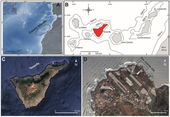
Palaeobiodiversity and Palaeoecology of the Last Interglacial (MIS 5e) Marine Fauna and Flora from San Juanito (Punta del Hidalgo, Tenerife Island) in the Canary Islands
by
Sérgio P. Ávila, Alfred Uchman, Sandra C. Marques, José Madeira, Markes E. Johnson, Patrícia Madeira, Ana Hipólito, Mohamed Amine Doukani, Gonçalo Castela Ávila, Mafalda R. Marques, Pablo J. González, Thomas Boulesteix, Andreas Kroh, Daniela Basso and Esther Martín-González
Quaternary 2026, 9(4), 50; https://doi.org/10.3390/quat9040050 - 6 Jul 2026
Abstract
►▼
Show Figures
The Macaronesian archipelagos host exceptionally well-preserved coastal sedimentary deposits formed during the warmest period of the Last Interglacial episode, the Marine Isotope Substage 5e (MIS 5e). Numerous MIS 5e fossiliferous outcrops occur, scattered across several islands of the Canary Archipelago. Among these is
[...] Read more.
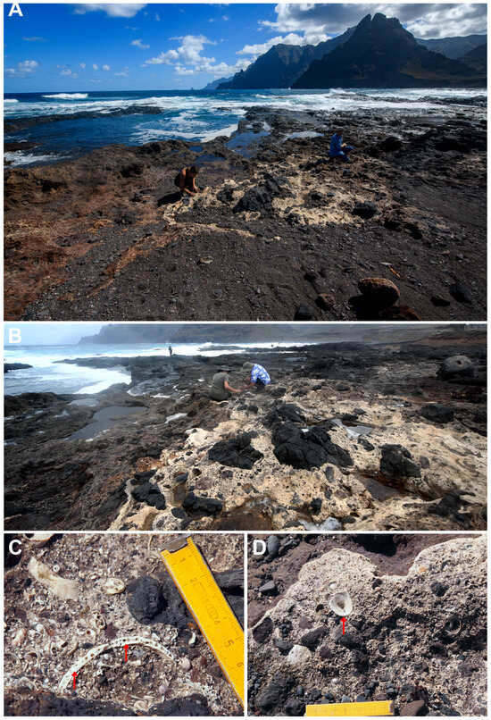
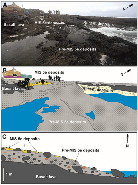
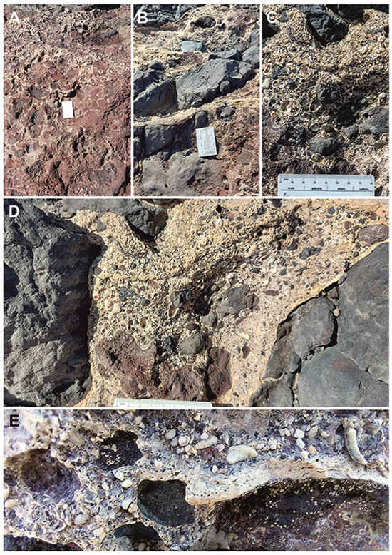
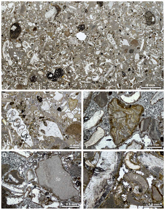
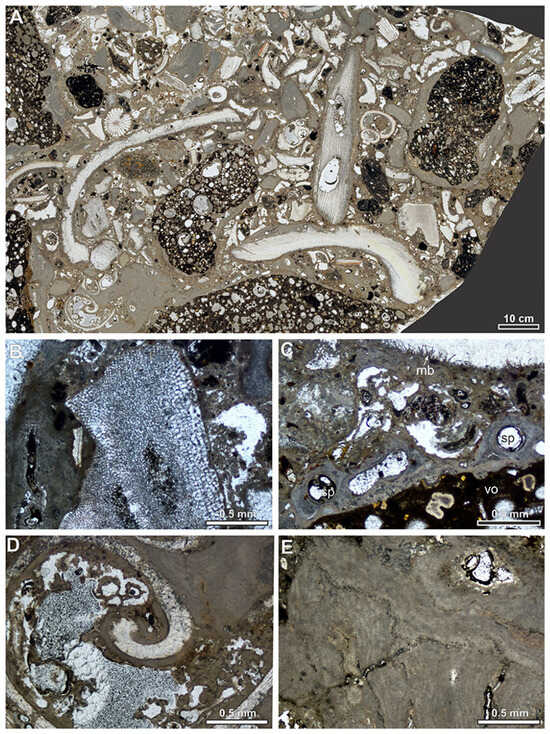
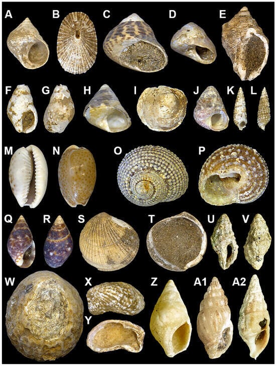
The Macaronesian archipelagos host exceptionally well-preserved coastal sedimentary deposits formed during the warmest period of the Last Interglacial episode, the Marine Isotope Substage 5e (MIS 5e). Numerous MIS 5e fossiliferous outcrops occur, scattered across several islands of the Canary Archipelago. Among these is San Juanito, a small outcrop located in the eastern sector of Punta del Hidalgo (northeast Tenerife Island), where MIS 5e sediments are distributed over an area of approximately 480 m2. A multidisciplinary study was conducted, aiming to: (i) determine the age of the fossiliferous sediments; (ii) define the stratigraphic relationships between the sedimentary deposit and the underlying/overlying volcanic sequences; (iii) assess the taxonomic richness and the functional palaeobiodiversity of this palaeosite; and (iv) provide a comprehensive palaeoecological reconstruction of the MIS 5e environment. Based on two key ecostratigraphic indicator species for the Canarian MIS 5e, the San Juanito sequence is here assigned to the Last Interglacial. Qualitative sampling yielded forty mollusc taxa, including three gastropods that represent new records—Alvania johannae Moolenbeek & Hoenselaar, 1998, Krachia tiara (Monterosato, 1874), and Barleeia unifasciata (Montagu, 1803)—bringing the current MIS 5e checklist for the Canary Islands to 202 gastropods and 80 bivalves. The highly cemented matrix of the San Juanito deposits prevented the collection of standardized 1 kg bulk sediment samples. Nevertheless, we strongly recommend adopting this quantitative approach in future studies of suitable MIS 5e outcrops across the archipelago. The faunal assemblage indicates that the San Juanito region was dominated by rocky shores during the MIS 5e, much like today. This paleoenvironmental reconstruction is based on the high frequency of species associated with hard substrates—including echinoids, vermetids, fissurellids, and patellids—and the overwhelming dominance (95%) of epifaunal gastropods.
Full article

Figure 1
Open AccessArticle
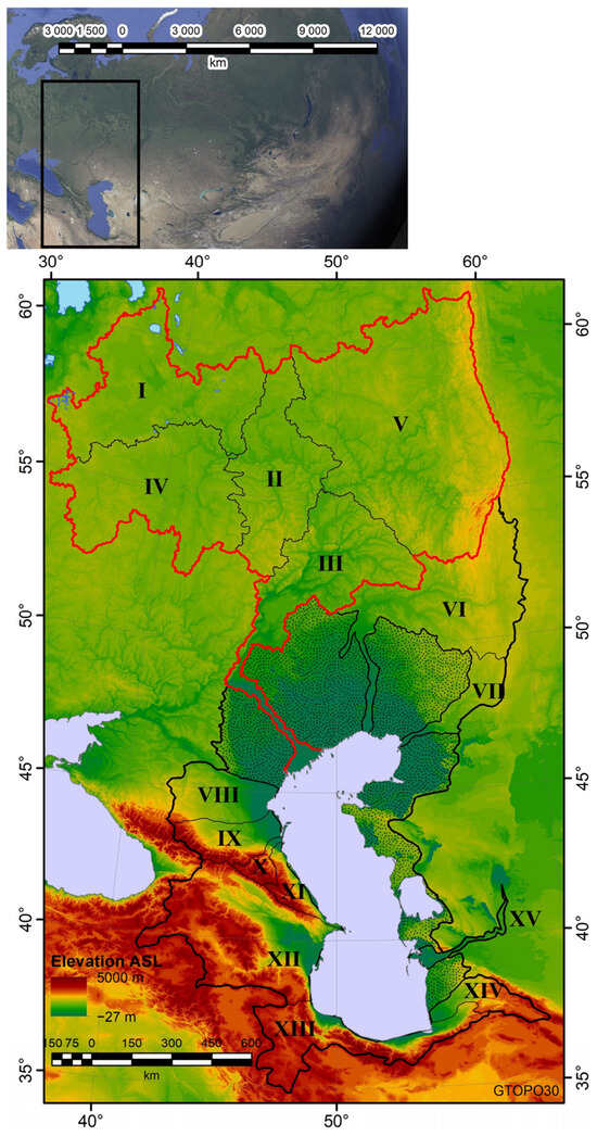
Middle Holocene Decline of River Runoff in the Volga Basin and Its Effect on the Caspian Sea Level
by
Aleksey Sidorchuk, Olga Borisova, Polina Morozova, Andrei Panin, Vadim Ukraintsev and Konstantin Ushakov
Quaternary 2026, 9(4), 49; https://doi.org/10.3390/quat9040049 - 29 Jun 2026
Abstract
►▼
Show Figures
Research in quantitative paleohydrology shows that a phase of very high river discharge on the northern Eurasian plains in the late Pleniglacial (about 18–14 ka BP) was followed by a much less studied phase of reduced discharge and small-channel formation. To characterize this
[...] Read more.
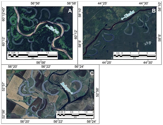
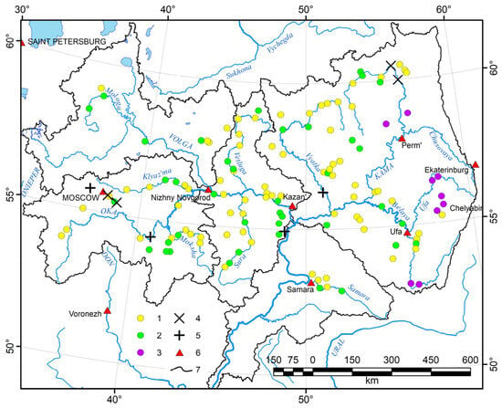
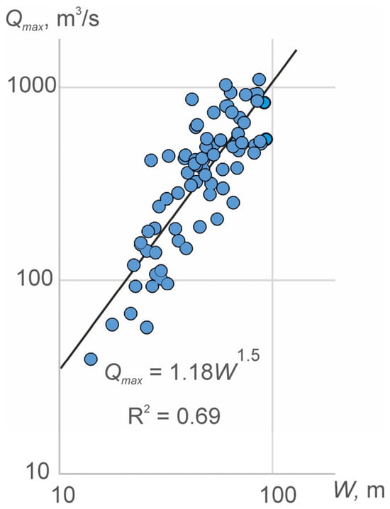
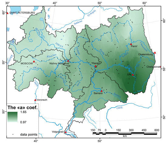
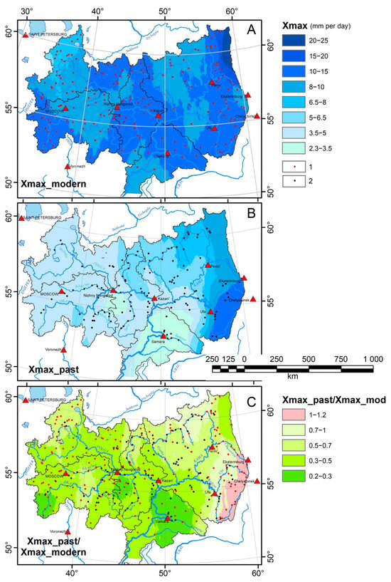
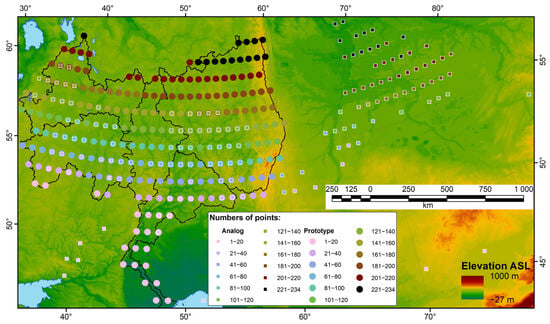
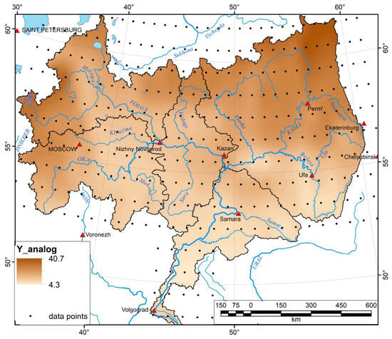
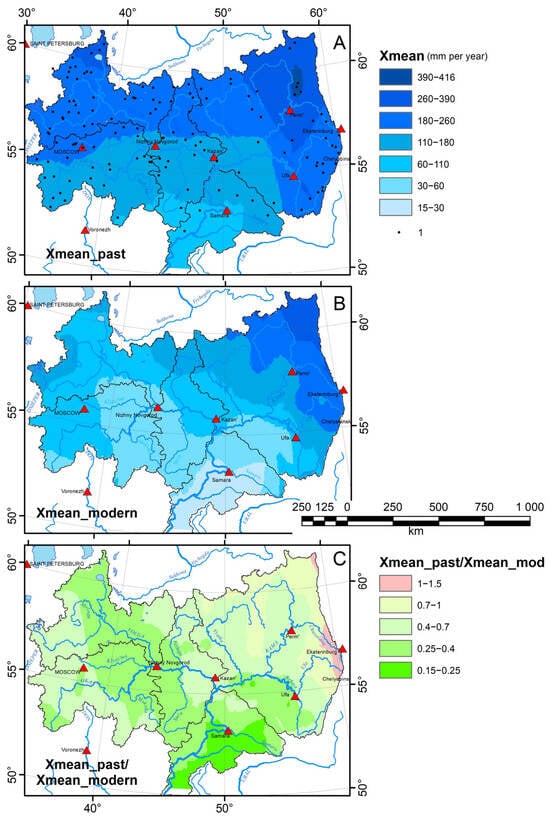
Research in quantitative paleohydrology shows that a phase of very high river discharge on the northern Eurasian plains in the late Pleniglacial (about 18–14 ka BP) was followed by a much less studied phase of reduced discharge and small-channel formation. To characterize this morphohydrological metamorphosis, we investigated the morphometry of small meandering paleochannels on floodplains at 132 river-valley sites in the Volga basin. On average, the widths and meander wavelengths of these paleochannels are approximately half those of modern channels. The ages of the paleochannels range from 10 to 4 ka BP. The hydrological regime of small mid-Holocene meandering rivers was reconstructed using morphometric relationships, principally the power-law relationship between bankfull channel width and mean maximum flood discharge and the relationship between maximum discharge and contributing basin area. The mean reconstructed daily maximum runoff depth for small catchments in the Volga basin during the snowmelt period in the mid-Holocene was about 5 mm/day, approximately half the modern value. The ratios between mean annual and mean maximum runoff depths in the mid-Holocene were estimated from modern regional analogues of the ancient climate, using climate models for the 6 ka BP time slice. Annual river runoff depths in the Volga basin in the mid-Holocene were then calculated from these analogue ratios and the daily maximum runoff depths. The mean annual runoff depth in small catchments was about 100 mm, almost half the current runoff in the Volga River basin. The annual Volga River runoff volume in the mid-Holocene was approximately 132 km3, compared with the current value of 250 km3. This decline in river runoff in the Volga basin resulted in a low stand of the Caspian Sea in the early–middle Holocene, with a calculated potential sea level of −65 to −79 m abs.
Full article

Figure 1
Open AccessArticle
Holocene Paleolake Evolution of the Bribir–Ostrovica Karst Polje (Dalmatia, Croatia): A Multi-Proxy Lake Sediment Record
by
Nikolina Ilijanić, Ivona Ivkić Filipović, Slobodan Miko, Valentina Hajek-Tadesse, Martina Šparica Miko, Sarah B. McClure, Douglas J. Kennett, Emma Hartke, Katherine H. Freeman, Željka Sladović and Emil Podrug
Quaternary 2026, 9(4), 48; https://doi.org/10.3390/quat9040048 - 26 Jun 2026
Abstract
►▼
Show Figures
Karst poljes in the Dinaric karst are widely infilled with Quaternary sediments. In the Bribir–Ostrovica karst polje, these sediments were investigated using geomorphological mapping and multiproxy analysis of lake sediment cores, including grain size, mineralogical, total organic and inorganic carbon (TOC, TIC), and
[...] Read more.
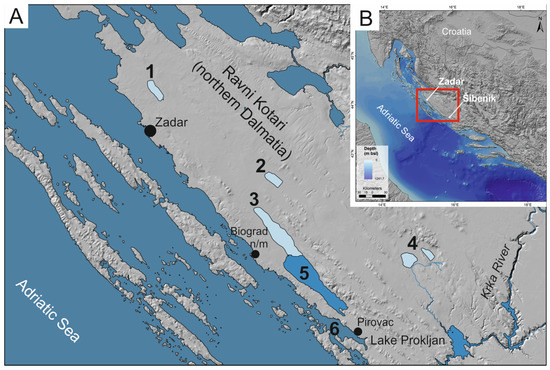
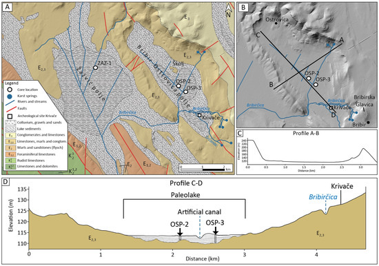
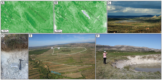
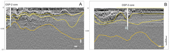
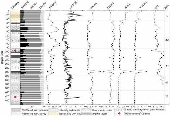
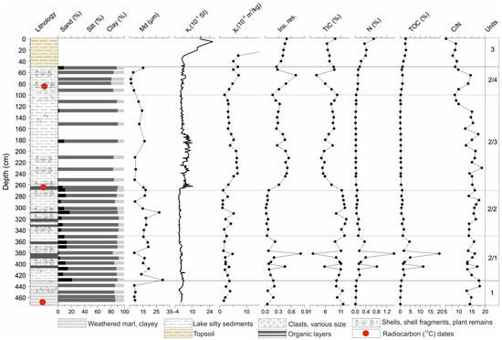
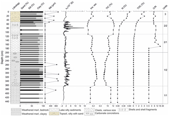
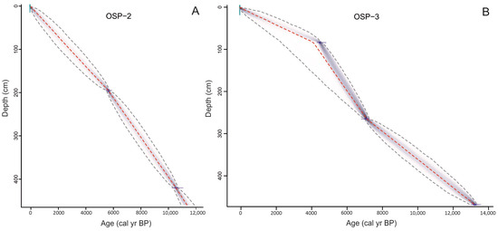
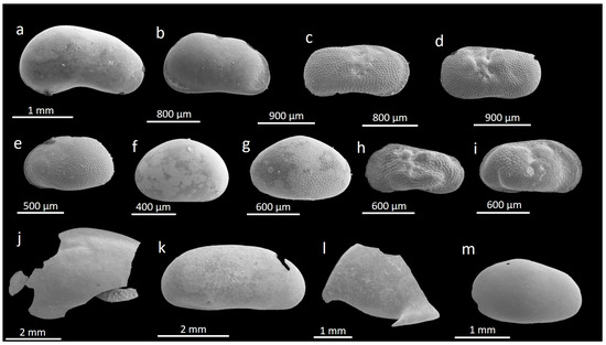
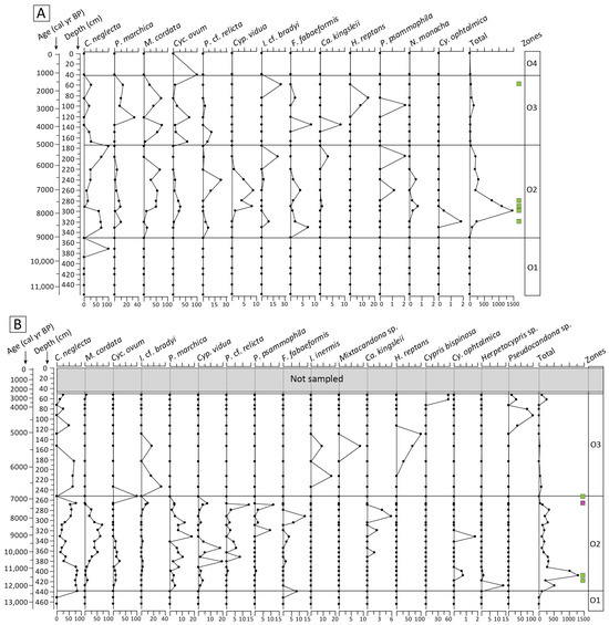
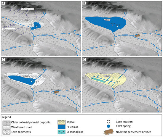
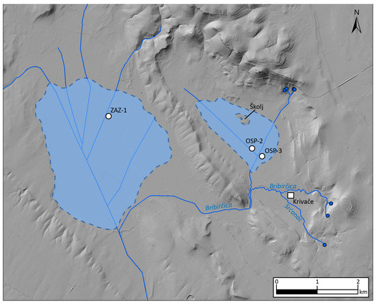
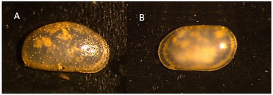
Karst poljes in the Dinaric karst are widely infilled with Quaternary sediments. In the Bribir–Ostrovica karst polje, these sediments were investigated using geomorphological mapping and multiproxy analysis of lake sediment cores, including grain size, mineralogical, total organic and inorganic carbon (TOC, TIC), and ostracod analyses, coupled with radiocarbon dating. A key sediment core (OSP-3) recovered a ~470 cm long sedimentary sequence dating back to 13,200 cal yr BP. The floodplain to wetland environment occurred at the Late Pleistocene to Holocene transition (ca. 12,100 cal yr BP), evident by the first appearances of ostracods and an increase in TOC. More stable lake conditions prevailed between 9600 and 7200 cal yr BP, with dominant carbonate deposition and abundant ostracods. During the Middle and Late Holocene, increased clastic input and reduced ostracod presence indicate a shallow, dynamic water body influenced by erosion and periodic flooding. Lake sedimentation was strongly controlled by local karst topography, with a maximum lake depth of ca. 6 m. The Bribir–Ostrovica paleolake represents a rare terrestrial Holocene paleoenvironmental record from the Dinaric karst of the eastern Adriatic coast and provides valuable context for interpreting the nearby Neolithic archaeological site of Krivače as a lakeside settlement.
Full article

Figure 1
Open AccessArticle
Between Claudius and Trajan: Palaeoenvironmental Evolution of the Imperial Port of Portus (Central Italy)
by
Francisco Ruiz, Gabriel Gómez, Javier Bermejo, Guadalupe Monge, María Isabel Carretero, María Luz González-Regalado, Sergio Ríos, Amanda López, Alejandro Cano, Lucía Fernández, Manuel Abad, Tatiana Izquierdo, Antonio Toscano, Paula Gómez, José Manuel Bernabé and Verónica Romero
Quaternary 2026, 9(3), 47; https://doi.org/10.3390/quat9030047 - 22 Jun 2026
Abstract
►▼
Show Figures
The port of Portus was located about 30 km southwest of Rome and was the most important in the Western Mediterranean during the Roman Imperial period (27 BCE–476 CE). This paper analyses the palaeoenvironmental evolution of the channel linking the outer harbour, or
[...] Read more.
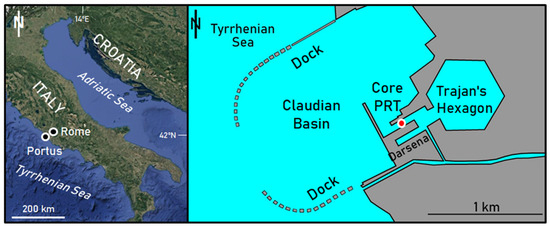
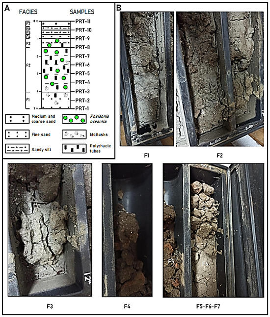
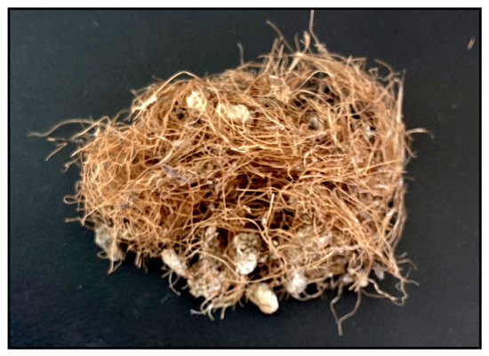
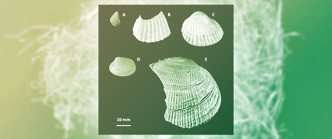
The port of Portus was located about 30 km southwest of Rome and was the most important in the Western Mediterranean during the Roman Imperial period (27 BCE–476 CE). This paper analyses the palaeoenvironmental evolution of the channel linking the outer harbour, or Claudius Basin, with the inner harbour, or Trajan’s Hexagon. During the 1st century CE, this area was situated in an open marine environment, which gradually became more confined due to sedimentation from the River Tiber and the silting caused by the massive accumulation of fibres and leaves from the seagrass Posidonia oceanica. In the ~2nd–5th centuries CE, the area transitioned to a brackish environment and eventually became silted up, with a marked decline in port activity from the 5th century CE onward.
Full article

Figure 1
Open AccessArticle
Glacier-Fed Deltas and New Age Constraints for Glacial Lake Grand Gorge in the Northern Catskill Mountains of New York State, USA
by
Andrew L. Kozlowski, Richard A. Frieman, Karl J. Backhaus, Hailey M. Forgeng, Robert S. Feranec and Shannon A. Mahan
Quaternary 2026, 9(3), 46; https://doi.org/10.3390/quat9030046 - 17 Jun 2026
Abstract
►▼
Show Figures
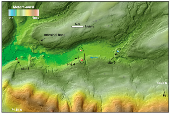
Ice-dammed lakes were common along the southern margin of the Laurentide Ice Sheet during deglaciation. In the Schoharie Valley of the northern Catskill Mountains, New York, a 171 km2 lake known as glacial Lake Grand Gorge formed in an interlobate area. Previous
[...] Read more.
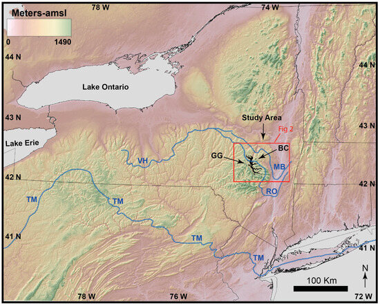
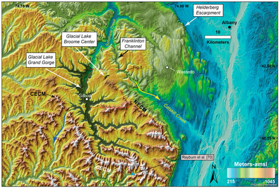
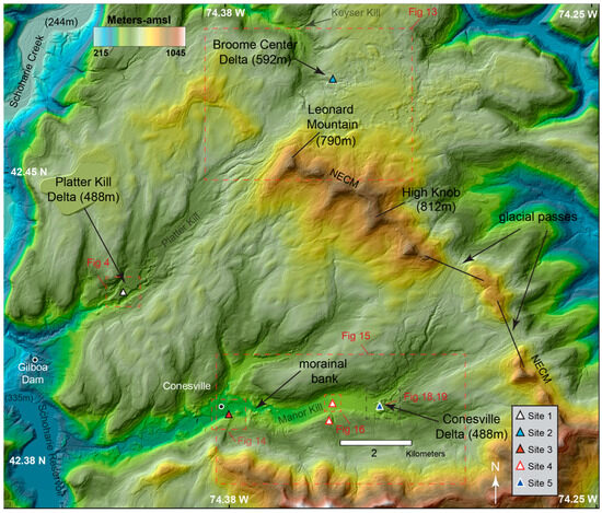
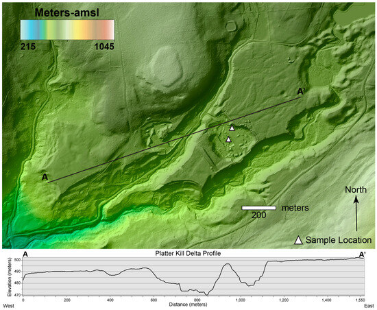
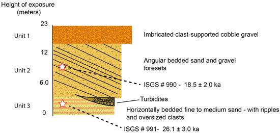
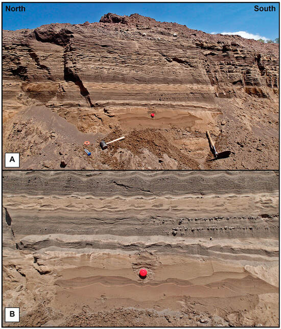
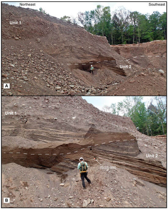
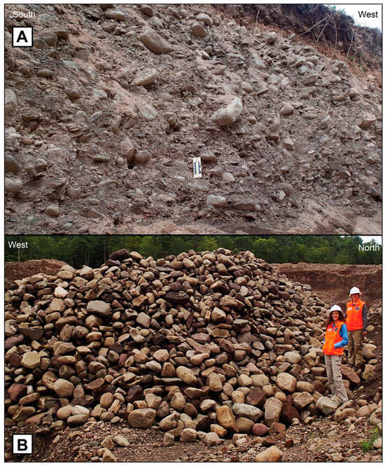
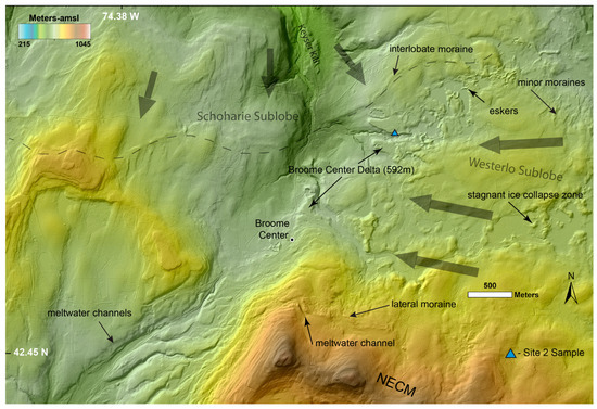
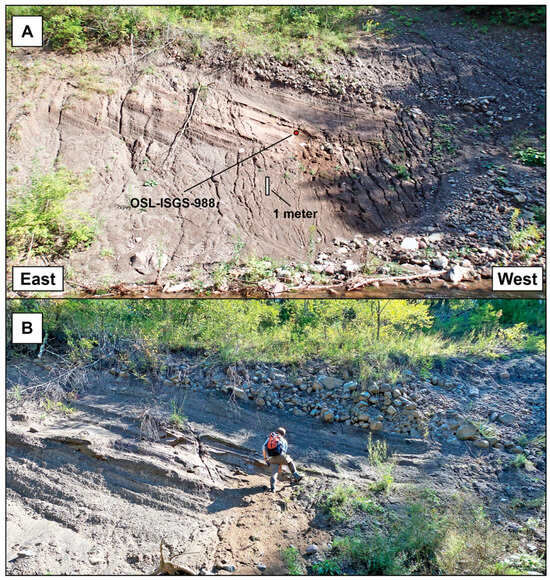
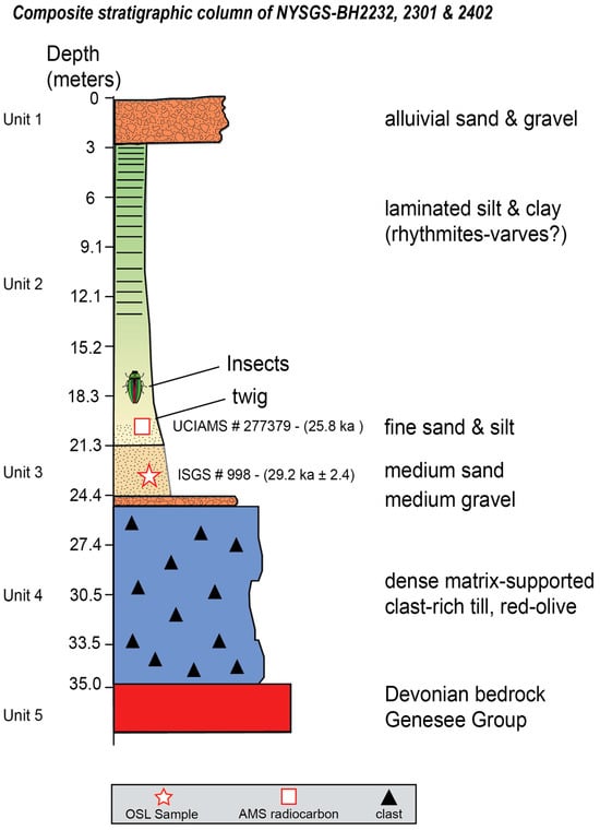
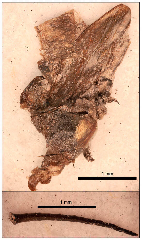
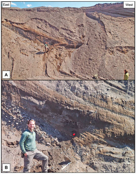
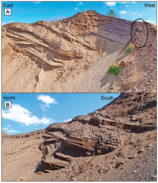
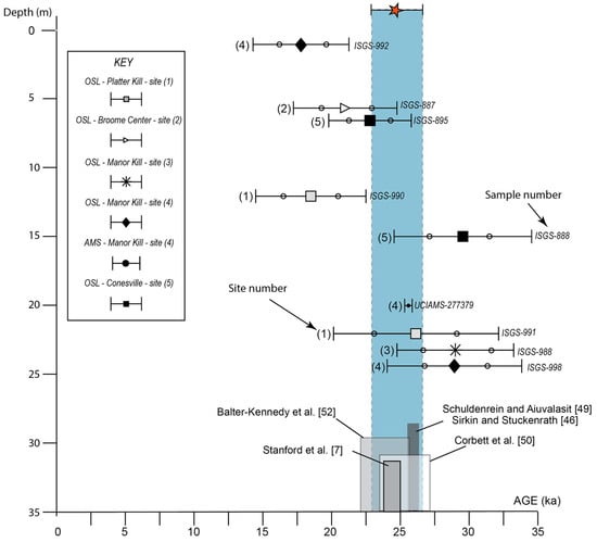
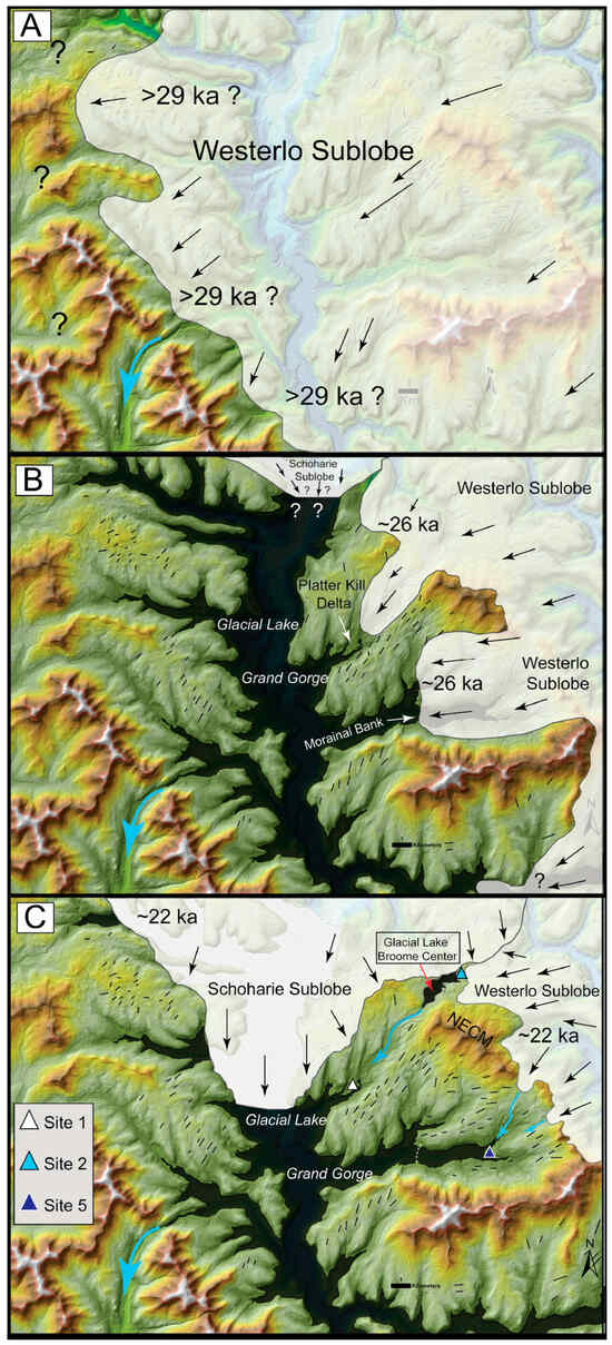
Ice-dammed lakes were common along the southern margin of the Laurentide Ice Sheet during deglaciation. In the Schoharie Valley of the northern Catskill Mountains, New York, a 171 km2 lake known as glacial Lake Grand Gorge formed in an interlobate area. Previous researchers suggested that deltas developed into this glacial lake from meltwater supplied by the adjacent Hudson Lobe during deglaciation. This study investigates stratigraphy and sedimentology of Pleistocene deltas and lake deposits to determine the source of meltwater and sediment. Detailed examination of stratigraphy from quarries, stream exposures, and new exploration borings was combined with radiocarbon and OSL geochronology to establish event stratigraphy. Sedimentologic and geomorphic data from deltas in the Manor Kill and Platter Kill Valleys demonstrates that braided outwash was supplied directly from the Westerlo Sublobe that crossed the northeastern escarpment of the Catskill Mountains. New geochronologic data indicates that the lake was established by 28 ka and likely persisted to at least 22 ka. Insects and twigs recovered from lake sediments complement the OSL data and indicate: (1) that the lake was present significantly earlier than previous deglacial models predict, and (2) that it existed in an ice-free area of the northern Catskill Mountains during the last glacial maximum of the MIS 2 glaciation.
Full article

Figure 1
Open AccessArticle
GECAS: A Modular, Non-Compensatory Alphanumeric Framework for Geosite and Geomorphosite Evaluation and Classification
by
Sebastiano Ettore Spoto
Quaternary 2026, 9(3), 45; https://doi.org/10.3390/quat9030045 - 12 Jun 2026
Abstract
►▼
Show Figures
Geoheritage assessment supports inventory design, geoconservation, geoeducation, public interpretation, and geotourism, yet many methods still merge intrinsic site significance with present-day conditions of access, interpretation, and management. This paper introduces the Geoheritage Evaluation and Classification Alphanumeric System (GECAS), a modular, non-compensatory framework for
[...] Read more.
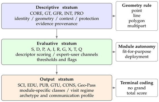
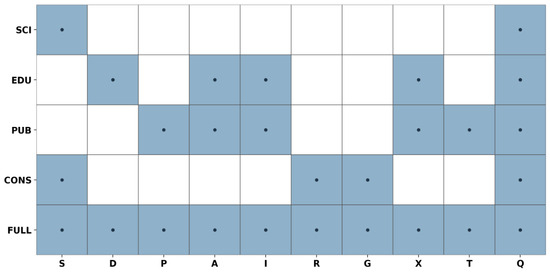
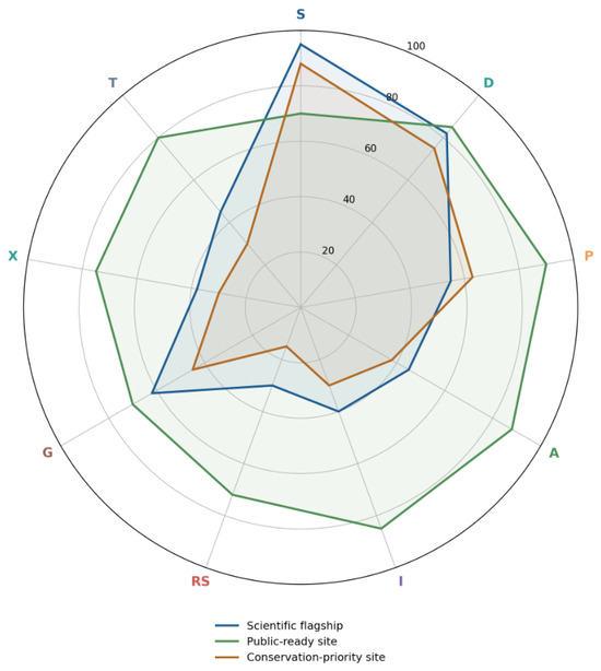
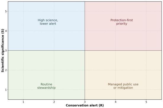
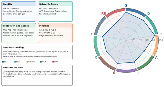
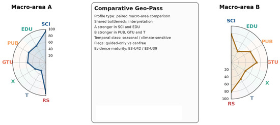
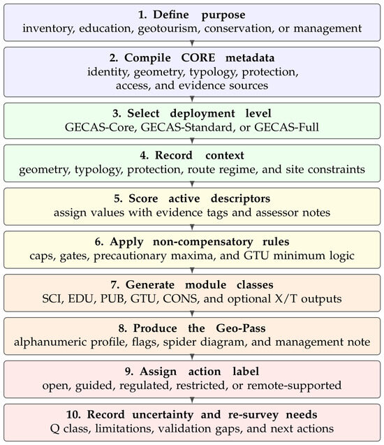
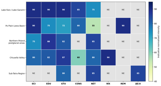
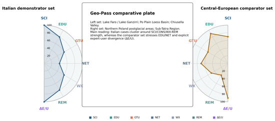
Geoheritage assessment supports inventory design, geoconservation, geoeducation, public interpretation, and geotourism, yet many methods still merge intrinsic site significance with present-day conditions of access, interpretation, and management. This paper introduces the Geoheritage Evaluation and Classification Alphanumeric System (GECAS), a modular, non-compensatory framework for classifying geosites and geomorphosites through autonomous profiles rather than through a single total score. The revised framework distinguishes a minimum deployable core from standard and full applications, separates descriptive metadata from evaluative axes, and produces purpose-specific outputs for scientific significance, geoeducational suitability, public-facing visit readiness, geotourism use potential, and conservation priority. GECAS also formalises evidence quality, expert- and user-derived channels, degradation-risk gates, and the Geo-Pass communication profile. A structured comparison with established assessment approaches, a step-by-step workflow, time–effort guidance, and a secondary-data demonstrator is provided. The framework is proposed as a scalable methodological grammar that improves transparency, avoids hidden compensation among non-equivalent criteria, and supports future calibration through field trials, inter-rater testing, and comparative applications.
Full article

Figure 1
Open AccessArticle
The First Record of Vulpes corsac Linnaeus, 1768 in the Late Pleistocene of Poland
by
Aleksandra Kropczyk and Adrian Marciszak
Quaternary 2026, 9(3), 44; https://doi.org/10.3390/quat9030044 - 1 Jun 2026
Abstract
►▼
Show Figures
The occurrence of Vulpes corsac in the Late Pleistocene of Europe is primarily supported by a limited number of uncertain records, many of which require revision. More reliable evidence derives from localities in Bohemia and Ukraine. The species’ history is particularly well documented
[...] Read more.
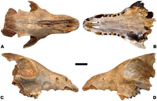
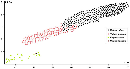
The occurrence of Vulpes corsac in the Late Pleistocene of Europe is primarily supported by a limited number of uncertain records, many of which require revision. More reliable evidence derives from localities in Bohemia and Ukraine. The species’ history is particularly well documented in Ukraine, which also preserves the only Holocene occurrences of V. corsac in Europe, and where it persists in the eastern regions to the present day. To this record we now add the first locality from Poland, identified in Rogóżka Cave (Sudety, Silesia). It appears that Vulpes corsac was never abundant in Late Pleistocene Europe. Confirming its presence requires careful taxonomic analysis, as its rare remains must be distinguished from those of Vulpes vulpes and Vulpes lagopus, which are far more common in Late Pleistocene and Holocene assemblages.
Full article

Figure 1
Open AccessArticle
Rediscovered Late Upper Palaeolithic Painted Imagery at Bacon Hole, Gower Peninsula, South Wales
by
George H. Nash, Hipólito Collado, Hugo Gomes, Sara Garcês, Virginia Lattao, Pierluigi Rosina, Elena Marrocchino, Negar Eftekhari, Barbara Oosterwijk, Alistair W. G. Pike, Dirk L. Hoffmann, Christopher D. Standish, John F. Hiemstra and Qingfeng Shao
Quaternary 2026, 9(3), 43; https://doi.org/10.3390/quat9030043 - 26 May 2026
Abstract
►▼
Show Figures
Recent and ongoing fieldwork at Bacon Hole, located on the Gower Peninsula, South Wales, is being conducted by an international team of researchers. This work includes pigment analysis and a chronometric dating programme focused on a vertical painted surface within a side chamber.
[...] Read more.
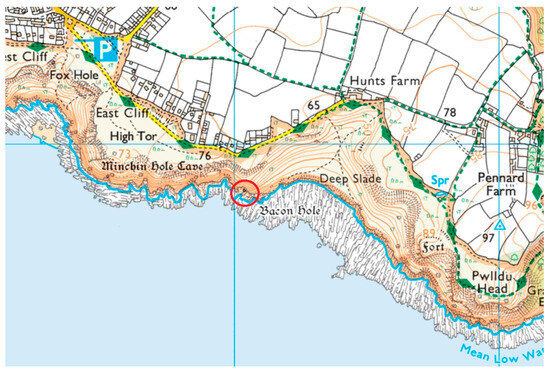
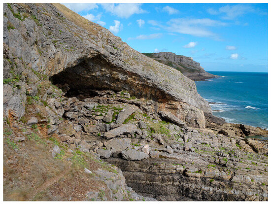
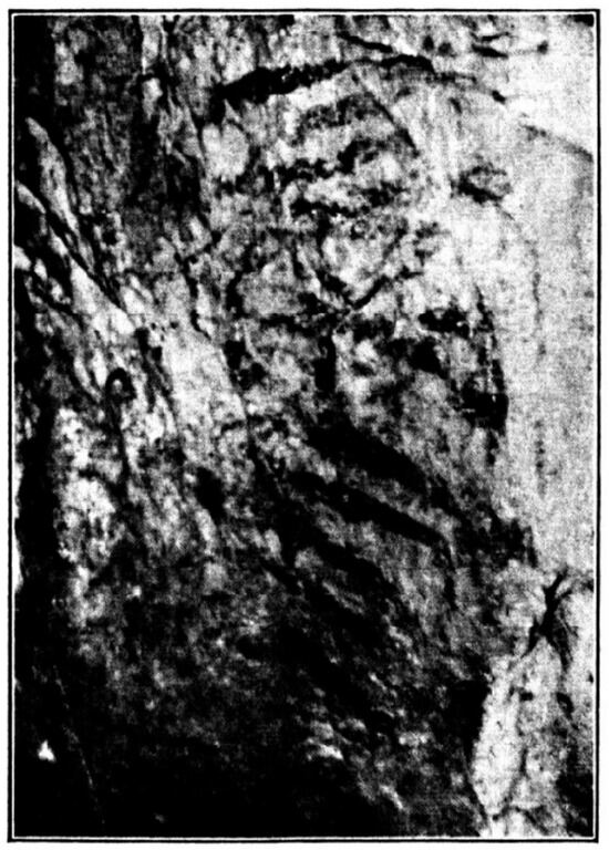
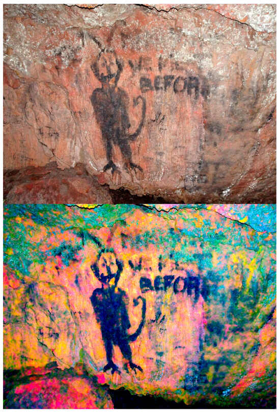
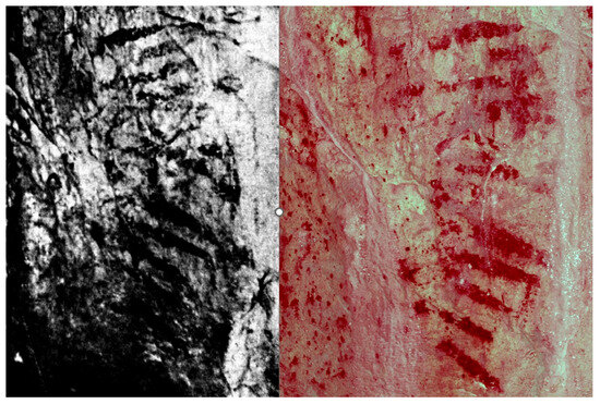
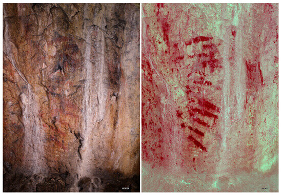
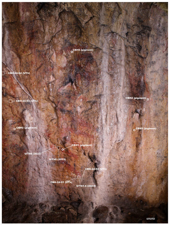
Recent and ongoing fieldwork at Bacon Hole, located on the Gower Peninsula, South Wales, is being conducted by an international team of researchers. This work includes pigment analysis and a chronometric dating programme focused on a vertical painted surface within a side chamber. The painted surface is considered a product of human agency, specifically applied haematite. Originally identified in 1912 by Professor William Sollas and Henri Breuil as Palaeolithic cave art, the painted panel was dismissed by 1928. In September 2022, the painted surface, along with other potential paintings, was rediscovered. In April 2023, the First Art team sampled the pigments for organic residues, while a team from the University of Southampton collected samples from several calcite flows overlying the painted surface for uranium–thorium dating. As a scientific control for the initial dating programme, the First Art team, in collaboration with scientists from Nanjing Normal University, conducted a second round of sample collecting and analysis in May 2024. This paper presents a discussion of the history and archaeological significance of the site, along with the results of the pigment and dating analysis carried out in April 2023 and May 2024.
Full article

Figure 1
Open AccessArticle
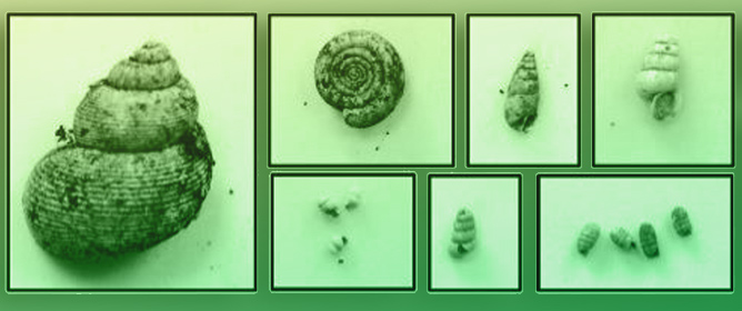
The Contribution of Malacological Studies to Understanding the Occupation Dynamics of the Prehistoric Site at Colombare di Villa-Negrar di Valpolicella (VR): Preliminary Report on the Remains from Trenches 4 and 15
by
Silvia Bandera, Umberto Tecchiati and Fiorenza Gulino
Quaternary 2026, 9(3), 42; https://doi.org/10.3390/quat9030042 - 20 May 2026
Abstract
►▼
Show Figures
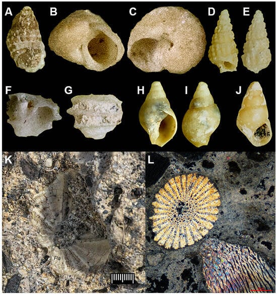
Archaeomalacological analyses have been carried out as part of the interdisciplinary project of Colombare di Negrar, a prehistoric site in the Lessini Mountains (northern Italy). The palaeoenvironmental and economic reconstruction from the Late to Final Neolithic was based on 1047 mollusc remains taken
[...] Read more.
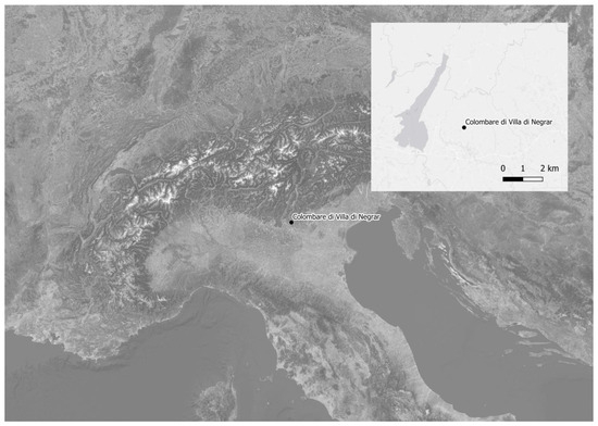
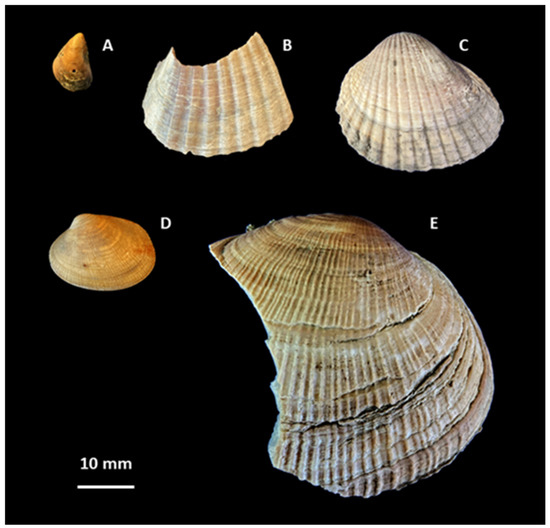
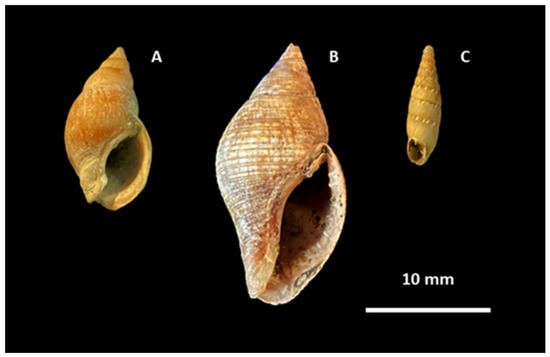
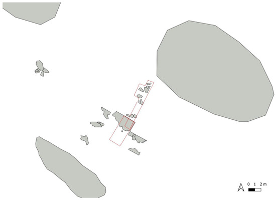
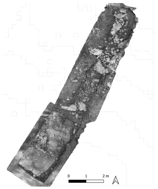
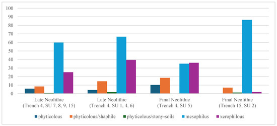
Archaeomalacological analyses have been carried out as part of the interdisciplinary project of Colombare di Negrar, a prehistoric site in the Lessini Mountains (northern Italy). The palaeoenvironmental and economic reconstruction from the Late to Final Neolithic was based on 1047 mollusc remains taken from two contiguous Trenches 4 and 15. The landscape reconstruction shows natural clearings in the woods. The faunal associations indicate that the environment from the Late to Final Neolithic became wetter. Finally, stony-soil species remained constant over time.
Full article

Figure 1
Highly Accessed Articles
Latest Books
E-Mail Alert
News
1 September 2026
MDPI INSIGHTS: The CEO’s Letter #38 – 2 Million Published Articles, Outstanding Reviewers, Michele Parrinello Award, AIS 2026 & WSF-12
5 August 2026
MDPI INSIGHTS: The CEO’s Letter #37 – Canada Summit, Sciforum Relaunch, 30 Years of Impactful Research & ISPRS 2026
Topics
Topic in
Environments, Geosciences, Minerals, Quaternary, Water, Sci
Past, Current and Future Processes in the Earth Critical Zone, 2nd Edition
Topic Editors: Gianluca Bianchini, Claudio Natali, Chiara Marchina, Valentina BrombinDeadline: 29 February 2028
Special Issues
Special Issue in
Quaternary
Environmental Changes and Their Significance for Sustainability
Guest Editors: Jef Vandenberghe, Slobodan B. MarkovićDeadline: 10 September 2026
Special Issue in
Quaternary
Quaternary Birds of the Planet of First, Ancient and Modern Humans
Guest Editor: Zlatozar BoevDeadline: 20 September 2026
Special Issue in
Quaternary
From Source to Sink: Sedimentary Archives and Its Palaeo-Environmental Implications During Quaternary
Guest Editor: Yan LiDeadline: 15 October 2026
Special Issue in
Quaternary
Beyond Bones: Digestive Taphonomy and Coprolites from Quaternary
Guest Editors: Montserrat Sanz, Jean-Philip Brugal, Philippe FosseDeadline: 15 December 2026
Topical Collections
Topical Collection in
Quaternary
Exclusive Collection: Papers from the Editorial Board Members (EBMs) of Quaternary
Collection Editor: Valentí Rull
Topical Collection in
Quaternary
Feature Papers in Quaternary Research
Collection Editors: Jef Vandenberghe, Valentí Rull