Next Issue
Volume 12, May
Previous Issue
Volume 12, March


J. Mar. Sci. Eng., Volume 12, Issue 4 (April 2024) – 168 articles

Cover Story (view full-size image): 
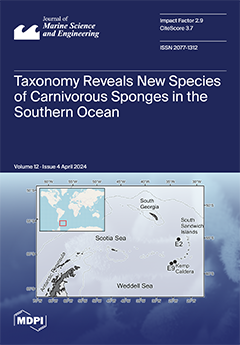
Taxonomic investigations of sponges collected in 2010 at the East Scotia Ridge resulted in the description of species that were all new to science. They belong to the family Cladorhizidae, which consists of deep-sea sponges that are characterized by a specialized carnivorous mode of feeding. This study provides the first record from hydrothermal vent ecosystems in the Antarctic of the genera Abyssocladia and Cladorhiza. It highlights the large taxonomic richness of the Cladorhizidae family and confirms our hypothesis that a large number of hitherto unknown sponge species is to be discovered within this family. The high potential for discovery of new taxa calls for enhanced research efforts and further expeditions into the Antarctic deep-sea. It also emphasizes the great need of new generations of taxonomic experts to identify and describe many animal taxa still hiding in the deep oceans. View this paper
  • Issues are regarded as officially published after their release is announced to the table of contents alert mailing list.
  • You may sign up for e-mail alerts to receive table of contents of newly released issues.
  • PDF is the official format for papers published in both, html and pdf forms. To view the papers in pdf format, click on the "PDF Full-text" link, and use the free Adobe Reader to open them.
Order results
Result details
Section
Select all
Export citation of selected articles as:
32 pages, 9240 KiB  
Review
State of the Art on Fe Precipitation in Porous Media: Hydrogeochemical Processes and Evolving Parameters
by Wenran Cao, Guanxi Yan, Harald Hofmann and Alexander Scheuermann
J. Mar. Sci. Eng. 2024, 12(4), 690; https://doi.org/10.3390/jmse12040690 - 22 Apr 2024
Viewed by 313
Abstract
The mixing of terrestrial groundwater and seawater creates dynamic reaction zones in intertidal areas, where land-derived Fe(II) is oxidized to Fe(III) and then precipitates as Fe hydroxides at the groundwater–seawater interface. These hydrogeochemical processes contribute to the formation of iron bands at the [...] Read more.
The mixing of terrestrial groundwater and seawater creates dynamic reaction zones in intertidal areas, where land-derived Fe(II) is oxidized to Fe(III) and then precipitates as Fe hydroxides at the groundwater–seawater interface. These hydrogeochemical processes contribute to the formation of iron bands at the saltwater wedge (SW) and beneath the upper saline plume (USP). This study provides a comprehensive review of physical and geochemical processes at field scale in coastal areas, explores the impact of mineral precipitation on pore structure at pore scale, and synthesizes reactive transport modeling (RTM) approaches for illustrating continuum-scale soil physio-chemical parameters during the evolution of porous media. Upon this review, knowledge gaps and research needs are identified. Additionally, challenges and opportunities are presented. Therefore, we reach the conclusion that the incorporation of observational data into a comprehensive physico-mathematical model becomes imperative for capturing the pore-scale processes in porous media and their influence on groundwater flow and solute transport at large scales. Additionally, a synergistic approach, integrating pore-scale modeling and non-invasive imaging, is equally essential for providing detailed insights into intricate fluid–pore–solid interactions for future studies, as well as facilitating the development of regional engineering-scale models and physio-chemical coupled models with diverse applications in marine science and engineering. Full article
Show Figures

Figure 1

32 pages, 14437 KiB  
Article
Towing Analysis and Validation of a Fully Assembled Floating Offshore Wind Turbine Based on an Experimental Study
by Rahul Chitteth Ramachandran, Jorrit-Jan Serraris, Jaume Hernandez Montfort, Erik-Jan De Ridder, Cian Desmond and Jimmy Murphy
J. Mar. Sci. Eng. 2024, 12(4), 689; https://doi.org/10.3390/jmse12040689 - 22 Apr 2024
Viewed by 363
Abstract
The offshore wind sector is moving into deep waters and using floating platforms to harness the higher wind speeds in exposed locations. There are various floating platform types currently in development, but semi-submersibles are considered the most prominent early movers. Such floaters need [...] Read more.
The offshore wind sector is moving into deep waters and using floating platforms to harness the higher wind speeds in exposed locations. There are various floating platform types currently in development, but semi-submersibles are considered the most prominent early movers. Such floaters need to be towed to and from wind farm locations for installation, special cases of repair and decommissioning. As with any other offshore activity, metocean limits exist for towing operations which can impact the development of a wind farm. It is important to calculate the motion and loads of the platform before commencing the towing operations and to check whether they exceed the defined limits to enable safe execution. In this paper, two approaches using two different numerical tools to predict the motion of a fully assembled floating wind platform under tow are presented and compared. A potential flow-based method derived from a low forward speed approach and a hybrid approach combining potential flow and Morison equation methods are investigated, and the numerical predictions are compared and validated against experimental results. Both methods demonstrate accurate predictions, depending on the wave condition and towing speed, albeit differing in execution time and the simplicity of the simulation setup. The first method was found to provide good predictions of the motion in low-speed (0.514–1.543 m/s) towing conditions. The second method provides better results for all the towing speeds and wave heights. As the wave height and towing speed increase, deviations from experiments were observed, signifying non-linear phenomena that are difficult to analyse using the mentioned potential-flow-based methods. Full article
(This article belongs to the Section Marine Energy)
Show Figures

Figure 1

17 pages, 3584 KiB  
Article
Variable Neighborhood Search for Multi-Port Berth Allocation with Vessel Speed Optimization
by Yalong Song, Bin Ji and Samson S. Yu
J. Mar. Sci. Eng. 2024, 12(4), 688; https://doi.org/10.3390/jmse12040688 - 22 Apr 2024
Viewed by 275
Abstract
This paper delves into the multi-port berth allocation problem (MBAP), enriching the traditional berth allocation problem (BAP) with vessel speed optimization (VSO). In the MBAP, it is assumed that there is cooperation between the port and the shipping companies, and the operation of [...] Read more.
This paper delves into the multi-port berth allocation problem (MBAP), enriching the traditional berth allocation problem (BAP) with vessel speed optimization (VSO). In the MBAP, it is assumed that there is cooperation between the port and the shipping companies, and the operation of the vessels and the ports is planned to maximize the overall benefits. Exploring this potential collaboration between ports and shipping entities has the potential to mitigate, or even resolve, the challenges plaguing maritime transportation, e.g., port congestion and suboptimal vessel schedules, to ultimately enhance the efficiency of maritime trade. In this paper, a new mixed-integer linear programming (MILP) model for the MBAP is formulated, which attempts to minimize the total cost incurred during operations, with various constraints such as vessel sailing, the vessel space–time relationship in ports, and the planning period. Meanwhile, an innovative variable neighborhood search (VNS) algorithm is presented, in which the initial solution generation method and neighborhood structures are proposed according to the MBAP characteristics. Furthermore, two sets of MBAP instances are generated to test the proposed MILP and VNS, of which the first set is based on real-world port data and the second on existing studies. The numerical experiments verify that the VNS can efficiently and reliably solve instances of all scales, with each neighborhood structure contributing uniquely to the iterative process. In addition, by analyzing the impact of varying oil prices on the MBAP, the study offers valuable management insights. Finally, a case study based on real data from a port group in the Yangtze River Basin is presented to further demonstrate the necessity of considering vessel service time window and planning period in the MBAP as well as the important role of the VSO in scheduling. Full article
(This article belongs to the Section Ocean Engineering)
Show Figures

Figure 1

19 pages, 5345 KiB  
Article
Tidal Flat Erosion Processes and Their Dynamic Mechanisms on the South Side of Sheyang River Estuary, Jiangsu Province
by Wangze Zhang, Kai Ouyang, Xiaofei Zhang, Aijun Wang, Qian Yu, Xiang Ye and Caihua Yao
J. Mar. Sci. Eng. 2024, 12(4), 687; https://doi.org/10.3390/jmse12040687 - 22 Apr 2024
Viewed by 336
Abstract
Tidal flats are accumulations of fine-grained sediment formed under the action of tides and play a very important role in coastal protection. The northern part of Jiangsu coast, as a typical example of muddy coasts found all over the world, has experienced serious [...] Read more.
Tidal flats are accumulations of fine-grained sediment formed under the action of tides and play a very important role in coastal protection. The northern part of Jiangsu coast, as a typical example of muddy coasts found all over the world, has experienced serious erosion since the Yellow River shifted northward, and the range of erosion has been gradually extending southward, now reaching the south of the Sheyang River estuary (SYRE). In order to address coastal erosion near the SYRE through protective measures, there is an urgent need for research on the spatial and temporal variation of coastal erosion processes and their control mechanisms in the SYRE and adjacent coastal areas. For this study, the tidal flats on the south side of the SYRE were selected as the study area, and the sediment dynamics in the upper and lower intertidal flat were observed in different seasons to investigate the erosion processes and their dynamic mechanisms. The results show that the tidal current and wave action in the observed intertidal flats are stronger in winter than in summer, and these intertidal flats erode under the combined action of waves and currents. During winter, the net transport of the near-bottom suspended sediment and bedload is primarily towards the southeast, while in summer, the direction tends toward the north and northeast. The net transport fluxes are larger in the lower part of the intertidal flat than in the upper part in summer and also larger in winter than in summer within the lower intertidal flat. Furthermore, the tidal flat erosion in the study area manifests as shoreline retreat and flat surface erosion. The average shoreline retreat rate increased from 23.3 m/a during 2014–2019 to 43.5 m/a during 2019–2021, and the average erosion depth of the lower and upper parts of the intertidal flat over a tidal cycle is, respectively, 1.98 cm and 0.24 cm in winter and 1.65 cm and 0.26 cm in summer. The ratio of the wave-induced bottom shear stress to the tidal current-induced bottom shear stress is 0.40~0.46 in the lower intertidal flat and increases to 0.66~0.67 in the upper intertidal flat, indicating that the intertidal flat erosion in the study area is primarily driven by tidal currents, with significant contributions from wave action, especially in the upper intertidal flat. Full article
Show Figures

Figure 1

21 pages, 19037 KiB  
Article
Numerical Simulation and Analysis of Added Mass for the Underwater Variable Speed Motion of Small Objects
by Xuanquan Wang, Suwei Xiao, Xinchun Wang and Debo Qi
J. Mar. Sci. Eng. 2024, 12(4), 686; https://doi.org/10.3390/jmse12040686 - 22 Apr 2024
Viewed by 326
Abstract
Unlike uniform motion, when an object moves underwater with variable speed, it experiences additional resistance from the water, commonly referred to as added mass force. At present, several methods exist to solve this force, including theoretical, experimental, and simulation approaches. This paper addresses [...] Read more.
Unlike uniform motion, when an object moves underwater with variable speed, it experiences additional resistance from the water, commonly referred to as added mass force. At present, several methods exist to solve this force, including theoretical, experimental, and simulation approaches. This paper addresses the challenge of determining the added mass force for irregularly shaped small objects undergoing variable speed motion underwater, proposing a method to obtain the added mass force through numerical simulation. It employs regression analysis and parameter separation analysis to solve the added mass force, added mass, viscous drag coefficient, and pressure drag coefficient. The results indicate that an added mass force exists during both the acceleration and deceleration of the object, with little difference between them. Under the same velocity conditions, significant differences exist in pressure drag forces, while differences in viscous drag forces are not significant. This suggests that the primary source of added mass force is pressure drag, with viscous drag having little effect on it. During acceleration, the surrounding fluid accelerates with the object, increasing the pressure drag with a high-pressure area concentrating at the object’s front, forming an added mass force that is directed backward. By contrast, during deceleration, the fluid at the object’s front tends to detach, and the fluid at the rear rushes forward, leading to a smaller high-pressure area at the front and a larger one at the rear, reducing the pressure drag and forming an added mass force that is directed forward. By comparing the added mass of a standard ellipsoid obtained from numerical simulation with theoretical values, the regression analysis method is proven to be highly accurate and entirely applicable for solving the added mass of underwater vehicles. Full article
(This article belongs to the Special Issue Application of CFD Simulations to Marine Hydrodynamic Problems)
Show Figures

Figure 1

19 pages, 3324 KiB  
Article
Risk Coupling Assessment of Vehicle Scheduling for Shipyard in a Complicated Road Environment
by Ningfei Wang, Jingbo Yin and Rafi Ullah Khan
J. Mar. Sci. Eng. 2024, 12(4), 685; https://doi.org/10.3390/jmse12040685 - 22 Apr 2024
Viewed by 301
Abstract
Vehicle scheduling at shipyards can involve delays due to numerous risk factors encountered in the complicated shipyard road environment. This paper studies the problems of risk coupling in shipyard vehicle scheduling based on the risk matrix approach, considering the complicated road environment, assessing [...] Read more.
Vehicle scheduling at shipyards can involve delays due to numerous risk factors encountered in the complicated shipyard road environment. This paper studies the problems of risk coupling in shipyard vehicle scheduling based on the risk matrix approach, considering the complicated road environment, assessing the degrees of coupling and disorder. Based on safety-engineering theory and comprehensive analysis of the road environment, four key criteria are identified, vehicles, the road environment, the working environment, and humans, including 12 factors and their specific contents. The degree of coupling between various combinations of risk criteria is quantitatively determined utilizing the N-K model. Additionally, the degree of disorder in the risk criteria is assessed based on information entropy theory. The model’s correction coefficients are determined through comparative analysis of experimental data. By integrating the degree of coupling and disorder, delays caused by different combinations of risk criteria in scheduling tasks are computed. The quantitative evaluation model enables accurate appraisal of risk events during shipyard vehicle scheduling. The model provides a valuable managerial tool to analyze delays caused when specific risk criteria are met and to compare these delays to the potential impact on time resulting from adjusting vehicle scheduling plans. This research has significant implications for enhancing vehicle distribution efficiency in shipyards. Full article
(This article belongs to the Special Issue Risk Assessment in Maritime Transportation)
Show Figures

Figure 1

23 pages, 1778 KiB  
Article
Optimization of Berth-Tug Co-Scheduling in Container Terminals under Dual-Carbon Contexts
by Yan Wang and Tianyu Zou
J. Mar. Sci. Eng. 2024, 12(4), 684; https://doi.org/10.3390/jmse12040684 - 21 Apr 2024
Viewed by 389
Abstract
In order to address the dynamic changes in vessel preferences for berth lines caused by the deployment of shore-based power equipment in major ports and the collaborative scheduling problem of berthing and towing assistance, this paper quantifies the environmental costs of pollutants from [...] Read more.
In order to address the dynamic changes in vessel preferences for berth lines caused by the deployment of shore-based power equipment in major ports and the collaborative scheduling problem of berthing and towing assistance, this paper quantifies the environmental costs of pollutants from the main engines of tugs and auxiliary engines of container ships using an environmental tax. Additionally, considering the economic costs such as vessel delay and shore power cable connection, a two-layer mixed-integer linear programming model is constructed using the task sequence mapping method. This model integrates the allocation of continuous berths at container terminals with coordinated towing scheduling for shore power selection. A solution approach is designed by combining the commercial solver (CPLEX) and the immune particle swarm optimization algorithm (IAPSO). The proposed scheme is validated using the example of the Nansha Phase IV Terminal at the Port of Guangzhou. The results show that compared to the traditional first-come-first-served and adjacent scheduling schemes, the collaborative scheduling scheme proposed in this paper reduces the total cost by 21.73%. By effectively utilizing berth resources and shore power equipment while densely arranging collaborative tasks and appropriately increasing the number of tugs, the port can convert the economic cost of leasing a small number of tugs (increased by 10.63%) into environmental benefits (decreased by 33.88%). This approach provides a reference for addressing nearshore pollution emissions in ports. Full article
(This article belongs to the Special Issue Smart Seaport and Maritime Transport Management)
Show Figures

Figure 1

24 pages, 10882 KiB  
Article
Development and Application of an FSI Model for Floating VAWT by Coupling CFD and FEA
by Wenping Luo, Weiqin Liu, Shuo Chen, Qilu Zou and Xuemin Song
J. Mar. Sci. Eng. 2024, 12(4), 683; https://doi.org/10.3390/jmse12040683 - 21 Apr 2024
Viewed by 314
Abstract
The emerging floating vertical axis wind turbines (VAWTs) are regarded as a preferred solution to overcome the challenges faced by the traditional horizontal type in open-sea environments. Numerous numerical models have been advanced for assessing this novel object. However, current fully coupled models [...] Read more.
The emerging floating vertical axis wind turbines (VAWTs) are regarded as a preferred solution to overcome the challenges faced by the traditional horizontal type in open-sea environments. Numerous numerical models have been advanced for assessing this novel object. However, current fully coupled models predominantly rely on simplified theories, assuming a linear fluid load and a one-dimensional slender beam structure. Despite computational fluid dynamic and finite element (CFD-FEA) coupling being qualified for high precision, this technology remains limited to the fixed VAWT field. To predict the load and structural response accurately and comprehensively, this study aims to extend CFD-FEA technology to floating VAWTs. First, an aero-hydro-moor-elastic fully coupled model is developed, and this model is validated by comparing it with several model experiments. Subsequently, a full-scale floating straight-bladed VAWT is simulated with the geometry and numerical models introduced. Furthermore, load and structural responses in a typical case are analyzed in both time and frequency domains. Finally, the sensitivity analysis of each structure part in floating VAWTs to environmental parameters is conducted and discussed. The discovery highlights the intricate nature of tower structural response, which incorporates 2-node, 3-node, wind frequency, and wave frequency components. Distinct from blades or floating foundations, which are primarily influenced by a single environmental parameter, the tower response is significantly amplified by the combined effects of wind and waves. Full article
Show Figures

Figure 1

15 pages, 12301 KiB  
Article
First Survey of the Sponge Community of a Semi-Submerged Marine Cave along the Adriatic Apulian Coast
by Antonella Schiavo, Muriel Oddenino, Guadalupe Giménez and Caterina Longo
J. Mar. Sci. Eng. 2024, 12(4), 682; https://doi.org/10.3390/jmse12040682 - 20 Apr 2024
Viewed by 691
Abstract
Mediterranean marine caves have been categorized as both biodiversity reservoirs and vulnerable habitats. However, only a few studies have focused on Porifera assemblages within marine caves along the Adriatic Apulian coast (southern Italy). In this study, the sponge fauna of the Rondinella cave, [...] Read more.
Mediterranean marine caves have been categorized as both biodiversity reservoirs and vulnerable habitats. However, only a few studies have focused on Porifera assemblages within marine caves along the Adriatic Apulian coast (southern Italy). In this study, the sponge fauna of the Rondinella cave, a semi-submerged marine cave along the coast of Bari (Southern Adriatic Sea), was investigated for the first time. The use of advanced image analysis in combination with targeted sampling has made it possible to determine the spatial distribution and diversity of Porifera along a transect from the entrance to the end of the cave. Data analysis clustered the stations into two groups, separated according to the distance from the entrance and corresponding to the cave entrance and the semi-dark zone. Sponges were found at all stations covering a considerable part of the substrate, with the highest cover values occurring in the semi-dark zone. A total of 54 sponge taxa were identified: 49 Demospongiae, 3 Homoscleromorpha, and 2 Calcarea. Six species are new records for the Apulian marine caves, one species represents a new record for marine caves, and two species are new findings for the southern Adriatic Sea. Full article
Show Figures

Figure 1

23 pages, 50114 KiB  
Article
Risk Analysis and Visualization of Merchant and Fishing Vessel Collisions in Coastal Waters: A Case Study of Fujian Coastal Area
by Chuanguang Zhu, Jinyu Lei, Zhiyuan Wang, Decai Zheng, Chengqiang Yu, Mingzhong Chen and Wei He
J. Mar. Sci. Eng. 2024, 12(4), 681; https://doi.org/10.3390/jmse12040681 - 19 Apr 2024
Viewed by 255
Abstract
The invasion of ship domains stands out as a significant factor contributing to the risk of collisions during vessel navigation. However, there is a lack of research on the mechanisms underlying the collision risks specifically related to merchant and fishing vessels in coastal [...] Read more.
The invasion of ship domains stands out as a significant factor contributing to the risk of collisions during vessel navigation. However, there is a lack of research on the mechanisms underlying the collision risks specifically related to merchant and fishing vessels in coastal waters. This study proposes an assessment method for collision risks between merchant and fishing vessels in coastal waters and validates it through a comparative analysis through visualization. First of all, the operational status of fishing vessels is identified. Collaboratively working fishing vessels are treated as a unified entity, expanding their ship domain during operation to assess collision risks. Secondly, to quantify the collision risk between ships, a collision risk index (CRI) is proposed and visualized based on the severity of the collision risk. Finally, taking the high-risk area for merchant and fishing vessel collisions in the Minjiang River Estuary as an example, this paper conducts an analysis that involves classifying ship collision scenarios, extracts risk data under different collision scenarios, and visually analyzes areas prone to danger. The results indicate that this method effectively evaluates the severity of collision risk, and the identified high-risk areas resulting from the analysis are verified by the number of accidents that occurred in the most recent three years. Full article
Show Figures

Figure 1

17 pages, 32322 KiB  
Article
Automatic Detection of Floating Ulva prolifera Bloom from Optical Satellite Imagery
by Hailong Zhang, Quan Qin, Deyong Sun, Xiaomin Ye, Shengqiang Wang and Zhixin Zong
J. Mar. Sci. Eng. 2024, 12(4), 680; https://doi.org/10.3390/jmse12040680 - 19 Apr 2024
Viewed by 379
Abstract
Annual outbreaks of floating Ulva prolifera blooms in the Yellow Sea have caused serious local environmental and economic problems. Rapid and effective monitoring of Ulva blooms from satellite observations with wide spatial-temporal coverage can greatly enhance disaster response efforts. Various satellite sensors and [...] Read more.
Annual outbreaks of floating Ulva prolifera blooms in the Yellow Sea have caused serious local environmental and economic problems. Rapid and effective monitoring of Ulva blooms from satellite observations with wide spatial-temporal coverage can greatly enhance disaster response efforts. Various satellite sensors and remote sensing methods have been employed for Ulva detection, yet automatic and rapid Ulva detection remains challenging mainly due to complex observation scenarios present in different satellite images, and even within a single satellite image. Here, a reliable and fully automatic method was proposed for the rapid extraction of Ulva features using the Tasseled-Cap Greenness (TCG) index from satellite top-of-atmosphere reflectance (RTOA) data. Based on the TCG characteristics of Ulva and Ulva-free targets, a local adaptive threshold (LAT) approach was utilized to automatically select a TCG threshold for moving pixel windows. When tested on HY1C/D-Coastal Zone Imager (CZI) images, the proposed method, termed the TCG-LAT method, achieved over 95% Ulva detection accuracy though cross-comparison with the TCG and VBFAH indexes with a visually determined threshold. It exhibited robust performance even against complex water backgrounds and under non-optimal observing conditions with sun glint and cloud cover. The TCG-LAT method was further applied to multiple HY1C/D-CZI images for automatic Ulva bloom monitoring in the Yellow Sea in 2023. Moreover, promising results were obtained by applying the TCG-LAT method to multiple optical satellite sensors, including GF-Wide Field View Camera (GF-WFV), HJ-Charge Coupled Device (HJ-CCD), Sentinel2B-Multispectral Imager (S2B-MSI), and the Geostationary Ocean Color Imager (GOCI-II). The TCG-LAT method is poised for integration into operational systems for disaster monitoring to enable the rapid monitoring of Ulva blooms in nearshore waters, facilitated by the availability of near-real-time satellite images. Full article
(This article belongs to the Special Issue New Advances in Marine Remote Sensing Applications)
Show Figures

Figure 1

24 pages, 785 KiB  
Article
Retrofitting Technologies for Eco-Friendly Ship Structures: A Risk Analysis Perspective
by Athanasios Kolios
J. Mar. Sci. Eng. 2024, 12(4), 679; https://doi.org/10.3390/jmse12040679 - 19 Apr 2024
Viewed by 380
Abstract
This paper presents a detailed risk assessment framework tailored for retrofitting ship structures towards eco-friendliness. Addressing a critical gap in current research, it proposes a comprehensive strategy integrating technical, environmental, economic, and regulatory considerations. The framework, grounded in the Failure Mode, Effects, and [...] Read more.
This paper presents a detailed risk assessment framework tailored for retrofitting ship structures towards eco-friendliness. Addressing a critical gap in current research, it proposes a comprehensive strategy integrating technical, environmental, economic, and regulatory considerations. The framework, grounded in the Failure Mode, Effects, and Criticality Analysis (FMECA) approach, adeptly combines quantitative and qualitative methodologies to assess the feasibility and impact of retrofitting technologies. A case study on ferry electrification, highlighting options like fully electric and hybrid propulsion systems, illustrates the application of this framework. Fully Electric Systems pose challenges such as ensuring ample battery capacity and establishing the requisite charging infrastructure, despite offering significant emission reductions. Hybrid systems present a flexible alternative, balancing electric operation with conventional fuel to reduce emissions without compromising range. This study emphasizes a holistic risk mitigation strategy, aligning advanced technological applications with environmental and economic viability within a strict regulatory context. It advocates for specific risk control measures that refine retrofitting practices, guiding the maritime industry towards a more sustainable future within an evolving technological and regulatory landscape. Full article
Show Figures

Figure 1

24 pages, 12578 KiB  
Article
The Response of Mixed Layer Depth Due to Hurricane Katrina (2005)
by Wonhyun Lee and Jayaram Veeramony
J. Mar. Sci. Eng. 2024, 12(4), 678; https://doi.org/10.3390/jmse12040678 - 19 Apr 2024
Viewed by 319
Abstract
The ocean’s mixed layer depth (MLD) plays an important role in understanding climate dynamics, especially during extreme weather occurrences like hurricanes. This study investigates the effects of Hurricane Katrina (2005) on the MLD in the Gulf of Mexico, using the Delft3D modeling system. [...] Read more.
The ocean’s mixed layer depth (MLD) plays an important role in understanding climate dynamics, especially during extreme weather occurrences like hurricanes. This study investigates the effects of Hurricane Katrina (2005) on the MLD in the Gulf of Mexico, using the Delft3D modeling system. By integrating hydrodynamics and wave dynamics modules, we simulate the ocean’s response to extreme weather, focusing on temperature, salinity and MLD variations. Our analysis reveals significant cooling and mixing induced by Katrina, resulting in spatial and temporal fluctuations in temperature (~±4 °C) and salinity (~±1.5 ppt). The MLD is estimated using a simple threshold method, revealing a substantial deepening to ~120 m on 29–30 August during Hurricane Katrina in the middle of the northern Gulf of Mexico, compared to an average MLD of ~20–40 m during pre-storm conditions. It took about 18 days to recover to ~84% of the pre-storm level after Katrina. Compared to the stand-alone FLOW model, the coupled FLOW+WAVE model yields a deeper MLD of ~5%. The MLD recovery and wave effect on the MLD provide insights from various scientific, environmental and operational perspectives, offering a valuable basis for ocean management, planning and applications, particularly during extreme weather events. Full article
(This article belongs to the Special Issue Ocean Modeling and Data Assimilation)
Show Figures

Figure 1

20 pages, 5944 KiB  
Article
Research on Abrasive Particle Target Detection and Feature Extraction for Marine Lubricating Oil
by Chenzhao Bai, Jiaqi Ding, Hongpeng Zhang, Zhiwei Xu, Hanlin Liu, Wei Li, Guobin Li, Yi Wei and Jizhe Wang
J. Mar. Sci. Eng. 2024, 12(4), 677; https://doi.org/10.3390/jmse12040677 - 19 Apr 2024
Viewed by 295
Abstract
The hydraulic oil of marine equipment contains a large number of abrasive contaminants that reflect the operating condition of the equipment. In order to realize the detection of particulate contaminants, this research first proposes a shape-based classification method for oil abrasive particles, designs [...] Read more.
The hydraulic oil of marine equipment contains a large number of abrasive contaminants that reflect the operating condition of the equipment. In order to realize the detection of particulate contaminants, this research first proposes a shape-based classification method for oil abrasive particles, designs an oil abrasive particle collection system, and constructs a new dataset. After that, the research introduces deep learning target detection technology in computer vision, and uses GhostNet to lighten the network structure, the CBAM (Convolutional Block Attention Module) attention mechanism to improve the generalization ability of the model, and the ASPP module to enhance the model sensory wildness, respectively. A lightweight target detection model, WDD, is created for the identification of abrasive particles. In this study, the WDD model is tested against other network models, and the mAP value of WDD reaches 91.2%, which is 4.8% higher than that of YOLOv5s; in addition, the detection speed of the WDD model reaches 55 FPS. Finally, this study uses real ship lubricating oils for validation, and the WDD model still maintains a high level of accuracy. Therefore, the WDD model effectively balances the accuracy and detection speed of marine oil abrasive particle detection, which is superior to other oil abrasive particle detection techniques. Full article
Show Figures

Figure 1

26 pages, 7000 KiB  
Article
A Gaussian-Process-Based Model Predictive Control Approach for Trajectory Tracking and Obstacle Avoidance in Autonomous Underwater Vehicles
by Tao Liu, Jintao Zhao and Junhao Huang
J. Mar. Sci. Eng. 2024, 12(4), 676; https://doi.org/10.3390/jmse12040676 - 18 Apr 2024
Viewed by 460
Abstract
To achieve the efficient and precise control of autonomous underwater vehicles (AUVs) in dynamic ocean environments, this paper proposes an innovative Gaussian-Process-based Model Predictive Control (GP-MPC) method. This method combines the advantages of Gaussian process regression in modeling uncertainties in nonlinear systems, and [...] Read more.
To achieve the efficient and precise control of autonomous underwater vehicles (AUVs) in dynamic ocean environments, this paper proposes an innovative Gaussian-Process-based Model Predictive Control (GP-MPC) method. This method combines the advantages of Gaussian process regression in modeling uncertainties in nonlinear systems, and MPC’s constraint optimization and real-time control abilities. To validate the effectiveness of the proposed GP-MPC method, its performance is first evaluated for trajectory tracking control tasks through numerical simulations based on a 6-degrees-of-freedom, fully actuated, AUV dynamics model. Subsequently, for 3D scenarios involving static and dynamic obstacles, an AUV horizontal plane decoupled motion model is constructed to verify the method’s obstacle avoidance capability. Extensive simulation studies demonstrate that the proposed GP-MPC method can effectively manage the nonlinear motion constraints faced by AUVs, significantly enhancing their intelligent obstacle avoidance performance in complex dynamic environments. By effectively handling model uncertainties and satisfying motion constraints, the GP-MPC method provides an innovative and efficient solution for the design of AUV control systems, substantially improving the control performance of AUVs. Full article
(This article belongs to the Special Issue Advancements in New Concepts of Underwater Robotics)
Show Figures

Figure 1

24 pages, 1450 KiB  
Review
Roadmap for Recommended Guidelines of Leak Detection of Subsea Pipelines
by Ahmed Reda, Ramy Magdy A. Mahmoud, Mohamed A. Shahin, Chiemela Victor Amaechi and Ibrahim A. Sultan
J. Mar. Sci. Eng. 2024, 12(4), 675; https://doi.org/10.3390/jmse12040675 - 18 Apr 2024
Viewed by 426
Abstract
The leak of hydrocarbon-carrying pipelines represents a serious incident, and if it is in a gas line, the economic exposure would be significant due to the high cost of lost or deferred hydrocarbon production. In addition, the leakage of hydrocarbon could pose risks [...] Read more.
The leak of hydrocarbon-carrying pipelines represents a serious incident, and if it is in a gas line, the economic exposure would be significant due to the high cost of lost or deferred hydrocarbon production. In addition, the leakage of hydrocarbon could pose risks to human life, have an impact on the environment, and could cause an image loss for the operating company. Pipelines are designed to operate at full capacity under steady-state flow conditions. Normal operations may involve day-to-day transients such as the operations of pumps, valves, and changes in production/delivery rates. The basic leak detection problem is to distinguish between the normal operational transients and the occurrence of non-typical process conditions that would indicate a leak. To date, the industry has concentrated on a single-phase flow, primarily of oil, gas, and ethylene. The application of a leak-monitoring system to a particular pipeline system depends on environmental issues, regulatory imperatives, loss prevention of the operating company, and safety policy rather than pipe size and configuration. This paper provides a review of the recommended guidance for leak detection of subsea pipelines in the context of pipeline integrity management. The paper also presents a review of the capability and application of various leak detection techniques that can be used to offer a roadmap to potential users of the leak detection systems. Full article
(This article belongs to the Special Issue Applications of Underwater Acoustics in Ocean Engineering)
Show Figures

Figure 1

19 pages, 5119 KiB  
Article
Diversity and Distribution of Mesozooplankton in the Coastal Southwestern Mediterranean Alboran Sea, during Summer: What Are the Driving Factors?
by Mohamed Reda Benallal, Ahmed Errhif, Laila Somoue, Mohamed Laabir, Hervé Demarcq, Mohammed Idrissi, Aziz Agouzouk, Yassine Goliat, Hajar Idmoussi, Ahmed Makaoui and Omar Ettahiri
J. Mar. Sci. Eng. 2024, 12(4), 674; https://doi.org/10.3390/jmse12040674 - 18 Apr 2024
Viewed by 426
Abstract
The southern Alboran Sea is a dynamic ecosystem and is highly influenced by Atlantic waters. Unfortunately, despite the importance of the mesozooplankton in this ecosystem, the number of studies on this ecosystem is low. The composition and abundance of mesozooplankton communities were studied [...] Read more.
The southern Alboran Sea is a dynamic ecosystem and is highly influenced by Atlantic waters. Unfortunately, despite the importance of the mesozooplankton in this ecosystem, the number of studies on this ecosystem is low. The composition and abundance of mesozooplankton communities were studied during the summer season (July 2017) along the Moroccan Mediterranean coast between M’diq and Saïdia. A total of 14 mesozooplankton groups were identified and were dominated by copepods (48%) and cladocerans (35%). Abundance and biomass spatial distribution distinguished two main regions east and west of Al Hoceima. The same distribution pattern was observed when using copepod and cladoceran abundance. Environmental parameters (temperature, salinity, and nutrients) differed in these two regions. Our results confirm the hypothesis that the water flux from the Atlantic Ocean is responsible for the eastward gradients of the mesozooplankton abundance and diversity. Copepods were the most diversified group with 27 species, dominated by Paracalanus parvus (30.5%), Temora stylifera (14%), and Oncaea venusta (12.4%). The diversity index (H’) of copepods varied between 1.35 and 2.8 bits ind−1, and the regularity index (J) varied between 0.21 and 0.45, without a remarkable longitudinal gradient. Multivariate analysis showed that the mesozooplankton biomass, abundance, and distribution were influenced mainly by hydrology (gyres), by temperature and salinity, and to a lesser degree by phytoplankton. Full article
(This article belongs to the Special Issue Plankton Community in Marine Ecosystem)
Show Figures

Figure 1

16 pages, 1619 KiB  
Article
Effects of Ocean Acidification and Summer Thermal Stress on the Physiology and Growth of the Atlantic Surfclam (Spisula solidissima)
by Laura Steeves, Molly Honecker, Shannon L. Meseck and Daphne Munroe
J. Mar. Sci. Eng. 2024, 12(4), 673; https://doi.org/10.3390/jmse12040673 - 18 Apr 2024
Viewed by 444
Abstract
This study examines the physiological response of the Atlantic surfclam (Spisula solidissima) to ocean acidification in warm summer temperatures. Working with ambient seawater, this experiment manipulated pH conditions while maintaining natural diel fluctuations and seasonal shifts in temperature. One-year-old surfclams were [...] Read more.
This study examines the physiological response of the Atlantic surfclam (Spisula solidissima) to ocean acidification in warm summer temperatures. Working with ambient seawater, this experiment manipulated pH conditions while maintaining natural diel fluctuations and seasonal shifts in temperature. One-year-old surfclams were exposed to one of three pH conditions (ambient (control): 7.8 ± 0.07, medium: 7.51 ± 0.10, or low: 7.20 ± 0.10) in flow-through conditions for six weeks, and feeding and digestive physiology was measured after one day, two weeks, and six weeks. After six weeks of exposure to medium and low pH treatments, growth was not clearly affected, and, contrastingly, feeding and digestive physiology displayed variable responses to pH over time. Seemingly, low pH reduced feeding and absorption rates compared to both the medium treatment and ambient (control) condition; however, this response was clearer after two weeks compared to one day. At six weeks, suppressed physiological rates across both pH treatments and the ambient condition suggest thermal stress from high ambient water temperatures experienced the week prior (24–26 °C) dominated over any changes from low pH. Results from this study provide important information about reduced energy acquisition in surfclams in acidified environments and highlight the need for conducting multistressor experiments that consider the combined effects of temperature and pH stress. Full article
(This article belongs to the Special Issue Impacts of Climate Change on Shellfisheries)
Show Figures

Figure 1

15 pages, 10240 KiB  
Article
Infragravity Wave Oscillation Forecasting in a Shallow Estuary
by Bernabe Gomez, Sarah N. Giddings and Timu Gallien
J. Mar. Sci. Eng. 2024, 12(4), 672; https://doi.org/10.3390/jmse12040672 - 18 Apr 2024
Viewed by 380
Abstract
Infragravity (IG) waves are low-frequency water waves, which can propagate into harbors and estuaries, affecting currents and sediment transport processes. Understanding and predicting IG oscillations inside harbors and estuaries is critical to coastal management and estimating future resilience to climate change impacts. High-resolution [...] Read more.
Infragravity (IG) waves are low-frequency water waves, which can propagate into harbors and estuaries, affecting currents and sediment transport processes. Understanding and predicting IG oscillations inside harbors and estuaries is critical to coastal management and estimating future resilience to climate change impacts. High-resolution water level and flow velocity observations collected within Seal Beach Wildlife Refuge in Southern California are analyzed for IG energy related to atmospheric parameters, water levels, and offshore wave conditions. A proof of concept approach for predicting infragravity oscillations within an estuary using machine learning (ML) is presented. Full article
(This article belongs to the Section Coastal Engineering)
Show Figures

Figure 1

13 pages, 4931 KiB  
Article
Analyzing the Mediterranean Sea’s Dynamic Current System and Modeling of Renewable Current Energy Potential
by Mehmet Ugur Gucel and Abdulla Sakalli
J. Mar. Sci. Eng. 2024, 12(4), 671; https://doi.org/10.3390/jmse12040671 - 18 Apr 2024
Viewed by 383
Abstract
In recent years, investments in renewable energy sources have been increasing in order to reduce fossil fuel consumption and mitigate the effects of global warming on the marine ecosystem. Recent studies have shown that marine current energy, which is one of the renewable [...] Read more.
In recent years, investments in renewable energy sources have been increasing in order to reduce fossil fuel consumption and mitigate the effects of global warming on the marine ecosystem. Recent studies have shown that marine current energy, which is one of the renewable energy sources, can provide very high energy gains. This study focuses on the Mediterranean region, which is one of the areas where the impacts of climate change are most clearly felt. The annual and seasonal analysis of the current velocity in the study area between 2016 and 2018 was carried out using remote sensing technology, and potential energy production was calculated using an underwater turbine system we selected. As a result of the study, it was determined that the maximum current velocities were 2.2 m/s in 2016 and 2017 and 2.7 m/s in 2018. In addition, it was observed that the current speed was approximately 2.7 m/s in the spring months and 2.0 m/s in the summer months. In the fall and winter months, it was 2.1 m/s and 2.2 m/s, respectively. Research has shown that the study area, especially in the eastern coastal areas, has the capacity to generate approximately 10 GWh of energy per year with the use of underwater turbine systems. Full article
Show Figures

Figure 1

17 pages, 15630 KiB  
Article
Submarine Morphological Description of the Ancient Archipelagic Aprons in the Marcus–Wake Seamount Group, Northwestern Pacific Ocean
by Xiao Wang, Huaiming Li, Yongshou Cheng, Pengfei Yao, Fengyou Chu, Weilin Ma, Hongyi Wang, Shihui Lv, Xiaohu Li, Zhenggang Li, Weiyan Zhang and Yanhui Dong
J. Mar. Sci. Eng. 2024, 12(4), 670; https://doi.org/10.3390/jmse12040670 - 18 Apr 2024
Viewed by 410
Abstract
Herein, the morphological characteristics of submarine archipelagic aprons were presented for five guyots, Suda, Arnold, Lamont, Niulang, and Zhinyv, which are over 80 Ma years old and are located in the Marcus–Wake seamount group, northwestern Pacific Ocean. Nearly 28 landslide deposits were recognized [...] Read more.
Herein, the morphological characteristics of submarine archipelagic aprons were presented for five guyots, Suda, Arnold, Lamont, Niulang, and Zhinyv, which are over 80 Ma years old and are located in the Marcus–Wake seamount group, northwestern Pacific Ocean. Nearly 28 landslide deposits were recognized using the bathymetry and backscatter intensity data collected from the studied guyots. Landslides and their deposits that surround seamounts are mostly related to the morphology of debris avalanches, scarps, gullies/channels, and bedforms. The morphology of the archipelagic aprons of the studied guyots indicates mutual landslide processes, including slump and distinct debris avalanches arising from a cohesive or cohesionless landslide material flow. The superimposition of debris flows and sedimentation dominates the recent stages of the studied guyots. The archipelagic aprons corresponding to convex-arc-shaped scarps exhibit larger domains compared to the invagination-arc-shaped scarps with similar lateral lengths. The scarp morphologies of the studied guyots are predominantly of the complex-arc shape, indicating multiple landslide events. Parallel and convergent gullies and channels are mostly found on the elongated landslide deposits, whereas divergent and radial gullies and channels are mostly distributed on the fan-shaped aprons. Ubiquitous sediment waves occurred on the bedforms of the distal archipelagic apron across the studied guyots because of sediment creep. Small-scale sediment waves were only observed in the channels on the aprons of the Suda guyot. Full article
Show Figures

Figure 1

13 pages, 2804 KiB  
Article
MTP-YOLO: You Only Look Once Based Maritime Tiny Person Detector for Emergency Rescue
by Yonggang Shi, Shaokun Li, Ziyan Liu, Zhiguo Zhou and Xuehua Zhou
J. Mar. Sci. Eng. 2024, 12(4), 669; https://doi.org/10.3390/jmse12040669 - 18 Apr 2024
Viewed by 472
Abstract
Tiny person detection based on computer vision technology is critical for maritime emergency rescue. However, humans appear very small on the vast sea surface, and this poses a huge challenge in identifying them. In this study, a single-stage tiny person detector, namely the [...] Read more.
Tiny person detection based on computer vision technology is critical for maritime emergency rescue. However, humans appear very small on the vast sea surface, and this poses a huge challenge in identifying them. In this study, a single-stage tiny person detector, namely the “You only look once”-based Maritime Tiny Person detector (MTP-YOLO), is proposed for detecting maritime tiny persons. Specifically, we designed the cross-stage partial layer with two convolutions Efficient Layer Aggregation Networks (C2fELAN) by drawing on the Generalized Efficient Layer Aggregation Networks (GELAN) of the latest YOLOv9, which preserves the key features of a tiny person during the calculations. Meanwhile, in order to accurately detect tiny persons in complex backgrounds, we adopted a Multi-level Cascaded Enhanced Convolutional Block Attention Module (MCE-CBAM) to make the network attach importance to the area where the object is located. Finally, by analyzing the sensitivity of tiny objects to position and scale deviation, we proposed a new object position regression cost function called Weighted Efficient Intersection over Union (W-EIoU) Loss. We verified our proposed MTP-YOLO on the TinyPersonv2 dataset. All these results confirm that this method significantly improves model performance while maintaining a low number of parameters and can therefore be applied to maritime emergency rescue missions. Full article
(This article belongs to the Special Issue Application of Advanced Technologies in Maritime Safety)
Show Figures

Figure 1

18 pages, 4660 KiB  
Article
Hurricane Ian Damage Assessment Using Aerial Imagery and LiDAR: A Case Study of Estero Island, Florida
by Leanne Hauptman, Diana Mitsova and Tiffany Roberts Briggs
J. Mar. Sci. Eng. 2024, 12(4), 668; https://doi.org/10.3390/jmse12040668 - 17 Apr 2024
Viewed by 525
Abstract
Remote sensing techniques have emerged as an essential tool for conducting damage assessments and are commonly used to improve disaster recovery planning and community resilience policies. The objective of this study was to use aerial imagery data and LiDAR to identify the hardest [...] Read more.
Remote sensing techniques have emerged as an essential tool for conducting damage assessments and are commonly used to improve disaster recovery planning and community resilience policies. The objective of this study was to use aerial imagery data and LiDAR to identify the hardest hit areas, quantify the extent of damages, and compare pre- and post-storm beach morphology conditions in Estero Island, Florida, relating to Hurricane Ian in 2022. This study identified >2400 structures that were impacted by Hurricane Ian, with 170 structures suffering extensive damage. Clustering of heavily damaged buildings was observed on the northern and central portions of the island, with lower levels of damage clustered on the southern part. Among the ‘severely damaged’ and ‘destroyed’ structures were seven mobile home subdivisions. The total assessed value of the heavily damaged structures was estimated at over USD 200 million. The results also indicated substantial post-storm debris and sand deposition across the entire island. Remote sensing provides advanced techniques that can help prioritize emergency response efforts after catastrophic impacts from a natural disaster. Full article
Show Figures

Figure 1

14 pages, 10253 KiB  
Article
Variations in the Upper Ocean Heat Content of the Southern Canadian Basin
by Yu Liu, Changcheng Ye, Haobin Cen, Xiayan Lin and Guoqing Han
J. Mar. Sci. Eng. 2024, 12(4), 667; https://doi.org/10.3390/jmse12040667 - 17 Apr 2024
Viewed by 372
Abstract
The marine environment of the Arctic Ocean has changed rapidly in recent decades. We used reanalysis data and observational data to explore the variations in the upper ocean heat content (OHC) of the Canadian Basin (CB) and the variations in the temperature profiles [...] Read more.
The marine environment of the Arctic Ocean has changed rapidly in recent decades. We used reanalysis data and observational data to explore the variations in the upper ocean heat content (OHC) of the Canadian Basin (CB) and the variations in the temperature profiles of the Southern Canadian Basin (SCB). Both the reanalysis data and observational data show increasing trends for the OHC of the CB from 1993 to 2023. Compared to the World Ocean Atlas data (WOA 18/23), the reanalysis data (ORAS5 or GLORYS12V1) significantly underestimated the values of the upper OHC of the Canadian Basin. To explain the OHC differences, the Ice-Tethered Profiler (ITP) observational data were used to analyze the variations in the vertical temperature profiles. We found that the reanalysis data remarkably underestimated the maximum temperatures of the subsurface Pacific warm water and its increasing trend. Based on the short-term prediction results from the Bi-LSTM neural network, we forecasted that the upper OHC will continue to increase in the SCB, mainly due to the warming of the intermediate Atlantic warm water. The research results provide a valuable reference for assessing and improving climate-coupled models. Full article
(This article belongs to the Section Physical Oceanography)
Show Figures

Figure 1

13 pages, 1776 KiB  
Article
First Results of a Campaign of the Measurement of Polycyclic Aromatic Hydrocarbons in the Sediments of the Hooghly River, West Bengal, India
by Michele Arienzo, Maria Toscanesi, Luciano Ferrara, Carlo Donadio, Priyanka Mondal, Jonathan Muthuswamy Ponniah, Gaetana Napolitano, Santosh Kumar Sarkar and Marco Trifuoggi
J. Mar. Sci. Eng. 2024, 12(4), 666; https://doi.org/10.3390/jmse12040666 - 17 Apr 2024
Viewed by 352
Abstract
This study presents the first data on a 2018–2021 campaign to monitor polycyclic aromatic hydrocarbon levels, PAHs, in the final stretch of the Hooghly River in West Bengal, India. The range of sedimentary PAHs was 0–47,366 ng/g, higher than the ranges given by [...] Read more.
This study presents the first data on a 2018–2021 campaign to monitor polycyclic aromatic hydrocarbon levels, PAHs, in the final stretch of the Hooghly River in West Bengal, India. The range of sedimentary PAHs was 0–47,366 ng/g, higher than the ranges given by the literature for comparable study areas. The assay reveals an outstanding level of PAHs contamination in the fine sediments of the Hooghly River and Sundarban wetland, where the dominance of 4–6 ring PAHs was 83% of the total. The diagnostic ratios based on molecular ratios of PAHs show that the pollution comes mainly from the combustion of petroleum. The ratio of anthracene relative to anthracene plus phenanthrene, ANT/(ANT + PHE), was >0.30, which is higher than the reference discriminant ratio of >0.10, suggesting that PAHs were from the combustion source. In the meantime, fluoranthene over the sum of fluoranthene plus pyrene, FLT/(FLT + PYR), was >0.5 and indicated coal combustion, in agreement with the literature. The mean level of carcinogenic hydrocarbons was at 18% of the total measured PAH, with a peak of 91%, revealing significant potential risk for humans and ecosystems. The toxicity equivalence factors, TEF, of the individual PAHs and the total BaP equivalent toxicity, TEQ, were adopted as a comparison reference of sediment quality. At most sites, toxic effect ranges were classified as high and very high. The results of this research call for public authorities to remedy a situation of severe ecological risk. Full article
Show Figures

Figure 1

20 pages, 12528 KiB  
Article
Numerical and Experimental Study of Static and Dynamic Characteristics of Marine Shear-Compression Isolators
by Ben Zhang, Yinglong Zhao and Jingyue You
J. Mar. Sci. Eng. 2024, 12(4), 665; https://doi.org/10.3390/jmse12040665 - 17 Apr 2024
Viewed by 297
Abstract
Due to their ability to buffer and attenuate vibrations, as well as their low cost, rubber-based isolators are widely used in military and civilian vessels. Since these isolators are part of a ship’s structure, the accurate prediction of their static and dynamic performance [...] Read more.
Due to their ability to buffer and attenuate vibrations, as well as their low cost, rubber-based isolators are widely used in military and civilian vessels. Since these isolators are part of a ship’s structure, the accurate prediction of their static and dynamic performance is essential for overall structural design. In this paper, two kinds of marine shear-compression rubber isolators of different models in the same series are taken as the research objects, and the static and dynamic constitutive models of the rubber materials are obtained through material tests, which are used as inputs to accurately predict the static and dynamic characteristics of the isolators in the three translational directions through numerical calculations. The effects of size and preload force on the dynamic characteristics of the vibration isolators were analyzed as were the reasons for the peaks in the impedance curves. The results show that the preload force increases the amplitudes of the peak transfer impedance in the X direction and decreases it in the Z direction. On the other hand, as the size of the vibration isolator increases, the peak frequency of the transfer impedance in the X direction increases, while in the Y and Z directions, the first-order peak frequency decreases and the second-order peak frequency increases. The peaks of the transfer impedance curves appear due to the resonance of the embedded metal blocks, and the order of appearance of the resonance modes is fixed. Full article
(This article belongs to the Special Issue Advanced Studies in Marine Mechanical and Naval Engineering)
Show Figures

Figure 1

16 pages, 4067 KiB  
Article
Physical Experimental Study on the Wave Reflection and Run-Up of a New Ecological Hollow Cube
by Haitao Zhao, Feiyue Ding, Junwei Ye, Huabin Jiang, Wei Chen, Weifang Gu, Gengfeng Yu and Qiang Li
J. Mar. Sci. Eng. 2024, 12(4), 664; https://doi.org/10.3390/jmse12040664 - 17 Apr 2024
Viewed by 323
Abstract
Implementing quadrangular hollow blocks on breakwaters is a common method for wave mitigation and ocean disaster prevention. In order to improve the wave-damping performance of conventional quadrangular hollow blocks, a new quadrangular hollow block is proposed. In this study, a series of physical [...] Read more.
Implementing quadrangular hollow blocks on breakwaters is a common method for wave mitigation and ocean disaster prevention. In order to improve the wave-damping performance of conventional quadrangular hollow blocks, a new quadrangular hollow block is proposed. In this study, a series of physical modeling experiments were conducted in a two-dimensional wave flume to investigate the wave reflection and wave run-up height of a new quadrilateral hollow block under regular wave action. Test results showed that wave reflection and wave run-up height decreased with the breakwater slope. The wave run-up height increased with wave height, and the reflection coefficient decreased with wave height. Wave reflection and run-up height increased with the wave period. The reflection coefficient of the new quadrangular hollow blocks was lower than that of the conventional quadrangular hollow blocks and decreased with frame height. In addition, this study found that the reflection coefficient and relative run-up height increased with the average wave breaking parameter. The new quadrilateral hollow block has advantages in wave mitigation compared to the conventional quadrilateral hollow block. Full article
(This article belongs to the Special Issue Wave Interactions with Coastal Structures II)
Show Figures

Figure 1

16 pages, 330 KiB  
Article
Enhancement of Maritime Sector Decarbonization through the Integration of Fishing Vessels into IMO Energy Efficiency Measures
by Luis Alfonso Díaz-Secades
J. Mar. Sci. Eng. 2024, 12(4), 663; https://doi.org/10.3390/jmse12040663 - 17 Apr 2024
Viewed by 399
Abstract
The escalating impact of anthropogenic activities on global climate patterns necessitates urgent measures to reduce emissions, with the maritime industry playing a pivotal role. This article aims to examine the adoption of International Maritime Organization energy efficiency measures for the often-overlooked fishing vessels [...] Read more.
The escalating impact of anthropogenic activities on global climate patterns necessitates urgent measures to reduce emissions, with the maritime industry playing a pivotal role. This article aims to examine the adoption of International Maritime Organization energy efficiency measures for the often-overlooked fishing vessels and their contribution to the overall maritime decarbonization efforts. The article analyzes the attained technical efficiency indices of a case study large-scale fishing vessel and compares them with those of two cargo ships where IMO measures already apply. To support the proposal, a comprehensive analysis of the energy efficiency indices of eight large purse seine fishing vessels is also presented. The results show that large-scale fishing vessels of 400 GT and above could be subject to the IMO energy efficiency measures. The operational challenges, unique to the fishing sector, suggest that sector-specific considerations may be required to integrate the fishing fleet into the already existing IMO energy efficiency guidelines. Looking ahead, this article explores the benefits of aligning Regulation (EU) 2023/957 and IMO guidelines, as well as applying the IMO Carbon Intensity Indicator (CII) in assessing the operational environmental impact of fishing operations, emphasizing the importance of including these vessels in the current regulatory frameworks to promote decarbonization. Full article
15 pages, 10734 KiB  
Article
Study on the Adsorption Performance of a Vortex Suction Cup under Varying Diameters of Underwater Structure Tubes
by Qinyun Tang, Ying Du, Zhaojin Liu, Shuo Zhang, Qiang Zhao, Yingxuan Li, Liquan Wang, Tong Cui and Gang Wang
J. Mar. Sci. Eng. 2024, 12(4), 662; https://doi.org/10.3390/jmse12040662 - 17 Apr 2024
Viewed by 327
Abstract
In certain precision work scenarios, underwater robots require the ability to adhere to surfaces in order to perform tasks effectively. An efficient and stable suction device plays a pivotal role in the functionality of such underwater robots. The vortex suction cup, distinguished by [...] Read more.
In certain precision work scenarios, underwater robots require the ability to adhere to surfaces in order to perform tasks effectively. An efficient and stable suction device plays a pivotal role in the functionality of such underwater robots. The vortex suction cup, distinguished by its uncomplicated design, high suction efficiency, and capability for non-contact adhesion, holds significant promise for integration into underwater robotic systems. This paper presents a novel design for a vortex suction cup and investigates its suction force and torque when encountering surfaces with varying curvature radii using Computational Fluid Dynamics (CFD) simulations and experimental testing. These findings offer valuable insights for the development of robots capable of adapting to underwater structures of different dimensions. Results from both experiments and simulations indicate that reducing the curvature radius of the adhered surface results in a decrease in suction force and an increase in torque exerted on the suction cup. As the adhered surface transitions from flat to a curvature radius of 150 mm, the adhesion force of our proposed vortex suction cup decreases by approximately 10%, while the torque increases by approximately 20% to 30%. Consequently, the adhesion efficiency of the suction cup decreases by about 25% to 30%. Full article
(This article belongs to the Section Ocean Engineering)
Show Figures

Figure 1

15 pages, 5268 KiB  
Article
Design and Optimization of the Teardrop Buoy Driven by Ocean Thermal Energy
by Danyao Zhao, Shizhen Li, Wenzhuo Shi, Zhengtong Zhou and Fen Guo
J. Mar. Sci. Eng. 2024, 12(4), 661; https://doi.org/10.3390/jmse12040661 - 16 Apr 2024
Viewed by 345
Abstract
With the inception of the Argo program, the global ocean observation network is undergoing continuous advancement, with profiling buoys emerging as pivotal components of this network, thus garnering increased attention in research. In efforts to enhance the efficiency of profiling buoys and curtail [...] Read more.
With the inception of the Argo program, the global ocean observation network is undergoing continuous advancement, with profiling buoys emerging as pivotal components of this network, thus garnering increased attention in research. In efforts to enhance the efficiency of profiling buoys and curtail energy consumption, a teardrop-shaped buoy design is proposed in this study. Moreover, an optimization methodology leveraging neural networks and genetic algorithms has been devised to attain an optimal profile curve. This curve seeks to minimize drag and drag coefficient while maximizing drainage, thereby improving hydrodynamic performance. Simulation-based validation and analysis are conducted to assess the efficacy of the optimized buoy design. Results indicate that the drag of the teardrop-shaped buoy with a deflector decreased by 9.2% compared to pre-optimized configurations and by 22% compared to buoys lacking deflectors. The hydrodynamic profile devised in this study effectively enhances buoy performance, laying a solid foundation for ocean thermal energy generation and buoyancy regulation control. Additionally, the optimized scheme serves as a valuable blueprint for the design of ocean exploration devices. Full article
(This article belongs to the Special Issue Offshore Renewable Energy)
Show Figures

Figure 1

Previous Issue
Next Issue
Back to TopTop