Open AccessArticle
Tourist Agroforestry Landscape from the Perception of Local Communities: A Case Study of Rwenzori, Uganda
by
Simone Iacopino, Carlo Piazzi, Julius Opio, Deus Kamunyu Muhwezi, Efrem Ferrari, Filippo Caporale and Tommaso Sitzia
Cited by 7 | Viewed by 3443
Abstract
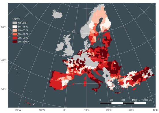
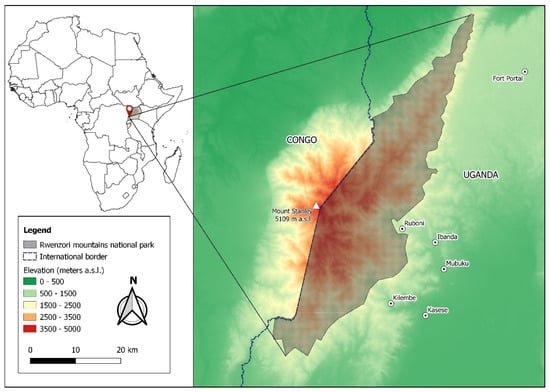
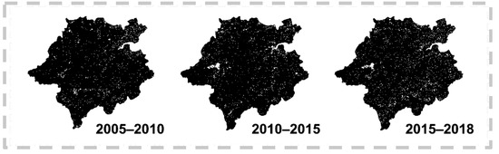
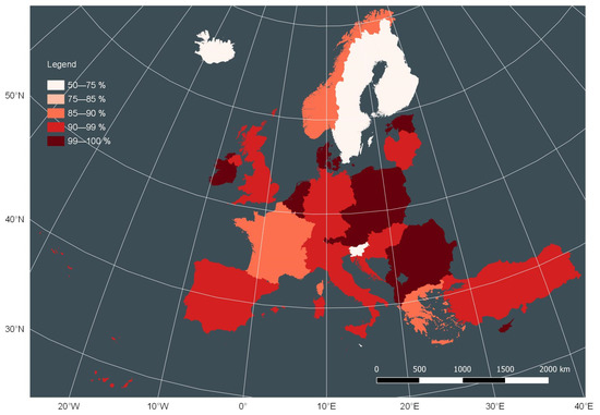
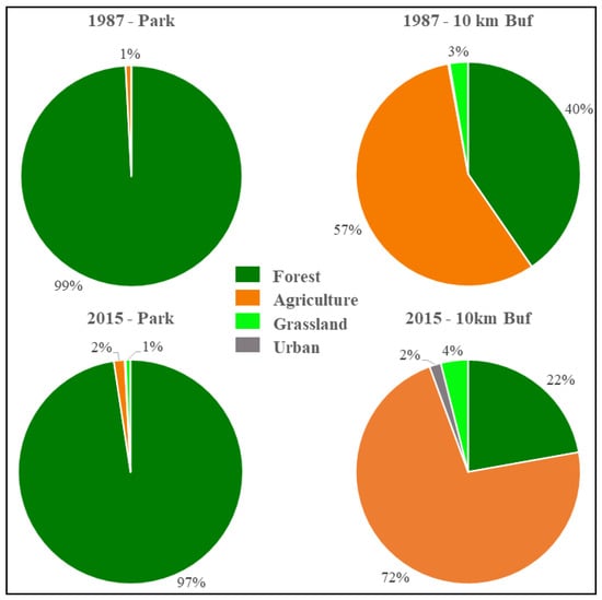
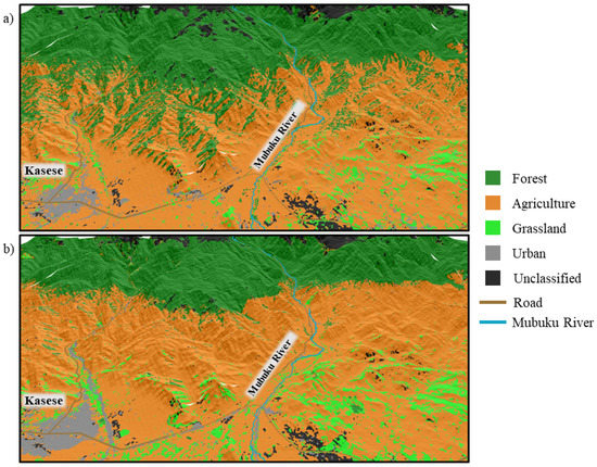
The Bakonjo have long practiced an agroforestry system of cultivation on the Ugandan slopes of the Rwenzori Mountain range. All terrain above 1600–2200 m has been strictly protected for many years because it is part of a national park. As a trade-off, the
[...] Read more.
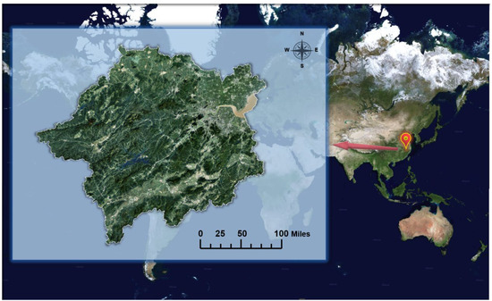
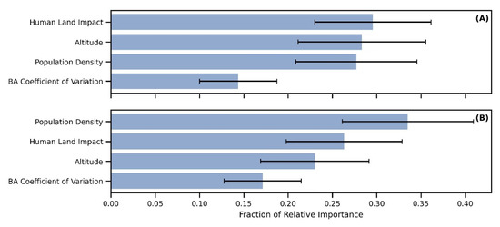
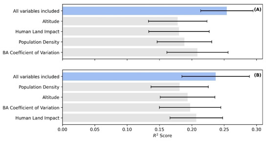
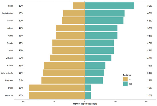
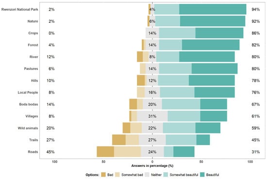
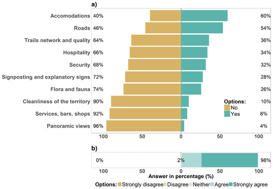
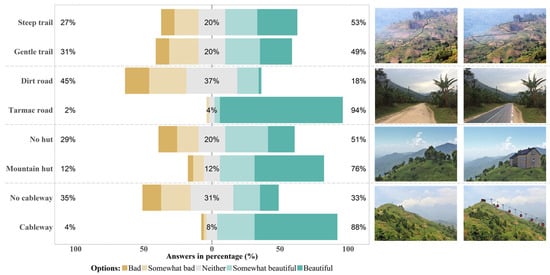
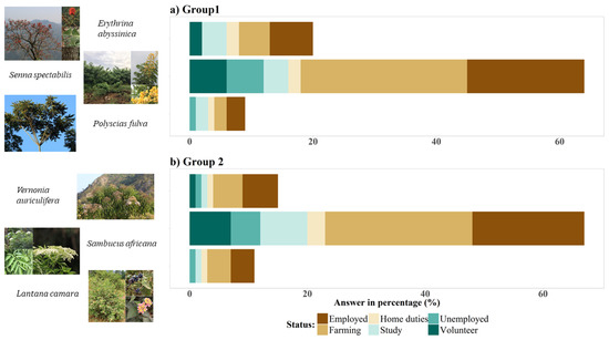
The Bakonjo have long practiced an agroforestry system of cultivation on the Ugandan slopes of the Rwenzori Mountain range. All terrain above 1600–2200 m has been strictly protected for many years because it is part of a national park. As a trade-off, the landscapes outside the park have been largely deforested. In the meantime, tourist numbers have increased. In Ruboni, a village of 1200 people, the closest to the eastern gate of the park, we interviewed a random sample of 51 residents aged >14 to understand how they perceived the landscape, park and tourism. Cultivated features were not essential to describe the place of residence, in contrast to natural features and human engineered devices. Cultivated and natural elements were judged as beautiful. Even if the inhabitants did not like human engineered facilities, they welcomed their improvement. The origin of native and non-native plants was not consistently recognized. These results show that the inhabitants feel affection for the agroforestry pattern of the Rwenzori landscape. However, ecological, social and economic pressures are challenging land use sustainability. This would be better addressed by an integrated pattern of land governance than the current two models: strict protection inside the park and relaxed land use outside.
Full article
►▼
Show Figures


