1
School of Resources and Environmental Economics, Inner Mongolia University of Finance and Economics, Hohhot 010070, China
2
Resource Utilization and Environmental Protection Coordinated Development Academician Expert Workstation in the North of China, Inner Mongolia University of Finance and Economics, Inner Mongolia, Hohhot 010070, China
Land 2022, 11(4), 559; https://doi.org/10.3390/land11040559 - 11 Apr 2022
Cited by 16 | Viewed by 2035
Abstract
The microbial quotient (Cmic/Corg) has been used extensively to evaluate agriculture soil fertility, but the microbial sensitivity should be considered during the forestry process. Therefore, the objective of this study was to examine a soil fertility evaluation method applied to four vegetation types
[...] Read more.
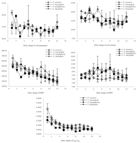
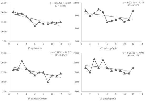
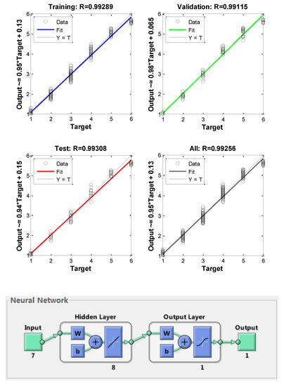
The microbial quotient (Cmic/Corg) has been used extensively to evaluate agriculture soil fertility, but the microbial sensitivity should be considered during the forestry process. Therefore, the objective of this study was to examine a soil fertility evaluation method applied to four vegetation types in the Mu Us Sandland in northwestern China, using the relationship between the Cmic/Corg ratio and soil moisture, and soil temperature under the premise of microbial diversity. The final predictive value was C. microphylla (0.2198) > P. sylvestris (0.2175) > P. tabulaeformis (0.0872) > S.psammophila (0.0767). We verified the evaluation results using two traditional methods, the back-propagation (BP) artificial neural network model and principal component analysis, which are widely used to evaluate soil quality based on the soil nutrient concentration. The results were the same as the Cmic/Corg predictions. We conclude that when the soil microbes are used in soil quality evaluations, the changing pattern should be fully considered.
Full article
(This article belongs to the Special Issue Soil Erosion Control and Land Degradation Neutrality)
▼
Show Figures
Figure 1


