1. Introduction
Recently, the application of Global Navigation Satellite System (GNSS) technology in deformation monitoring has become an important way to monitor the structural health of buildings for its advantages in automation, all-weather, real time and large scale, etc. [
1]. Affected by orbit error, ionospheric delay, tropospheric delay, phase center offset and multipath error, the accuracy of GNSS carrier phase measurement generally only reaches centimeter level. To achieve the millimeter or even submillimeter accuracy which is necessary for deformation monitoring, strict elimination of errors is essential. In the case of short baseline (<3 km), most errors excluding multipath can be eliminated to a large extent by the carrier phase double difference (DD) technique because of the high space correlation.
During the last two decades, many GPS multipath mitigation methods have been developed which can be classified to three classes [
2]. The first one is selecting an open area with no reflection or shelter for GNSS measurement while it is limited by objective conditions in deformation monitoring. The second one is improving the hardware devices of GNSS receivers to exclude multipath errors when the GNSS signal is used. The last and most common method is data post-processing approaches, including weight adjustment based on data signal to noise ratio (SNR) techniques [
3]; ray-tracing approach [
4]; and sidereal filtering (SF) based on the coordinate domain [
5,
6]/observation domain [
7,
8] method, which is the most popular.
At present, the BeiDou Navigation Satellite System (BDS) consisting of geostationary earth orbit (GEO) satellites, inclined geosynchronous orbit (IGSO) satellites and medium Earth orbit (MEO) satellites can provide high-accuracy location services, which are comparable to Global Position System (GPS) in the Asian-Pacific region [
9,
10]. Many literatures have researched the performance of the combination of BDS/GPS [
11,
12]. By 2020, the service range of BDS will cover all the world and its data processing has become a hot spot and focus of GNSS positioning. It is necessary to conduct accuracy assessments and to develop error cancellation techniques about BDS positioning such as multipath mitigation.
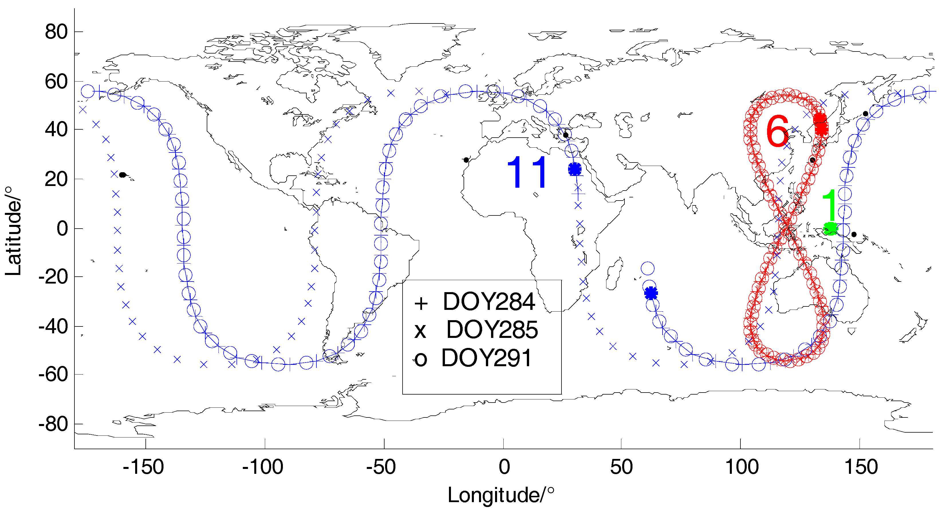
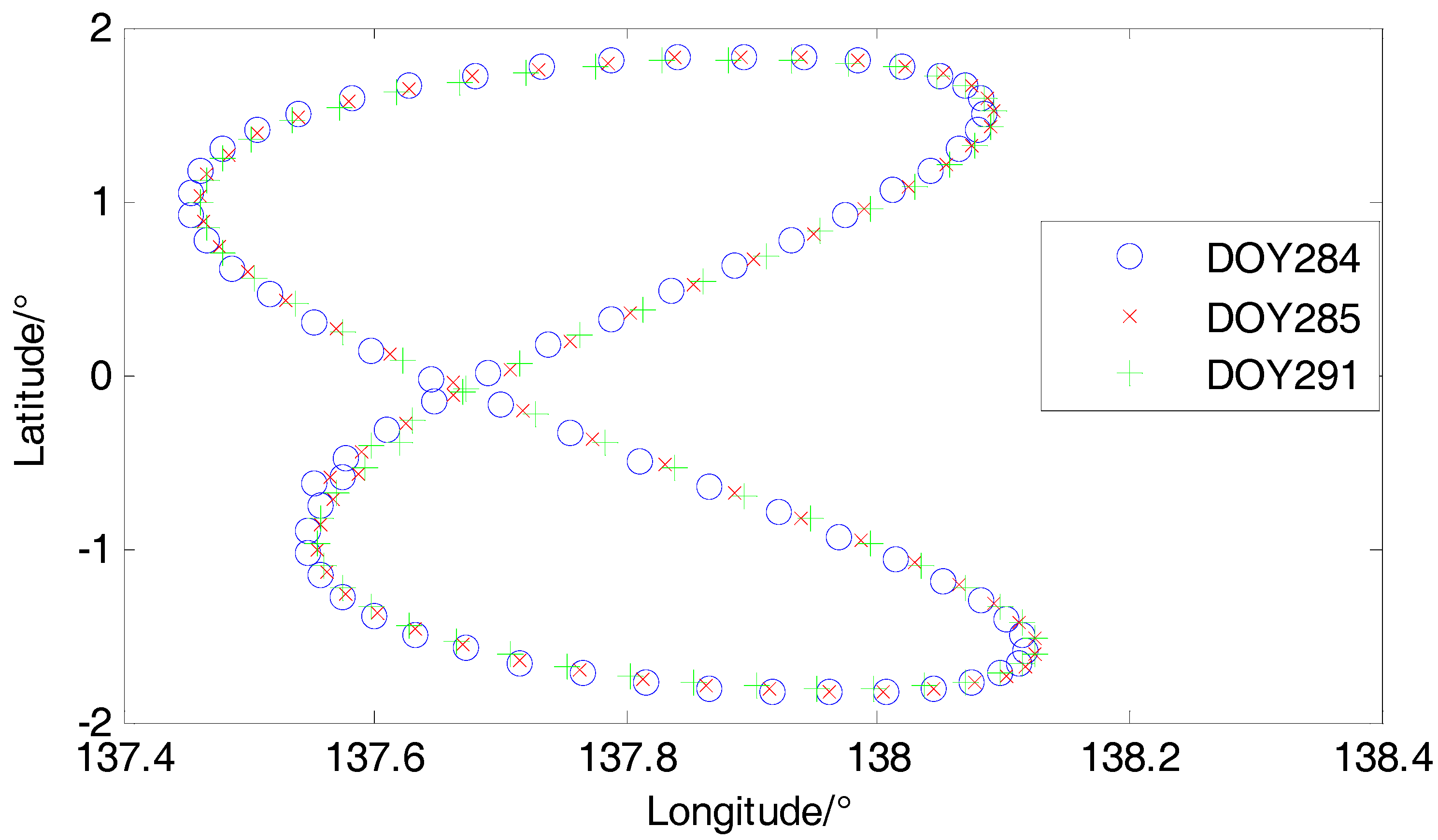
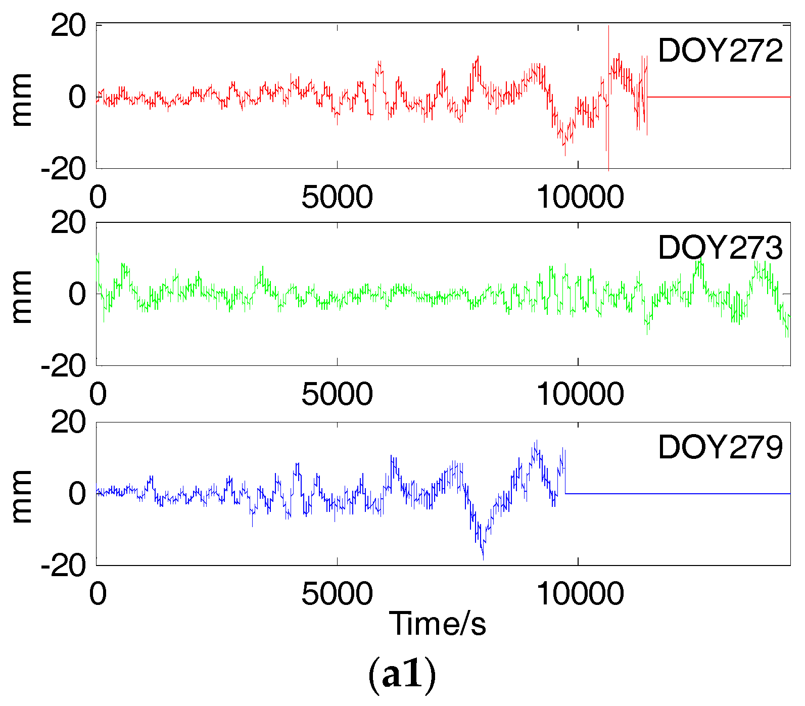
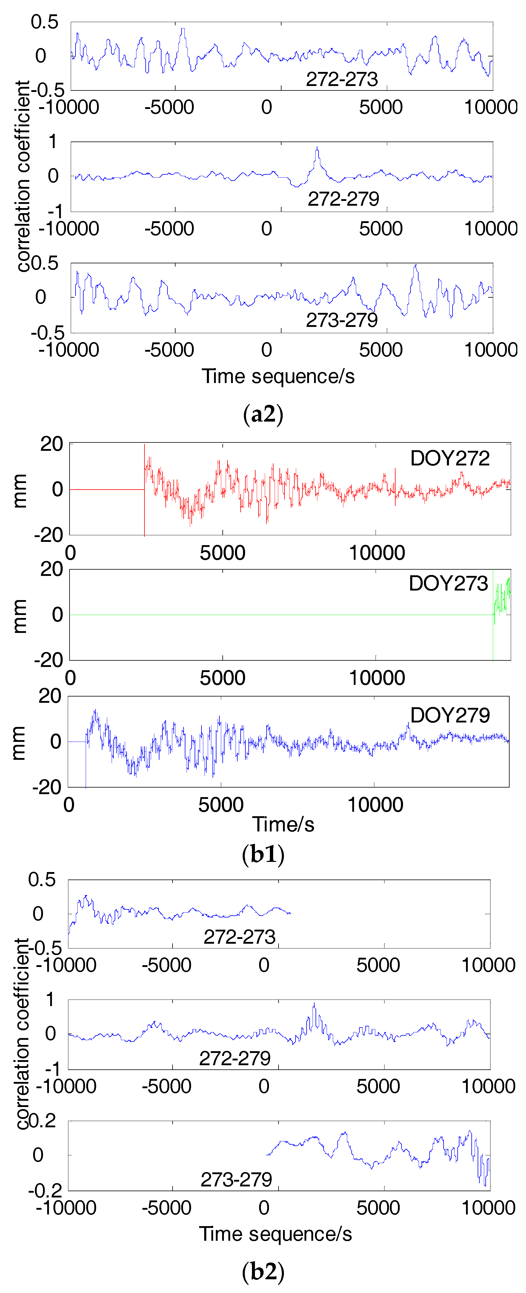
Since the relative geometry of a GPS satellite with receiver and reflective surface repeats itself in each sidereal day, multipath errors are highly correlated between consecutive sidereal days if the geometry changes are the same [
13,
14]. Hence, the SF based on coordinate domain using daily repetition of multipath can extract the multipath model from the coordinate sequence of the first day to correct that of the next day at a fixed station. However, this method uses the average satellite orbital period and ignores the differences between satellites, so it cannot be effectively applied in BDS multipath mitigation with its three different types of orbital satellites. Axelrad et al. found that the orbital repeat periods of GPS satellites are not strictly a sidereal day (about 23 h and 56 min) and there is a time shift which is not a constant for different satellites [
15]. Therefore, the SF based on observation domain, which calculates the orbital period of each satellite, extracts and corrects the multipath model on corresponding satellite observations between the observation sequences of two multipath periods, was proposed and developed. Zhong et al. developed a SF based on single difference (SD) residuals for mitigating GPS multipath effects on short baselines [
7]. Ye et al. studied the multipath repeat cycle of BDS satellites, and proposed a SF carrier phase multipath elimination approach of BDS system [
14]. Dong et al. proposed a Multipath Hemispherical Map (MHM) to achieve real-time resolution and correction of multipath errors [
16]. Dai et al. compared the MHM algorithm with the sidereal filtering algorithm, and proposed an improved multipath error parameterization model for BDS GEO multipath elimination [
17].
In order to obtain the multipath error model, it is essential to select an effective filtering method which controls the effect of multipath elimination. Lau proposed a robust three-level wavelet packet for carrier phase multipath [
18]. Zhong et al. proposed an adaptive wavelet transform based on a cross-validation method to mitigate GPS multipath effects [
19]. Dai et al. applied empirical mode decomposition (EMD) in denoising coordinate sequence of short GPS baseline [
20]. Kaloop et al. used four prediction models which are applied and used with neural network solutions: back-propagation, Cascade-forward back-propagation, adaptive filter and extended Kalman filter, to extract GPS time-series model and denoise the data for monitoring of structures [
21]. FIR filtering has also been used in extracting multipath models in literature [
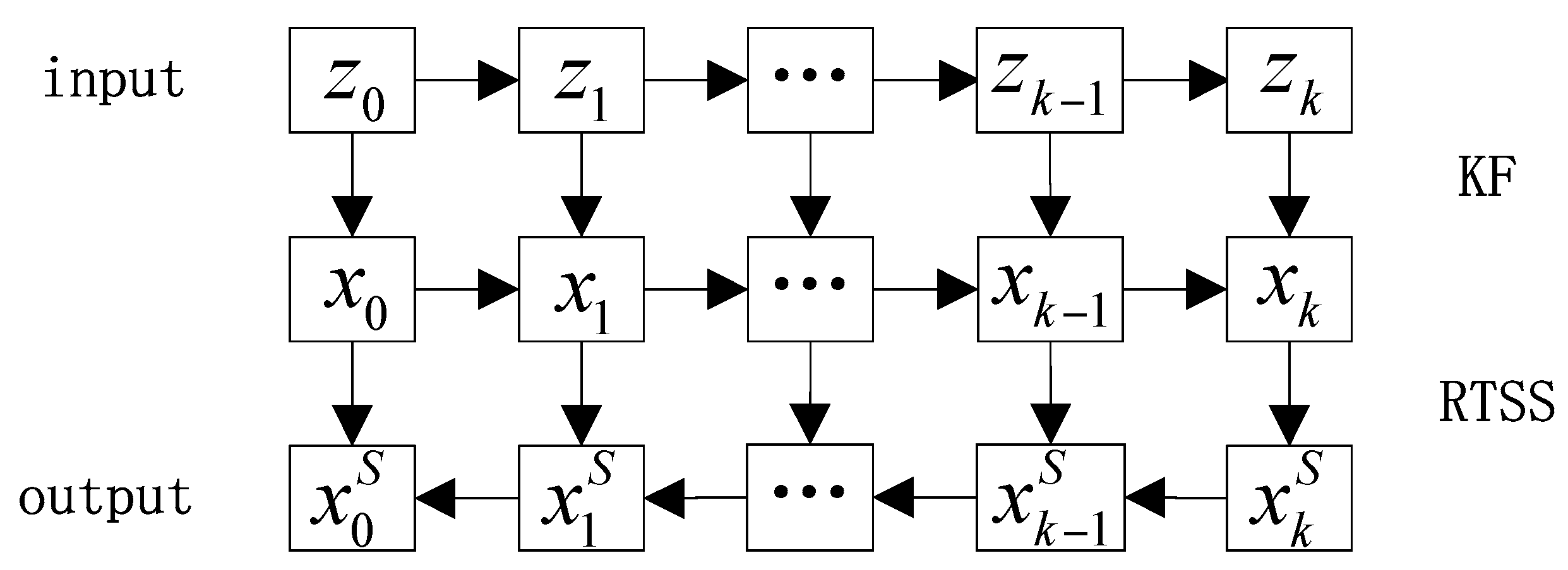
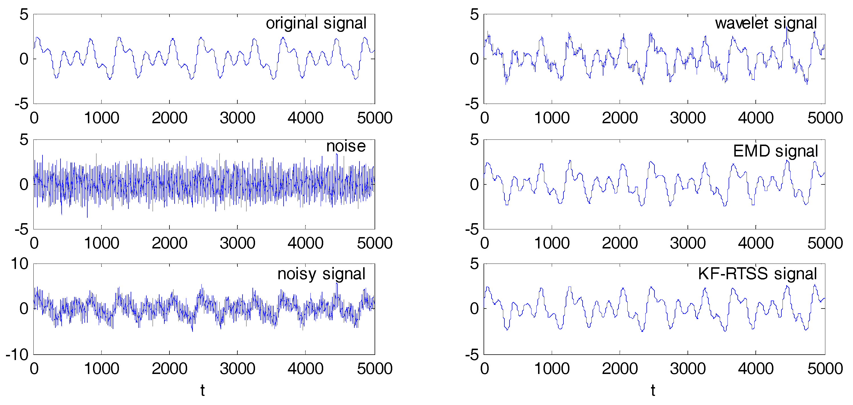
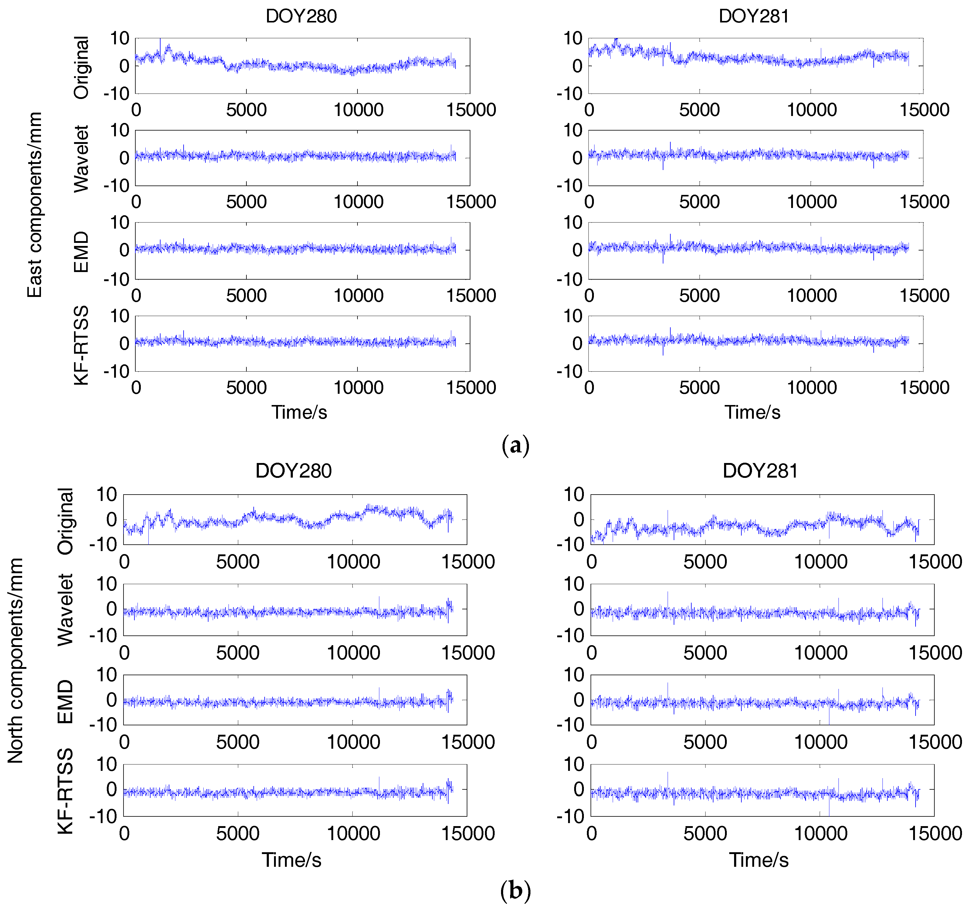
22]. To obtain a more accurate multipath model, a multipath model extraction method based on Kalman filter and Rauch-Tung-Striebel Smoother (RTSS) was proposed and the multipath repetition characteristics of BDS satellites were explained by qualitative analysis and quantitative calculation in the paper. To verify the performance of the new method, we compared it with the traditional wavelet and EMD methods used in [
19,
20].
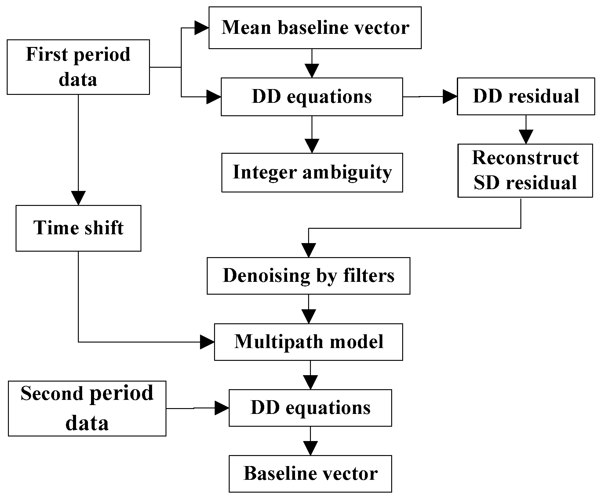
The paper is arranged as follows: in
Section 2, the basic principle of multipath error is explained and the steps of reconstructing single difference (SD) residuals is shown with a flowchart. Qualitative analysis and quantitative calculation of orbital periods of BDS satellites are carried out in
Section 3.
Section 4 introduces three filter methods for denoising SD residuals for extracting multipath models and a simulation experiment was carried out. In
Section 5, we verified the consistency between orbital periods and multipath periods of BDS satellites through a set of measured data, applied three filtering methods in extracting multipath models and found they all achieve good results in multipath mitigation. Finally, conclusions were drawn in
Section 6.
6. Conclusions
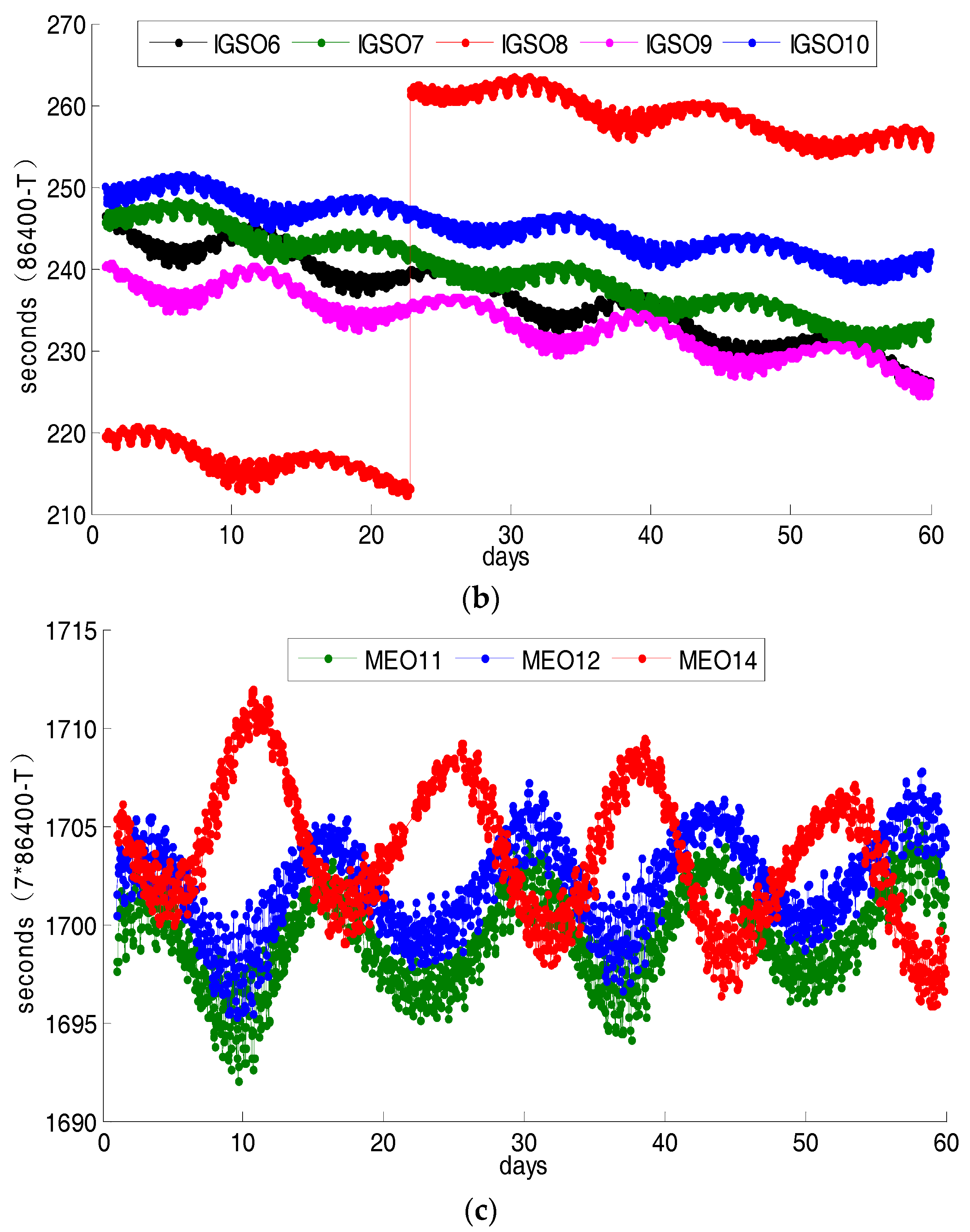
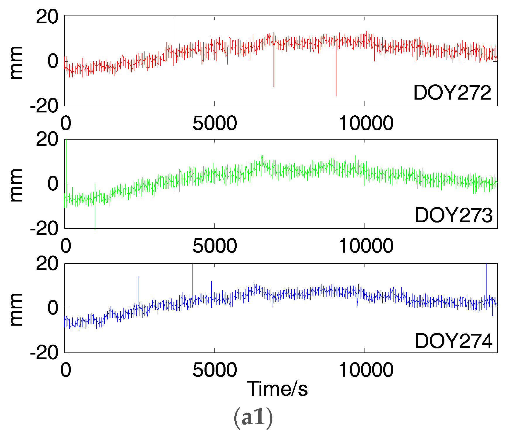
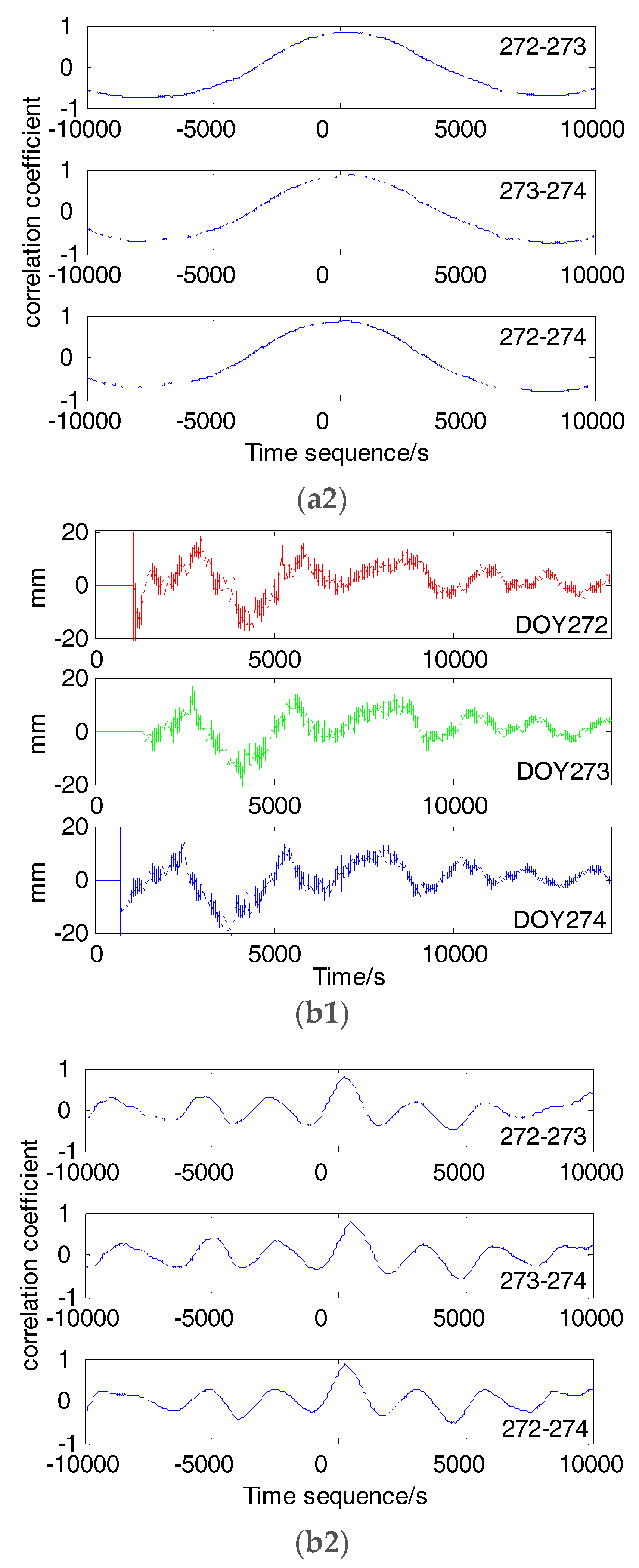
In order to meet the requirements of deformation monitoring with BDS precise positioning techniques for large structures, it is of significance to mitigate multipath effects in carrier phase observations. In this paper, detailed analysis was provided about the characteristics of orbital periods and multipath repeat periods of BDS satellites. It was found that they are consistent. The period of orbit and multipath errors for BDS GEO and IGSO satellites is about one day and that of BDS MEO satellites is about seven days. Sidereal filters based on SD difference were applied to correct multipath errors. The KF-RTSS method was introduced to extract multipath models from single difference (SD) residuals. After subtracting multipath models, the improvement of baseline accuracy on E, N, U directions are about 62.8%, 63.6%, 62.5% on DOY 280 and 57.3%, 53.4%, 55.9% on DOY 281, respectively. Wavelet filter and EMD filter were also used in multipath mitigation. The experimental results indicate that the three filters all have obvious effect on improvement of baseline accuracy and the performance of KT-RTSS method is slightly better than that of the wavelet filter and EMD filter.


