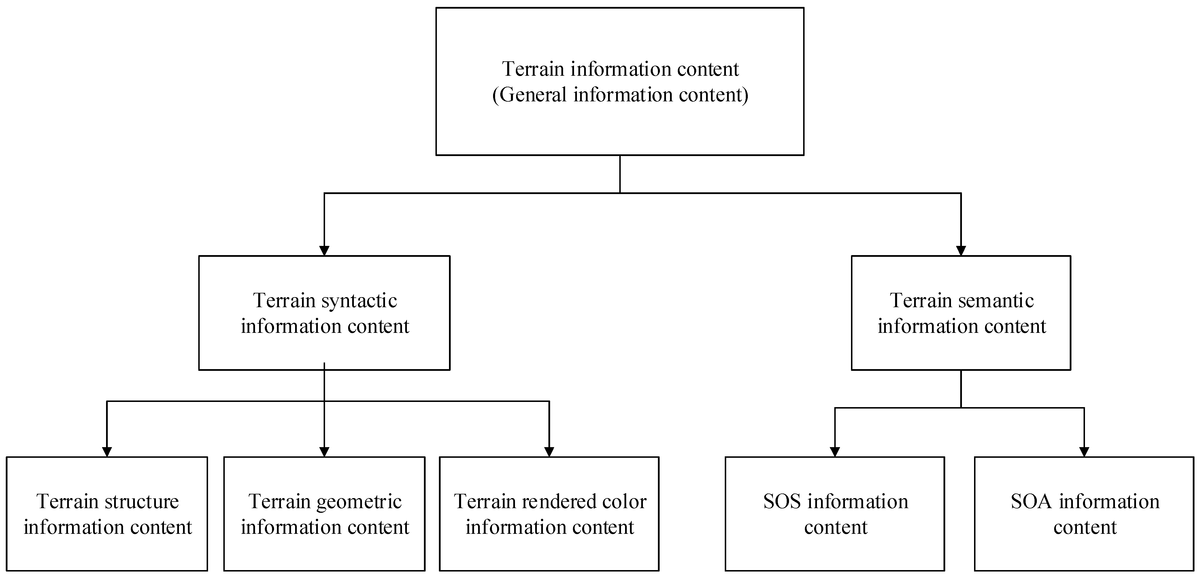
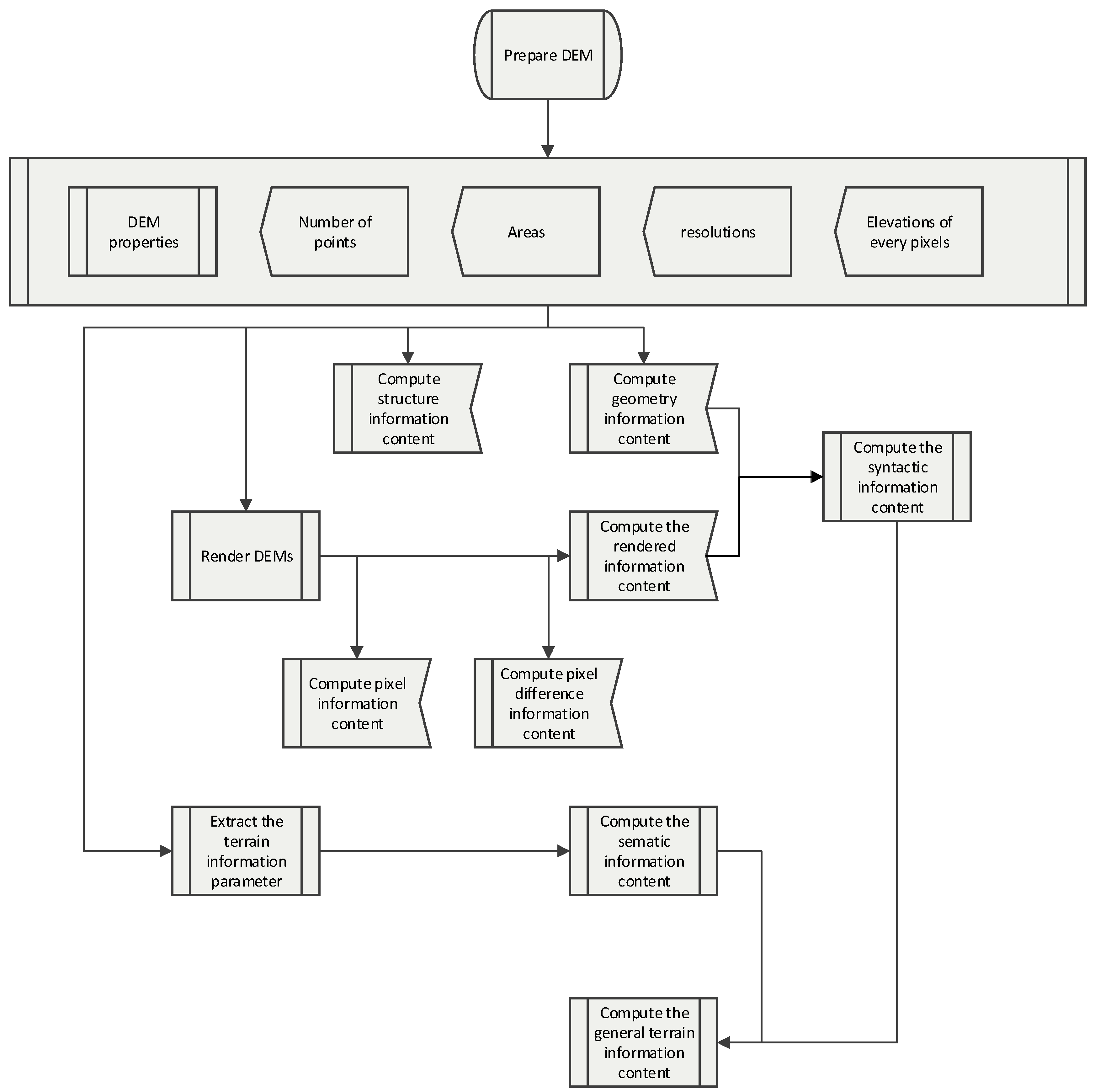
Terrain semantic information content is proposed to represent the potential meaning of terrain. Horizontal and vertical variations are the potential information of terrain. Slope angle of slope angle (SOS) and slope angle of slope aspect (SOA) [
26] are chosen to represent the horizontal and vertical elevation changes of the terrain surface. If we use the other terrain information, such as relief degree, slope, roughness, most of them can only reflect some of the terrain information, but not the horizontal and the vertical totally. We should choose more than one terrain factor, but it is hard to find a suitable factor to just make up the parts that the current factor is not involved. But the SOA and SOS can reflect the horizontal variation and vertical variation comprehensively. Hence, the terrain semantic information content is computed as the entropy of the SOS value and the SOA value with a proper subset.
There are three main problems for computing the terrain semantic information content. One is how to compute the SOS and SOA. Another is how to partition the SOS and SOA values into subsets, and the third is how to compute the terrain semantic information content with the subsets of SOA and SOS.
3.2.1. SOA and SOS
To compute the values of SOS and SOA, we should first know the slope angle and slope aspect calculation models because they are the basis for the computation of SOA and SOS.
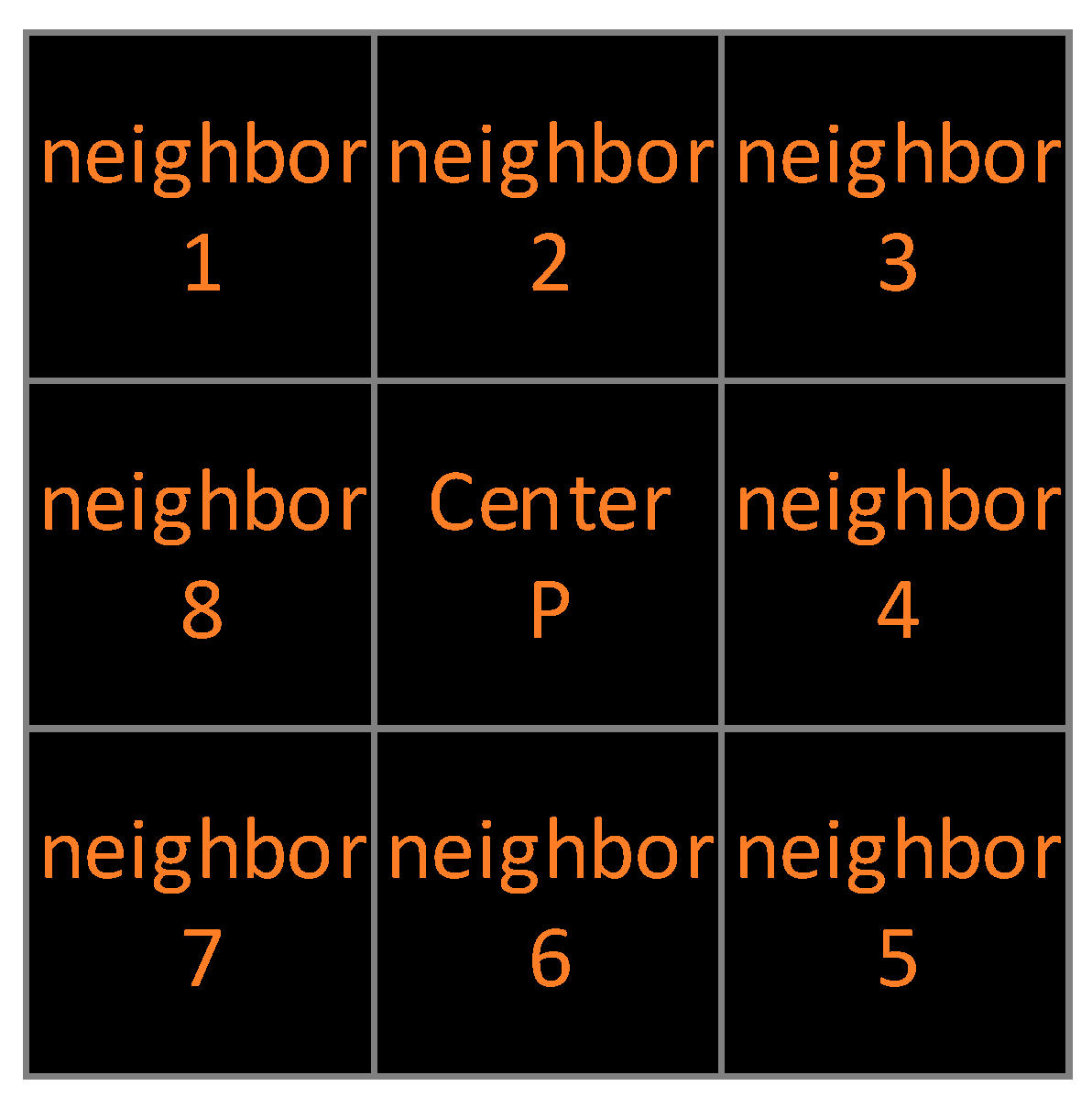
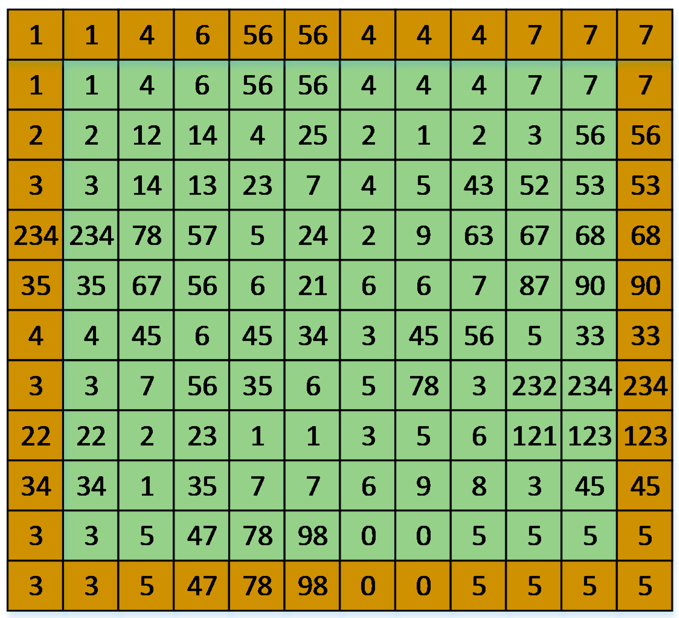
(1) Slope angle, as one of the most important parameters of terrain features, has been used in many aspects, such as hydrological models, soil erosion models, and land use planning. On the surface of the earth, the slope of a certain point is the elevation variability in the earth’s surface z = f (x, y) from the east-west (X axis) to the north-south (Y axis). Based on Grid DEM, slope is generally calculated at a local scale (such as a 3 × 3 moving window, as shown in
Figure 4). The most used slope calculation model is the three-order inverse distance square weight difference, which has been used in ArcGIS software (Environmental Systems Research Institute Inc., Redlands, CA, USA). The variation rates of the surface at the horizontal (
dz /
dx) and vertical (
dz /
dy) directions from the center cell determine the slope. Slope is commonly measured in the units of degrees, and the data range is from 0 to 90. The basic algorithm used to calculate the slope is [
26,
27,
28]:
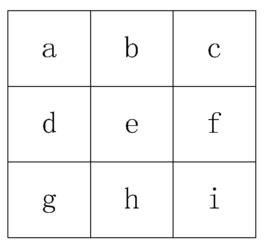
If the letters from
a to
h represent the grid elevation in a 3 × 3 window. As shown in
Figure 4,
e is the center grid’s elevation. Then the horizontal change (
dz /
dx) and the vertical change (
dz /
dy) can be computed as [
27,
28]:
Figure 4.
The 3 × 3 moving window for the slope computation.
Figure 4.
The 3 × 3 moving window for the slope computation.
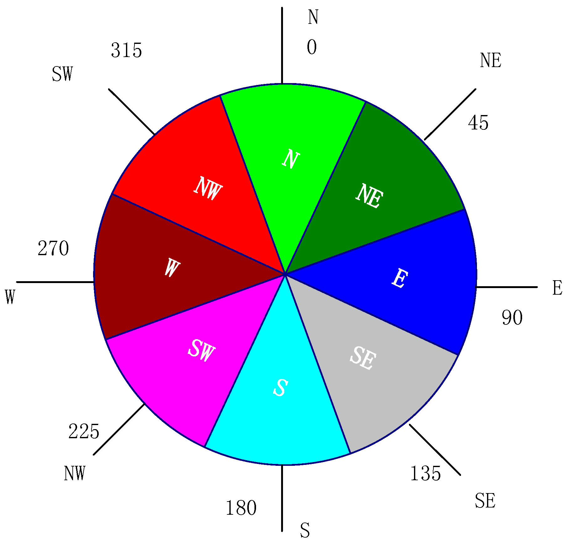
(2) Slope aspect is the slope angle direction. With the grid DEM, all of the points can indicate the compass direction of the terrain surface. Methods of calculating slope aspect are based on the slope angle in accordance with the instructions of the compass; the output includes nine directions (as shown in
Figure 5): median (Flat), north (N), northeast (NE), east (E), southeast (SE), south (S), northwest (NW), southwest (SW) and west (W). Every direction has an aspect value data range (with units of degrees),
i.e., flat:
, north:
, northeast:
, east:
, southeast:
, south:
, northwest:
, southwest:
, west:
. The output of the slope aspect is represented as these nine directions (mostly the result is a rendered aspect map, with nine colors to represent different directions). While the output of the slope aspect data is stored as a raster dataset, and every grid has a slope aspect value.
Figure 5.
Slope aspect compass.
Figure 5.
Slope aspect compass.
The slope aspect can be calculated as (units is degrees) [
27,
28]:
The aspect value is then converted to compass direction values, according to the following rule [
27,
28]:
If Aspect < 0, then the new aspect value will be set as 90-Aspect; Else if Aspect > 90, the new aspect value will be set as 360-Aspect + 90; if 0 < Aspect < 90, the new aspect value will be set as 90-Aspect. Then according to the slope aspect direction compass and the slope aspect data range, the slope direction can be defined.
(3) SOS is the slope angle of the slope angle. It is based on the slope angle calculation model, after calculating the slope angle of the terrain surface, and then the calculated model is superimposed with the input of the slope angle. The SOS is the expression of the change of the ground elevation, which is characterized by the second order derivative of the surface elevation relative to the horizontal plane. Because of its simple calculation method, it is used to replace the curvature factor of a terrain profile. Because SOS is calculated by the slope degree calculation model, its output value range is the same as the slope degree, which is from 0 to 90. The output value of SOS stores as a raster dataset, and every grid has a SOS value.
If
,
,
,
,
,
,
,
,
represent the slope degree of the 3 × 3 window (
Figure 4), the SOS can be computed as [
26]:
(4) SOA refers to the slope aspect variability in the horizontal direction. The extraction method is based on the calculation of the surface slope angle. SOA can be obtained from the input of slope aspect in the slope angle calculation model.
If
,
,
,
,
,
,
,
,
represent the slope aspect of the 3 × 3 window (
Figure 4), the SOA can be computed as [
26]:
Because SOA is calculated with the slope degree model, its output data range is the same as the slope degree. Its value data range is from 0 to 90. The output value of SOA is stored as a raster dataset, and every grid has a SOA value. There are some situations may met for the SOA computation,
i.e., when two of the aspect value are 350 and 15, according to the SOA calculation model, the aspect variation will be very large, but in fact, it is small, which can be seen from the slope aspect compass. So in reference [
26], a rectification has been made for the SOA computation. The rectified method can be realized by two steps: First, the negative terrain should be calculated out, with the maximum elevation value minus every grid elevation value in the DEM raster dataset. Second, with the SOA calculation model (Equation (21)), the SOA values of the original DEM and the negative DEM can be computed out. We use
SOAori and
SOAneg to represent them, respectively. Then the rectified SOA (
SOArec) can be computed as:
The terrain information parameters SOA and SOS should be normalized. The extremum standardization method is used for the normalization. The normalization method calculation formula is as follows:
where
C(
xi) is the normalized of value
xi,
xmax is the maximum value of
xi,
xmin is the minimum value of
xi,
NSOS is the normalized value of SOS, and
NSOA is the normalized value of SOA.


