Classifying UAVSAR Polarimetric Synthetic Aperture Radar (PolSAR) Imagery Using Target Decomposition Features †


Abstract
:1. Manuscript
General Instructions
2. Proposed Method
2.1. Support Vector Machine
2.2. K-Nearest Neighbour (KNN)
2.3. Random Forest Algorithm (RF)
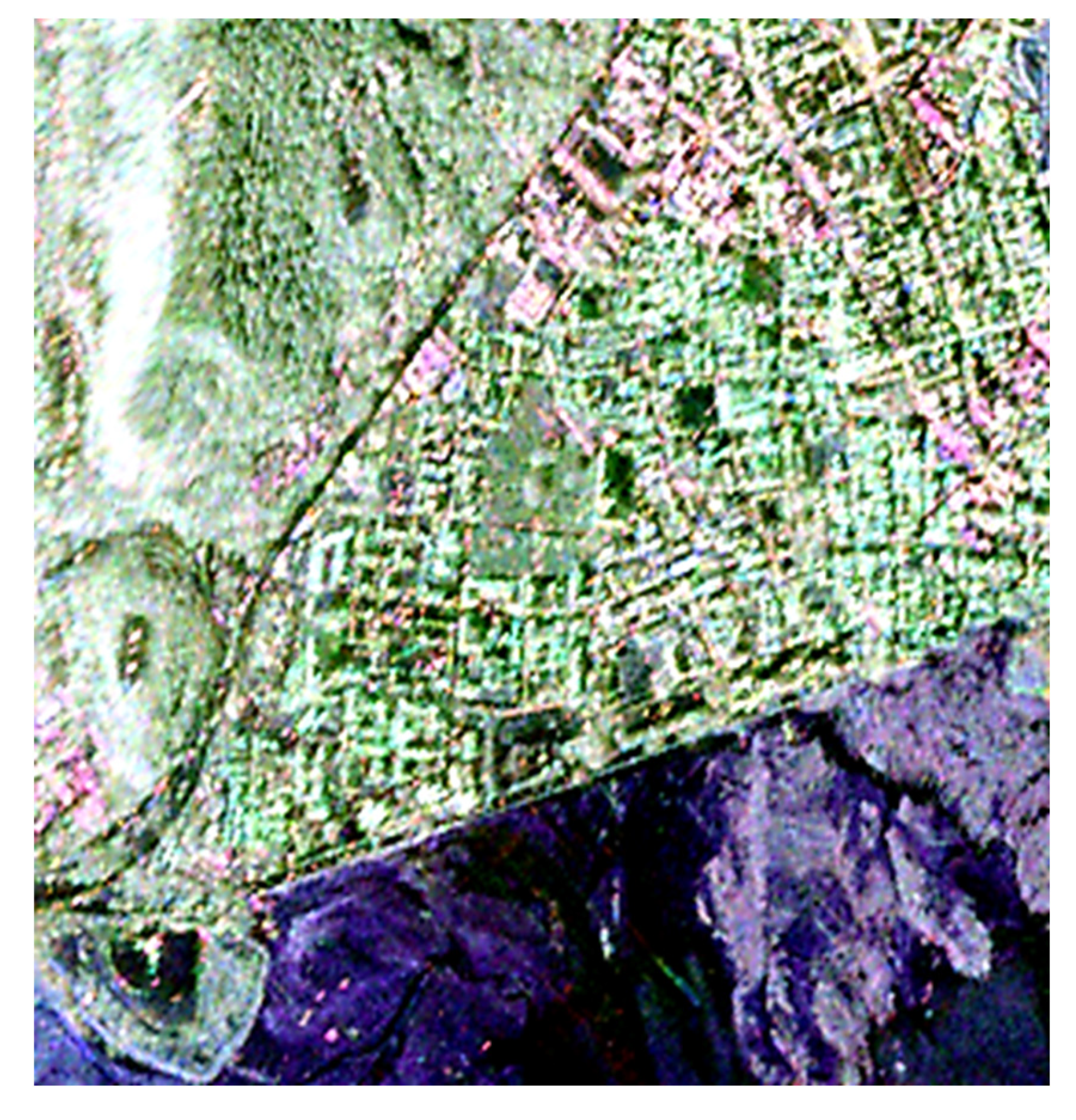
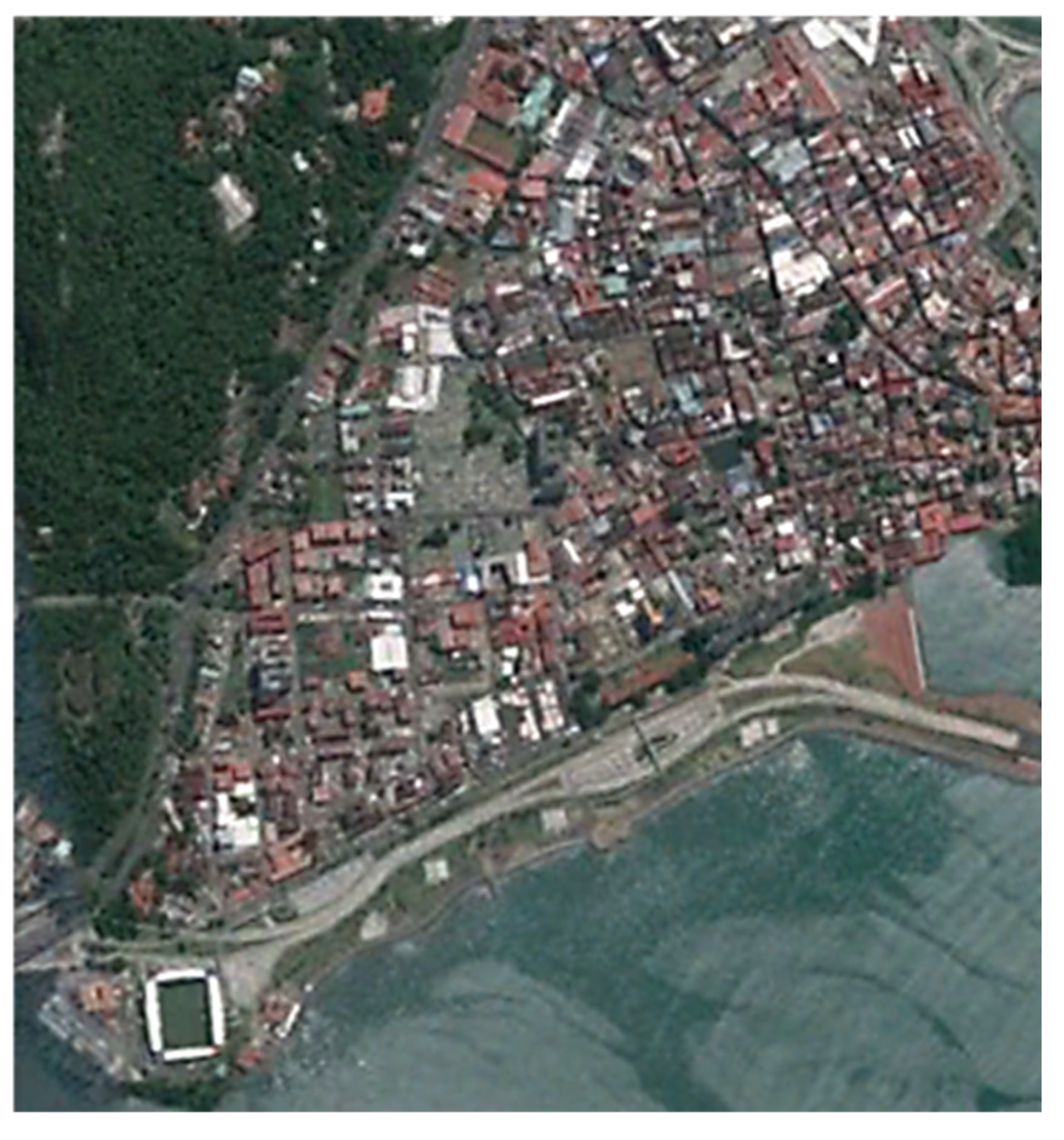
3. Study Area
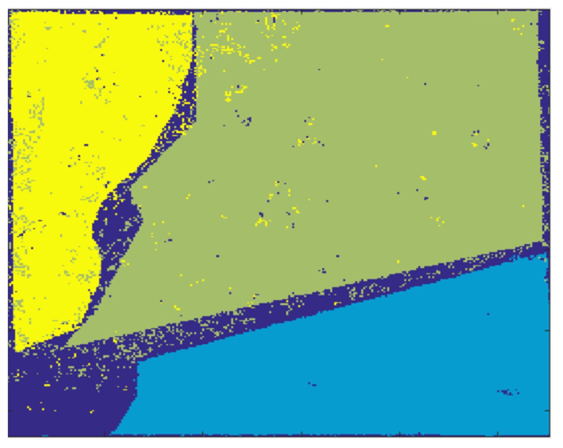
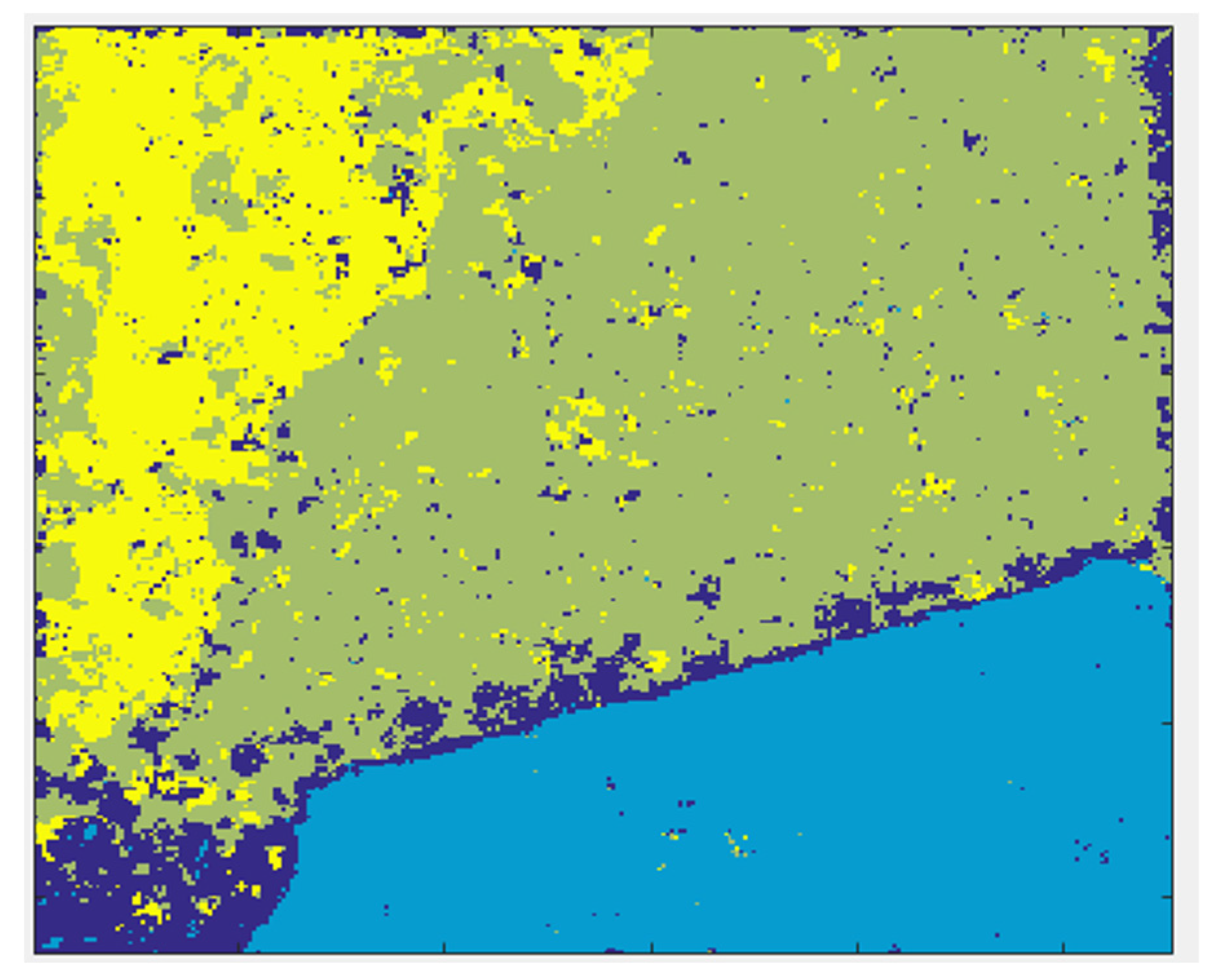
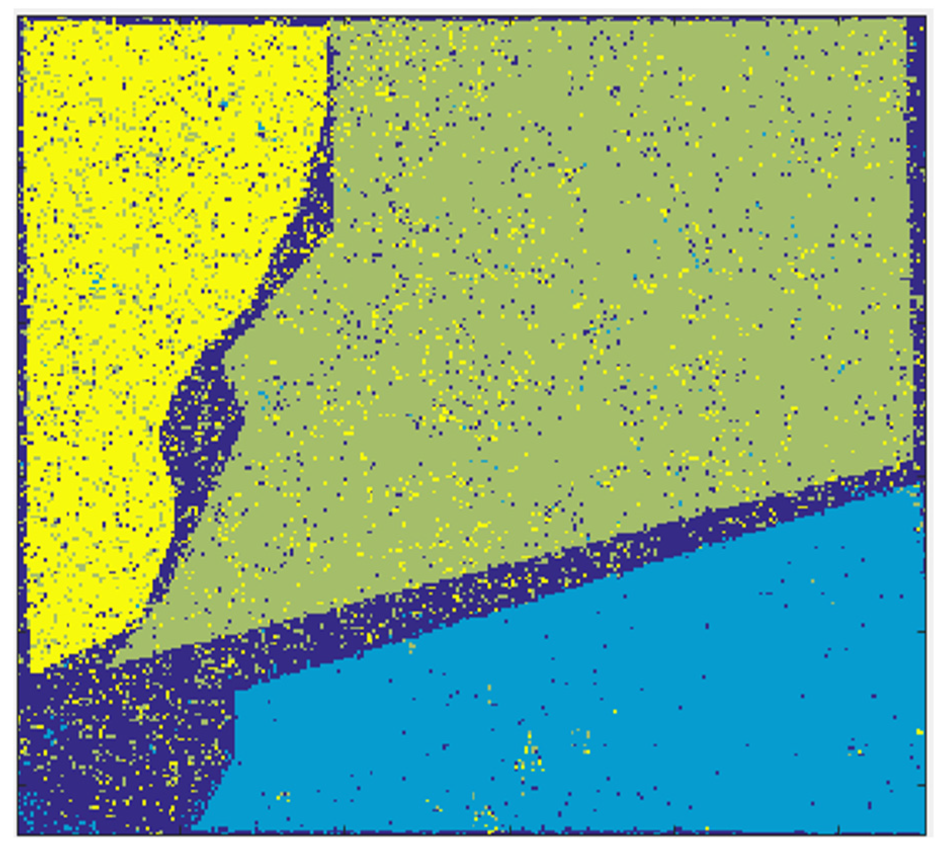
4. Implementation
4.1. Extracted Decomposition Descriptors
4.2. Steps for Implementation
5. Conclusions
Conflicts of Interest
References
- Krogager, E.; Czyz, Z.H. Properties of the Sphere, Diplane Helix Decomposition. In Proceedings of the Third International Workshop on Radar Polarimetry, (JIPR’95), RESTE, Nantes, France, 1 March 1995; pp. 106–114. [Google Scholar]
- Yekkehkhany, B.; Homayouni, S.; Mcnairn, H.; Safari, A. Multi-temporal Full Polarimetry L-Band SAR data classification for Agriculture Land cover mapping. In Proceedings of the IEEE International Geoscience and Remote Sensing Symposium (IGARSS), Quebec City, QC, Canada, 13–18 July 2014. [Google Scholar]
- Lardeux, C.; Frison, P.-L.; Rudant, J.-P.; Souyris, J.-C.; Tison, C.; Stoll, B. Use of the SVM classification with polarimetric SAR data for land use cartography. In Proceedings of the Geoscience and Remote Sensing Symposium, IGARSS 2006, Denver, CO, USA, 31 July–4 August 2006; pp. 493–496. [Google Scholar]
- Khosravi, I.; Mohammad-Beigi, M. Multiple Classifier Systems for Hyperspectral Remote Sensing Data Classification. J. Indian Soc. Remote Sens. 2014, 42, 423–428. [Google Scholar] [CrossRef]
- Noi, P.T.; Kappas, M. Comparison of Random Forest, K-Nearest Neighbor, and Support Vector Machine Classifiers for Land Cover Classification Using Sentinel-2 Imagery. Sensors 2018, 18, 18. [Google Scholar] [CrossRef]
- Lee, J.S.; Pottier, E. Polarimetric Radar Image: From Basics to Applications; CRC Press: Boca Raton, FL, USA, 2009. [Google Scholar]
- Vapnik, V. The Nature of Statistical Learning Theory; Springer: New York, NY, USA, 2000. [Google Scholar]
- Barandela, R.; Gasca, E. Decontamination of Training Samples for Supervised Pattern Recognition Methods; Springer: Berlin/Heidelberg, Germany, 2000; pp. 621–630. [Google Scholar]
- Breiman, L. Manual for setting up, using, and understanding random forest. Remote Sens. J. 2003, 4, 23–41. [Google Scholar]
- Jin, J. A Random forest based method for urban land cover classification using LiDAR data and aerial imagery. Remote Sens. Environ. 2012, 81, 190–211. [Google Scholar]
- Zhou, Z.H. Ensemble Methods: Foundations and Algorithms; Taylor & Francis: Abingdon, UK, 2012; 236p. [Google Scholar]
- Hasanlou, M.; Samadzadegan, F.; Homayouni, S. SVM-based hyperspectral image classification using intrinsic dimension. Arabian J. Geosci. 2015, 8, 477–487. [Google Scholar] [CrossRef]


| Alpha anisotropy beta combination_1mH1mA combination_1mHA combination_H1mA combination_HA delta entropy gamma lambda Huynen_T11 Huynen_T22 Huynen_T33 Barnes1_T11 Barnes1_T22 Barnes1_T33 Barnes2_T11 Barnes2_T22 Barnes2_T33 Cloude_T11 Cloude_T22 Cloude_T33 | Holm1_T11 Holm1_T22 Holm1_T33 Holm2_T11 Holm2_T22 Holm2_T33 Freeman_Dbl Freeman_Odd Freeman_Vol Freeman2_Ground Freeman2_Vol HAAlpha_T11 HAAlpha_T22 HAAlpha_T33 Krogager_Kd Krogager_Kh Krogager_Ks Neumann_delta_mod Neumann_delta_pha Neumann_psi Neumann_tau TSVM_alpha_s TSVM_alpha_s1 | TSVM_alpha_s2 TSVM_alpha_s3 TSVM_phi_s TSVM_phi_s1 TSVM_phi_s2 TSVM_phi_s3 TSVM_psi TSVM_psi1 TSVM_psi2 TSVM_psi3 TSVM_tau_m TSVM_tau_m1 TSVM_tau_m2 TSVM_tau_m3 VanZyl3_Dbl VanZyl3_Odd VanZyl3_Vol Yamaguchi3_Dbl Yamaguchi3_Odd Yamaguchi3_Vol Yamaguchi4_Dbl Yamaguchi4_Hlx Yamaguchi4_Odd Yamaguchi4_Vol |
| Method | Parameter | |
|---|---|---|
| SVM | C = 2 | Γ = 2/4414 × 10−4 |
| RF | Ntree = 100 | Mtry = 8 |
| KNN | K = 1 | - |
| Method | Overall Accuracy (%) |
|---|---|
| RF | 88.65 |
| SVM | 77.38 |
| KNN | 73.29 |
Publisher’s Note: MDPI stays neutral with regard to jurisdictional claims in published maps and institutional affiliations. |
© 2018 by the authors. Licensee MDPI, Basel, Switzerland. This article is an open access article distributed under the terms and conditions of the Creative Commons Attribution (CC BY) license (https://creativecommons.org/licenses/by/4.0/).
Share and Cite
Alijani, G.; Hasanlou, M.; Azizi, Z. Classifying UAVSAR Polarimetric Synthetic Aperture Radar (PolSAR) Imagery Using Target Decomposition Features. Proceedings 2018, 2, 333. https://doi.org/10.3390/ecrs-2-05146
Alijani G, Hasanlou M, Azizi Z. Classifying UAVSAR Polarimetric Synthetic Aperture Radar (PolSAR) Imagery Using Target Decomposition Features. Proceedings. 2018; 2(7):333. https://doi.org/10.3390/ecrs-2-05146
Chicago/Turabian StyleAlijani, Ghazaleh, Mahdi Hasanlou, and Zahra Azizi. 2018. "Classifying UAVSAR Polarimetric Synthetic Aperture Radar (PolSAR) Imagery Using Target Decomposition Features" Proceedings 2, no. 7: 333. https://doi.org/10.3390/ecrs-2-05146
APA StyleAlijani, G., Hasanlou, M., & Azizi, Z. (2018). Classifying UAVSAR Polarimetric Synthetic Aperture Radar (PolSAR) Imagery Using Target Decomposition Features. Proceedings, 2(7), 333. https://doi.org/10.3390/ecrs-2-05146