Vertical Measurements in Oblique Aerial Imagery

Abstract
:
1. Introduction
2. Methods
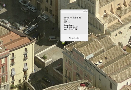
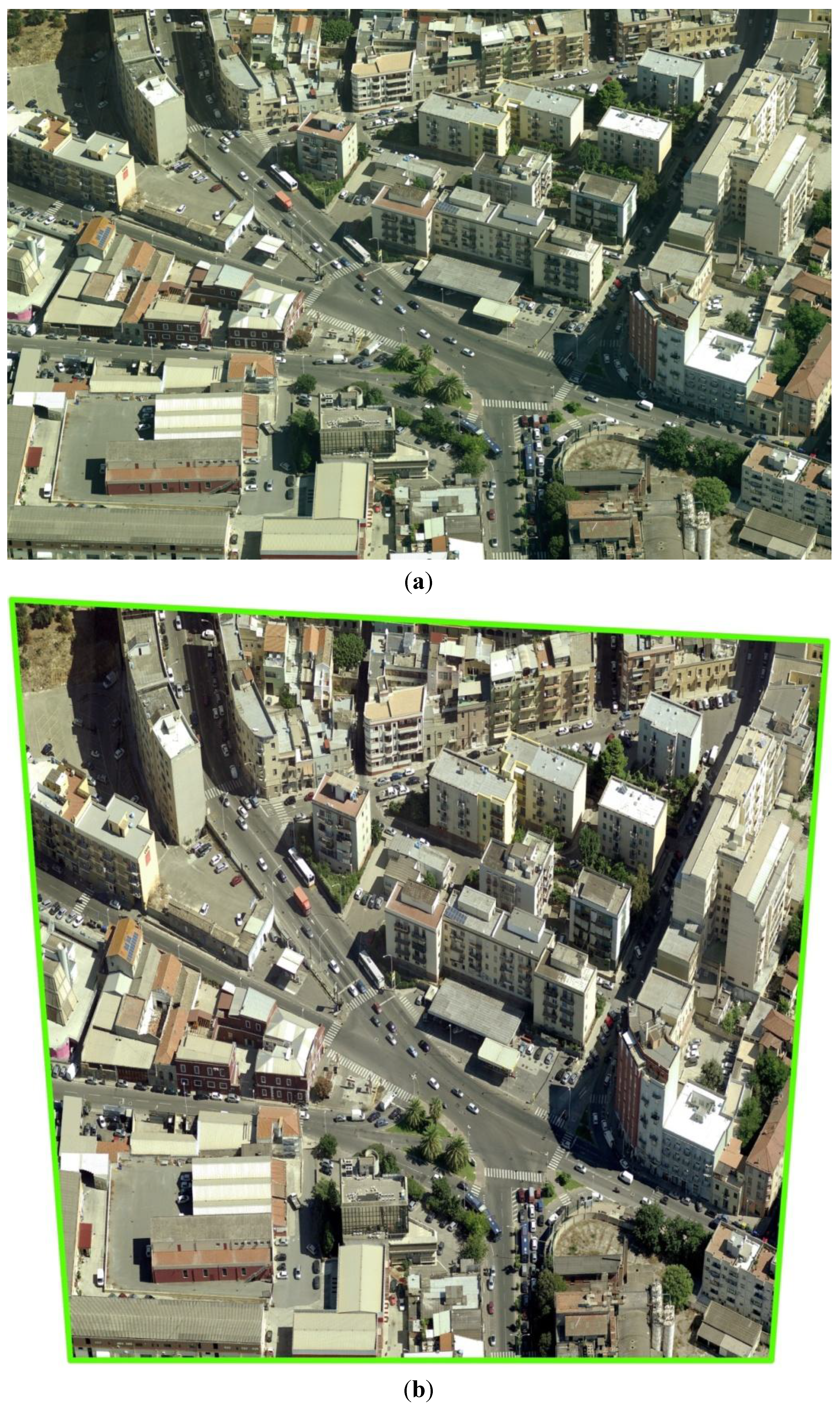
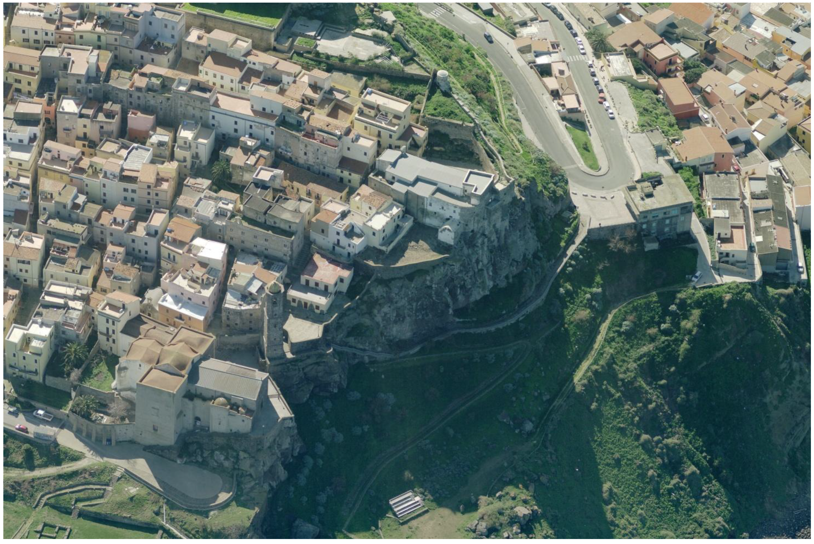
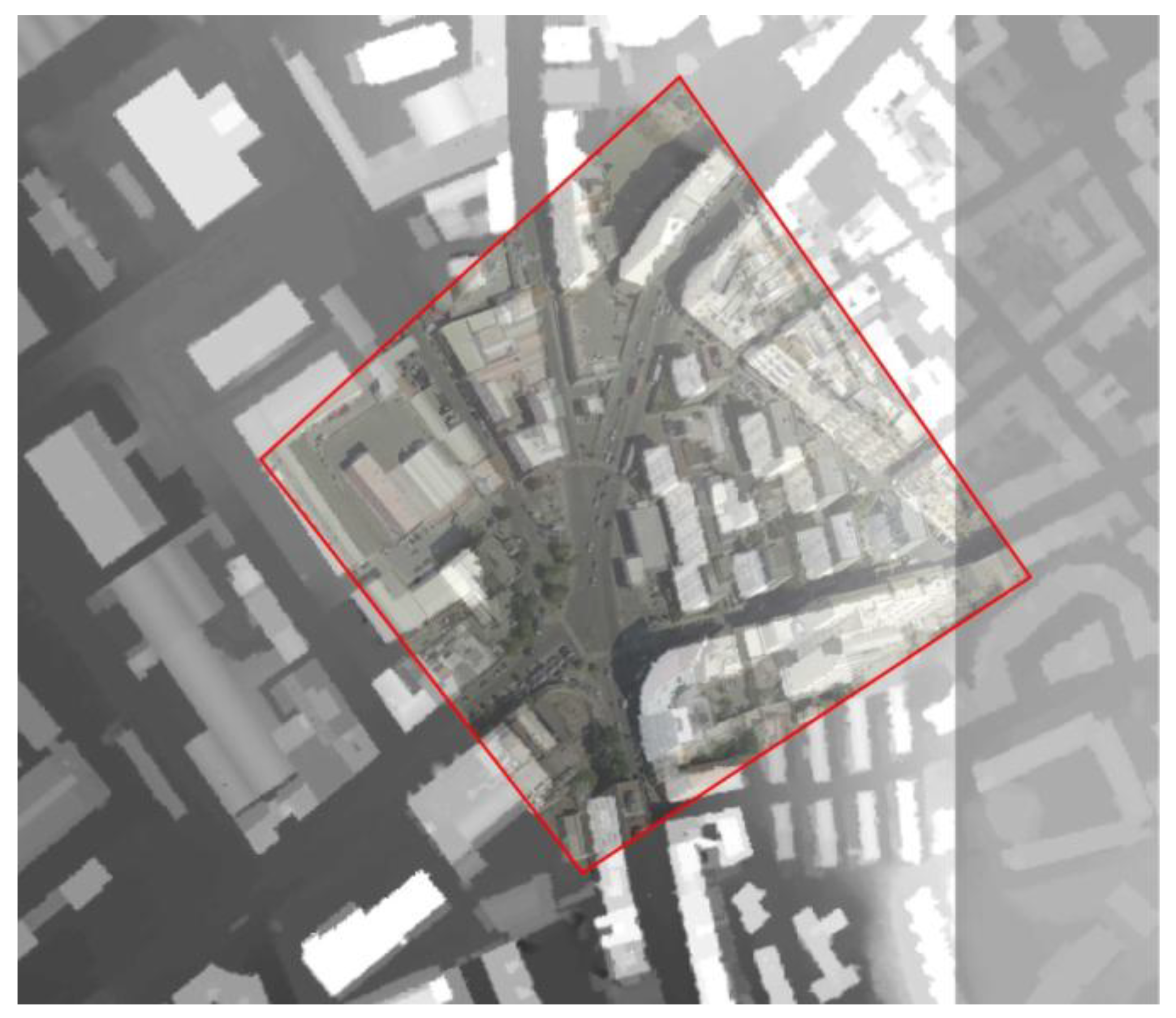
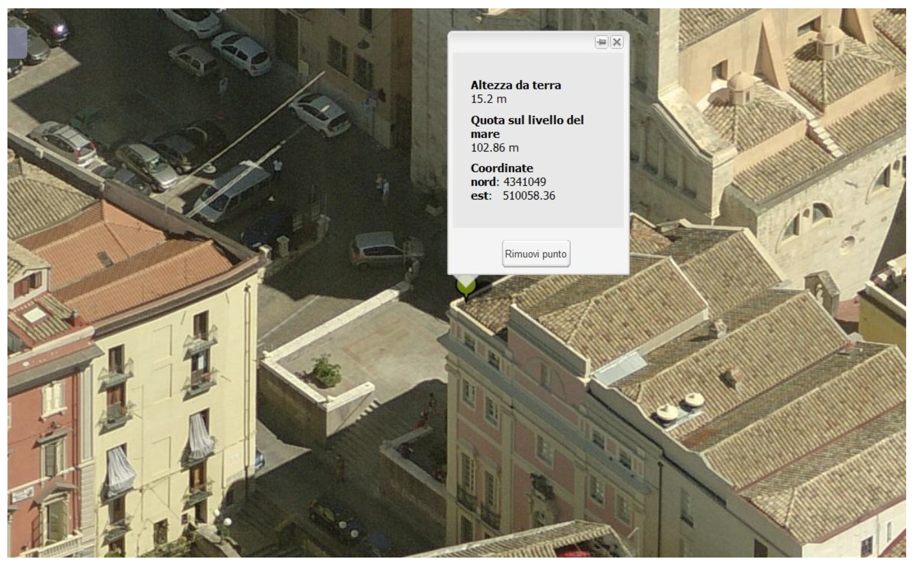
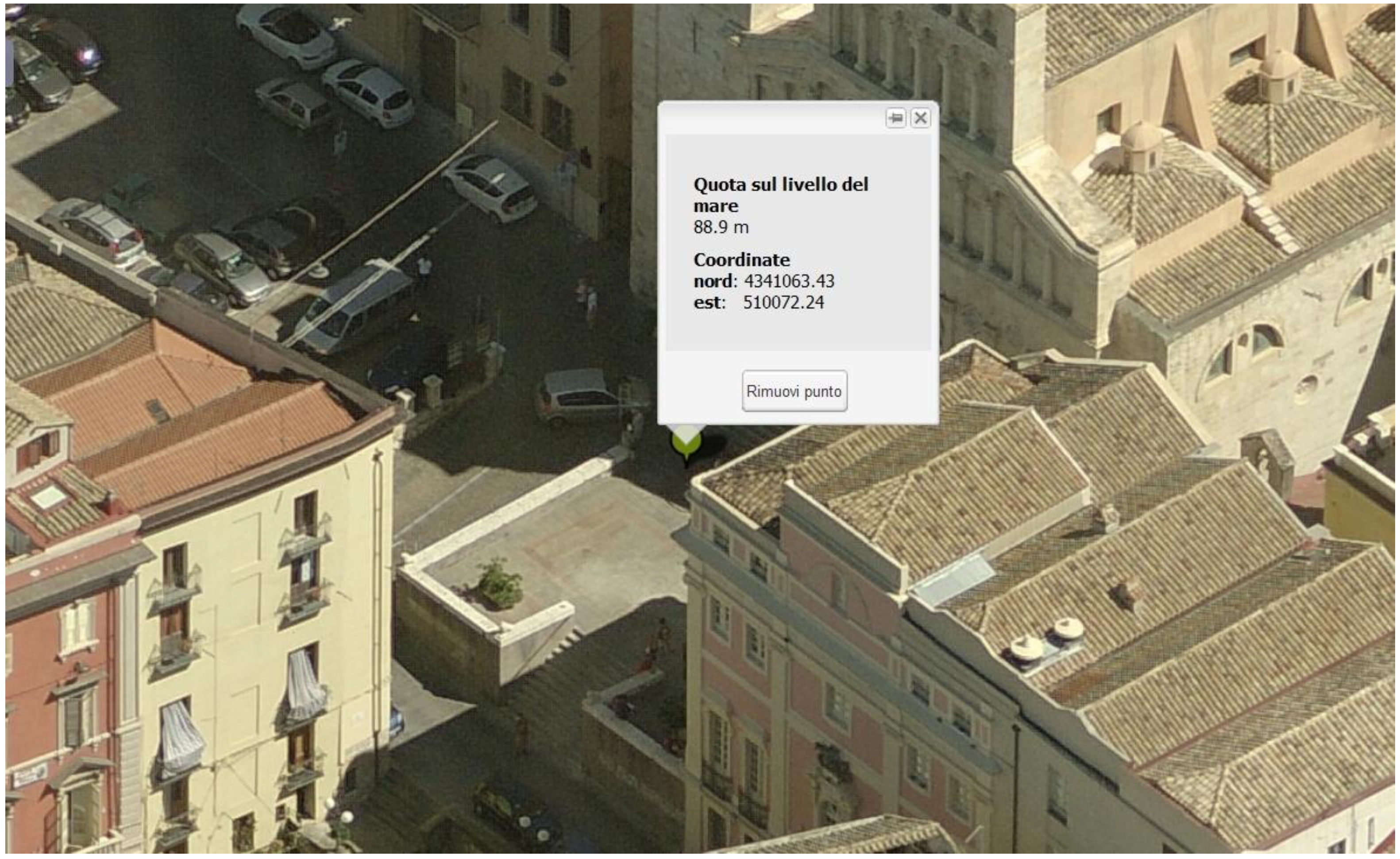
2.1. Oblique Images
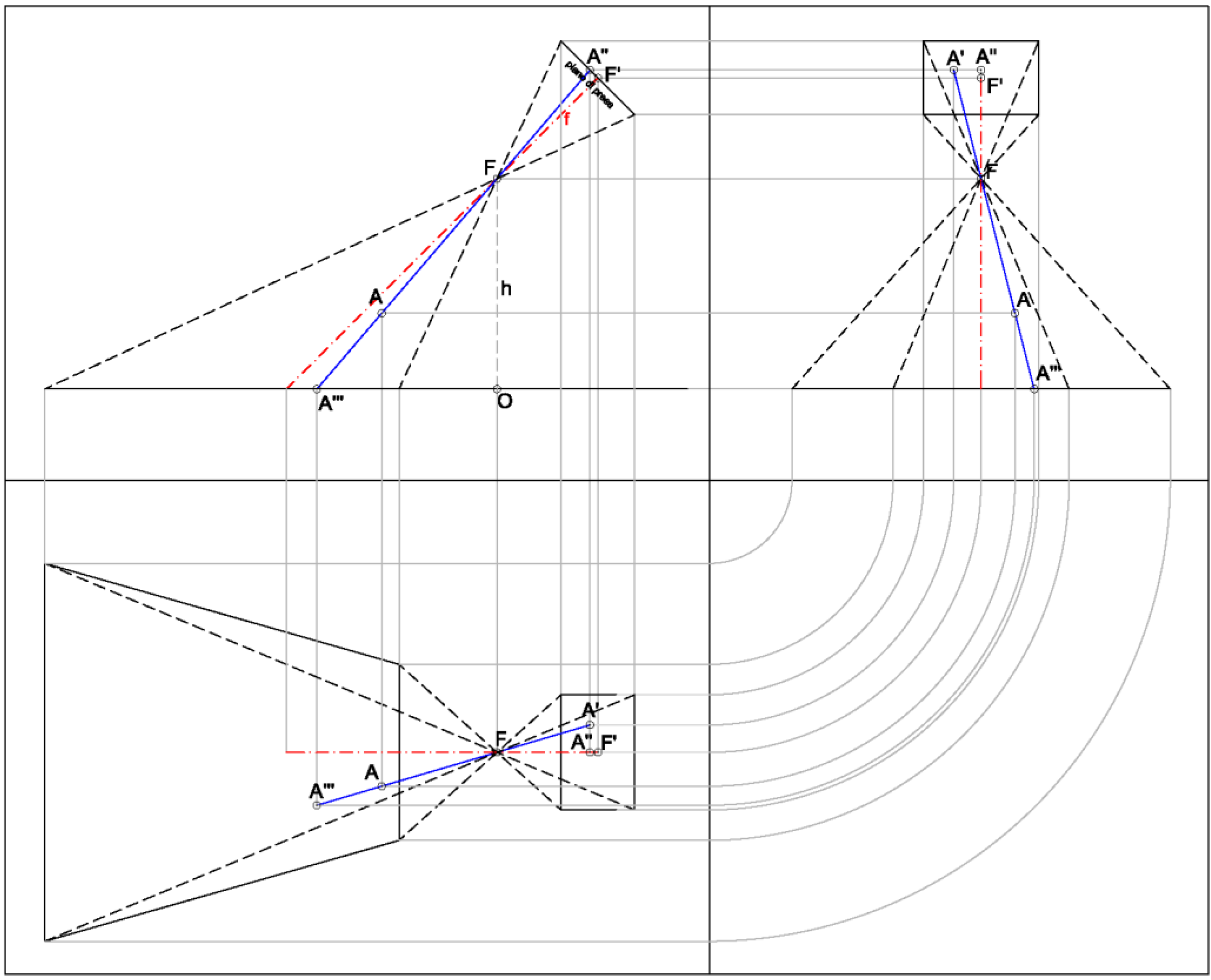
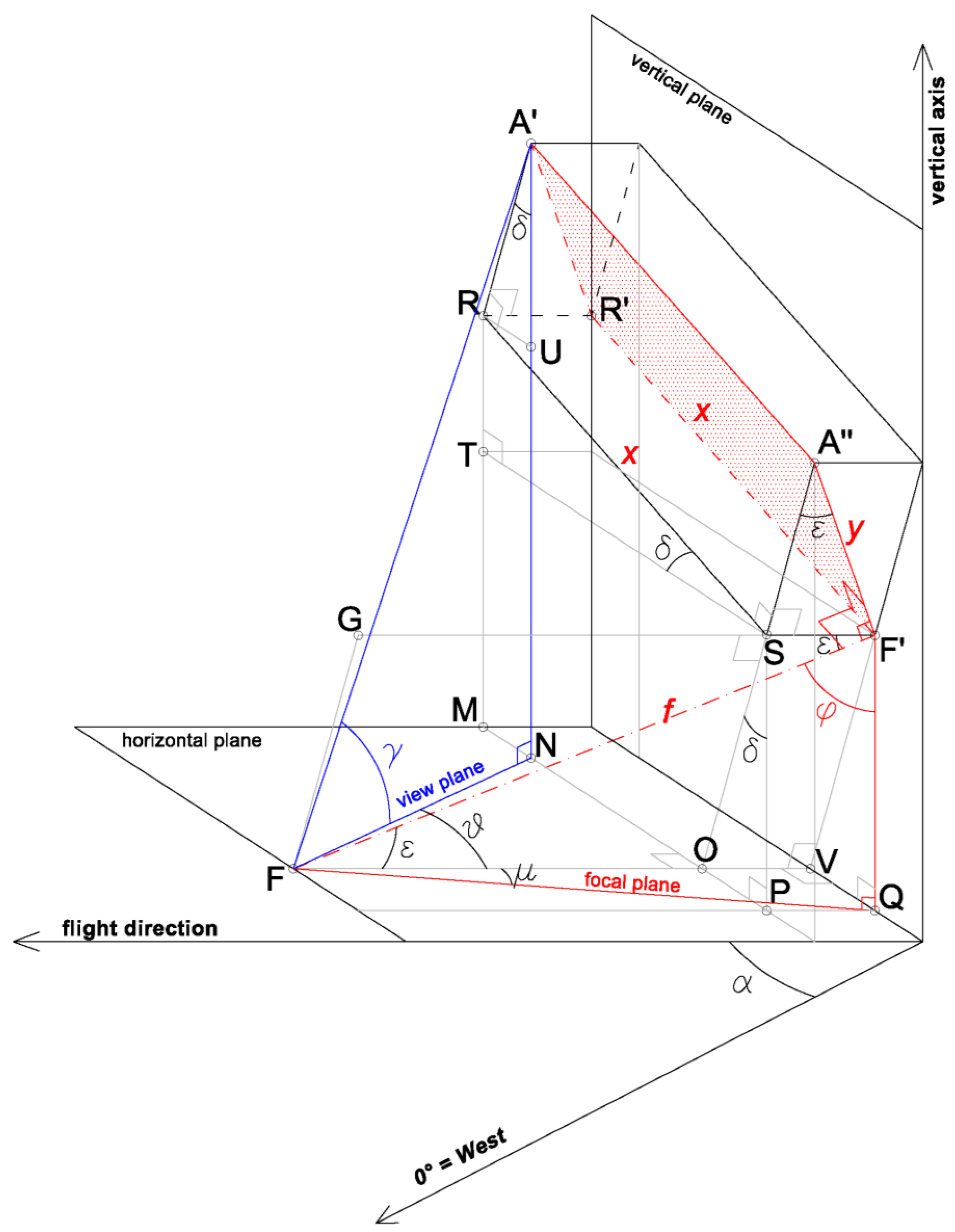
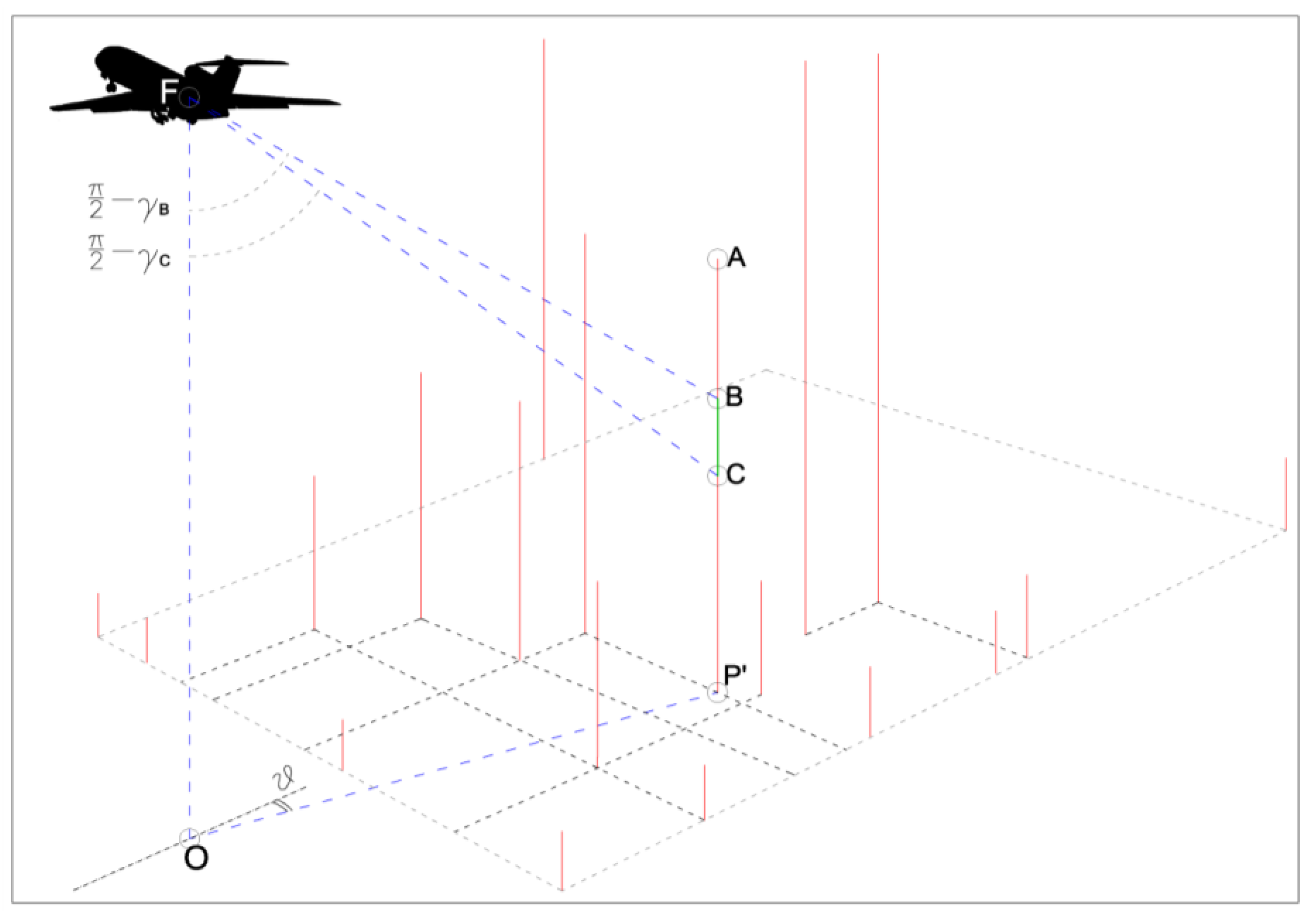
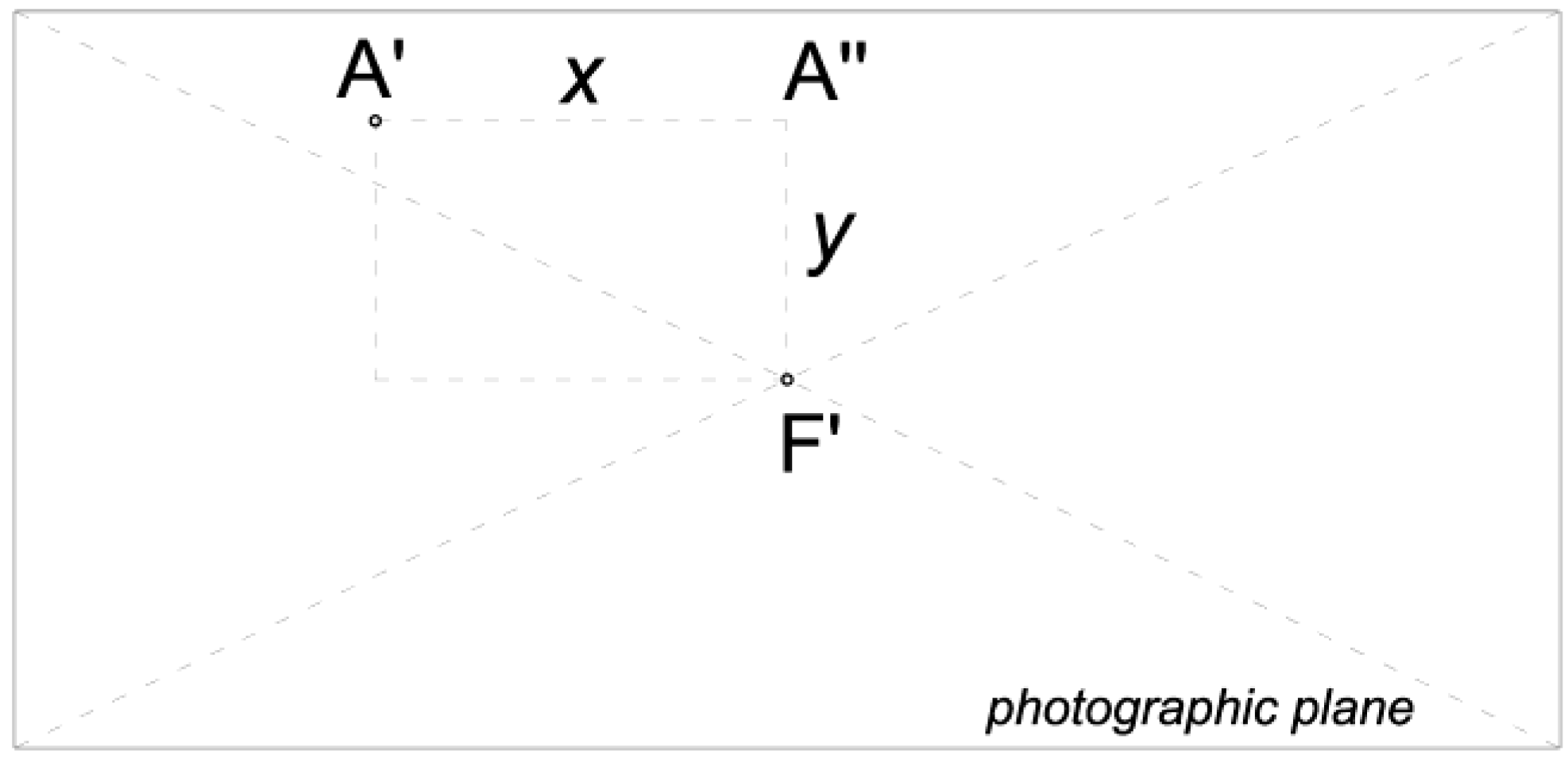
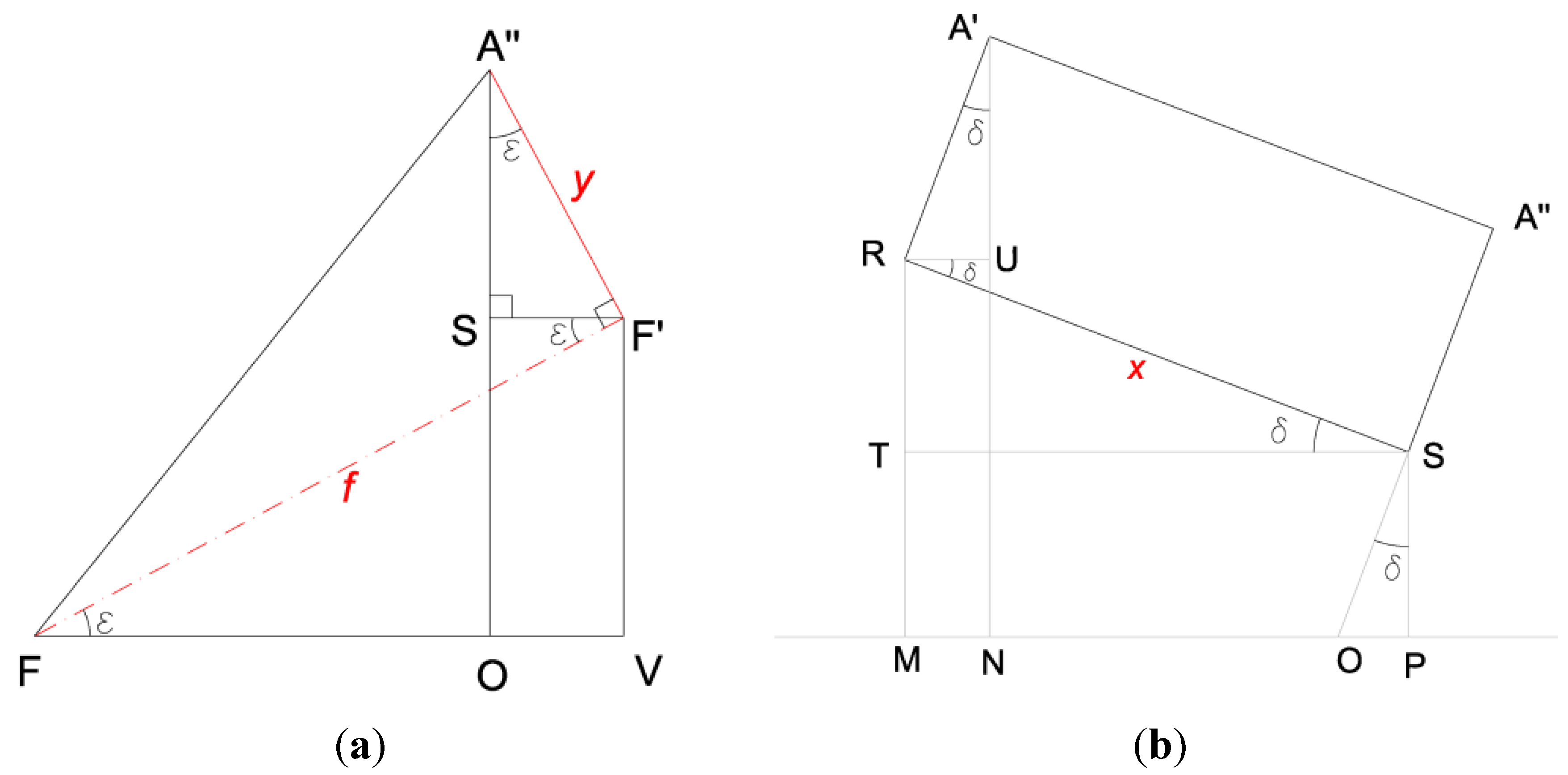
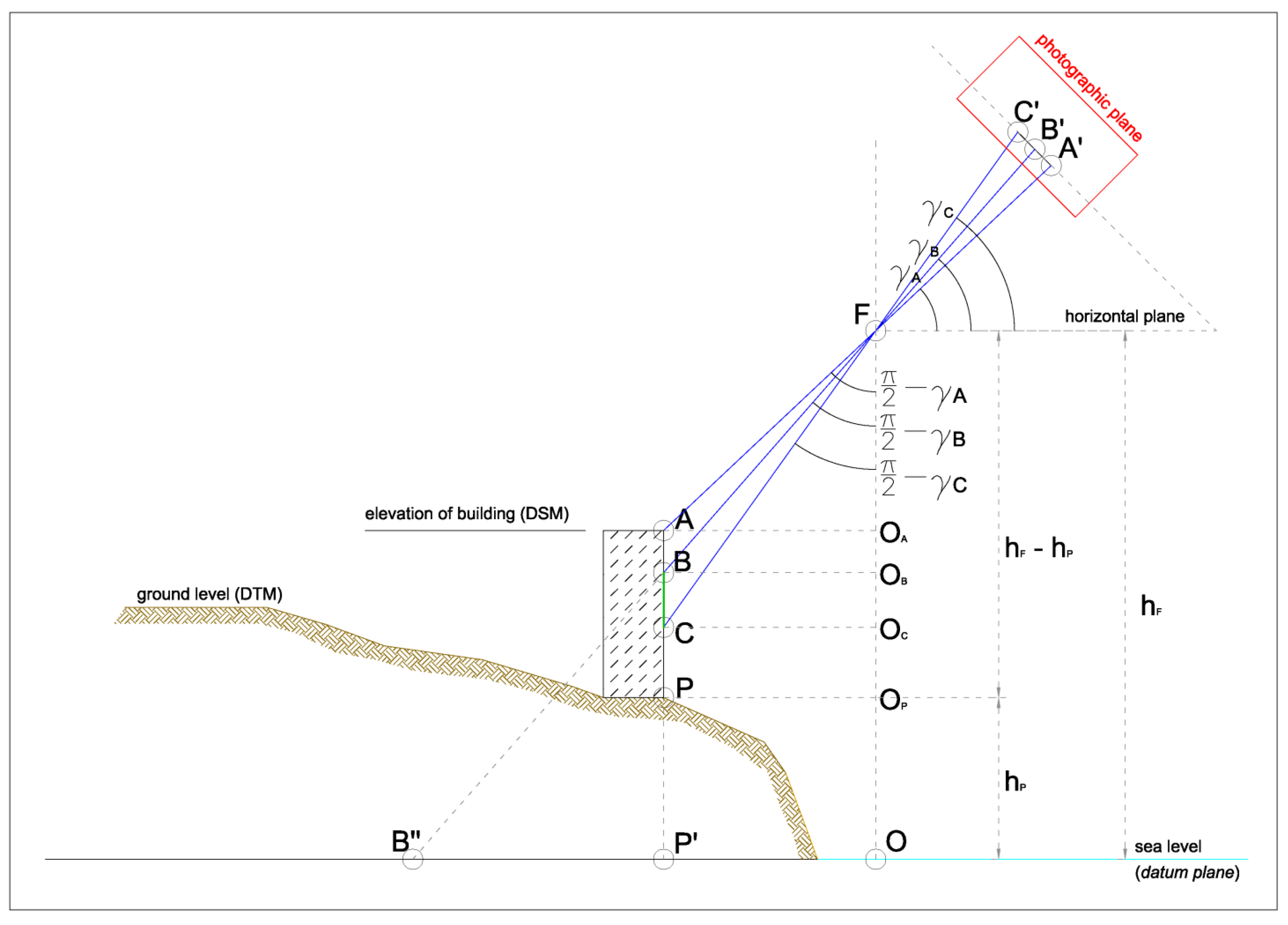
2.2. Calculating Vertical Distances
- -
- FQ the projection of the focal axis f on the horizontal plane;
- -
- Declination angle δ =
![Ijgi 03 00914 i001]() (that is, the angle formed by RS and ST; we will follow this convention from now on), positive, as shown in Figure 3, and known from the camera parameters. This angle being other than zero means that the airplane was not flying on a perfectly horizontal plane when the shot was taken;
(that is, the angle formed by RS and ST; we will follow this convention from now on), positive, as shown in Figure 3, and known from the camera parameters. This angle being other than zero means that the airplane was not flying on a perfectly horizontal plane when the shot was taken; - -
- φ the roll angle, i.e., the angle between the focal axis and the vertical direction (known);
- -
- α the bearing angle, i.e., the azimuth angle between the camera longitudinal axis and west (known);
- -
- S the intersection between the vertical plane containing A' and A'' and the horizontal line passing through F' and parallel to the direction of flight;
- -
- O the intersection between the horizontal plane containing F and the line through A'' and S;
- -
- R the fourth corner of the rectangle A'A''SR;
- -
- T the intersection between the vertical axis through R and the horizontal plane through S;
- -
- M, N, P and Q the intersection of the horizontal plane with the vertical axes through R, A', S and F', respectively.

 and the azimuth ϑ =
  .
.


 , from triangle FVQ, we have:


2.3. Calculating Ground Projections
- -
- NCOLS and NROWS represent the number of columns and rows in the matrix;
- -
- CELLSIZE is the grid cell size (1 m);
- -
- XLLCENTER, YLLCENTER are the geographical coordinates of the lower left number of the matrix (the number itself is the height of the point at those coordinates).


 , known from the previous calculations, with reference to Figure 7, that condition is satisfied if:

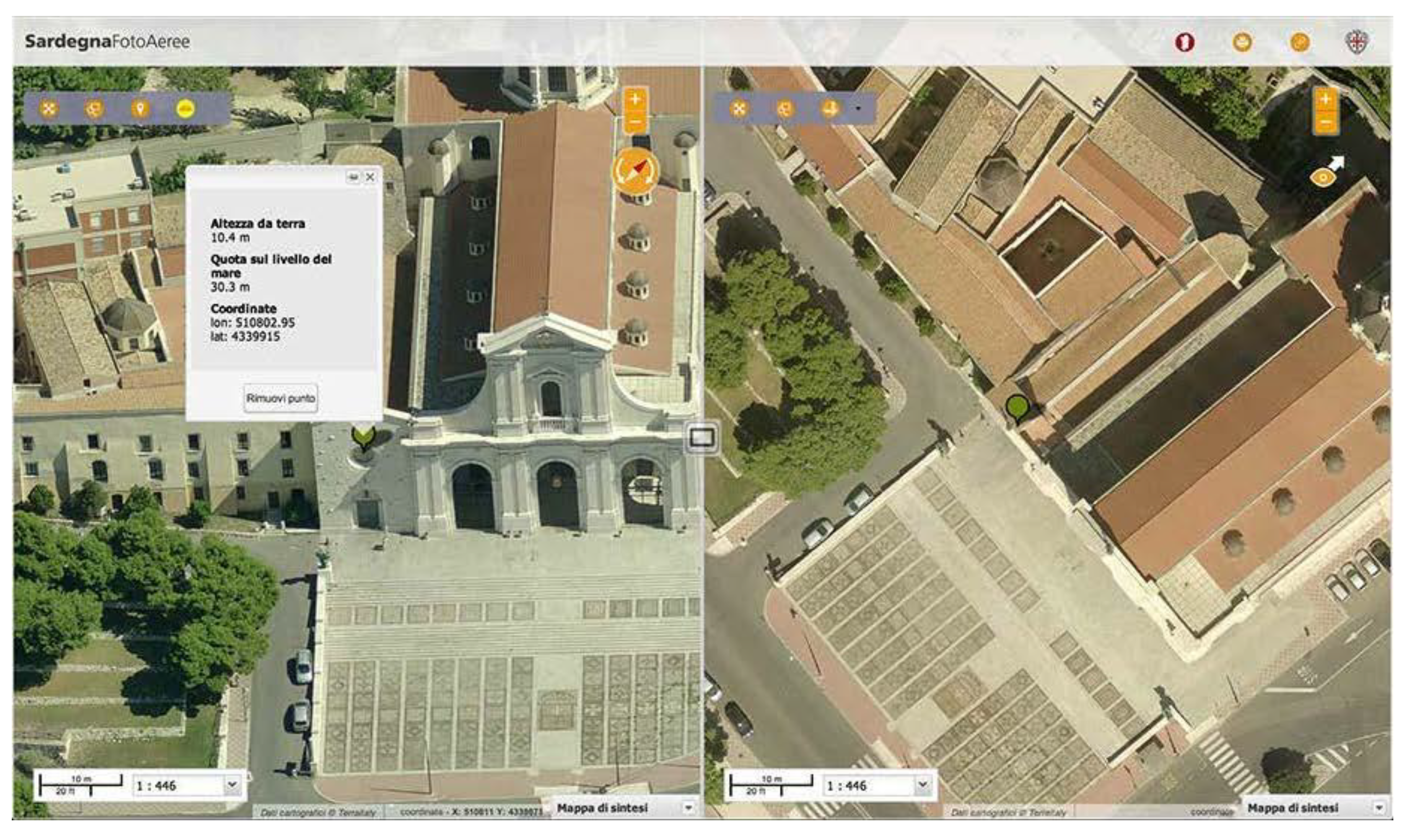
3. Results: Algorithm Implementation and Accuracy


4. Discussion
5. Conclusions
Author Contributions
Conflicts of Interest
References
- Grenzdörffer, G.J.; Guretzki, M.; Friedlander, I. Photogrammetric Image Acquisition and Image Analysis of Oblique Imagery—A New Challenge for the Digital Airborne System PFIFF. In Proceedings of 2007 ISPRS Hannover Workshop: High-Resolution Earth Imaging for Geospatial Information, Hannover, Germany, 29 May–1 June 2007.
- Przemyslaw, M.; Wonka, P.; Aliaga, D.G.; Wimmer, M.; Gool, L.; Purgathofer, W. A Survey of Urban Reconstruction. In Computer Graphics Forum; John Wiley & Sons Ltd.: New York, NY, USA, 2013; Volume 32, pp. 146–177. [Google Scholar]
- Pons, J.P.; Soubra, S. 3D Reconstruction of Large Scale City Models as a Support to Sustainable Development. In Cooperative Design, Visualization, and Engineering; Springer: Berlin/Heidelberg, Germany, 2008; pp. 172–175. [Google Scholar]
- Charalambos, P.; You, S. 3D Reconstruction of Urban Areas. In Processing of the 2011 International Conference on 3D Imaging, Modeling, Visualization and Transmission (3DIMPVT), Hangzhou, China, 16–19 May 2011; pp. 33–40.
- Guo, R.; Li, L.; Ying, S.; Luo, P.; He, B.; Jiang, R. Developing a 3D cadastre for the administration of urban land use: A case study of Shenzhen, China. Comput. Environ. Urban Syst. 2013, 40, 46–55. [Google Scholar] [CrossRef]
- AIMS. Available online: http://aims.jocogov.org/AIMSData/Oblique.aspx (accessed on 17 April 2014).
- Massachusetts Department of Transportation. Available online: https://www.massdot.state.ma.us/planning/Main/MapsDataandReports/Maps/InteractiveMaps/Pictometry.aspx (accessed on 16 April 2014).
- Idan Computers Ltd. Available online: http://www.idan.com (accessed on 17 April 2014).
- Google Maps. Available online: https://maps.google.it (accessed on 22 April 2014).
- Bing Maps. Available online: http://www.bing.com/maps (accessed on 22 April 2014).
- Fugro. Available online: http://www.fugrogeospatial.com/services/aerial-imagery/panoramix_oblique_imagery (accessed on 22 April 2014).
- Blom. Available online: http://www.pictometry.com (accessed on 3 December 2013).
- Garnero, G.; Cogoni, A. Activity at Low Altitude Photography in Urban Agglomerations of Sardinia and Its Architectural Context. In Planning Support Tools: Policy Analysis, Implementation and Evaluation, Proceedings of the 2012 International Conference on Informatics and Urban and Regional Planning, Cagliari, Italy, 10–12 May 2012.
- Hohle, J. Photogrammetric measurements in oblique aerial images. Photogramm. Fernerkund. Geoinform. 2008, 1, 7–14. [Google Scholar]
- Cannarozzo, R.; Cucchiarini, L.; Meschieri, W. La presa dei fotogrammi. In Misure, Rilievo, Progetto, 4th ed.; Zanichelli Editore: Bologna, Italy, 2012; Volume 3, pp. 34–66. [Google Scholar]
© 2014 by the authors; licensee MDPI, Basel, Switzerland. This article is an open access article distributed under the terms and conditions of the Creative Commons Attribution license (http://creativecommons.org/licenses/by/3.0/).
Share and Cite
Molinari, M.; Medda, S.; Villani, S. Vertical Measurements in Oblique Aerial Imagery. ISPRS Int. J. Geo-Inf. 2014, 3, 914-928. https://doi.org/10.3390/ijgi3030914
Molinari M, Medda S, Villani S. Vertical Measurements in Oblique Aerial Imagery. ISPRS International Journal of Geo-Information. 2014; 3(3):914-928. https://doi.org/10.3390/ijgi3030914
Chicago/Turabian StyleMolinari, Massimiliano, Stefano Medda, and Samir Villani. 2014. "Vertical Measurements in Oblique Aerial Imagery" ISPRS International Journal of Geo-Information 3, no. 3: 914-928. https://doi.org/10.3390/ijgi3030914