1. Introduction
The information in satellite images plays an important role in environmental monitoring, disaster forecasting, geological surveying, and other applications. With the steadily expanding demand for remotely sensed images, many satellites have been launched, and thousands of images are acquired every day. Increasingly, many researchers and organizations use satellite images to study the surface evolution process of a Region of Interest (ROI), and the entrance of the remote sensing application is satellite image retrieval.
Conventional satellite image retrieval in remote sensing applications is performed using a compound search composed of spatial search and attribute search. The condition of the spatial search is a defined geographical area commonly referred to as the Region of Interest (ROI), and the condition of attribute search generally refers to the imaging time range, spatial resolution, imaging platform, etc. For example, we need some high-resolution satellite images as first-hand information for a land use survey of Wuhan in 2016; the ROI is Wuhan in the retrieval task, and the conditions of the attribute search are imaging in 2016 and a spatial resolution above 10 m per pixel. Some well-known satellite imagery portals use this form of retrieval [
1,
2,
3].
However, the image set searched by the composite retrieval method cannot be directly applied in most applications; a screening process is required to finish the retrieval task. The purpose of the screening is to select images that can be directly used for subsequent processing. The screening is performed according to the following guidelines: (a) The entire ROI should be effectively covered, i.e., there should be at least one image that covers the area, and the content of the corresponding part of the image should be the earth’s surface instead of cloud; and (b) The number of images in the collection should be as small as possible because fewer images correspond to lower processing costs.
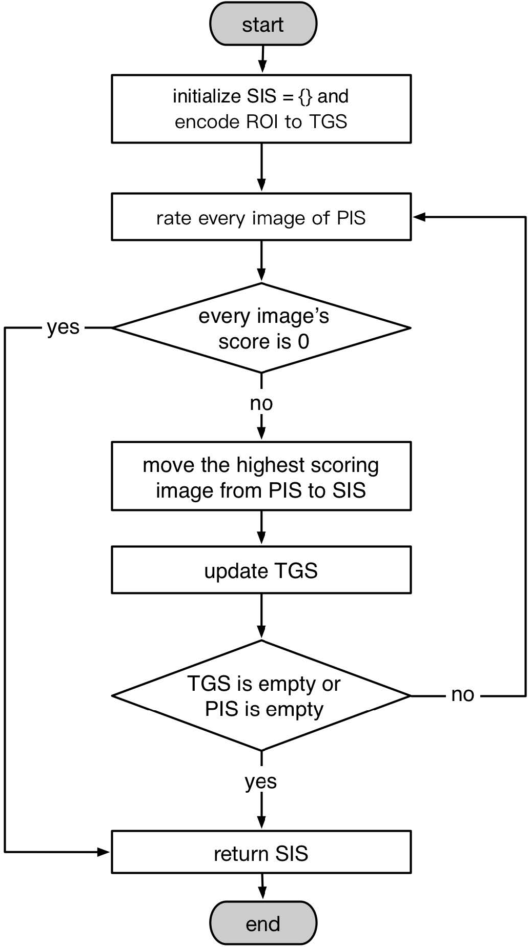
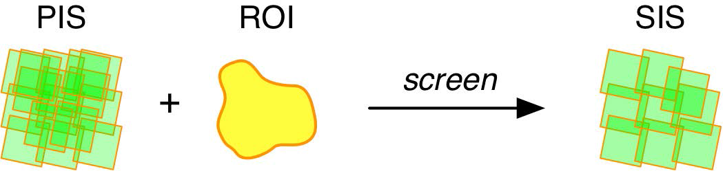
The screening process of the conventional satellite image retrieval is currently manually performed, which restricts the efficiency of applications using satellite images. We describe the image screening as a process of selecting a suitable satellite image set “B” from the image set “A” queried by the composite retrieval method. We call image set A the “Pre-selected Image Set” (PIS) and image set B the “Selected Image Set” (SIS). To make these concepts more intuitive, an example is shown below.
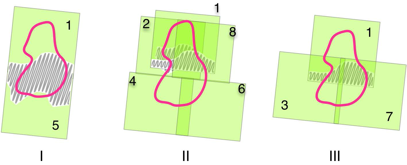
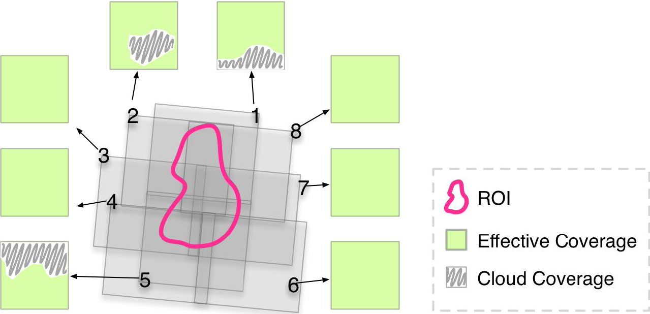
As shown in
Figure 1, there are eight satellite images that cover the ROI, which makes
, and each image in
has a different effective coverage.
Figure 2 shows three image sets screened out from PIS: image sets I, II, and III. There are two images in I, and the union of the two images can completely cover the ROI. However, a part of the ROI is covered by cloud; thus, image set I does not satisfy screening criteria (a). Both image sets II and III satisfy screening criteria (a); II has five images, and III has three. Thus, according to screening criteria (b), III is selected as the final SIS.
Although there has been no automatic solution for this problem, some studies are helpful in solving this problem, including cloud detection methods and the cloud distribution expression of remote-sensing images. Cloud detection technology supports the automatic extraction of effective coverage information of satellite images. The reasonable expression of the cloud distribution of satellite images is the prerequisite for realizing automatic screening.
Cloud detection is widely used in remote-sensing applications. In recent years, new cloud detection methods have continued to emerge. Hagolle O, Huc M et al. (2010) developed a multi-temporal cloud detection method for FORMOSAT-2 and LANDSAT images [
4]. Zhu Z and Woodcock C. E (2012) proposed an Fmask cloud detection method by combining with Landsat Top of Atmosphere (TOA) reflectance and Brightness Temperature (BT) [
5]. Laban N, Nasr A et al. (2012) developed the multi-scale cloud extraction of remote-sensing images using spatial and texture features [
6]. Surya S. R and Simon P (2013) used color space transform and Fuzzy C-means clustering to extract cloud in Landsat images [
7]. Goodwin N. R, Collett L. J et al. (2013) proposed a fast cloud detection algorithm for the Landsat images using the hierarchical processing and combining the spectral information of the multi-temporal images [
8]. Fisher A (2014) developed a cloud detection method specifically for SPOT5 HRG images [
9]. Han Y, Kim B et al. (2014) proposed a cloud detection algorithm based on a reference image for high-resolution remote-sensing images [
10]. Başeski E and Cenaras Ç (2015) use color and texture information to detect cloud in remote-sensing images [
11]. Zhu Z, Wang S et al. (2015) improved the Fmask algorithm for cloud detection of Landsats 4–8 images [
12]. An Z and Shi Z (2015) proposed a new automatic supervised approach based on the “scene-learning” scheme for cloud detection on remote-sensing images [
13]. Wu T, Hu X et al. (2016) introduced the stereoscopic vision frame to solve the automatic cloud detection problem using DSM and DEM data [
14].
In recent years, some studies have discussed the cloud distribution expression of remote-sensing images. Laban N, Nasr A et al. (2012) developed a spatial cloud detection and retrieval system (SCDRS) to retrieve the cloud distribution of remote-sensing images, and the cloud distribution information is expressed using tiling grids in their system [
6]. Feng A and Shu S (2014) proposed a model of index of cloud in images based on GeoSOT, which is cloud distribution information organized by a global discrete grid system and saved in a particular file [
15].
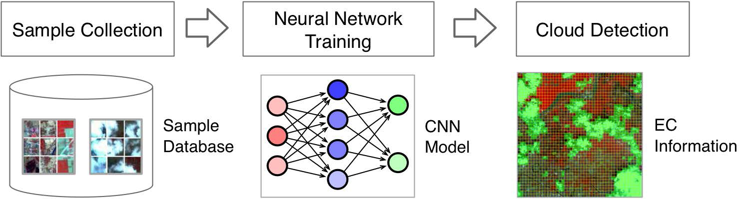
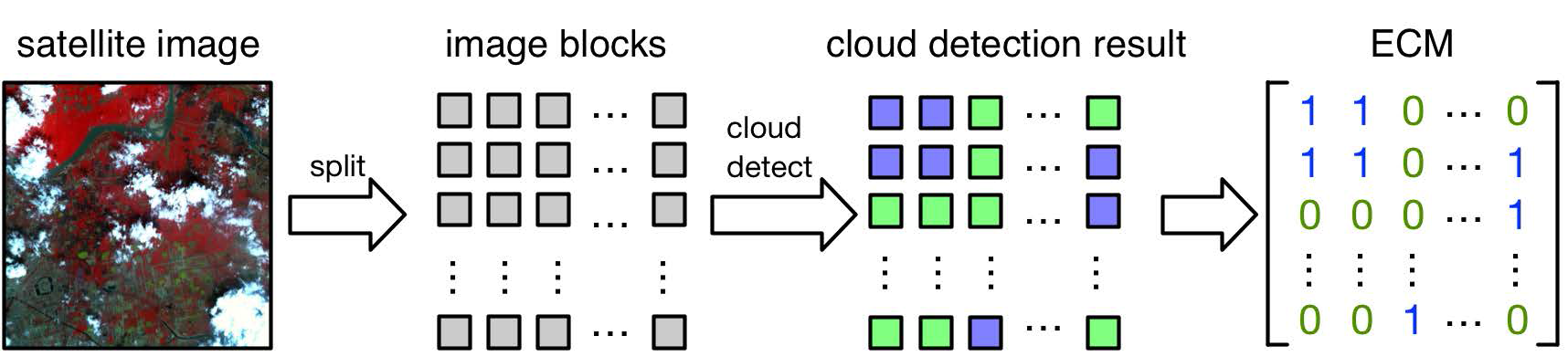
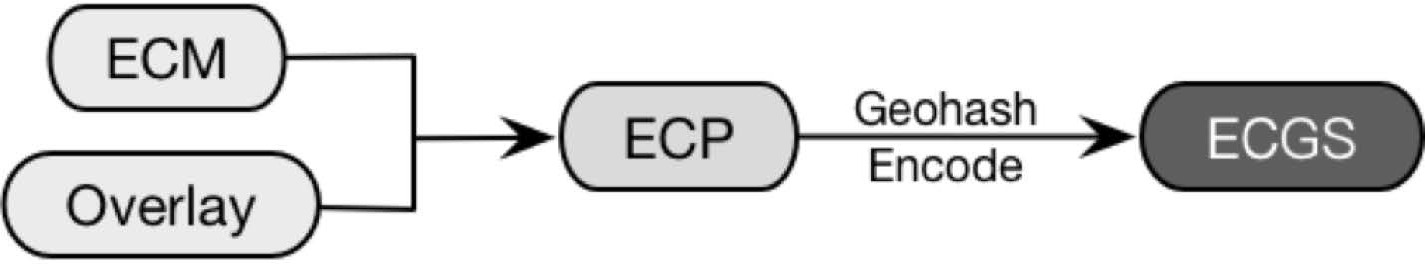
Obviously, the essential factor that affects the screening process is the effective coverage (EC) of the images in PIS. If the EC of satellite images can be extracted, organized, and rightfully used, the screening task can achieve automation. Based on this idea, an automatic accurate high-resolution satellite image retrieval (AA-HRSIR) method is presented in this study. The AA-HRSIR method consists of three parts: (1) automatic extraction of EC; (2) the effective coverage grid set (ECGS); and (3) the satellite image accurate retrieval algorithm.
The remainder of the article is organized as follows. In
Section 2, details of the AA-HRSIR method are provided. In
Section 3, experiments are presented to demonstrate the results of the AA-HRSIR method. In
Section 4, the effectiveness of the AA-HRSIR method is discussed. Finally, conclusions are presented in
Section 5.
4. Discussion
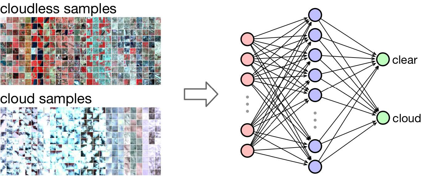
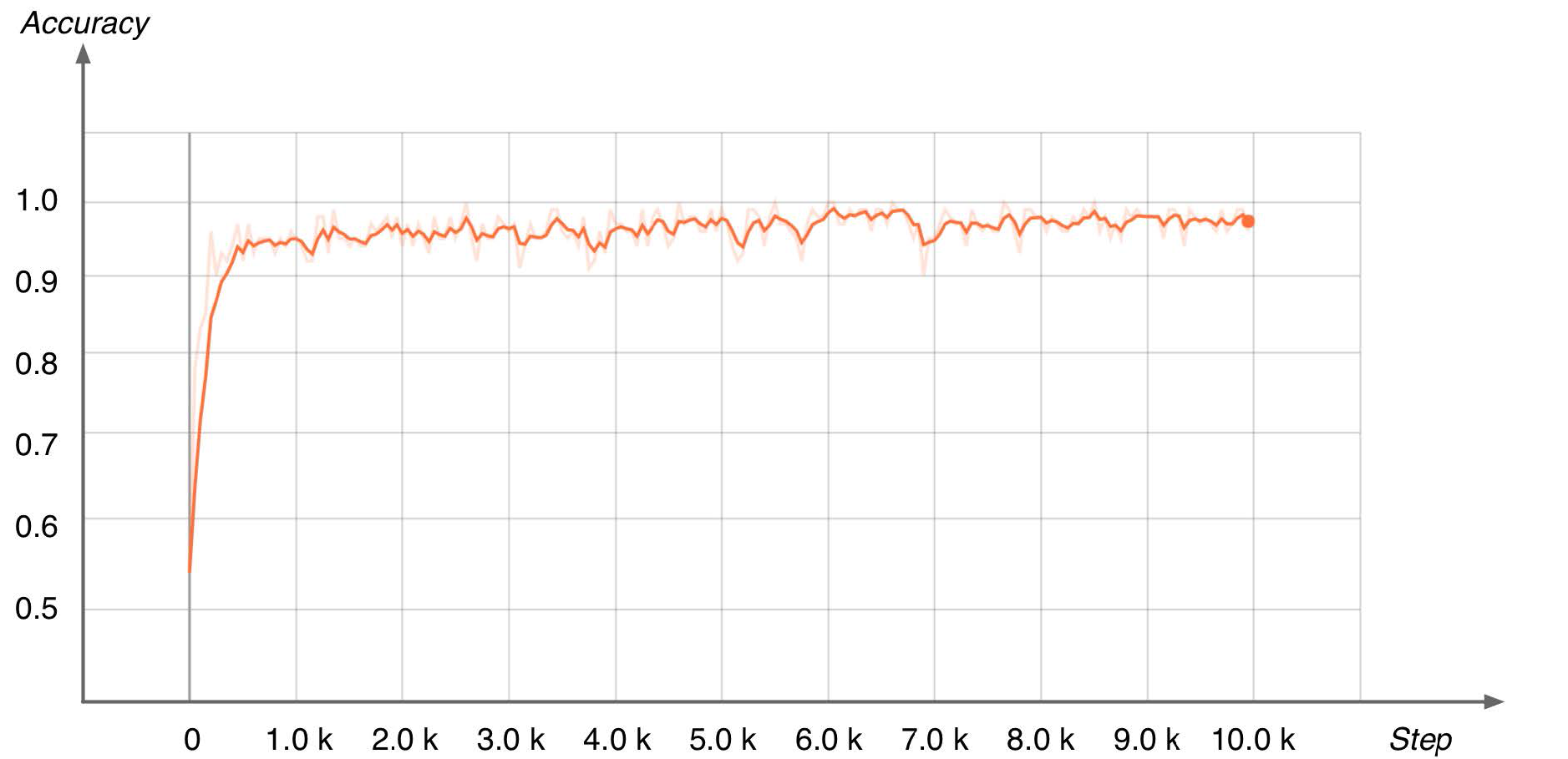
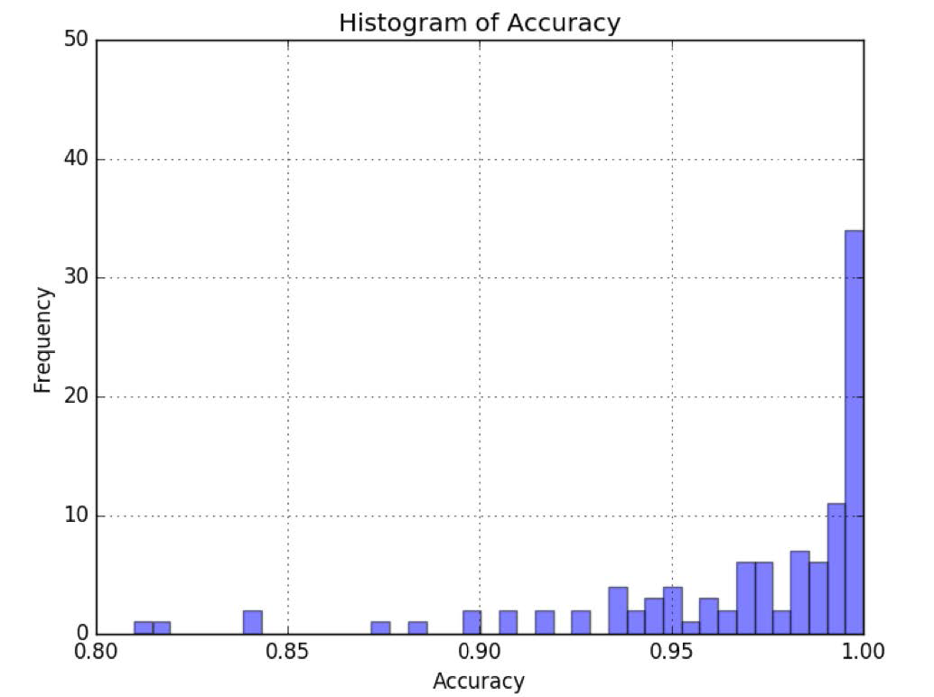
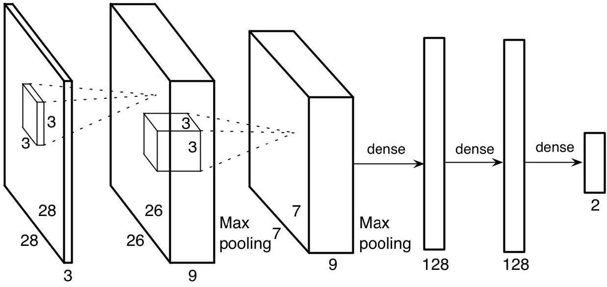
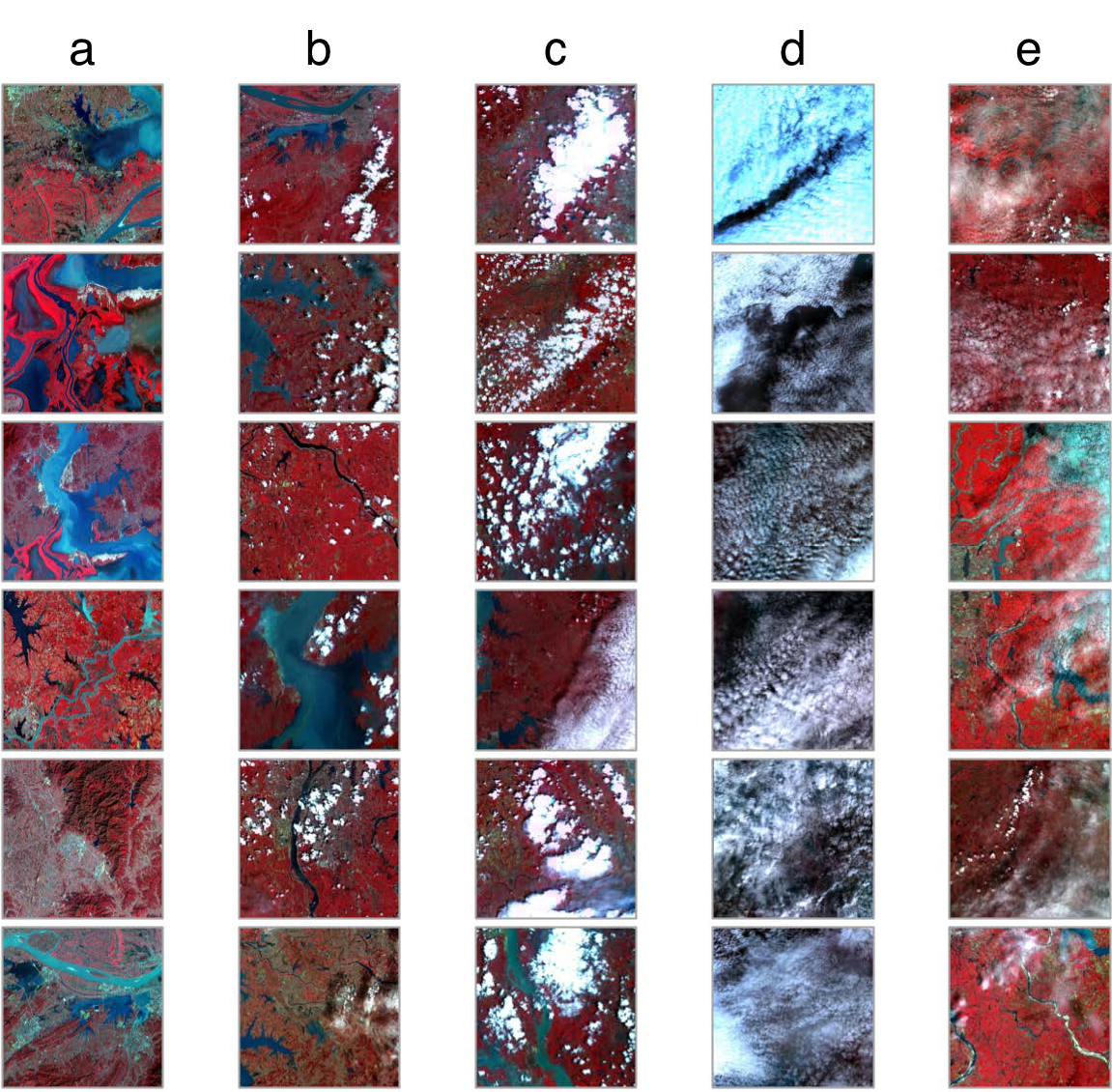
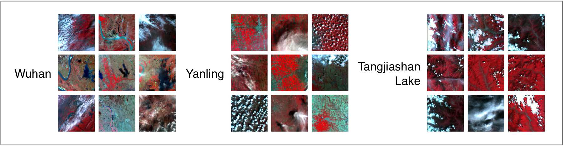
Extracting effective coverage from satellite images is a notably important first step to implement an accurate retrieval study and for application of remote sensor data. In this study, we use a convolutional neural network model to classify the image blocks that are divided from satellite images into “cloudy” and “cloud-free”. According to the results in
Section 3.1, the cloud detection accuracy could exceed 95%, and the algorithm performs well on all types of satellite images (most of the accuracy is more than 90%). Accordingly, the CNN cloud detection model here can satisfy the requirement of accurate retrieval.
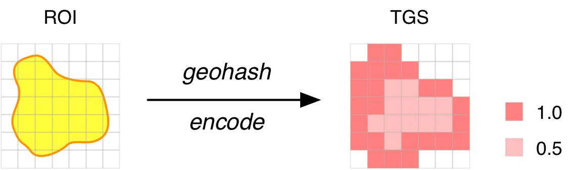
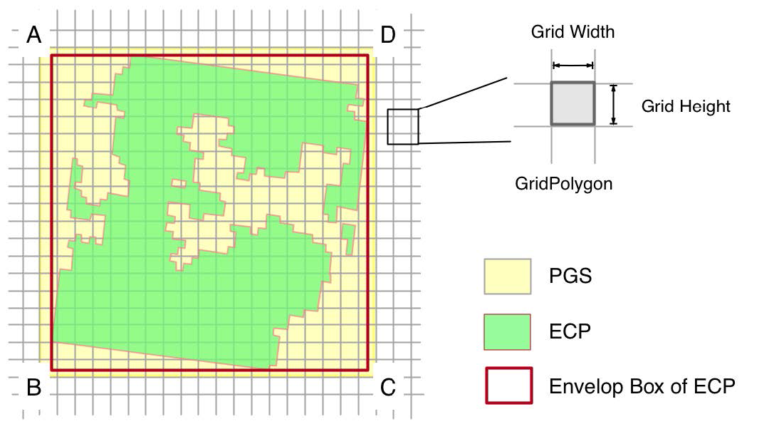
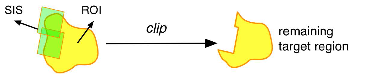
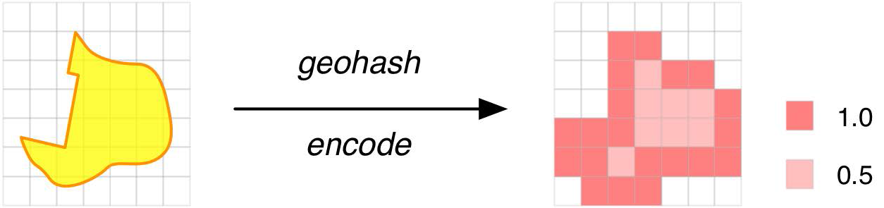
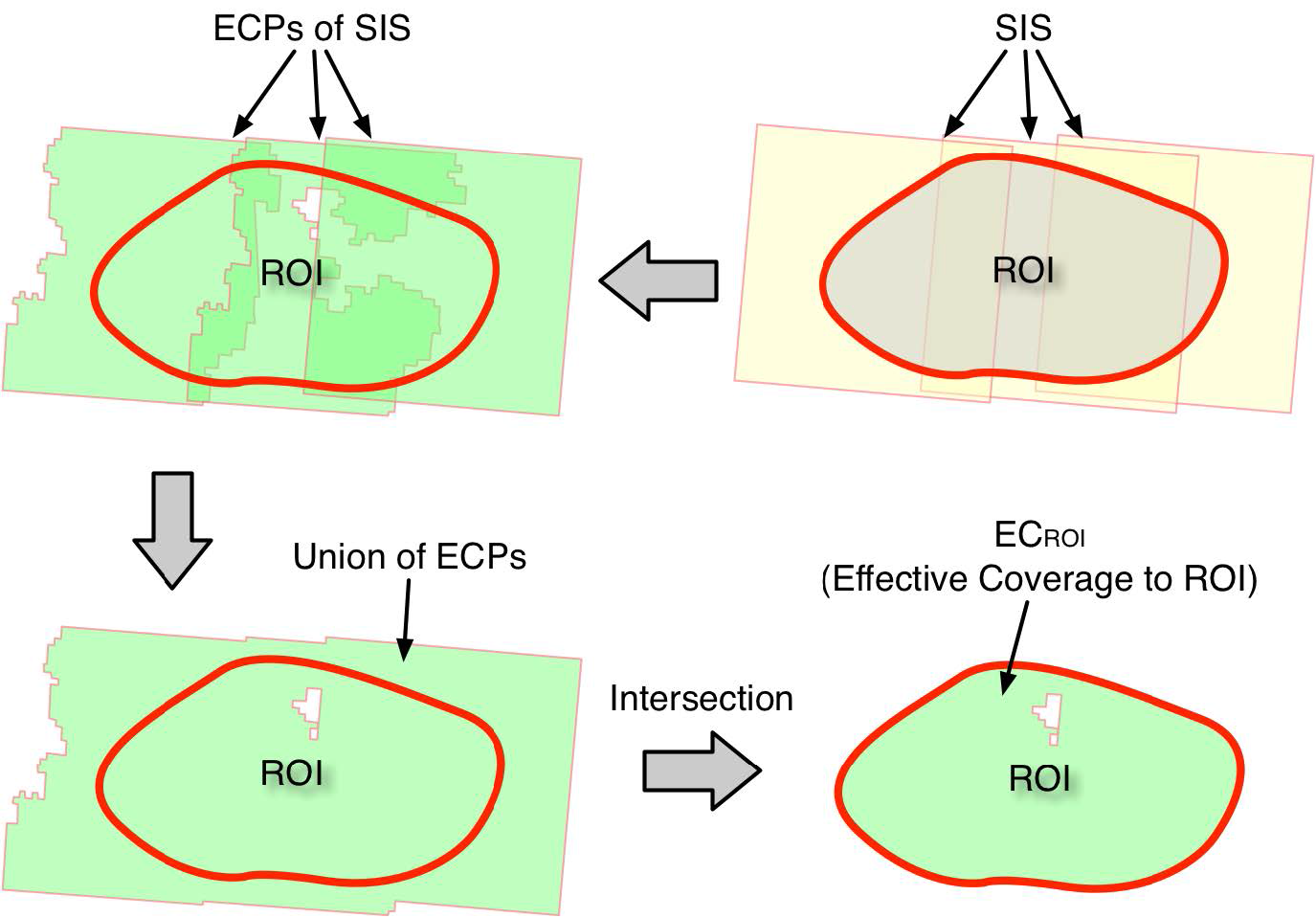
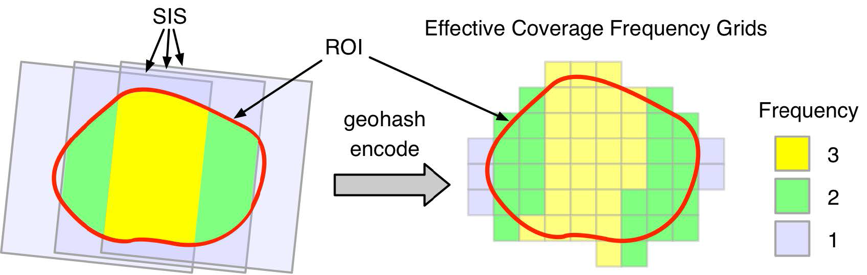
The management of the satellite image effective coverage information is critical to the accurate retrieval algorithm. ECGS is used in this study to organize the effective coverage information of satellite images. It has two main advantages: (1) The ECs of different satellite images are mapped into a unified coding system with geographical meaning, which makes the calculation between ECs of different satellite images convenient. (2) ECGS simplifies the representation of the effective coverage from a complex polygon to a linear set, which makes it easy to process in the accurate retrieval process.
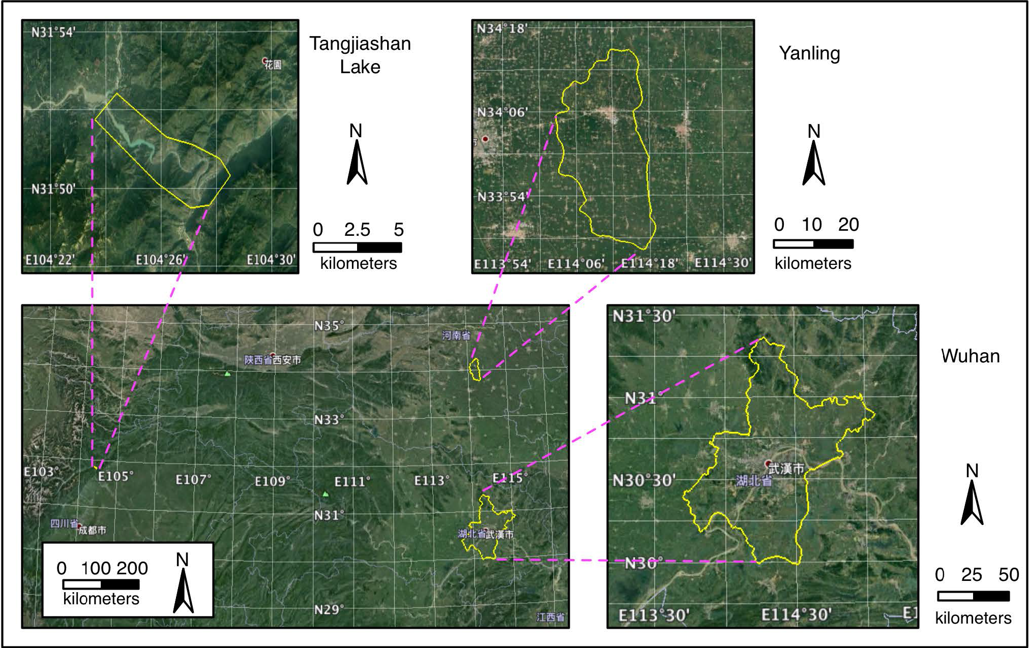
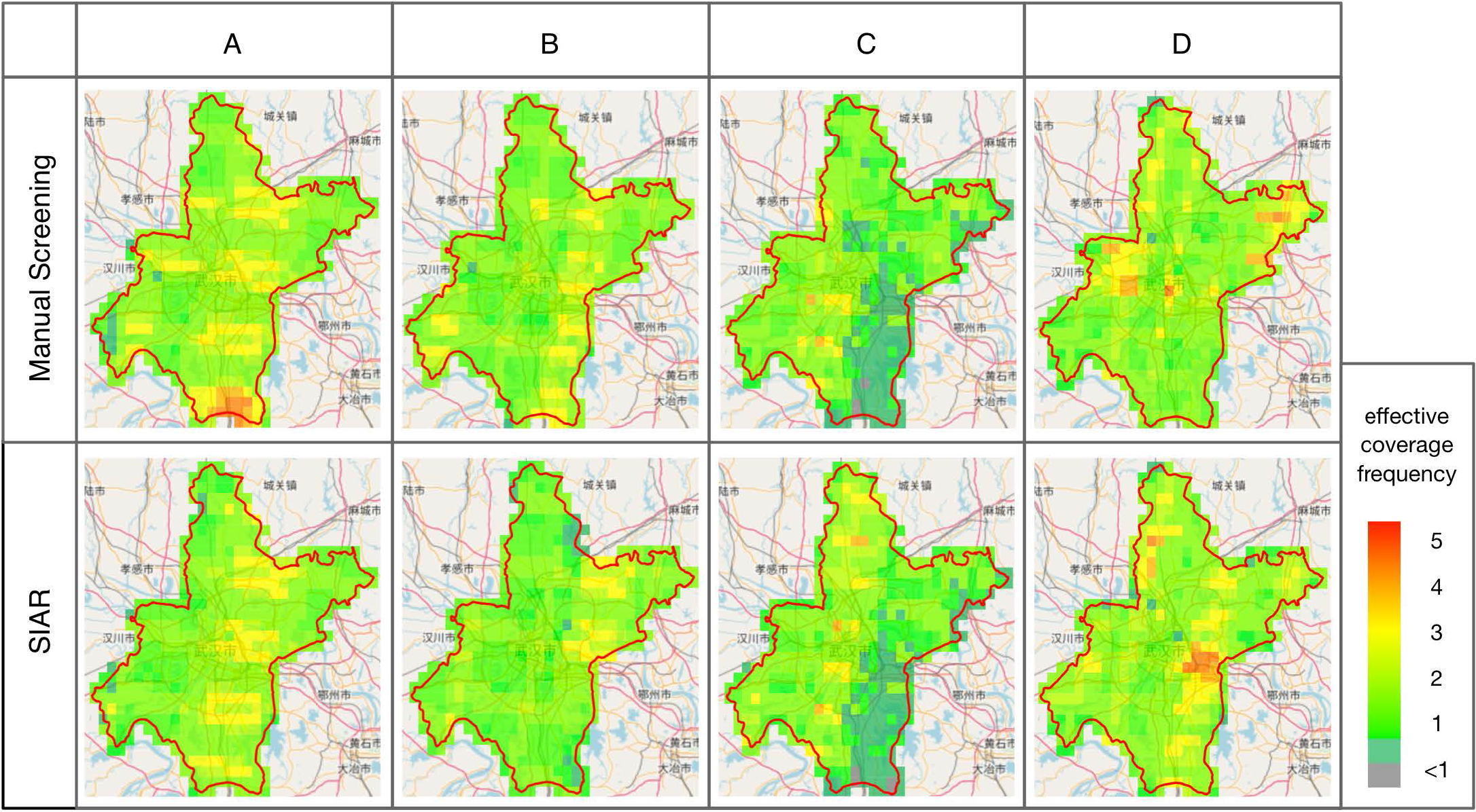
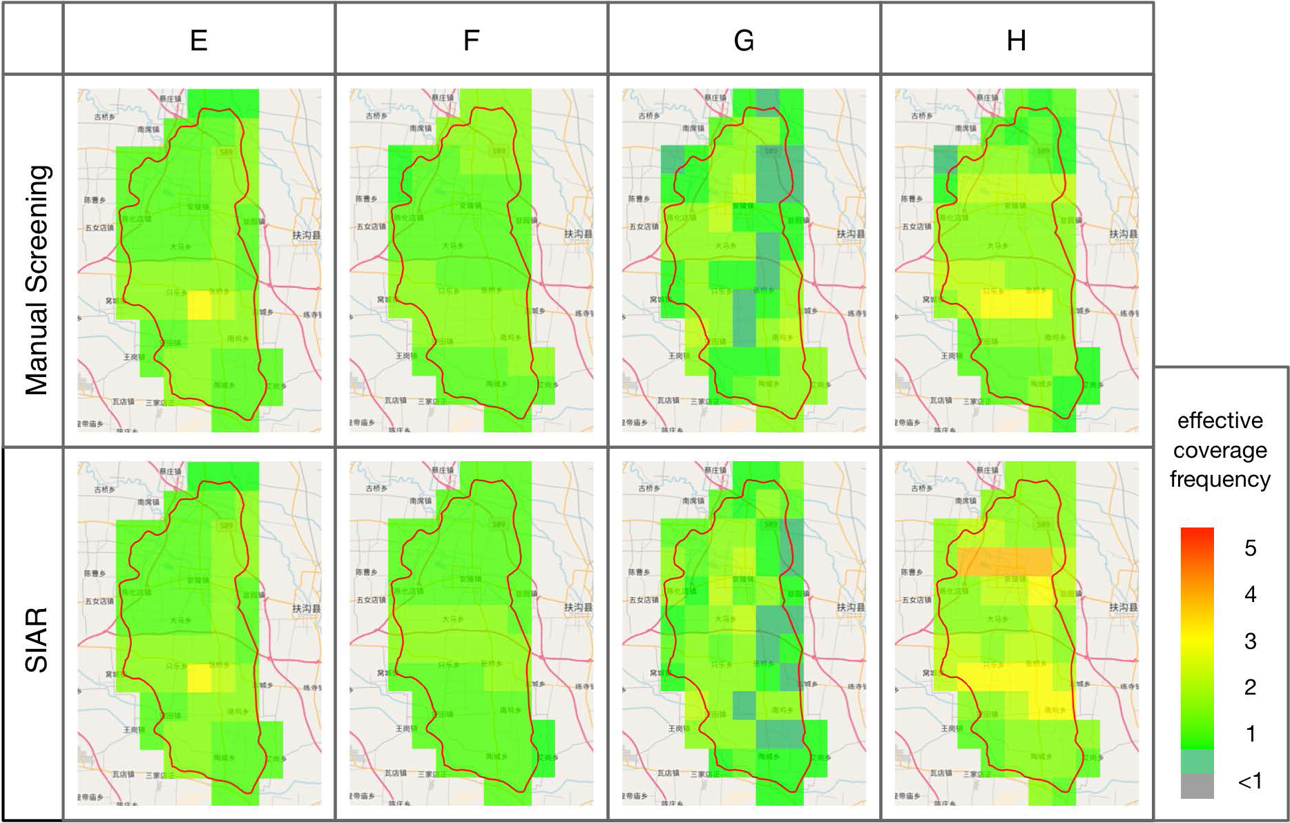
The SIAR algorithm is the core of the automatic accurate satellite image retrieval method. It combines the ECGS with the rules of manual-screening approaches to automatically screen satellite images. To evaluate the performance of the SIAR algorithm in screening image tasks, we use the manual-screening results as the standard to determine the SIAR results and introduce three indicators to quantify such judgement: effective coverage ratio (ECR), effective coverage frequency (ECF) and screening time consumption. Three experiments cover different types (small-area, medium-area, and large-area) of satellite image retrieval and are arranged to verify the applicability of the SIAR algorithm. The experiments show that: (1) The ECRs of the SIAR algorithm slightly vary (within less than 2.5%); (2) The s of the satellite images screened by the SIAR algorithm and the manual-screening results are greater than 1 and lower than 2; and (3) The SIAR algorithm is ten to hundreds of times more efficient than the manual screening in satellite image screening tasks. The first two findings have proven that the satellite images screened by the SIAR algorithm have similar quality to manually screened images. The third finding of screening time reduction demonstrates that the SIAR algorithm can increase the gains by replacing the manual-screening work.
The proposed method has some limitations: (1) The method of extracting effective coverage information only applies to optical satellite images; and (2) The accuracy of the SIAR algorithm highly depends on the accuracy of the effective coverage information; however, a small part of cloud detection accuracy (less than 90%) is not sufficiently high, so the effective information is not sufficiently accurate for the satellite image screening process.
5. Conclusions
To achieve the automation of satellite image retrieval, this paper proposes an automatic accurate high-resolution satellite image retrieval (AA-HRSIR) approach using the effective coverage grid set (ECGS). This paper designs a CNN model to detect cloud satellite images, which can achieve good cloud detection performance on diverse satellite images. To convert the cloud detection result into effective coverage information that can be directly used in automatic accurate satellite image retrieval, this paper advocates geohash encoding to record the effective coverage of each satellite image, i.e., ECGS. We use an auto-acquired ECGS to design the satellite image accurate retrieval (SIAR) algorithm and achieve the automation of satellite image retrieval. Many experiments show that the proposed AA-HRSIR can replace the manual screening of satellite images and significantly improve efficiency.
Retrieval is the entrance to satellite imagery applications, and the current retrieval work requires human intervention, which limits the efficiency of satellite imagery applications. The automation of retrieval is bound to improve the efficiency of satellite image retrieval and can promote continuous and periodic applications of satellite images. In future work, we will extend the proposed AA-HRSIR to more applications in the remote sensing community. For example, the proposed AA-HRSIR will be used to obtain an annual high-resolution satellite image album of one country or one region, automatically obtain historical satellite images of the affected areas after disasters, and automatically search satellite images of objects with large geographical spans (e.g., large rivers).


