Canscan — An Algorithm for Automatic Extraction of Canyons

Abstract
:1. Introduction
2. Materials
2.1. Study Area and Datasets
2.2. Implementation of the Algorithm
3. Methods
- -
- Identification of input parameters
- -
- Recognition of cross-sections of the canyon
- -
- Merging pixels in DEM representing these cross-sections into regions
- -
- Length assessment of the regions composed of recognized cross-sections.
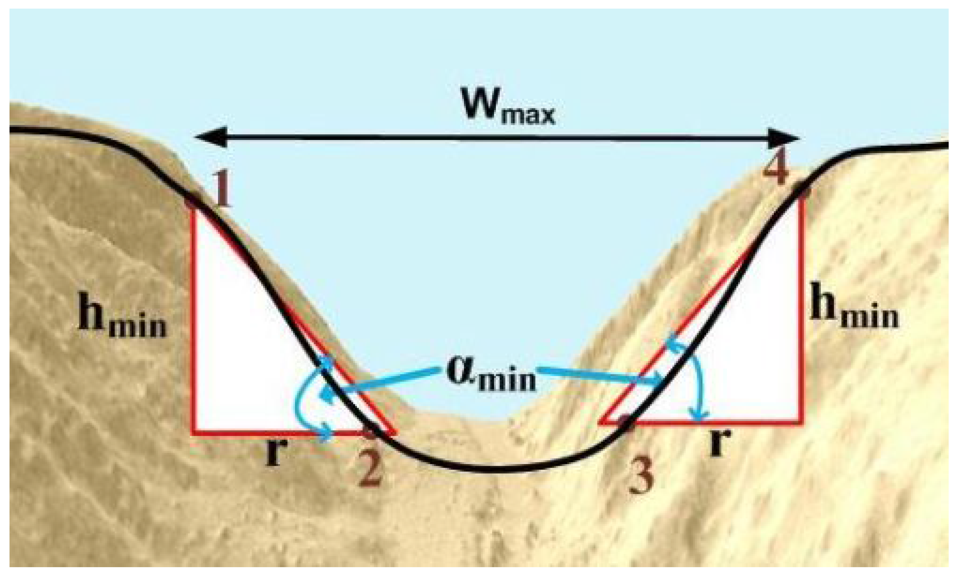
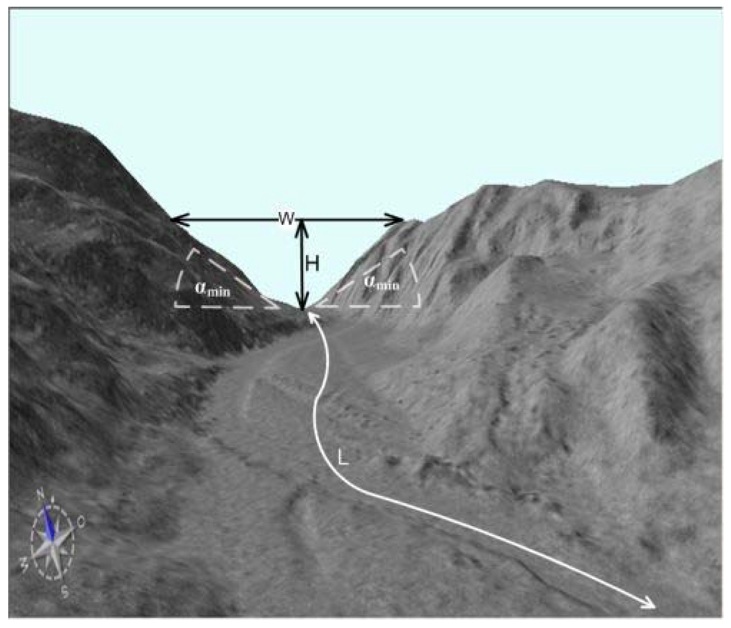
3.1. Identification of Input Parameters
- -
- minimal inclination of slopes αmin
- -
- maximal width (the horizontal length of the longest cross-section along the canyon) Wmax
- -
- minimal width (the horizontal length of the shortest cross-section along the canyon) Wmin
- -
- minimal depth ( the height of the shallowest cross-section along the canyon) Hmin
- -
- minimal length Lmin
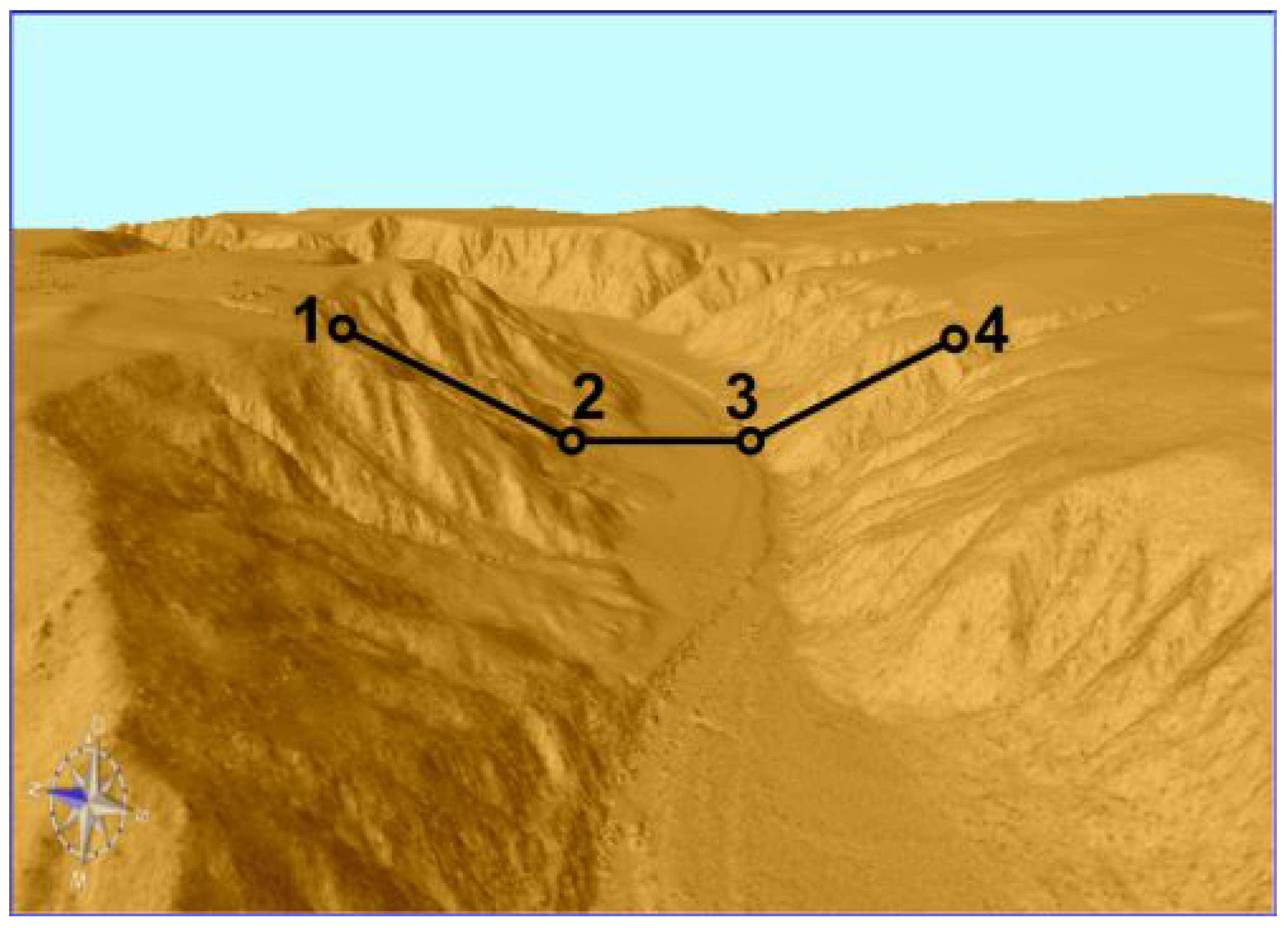
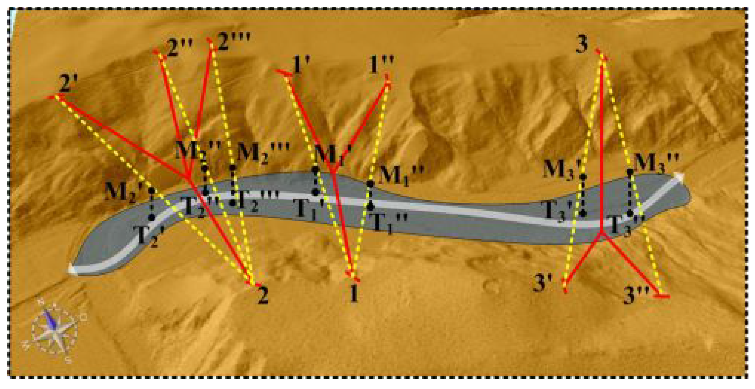
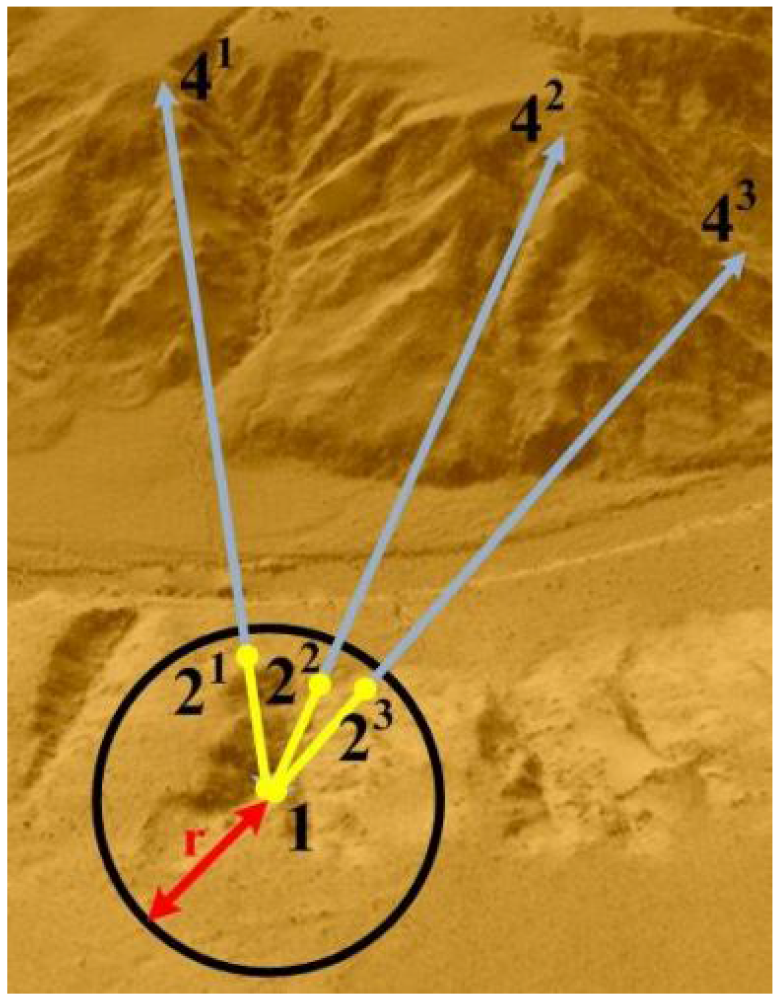
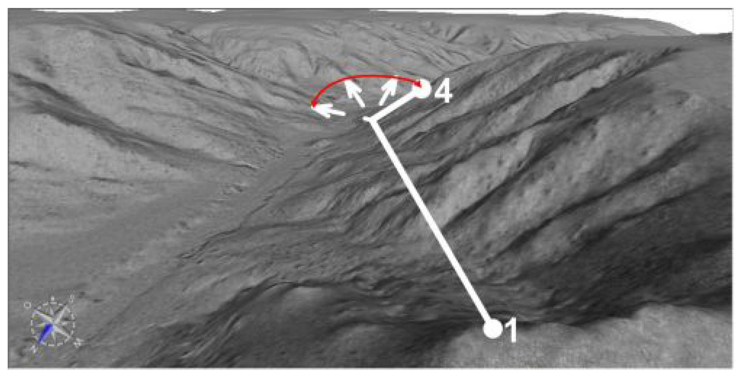
3.2. Recognition of the Cross-Sections


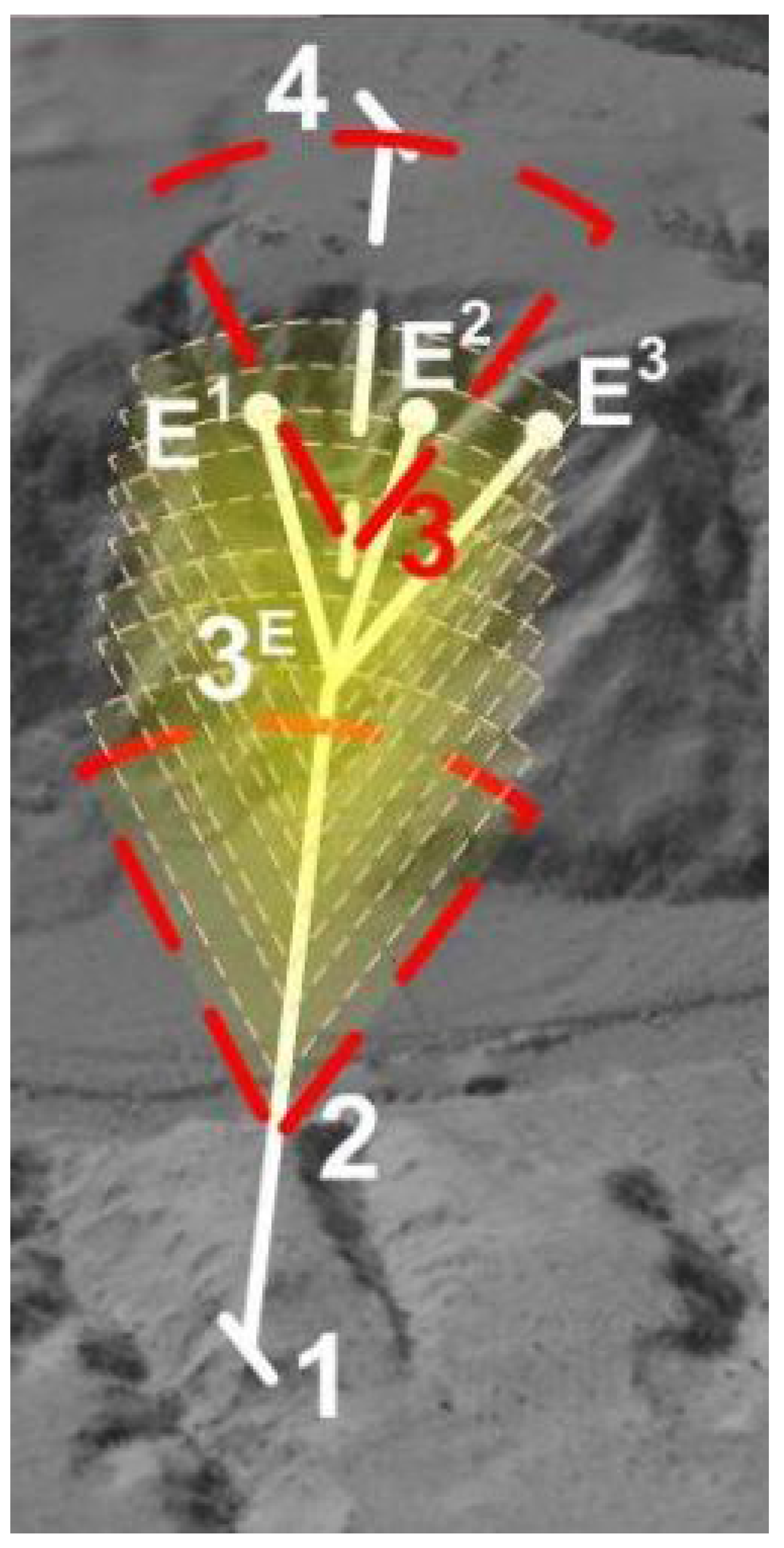
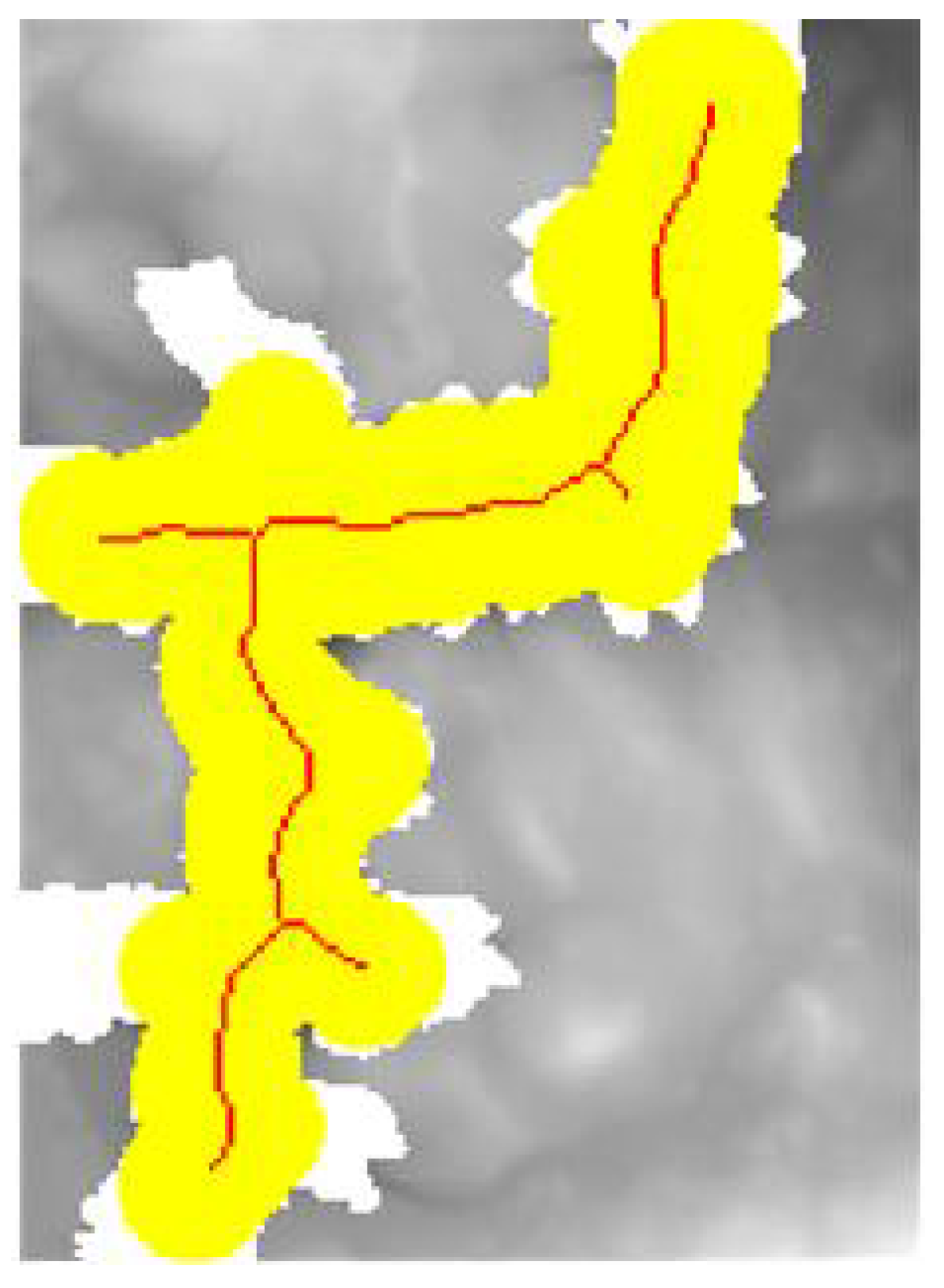
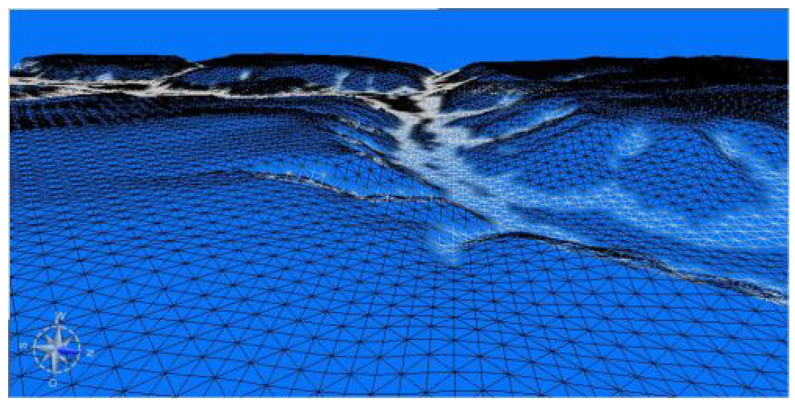
3.3. Merging of the DTM Pixels Representing Cross-Sections in to Regions
3.4. The Estimation of the Length of the Regions Composed of Identified Cross-Sections


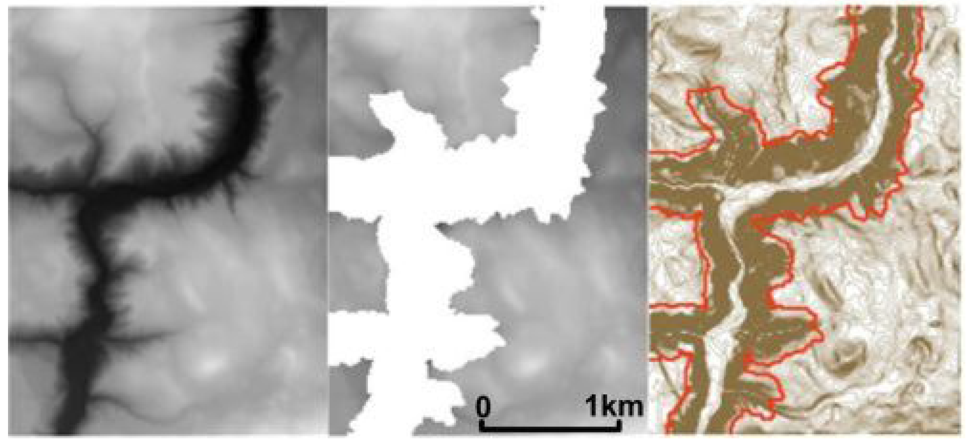
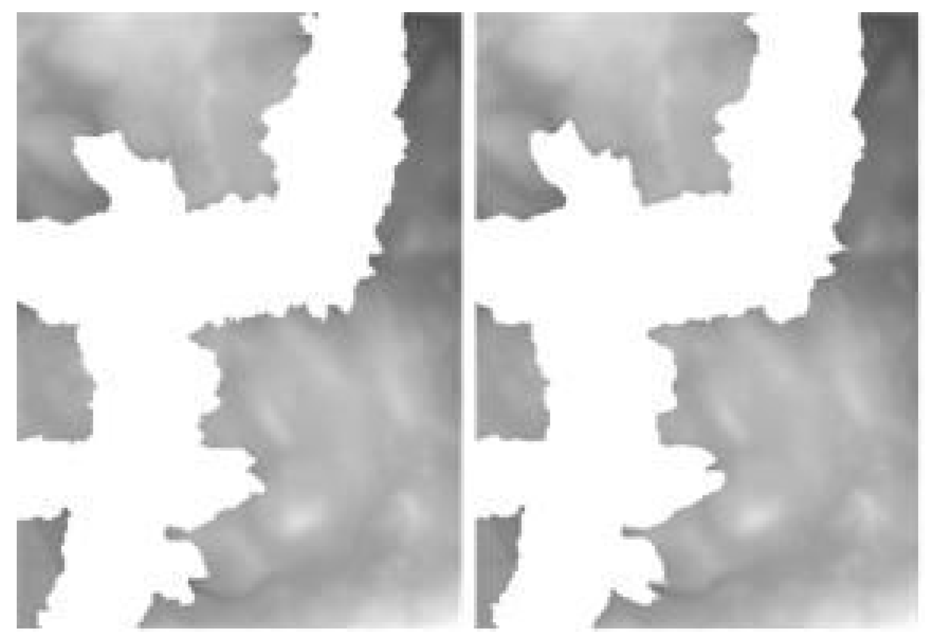
4. Results

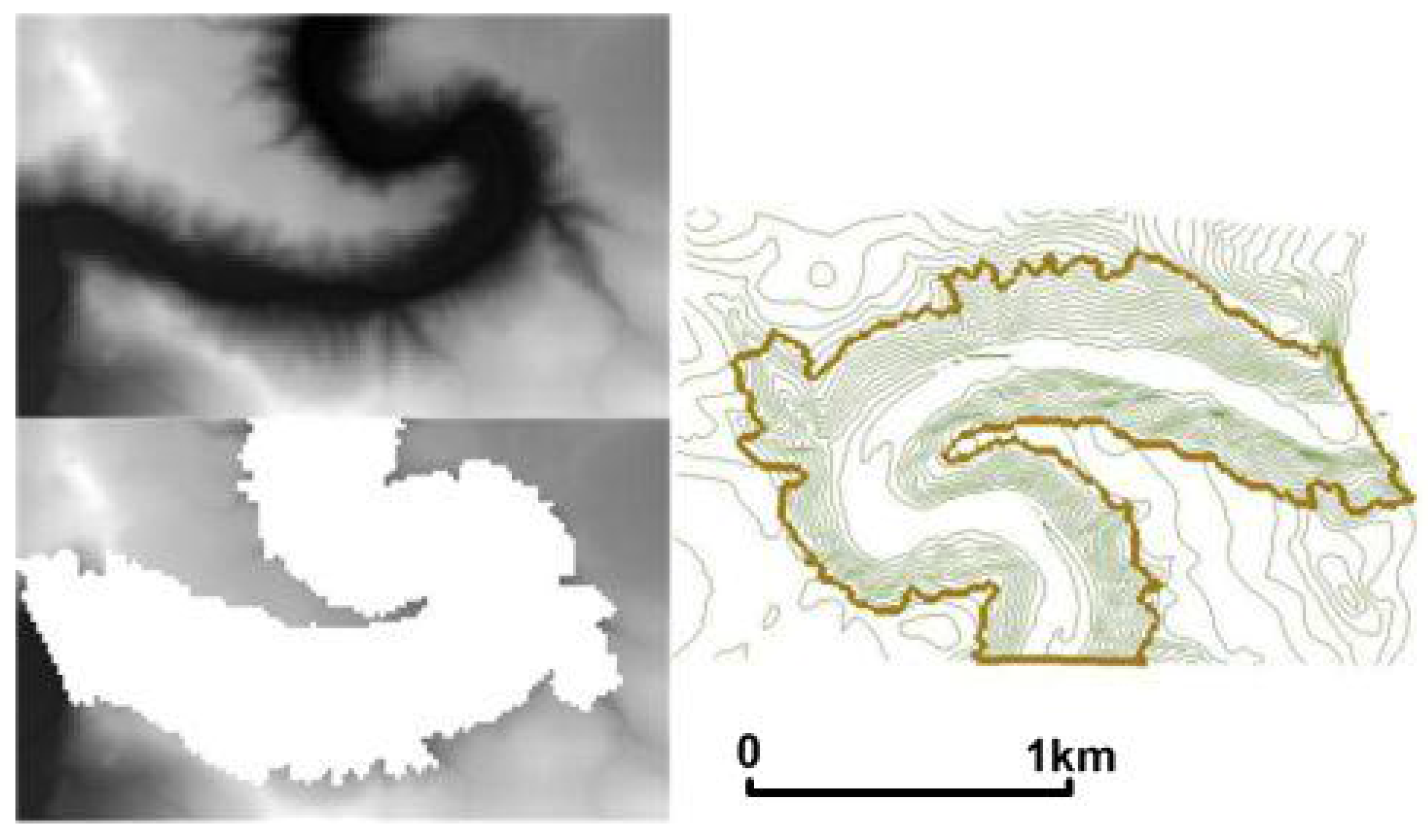
5. Discussion
6. Conclusions
Acknowledgements
References and Notes
- Strobl, J. Segmentation-Based Terrain Classification. In Advances in Digital Terrain Analysis; Zhou, Q., Lees, B., Tang, G, Eds.; Springer Verlag: Berlin, Germany, 2008; pp. 125–139. [Google Scholar]
- Schmidt, J.; Dickau, R. GIS and DEMs – Semantics, Methods, Future Needs. In GIS for Earth Surface Systems: Analysis and Modelling the Natural Environment; Dikau, R., Saurer, H., Eds.; Gebruder Borntraeger Verlagsbuchhandlung: Stuttgart, Germany, 1999; pp. 153–173. [Google Scholar]
- Dragut, L.; Blaschke, T. Automated classification of landform elements using object-based image analysis. Geomorphology 2006, 81, 330–344. [Google Scholar] [CrossRef]
- Babonneau, N.; Savoye, B.; Cremer, M.; Klein, B. Morphology and architecture of the present canyon and channel system of the Zaire deep-sea fan. Mar. Petrol. Geol. 2002, 19, 445–467. [Google Scholar] [CrossRef]
- Goff, J.A. Quantitative classification of canyon system on continental slopes and a possible relationship to slope curvature. Geophys. Res. Lett. 2001, 28, 4359–4362. [Google Scholar] [CrossRef]
- Weinacker, H.; Koch, B.; Weinacker, R. TREESVIS - A Software System for Simultaneous 3D-Real-Time Visualization of DTM, DSM, Laser Row Data, Multi-Spectral Data, Simple Tree and Building Models. In Proceedings of the ISPRS Working Group on Laser-Scanners for Forest and Landscape Assessment, Freiburg, Germany, October 2004; pp. 90–95.
- OGC: Web Processing Service – Open Geospatial Consortium – the official web site. Available Online: http://www.opengeospatial.org/standards/wps (accessed on 21 February 2009).
- Heipke, C.; Mayer, H.; Wiedemann, C.; Jamet, O. Evaluation of Automatic Road Extraction. Int. Arch. Photogramm. Remote Sens. 1997, 32, 47–56. [Google Scholar]
- Smith, B.; Mark, D.M. Do mountains exist? Towards and ontology of landforms. Environ. Plan. B - Plan. Design 2003, 30, 411–427. [Google Scholar] [CrossRef]
- Fried, J.S.; Brown, D.G.; Zweifler, M.O.; Gold, M.A. Mapping Contributing Area for Stormwater Discharge to Streams Using Terrain Analysis. In Terrain Analysis: Principles and Applications; Wilson, J.P., Gallant, J.C., Eds.; John Wiley & Sons: New York, NY, USA, 2000; pp. 183–204. [Google Scholar]
© 2009 by the authors; licensee Molecular Diversity Preservation International, Basel, Switzerland. This article is an open-access article distributed under the terms and conditions of the Creative Commons Attribution license (http://creativecommons.org/licenses/by/3.0/).
Share and Cite
Balic, N.; Koch, B. Canscan — An Algorithm for Automatic Extraction of Canyons. Remote Sens. 2009, 1, 197-209. https://doi.org/10.3390/rs1030197
Balic N, Koch B. Canscan — An Algorithm for Automatic Extraction of Canyons. Remote Sensing. 2009; 1(3):197-209. https://doi.org/10.3390/rs1030197
Chicago/Turabian StyleBalic, Nebojsa, and Barbara Koch. 2009. "Canscan — An Algorithm for Automatic Extraction of Canyons" Remote Sensing 1, no. 3: 197-209. https://doi.org/10.3390/rs1030197