Proceeding Paper

Sediment Yield and Soil Loss Estimation Using GIS Based Soil Erosion Model: A Case Study in the MAN Catchment, Madhya Pradesh, India †

1
National Institute of Hydrology, Roorkee 247 667, India
2
Department of Civil Engineering & Applied Mechanics, Shri Govindram Seksaria Institute of Technology and Science, Indore 452 003, India
3
Institute of Infrastructure and Environment, Heriot-Watt University, Edinburgh EH14 5BU, UK
*
Author to whom correspondence should be addressed.
Presented at the 4th International Electronic Conference on Atmospheric Sciences, 16–31 July 2021, Available online: https://ecas2021.sciforum.net/.
Environ. Sci. Proc. 2021, 8(1), 26; https://doi.org/10.3390/ecas2021-10348
Published: 22 June 2021
(This article belongs to the Proceedings of The 4th International Electronic Conference on Atmospheric Sciences)

Abstract

:
Soil erosion is one of the most critical environmental hazards of recent times. It broadly affects to agricultural land and reservoir sedimentation and its consequences are very harmful. In agricultural land, soil erosion affects the fertility of soil and its composition, crop production, soil quality and land quality, yield and crop quality, infiltration rate and water holding capacity, organic matter and plant nutrient and groundwater regimes. In reservoir sedimentation process the consequences of soil erosion process are reduction of the reservoir capacity, life of reservoir, water supply, power generation etc. Based on these two aspects, an attempt has been made to the present study utilizing Revised Universal Soil Loss Equation (RUSLE) has been used in integration with remote sensing and GIS techniques to assess the spatial pattern of annual rate of soil erosion, average annual soil erosion rate and erosion prone areas in the MAN catchment. The RUSLE considers several factors such as rainfall, soil erodibility, slope length and steepness, land use and land cover and erosion control practice for soil erosion prediction. In the present study, it is found that average annual soil erosion rate for the MAN catchment is 13.01-tons/ha/year, which is higher than that of adopted and recommended values for the project. It has been found that 53% area of the MAN catchment has negligible soil erosion rate (less than 2-tons/ha/year). Its spatial distribution found on flat land of upper MAN catchment. It has been detected that 26% area of MAN catchment has moderate to extremely severe soil erosion rate (greater than 10-tons/ha/year). Its spatial distribution has been found on undulated topography of the middle MAN catchment. It is proposed to treat this area by catchment area treatment activity.

1. Introduction

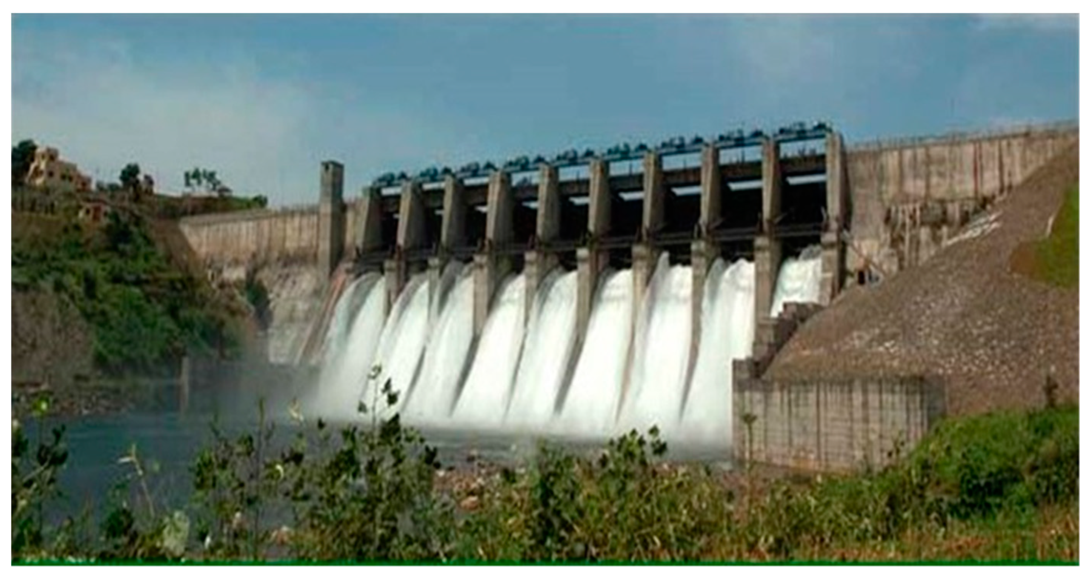
It is estimated that out of the total geographical area of 329 Mha of India, about 167 Mha is affected by serious water and wind erosion [1]. Soil erosion has been accepted as a serious problem arising from agricultural intensification, land degradation and possibly due to global climatic change. Sediment yield to river channels and reservoir is probably the most problematic off-site consequence of soil erosion. Not only the deposition of sediment transported by river into a reservoir reduces the reservoir capacity, but also sediment deposition on riverbed and banks causes widening of flood plains during floods.
Soil erosion is the removal of surface material by water and wind. Soil particles are detached both by raindrop impact and the shearing force of flowing water. Rate of detachment is non uniform in time and space owing to variation in raindrop, runoff, soil, slope, and cover conditions. While detachment by raindrops occurs over a broad area, detachment by flow is often concentrated in small definable channels. Gross erosion from catchment is the sum of all erosion from watershed.
All erosion from catchment does not reach to channel system because it is deposited at various phases and locations within catchment. Total Sediment outflow from a catchment at a reference section in a selected time interval is known as sediment yield. The sediment yield is always less than the gross erosion. The ratio of sediment yield to gross erosion is known as sediment delivery ratio. All the process carried out either by runoff and wind from the whole catchment is known as soil erosion. In the previous study Geographical Information System (GIS) and the Revised Universal Soil Loss Equation (RUSLE) applied to predict the annual average soil loss rate from the Eurajoki watershed (South-West Finland) [2]. He indicates that the average annual soil loss within the catchment is about 5 Mg/ha/yr (5 metric tons per year). This is highly dependent on R value which ranges between 299 and 307 MJ/ha.mm/h with the highest values being in the lower part of the catchment and the lowest value in the higher part of the catchment. Slopes in the catchment varied with steep slopes having higher values of slope length and mean LS factor is 1.34. In another previous research, the Soil and Water Assessment Tool (SWAT) model applied to predict surface runoff generation patterns and soil erosion hazard in the Sarrath river catchment (1491 km2), north of Tunisia [3]. According to his results only 10% of the watershed was vulnerable to soil erosion with an estimated sediment loss exceeding 10 tons/ha/yr. Another study has combined the capabilities of remote sensing, geographic information system (GIS) and agricultural non-point source (AgNPS) model to estimate peak runoff rate and sediment yield from the upper River Njoro catchment [4]. It observed that simulated peak runoff rates in Upstream (Treetop) station were satisfactory with an EFF of 0.78 and a percent error of 4.1%. The sediment yield was also reasonably estimated with an EFF of 0.88 and a 2% error. The downstream (Egerton) station results were also satisfactorily predicted with peak runoff rate having an EFF of 0.69 and a 5.5% error of estimates, while the estimated sediment yield had an EFF of 0.86 and 2.5% error. In previous research the Revised Universal Soil Loss Equation (RUSLE) model, Geographic Information Systems (GIS) and Remote sensing images were applied for assessment of soil erosion downstream of the Pahang river basin [5]. The estimated soil erosion at the catchment area ranged from 0 to 364 tons/acr/yr. Another study demonstrated the utility of high resolution LISS IV satellite data for accurate mapping of land use and land cover, which forms an important component, while computing the land cover and management factor and erosion control practice factor for soil loss estimation using RUSLE model [6]. He suggested that the maximum area contributing to soil erosion was from agricultural lands where the slope is less than 5° and having soil loss up to 10 tons/ha/yr; however, the maximum rate of soil erosion was observed near the upper catchment near the 6th order river channel and over the hilly region with annual average soil erosion between 26 and 30 tons/ha/yr.
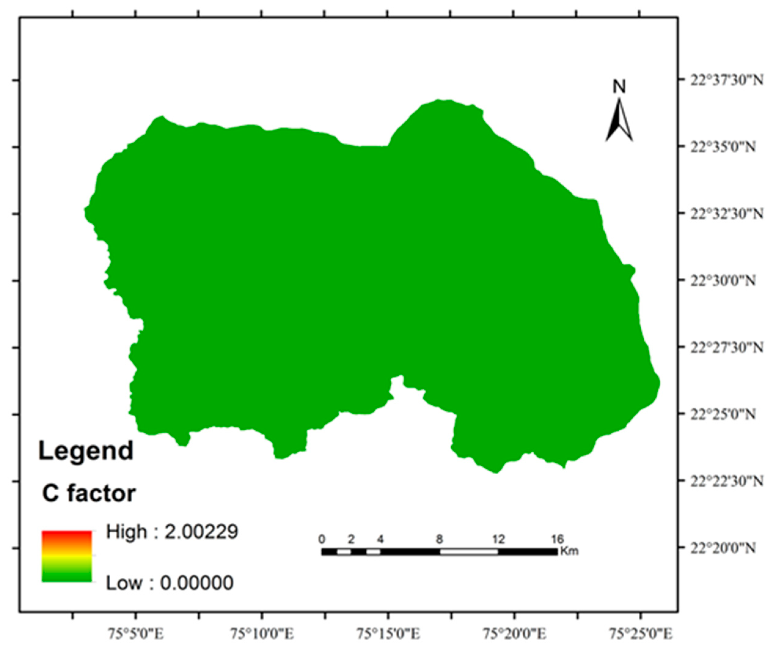
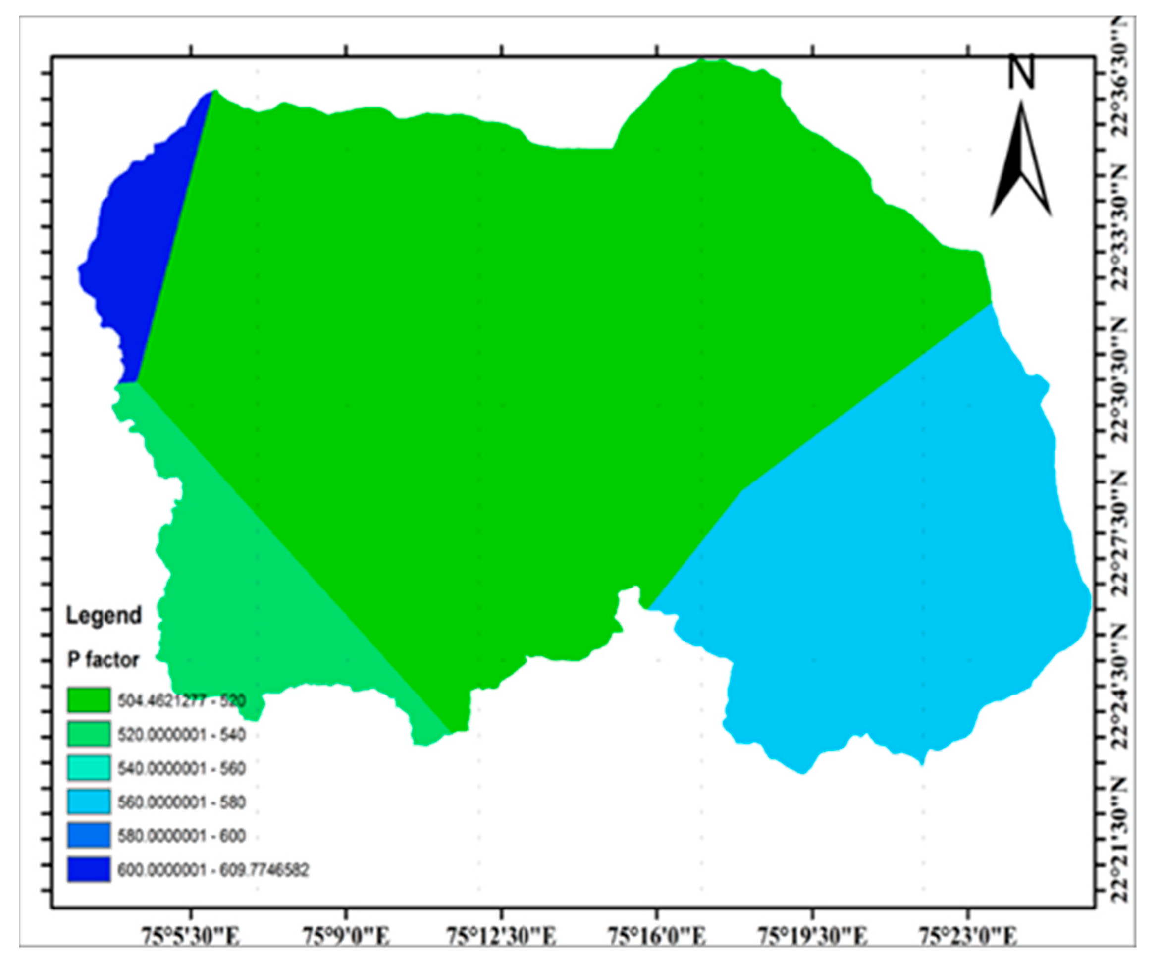
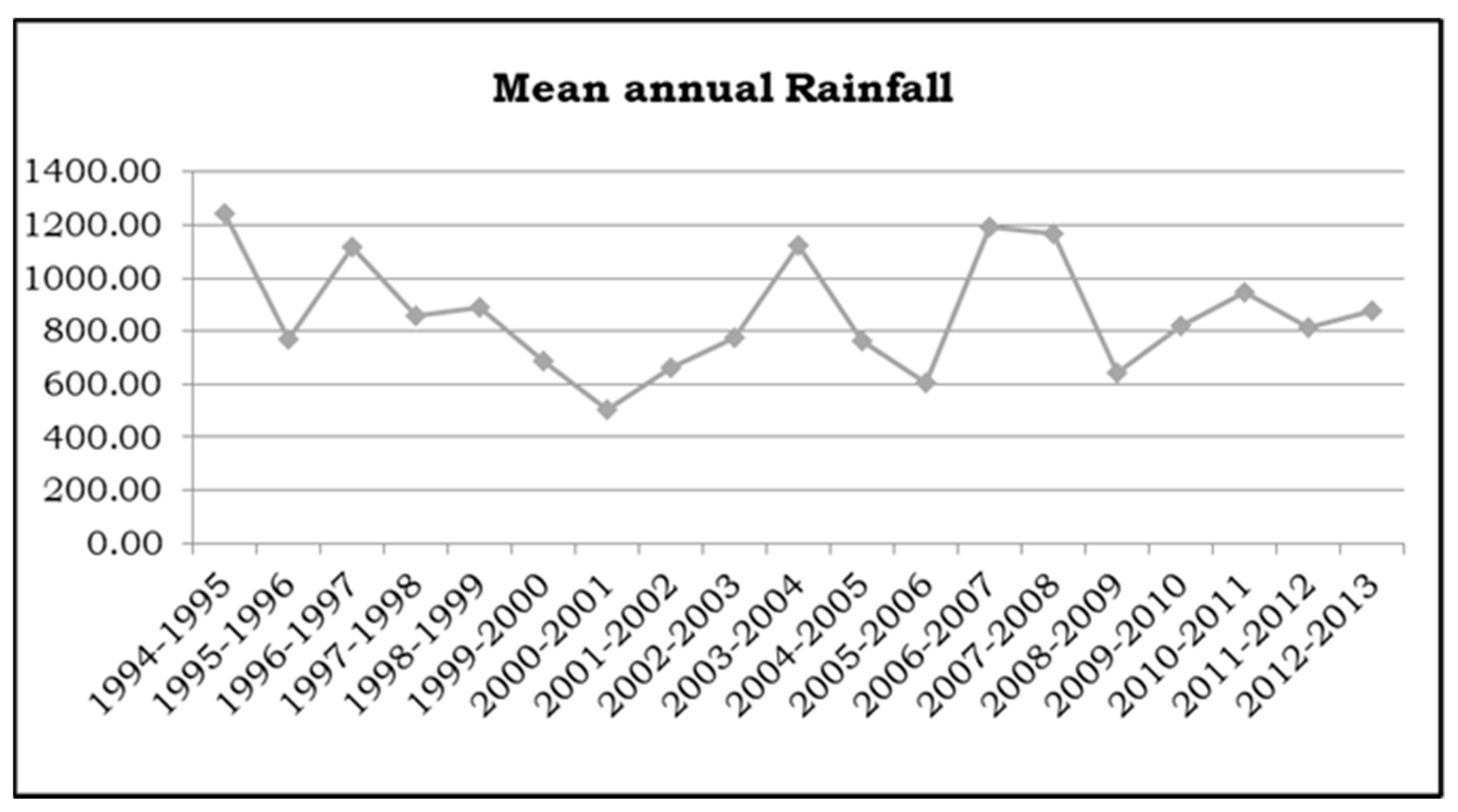
According to study of various researchers [7,8,9,10,11,12,13,
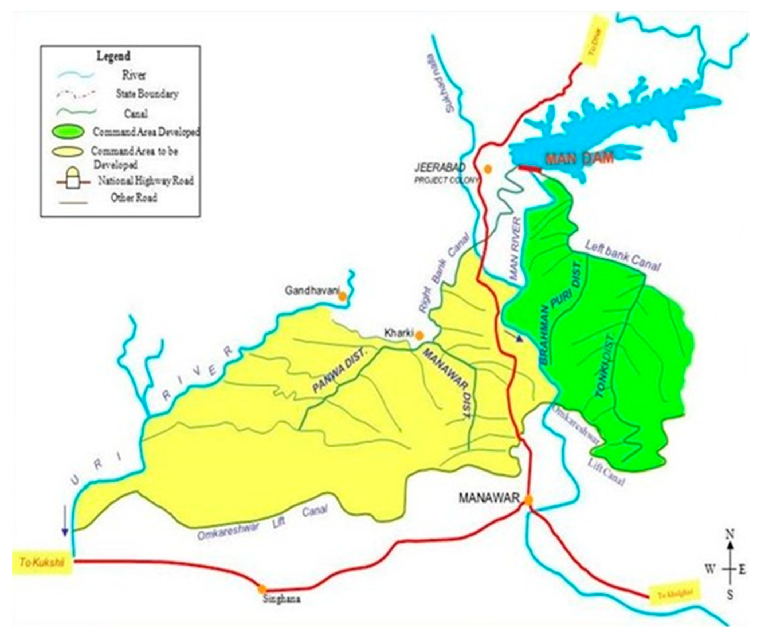
14] has been done on Geographical Information System (GIS) and Revised Universal Soil Loss Equation (RUSLE) techniques makes soil erosion estimation and its spatial distribution feasible with less parameter with better accuracy in larger areas than Physical based models. So Revised Universal Soil Loss Equation (RUSLE) integrated with Geographical Information System (GIS) and Remote Sensing has been attempted in this study to estimate detailed study of RUSLE, collection of the Topographical, Hydrological, Geological and Remote Sensing data for the study area. Evaluation of soil erosion rate, gross soil erosion and gross sediment yield from RUSLE. Identification of area of MAN Catchment which needs Treatment based on Average Annual Soil Erosion Rate.

2. Study Area and Data Used

The whole study is conducted in MAN project which is being constructed at village Jeerabad of Manawar tehsil of district Dhar, Madhya Pradesh, India. The project site is about 2 km from village Jeerabad located on Khalghat-Manawar-Amjhera district road and is about 22 km from Manawar [15]. The dam being built on the river MAN (shows in Figure 1), drained by the Narmada is one of the 30 major dams being built in the Narmada Valley—A part of the controversial Narmada Valley Development Project (NVDP) [16]. The total catchment area at MAN Project site is 713.76 km2. The geographical location of the MAN catchment is 22°24′20″ N latitude and 75°05′40″ E longitude which shows in Figure 2. The catchment area lies in the survey of India toposheet number 46N/2, 46N/3, 46N/6 and 46N/7 the detail feature and canal distributaries system of command area is shows in Table 1. The catchment area of MAN is almost circular which indicated in Figure 3. It has four major tributaries: Man, Dilwariya, Hindola, and Dongaliya. The mean annual rainfall is 781.05 mm. The general climate is sub-tropical. A major part of the area has steep to very steep slopes associated with undulating landscapes. The soil and land cover that have been identified in the upper and valley part of catchment is clay and agriculture, middle part of catchment is confined by loam soil and forest land cover. The hydrologic features of the MAN project are shown in Table 2.

2.1. Features of the MAN Project

MAN Irrigation Project is a Composite Masonry cum Earth Dam; 633 m long (including spillway) across river MAN, a tributary of Narmada, and brief particulars of this is highlighted in Table 3.

2.2. Data Used

The detail of data source and its description has given to estimate the input parameters of Revised Universal Soil Loss Equation (RUSLE). Following heads categorizes the various data which has been acquired for evaluation of soil erosion for MAN catchment. The detail of data source and its description has given to estimate the input parameters of RUSLE. Following heads categorizes the various data which has been acquired for evaluation of soil erosion for MAN catchment. Figure 4 shows Madhya Pradesh soil map and mapping unit under MAN catchment has been collected from National Bureau of Soil Survey and Land Use Planning (NBSSLUP), Nagpur, Govt. of India. Details are given in 4. Remote Sensing Images of LANDSAT ETM+ 7 and TM 5 were downloaded from USGS website (https://earthexplorer.usgs.gov/; accessed on: 11 October 2018), Specification of images is tabulated in table as below:

3. Methodology

3.1. Toposheet Georeferencing

Four corners latitude and longitude values of toposheet were added from excel sheet to ArcMap viewer (https://desktop.arcgis.com/en/arcmap/; accessed on: 10 October 2018). ArcMap viewer shows locations of all four points in the viewer. A toposheet was added in the viewer and the locations of four points were set on four corners of the toposheet using the control point tool. The georeferencing menu was updated and the toposheet rectified. The above process was repeated for other MAN Catchment toposheet for georeferencing.

3.2. Basemap and Digitization of MAN River

Basemap and digitized MAN river were prepared by digitization and demarcation of MAN catchment area and MAN river with reference to toposheet and Landsat image.

3.3. Rain Gauge Station Selection and Calculation of Soil Loss Factor

A selection of five rain gauge station nearest or within the MAN catchment was performed to calculate the mean annual rainfall and rainfall runoff erosivity factor of 19 years from 1994–95 to 2012–13 for these stations. A rainfall erosivity map was prepared, as shown in Figure 5, and the equation used to generate rainfall erosivity map is tabulated in Table 4.
Soil erosion is main concern of soil texture (sand silt and clay). The cohesion forces between various soil textures are different which demonstrates ablilty to resist the soil erosion. The soil erodibility factor map was prepared (Figure 6), which shows the maximum value 0.3 for loamy soil 0.22 for clay soil. The range of K value varies between 0 to 1.
Slope and steepness are a main concern of the time of concentration of watershed. Slope of the study area is indicated in Figure 7; slope length and slope steepness played a major role in soil loss estimation. The LS factor map varies from 0 to 5088.5 as shown in Figure 8. The cover management factor prepared by NDVI (Normalized Difference Vegetation Index) shows the values 0 to 2 as indicated in Figure 9. The practice management factor reduces the erosion rate of watershed, as shown in Figure 10, in the range of 504.46 to 609.77 according to slope classification the P factor value (Table 5).

3.4. Focal Analysis

Remote sensing Landsat images from 2003 to 2012 are processed by focal analysis to remove the strip lines.

4. Results

In the present study, it is found that gross erosion from MAN catchment is 928,607.89 (Ton/year) and average annual soil erosion rate is 13.01 (Tons/ha/yr) for 19 rainfall year. Yearly details are in below Table 6. Annual rainfall from 1994–2013 is plotted in Figure 11.

4.1. Annual Sediment Yield

Sediment yield calculation has performed using following relationship.
Sediment yield = Average annual soil erosion × Sediment delivery ratio.
Sediment delivery ratio = 0.627 × SLP 0.403 [20].
The annual soil loss of the MAN catchment is minimum of 6.20 in year of 2000–01 to higher rate of erosion 18.25 in 1994–95 the average annual rate of erosion is 13.01 (Tons/ha/year) which is plotted in Figure 12. Where, SLP is Slope in percent of mainstream channel.
In the present study following results has been found.
Numbered lists can be added as follows:
  • Length of MAN River is 57.68 km.
  • MAN river ridge point elevation is 720 m.
  • MAN river outlet point elevation is 257 m.
  • Sediment Yield for MAN dam site is 532,870.05 (Tons/year).

4.2. Soil Erosion Effects on Reservoir

Calculations of Life of Reservoir are as following steps.
The Dead Storage Capacity of MAN Dam is 18.16 m.cum.
MAN Catchment Area is 713.7653 sq.km.
Value of Soil Erosion Rate per year for fixing of zero elevation level and Height of MAN dam is 9.93 Tons/ha/year.
Useful Life of Reservoir corresponding to adopted Soil Erosion Rate is 100 Years.
Estimated soil Erosion Rate from present study is 13.01 Tons/ha/year.
Relationship used
Dead storage capacity (m.cum) = Silt Index (m.cum/ha/year) × Catchment Area (sq.km.) × Life of Reservoir (yr).
Output of the calculation
We estimated Life of Reservoir for dead storage capacity of MAN Reservoir to be 76 years.

4.3. Spatial Distribution of Soil Erosion Classes and Area Details

Soil erosion classes are classified, and treatment suggestions based on reference paper [21].

4.4. Areawise Soil Erosion Rate

As indicated in Table 7, the results shows that more than 50 percent of the area is under no erosion zone, around 20 percent area is under very slight and slight erosion, but few areas are under severe erosion. These high erosion zones have priority for immediate treatment.

4.5. Proposed Treatment Details

According to the erosion classification the proposed treatment plan is indicated in Table 8 in which around 65 percent of the area does not need any major treatment and the rest of the area requires necessary treatment as seen in Table 8.
The average annual soil erosion rate as estimated for MAN catchment comes out to be 13.01 Tons/ha/year. The adopted value of soil erosion rate for a useful life of reservoir of 100 years is 9.93 Tons/ha/year according to the Central Water Commission, New Delhi. This study indicates that the actual rate is sufficiently higher than that adopted in the planning and design of the project, and thus the useful life of the reservoir will be reduced due to the higher rate of annual soil loss in MAN catchment. The soil losses rates are classified from negligible to extremely severe, along with proper management practices that should be adopted. It has been found that rainfall and soil erosion of MAN catchment show the same pattern. It has been found that slope shows the proportional relation with average annual soil erosion in MAN catchment. In the present study, average annual soil erosion rate shows higher value corresponding to a lower value of C factor. It means other input parameters have a high influence in soil erosion.

5. Conclusions

Based on the results obtained in the present study the following conclusions can be made. The average annual soil erosion rate for MAN catchment is 13.01 Tons/ha/year which is higher than that of adopted and recommended values for the project (9.93 Tons/ha/year by Central Water Commission, New Delhi). The useful life of a reservoir considering the estimation in the present study soil erosion rate will be 76 years instead of 100 years. Analyzing current ASTER GDEM it is found that Water Resource Structure has been constructed at Nalcha which contributes water to the MAN catchment. We estimate the present length of the MAN river to be 57.68 km instead of 48.92 km and Present MAN catchment Area to be 713.76 km2 instead of 690 km2. We found that 53% of the area of MAN catchment has negligible soil erosion rate (less than 2 tons/ha/year). Its spatial distribution was found on flat land of upper MAN catchment. We found that 26% area of the MAN catchment has moderate to extremely severe soil erosion rate (greater than 10 tons/ha/year). Its spatial distribution found on undulated topography of middle MAN catchment. This area must be treated by a catchment area treatment activity. According to the shape of the watershed, results indicate that only a few areas are generating higher soil erosion problems, so a distributed approach of watershed treatment will give better results both from a proper management- and an economic point of view. We can distribute the area into a few sub watersheds for proper management. Based on present research and outcomes, further extension and modification could be adapted. Similar works should be conducted on the study area by various other models to check the consequence results. This work could also be performed on different catchments to check the soil loss and sediment yield.

Author Contributions

Conceptualization, M.P. and R.P.; methodology, M.P.; software, M.P. and A.S.; validation, M.P., R.P. and A.S.; formal analysis, M.P. and R.P.; investigation, M.P. and A.S.; data curation, M.P.; writing—original draft preparation, M.P. and R.P.; writing—review and editing, M.P. and A.S.; visualization, M.P. and A.S. All authors have read and agreed to the published version of the manuscript.

Acknowledgments

Thanks to National Institute of Hydrology, Roorkee for providing feedback on the results of this research. The author would thanks to Shri Govindram Seksaria Institute of Technology and Science, Indore and Heriot-Watt University, Edinburgh for providing feedback and support. The author would also like to thank the editors for inviting to present this conference.

Conflicts of Interest

The authors declare no conflict of interest.

References

  1. Das, D. Identification of Erosion Prone Areas by Morphometric Analysis Using GIS. J. Inst. Eng. (India) Ser. A 2014, 95, 61–74. [Google Scholar] [CrossRef] [Green Version]
  2. Wordofa, G. Soil Erosion Modeling Using GIS and RUSLE on the Eurajoki Watershed, Finland. Bachelor’s Thesis, Tampere University of Applied Sciences, Tampere, Finland, 2011; pp. 1–50. [Google Scholar]
  3. Mosbahi, M.; Benabdallah, S.; Boussema, M.R. Assessment of soil erosion risk using SWAT model. Arab. J. Geosci. 2013, 6, 4011–4019. [Google Scholar] [CrossRef]
  4. Otieno, H.; Onyando, J. Coupling agricultural non-point source (AgNPS) model and geographic information system (GIS) tools to predict peak runoff and sediment generation in the upper River Njoro catchment in Kenya. Int. J. Water Resour. Environ. Eng. 2012, 4, 397–403. [Google Scholar] [CrossRef]
  5. Agele, D.; Lihan, T.; Sahibin, A.R.; Rahman, Z.A. Application of the RUSLE model in forecasting soil erosion at downstream of the Pahang river basin, Malaysia. J. Appl. Sci. Res. 2013, 9, 413–424. [Google Scholar]
  6. Tirkey, A.S.; Pandey, A.; Nathawat, M. Use of Satellite Data, GIS and RUSLE for Estimation of Average Annual Soil Loss in Daltonganj Watershed of Jharkhand (India). J. Remote Sens. Technol. 2013, 1, 20–30. [Google Scholar] [CrossRef]
  7. Van Rompaey, A.; Verstraeten, G.; Van Oost, K.; Govers, G.; Poesen, J. Modelling mean annual sediment yield using a distributed approach. Earth Surf. Process. Landforms 2001, 26, 1221–1236. [Google Scholar] [CrossRef]
  8. Behera, P.; Rao, K.H.V.D.; Das, K.K. Soil erosion modeling using MMF model—A remote sensing and GIS perspective. J. Indian Soc. Remote Sens. 2005, 33, 165–176. [Google Scholar] [CrossRef]
  9. Biswas, S. Estimation of soil erosion using remote sensing and GIS and prioritization of catchments. Int. J. Emerg. Technol. Adv. Eng. 2012, 2, 124–128. [Google Scholar]
  10. Jain, S.K.; Kumar, S.; Varghese, J. Estimation of Soil Erosion for a Himalayan Watershed Using GIS Technique. Water Resour. Manag. 2001, 15, 41–54. [Google Scholar] [CrossRef]
  11. Mishra, A.; Kar, S.; Singh, V.P. Prioritizing Structural Management by Quantifying the Effect of Land Use and Land Cover on Watershed Runoff and Sediment Yield. Water Resour. Manag. 2007, 21, 1899–1913. [Google Scholar] [CrossRef]
  12. Morgan, R.P.C.; Quinton, J.N.; Smith, R.E.; Govers, G.; Poesen, J.W.A.; Auerswald, K.; Styczen, M.E. The European Soil Erosion Model (EUROSEM): A dynamic approach for predicting sediment transport from fields and small catchments. Earth Surf. Process. Landf. J. Br. Geomorphol. Group 1998, 23, 527–544. [Google Scholar] [CrossRef]
  13. Sharma, A.; Tiwari, K.N.; Bhadoria, P.B.S. Effect of land use land cover change on soil erosion potential in an agricultural watershed. Environ. Monit. Assess. 2010, 173, 789–801. [Google Scholar] [CrossRef] [PubMed]
  14. Machiwal, D.; Srivastava, S.K.; Jain, S. Estimation of Sediment Yield and Selection of Suitable Sites for Soil Conservation Measures in Ahar River Basin of Udaipur, Rajasthan using RS and GIS Techniques. J. Indian Soc. Remote. Sens. 2010, 38, 696–707. [Google Scholar] [CrossRef]
  15. Wikipedia Contributors. Manawar. Available online: https://en.wikipedia.org/wiki/Manawar (accessed on 18 May 2021).
  16. A Brief Introduction to the Narmada Issue—Europe Solidaire Sans Frontières (10 July 2010). Available online: http://www.europe-solidaire.org/spip.php?article17756 (accessed on 18 May 2021).
  17. Man Project|Narmada Valley Development Authority, Government of Madhya Pradesh. 2017. Available online: http://www.nvda.mp.gov.in/man-project-0 (accessed on 18 May 2021).
  18. Singh, G.; Babu, R.; Narain, P.; Bhushan, L.S.; Abrol, I.P. Soil Loss and Prediction Research in India; Bulletin, No. T, 12/D9; Central Soil and Water Conservation Research Training Institute: Dehra Dun, India, 1981. [Google Scholar]
  19. Morgan, R.P.C.; Davidson, D.A. Soil Erosion and Conservation; Longman Group: London, UK, 1991. [Google Scholar]
  20. Williams, J.R.; Berndt, H.D. Sediment Yield Computed with Universal Equation. J. Hydraul. Div. 1972, 98, 2087–2098. [Google Scholar] [CrossRef]
  21. Srinivas, C.V.; Maji, A.K.; Reddy, G.P.O.; Chary, G.R. Assessment of soil erosion using remote sensing and GIS in Nagpur district, Maharashtra for prioritisation and delineation of conservation units. J. Indian Soc. Remote. Sens. 2002, 30, 197–212. [Google Scholar] [CrossRef]
Figure 1. Top view of MAN dam.
Environsciproc 08 00026 g001
Figure 2. Command area of MAN catchment.
Environsciproc 08 00026 g002
Figure 3. Study area map of MAN catchment.
Environsciproc 08 00026 g003
Figure 4. NBSS and LUP Soil map of MAN project.
Environsciproc 08 00026 g004
Figure 5. Rainfall Erosivity Factor R.
Environsciproc 08 00026 g005
Figure 6. Soil Erodibility Factor K.
Environsciproc 08 00026 g006
Figure 7. Slope of MAN catchment.
Environsciproc 08 00026 g007
Figure 8. Slope steepness factor LS.
Environsciproc 08 00026 g008
Figure 9. Cover management Factor C.
Environsciproc 08 00026 g009
Figure 10. Practice management Factor P.
Environsciproc 08 00026 g010
Figure 11. Annual rainfall of Study area.
Environsciproc 08 00026 g011
Figure 12. Average annual soil loss.
Environsciproc 08 00026 g012
Table 1. Details of Command area [17].
Name of CanalLength of Canal System (km)Irrigation
Main CanalDistrib-UtariesMinor- Sub MinorsCapacity (m3)CCA (ha)Annual Irrigation (ha)Benefited Villages (No.)
Right Bank Canal16.2725.2968.178.1210,56610,71034
Left Bank Canal10.2926.7535.233.414434699019
Total27.1952.04103.40 15,00017,70053
Table 2. Hydrologic features of MAN project [17].
1Total Catchment Area at the proposed Dam site713.76 km2
3Average Annual Rainfall958.00 mm
4Maximum Annual Rainfall (Weighted)1716.00 mm
575% dependable rainfall792.00 mm
6Yield at 75% dependability113.37 m3
7Design Flood10,254.00 m3
Table 3. Reservoir features [17].
1Full Reservoir Level (FRL)297.65 m
2Maximum Water Level (MWL)297.65 m
3Minimum Drawdown Level (MDDL)278.30 m
4Sill level of canal outlet277.00 m
5Gross storage145.03 mm3
6Dead Storage at RL 278.30 m18.16 mm3
7Live storage126.87 mm3
8Storage at LSL15.48 mm3
Radial gates9 Nos. (12 m × 12 m)
9Water spread (sq.km) Full Reservoir level Maximum drawdown level10.94 km2
2.83 km2
10Gross Utilization126.87 mm3
Table 4. Reference Erosivity factor.
S. No.R FactorReferences
1R = 79 + 0.363PSingh et al., (1981) [18]
2R = P × 0.5Roose in Morgan and Davidson, (1991) [19]
3R = 81.5 + 0.375 × rTirkey et al., (2013) [6]
Table 5. Relation between slope and P factor.
Slope (%)0–22–55–88–1212–1616–2020–2525–Above
P factor0.60.50.50.60.70.80.91
Table 6. Gross soil erosion.
YearTotal Soil Erosion (Ton/Year)Soil Erosion Rate (Ton/ha/Year)
1994–19951,302,644.6018.25
1995–1996887,444.3312.43
1996–1997958,862.5613.43
1997–19981,138,276.6515.95
1998–1999954,664.3313.38
1999–2000833,734.6511.68
2000–2001492,483.706.90
2001–2002723,704.9110.14
2002–2003779,310.0310.92
2003–20041,298,710.2618.20
2004–2005489,670.286.86
2005–2006606,727.838.50
2006–20071,176,059.1516.48
2007–20081,254,114.2517.57
2008–2009635,964.788.91
2009–2010883,475.6412.38
2010–20111,178,661.3516.51
2011–20121,110,678.0915.56
2012–2013938,362.5813.15
Table 7. Area wise soil erosion rate.
Erosion ClassPotential ErosionArea (ha)Area (%)
Less than 2Negligible38,058.2153.32
2 to 5Very slight7909.2911.08
5 to 10Slight6493.869.10
10 to 15Moderate3754.535.26
15 to 20Moderately severe2731.863.83
20 to 40Severe6623.649.28
40 to 80Very severe4131.545.79
above 80Extremely severe1673.552.34
Table 8. Proposed treatment details.
Erosion ClassProposed Soil Conservation Activity Treatment
Less than 2Negligible
2 to 5Negligible
5 to 10Field bunding, pasture development
10 to 15Contour cultivation, strip cropping, contour strip cropping, inter cropping, vegetative bunding
15 to 20Inter cropping, contour bunding, vegetative bunding, diversion of drainage chennels.
20 to 40Graded bunding, land leveling, gully control structure, vegetative hedges, pasture development
40 to 80Afforestration, gully control structure, graded bunding, pasture development
above 80Afforestration, gully control structure, graded bunding, bench trenching, terracing
Publisher’s Note: MDPI stays neutral with regard to jurisdictional claims in published maps and institutional affiliations.

