1. Introduction
Water resources monitoring traditionally refers to the observation of surface or groundwater as separate entities. However, in one watershed, almost all characteristics of surface water interact with groundwater. The connection of these resources can be different—the withdrawal of water from river can deplete groundwater, contamination from surface can cause degradation of groundwater quality and vice versa. This research was done in order to obtain more accurate assumptions about the interaction between groundwater and surface water and establish recharge zones on the example of Banja river catchment area.
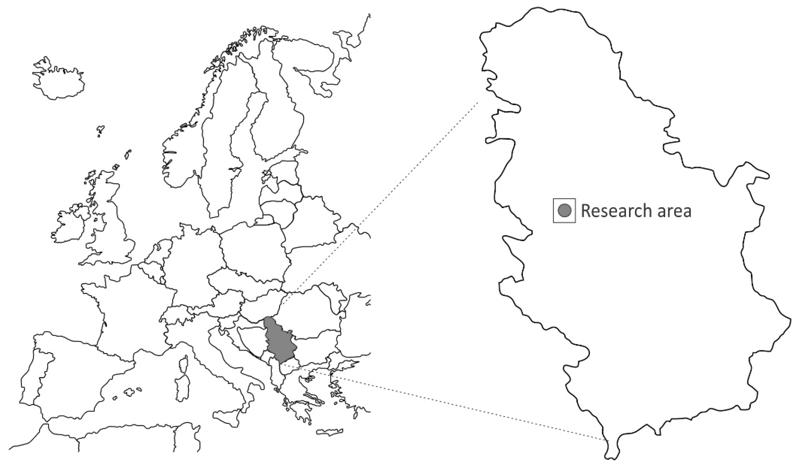
Banja river is in western Serbia, about 100 km southeast from Belgrade, Capital of Serbia (
Figure 1). Banja river is formed from Petnica spring at 175 m. It is about 10 km long with average annual flow of about 360 L/s at the source. This river has only one constant tributary named Pocibrava with average annual flow of about 3.8 L/s [
1].
In terms of geological and hydrogeological settings in the research area, three types of aquifers are formed: karst, fractured and intergranular. Karst aquifer was formed in limestones in the upper part of catchment area of Triassic age. Fractured aquifer was formed in marl and shale located in the lower part of catchment area dominantly of Miocene age, while intergranular aquifer is formed in Quaternary sediments in the river valley [
2,
3]. Aquifer’s recharge is dominantly from direct infiltration of precipitation and to some small extent, from rivers and streams.
2. Materials and Methods
Research was divided into three groups: field investigation and sampling, laboratory analyses and processing and interpretation of results. During research, standard hydrogeological, hydrological, hydrochemical and geostatistical methods were used [
4,
5].
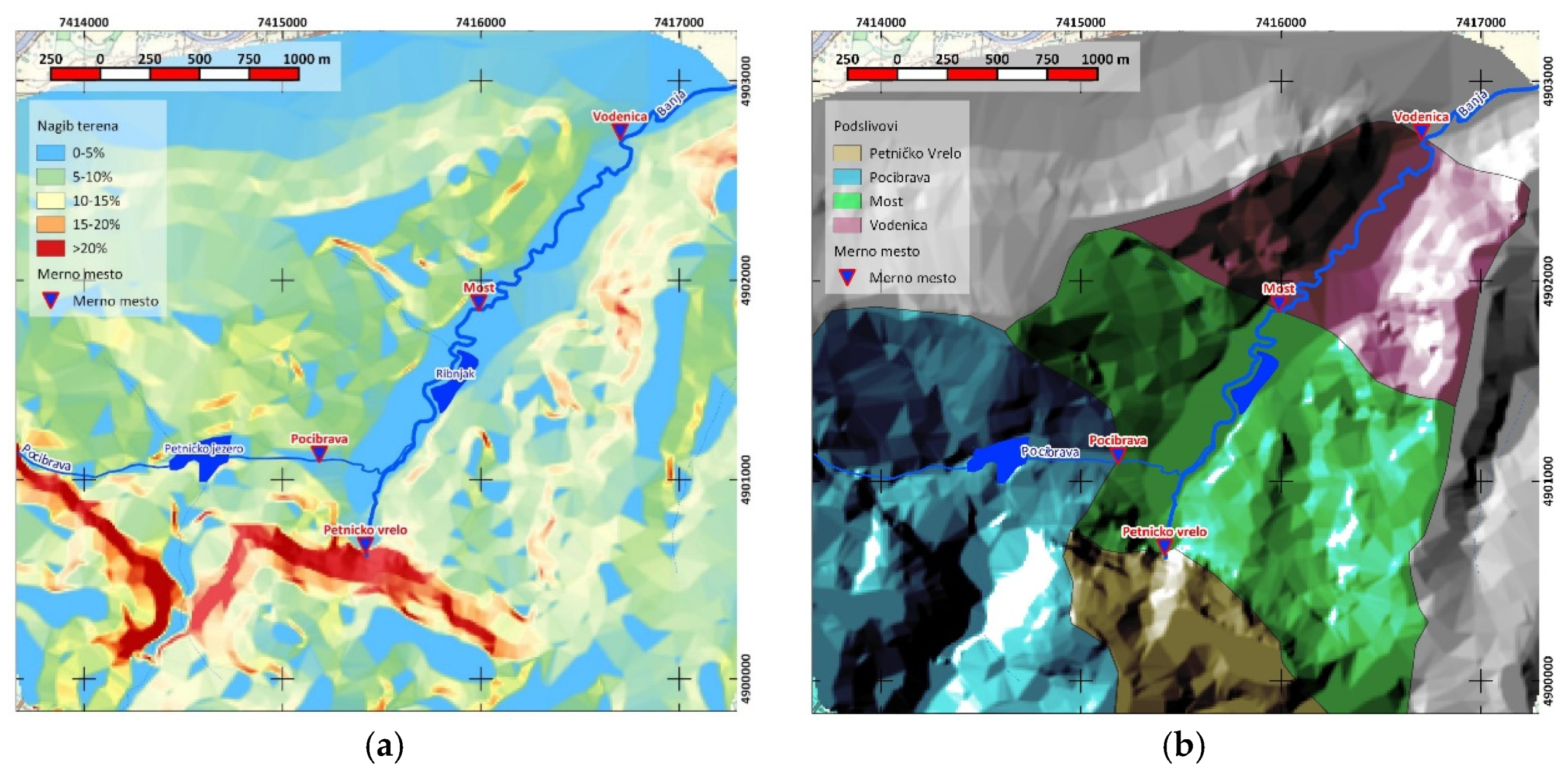
Samples were taken from five sampling points on Banja River, one on Pocibrava tributary, five from sampling wells in Banja river catchment, one from nearby fishpond and one from cave lake. Samples for chemical analysis were taken only once, after intense rainfall, while river flow was measured in four occasions (
Figure 2a,b).
On the field, basic physical properties of the sampled water were examined. Color, blur and odor were determined through organoleptic evaluation, pH value and conductivity were measured using field pH/Conductometer. River flow was measured using float method. Water and air temperature were measured at the sampling points. In the laboratory, chemical analyses of the samples were performed. Concentration of ammonium, nitrite, nitrate, sulfate and phosphate ions was determined by the colorimetric method while concentration of calcium, magnesium, hydrocarbonate and chloride ions as well as consumption of KMnO4 was determined using volumetric method. Concentration of sodium, potassium as well as total mineralization were determined by calculation.
Also, field and laboratory results were analyzed. A mass balance approach was used to assess the interaction between surface and groundwater. When assessing the balance of the basin, a TIN (triangulated irregular network) was created. Based on it, DEM (digital elevation model) was created to calculate terrain slope, surface and groundwater flow vectors and define sub-basins within river catchment. For these analyses, software packages Surfer 9 and QGIS 2.10.1 Pisa were used. The construction of isolines with the same concentrations of chemical compounds were carried out manually using the method of linear interpolation due to insufficient number of observed points and their spatial distribution.
3. Results and Discussion
Water masses that enter through the determined surface are equal to the water masses that exit, increased or subtracted for those quantities of water that have increased or decreased existing water masses in the mentioned area [
6]. For a concrete river basin, with a clearly defined boundary, the water balance equation has the following form:
where: P—precipitation; Qrun—runoff; Qinf—infiltration; E—evapotranspiration; ΔW—change or groundwater reserves in basin.
Considering small number of available input data, individual components of the balance equation were approximated based on previous research in this and similar areas. Information about precipitation was taken from the Valjevo synoptic weather station for the observation period [
7]. Evapotranspiration values were calculated from the free water area according to the Penman method taken from the previous research [
1]. Assumption was that groundwater reserves in the basin did not change during the observation period and that only change was the flow regime of river Banja, as only discharge point of this basin. Petnica spring aquifer is the part of bigger structure called “Lelićki Karst” which is divided into four sub-basins (
Figure 3). Sub-basins of Gradac and Paklje springs are well researched because those springs are used for public water supply for city of Valjevo [
8]. Taking into account natural conditions on the wider location, authors used analogy to define characteristic of Petnica sub-basin. These assumptions were adopted due to inability to carry out a continuous monitoring of groundwater level on control wells due to their constructive elements. Runoff and infiltration were calculated based on analysis of water regime in the basin.
3.1. Analysis of the Surface Water Regime
To precisely establish recharge zones of the Banja River, monitoring of flow was carried out over the course of 10 days. River flow measurements at different locations were compared with the flow of Petnica spring, as its main source. Also, flow of Pocibrava stream and precipitation were included. Measured elements of the regime are shown on
Figure 4a,b.
Based on observations on the spring, an increase in yield from 158 L/s to 221 L/s can be seen. This increase is strongly connected with precipitation. Correlation analysis between precipitation and yield show correlation coefficient of 0.88 for the two-day delay. That means that infiltration through karst system is fast and that recharge at the expense of intense precipitation is seen within a short period. Same situation is with Pocibrava tributary where the correlation coefficient is 0.9.
There is noticeable increase of flow during the intense precipitation period on Banja River (20–21 August). Based on the measured parameters, it can be concluded that during the period of drought, the dominant source of recharge for river is the Petnica spring. It participated in the flow of Banja River with 93% to the 2nd kilometer and with 88% to the 4th kilometer. On the other hand, after intensive rainfall, it is noticeable that the increase of the flow comes from other directions (
Table 1). The only permanent tributary Pocibrava has no major contribution to the flow of Banja River.
Water recharge can be divided into three parts. Precipitation directly on water surface, runoff in form of occasional torrential flows and infiltration to shallow intergranular aquifer, which gets discharged into river. Recharge through precipitation directly on the water surface is marginal since the entire length of the Banja River is covered with thick vegetation. Based on the results of the regime monitoring, we can make some conclusions about the inflow from runoff and aquifer drainage.
After the first rainfall (20 August) uniform increase in flows on both the 2nd and 4th kilometer was observed. Having in mind that prior this rainfall there was an extensive period of drought, it can be assumed that in areas of “open” karst at the first moment, the greatest quantities of precipitation were infiltrated into aquifer. At that point, recharge from aquifer drainage was dominant, on average measured at about 20 L/s per kilometer of river. In areas of “covered” karst, initial precipitation was retained by the soil to recover it’s moisture.
After two days of intense rainfall (22 August), the soil was saturated with moisture and more and more water contributed as runoff. Slope analysis (
Figure 5a) gave information that bigger slope is located up to 2nd kilometer of the Banja river basin which corresponds with more pronounced increase in the flow of the Banja River in that zone relative to the zone up to 4th kilometer. Based on assumption that recharge from aquifer drainage did not increase, it was concluded that 40 L/s per kilometer of river came from runoff in the first zone while in the second zone, runoff was up to 5 L/s per kilometer of river.
By sublimation of all results, a map of sub-basin within Banja River catchment was defined. (
Figure 5b). The sub-basins are defined in accordance to the locations of measuring points (Petnica spring, Pocibrava tributary, Bridge (Station +2 km) and Water Mill (Station +4 km). Due to inadequate information on the circulation of the groundwater through karst in this area, topographic boundaries were used to contour the sub-basins. Defined with this methodology, largest surface has sub-basin of the first zone (up to Station +2 km) while smallest surface has sub-basin of Petnica spring. What can be deducted from this analysis that, if there were no Petnica lake, the participation of Pocibrava in the Banja river flow would be scientifically higher, considering the surface of the sub-basin and the large slope gradient.
3.2. Hydrochemical Analysis
During research, groundwater and surface water samples were taken, in order to indirectly, on the basis of the concentrations of certain parameters, indicate the directions of migration and possible connection between surface water and groundwater in the river basin. Sampling locations were divided into four zones, based on sub-basin they are a part of: Petnica spring catchment area, Pocibrava sub-basin, the zone of station +2 km and the zone of station +4 km.
3.2.1. Sub-Basin of the Petnica Spring
In this zone, samples were taken from two shallow wells, one spring, lake in Petnica cave, Petnica spring and one catchment that is in close vicinity. Spatial distribution of migratory nitrogen compounds (NO2, NO3, NH4), KMnO4 consumption and on macro-components was observed. High concentrations of nitrates in wells are most likely the result of local pollution, the use of fertilizers in agricultural production. The consumption of KMnO4 is due to water retention in above mentioned catchment and connected with high air temperatures in the research period. There are also ample differences in macro-components between spring and other control points, especially concentrations of Na, Ca and HCO3 so it is possible to conclude that those samples don’t have same genesis.
3.2.2. Pocibrava Sub-Basin
In the zone of Pocibrava basin, sampling was carried out on one well upstream from Pocibrava and at Pocibrava itself. The differences that were observed are reflected in total mineralization. Water types match, so, hydraulic connection between groundwater and surface water exists this zone, with the inflow based on precipitation and runoff that led to reduction in mineralization in Pocibrava. Greater KMnO4 consumption can be connected with the fact that Pocibrava originates from Petnica Lake, which is rich with flora and fauna.
3.2.3. Station +2 km Sub-Basin
In this zone, sampling was carried out on Banja River, fishpond nearby and from one shallow well. Chemical composition of samples from well and Banja river are almost complete match, it is the same water type, which draws a conclusion of good hydraulic connection. On the other hand, water from the fishpond has a very different composition compared to the river Banja. Elevated NO2, NO3 NH4 and KMnO4 consumption are a consequence of water stagnation in fishpond and because sample was taken from the water surface. However, what points to the fact that the recharge zones of fishpond are different than River are drastic differences in macro-components.
3.2.4. Station +4 km Sub-Basin
In this zone, a well on the left bank of the river was taken as control sample, while three samples were taken from the river itself. All samples on the river do not deviate to big extent from each other. On the other hand, water from the control well has completely different chemistry compared to the river, which again indicates the absence of a direct hydraulic connection.
3.2.5. Banja River Analysis
Counting Petnica spring, five samples were taken on the observer part of Banja River. Analyzing results, consistency of chemical composition was determined, which was also confirmed by the correlation coefficient of 0.99. Small differences are reflected in the gradual increase on Na
+ and Mg
2+ ions to Ca
2+. There is also a slight increase of KMnO
4 consumption downstream, especially in the zone of fishpond, so it can be concluded that the water from the pond has a direct effect on the increase of this compound to Banja river. Nitrogen compounds show a stable regime, but the effect of spraying of fertilizers in the zone of Petnica spring and the station +2 km due to abundant precipitation is also visible (
Figure 6a,b).
4. Conclusions
Provided analysis and monitoring of changes in the flow rate, considering precipitation, leads to the conclusion that in the periods without precipitation, dominant recharge of the Banja river comes from Petnica spring. In periods with some precipitation, some share of river flow goes to infiltration and groundwater drainage while after intense rainfall, water inflow comes from the runoff. During intense precipitation, recharge is more pronounced in the zone between Petnica spring and 2nd kilometer. Recharge from the Pocibrava sub-basin is marginal because Petnica Lake represents a local erosion base and a barrier to the flow of groundwater and surface water.
Spatial distribution of migratory nitrogen compounds, (NO2, NO3 NH4), KMnO4 consumption and macro-components led to construction of isolines with the same concentrations of chemical elements and compounds. Based on these observations, it is not possible to draw conclusions about direct hydraulic connectivity between groundwater and surface water. For that it would be necessary to monitor changes in the chemical composition over a longer period. Analyzing the results from Banja River itself, it was concluded that there are no major oscillations in the chemical composition of the water.
To summarize, this research shows the possibility to have both quantitative and qualitative analyses of groundwater–surface water interactions of some river catchment with limited input data in short period of time, which can be beneficial, specifically on remote locations and in areas with poor monitoring network and scarce input data. Although methodology used has its limitations, and can’t replace long term monitoring, it can provide us insights and help in decision making. Solutions like this can optimize research process, save time and reduce cost, especially in prefeasibility stage.


