
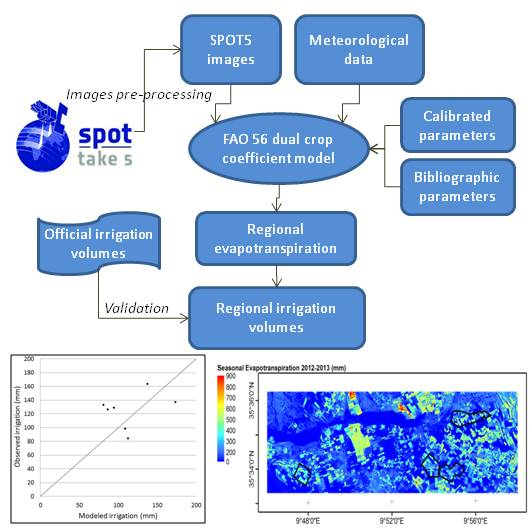
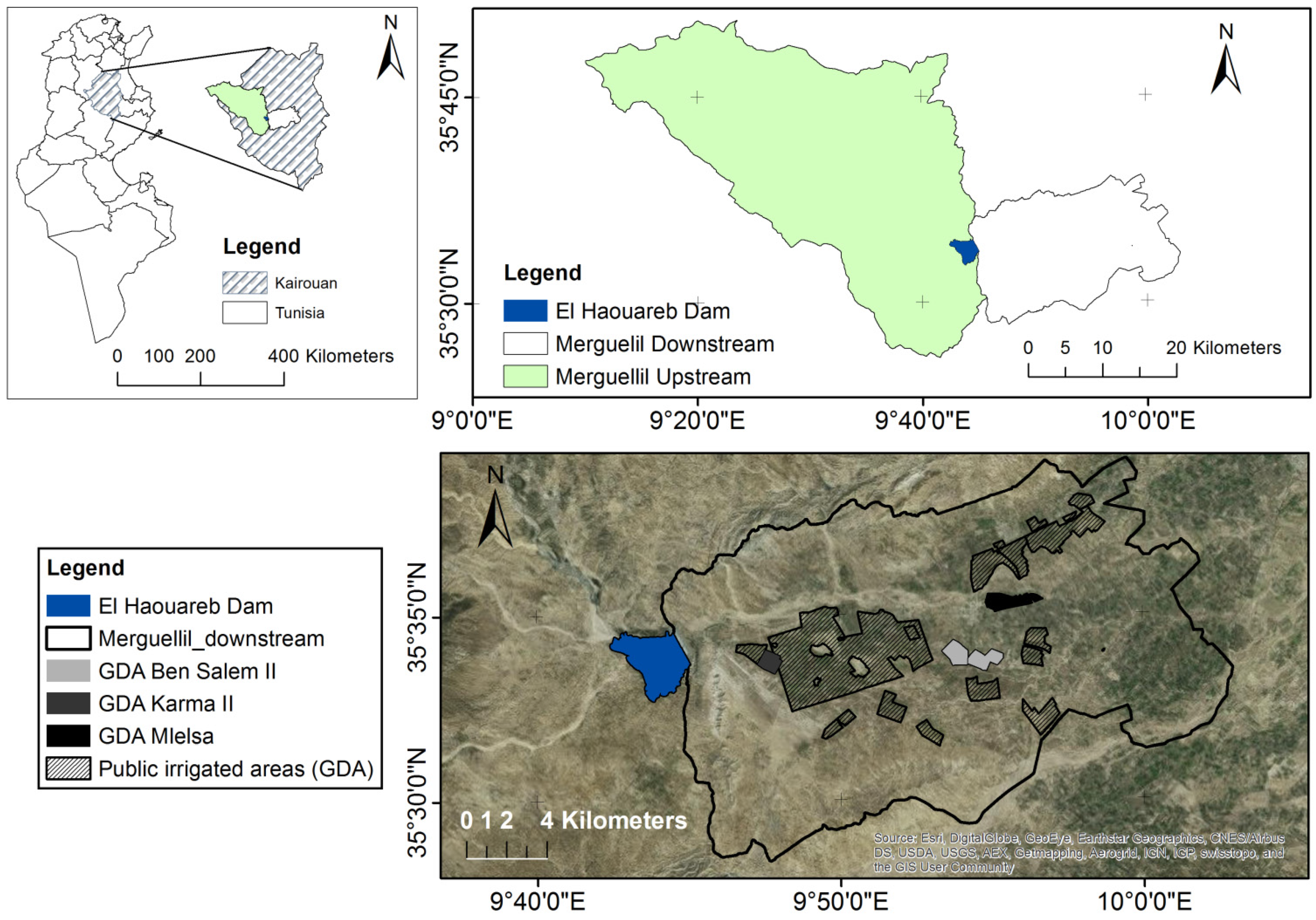
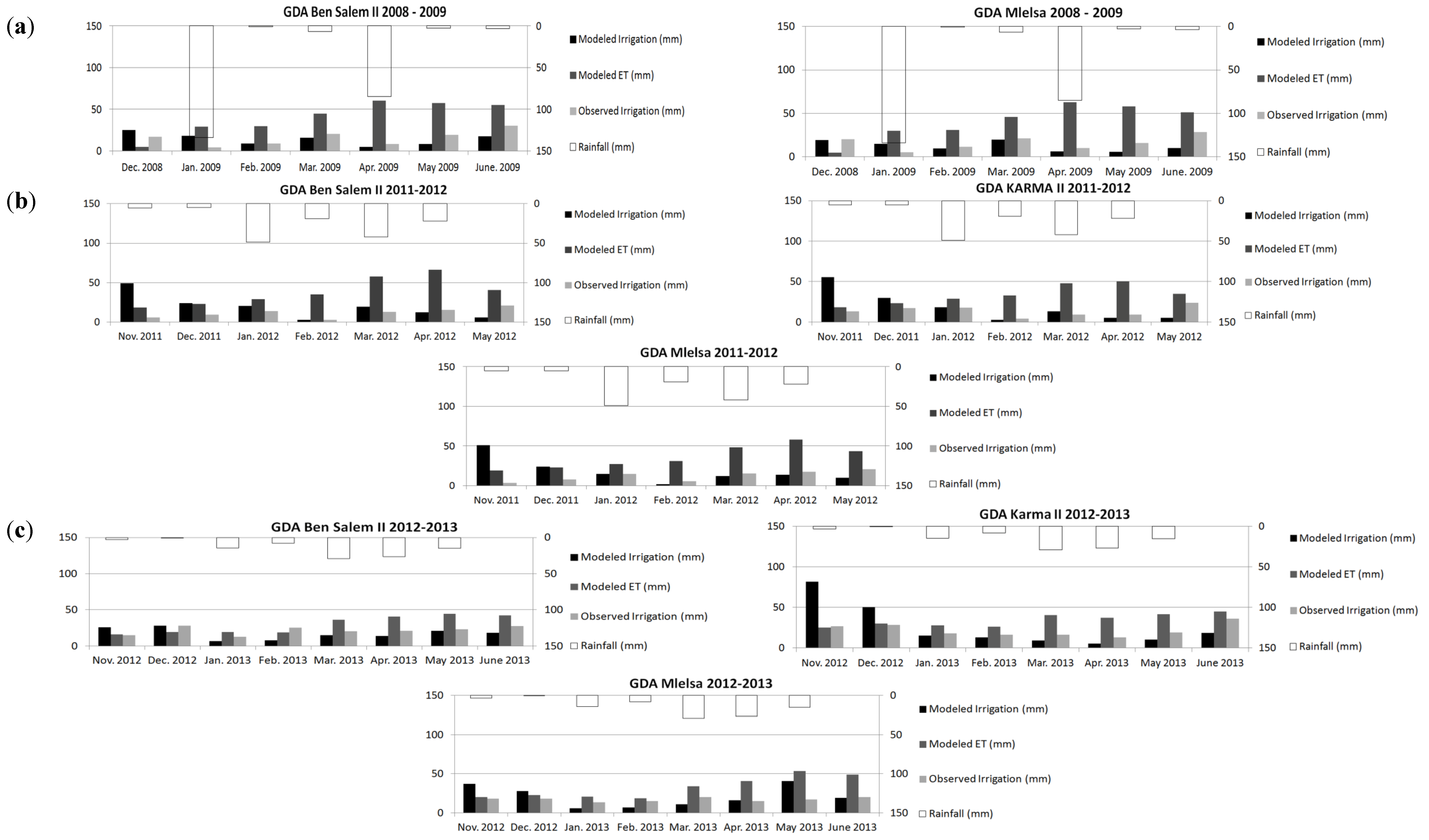
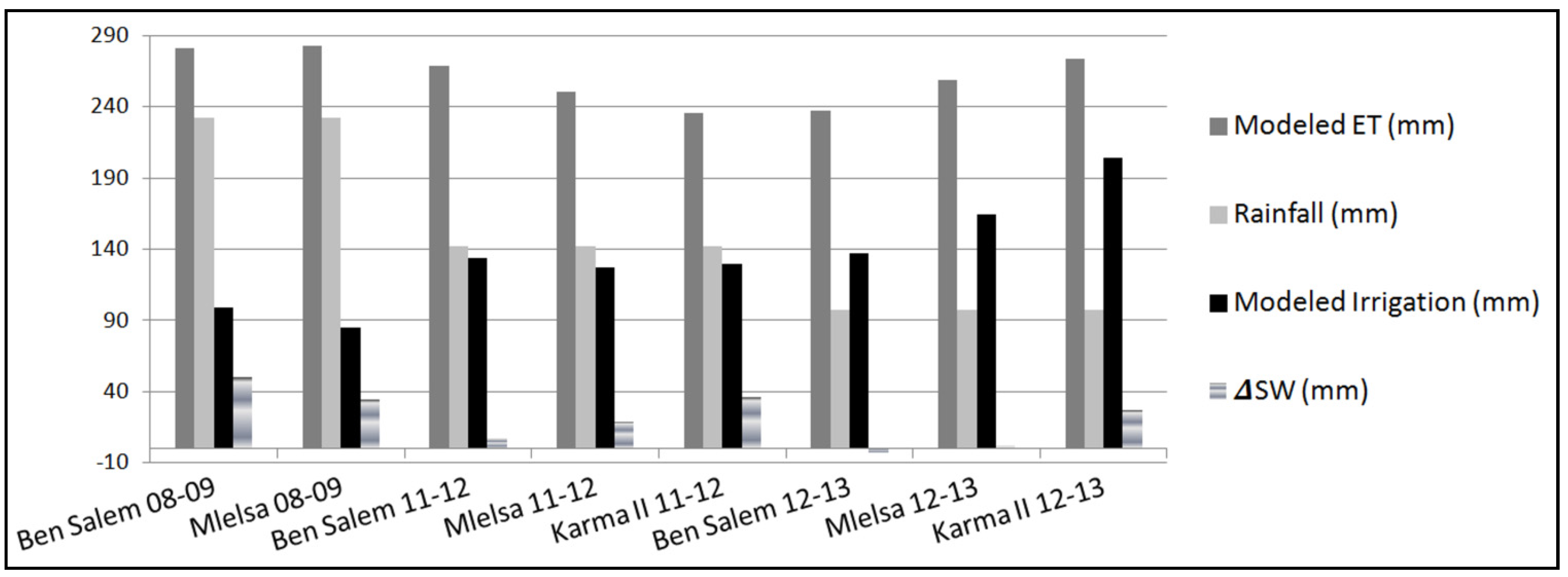
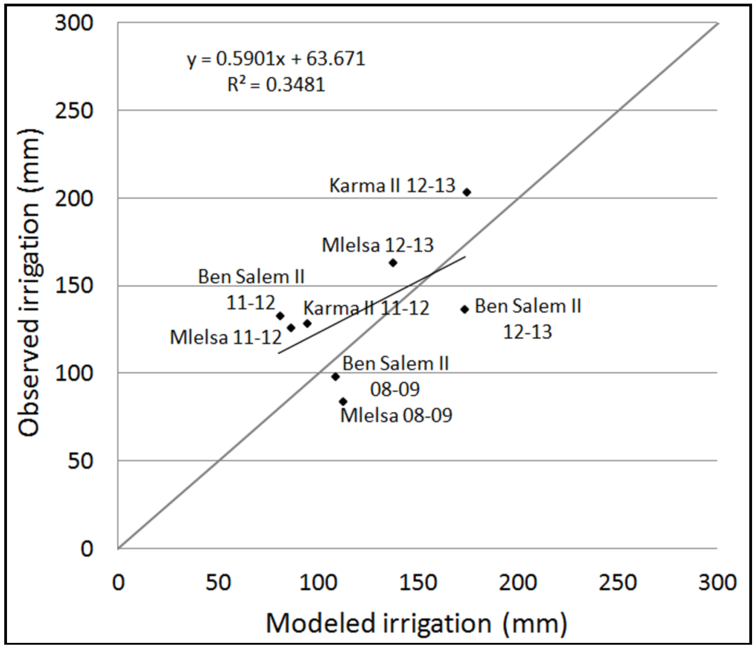
Monitoring Irrigation Consumption Using High Resolution NDVI Image Time Series: Calibration and Validation in the Kairouan Plain (Tunisia)


 , ,
, , Abstract

Share and Cite
Saadi, S.; Simonneaux, V.; Boulet, G.; Raimbault, B.; Mougenot, B.; Fanise, P.; Ayari, H.; Lili-Chabaane, Z. Monitoring Irrigation Consumption Using High Resolution NDVI Image Time Series: Calibration and Validation in the Kairouan Plain (Tunisia). Remote Sens. 2015, 7, 13005-13028. https://doi.org/10.3390/rs71013005
Saadi S, Simonneaux V, Boulet G, Raimbault B, Mougenot B, Fanise P, Ayari H, Lili-Chabaane Z. Monitoring Irrigation Consumption Using High Resolution NDVI Image Time Series: Calibration and Validation in the Kairouan Plain (Tunisia). Remote Sensing. 2015; 7(10):13005-13028. https://doi.org/10.3390/rs71013005
Chicago/Turabian StyleSaadi, Sameh, Vincent Simonneaux, Gilles Boulet, Bruno Raimbault, Bernard Mougenot, Pascal Fanise, Hassan Ayari, and Zohra Lili-Chabaane. 2015. "Monitoring Irrigation Consumption Using High Resolution NDVI Image Time Series: Calibration and Validation in the Kairouan Plain (Tunisia)" Remote Sensing 7, no. 10: 13005-13028. https://doi.org/10.3390/rs71013005
APA StyleSaadi, S., Simonneaux, V., Boulet, G., Raimbault, B., Mougenot, B., Fanise, P., Ayari, H., & Lili-Chabaane, Z. (2015). Monitoring Irrigation Consumption Using High Resolution NDVI Image Time Series: Calibration and Validation in the Kairouan Plain (Tunisia). Remote Sensing, 7(10), 13005-13028. https://doi.org/10.3390/rs71013005