Remote Sens. 2015, 7(6), 7212-7230; https://doi.org/10.3390/rs70607212 - 2 Jun 2015
Cited by 154 | Viewed by 8789
Abstract
Long-term snow depth/snow water equivalent (SWE) products derived from passive microwave remote sensing data are fundamental for climatological and hydrological studies. However, the temporal continuity of the products is affected by the updating or replacement of passive microwave sensors or satellite platforms. In
[...] Read more.
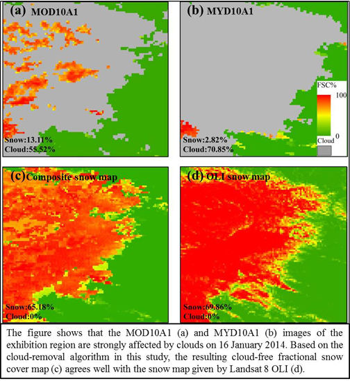
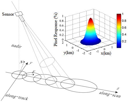
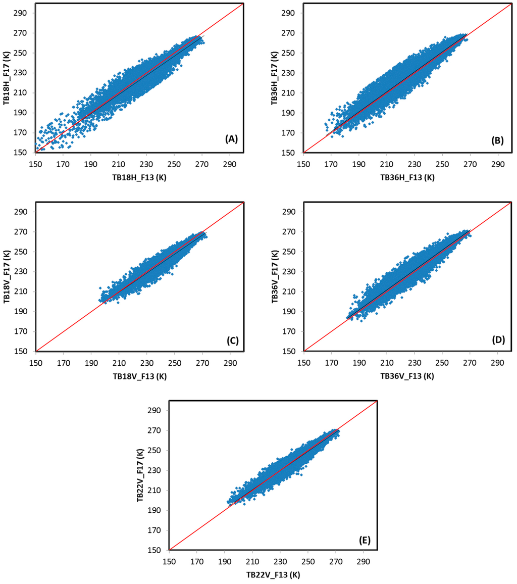
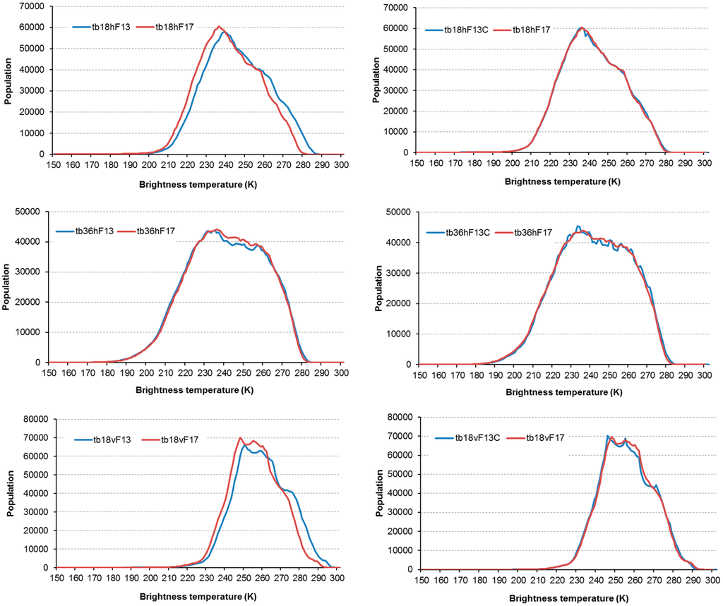
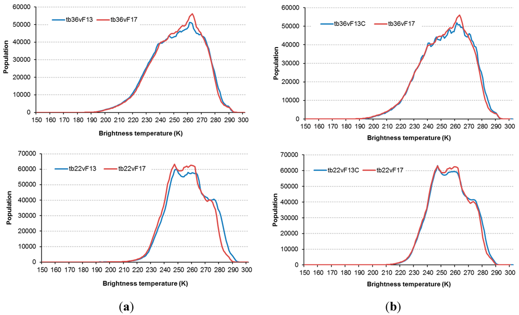
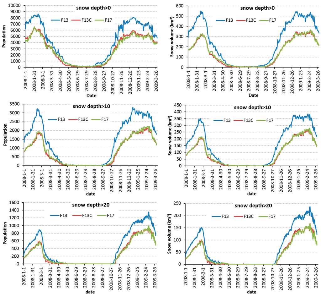
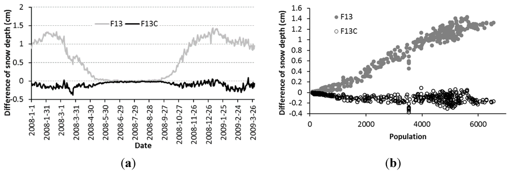
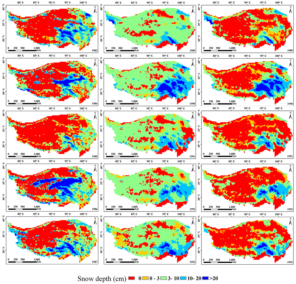
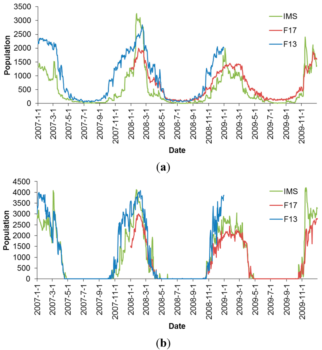
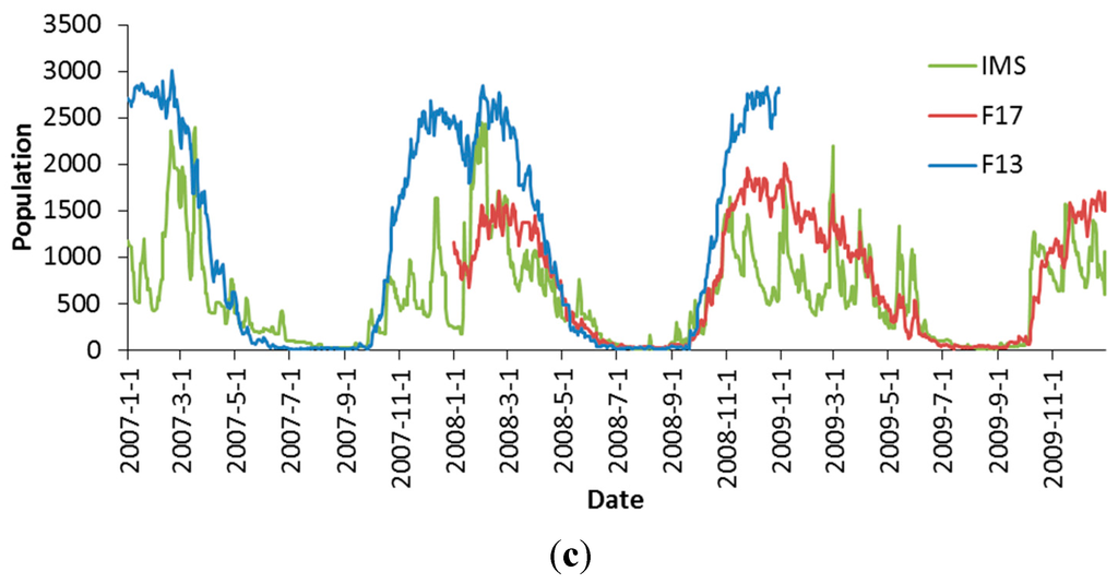
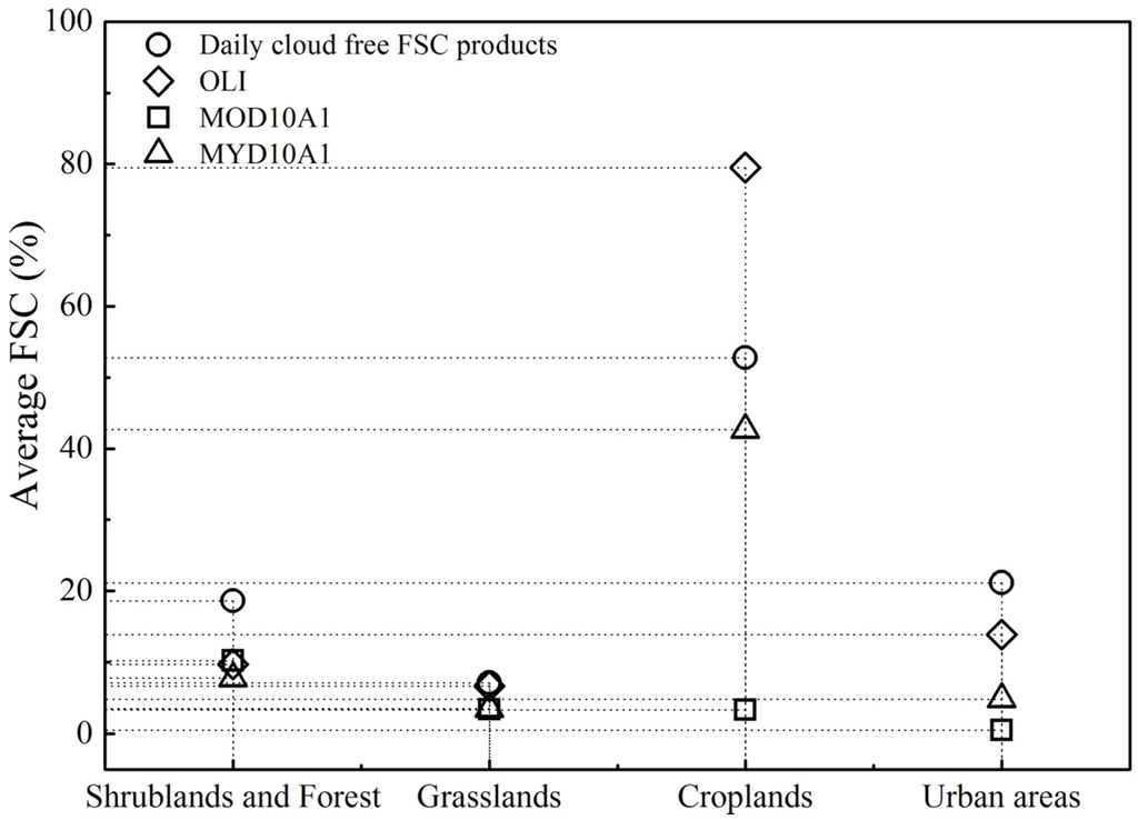
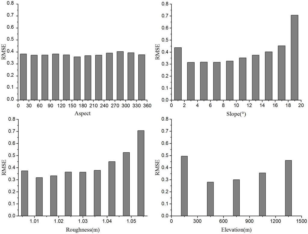
Long-term snow depth/snow water equivalent (SWE) products derived from passive microwave remote sensing data are fundamental for climatological and hydrological studies. However, the temporal continuity of the products is affected by the updating or replacement of passive microwave sensors or satellite platforms. In this study, we inter-calibrated brightness temperature (Tb) data obtained from the Special Sensor Microwave Imager (SSM/I) and the Special Sensor Microwave Imager/Sounder (SSMI/S). Then, we evaluated the consistency of the snow cover area (SCA) and snow depth derived from the Scanning Multichannel Microwave Radiometer (SMMR), SSM/I and SSMI/S. The results indicated that (1) the spatial pattern of the SCA derived from the SMMR and SSM/I data was more consistent after calibration than before; (2) the relative biases in the SCA and snow depth in China between the SSM/I and SSMI/S data decreased from 42.42% to 1.65% and from 66.18% to −1.5%, respectively; and (3) the SCA and snow depth derived from the SSM/I data carried on F08, F11 and F13 were highly consistent. To obtain consistent snow depth and SCA products, inter-sensor calibrations between SMMR, SSM/I and SSMI/S are important. In consideration of the snow data product continuation, we suggest that the brightness temperature data from all sensors be calibrated based on SSMI/S.
Full article
(This article belongs to the Special Issue The Development and Validation of Remote Sensing Products for Terrestrial, Hydrological, and Ecological Applications at the Regional Scale)
►
Show Figures

Graphical abstract
