Article

Remote Sensing of Epibenthic Shellfish Using Synthetic Aperture Radar Satellite Imagery
1
Royal Netherlands Institute for Sea Research (NIOZ-Yerseke), P.O. Box 140, 4400 AC Yerseke, The Netherlands
2
Institute for Marine Resources and Ecosystem Studies (IMARES), P.O. Box 167, 1790 AD Den Burg, The Netherlands
3
Institute for Marine Resources and Ecosystem Studies (IMARES), P.O. Box 77, 4400 AB Yerseke, The Netherlands
*
Author to whom correspondence should be addressed.
Remote Sens. 2015, 7(4), 3710-3734; https://doi.org/10.3390/rs70403710
Submission received: 25 December 2014 / Accepted: 11 March 2015 / Published: 27 March 2015

Abstract

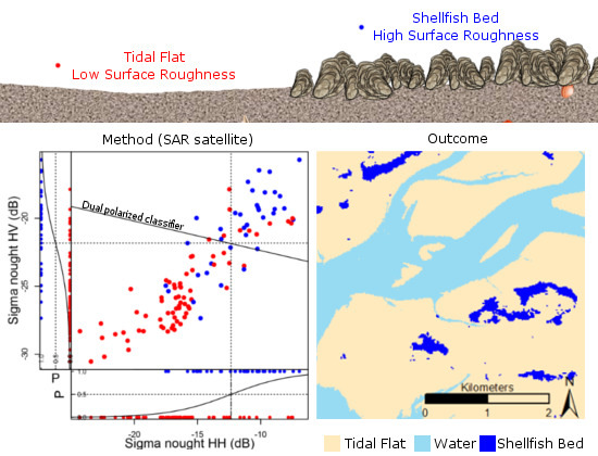
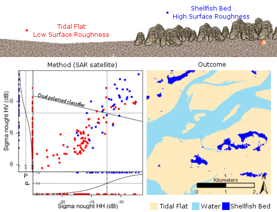
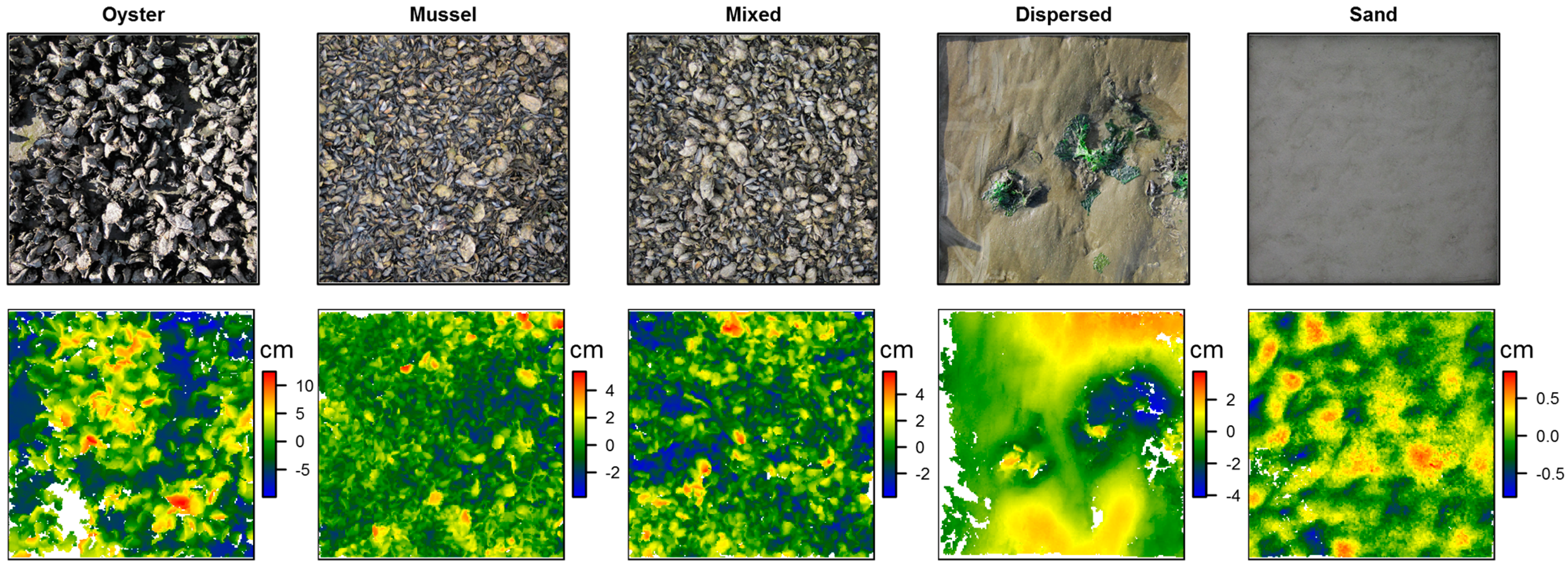
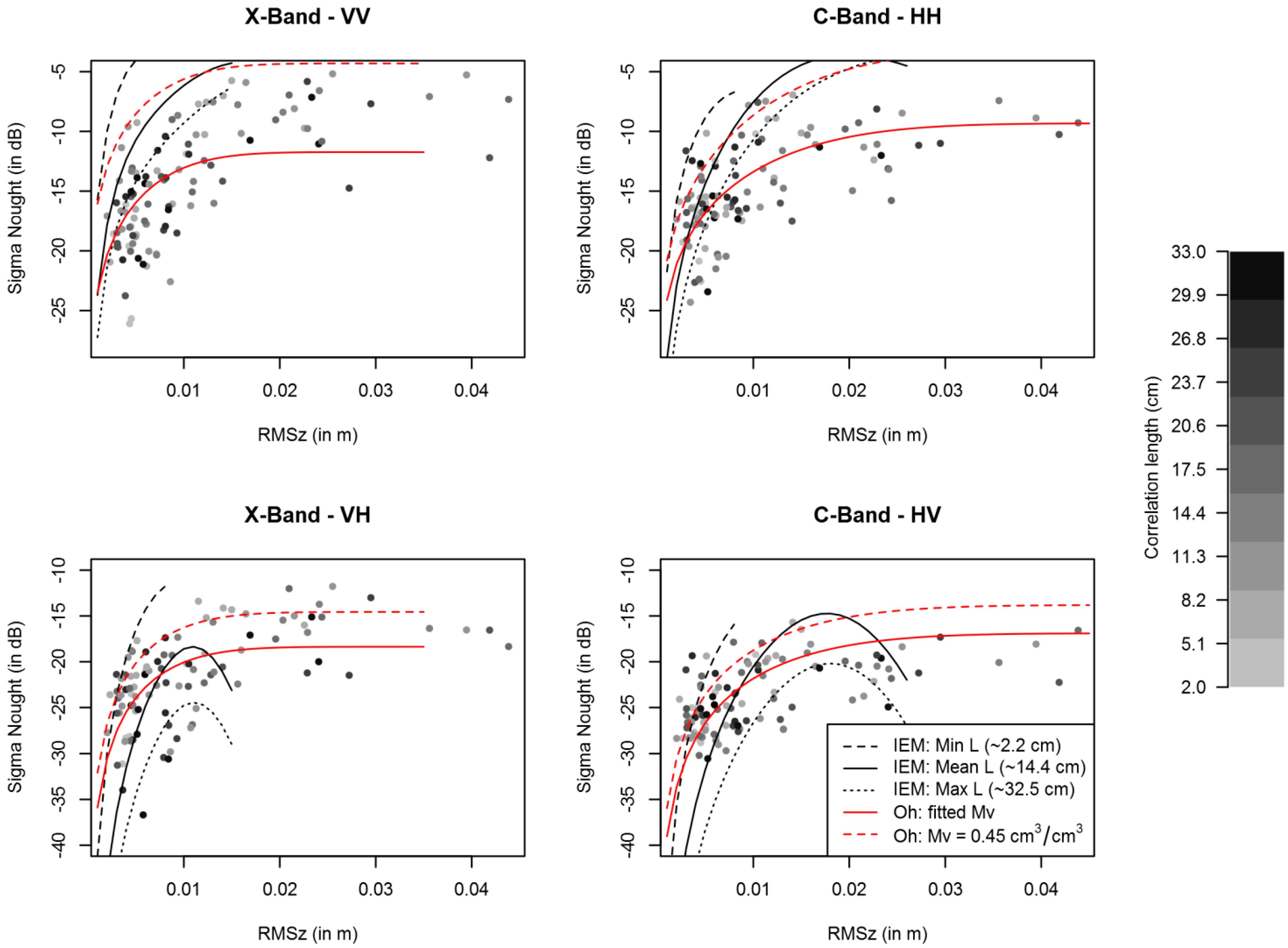
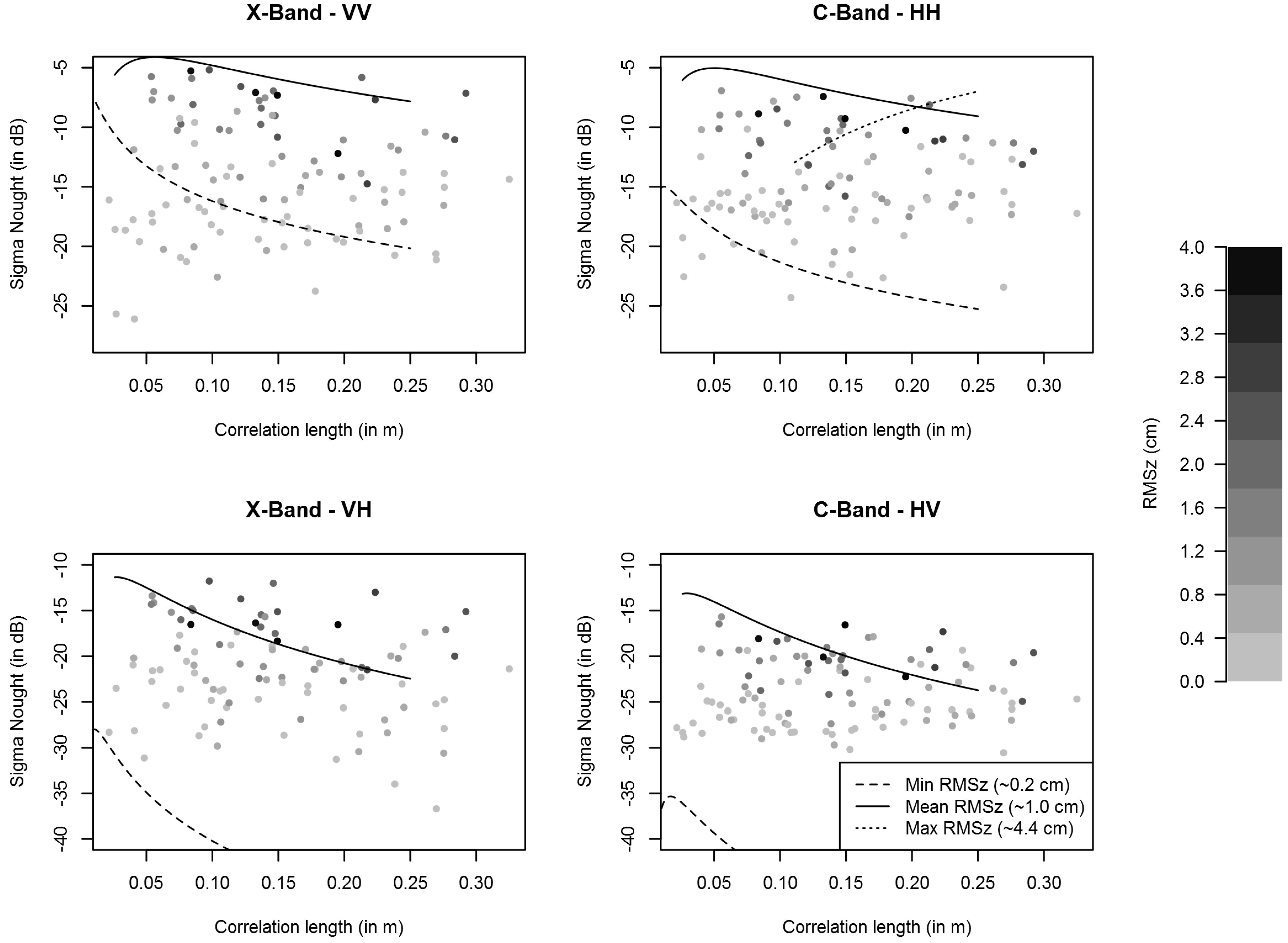
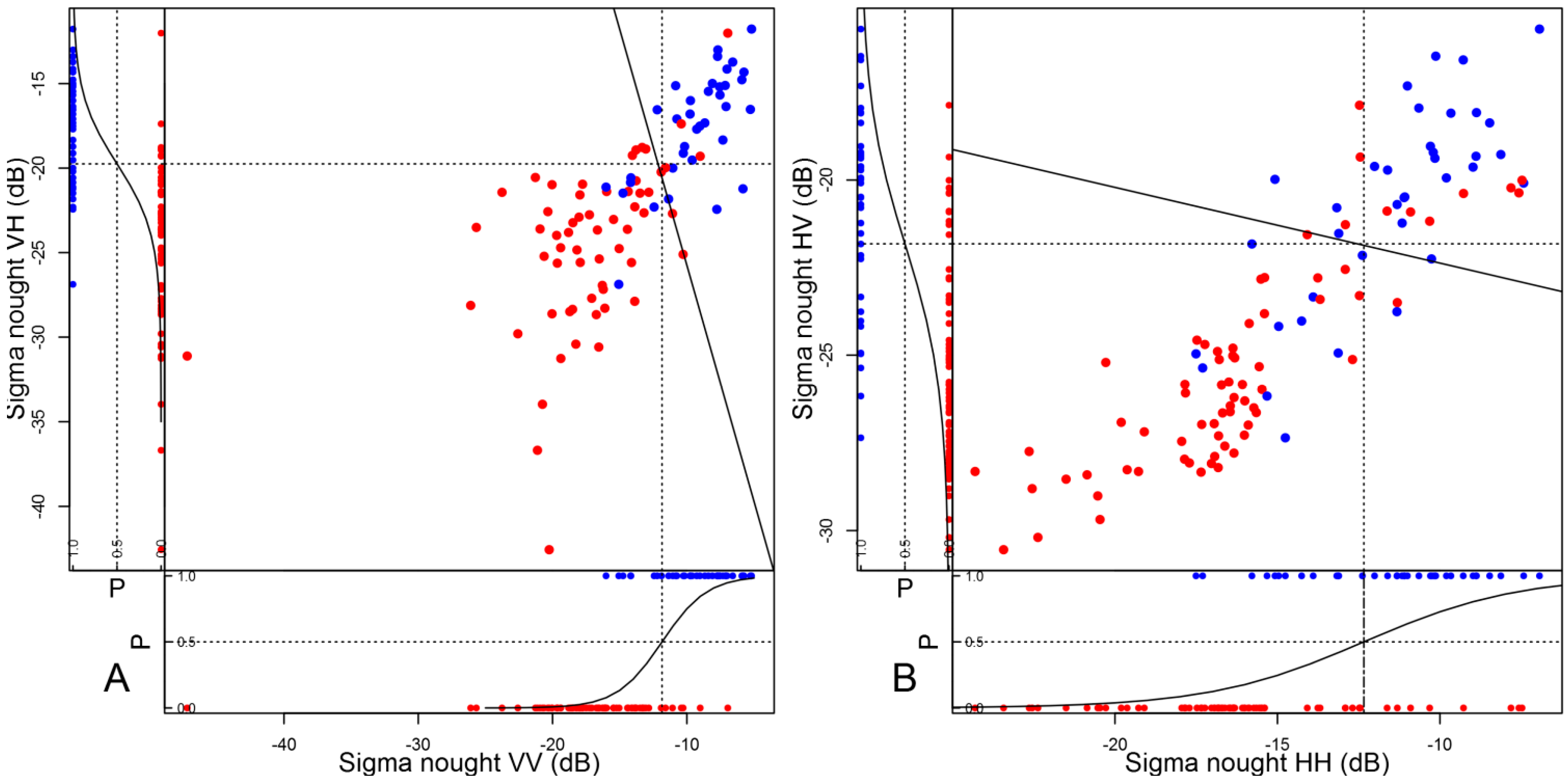
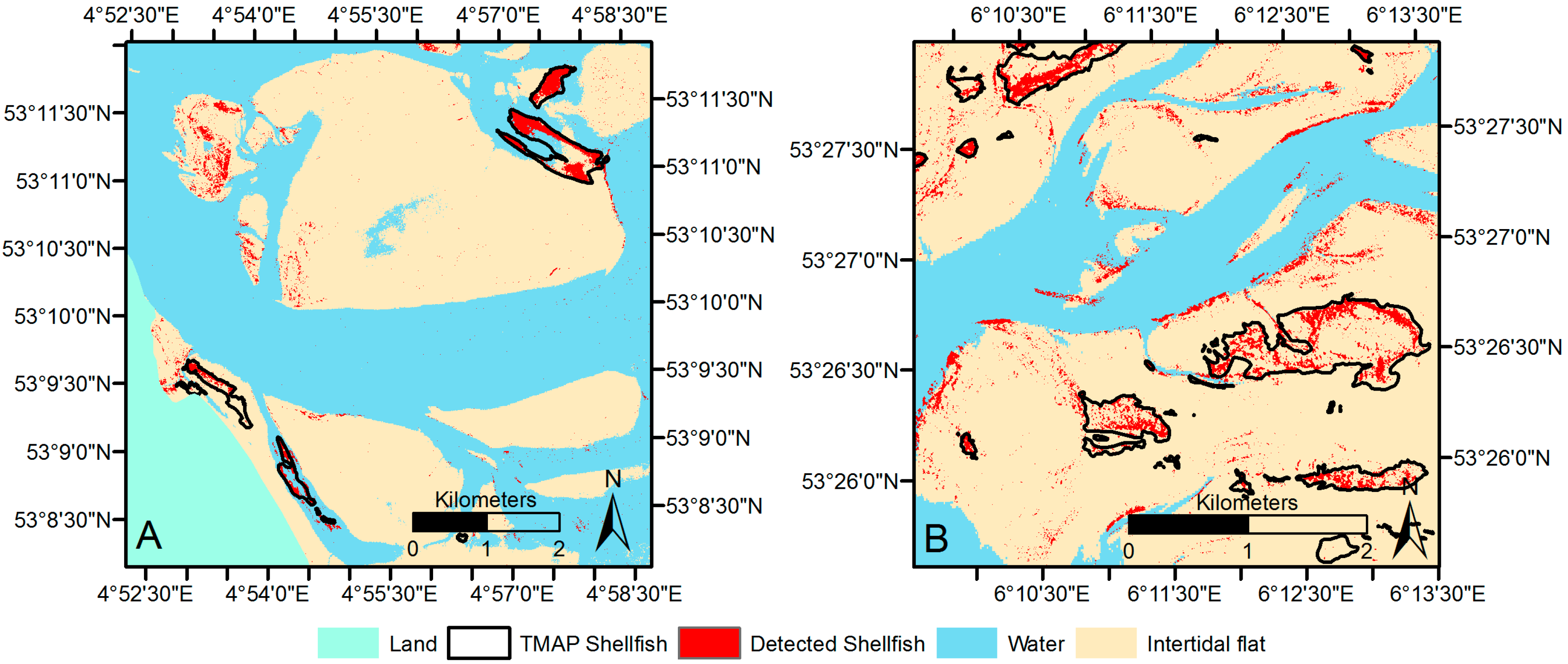
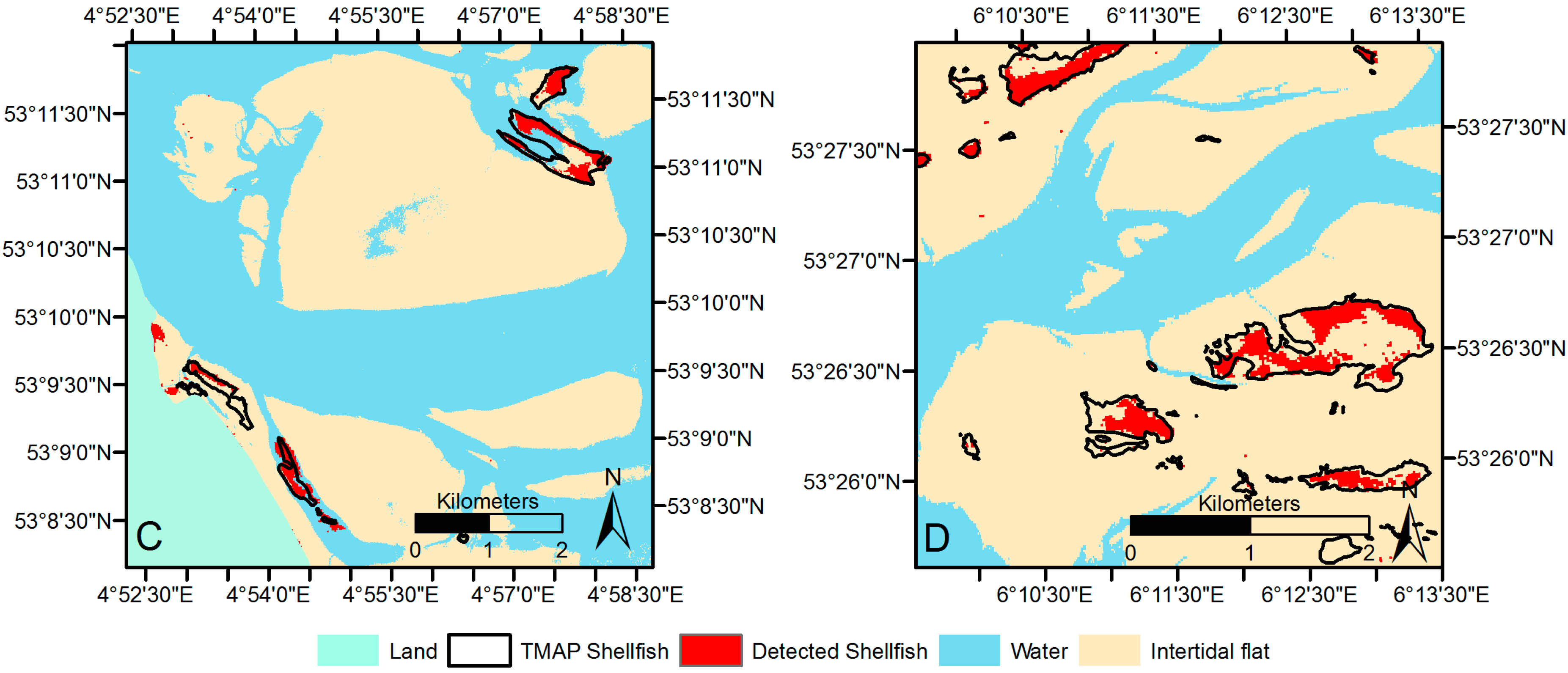
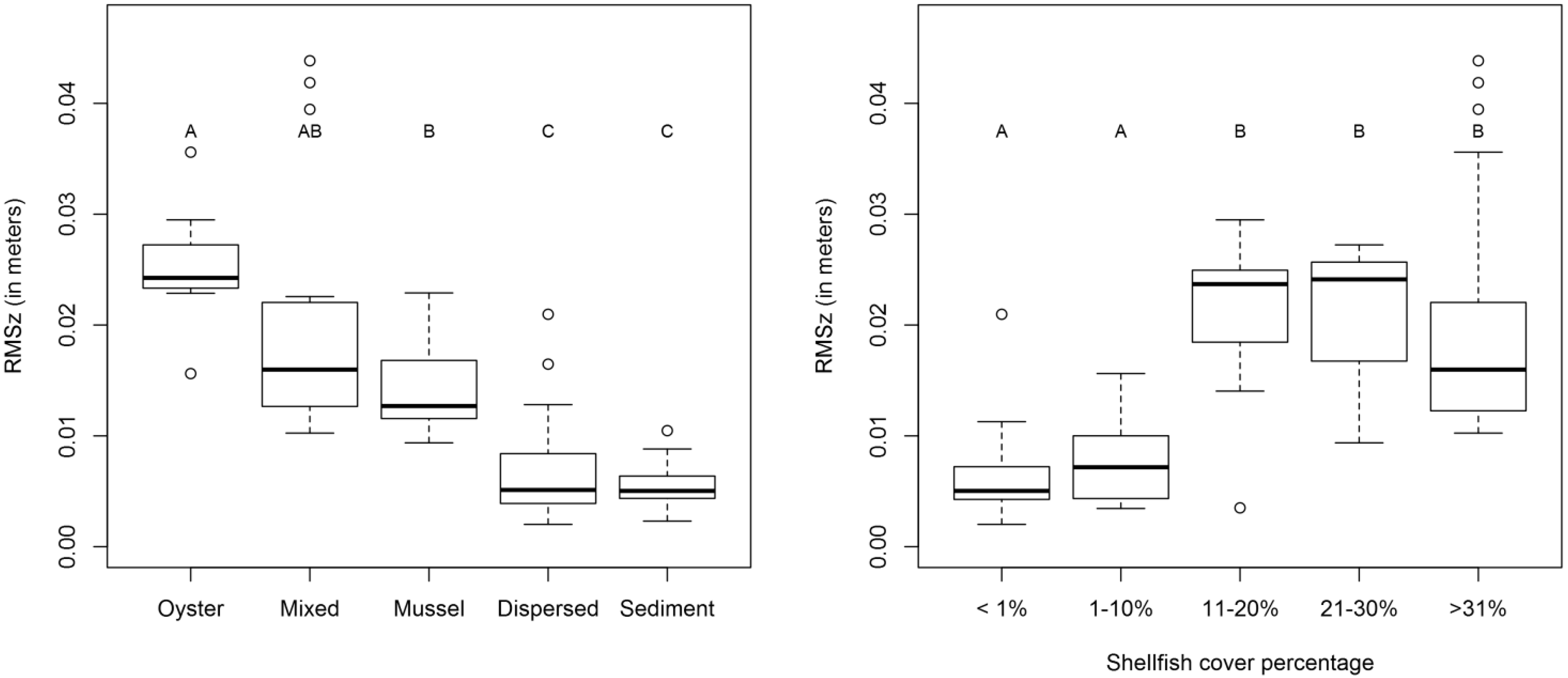
On intertidal mudflats, reef-building shellfish, like the Pacific oyster and the blue mussel, provide a myriad of ecosystem services. Monitoring intertidal shellfish with high spatiotemporal resolution is important for fisheries, coastal management and ecosystem studies. Here, we explore the potential of X- (TerraSAR-X) and C-band (Radarsat-2) dual-polarized SAR data to map shellfish densities, species and coverage. We investigated two backscatter models (the integral equation model (IEM) and Oh’s model) for inversion possibilities. Surface roughness (vertical roughness RMSz and correlation length L) was measured of bare sediments and shellfish beds, which was then linked to shellfish density, presence and species. Oysters, mussels and bare sediments differed in RMSz, but because the backscatter saturates at relatively low RMSz values, it was not possible to retrieve shellfish density or species composition from X- and C-band SAR. Using a classification based on univariate and multivariate logistic regression of the field and SAR image data, we constructed maps of shellfish presence (Kappa statistics for calibration 0.56–0.74 for dual-polarized SAR), which were compared with independent field surveys of the contours of the beds (Kappa statistics of agreement 0.29–0.53 when using dual-polarized SAR). We conclude that spaceborne SAR allows one to monitor the contours of shellfish-beds (thus, distinguishing shellfish substrates from bare sediment and dispersed single shellfish), but not densities and species. Although spaceborne SAR cannot replace ground surveys entirely, it could very well offer a significant improvement in efficiency.
Keywords: SAR; epibenthic shellfish; oyster; mussel; mapping; surface roughness SAR; epibenthic shellfish; oyster; mussel; mapping; surface roughness
Graphical Abstract