1. Introduction
Relational approaches in social geography understand places as constellations of routes, institutions, practices, identities, material conditions, and connections rather than as sealed spatial containers [
1,
2,
3,
4,
5,
6,
7]. Urban–rural scholarship provides important background by showing that mobility, labour, services, markets, infrastructure, and environmental resources exceed administrative classifications [
1,
2,
3,
4]. In this article, however, literature serves as a conceptual point of departure rather than an empirical object: the evidence concerns a historic urban core and how its lived geography extends beyond the study area’s geographical boundary.
Historic urban areas present a particularly useful test of relational thinking. Conservation practice often begins from designated boundaries, protected monuments, morphological continuity, and visual integrity. These remain indispensable, but they can make a historic district appear more socially and territorially self-contained than it is [
8,
9,
10]. A heritage area is also constituted through commuting, worship, trade, tourism, residence, institutional use, food practices, waterfront connections, and repeated movement [
11,
12]. People who enter it with different purposes and memories, and relationships that cross neighbourhood and municipal limits, produce its meanings. A bounded urban heritage site may therefore operate as a node within wider metropolitan and territorial geographies even when a study does not directly trace rural origins or destinations [
6,
7].
Critical heritage scholarship reinforces this argument by treating heritage as a present social and political practice rather than as value inherent in surviving objects [
8,
9,
10]. Monumental recognition gives visibility to particular buildings, histories, and identities, while everyday routes, institutions, commercial practices, and sensory atmospheres may remain less formally represented. The distinction is not simply between official and unofficial objects; it concerns the relationships through which some memories become dominant, and others remain local, embodied, or routine. The ‘Historic Urban Landscape’ approach similarly expands heritage assessment beyond isolated monuments to include territorial, environmental, social, cultural, and perceptual processes [
11,
12].
Urban landscape transformation therefore extends beyond demolition, construction, or land-use conversion. Material continuity may coexist with altered lived meanings when access, routes, functions, sensory conditions, social composition, or everyday practices change. Conversely, adaptation may sustain heritage when inherited relationships remain accessible and active. Environmental psychology, phenomenology, and humanistic geography support this relational view by showing that perception develops through transactions among material conditions, bodily capacities, intentions, familiarity, and culturally learned meanings [
13,
14,
15,
16,
17]. Place identity and memory are consequently produced through situated experience rather than through visual form alone [
18,
19].
Cognitive mapping has long examined how people select and remember spatial information. Lynch’s paths, edges, districts, nodes, and landmarks established the importance of organised environmental knowledge, while later work showed that cognitive maps are selective, topological, and influenced by familiarity, purpose, movement, and activity [
20,
21,
22,
23,
24]. Imageability nevertheless tends to privilege visible and graphically representable form. It cannot independently explain how sound, smell, temperature, bodily effort, social expectations, or atmosphere contribute to orientation and memory.
Walking-based sensory methods address this limitation by following perception as it develops through movement.
Sensewalking retains the material, social, temporal, and embodied contexts of experience, while participant-generated mapping spatialises perceptions, emotions, memories, and evaluations [
25,
26,
27,
28,
29]. Combining these methods makes it possible to compare immediate encounters with the spatial relationships retained after movement. It also offers a way to examine which monuments become salient in participants’ accounts, how neighbourhood-based identities are represented, and how routes and connections beyond the study boundary organise heritage experience.
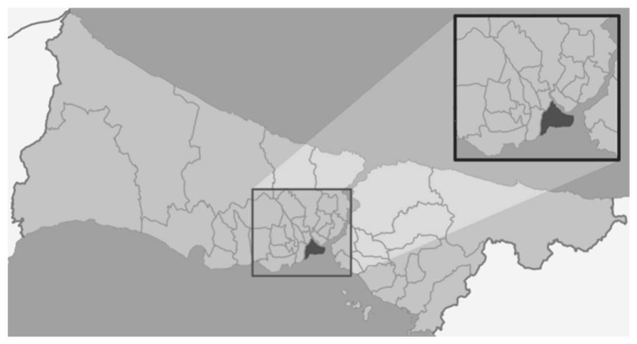
Istanbul’s Historical Peninsula provides an appropriate case. Internationally recognised monuments coexist with residential, religious, commercial, educational, waterfront, and transport-oriented environments. The Peninsula is physically bounded by water and walls but functionally connected to the wider city through bridges, ferries, roads, rail, tramways, institutions, markets, tourism, and everyday mobility. Treating it only as a monumental enclave would obscure the routes, activities, and social practices through which it remains part of contemporary urban life. Here, the study area is the historic peninsula bounded by the Golden Horn, the Sea of Marmara and the land walls. References to connections beyond the study boundary use this geographical frame. The Fatih district locator in
Figure 1 provides administrative context; the study boundary is not equated with the four component areas of UNESCO’s Historic Areas of Istanbul [
30].
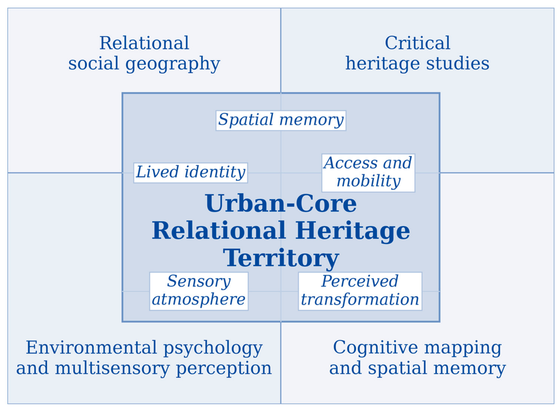
In this study, a relational heritage territory means a historically layered place constituted through perceived, lived, remembered, and spatially connected relationships among monuments, routes, neighbourhoods, institutions, sensory atmospheres, everyday practices, and connections beyond formal boundaries. The concept does not denote measured commodity flows, administrative integration, or a demonstrated urban–rural system. The study asks two focused questions: RQ1. How do participants perceive and remember the relationships between monumental heritage and everyday heritage through routes, sensory atmospheres, neighbourhood identities, and continuing uses? RQ2. How do sensewalking materials and post-walk cognitive maps represent connections within and beyond the geographical boundary of the Historical Peninsula, and what perceived transformations threaten or sustain those relationships?
The objectives are to operationalise monumental prominence, everyday familiarity, boundary crossing, neighbourhood identity, access, sensory atmosphere, and continuing use in participant-generated materials; to compare immediate embodied observations with post-walk representations that also draw on prior familiarity; and to assess how these qualitative forms of evidence can inform heritage-sensitive, place-based planning without being treated as measurements of material flows or population-wide preferences.
During late autumn and winter 2025, 40 unique participants aged 18–26 took part in 22 group
sensewalks across monumental, residential, religious, commercial, waterfront, institutional, and transport-oriented environments. They answered 18 guiding questions and produced written notes, photographs, in-walk sketches, and 23 optional post-walk cognitive maps. The materials were analysed manually through an iterative deductive–inductive thematic approach, first within each location and then comparatively across locations and data forms.
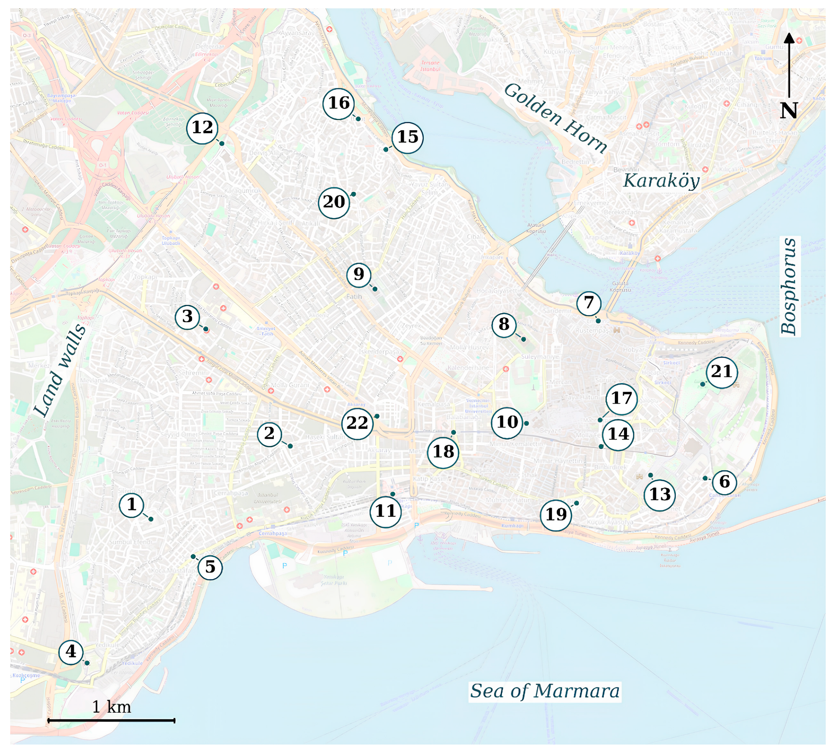
Figure 2 and
Table 1 locate the named study areas; the adjoining key identifies their principal comparative settings.
The study’s primary contribution is an urban-core perspective on relational heritage. Urban–rural and integrated-territorial debates remain conceptual background, clarifying why a protected boundary should not be assumed to contain the geography of lived relationships. Empirically, the article examines multi-scalar mobility, neighbourhood identities, sensory conditions, everyday practices, and metropolitan connections perceived from within the Historical Peninsula; it neither compares urban and rural settlements nor infers rural flows from urban activities.
3. Materials and Methods
3.1. Social-Geographical and Relational Research Design
This cross-sectional qualitative study combined group sensewalking with participant-generated documentation and cognitive mapping. The design examined how participants perceived and spatially represented the relationships among monuments, routes, neighbourhood functions, sensory atmospheres, identities, and everyday practices. It did not compare the same environments before and after a documented intervention, nor did it trace material urban–rural flows. The analysis therefore concerns perceived continuity, transformation, relationality, and threat rather than longitudinal causality or a direct measurement of urban–rural interdependence.
The social-geographical contribution lies in treating the study area as a socially produced, relational territory rather than a bounded collection of heritage objects [
6,
7].
Sensewalking follows experience as it develops through movement along a route [
26,
47], whereas mapping locates sensations, emotions, memories, identities, and interpretations in relation to points, areas, boundaries, and transitions [
28,
29]. Together, they allow comparison between observations made during walking and post-walk representations informed by both the walk and prior familiarity.
Walking was treated as part of perception rather than merely a means of reaching observation points. Sounds, smells, temperatures, surfaces, and visual fields changed along the routes, while familiarity, bodily capacity, social identity, and purpose may have affected how slope, enclosure, crowding, surface resistance, and climatic exposure were encountered [
26,
27,
47,
49]. Tactile and haptic experience can include contact, temperature, vibration, balance, proprioception, kinaesthetic awareness, and bodily effort [
49]. Environmental conditions may therefore offer different possibilities according to mobility, sensory capacity, experience, and social expectation.
The method did not treat sensory accounts as objective recordings. Instructions, group dynamics, documentation procedures, researcher presence, weather, season, time, crowd density, route design, and familiarity could shape what was noticed and reported [
27,
47,
48]. Nor did it infer rural provenance from references to food, markets, or mobility. The study coded a connection beyond the study boundary only when participant-generated material explicitly identified an external location, route, destination, view, or transport relationship.
Participant-generated maps were interpreted as situated cultural and spatial representations. They could include sound, smell, texture, temperature, emotion, bodily response, activity, and atmosphere as well as routes and landmarks [
28,
29,
50]. They could also show which monuments dominated shared memory, which neighbourhoods supported distinctive identities, and which paths connected the Peninsula to the wider city. Because maps stabilise fluid experiences and are shaped by graphic confidence and instruction, they were analysed with participant accounts, photographs, sketches, and temporal field information rather than as independent evidence of causal environmental effects.
3.2. Comparative Sensewalk Design Across the Historical Peninsula
The fieldwork comprised 22 group
sensewalks across Istanbul’s Historical Peninsula during late autumn and winter 2025. Locations and routes were selected purposively, not through random sampling or space-syntax optimisation. Selection sought maximum qualitative contrast among monumental, residential, religious, commercial, waterfront, institutional, and transport-oriented environments while retaining routes that could be walked safely within approximately one hour. One walk was conducted in each of the following areas: Kocamustafapaşa, Haseki, Çapa, Yedikule, Samatya, Cankurtaran, Eminönü, Süleymaniye, Fatih, Beyazıt, Yenikapı, Edirnekapı, Sultanahmet, Çemberlitaş, Fener, Balat, Mahmutpaşa, Laleli, Kadırga, İsmailağa, Gülhane, and Aksaray. The design supports qualitative comparison across contrasting settings; it does not constitute a statistically representative spatial sample. The named areas are comparative contexts, not equivalent administrative units, and the study did not include suburban or rural comparison sites.
Figure 2 locates the areas but does not provide the exact street-by-street itineraries; the approximate distance and duration therefore describe the protocol rather than reproducible route geometries.
We recruited participants through purposive convenience sampling. The study involved 40 unique participants aged 18–26, comprising 22 women and 18 men. Participants were predominantly university students in architecture or related design fields, although the anonymised analytical dataset did not retain an exact discipline-by-discipline count. All were from Istanbul; most lived on the Historical Peninsula, and all reported prior familiarity with the area and multiple previous visits. The age range and disciplinary profile describe the recruited group; they do not establish that other age groups were unsuitable for the method. The design was exploratory and did not seek demographic representativeness or claim formal saturation. This profile may have supported attentive observation of built form, routes, architectural texture, and heritage references, but it may also have foregrounded monuments, geometry, and visual organisation relative to concerns that older, non-specialist, or less familiar users might emphasise.
Each session included three to five participants, followed a predefined route of approximately 1.5 km, and lasted about 60 min. Some individuals participated in more than one walk; 40 denotes unique participants, while cumulative attendance across the 22 sessions was 80. Stable participant codes distinguished repeat encounters, and participant-level counts included each person once. Repetition may have increased familiarity with the prompts and documentation process; we treat this potential learning effect as a limitation rather than statistically filtering it from the qualitative material. All walks took place in daylight during late autumn and winter 2025. Daylight participation was a shared condition, not a fixed clock-time control or a guarantee of equivalent light exposure. Weather, shade, crowding, pedestrian and vehicular activity, and commercial rhythms were not standardised across sessions. The design compared locations within this fieldwork period, not different seasons.
Before each walk, participants received the same 18 guiding questions addressing sensory, spatial, affective, and heritage-related qualities without restricting attention to predetermined sensory categories. Routes were predefined, and approximate distance and duration were broadly comparable. No single clock-time interval is claimed across sessions. The study specifies the 18 question domains; they should not be read as the verbatim wording of the original prompts. The study did not use sound-level, air-quality, temperature, or odour-concentration instruments because it examined perceived and interpreted experience rather than calibrated physical exposure. During the route, participants answered questions, made written notes, photographed significant features, activities, and situations, and produced provisional sketches of routes, transitions, and experientially salient locations.
Participants completed documentation individually, although informal interaction was permitted during the small-group walks. The group format was intentional: shared stopping, pointing, and conversation could prompt attention, comparison, or disagreement and therefore formed part of the situated walking context. Because we did not audio-record or transcribe these conversations, we did not code them as an independent data source, and individual notes, photographs, sketches, and maps remained the units of analysis. Participant materials were produced primarily in Turkish; the bilingual authors coded them in the original language and jointly checked English translations used for reporting. All materials were labelled by participant code, study location, and session date.
Table 2 summarises the design and the limits of comparison.
3.3. Analysis of Relational Heritage, Spatial Memory, and Perceived Transformation
Data collection generated five interconnected forms of material: responses to guiding questions, written notes, photographs, provisional in-walk sketches, and optional post-walk cognitive maps. The 18 questions addressed: (1) iconic buildings and monuments; (2) neighbourhood associations; (3) legibility; (4) spatial integration; (5) connectedness; (6) spatial looseness and flexibility; (7) tourism; (8) street connectivity; (9) building-typology diversity; (10) permeability; (11) walkability; (12) privacy and publicness; (13) greenness; (14) temporality and historical layering; (15) pedestrian- and automobile-oriented conditions; (16) major problems; (17) important characteristics and values; and (18) purposes of using or experiencing the area. This common framework supported comparison while allowing unanticipated sensory, bodily, affective, social, and spatial observations.
Written notes recorded sounds, smells, surfaces, atmospheric changes, movement difficulties, and feelings of comfort or discomfort close to the moment of experience. Photographs retained the material and situational contexts of these observations but were not treated as instrument readings or self-explanatory evidence. In-walk sketches documented routes and salient transitions as the walks unfolded. Immediately after each session, participants could also produce a hand-drawn cognitive map informed by Lynch’s five elements of imageability [
20]. Twenty-three unique participants completed 23 maps across the 22 sessions. Because map production was optional, drawing confidence varied, and not all participants contributed a map, we used this material only as complementary qualitative evidence. We interpreted scale, graphic detail, and legibility as features of representation and did not convert them into metric accuracy scores. The 23 maps constitute a self-selected subset; the remaining 17 participants provided no post-walk map. Without pre-walk maps, the analysis cannot separate newly retained observations from spatial knowledge acquired before the study.
We organised all materials manually by participant, session, location, and data type. We cross-referenced records from the same encounter so we could interpret evaluations alongside their photographic, graphic, and spatial contexts. Consistent codes traced participants who joined more than one walk. We retained contributions as separate, location-specific encounters because they involved different routes and field conditions, but counted repeat participants only once in participant-level summaries.
The two authors conducted an iterative qualitative thematic analysis collaboratively [
51]. A combined deductive–inductive strategy used concepts embedded in the guiding questions—such as legibility, perceived integration, permeability, walkability, temporality, and place value—as sensitising categories, while open coding identified unexpected sensory, bodily, affective, social, and spatial experiences. The authors jointly reviewed participant materials, developed and refined a shared codebook, compared codes with the original records, and resolved differences through discussion. Social-geographical sensitising concepts included relational territory, boundary crossing, scalar reach, neighbourhood identity, accessibility, continuing use, and representational hierarchy. These concepts oriented interpretation but were not imposed as evidence of urban–rural linkage or institutional power.
Appendix B makes the operational definitions and interpretive limits explicit and provides examples linking reported observations to codes and themes.
We first analysed each location separately to preserve its functional and experiential specificity. Initial codes addressed sensory atmosphere, bodily movement, emotional appraisal, environmental cognition, place associations, activity, architectural characteristics, perceived values, and perceived problems. They included sound, smell, texture, temperature, light, greenery, traffic, crowding, openness, enclosure, bodily effort, comfort, familiarity, tranquillity, liveliness, and atmosphere. Spatial codes included paths, nodes, edges, districts, landmarks, legibility, integration, connectedness, flexibility, permeability, walkability, privacy, publicness, street connectivity, architectural diversity, and temporality.
We developed relational codes when materials explicitly connected a place to another location, route, function, institution, view, or mobility system. We interpreted neighbourhood identity through land use, architecture, sensory conditions, activity, cultural memory, and continuing practice. Representational hierarchy referred to the unequal prominence of landmarks and narratives in the participant materials; it did not establish the institutional mechanisms that produced official heritage values. We examined perceived transformation through reported changes or threats affecting landmark visibility, route continuity, access, functions, sensory atmosphere, neighbourhood identity, and continuing use.
We analysed the 23 post-walk maps using Lynch’s paths, nodes, edges, districts, and landmarks, as well as omissions, graphic emphasis, relative scale, distortion, sequence, and relationships among features [
20]. These features were read as situated representations; neither an omission nor an enlarged landmark alone establishes salience, unfamiliarity or difficulty. We did not digitise the maps into calibrated geometries or register them to a common coordinate system, and we did not calculate metric accuracy, network topology, or georeferencing error. Explicit names and recognisable relationships supported interpretation; illegible annotations were not reconstructed as evidence. We cross-read the drawings with notes, photographs, sketches, and question responses where available, and treated differences between data forms as part of the interpretation.
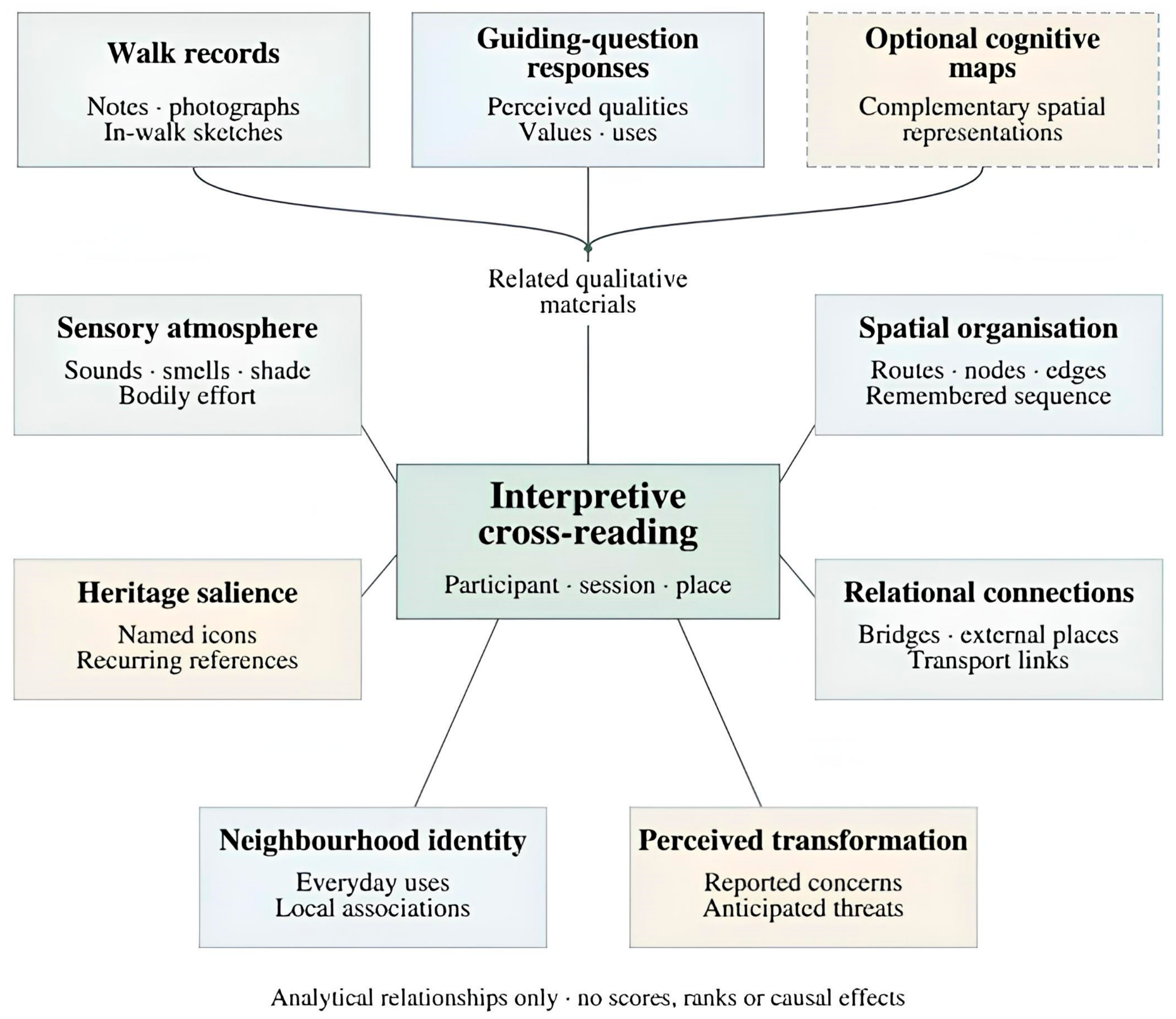
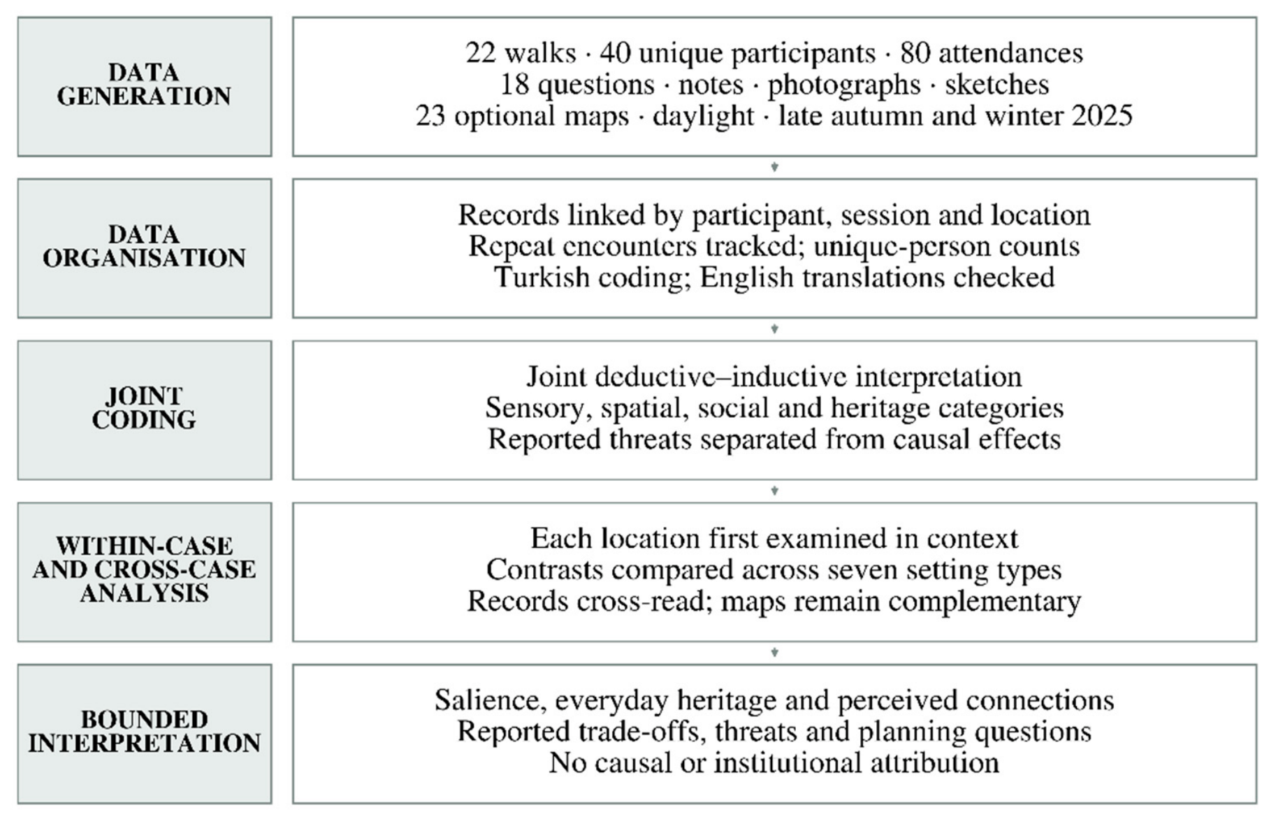
Figure 4 links the principal evidence groups through contextual cross-reading to the analytical dimensions, without assigning scores, ranks or relative evidential weights.
After the within-location analysis, the 22 areas were compared to identify recurring patterns, contrasts and exceptional experiences across monumental, residential, commercial, religious, waterfront, institutional and transport-oriented settings. The comparison concerned meanings attached to places rather than a ranked assessment of all 22 areas by every participant. Location-specific groups, repeat exposure and prior familiarity differed, and the reported comparisons do not provide a common respondent denominator for each spatial quality. Accordingly, the study presents attributed descriptions and contrasts without treating places as the best or worst on a standardised scale. High activity, for example, could be associated with vitality and connectedness in one account but sensory overload or reduced walkability in another.
Raw counts are reported as descriptive summaries of the 40 unique participants, not as estimates of population preferences. For questions requiring a single principal response, each participant contributed one entry to the recorded distribution. When several iconic structures were named, the one explicitly presented as principal or most strongly emphasised was retained for the summary; other references remained in the qualitative interpretation. Observations from repeat walks remained separate location-specific encounters. The reported summaries do not supply a session-by-session reconciliation of changing principal responses or a distribution of walks per person, so equal exposure and stable preferences cannot be assumed. No statistical power calculation, confidence interval or significance test was used: the study pursued situated qualitative interpretation, not a prespecified population or between-group inference.
We developed higher-order themes through repeated joint comparison of codes, analytical categories, and original materials. We retained a theme when it was supported by more than one data form, recurred across locations, or explained a meaningful contrast or exceptional case; we also preserved less frequent and contradictory accounts. We did not calculate an algorithmic convergence threshold or an independent inter-rater reliability coefficient. Collaborative interpretation and discussion supported theme development; these procedures do not demonstrate independent coding reproducibility. Credibility instead rested on a shared codebook, traceable participant-session-location identifiers, cross-reading of five data forms, repeated return to the original material, and explicit evidential limits. Cross-reading was interpretive triangulation, not an independent validation test, because materials could originate from the same participants and encounters. The resulting themes are situated and time-bound interpretations, not objective measurements, population-representative claims or causal demonstrations of transformation.
Figure 5 summarises this workflow.
4. Results: Relational Heritage, Spatial Memory, and Perceived Transformation
The findings show that participants did not perceive Istanbul’s Historical Peninsula as a fixed collection of protected objects. Instead, they produced a dual image: an uneven, monumental hierarchy and a wider, lived landscape organised through neighbourhood institutions, routes, commerce, transport, sensory atmospheres, and everyday practices. Because the study did not measure change longitudinally, the results concern perceived continuities, transformations and threats. Across the four themes below, participants described transformation as consequential when they anticipated alterations to visibility, access, movement, function, atmosphere or use. These accounts identify perceived vulnerabilities in heritage relationships, not observed effects of a measured intervention.
4.1. Monumental Salience, Everyday Heritage, and Identity
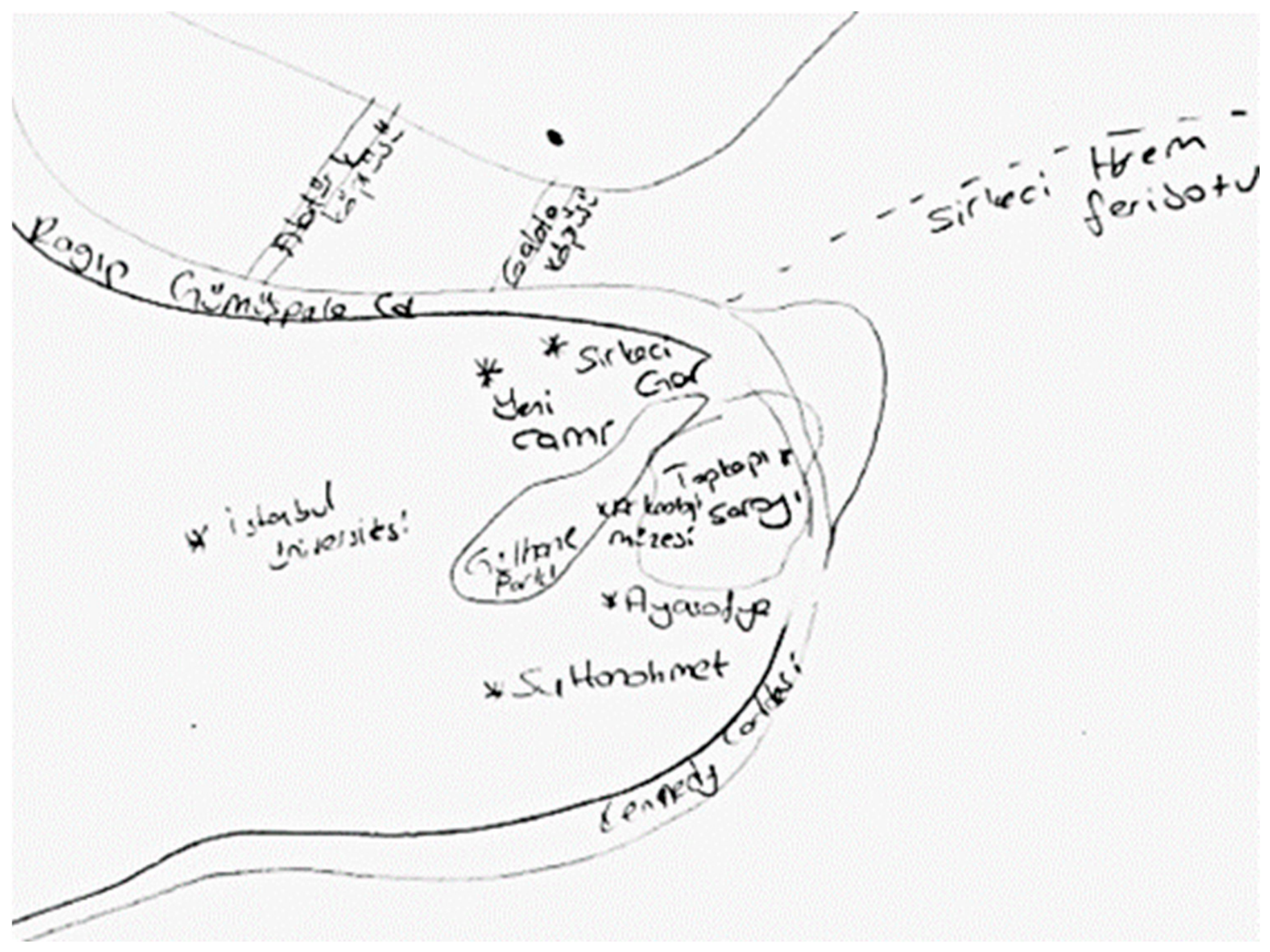
All 40 participants responded to the question about iconic structures, and each participant was coded for one principal structure. Hagia Sophia was identified most frequently (n = 10), followed by Topkapı Palace (n = 9), Süleymaniye Mosque (n = 8), the Blue Mosque (n = 7), the Aqueduct of Valens (n = 4) and the Great Walls of Constantinople (n = 2). The post-walk maps similarly concentrated on the eastern monumental core, often representing Hagia Sophia, Topkapı Palace and the Blue Mosque as individual landmarks or a combined heritage zone. Gülhane Park, the Archaeological Museum, the Hippodrome and Sarayburnu extended this image into a larger landscape of architecture, greenery, public space and waterfront.
Süleymaniye Mosque formed a second landmark system connected to Eminönü, Mahmutpaşa, Vefa and the Golden Horn. The Aqueduct and the city walls operated more locally in relation to Saraçhane, Aksaray, Edirnekapı, Ayvansaray and Yedikule. Less canonical landmarks—including Bulgur Palas, Küçük Hagia Sophia, Hagia Irene, the Fener Greek Orthodox Patriarchate, Mihrimah Sultan Mosque, Fatih Mosque, the New Mosque and Yedikule Dungeons—were associated with route memory, orientation and neighbourhood identity. Within this sample, internationally recognised monuments and locally familiar structures appeared together in heritage recollection.
Neighbourhood associations revealed the everyday settings through which people inhabited this monumental framework. Kocamustafapaşa, Haseki, and Çapa were linked mainly to hospitals and student accommodation, whereas Yedikule, Samatya, and Cankurtaran were associated with the coastline, seagulls, and healthcare functions. Eminönü produced a denser associative image combining Galata Tower, fish sandwiches, large ships, piers, Galata Bridge, the New Mosque, the Spice Bazaar, Sirkeci, food sellers and coffee shops. References to Karaköy, Pera and Taksim linked these accounts to places across the Golden Horn.
Elsewhere, Süleymaniye connected religious monumentality with tea drinking, hookah smoking, and slower café use; Fatih combined Fatih Mosque with wedding-dress shops and bazaars; and Beyazıt centred on Istanbul University, bookshops, cafés, and Beyazıt Square. Yenikapı and Vatan Street were mainly remembered for transport and traffic, while Edirnekapı brought the Great Walls and the Metrobus into a single image. Sultanahmet appeared as a compact, monumental cluster, part of a longer corridor leading to Beyazıt and Aksaray. Fener and Balat, by contrast, were associated with historic housing, second-hand jewellery shops, graffiti and the Patriarchate, giving them an image based on domestic architecture, religious diversity, small-scale commerce and perceived everyday authenticity.
These findings suggest two interconnected forms of perceived continuity. Monumental continuity was associated with recognisable landmarks and spatial compositions; lived continuity with institutions, commerce, food, mobility, coastal atmosphere and repeated practices. Participants’ accounts therefore connected heritage and memory to neighbourhood life as well as to designated monuments. Whether changes in these relationships subsequently alter memory would require longitudinal evidence.
The contrast also revealed a representational hierarchy. Internationally recognised monuments supplied a shared image within this participant group, whereas neighbourhood identities depended on more local combinations of housing, worship, trade, institutions, food, graffiti, and routine movement. The hierarchy does not show that institutions imposed one form of heritage on participants; it indicates differing scales of reported recognition among monumental and everyday references.
4.2. Routes, Edges, and Relational Territoriality
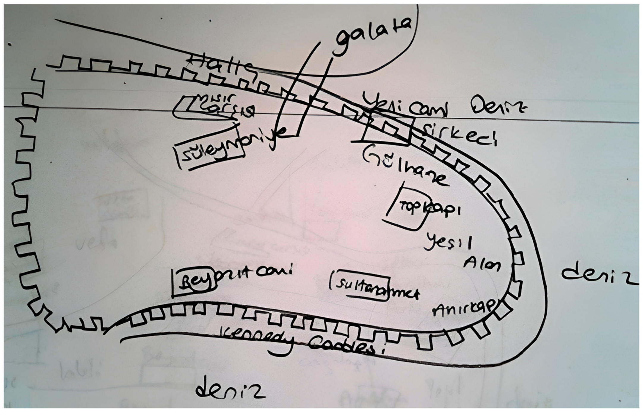
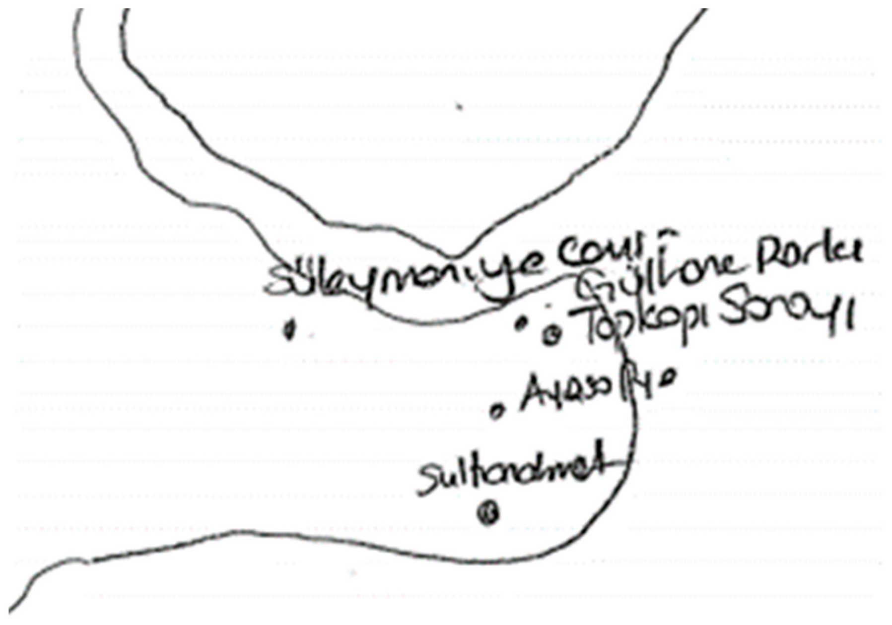
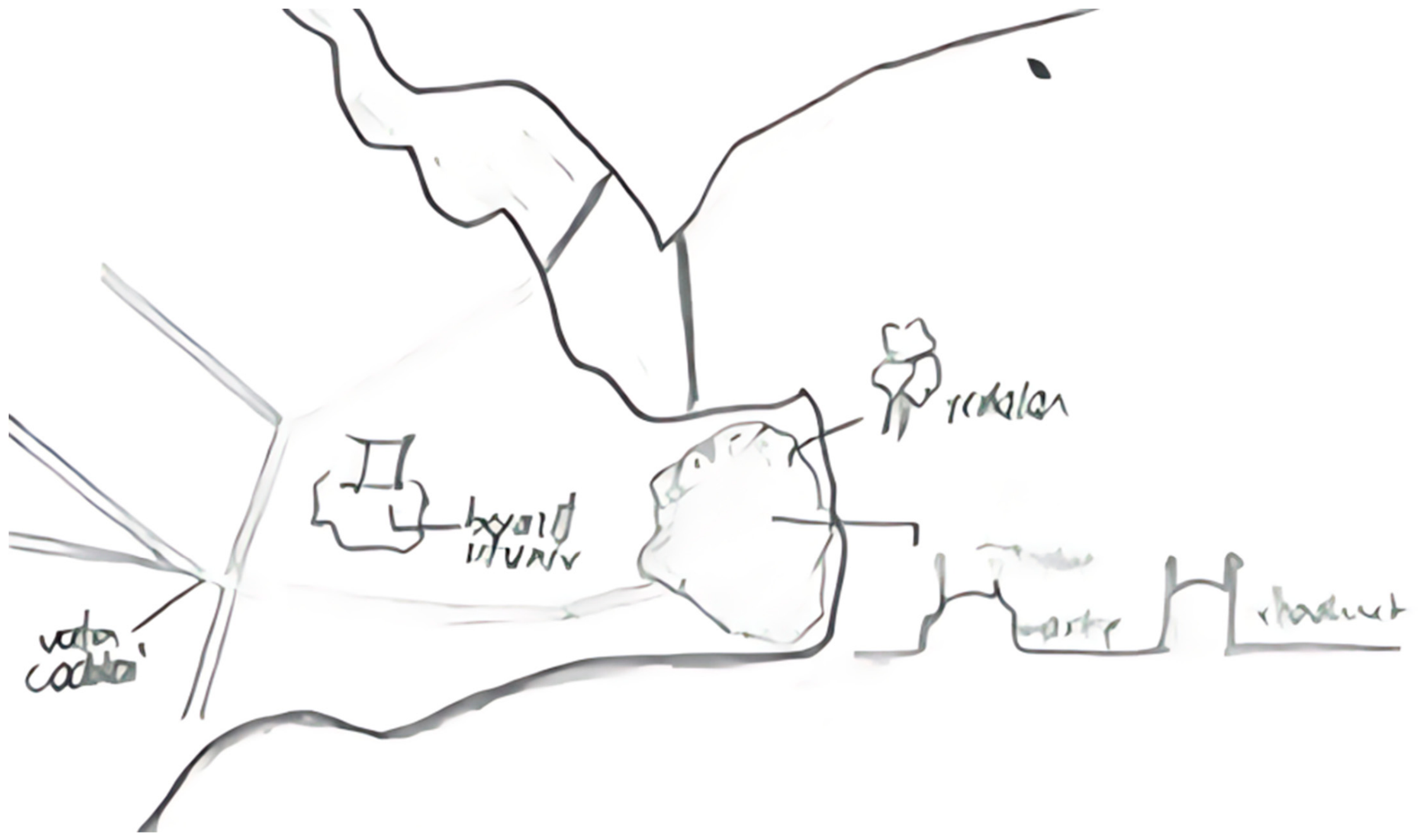
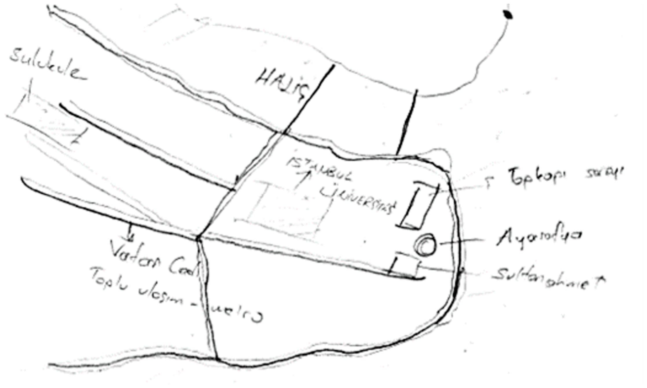
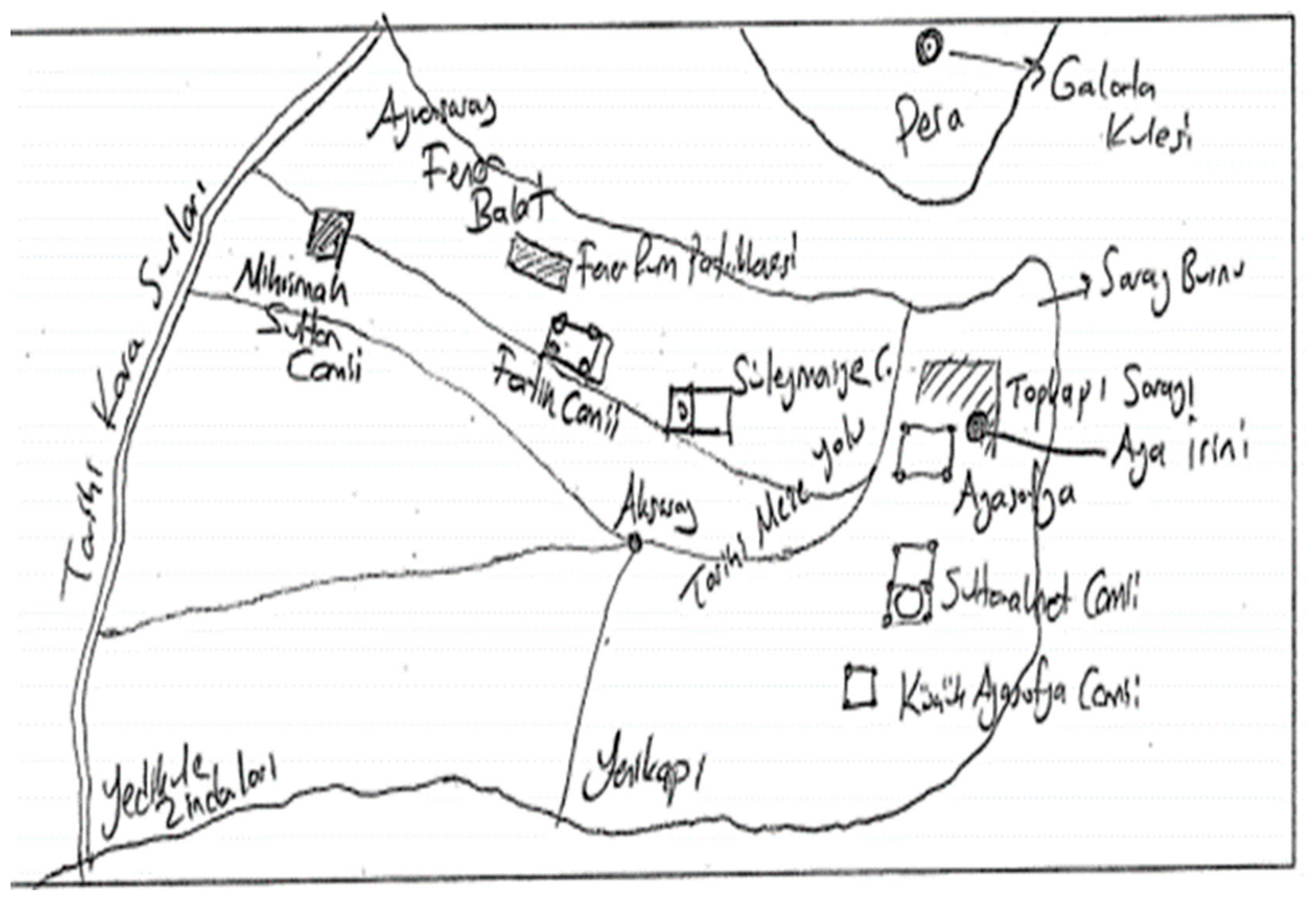
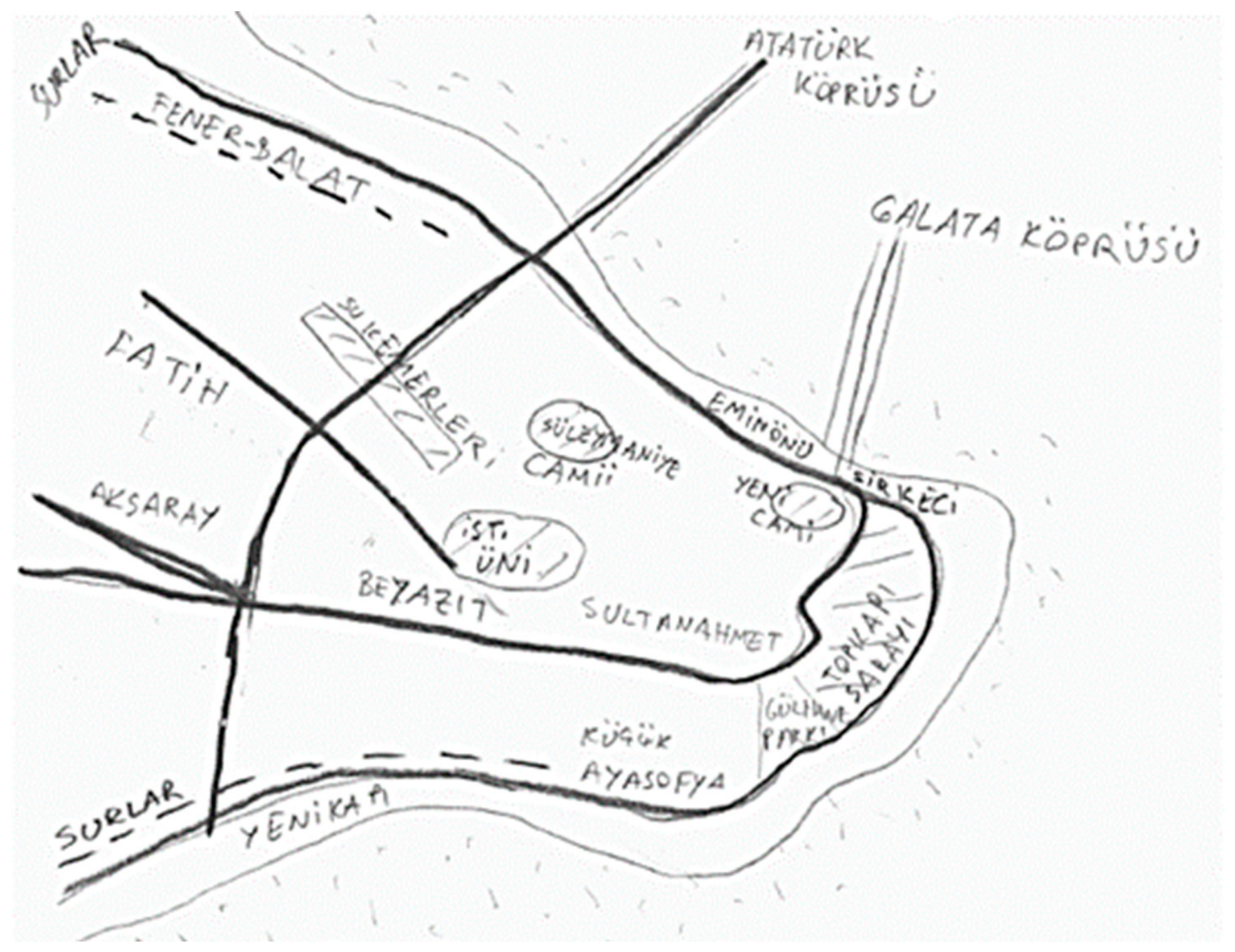
The 23 optional post-walk maps were analysed as complementary qualitative evidence rather than standardised representations produced by all participants. Drawing confidence, scale, level of detail, and legibility varied. Analysis therefore focused on relative emphasis, omission, sequence, boundary crossing, and relationships among features, and checked every interpretation against notes, photographs, sketches, or question responses where available.
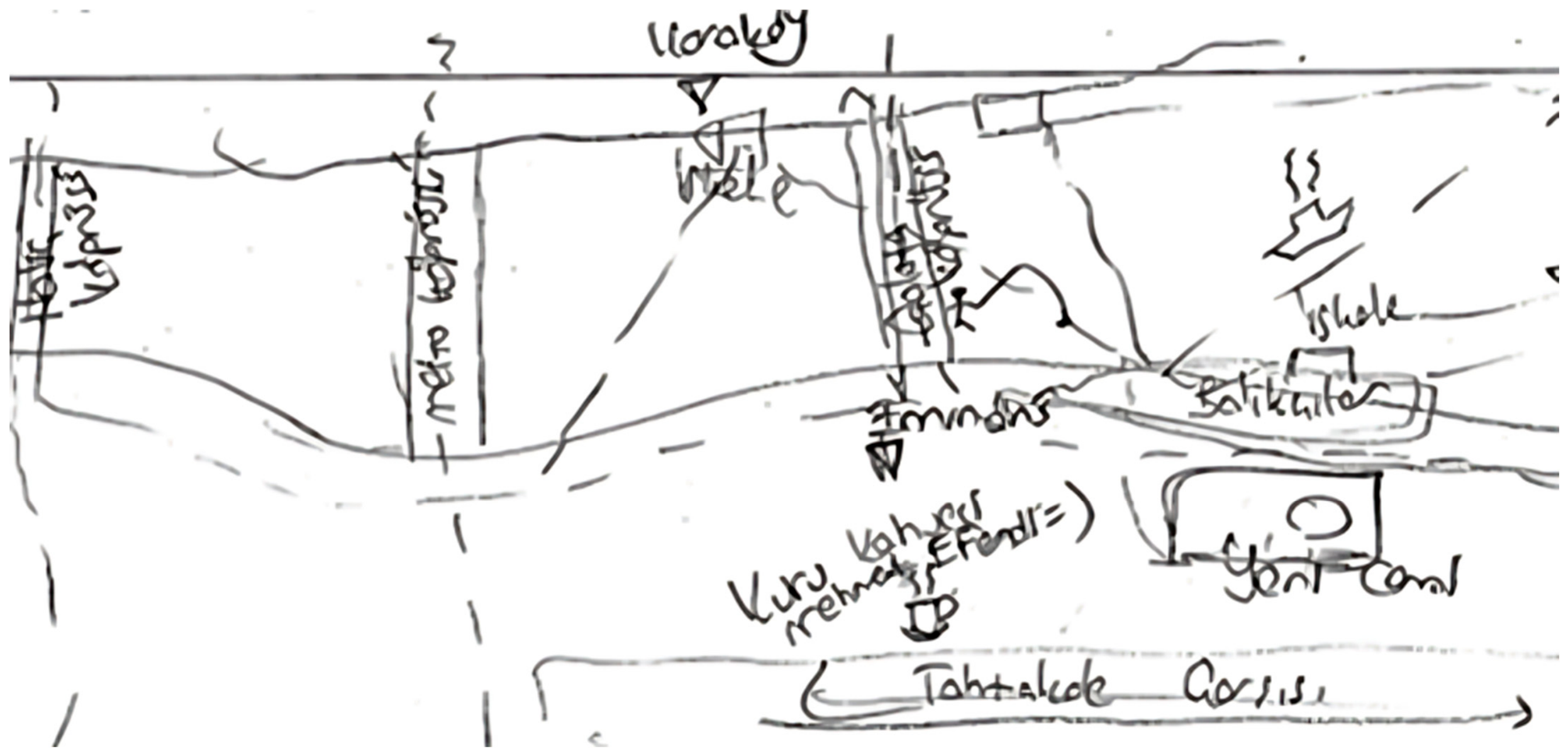
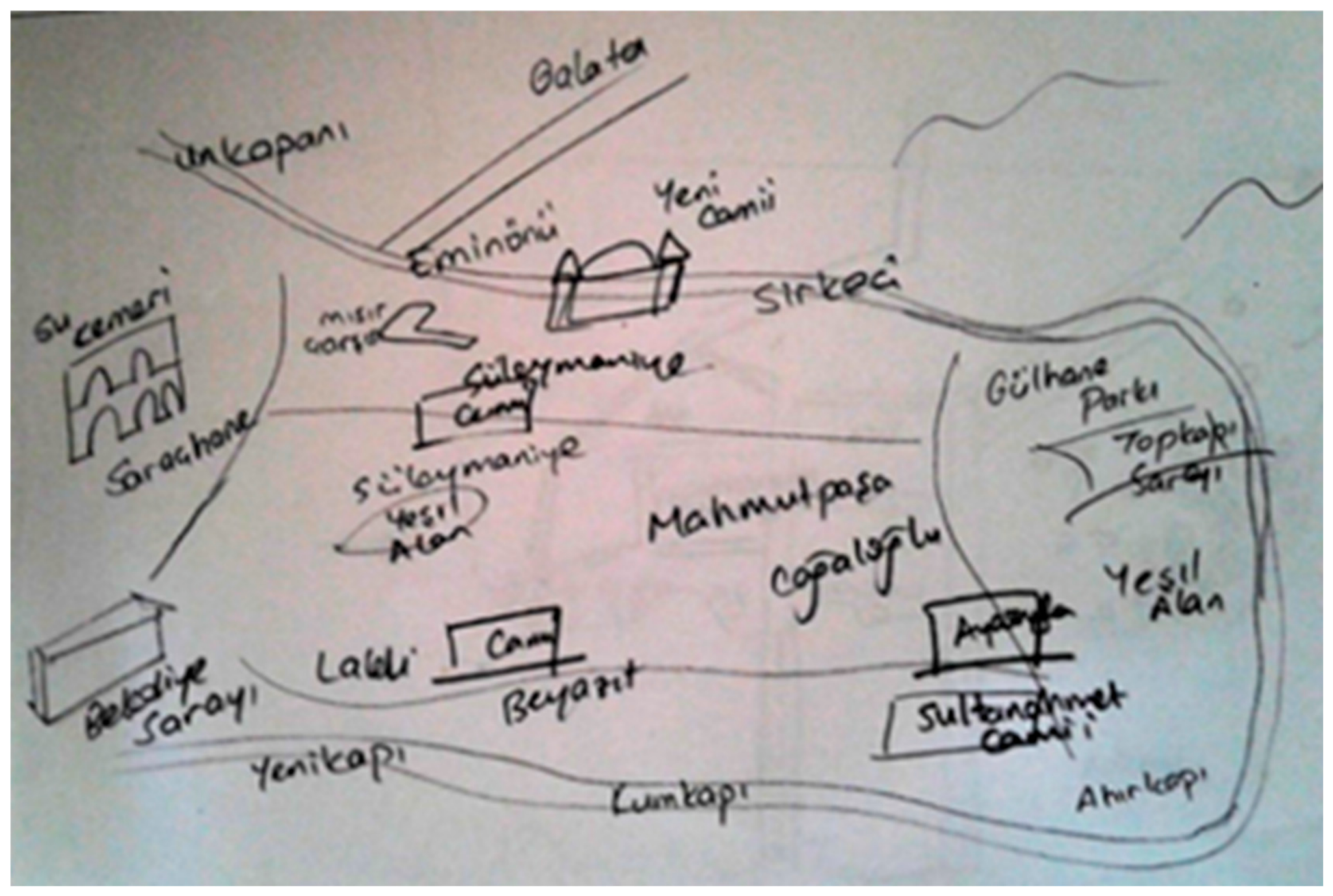
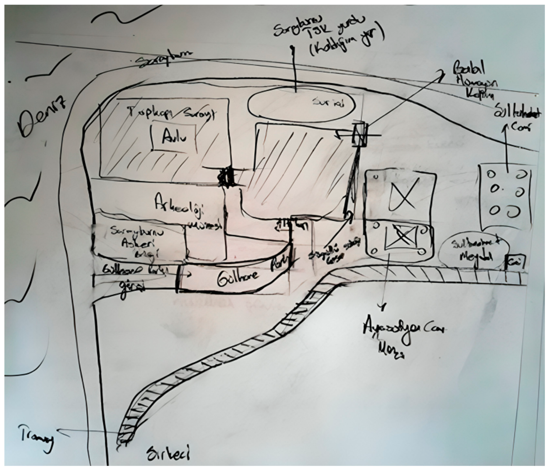
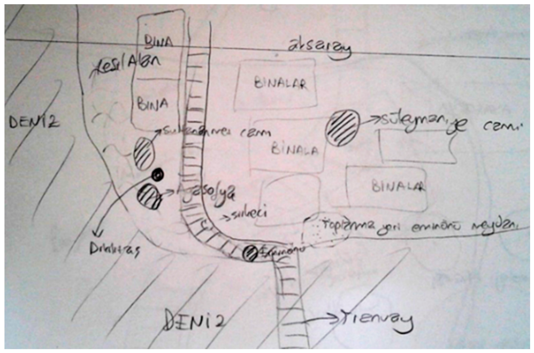
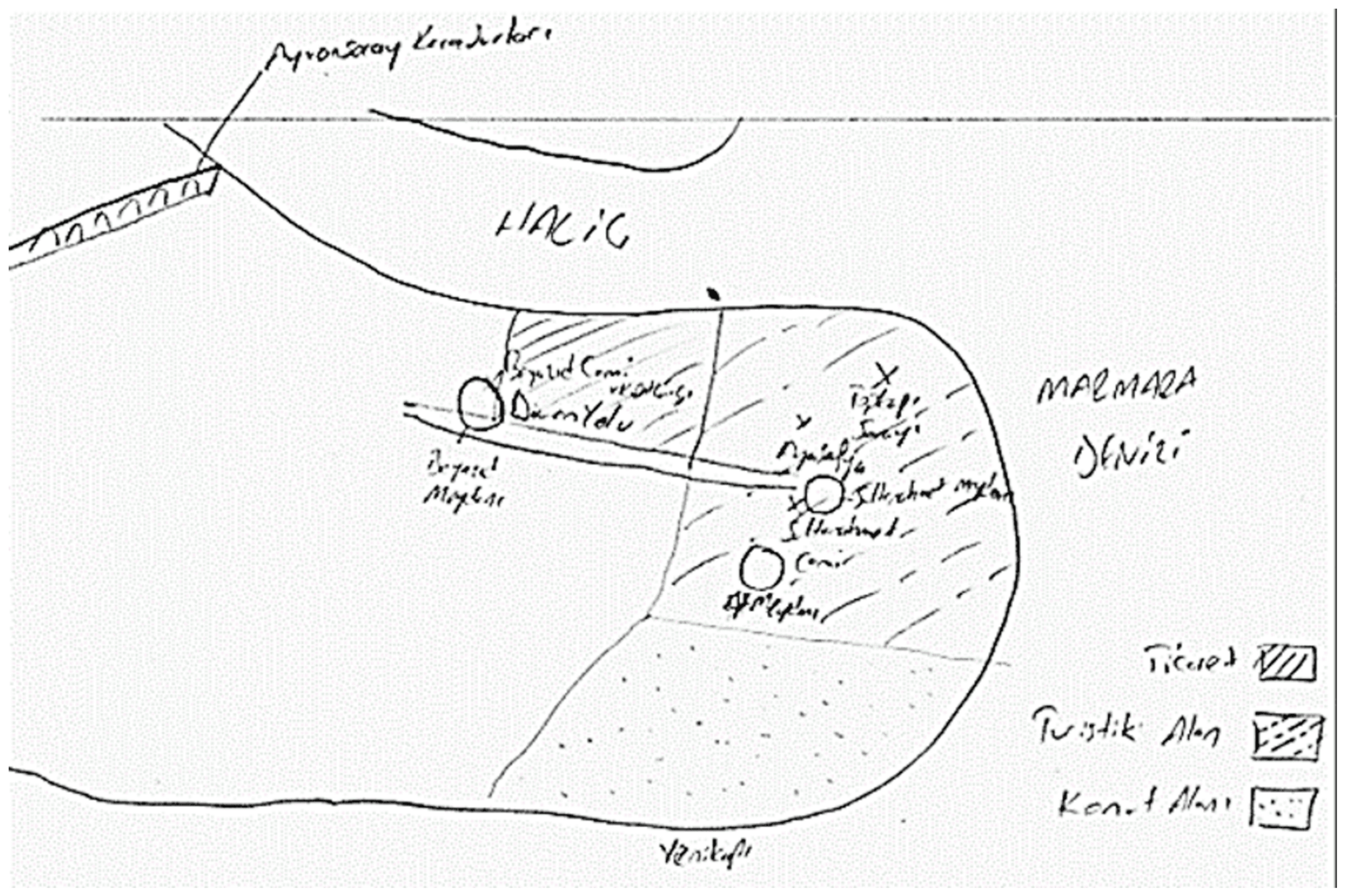
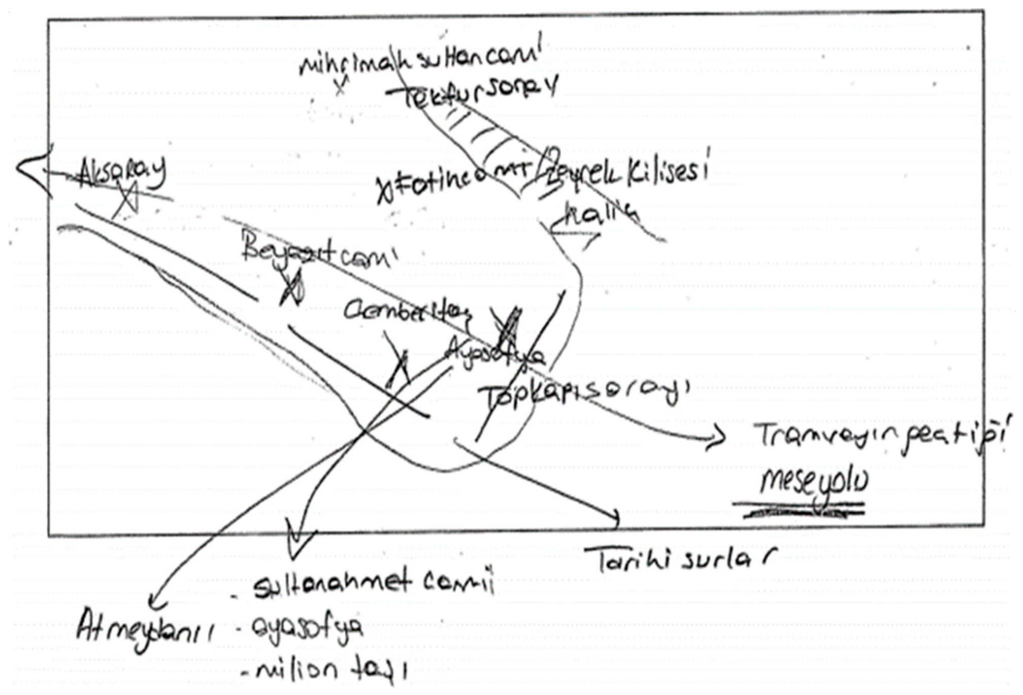
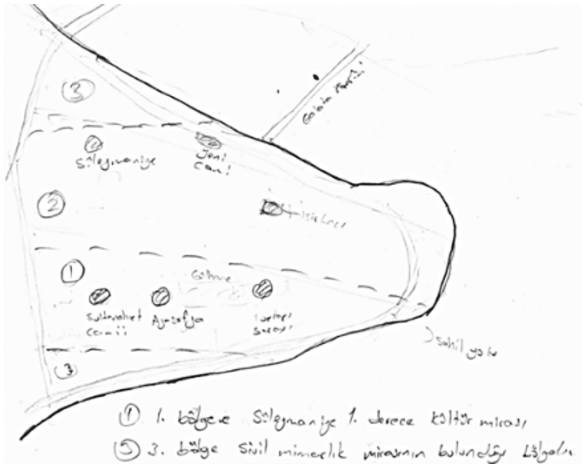
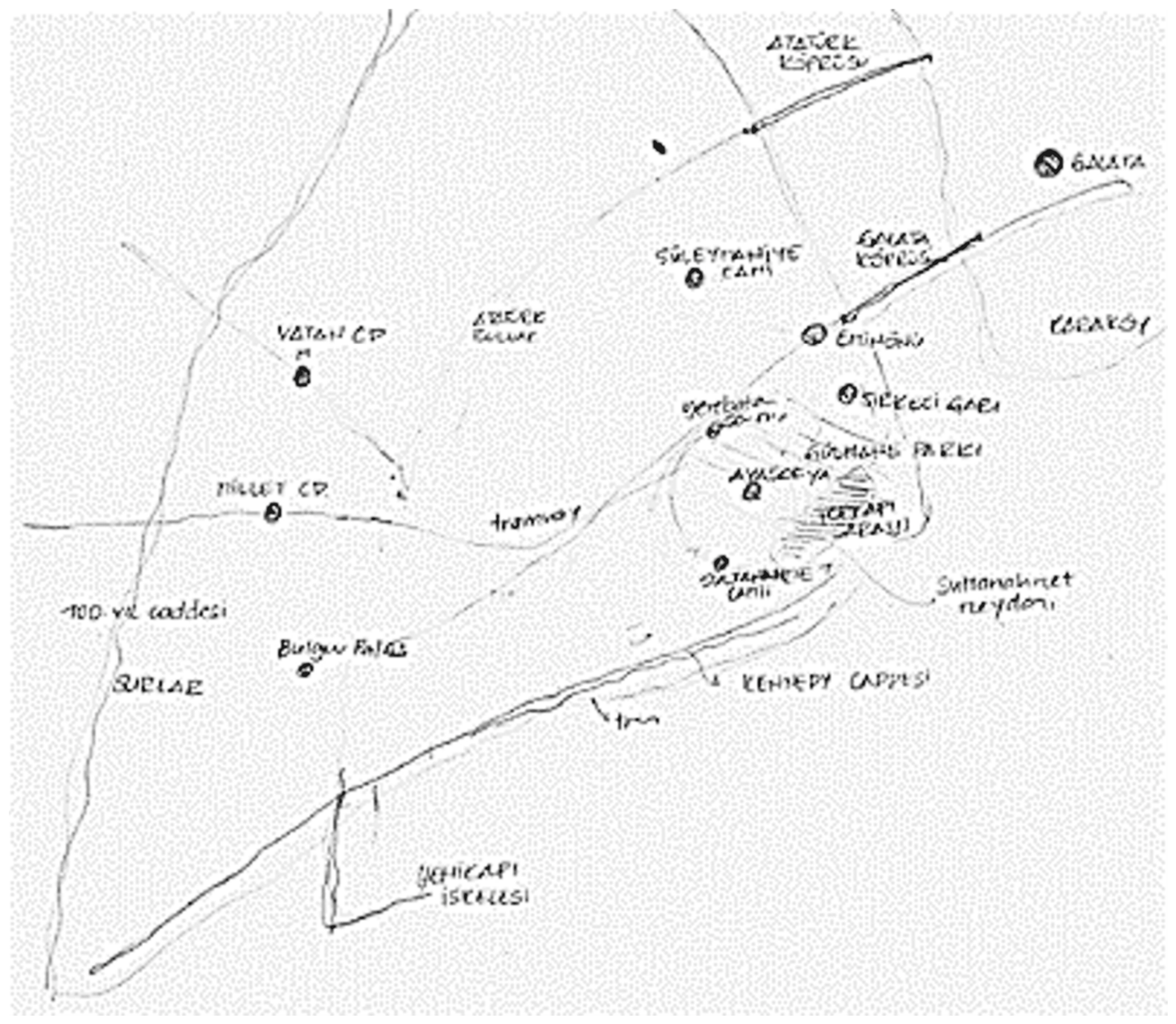
Topkapı Palace, Hagia Sophia and the Blue Mosque formed a recurring monumental cluster, illustrated in
Figure A10 and
Figure A22 (
Appendix A). Some participants compressed the eastern Peninsula into a few symbolic structures, while others differentiated the palace compound, Gülhane Park, the Archaeological Museum, the Hippodrome, the tramway and surrounding streets. Süleymaniye Mosque provided a second orienting centre connecting the Golden Horn, interior neighbourhoods and commercial districts. The Aqueduct of Valens, Istanbul University, the Fener Greek Orthodox Patriarchate, Yedikule Dungeons and Bulgur Palas supported more localised spatial memories. These associations fit several explanations, including symbolic recognition, institutional identity, familiarity, and route exposure; the present materials cannot isolate their respective effects.
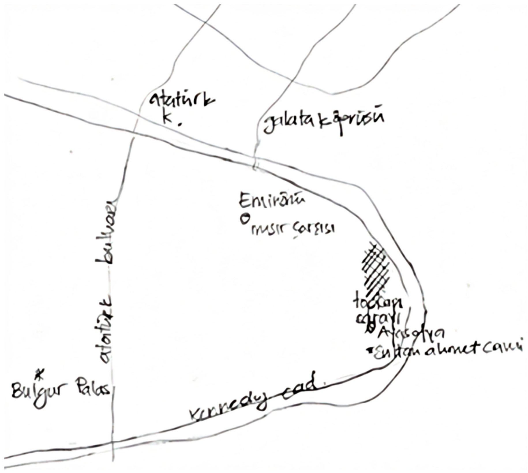
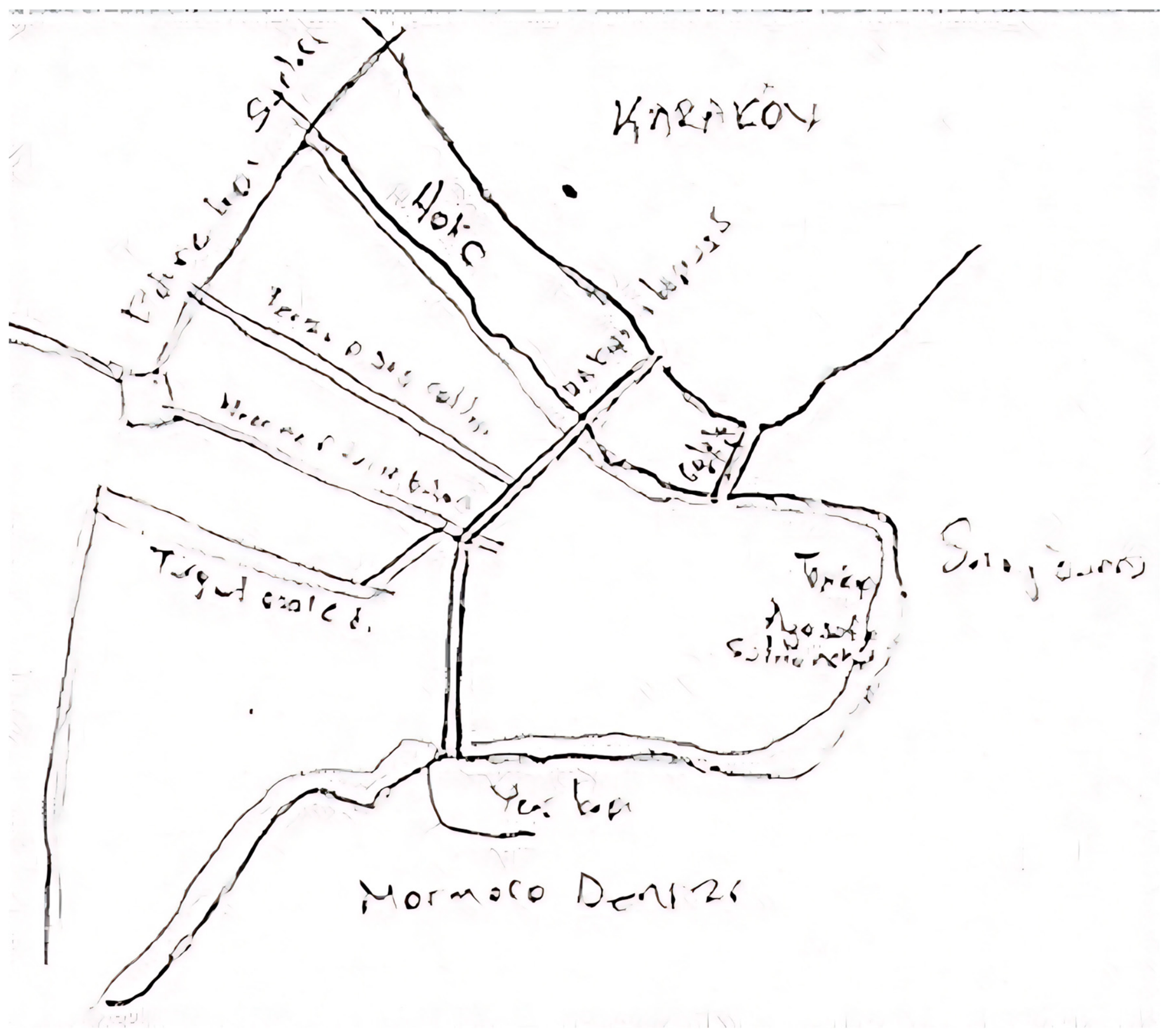
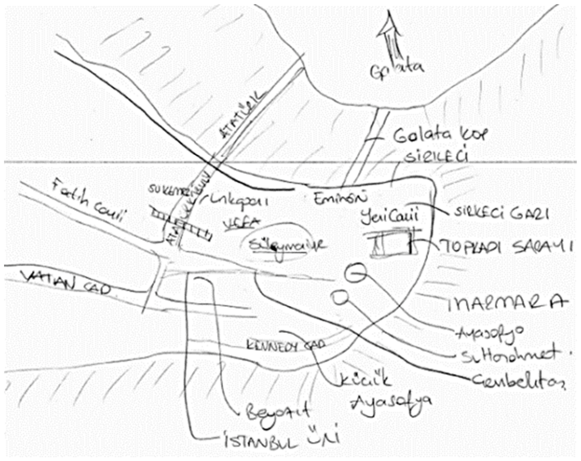
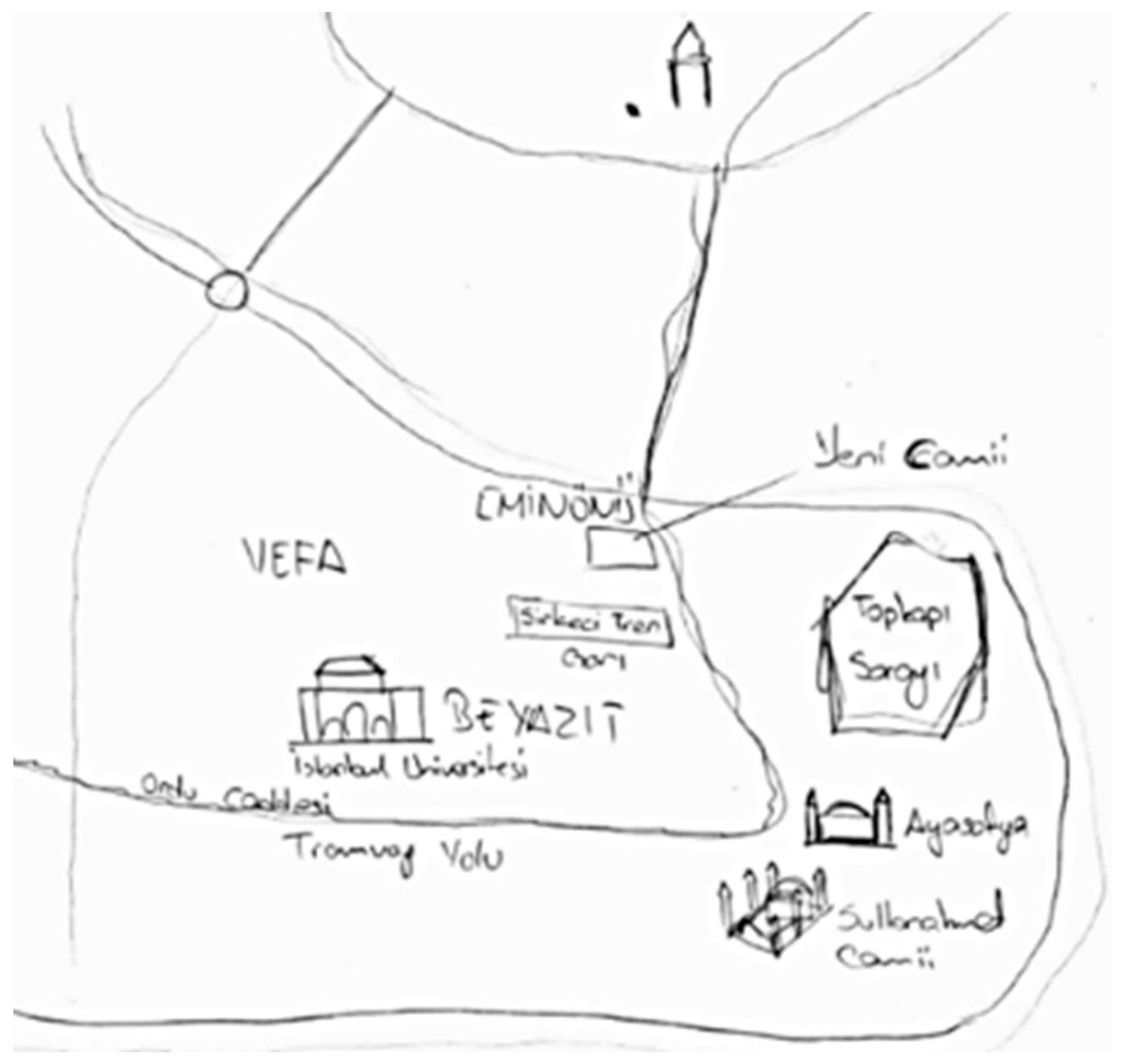
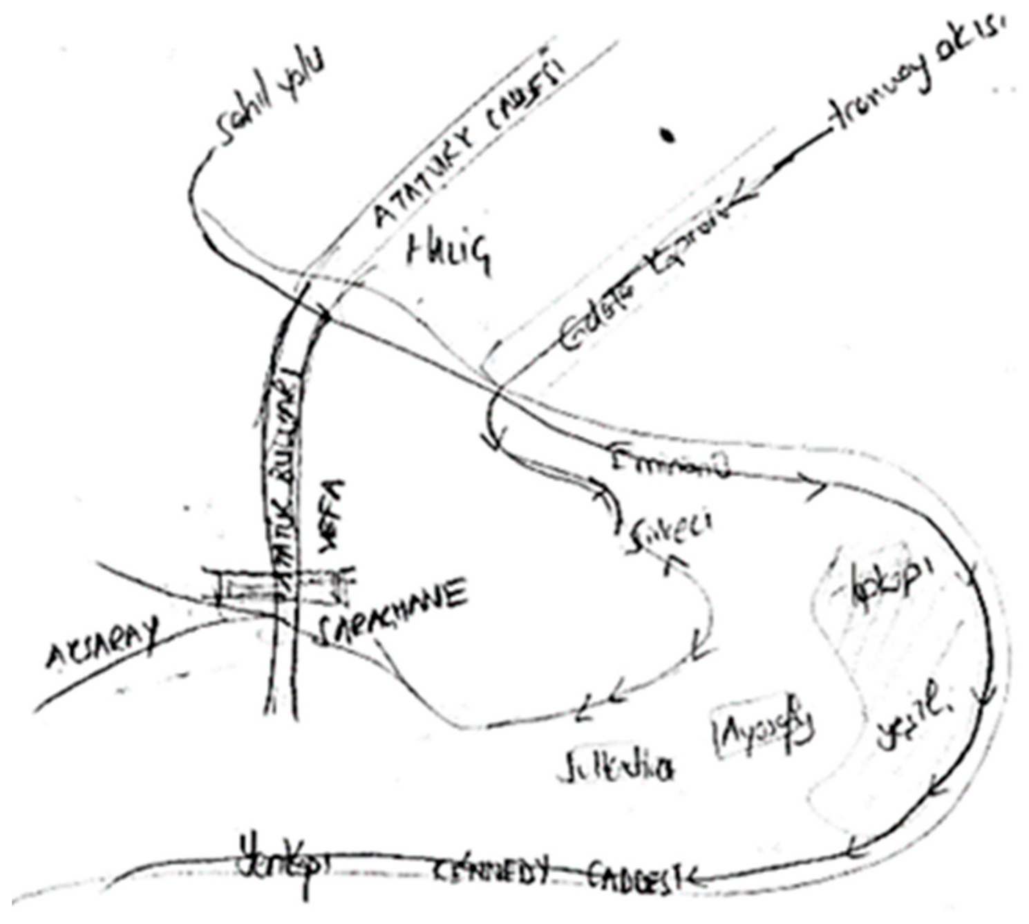
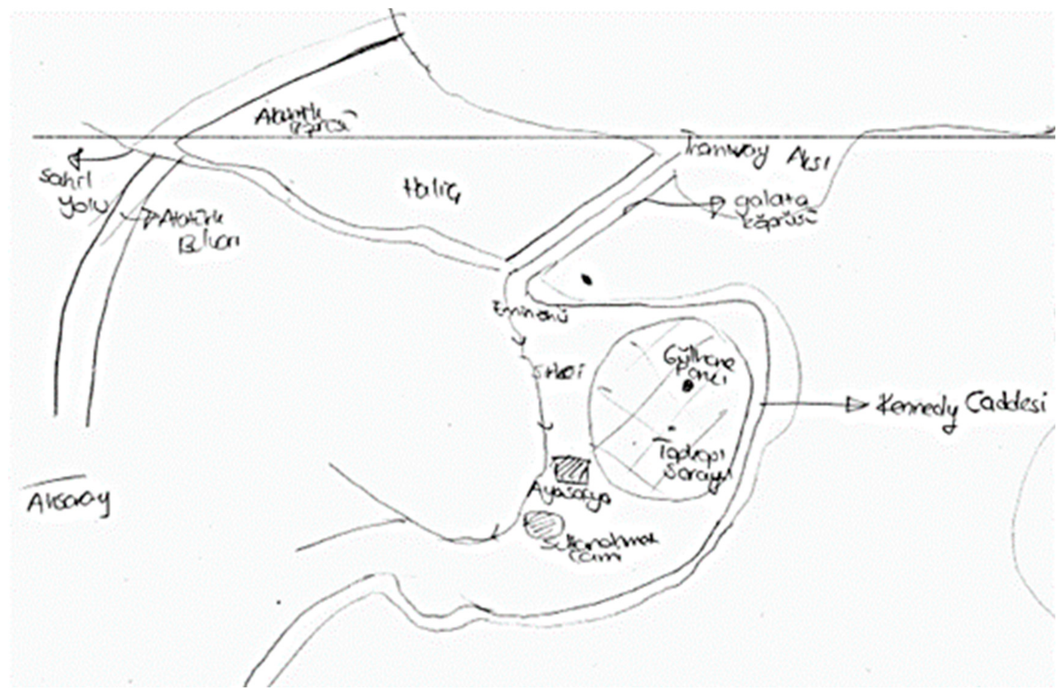
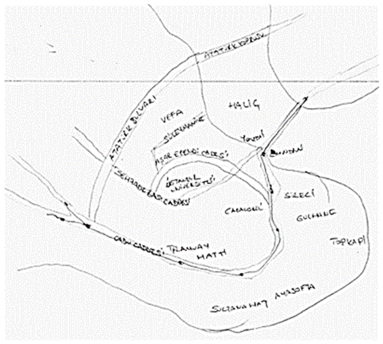
Roads and transport corridors provided another organising system. Vatan Street, Fevzipaşa Street, Millet Street, Atatürk Boulevard, Kennedy Street, Ordu Street, Ragıp Gümüşpala Street and the tramway frequently structured the maps. Atatürk Boulevard connected Aksaray, Vefa, Saraçhane and the Golden Horn; Kennedy Street functioned as both a coastal route and territorial edge; and the tramway ordered Aksaray, Beyazıt, Sultanahmet, Sirkeci and Eminönü sequentially. The historical Mese–Divanyolu axis remained cognitively active through its contemporary street and tram system, while Fevzipaşa Street was remembered through Mihrimah Sultan, Fatih and Süleymaniye mosques.
Figure A5 and
Figure A15 illustrate the organising role of roads and bridges. The accounts link inherited routes to present-day movement without explaining how either shaped their prominence in memory.
The maps varied between monument-centred and route-centred representations. The former compressed the Peninsula around symbolic landmarks; the latter emphasised direction, connection and accessibility. Some combined both by drawing major monuments individually while generalising the surrounding fabric. This variation is consistent with differences in symbolic recognition, route familiarity and everyday mobility, but drawing confidence and the mapping task may also have contributed. This design cannot separate their effects.
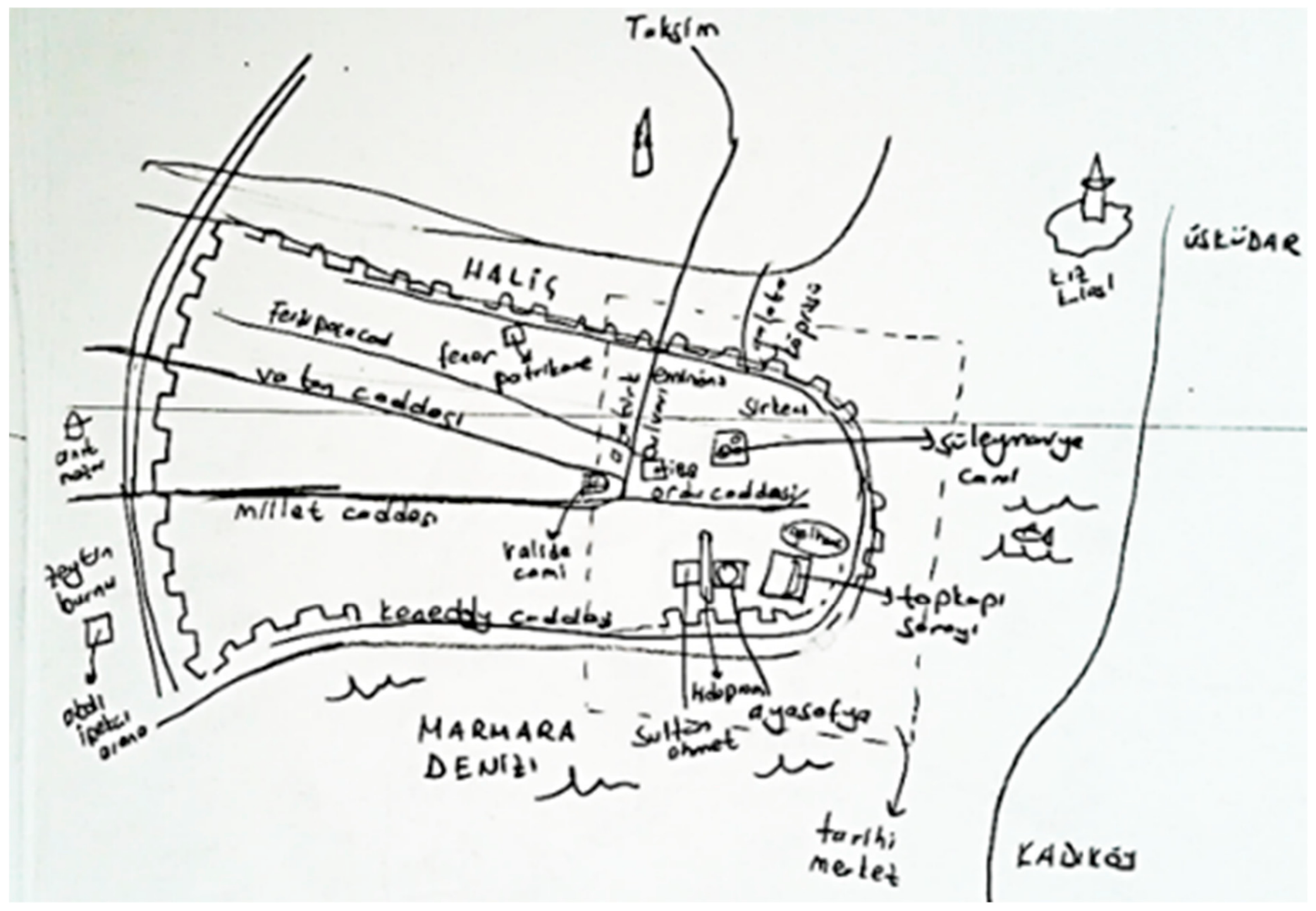
Bridges and waterfronts extended participants’ representations beyond the study area’s geographical boundary.
Figure A14 names Taksim, Üsküdar and Kadıköy, while
Figure A22 includes Pera and Galata; these are traceable examples of external references rather than evidence of measured travel flows. Galata Bridge linked Eminönü, Sirkeci, Karaköy, Galata Tower, the tramway, piers and the New Mosque, while Atatürk Bridge connected Unkapanı, Saraçhane and Aksaray with the Golden Horn. References to Galata Tower, Karaköy, Taksim, Pera, Üsküdar, Kadıköy, the Maiden’s Tower and Zeytinburnu further showed that the Peninsula was cognitively organised through visibility, bridges, ferries and metropolitan transport networks.
The Golden Horn, the Marmara coast and the city walls formed the main edges. The Golden Horn operated simultaneously as a boundary and a field of connection; the Marmara coast appeared more often as a linear edge or traffic corridor; and the walls worked at both territorial and neighbourhood scales in Edirnekapı, Ayvansaray and Yedikule. Districts were differentiated by form, activity, and cultural identity: Sultanahmet as monumental and touristic; Eminönü as commercial, transport-oriented, and waterfront-based; Beyazıt as institutional and commercial; and Fener and Balat as residential and culturally distinctive. Some maps explicitly divided the Peninsula into touristic, commercial, residential and heritage-oriented territories.
Nodes concentrated movement and historical meaning. Beyazıt Square, Sultanahmet Square, the Hippodrome, Eminönü Pier, Sirkeci Railway Station, Aksaray and Yenikapı Pier were described in association with intersecting routes, activities and landmarks. Sirkeci combined railway, ferry, tram, and everyday circulation; Eminönü brought together piers, bridges, markets, religious architecture, food sellers, and commercial smells. Food sellers and coffee shops functioned as sensory landmarks and activity nodes, while Gülhane Park and the green areas around Topkapı Palace and Süleymaniye served as districts, atmospheric transitions, and affective reference points.
The coding pathway can be illustrated through specific observations. References to spice and herb smells in the Spice Bazaar were first coded as olfactory intensity and commercial activity, then related to sensory landmarks and everyday heritage. Seagull calls, ship sounds, fish-sandwich sellers, and coffee smells around Eminönü were coded separately as auditory, olfactory, food-practice, and mobility observations; their contextual association with piers, markets and Galata Bridge informed the higher-level theme of a waterfront-commercial node. Notes on shade and greenery in Gülhane were coded as reported thermal comfort, visual relief, and walking support and contributed to the theme of atmospheric transition. Reports of traffic noise, broad road sections, and difficult pedestrian continuity in Yenikapı and along Kennedy Street were coded as sensory intensity, vehicular scale, and bodily effort and informed the environmental trade-off between metropolitan access and local walkability.
Appendix B summarises these observation–code–theme links as paraphrased analytical examples. They are not verbatim participant quotations, calibrated sensory measurements or statistical tests of spatial co-location.
Participants compressed distant areas, enlarged landmarks and merged elements. We interpreted these features alongside participants’ reported functional, cultural, and sensory associations as aspects of situated spatial representation. We did not treat these features independently as evidence of cognitive salience or assess them for cartographic accuracy. The resulting spatial memory was centred on the eastern monumental core but extended through inherited routes, neighbourhoods, institutions, waterfronts, transport systems and everyday sensory activity. The accounts suggest that transformation could reshape these remembered relationships, but the study did not demonstrate this effect.
These extensions are important for relational social geography. The maps did not portray the Peninsula as an isolated heritage container: bridges, ferries, coastlines, views, and transport corridors connected it to Karaköy, Galata, Taksim, Üsküdar, Kadıköy, Zeytinburnu, and the wider metropolis. They do not demonstrate direct rural linkages, because participants did not trace rural origins, destinations, value chains, or resource flows. They nevertheless show that the perceived geography of an urban core extended beyond the study area’s geographical boundary and was organised through multi-scalar mobility and association.
4.3. Uneven Access, Mobility, and Environmental Trade-Offs
Participants described contrasting, context-dependent spatial qualities. Integration, connectivity, permeability and walkability denote perceptions elicited by the guiding questions, not space-syntax values, instrument readings or network metrics. Because participants did not constitute an equally exposed assessment panel for all locations, the following examples identify situated contrasts rather than an overall ordering of places. They combine reported route experience with prior familiarity; their relative contributions cannot be separated.
The Blue Mosque area was described as readily legible, with recognisable monuments, public spaces and sequential landmarks supporting participants’ accounts of orientation in Sultanahmet. Vatan Street was associated with greater orientation difficulty and a vehicular corridor with fewer differentiated pedestrian references. Eminönü was described through connections among ferries, piers, the tramway, Galata Bridge, markets, religious landmarks and pedestrian movement. Accounts of Samatya emphasised weaker connections to larger circulation systems alongside enclosure, tranquillity, familiarity and neighbourhood identity. These are contrasts between reported experiences, not measured differences in integration.
The Grand Bazaar and Mahmutpaşa were associated with connected passages, commercial streets, and dense pedestrian movement, along with crowding, sensory overload, or disorientation. Aksaray Metro Station was described in relation to spatial looseness, transfers, waiting and temporary occupation; Atpazarı Square was associated with flexibility, youth and changing informal uses. Laleli’s tourist identity was linked to hotels, trade and transnational mobility, whereas Sultanahmet was described through monument-oriented tourism. In participants’ accounts of distinctiveness, the Spice Bazaar brought together architectural heritage, commerce, spices, herb smells, and visitor activity.
Divanyolu was described through pedestrian and tram connections among Beyazıt, Çemberlitaş and Sultanahmet, while accounts of Kennedy Street emphasised vehicular continuity and more difficult pedestrian or neighbourhood connections. Fener and Balat were associated with varied building types, periods, façades and street relationships; descriptions of Çapa foregrounded hospitals and more repetitive institutional forms. These examples concern perceived diversity and connectedness, without a building inventory, common rating scale or network analysis.
Participants associated Eminönü with multiple routes, transport modes and passages. Accounts of Kadırga linked narrow streets, topography and residential enclosure to constrained wider connections, while also mentioning privacy and local identity. The Topkapı–Gülhane–Sultanahmet area was described as supportive of walking through greenery, landmarks, pedestrian routes and environmental interest. In Yenikapı, accounts of walking difficulty highlighted traffic infrastructure, large transport spaces, and discontinuous pedestrian relationships. Neither comparison establishes a measured permeability or walkability ranking.
İsmailağa was associated with privacy, residential and religious character, enclosure, and social codes; Beyazıt Square with publicness, the university, the mosque, commerce, transport, and varied users. Gülhane, the Hippodrome and the surroundings of Hagia Sophia appeared in accounts of greenery, orientation and sensory relief, without measured comparisons of vegetation cover. Sirkeci Railway Station was associated with temporality through railway memory, ferries, the tramway and contemporary circulation. Aksaray was described through pedestrian activity despite substantial traffic, whereas accounts of Millet Street foregrounded its broad road section and vehicular scale.
The participant-reported assessments reveal perceived environmental trade-offs rather than a measured opposition between conservation and change. Monumental concentration was associated with stronger legibility and greater tourism pressure; commercial density with vitality, connection, crowding, and sensory stimulation; transport infrastructure with metropolitan access but weaker local walkability; and residential enclosure with lower permeability but greater privacy and familiarity. These relationships were not tested using space syntax, pedestrian counts, acoustic instruments, or other objective spatial indicators. They identify hypotheses and planning questions for subsequent mixed-method research rather than verified physical effects.
Here, unevenness refers primarily to contrasts among settings and modes of use. The relatively homogeneous participant group does not support comparative claims about class, ethnicity, age, disability, migration status, or urban–rural identity. The findings identify where differentiated access and experience became perceptible and establish questions for more socially diverse research rather than demonstrating population-level inequality.
4.4. Heritage Values, Perceived Threats, and Observed Salience
Participants valued the Historical Peninsula as a layered, actively inhabited cultural landscape rather than a collection of protected monuments. Reported concerns included silhouette change, urban regeneration and loss of authenticity. No participant-level frequency distribution is presented for these concerns, so they are discussed as themes rather than a ranked prevalence of threats. These responses record participants’ concerns about existing tendencies or possible future change; the cross-sectional design cannot demonstrate that regeneration had already altered heritage memory. Concern about the silhouette reflected perceived relationships among domes, minarets, topography, coastlines, and surrounding fabric.
Participants did not automatically regard urban regeneration as improvement; their concerns addressed possible changes to routes, material relationships, neighbourhood identities, everyday uses and architectural form. The prominence of the Bulgur Palas, the Fener Greek Orthodox Patriarchate, the Aqueduct of Valens, Istanbul University, and the Yedikule Dungeons was consistent with participants’ accounts of continuity at neighbourhood and route scales. Loss of authenticity was associated with historic housing, specialised commerce, food environments, religious practices, informal visual expression and continuing social activity. Fener and Balat combined domestic architecture, small-scale commerce, graffiti and the Patriarchate, while Süleymaniye connected the mosque with cafés, tea drinking and hookah practices. Authenticity was therefore understood as an ongoing relationship among inherited fabric, contemporary occupation and atmosphere rather than as visual immobility.
Among the 40 principal responses, 13 participants selected architectural texture richness, 11 selected historical value, 6 selected cultural diversity, 4 selected spirituality, 4 selected liveliness, and 2 selected tranquillity. These raw counts reflect the principal selections recorded in this purposive sample. They do not estimate population preferences or establish statistically significant differences between values. Architectural texture richness referred to differences in building type, scale, period, material, façade, and street relationship. Historical value encompassed monuments, walls, inherited road alignments, railway infrastructure, and continuing movement patterns.
Cultural diversity was expressed through the contrasting identities of Eminönü, Beyazıt, Fatih, Fener, and Balat, and through the coexistence of education, trade, tourism, religion, residence, and transportation. Spirituality was associated with mosques, churches and active religious use. Liveliness was concentrated in Eminönü, Mahmutpaşa, the Grand Bazaar and Beyazıt, where commerce, transport and pedestrian movement overlapped. Tranquillity appeared in accounts of greener, less intensive settings such as Gülhane Park and the surroundings of Topkapı Palace.
The recorded principal purposes of use described another aspect of participants’ relationships with the area: cultural activity by 20 participants, religious practice by 6, shopping by 5, wandering by 4, working by 3, and sport by 2. Cultural engagement included monuments and museums but also walking through neighbourhoods, recognising historical layers and encountering commercial traditions. Religious practice connected sacred heritage with active communities; shopping and working sustained bazaars, specialised shops, booksellers and food sellers; wandering foregrounded exploration and shifting sensory attention; and sport maintained bodily engagement with waterfront and green spaces.
Within this sample, cultural visitation coexisted with worship, commerce, work, exploration and physical activity. Sensewalking documented situated multisensory encounters, while the post-walk maps represented selected spatial relationships informed by both those encounters and prior knowledge. Together, these materials suggest that participants associated heritage continuity with accessibility, use, perception and social meaning as well as surviving fabric. They do not establish that the walk itself produced these memories or that the same associations characterise the wider public.
The findings therefore answer the research questions conditionally: participants anticipated that heritage and memory could be altered when relationships among monuments, routes, neighbourhood functions, sensory atmospheres, and continuing practices were reordered. The cross-sectional evidence identifies perceived vulnerabilities and reported concerns, not before-and-after effects or proof that regeneration has already transformed memory. Heritage-sensitive planning should consequently investigate the routes, uses, institutions, sensory conditions, and social environments that participants associated with lived continuity.
The findings identify a hierarchy of representational salience in participants’ outputs. Monumental structures appeared most consistently, while residential, commercial, religious, and sensory heritage acquired significance through reported familiarity and continuing use. The data cannot separate the effects of monument visibility, route exposure, prior familiarity, design education, or institutional heritage narratives. Nor can they determine how planning institutions, property relations, or decision-making produced these patterns.
Table 3 brings together the main interpretations and their evidential limits.
5. Discussion: From a Bounded Heritage District to a Relational Territory
The study shows that Istanbul’s Historical Peninsula was perceived neither as a homogeneous historic district nor as a collection of isolated monuments. Participants produced a dual geography: an observed hierarchy of monumental salience and a more differentiated landscape of routes, neighbourhood identities, institutions, commerce, worship, transport, food, sensory atmosphere, and everyday use. Potential landscape transformation was considered consequential when participants anticipated changes to access, connection, atmosphere, function, or memory. Because the research was cross-sectional, these are perceived vulnerabilities and concerns rather than measured before-and-after effects.
5.1. Relational Territoriality and the Limits of Bounded Urban Analysis
The cognitive maps can be read through Lynch’s paths, nodes, edges, districts, and landmarks [
20] and relational conceptions of place [
6,
7]. Because the mapping task drew on Lynch’s framework, the appearance of these elements does not independently validate that framework. The Peninsula’s walls and coastlines were materially important boundaries, yet its perceived geography repeatedly exceeded them. Galata Bridge and Atatürk Bridge linked the historic core to Karaköy, Galata, and the Golden Horn; ferries and waterfront views connected it to Üsküdar, Kadıköy, and the Maiden’s Tower; roads, rail, tramways, and the Metrobus placed neighbourhoods within wider mobility systems. The boundary functioned selectively—as an edge, view, climatic exposure, route, and point of connection.
This finding challenges methodological city-centrism without denying the Peninsula’s urban and historical specificity. Relational territory does not imply placelessness. Hagia Sophia, Topkapı Palace, the Blue Mosque, Süleymaniye Mosque, the city walls, the Golden Horn, and the Mese–Divanyolu axis remained distinctive because of their particular material and historical relations. The maps challenge the assumption that their meaning can be understood entirely within the study area’s geographical boundaries.
The primary contribution is an urban-core perspective on relational heritage. The data show that a geographically bounded historic urban core is experienced through outward-facing routes, views, bridges, waterfronts, neighbourhood identities, and metropolitan connections. Urban–rural scholarship remains useful conceptual background because it cautions against sealed territorial categories [
1,
2,
3,
4,
5], but this study does not trace rural places, origin trajectories, value chains, resource flows, or regional ecological systems. It therefore makes no empirical claim that the Peninsula constitutes a measured urban–rural continuum.
Methodologically, sensewalking can identify the routes, nodes, memories, and sensory references through which a bounded site opens outward. These indications can then guide targeted research on commuting, migration, food systems, water, waste, tourism labour, religious networks, and other urban–rural relations. Participant mapping is thus a diagnostic entry point for relational territorial research, not a substitute for material-flow or governance analysis.
5.2. Monumental Salience, Lived Heritage, and Identity
Participants’ maps were frequently organised around Hagia Sophia, Topkapı Palace, the Blue Mosque, and Süleymaniye Mosque. This recurring prominence, read alongside named icons and participant accounts, supports an observed hierarchy of salience within the sample. Distance compression, enlarged landmarks, merged structures, and omitted fabric did not independently establish that hierarchy. Such selective representations are consistent with cognitive mapping research [
22,
23,
24].
The observed salience pattern also has implications for critical heritage studies. Monumental structures were prominent in the participant outputs. At the same time, Bulgur Palas, the Aqueduct of Valens, the Fener Greek Orthodox Patriarchate, Küçük Hagia Sophia, Yedikule Dungeons, railway infrastructure, historic housing, bookshops, food sellers, cafés, and specialised commerce supported more situated identities and memories. The data do not isolate whether monument prominence resulted from visual impact, route exposure, familiarity, design education, or authorised heritage narratives. They show only that monumental and everyday references operated at different scales of reported recognition.
Routes were crucial to this relationship. Vatan Street, Fevzipaşa Street, Atatürk Boulevard, Kennedy Street, Ordu Street, the tramway, and the Mese–Divanyolu axis organised heritage sequentially. Accounts of the Mese linked its historical meaning to contemporary streets, tram movement, and successive landmarks. Sirkeci Railway Station connected railway memory with active ferry, tram, and pedestrian circulation. In these accounts, perceived continuity was associated with use and movement alongside material survival, consistent with process-based approaches to heritage and temporality [
8].
Sensory and functional references further extended imageability. Fish-sandwich sellers, coffee shops, spice smells, ships, seagulls, greenery, crowding, and shaded routes became landmarks, nodes, or atmospheric transitions. The significance of these references was not independent of visual form; it developed through relationships among architecture, activity, bodily movement, and memory. Sensewalking therefore expanded Lynch’s framework without replacing it.
Power should be interpreted cautiously. The data reveal representational dominance—what was most visible and memorable—but not the institutional processes that produced conservation priorities, tourism policy, regeneration, or commercial displacement. Questions such as whose heritage is authorised, who benefits from visitor economies, and whose practices are displaced require additional stakeholder, policy, and property data. The findings motivate these questions by documenting monumental prominence alongside the everyday relationships participants associated with authenticity.
5.3. Uneven Access, Environmental Trade-Offs, and Place-Based Policy
The accounts illustrate context-dependent interpretations of legibility, integration, connectedness, permeability, walkability, privacy, publicness, greenness and temporality. Participants associated Sultanahmet’s monuments, public spaces and sequential landmarks with orientation, while descriptions of Vatan Street foregrounded fewer pedestrian references. Eminönü’s transport and commercial connections appeared alongside crowding and sensory intensity. Yenikapı was described through metropolitan accessibility, alongside concerns about local pedestrian continuity. These associations describe the experiences reported by this young, familiar sample in the context of the late autumn and winter 2025 fieldwork; they do not establish objective differences or identify seasonal or other causes.
These accounts also describe perceived trade-offs: monumentality was associated with orientation and tourism pressure; commercial activity with vitality and crowding; transport infrastructure with access and difficult walking conditions; and residential enclosure with privacy and constrained connections. These contrasts are compatible with transactional accounts of environmental experience [
17,
37]. They provide questions for site-specific assessment, but cannot show that an intervention caused either benefit or harm. Evaluating such effects would require objective access audits, pedestrian observations, and consultation with other user groups.
The participant profile may have shaped what became visible. Familiarity with the Peninsula and predominant training in architecture or related design fields may have supported detailed recognition of routes, built fabric, spatial geometry, architectural texture, and canonical heritage references. The same profile may have reinforced the prominence of monuments and visual organisation and may have underrepresented meanings emphasised by older residents, non-specialists, workers, recent migrants, disabled users, or first-time visitors. The study therefore interprets the maps as situated accounts of a young, familiar, predominantly design-trained group rather than as a proxy for the Peninsula’s public. It cannot establish variation by class, age, disability, ethnicity, or migration status.
For place-based planning, the findings can be translated into five operational questions: (1) Which routes and movement sequences sustain heritage memory and connect monuments with everyday settings? (2) Which sensory atmospheres—such as market smells, waterfront sounds, shade, greenery, or relative tranquillity—are vulnerable to regeneration or visitor pressure? (3) Which continuing practices, specialised uses, and neighbourhood institutions support perceived authenticity? (4) Which bridges, views, waterfronts, and transport connections should be included in heritage-impact assessment beyond the study area or an individual conservation designation? (5) Who gains or loses pedestrian continuity, comfort, legibility, and access when mobility or public-space interventions are introduced? These questions complement monument protection and visual-impact assessment; they do not replace demographic, accessibility, economic, or governance studies.
For the Peninsula, these questions point to specific assessment tasks: examine pedestrian continuity between the Yenikapı transport spaces and adjoining neighbourhood streets; document the relationship between visitor movement, shade and resting opportunities along the Topkapı–Gülhane–Sultanahmet sequence; and consult traders and users about the sensory and everyday practices associated with Eminönü and the Spice Bazaar. References to Galata, Karaköy and the opposite shores also justify considering view and access connections in heritage-impact assessment. These priorities for investigation come from participant accounts, not validated design prescriptions.
Integrated territorial frameworks emphasise that administrative boundaries rarely coincide with functional relationships [
33,
34]. In the Historical Peninsula, bridges, ferries, transport corridors, institutions, tourism, and commerce make this mismatch perceptible. The findings suggest considering heritage, mobility, public space, commerce and neighbourhood uses together when defining the scope of further assessment. The participant-generated evidence is not a regulatory prescription; it identifies relationships and values that formal assessments can investigate through additional demographic, economic, ecological, and governance data.
5.4. Methodological Contribution, Limitations, and Future Research
The principal methodological contribution is integrating group sensewalking with guiding questions, written notes, photographs, in-walk sketches, and participant-generated cognitive maps. The design brought immediate embodied observation into dialogue with post-walk spatial representation and prior familiarity. Its group format also made perception socially situated: shared stopping, pointing, and informal conversation could direct attention or stimulate comparison, even though only individual documentation was analysed. This social prompting is part of the method’s generative value and a potential source of convergence that must be reported transparently.
Several limitations define the conclusions. The study involved 40 unique participants aged 18–26 and 22 group walks. Participants were predominantly architecture or related design students, but the anonymised analytical dataset did not retain an exact discipline-by-discipline distribution. All were from Istanbul, most lived within the Historical Peninsula, and all were familiar with the area. Familiarity and design training may have supported detailed spatial observation but may also have increased attention to architectural form, monuments, geometry, and graphic organisation. The findings cannot represent first-time visitors or the Peninsula’s full social and demographic diversity.
Across the 22 walks, 40 unique participants contributed 80 attendances. Stable codes linked repeat encounters, and participant-level summaries counted each person once. However, the report does not show the distribution of walks per person, and the summaries do not reconcile session-by-session changes in principal responses. Repeat attendance may therefore have increased procedural familiarity, affected later observations and allowed some individuals to contribute more qualitative material. These effects were not statistically removed; the thematic comparisons and descriptive counts should not be read as equally exposed or independent judgements.
The 23 optional post-walk maps introduced self-selection because participants comfortable with drawing or spatial recall may have been more likely to complete them. Differences in scale, detail, orientation, technique, and legibility precluded metric comparison. The analysis consequently treated emphasis, omission, sequence, and relationships as qualitative evidence and cross-read them with other materials. Produced after walking, the maps documented selective reconstruction rather than total experience. No pre-walk mapping or comparison between map submitters and non-submitters was available to distinguish learning during the walk, earlier spatial knowledge and drawing confidence. Predefined routes and guiding questions supported comparison but directed attention, while group conversation and collective stopping may have shaped individual observation.
We examined each location through one approximately 60 min daytime walk during late autumn and winter 2025. This period defines the temporal context of the observations rather than a controlled explanatory variable. Daylight was common to all sessions, but we did not use a fixed clock-time interval or claim equivalent weather, light exposure, shade, crowding, or commercial activity. Accounts of atmosphere, waterfront comfort, walkability and lived heritage concern these particular encounters, also informed by participants’ prior familiarity. The study did not compare seasons or isolate seasonal effects from differences in location, weather, activity and the circumstances of each walk. Experiences may differ in the evening, in other seasons, during Ramadan or religious festivals, and with visitor and commercial rhythms. The design did not compare conditions before and after an intervention or collect direct evidence on rural linkages, governance actors, property change, displacement or material flows. Its interpretations focus on perceived relationships, continuity, and threats rather than causal change or measured territorial interdependence.
Future studies should combine repeated sensewalks with interviews involving residents, vendors, workers, visitors, migrants, mobility-impaired users, planning actors, and participants from different urban, peri-urban, and rural backgrounds. Routes could follow food, labour, religious, tourism, water, waste, or transport connections between the historic core and wider territories. Longitudinal walks before and after regeneration or mobility interventions would document change over time; causal attribution would additionally require suitable comparison conditions and attention to concurrent changes. Such extensions would move from the present study’s urban-core diagnosis toward a direct account of how heritage, identity, and everyday practice are reorganised across urban–rural systems.
6. Conclusions
This study developed an urban-core perspective on relational heritage by examining Istanbul’s Historical Peninsula as a place constituted through perceived, lived, remembered, and spatially connected relationships. In accounts produced during late autumn and winter 2025, this young, predominantly design-trained and familiar sample represented it through two related patterns: a representational hierarchy centred on major monuments and an everyday geography structured by inherited routes, neighbourhood functions, transport, worship, commerce, sensory atmospheres, and continuing practices.
The cognitive maps included places and connections beyond the Peninsula’s geographical limits through bridges, waterfronts, views and metropolitan mobility. These representations suggest that participants’ heritage associations extended beyond the study area and connected material form with access, movement, identity, sensory atmosphere and use. They do not establish rural linkages, commodity flows, institutional causes or a regional ecological continuum.
Participants regarded possible transformation as consequential when they anticipated changes to these relationships. Silhouette change was associated with concern about territorial compositions; transport infrastructure with a possible trade-off between metropolitan access and local walkability; commercial density with vitality and crowding; and regeneration with the risk of preserving façades while weakening specialised functions or neighbourhood meanings. These are perceived vulnerabilities derived from a cross-sectional study, not demonstrated before-and-after effects.
The combination of sensewalking and participant-generated mapping offers an experience-based method for identifying representational hierarchy, everyday heritage, sensory atmospheres, boundary crossings, and environmental trade-offs. It can complement inventories and visual-impact assessments by revealing which routes, practices, neighbourhood identities, and external connections participants consider meaningful. It cannot replace demographic, accessibility, governance, economic, ecological, instrument-based, or material-flow analysis.
The article’s contribution is therefore deliberately bounded: it documents how this participant group represented a historic urban core through broader perceived relationships and offers planning questions to guide subsequent multi-scalar research. Heritage-sensitive planning should not mistake designation boundaries for boundaries of lived identity, mobility, memory, sensory experience, or responsibility. Future research should test these relationships through repeated walks, more socially diverse participants, longitudinal designs, and direct investigation of metropolitan, peri-urban, or rural flows as the empirical object.