Ultra-High-Resolution Optical Remote Sensing Satellite Identification of Pine-Wood-Nematode-Infected Trees
Abstract
1. Introduction
2. Materials and Methods
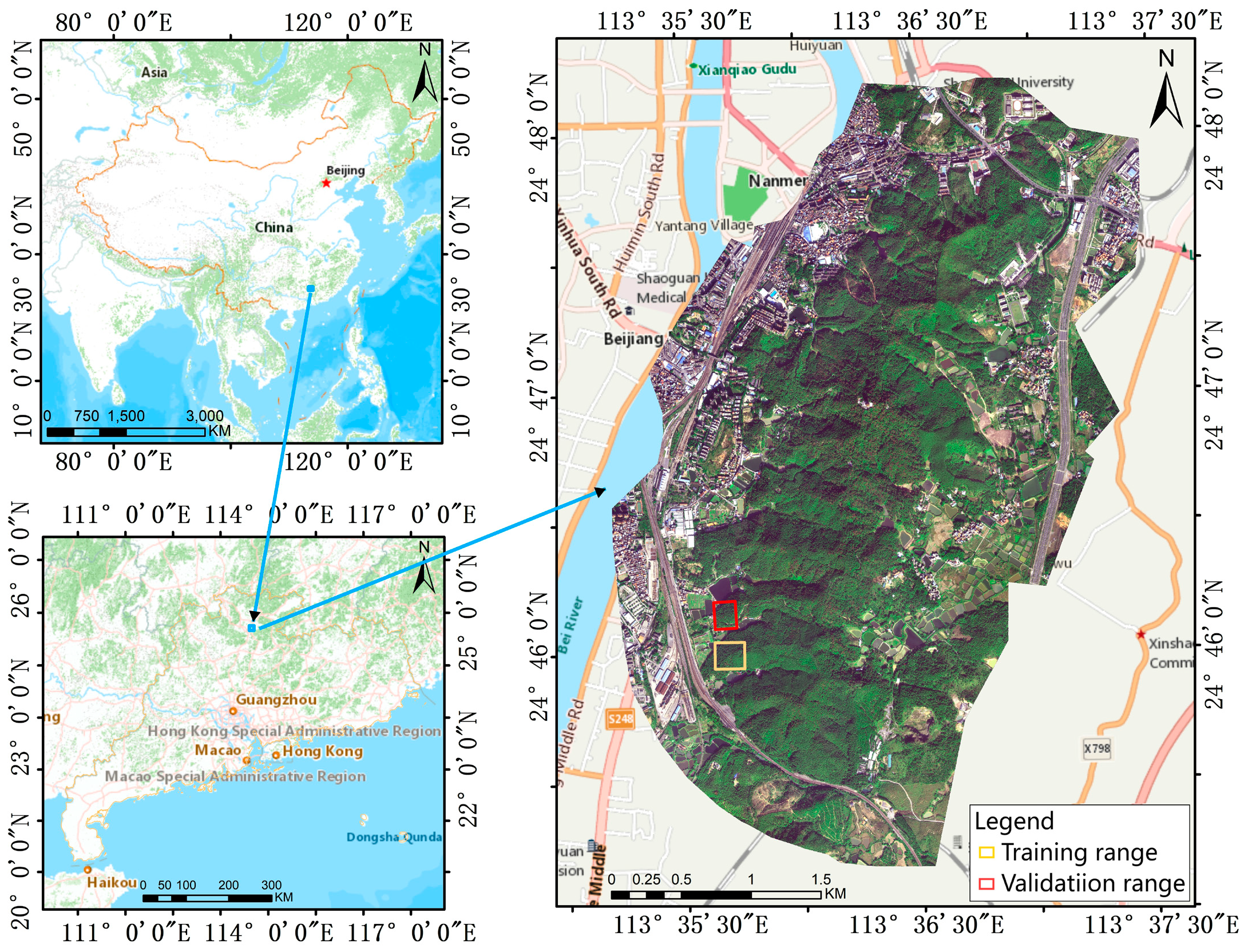
2.1. Study Area
2.2. Data
2.2.1. BJ3N
2.2.2. BJ3A
2.2.3. UAV
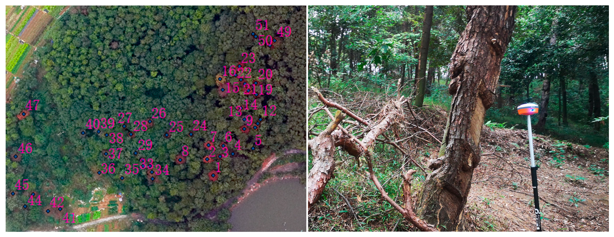
2.3. Sample Plotting
2.3.1. Training Set
2.3.2. Validation Sets
2.4. Research Methodology
2.4.1. U-Net Network Model
2.4.2. Accuracy Evaluation Method
3. Results and Analyses
3.1. Experimental Setup
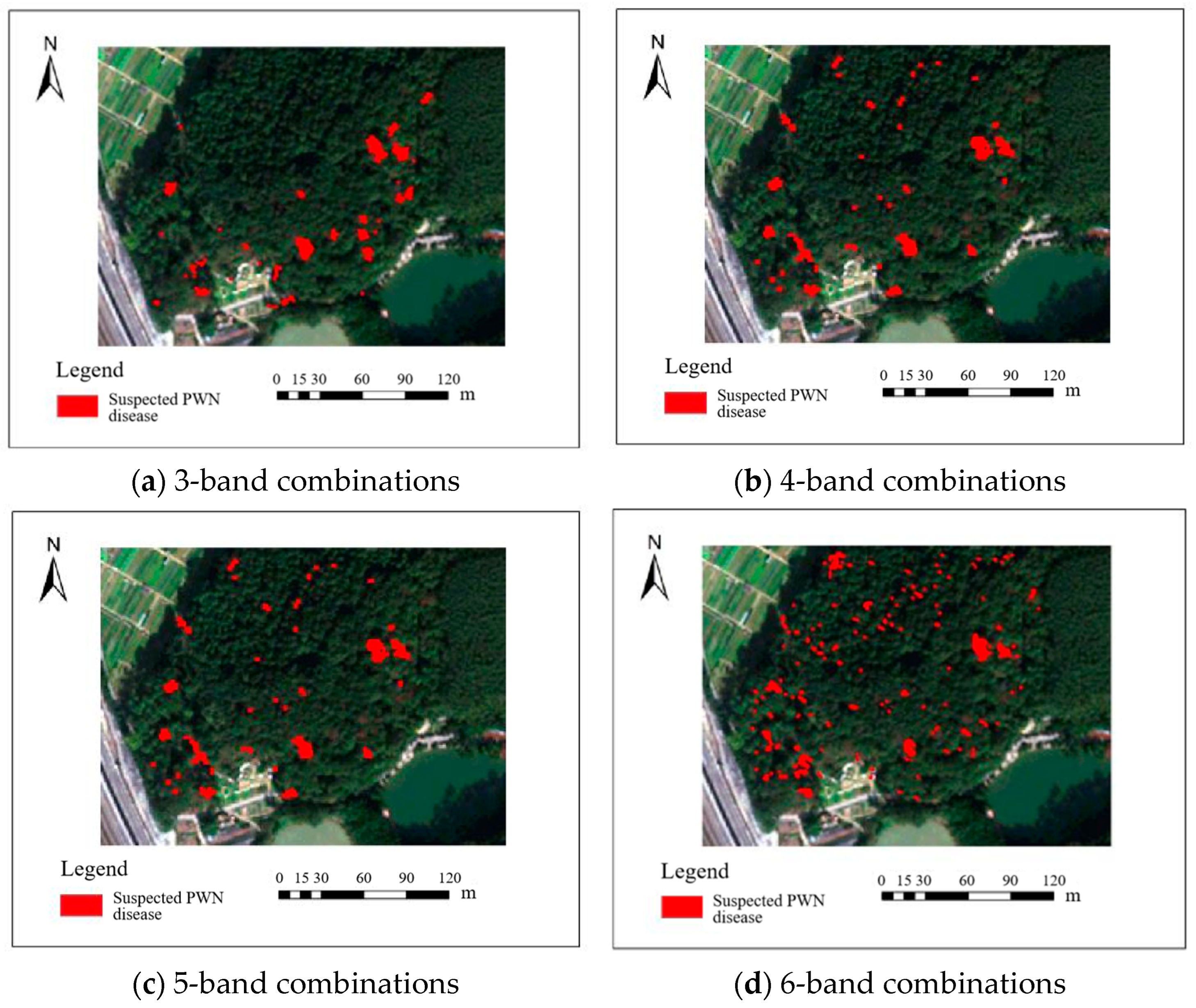
3.2. Identifying PWN-Infected Trees Using BJ3N Imagery
3.2.1. Using Multispectral Imagery with Raw Spatial Resolution of 1.2 m
3.2.2. Using Multispectral Imagery with a Fused Spatial Resolution of 0.3 m
3.3. Identifying PWN-Infected Trees Using BJ3A Imagery
3.3.1. Using Multispectral Imagery with a Raw Spatial Resolution of 2 m
3.3.2. Using Multispectral Imagery with a Fused Spatial Resolution of 0.5 m
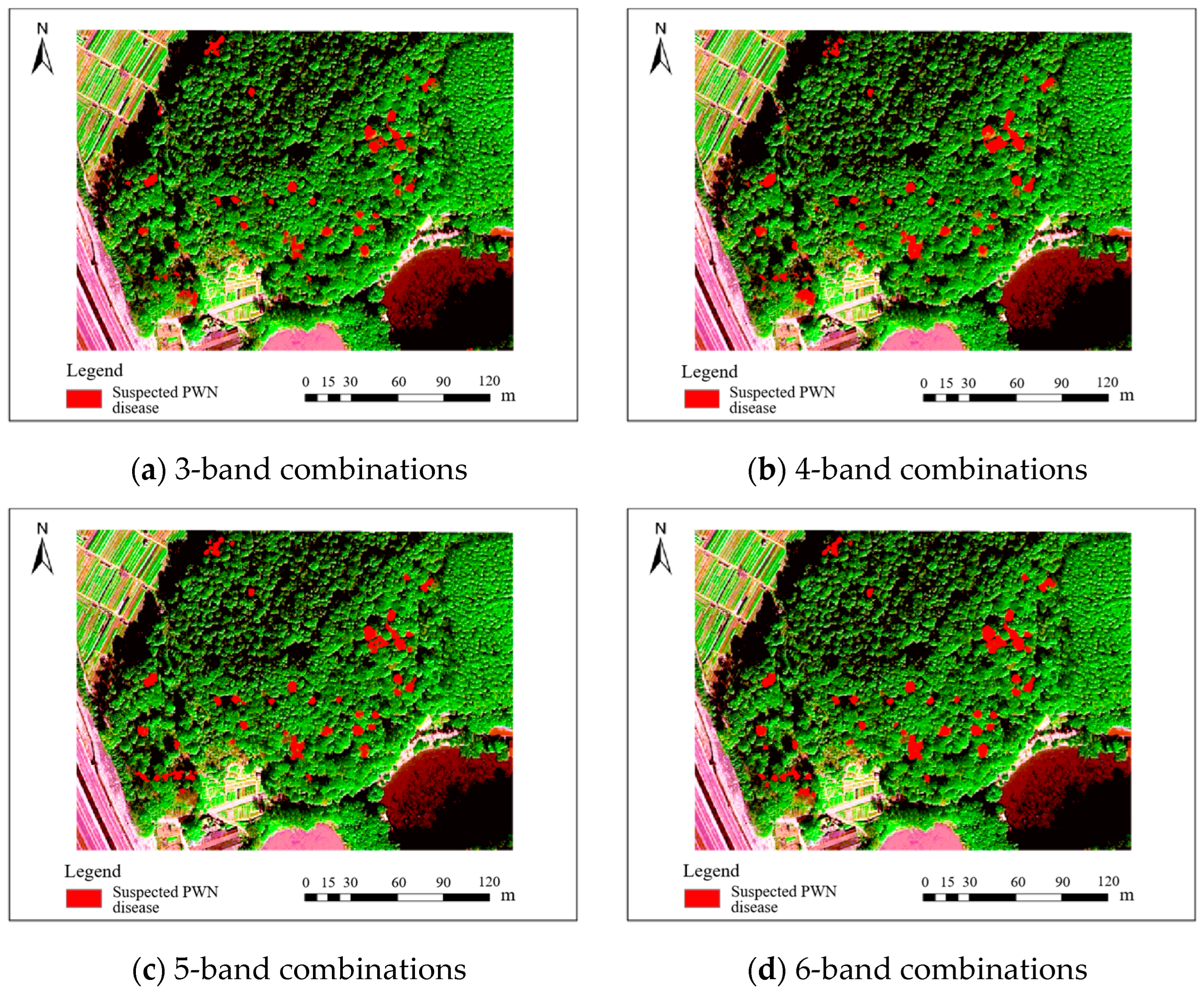
3.4. Identifying PWN-Infected Trees Using UAV Multispectral Imagery
4. Discussion
4.1. Effect of Spatial Resolution of Remote Sensing Images on Identification of PWN-Infected Trees
4.2. Effect of Spectral Features of Remote Sensing Imagery on Identification of PWN-Infected Trees
5. Conclusions
Author Contributions
Funding
Data Availability Statement
Conflicts of Interest
Abbreviations
| PWN | Pine wood nematode |
| BJ3N | Beijing 3 International Cooperative Remote Sensing Satellite |
| BJ3A | Beijing 3A satellite |
| UAV | Unmanned aerial vehicle |
| ANNs | artificial neural networks |
| SGDM | Stochastic Gradient Descent with Momentum |
References
- Ye, J. Epidemic Status of Pine Wilt Disease in China and Its Prevention and Control Techniques and Counter Measures. Sci. Silvae Sin. 2019, 55, 1–10. [Google Scholar] [CrossRef]
- Suzuki, K. Pine Wilt Disease—A Threat to Pine Forests in Europe. In The Pinewood Nematode, Bursaphelenchus xylophilus; Mota, M., Vieira, P., Eds.; BRILL: Leiden, The Netherlands, 2004; pp. 25–30. ISBN 978-90-474-1309-7. [Google Scholar] [CrossRef]
- Qin, J.; Wang, B.; Wu, Y.; Lu, Q.; Zhu, H. Identifying Pine Wood Nematode Disease Using UAV Images and Deep Learning Algorithms. Remote Sens. 2021, 13, 162. [Google Scholar] [CrossRef]
- Giordan, D.; Manconi, A.; Tannant, D.D.; Allasia, P. UAV: Low-Cost Remote Sensing for High-Resolution Investigation of Landslides. In Proceedings of the 2015 IEEE International Geoscience and Remote Sensing Symposium (IGARSS), Milan, Italy, 26–31 July 2025; IEEE: Milan, Italy, 2015; pp. 5344–5347. [Google Scholar] [CrossRef]
- Li, M.; Li, H.; Ding, X.; Wang, L.; Wang, X.; Chen, F. The Detection of Pine Wilt Disease: A Literature Review. Int. J. Mol. Sci. 2022, 23, 10797. [Google Scholar] [CrossRef]
- Wulder, M.; Dymond, C.C.; White, J.C.; Erickson, R.D. Detection, Mapping, and Monitoring of the Mountain Pine Beetle. In The Mountain Pine Beetle: A Synthesis of Biology, Management, and Impacts on Lodgepole Pine; Natural Resources Canada, Canadian Forest Service, Pacific Forestry Centre: Victoria, BC, Canada, 2006; ISBN 978-0-662-42623-3. [Google Scholar]
- Kim, S.-R.; Lee, W.-K.; Lim, C.-H.; Kim, M.; Kafatos, M.; Lee, S.-H.; Lee, S.-S. Hyperspectral Analysis of Pine Wilt Disease to Determine an Optimal Detection Index. Forests 2018, 9, 115. [Google Scholar] [CrossRef]
- Zhou, X.; Liao, L.; Cheng, D.; Chen, X.; Huang, Q. Extraction of the individual tree infected by pine wilt disease using unmanned aerial vehicle optical imagery. Int. Arch. Photogramm. Remote Sens. Spat. Inf. Sci. 2020, XLIII-B3-2020, 247–252. [Google Scholar] [CrossRef]
- Zhang, Z.; Wang, B.; Chen, W.; Wu, Y.; Qin, J.; Chen, P.; Sun, H.; He, A. Recognition of Abnormal Individuals Based on Lightweight Deep Learning Using Aerial Images in Complex Forest Landscapes: A Case Study of Pine Wood Nematode. Remote Sens. 2023, 15, 1181. [Google Scholar] [CrossRef]
- Zhang, B.; Ye, H.; Lu, W.; Huang, W.; Wu, B.; Hao, Z.; Sun, H. A Spatiotemporal Change Detection Method for Monitoring Pine Wilt Disease in a Complex Landscape Using High-Resolution Remote Sensing Imagery. Remote Sens. 2021, 13, 2083. [Google Scholar] [CrossRef]
- Kim, J.-B.; Jo, M.-H.; Kim, I.-H.; Kim, Y.-K. A Study on the Extraction of Damaged Area by Pine Wood Nematode Using High Resolution IKONOS Satellite Images and GPS. J. Korean Soc. For. Sci. 2003, 92, 362–366. [Google Scholar]
- White, J.; Wulder, M.; Brooks, D.; Reich, R.; Wheate, R. Detection of Red Attack Stage Mountain Pine Beetle Infestation with High Spatial Resolution Satellite Imagery. Remote Sens. Environ. 2005, 96, 340–351. [Google Scholar] [CrossRef]
- Franklin, S.E.; Wulder, M.A.; Skakun, R.S.; Carroll, A.L. Mountain Pine Beetle Red-Attack Forest Damage Classification Using Stratified Landsat TM Data in British Columbia, Canada. Photogramm. Eng. Remote Sens. 2003, 69, 283–288. [Google Scholar] [CrossRef]
- Skakun, R.S.; Wulder, M.A.; Franklin, S.E. Sensitivity of the Thematic Mapper Enhanced Wetness Difference Index to Detect Mountain Pine Beetle Red-Attack Damage. Remote Sens. Environ. 2003, 86, 433–443. [Google Scholar] [CrossRef]
- Wang, J.; Zhao, J.; Sun, H.; Lu, X.; Huang, J.; Wang, S.; Fang, G. Satellite Remote Sensing Identification of Discolored Standing Trees for Pine Wilt Disease Based on Semi-Supervised Deep Learning. Remote Sens. 2022, 14, 5936. [Google Scholar] [CrossRef]
- Poona, N.K.; Ismail, R. Discriminating the Occurrence of Pitch Canker Infection in Pinus Radiata Forests Using High Spatial Resolution QuickBird Data and Artificial Neural Networks. In Proceedings of the 2012 IEEE International Geoscience and Remote Sensing Symposium, Munich, Germany, 22–27 July 2012; IEEE: Munich, Germany, 2012; pp. 3371–3374. [Google Scholar] [CrossRef]
- Takenaka, Y.; Katoh, M.; Deng, S.; Cheung, K. Detecting forests damaged by pine wilt disease at the individual tree level using airborne laser data and worldview-2/3 images over two seasons. Int. Arch. Photogramm. Remote Sens. Spat. Inf. Sci. 2017, XLII-3/W3, 181–184. [Google Scholar] [CrossRef]
- Vollenweider, P.; Günthardt-Goerg, M.S. Diagnosis of Abiotic and Biotic Stress Factors Using the Visible Symptoms in Foliage. Environ. Pollut. 2005, 137, 455–465. [Google Scholar] [CrossRef] [PubMed]
- Wang, H.; Shu, Q.; Wu, Q.; Liu, Y.; Ji, Y. Application of Imaging Spectral Remote Sensing Techniques in Monitoring of Forestry Disease and Insect Pests. China Plant Prot. 2018, 38, 24–28. [Google Scholar] [CrossRef]
- Zhang, S.; Qin, J.; Tang, X.; Wang, Y.; Huang, J.; Song, Q.; Min, J. Spectral Characteristics and Evaluation Model of Pinus massoniana Suffering from Bursaphelenchus xylophilus Disease. Spectrosc. Spectr. Anal. 2019, 39, 865–872. [Google Scholar] [CrossRef]
- Huang, J.; Lu, X.; Chen, L.; Sun, H.; Wang, S.; Fang, G. Accurate Identification of Pine Wood Nematode Disease with a Deep Convolution Neural Network. Remote Sens. 2022, 14, 913. [Google Scholar] [CrossRef]
- Zhu, X.; Wang, R.; Shi, W.; Yu, Q.; Li, X.; Chen, X. Automatic Detection and Classification of Dead Nematode-Infested Pine Wood in Stages Based on YOLO v4 and GoogLeNet. Forests 2023, 14, 601. [Google Scholar] [CrossRef]
- Ye, W.; Lao, J.; Liu, Y.; Chang, C.-C.; Zhang, Z.; Li, H.; Zhou, H. Pine Pest Detection Using Remote Sensing Satellite Images Combined with a Multi-Scale Attention-UNet Model. Ecol. Inform. 2022, 72, 101906. [Google Scholar] [CrossRef]
- Han, Z.; Hu, W.; Peng, S.; Lin, H.; Zhang, J.; Zhou, J.; Wang, P.; Dian, Y. Detection of Standing Dead Trees after Pine Wilt Disease Outbreak with Airborne Remote Sensing Imagery by Multi-Scale Spatial Attention Deep Learning and Gaussian Kernel Approach. Remote Sens. 2022, 14, 3075. [Google Scholar] [CrossRef]
- Ronneberger, O.; Fischer, P.; Brox, T. U-Net: Convolutional Networks for Biomedical Image Segmentation. In Proceedings of the Medical Image Computing and Computer-Assisted Intervention—MICCAI 2015, Munich, Germany, 5–9 October 2015; Springer International Publishing: Cham, Switzerland, 2015; Volume 9351, pp. 234–241. [Google Scholar] [CrossRef]
- Zhu, Y.; Xu, Q.; Yang, J.; Mo, H. Full Convolution Neural Network Based Building Extraction Approach from High Resolution Aerial Image. Geomat. World 2020, 27, 101–106. [Google Scholar] [CrossRef]
- Zhou, Z. Machine Learning; Tsinghua University Press: Beijing, China, 2016. [Google Scholar]
- Ota, T.; Mizoue, N.; Yoshida, S. Influence of Using Texture Information in Remote Sensed Data on the Accuracy of Forest Type Classification at Different Levels of Spatial Resolution. J. For. Res. 2011, 16, 432–437. [Google Scholar] [CrossRef]
- Bolch, E.A.; Hestir, E.L.; Khanna, S. Performance and Feasibility of Drone-Mounted Imaging Spectroscopy for Invasive Aquatic Vegetation Detection. Remote Sens. 2021, 13, 582. [Google Scholar] [CrossRef]
- Saltiel, T.M.; Dennison, P.E.; Campbell, M.J.; Thompson, T.R.; Hambrecht, K.R. Tradeoffs between UAS Spatial Resolution and Accuracy for Deep Learning Semantic Segmentation Applied to Wetland Vegetation Species Mapping. Remote Sens. 2022, 14, 2703. [Google Scholar] [CrossRef]
- Müllerová, J.; Brůna, J.; Bartaloš, T.; Dvořák, P.; Vítková, M.; Pyšek, P. Timing Is Important: Unmanned Aircraft vs. Satellite Imagery in Plant Invasion Monitoring. Front. Plant Sci. 2017, 8, 887. [Google Scholar] [CrossRef]
- Lopatin, J.; Dolos, K.; Kattenborn, T.; Fassnacht, F.E. How Canopy Shadow Affects Invasive Plant Species Classification in High Spatial Resolution Remote Sensing. Remote Sens. Ecol. Conserv. 2019, 5, 302–317. [Google Scholar] [CrossRef]

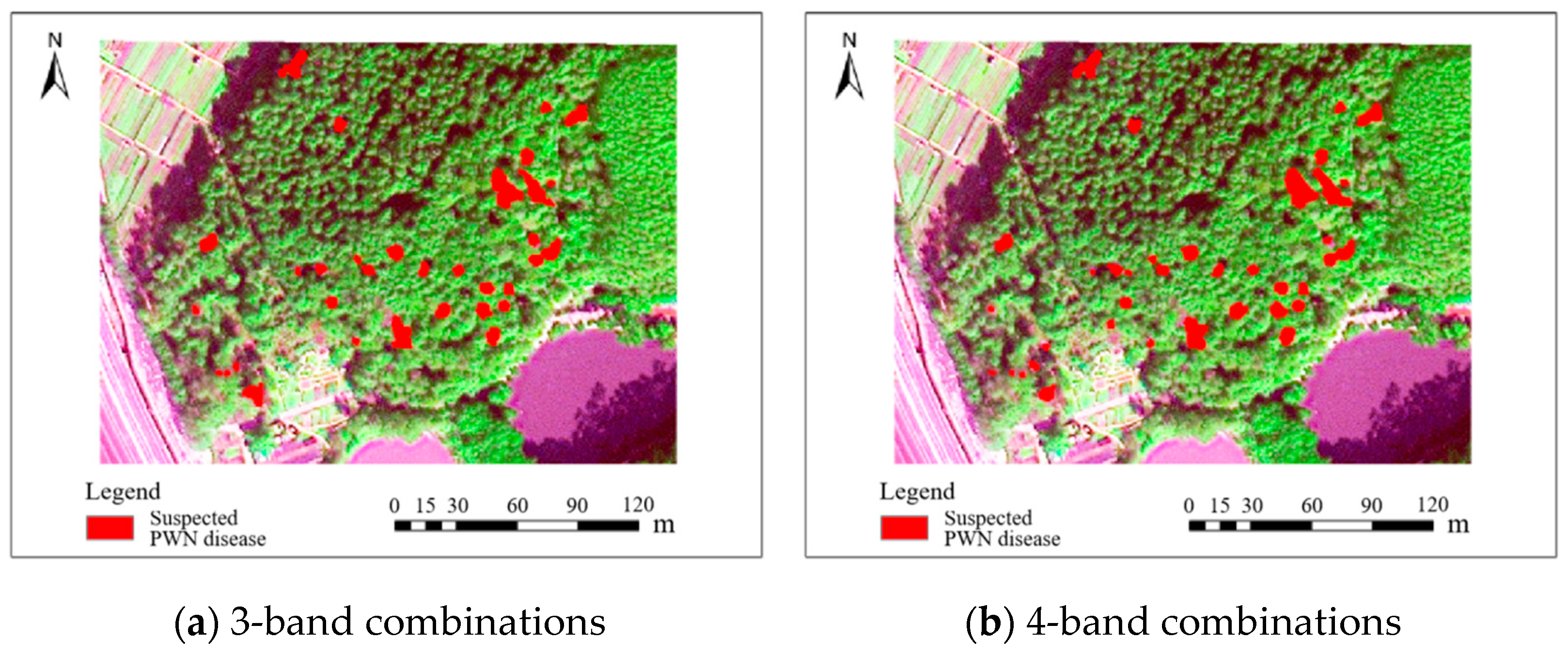

| Category | Parameter | |
|---|---|---|
| Satellite Orbit | Sun-synchronous orbit | |
| Orbit Altitude | 620 km | |
| Spatial Resolution | Panchromatic | 0.3 m |
| Multispectral | 1.2 m | |
| Spectral Bands | Panchromatic | 450–800 nm |
| Multispectral | Deep Blue: 400–450 nm | |
| Blue: 450–520 nm | ||
| Green: 530–590 nm | ||
| Red: 620–690 nm | ||
| Red Edge: 700–750 nm | ||
| Near-Infrared: 770–880 nm | ||
| Category | Parameter | |
|---|---|---|
| Satellite Orbit | Sun-synchronous orbit | |
| Orbit Altitude | 500 km | |
| Spatial Resolution | Panchromatic | 0.5 m |
| Multispectral | 2.0 m | |
| Spectral Bands | Panchromatic | 450–700 nm |
| Multispectral | Blue: 450–520 nm | |
| Green: 520–590 nm | ||
| Red: 630–690 nm | ||
| Near-Infrared: 770–890 nm | ||
| Category | Parameter | |
|---|---|---|
| Lens | FOV: 62.7°; Focal length: 5.74 mm; Fixed focus at infinity; Aperture: f/2.2 | |
| Imaging Sensor | 1/2.9inch CMOS | Including 1 color sensor for visible light imaging and 5 monochrome sensors for multispectral imaging |
| Individual Sensor | Effective pixels: 2.08 million (total pixels: 2.12 million) | |
| Spectral bands | Blue: 434–466 nm | |
| Green: 544–576 nm | ||
| Red: 634–666 nm | ||
| Red Edge: 714–746 nm | ||
| Near-Infrared: 814–866 nm | ||
| Image Type | Sample Area | Label Drawing Results |
|---|---|---|
| BJ3A imagery | 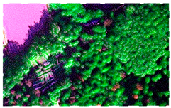 | 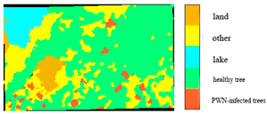 |
| BJ3N imagery | 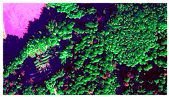 | 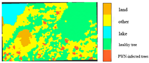 |
| UAV imagery | 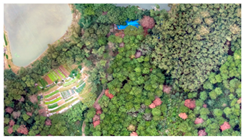 | 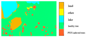 |
| Image Type | Resolution/m | Band Type | P/% | R/% | F1/% |
|---|---|---|---|---|---|
| raw spatial resolution | 1.2 | R, G, B, NIR, Red-edge, Deep-blue | 25.8 | 22.5 | 24 |
| R, G, B, NIR, Red-edge | 41.3 | 64.7 | 50.4 | ||
| R, G, B, NIR | 52.1 | 49 | 50.5 | ||
| R, G, B | 71.1 | 62.7 | 66.6 | ||
| fused spatial resolution | 0.3 | R, G, B, NIR, Red-edge, Deep-blue | 84.3 | 84.3 | 84.3 |
| R, G, B, NIR, Red-edge | 91.7 | 86.3 | 88.9 | ||
| R, G, B, NIR | 82.7 | 81.1 | 81.9 | ||
| R, G, B | 86 | 84.3 | 85.1 |
| Image Type | Resolution/m | Band Type | P/% | R/% | F1/% |
|---|---|---|---|---|---|
| raw spatial resolution | 2 | R, G, B, NIR | 22.4 | 37.3 | 28 |
| R, G, B | 64.3 | 52.9 | 58 | ||
| fused spatial resolution | 0.5 | R, G, B, NIR | 89.4 | 82.4 | 85.8 |
| R, G, B | 93.2 | 80.4 | 86.3 |
| Image Type | Resolution/m | Band Type | P/% | R/% | F1/% |
|---|---|---|---|---|---|
| UAV multispectral imagery | 0.07 | R, G, B, NIR, Red-edge | 83.1 | 96.1 | 89.1 |
| R, G, B, NIR | 79.4 | 98 | 87.7 | ||
| R, G, B | 80.6 | 98 | 88.5 |
Disclaimer/Publisher’s Note: The statements, opinions and data contained in all publications are solely those of the individual author(s) and contributor(s) and not of MDPI and/or the editor(s). MDPI and/or the editor(s) disclaim responsibility for any injury to people or property resulting from any ideas, methods, instructions or products referred to in the content. |
© 2025 by the authors. Licensee MDPI, Basel, Switzerland. This article is an open access article distributed under the terms and conditions of the Creative Commons Attribution (CC BY) license (https://creativecommons.org/licenses/by/4.0/).
Share and Cite
Nie, Z.; Qin, L.; Xing, P.; Meng, X.; Meng, X.; Qin, K.; Wang, C. Ultra-High-Resolution Optical Remote Sensing Satellite Identification of Pine-Wood-Nematode-Infected Trees. Plants 2025, 14, 3436. https://doi.org/10.3390/plants14223436
Nie Z, Qin L, Xing P, Meng X, Meng X, Qin K, Wang C. Ultra-High-Resolution Optical Remote Sensing Satellite Identification of Pine-Wood-Nematode-Infected Trees. Plants. 2025; 14(22):3436. https://doi.org/10.3390/plants14223436
Chicago/Turabian StyleNie, Ziqi, Lin Qin, Peng Xing, Xuelian Meng, Xianjin Meng, Kaitong Qin, and Changwei Wang. 2025. "Ultra-High-Resolution Optical Remote Sensing Satellite Identification of Pine-Wood-Nematode-Infected Trees" Plants 14, no. 22: 3436. https://doi.org/10.3390/plants14223436
APA StyleNie, Z., Qin, L., Xing, P., Meng, X., Meng, X., Qin, K., & Wang, C. (2025). Ultra-High-Resolution Optical Remote Sensing Satellite Identification of Pine-Wood-Nematode-Infected Trees. Plants, 14(22), 3436. https://doi.org/10.3390/plants14223436


