
Use of LUCAS LC Point Database for Validating Country-Scale Land Cover Maps


Abstract
:
1. Introduction
2. Study Area and Dataset
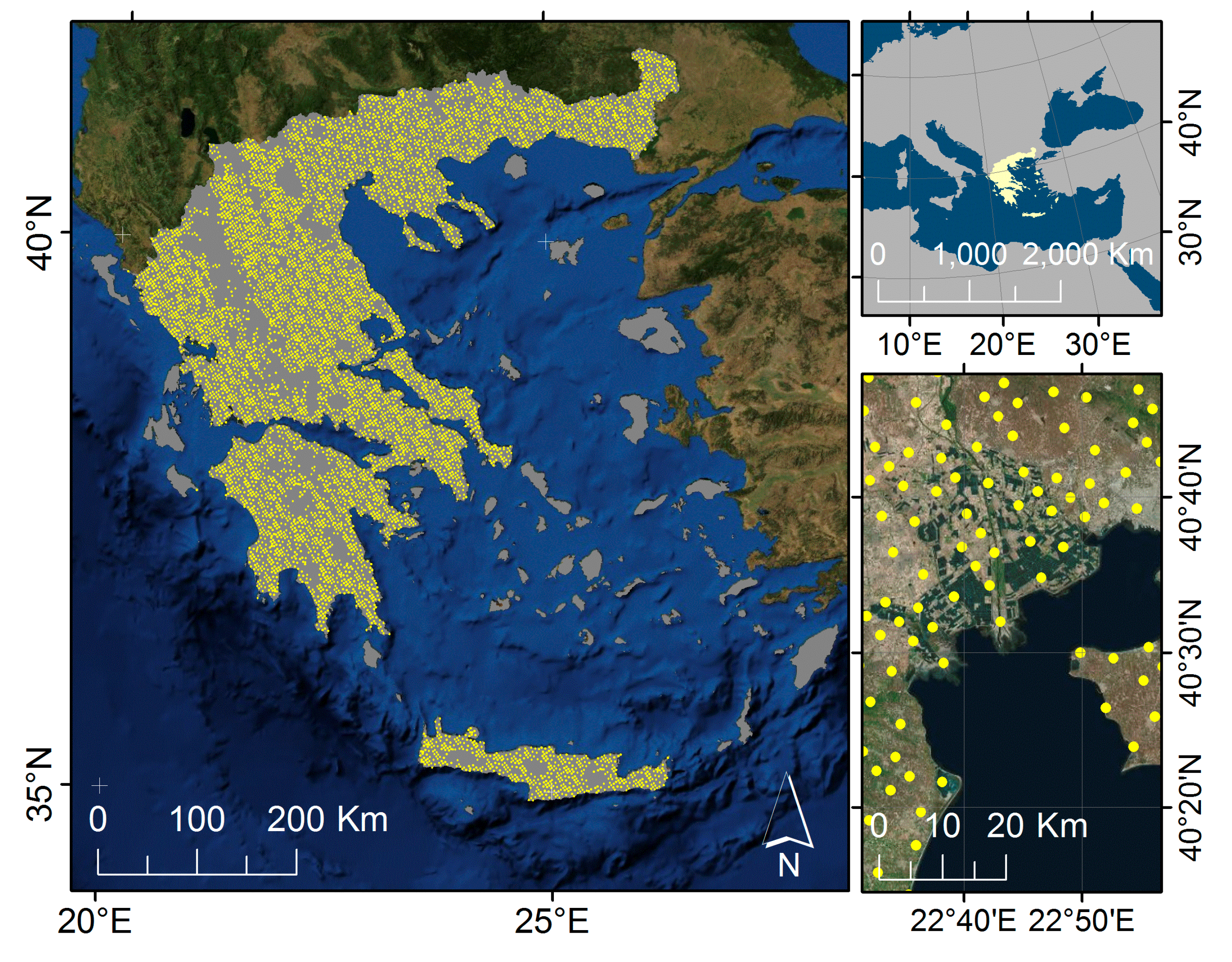
2.1. The Study Area
2.2. The Land Cover Map
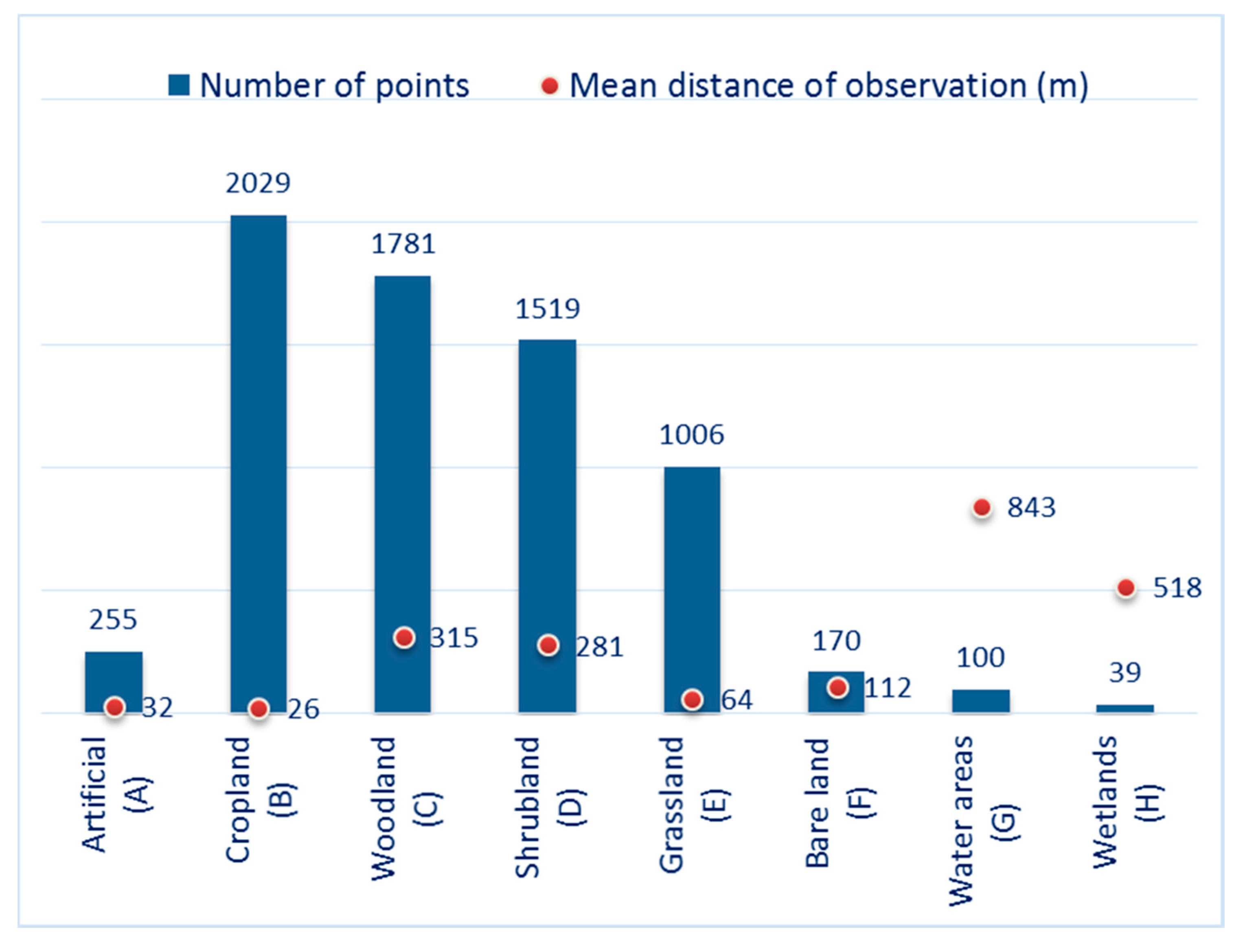
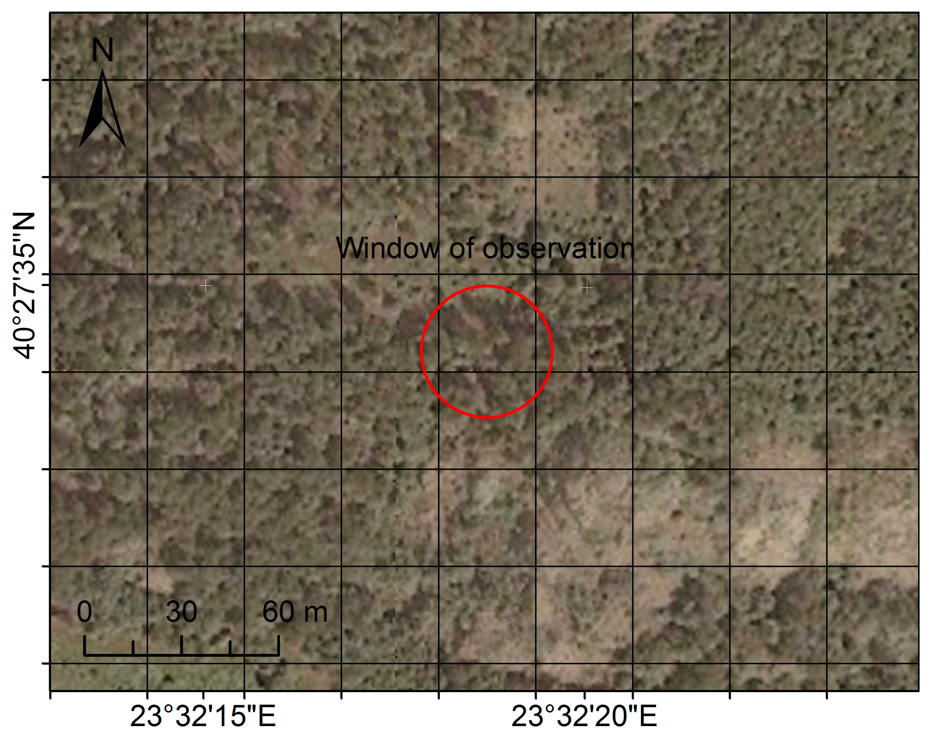
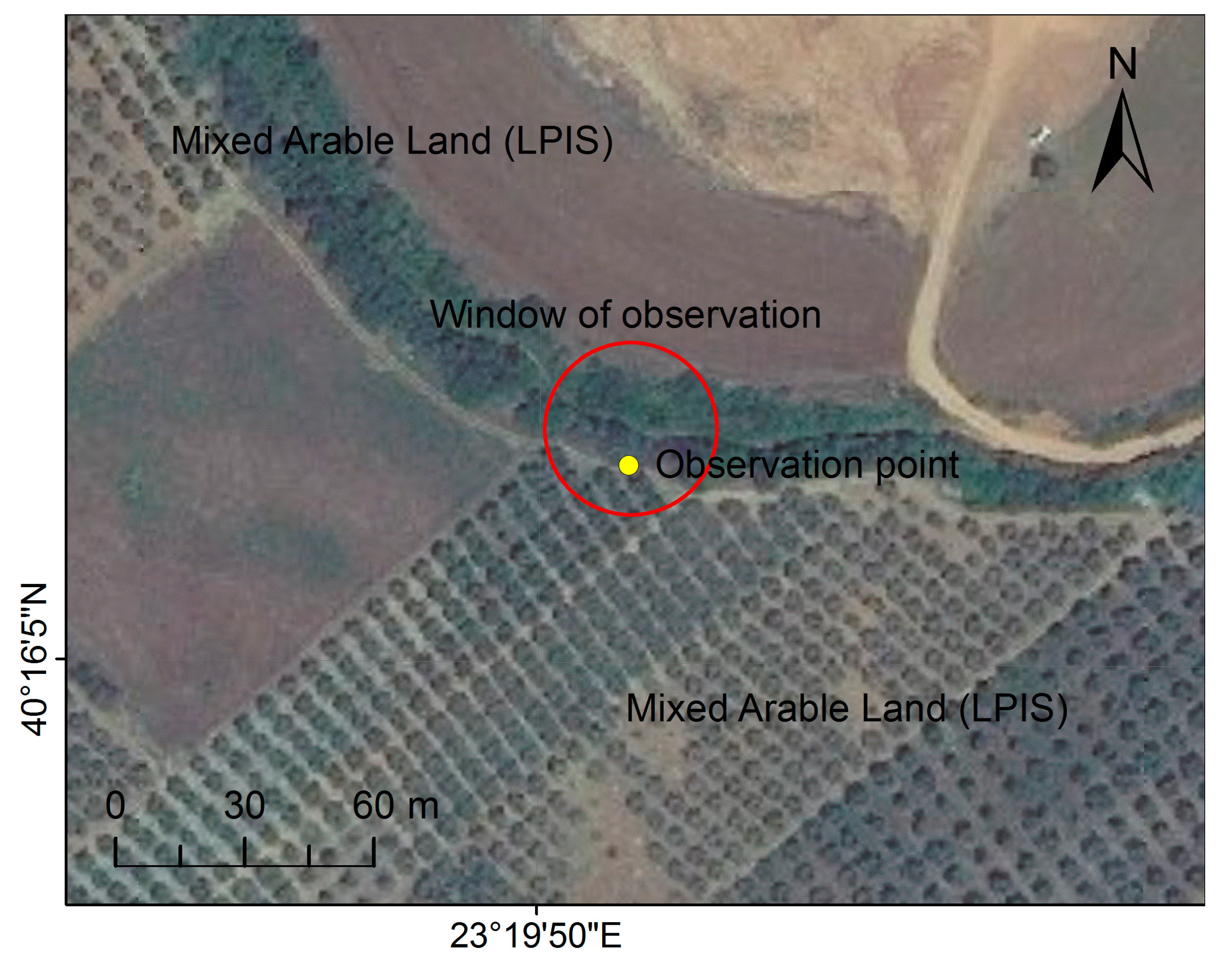
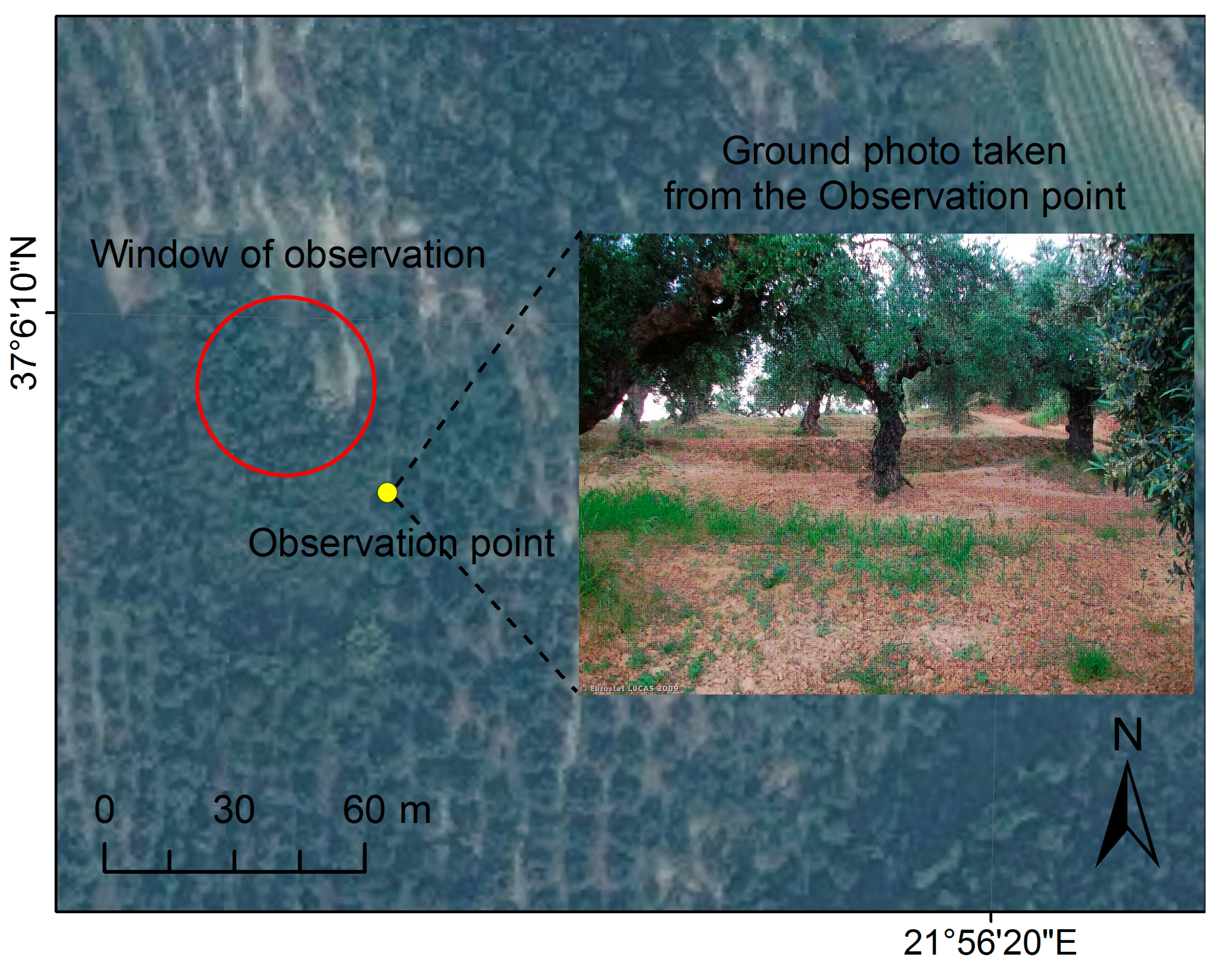
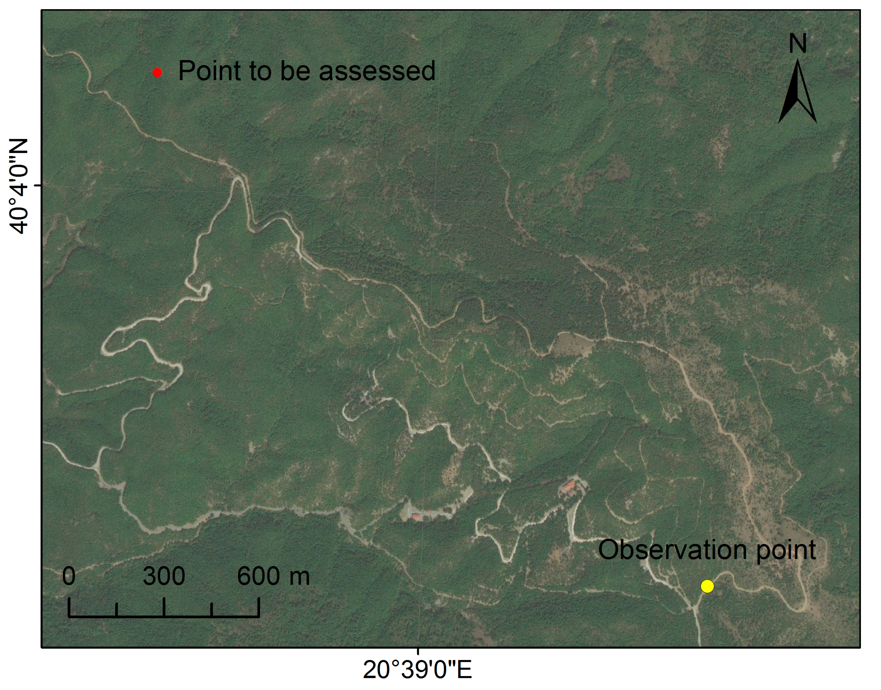
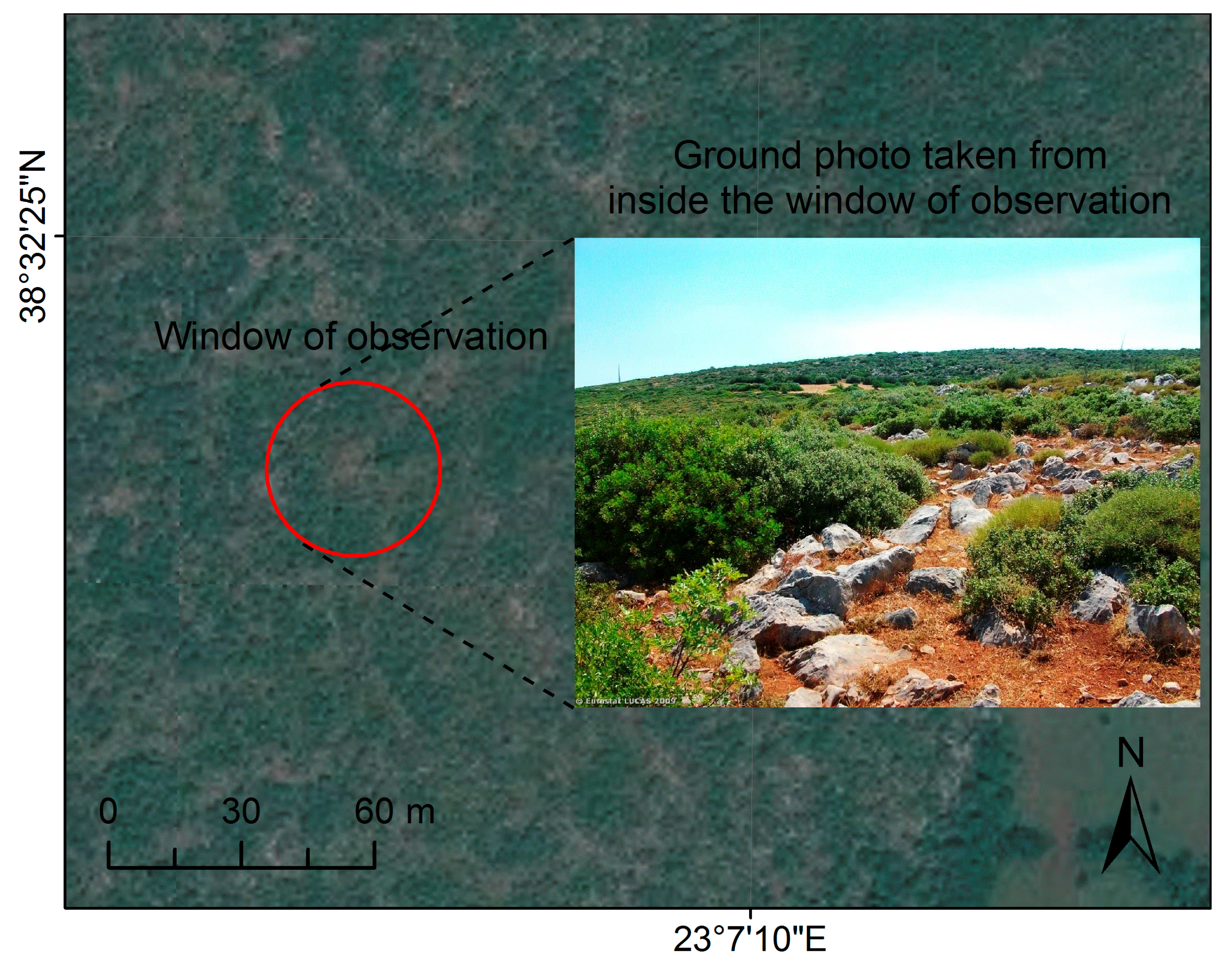
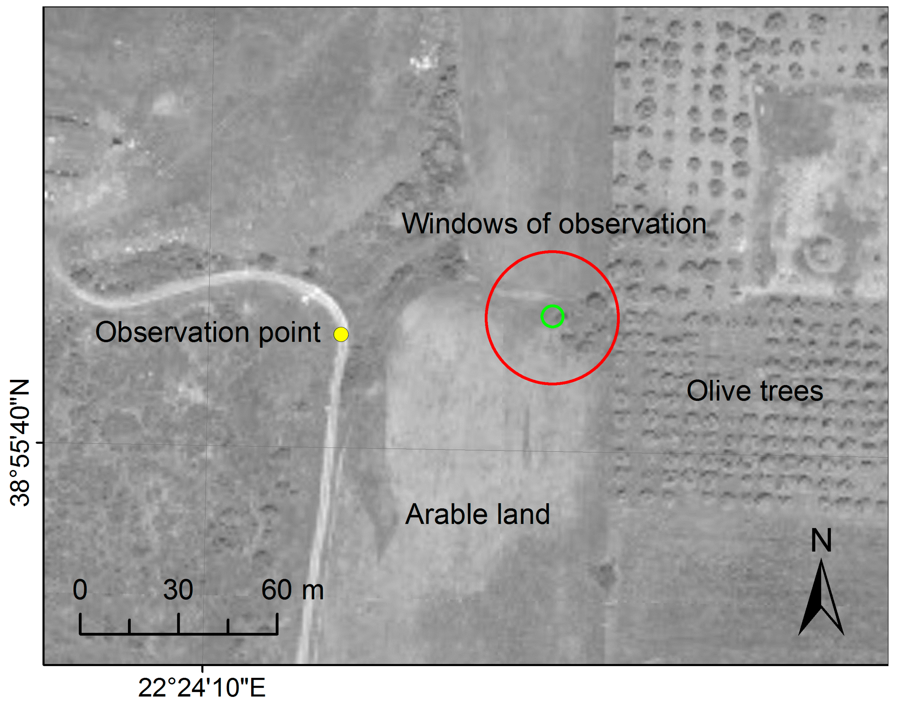
2.3. The Validation Dataset

3. Methodology
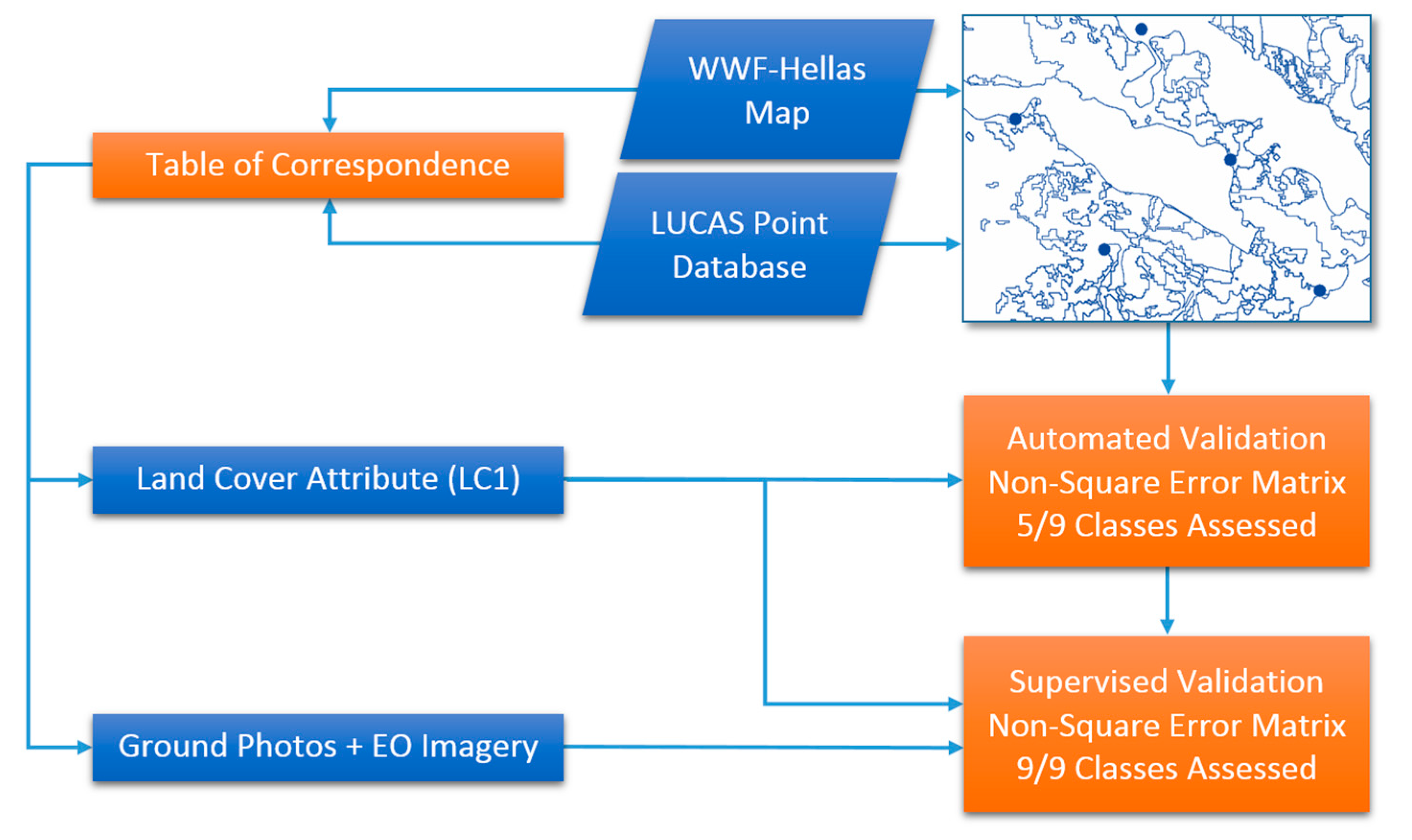
3.1. Overview
- In the first process, reference information was taken exclusively from the LUCAS main land cover attribute, namely LC1. This process was called “automated” and those WWF Hellas classes that were not identical to a specific LUCAS category were excluded (5/9 classes were assessed).
- In the second process, reference information was extracted not only from LC1, but also from the ground photos taken by the LUCAS surveyors and by interpreting available earth observation imagery, either satellite or air photographs. This process was called “supervised” and demanded a different (more extensive) error matrix (9/9 classes were assessed).
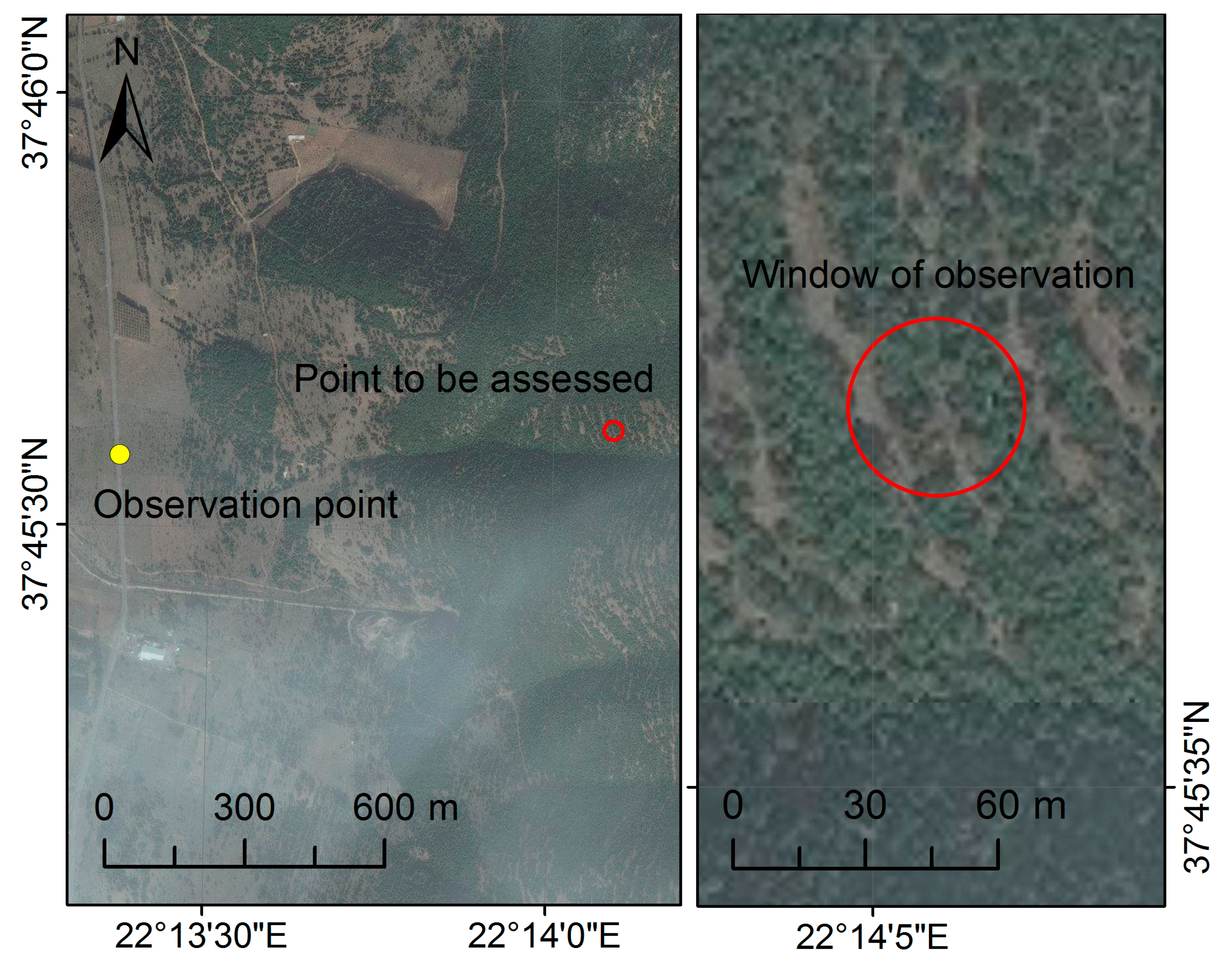
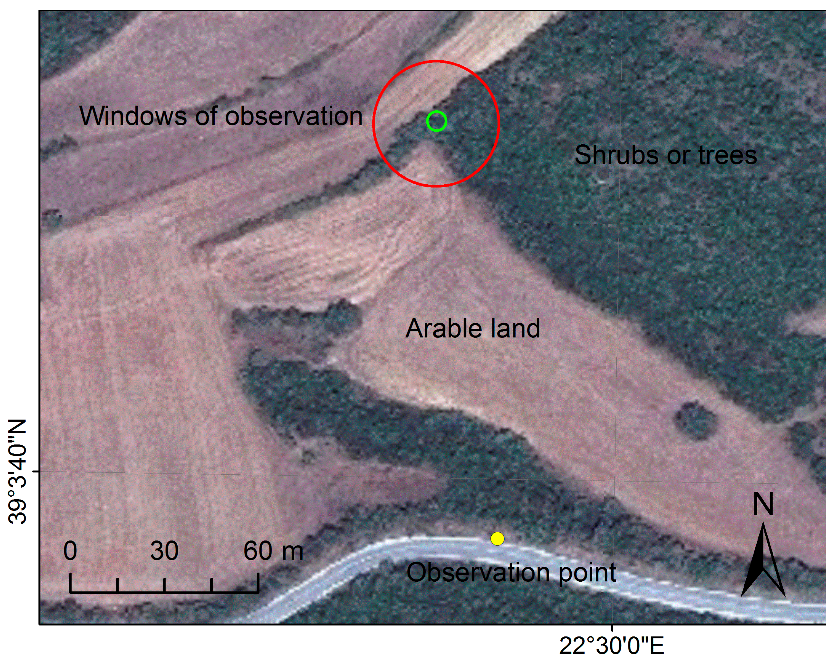
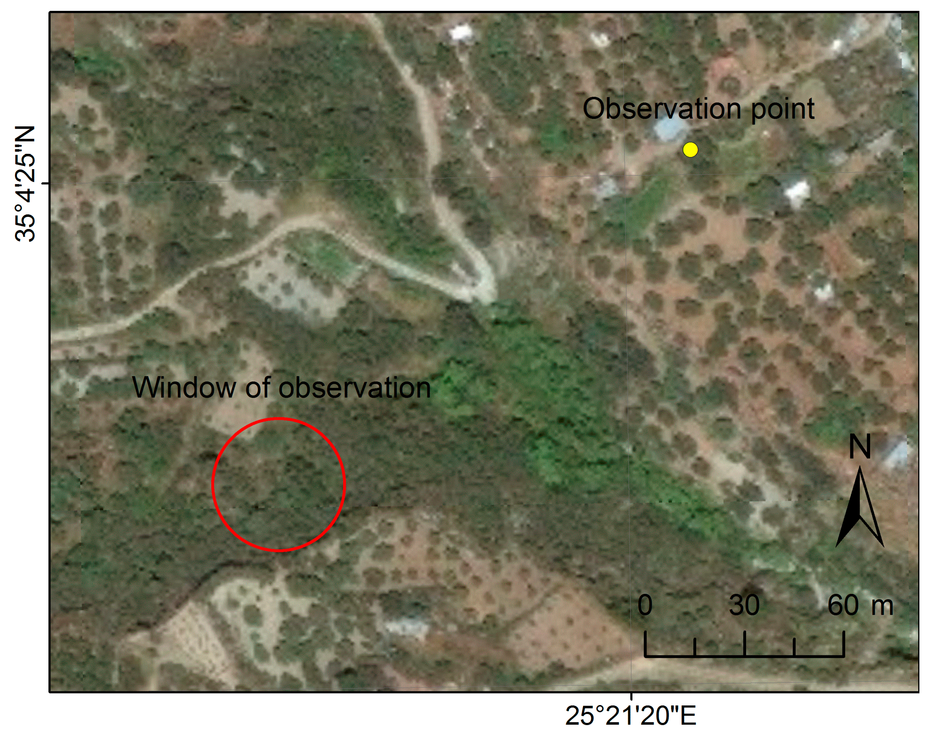
3.2. Data Co-Registration
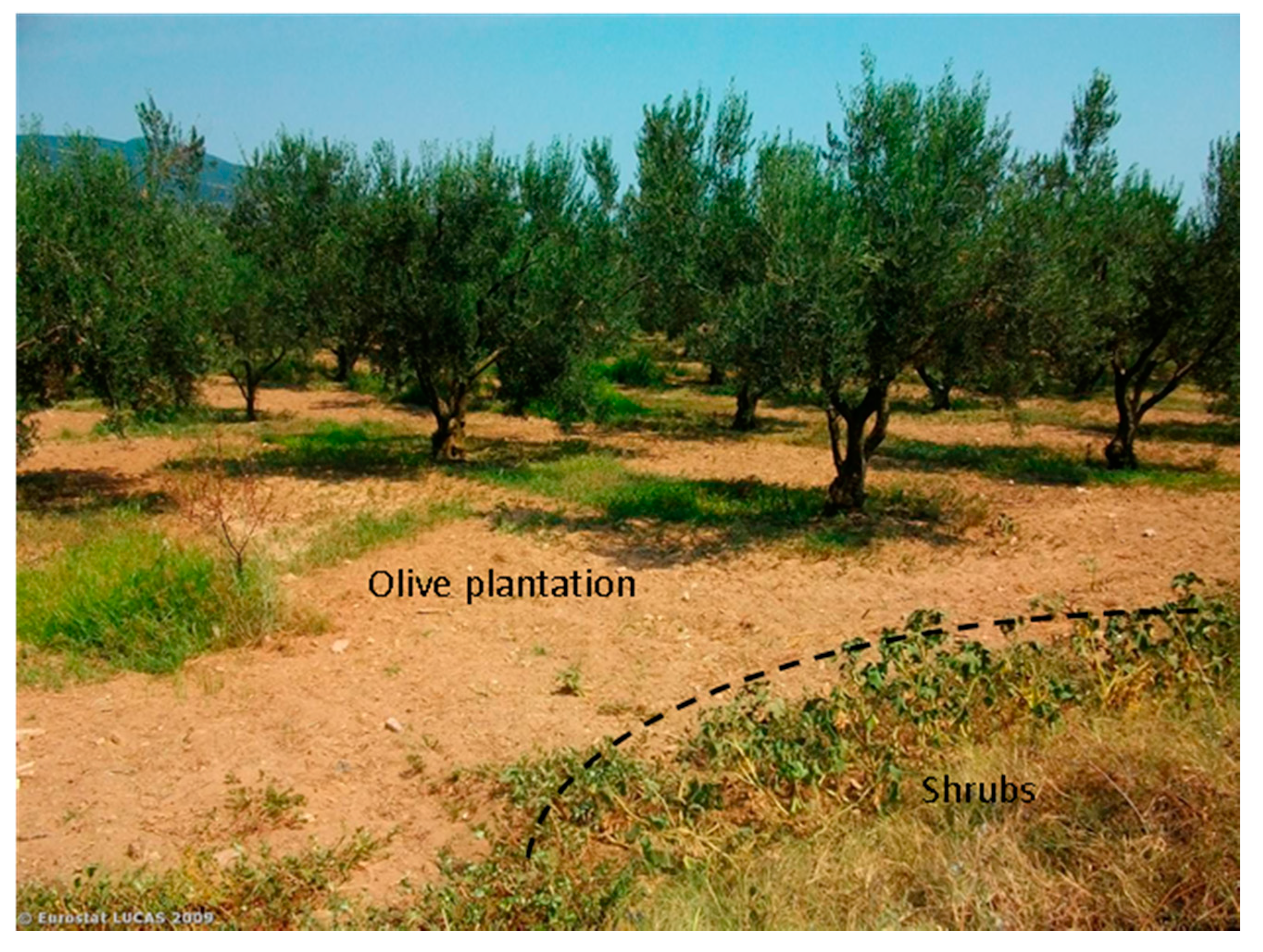
3.3. Nomenclature Differences
3.3.1. Generic

| LUCAS Categories (1st Level) | WWF Hellas Categories (Single Level) |
|---|---|
| A: Artificial land | 1: Bare land and artificial surfaces |
| B: Cropland | 2: Agricultural land |
| C: Woodland | 3: Broadleaved forests |
| D: Shrubland | 4: Coniferous forests |
| E: Grassland | 5: Sclerophyllous vegetation |
| F: Bare land | 6: Shrublands |
| G: Water areas | 7: Sparsely vegetated areas |
| H: Wetlands | 8: Burnt areas |
| 9: Water bodies |
3.3.2. Artificial Surfaces, Agricultural Land, and Bare Land
3.3.3. Forest Land
3.3.4. Shrublands and Grasslands
| Forest Parameter | WWF Hellas | LUCAS |
|---|---|---|
| MMU | 900 m2 | 1257 m2 |
| Shape | Square | Circular |
| Density | - | >10% |
| Tree height | >2 m | - |
| Purity (Mixture) | >50% (mixture N/A) | >75% (25%–75%) |

3.3.5. Other Categories
3.3.6. Inter-Class Relations and Decision-Tree
- Vegetation type, which refers to the ecologically dominant groups in terms of trees, shrubs, or grasses.
- Vegetation height, concerning shrub associations only.
- Vegetation density, in terms of thresholds associated with specific categories.
- Composition, in terms of species thresholds associated with specific groups.
| LUCAS | WWF Hellas | “Shrublands” (6) or “Sclerophyllous Vegetation” (5) if Sclerophyllous Species are Predominant | “Sparsely Vegetated Areas” (7) | “Bare land and Artificial Surfaces” (1) |
|---|---|---|---|---|
| D10: Shrubland with trees | ● shrubs > 20%/high shrubs | ● small woody plants > 20%/low sparse vegetation | N/A | |
| ● 10% < tree cover < 20%/transitional woodland | ● 10% < tree cover < 20%/transitional woodland | |||
| D20: Shrubland without trees | ● shrubs > 20%/high shrubs | ● small woody plants > 20%/low sparse vegetation | N/A | |
| ● tree cover < 10%/transitional woodland | ● tree cover < 10%/transitional woodland | |||
| E10: Grassland with trees | N/A | ● grass >50%/low sparse vegetation | N/A | |
| ● 5% < tree cover < 10%/N/A | ||||
| E20: Grassland without trees | N/A | ● grass > 50%/low sparse vegetation plants | N/A | |
| ● tree cover < 5%/N/A | ||||
| F: Bare land | N/A | ● bare land > 50% (but not 100%)/low sparse vegetation | ● bare land = 100%/rock outcrops | |
| WWF Hellas Class Name | WWF Hellas Class Definition | Automated Validation (Use of LC1 Attribute) | Supervised Validation (Use of Ground Photos & Imagery) | Justification |
|---|---|---|---|---|
| 1. Bare land and artificial surfaces | Settlements, industrial areas, rocky outcrops, quarries, and land covered by snow | A: Artificial land (excl. A13) F: Bare land | F: Bare land | A13: Greenhouses correspond to “2” “Rocky outcrops” of “1” correspond to F |
| 2. Agricultural land | Land used for crop production including greenhouses and bare arable land (rangelands excluded) | B: Cropland A13: Greenhouses | F: Fallow/abandoned land E30: Spontaneous re-vegetated surfaces D: Shrubland | F, E30, or D can be used for crops difficult to identify after harvesting (not rangelands) |
| 3. Broadleaved forests | Areas covered by broadleaf trees >2 m high with sparse or dense cover | C10: Broadleaved and Evergreen Woodland | C30: Mixed Woodland | Due to lack of a mixed forest class in WWF Hellas, C30 may be used for reinterpretation of class “3” |
| 4. Coniferous forests | Areas covered by coniferous trees >2 m high with sparse or dense cover | C20: Coniferous Woodland | C30: Mixed Woodland | Due to lack of a mixed forest class in WWF Hellas, C30 can be used as reference to “Coniferous forests” |
| 5. Sclerophyllous vegetation | Surfaces covered by sclerophyllous shrubs or tree types | N/A | C10: Broadleaved and Evergreen Woodland C30: Mixed Woodland D: Shrubland | Sclerophyllous surfaces do not form a single class in LUCAS; instead, sclerophyllous species may be contained in C10, C30, or D classes |
| 6. Shrublands | Areas covered by high evergreen broadleaved shrubs and transitional woodland; usually, surfaces adjacent to forests | N/A | D: Shrubland | “Small woody plants” of LUCAS are not included in class “6” of WWF Hellas; instead, they are included in class “7” |
| 7. Sparsely vegetated areas | Natural surfaces covered with sparse low vegetation | N/A | D: Shrubland E: Grassland | D of LUCAS can be low and sparse; E is low and can be sparse |
| 8. Burned areas | Areas burned within a period less than a year before image acquisition | N/A | C: Woodland D: Shrubland F: Bare land | Burnt areas by WWF Hellas may be any natural land cover; in LUCAS terminology, they are classified as the present natural category, or they can be “fire breaks” within forests |
| 9. Water bodies | Lakes, rivers, wetlands, etc. | G: Water areas H: Wetlands | N/A | Wetland is not independent class in WWF Hellas map; instead, it is contained in “Water bodies” class |
4. Results and Discussion
4.1. Automated Validation
4.1.1. Generic
4.1.2. Error Matrix
| LUCAS categories | A: Artificial Land Except Greenhouses (A13) | A13: Greenhouses | B: Cropland | C10: Broadleaved and evergreen woodland | C20: Coniferous woodland | C30: Mixed woodland | D: Shrubland | E10,E20: Grassland with, without sparse tree/shrub cover | E30: Spontaneous re-vegetated surfaces | F: Bare land | G: Water areas | H: Wetlands | Total points | User's accuracy | |
|---|---|---|---|---|---|---|---|---|---|---|---|---|---|---|---|
| WWF Hellas classes | |||||||||||||||
| 1: Bare land and artificial surfaces | 90 | 0 | 18 | 4 | 3 | 1 | 23 | 39 | 2 | 23 | 6 | 2 | 211 | 53.6% | |
| 2: Agricultural land | 136 | 5 | 1972 | 290 | 43 | 57 | 351 | 430 | (257) | (99) | 17 | 15 | 3316 | 59.6% | |
| 3: Broadleaved forests | 6 | 0 | 6 | 389 | 20 | (61) | 42 | 12 | 0 | 3 | 2 | 1 | 481 | 80.9% | |
| 4: Coniferous forests | 0 | 0 | 2 | 52 | 109 | (32) | 32 | 7 | 1 | 0 | 0 | 0 | 203 | 53.7% | |
| 5: Schlerophyllous vegetation | 1 | 0 | 1 | (130) | 47 | (36) | (138) | 12 | 0 | 2 | 0 | 0 | N/A | N/A | |
| 6: Shrublands | 3 | 0 | 6 | 175 | 43 | 38 | (284) | 42 | 2 | 6 | 0 | 0 | N/A | N/A | |
| 7: Sparsely vegetated areas | 13 | 0 | 21 | 142 | 63 | 30 | (636) | (188) | (6) | (33) | 2 | 3 | N/A | N/A | |
| 8: Burnt areas | 0 | 0 | 0 | (0) | (7) | (1) | (3) | (2) | (0) | (0) | 0 | 0 | N/A | N/A | |
| 9: Water bodies | 0 | 0 | 3 | 6 | 0 | 0 | 9 | 5 | 1 | 3 | 72 | 17 | 116 | 76.7% | |
| Total points | 232 | 5 | 2001 | 741 | 175 | N/A | N/A | N/A | N/A | 29 | 97 | 35 | 4327 | ||
| Producer's accuracy | 38.8% | 100.0% | 98.6% | 52.5% | 62.3% | N/A | N/A | N/A | N/A | 79.3% | 74.2% | 48.6% | 61.9% | ||
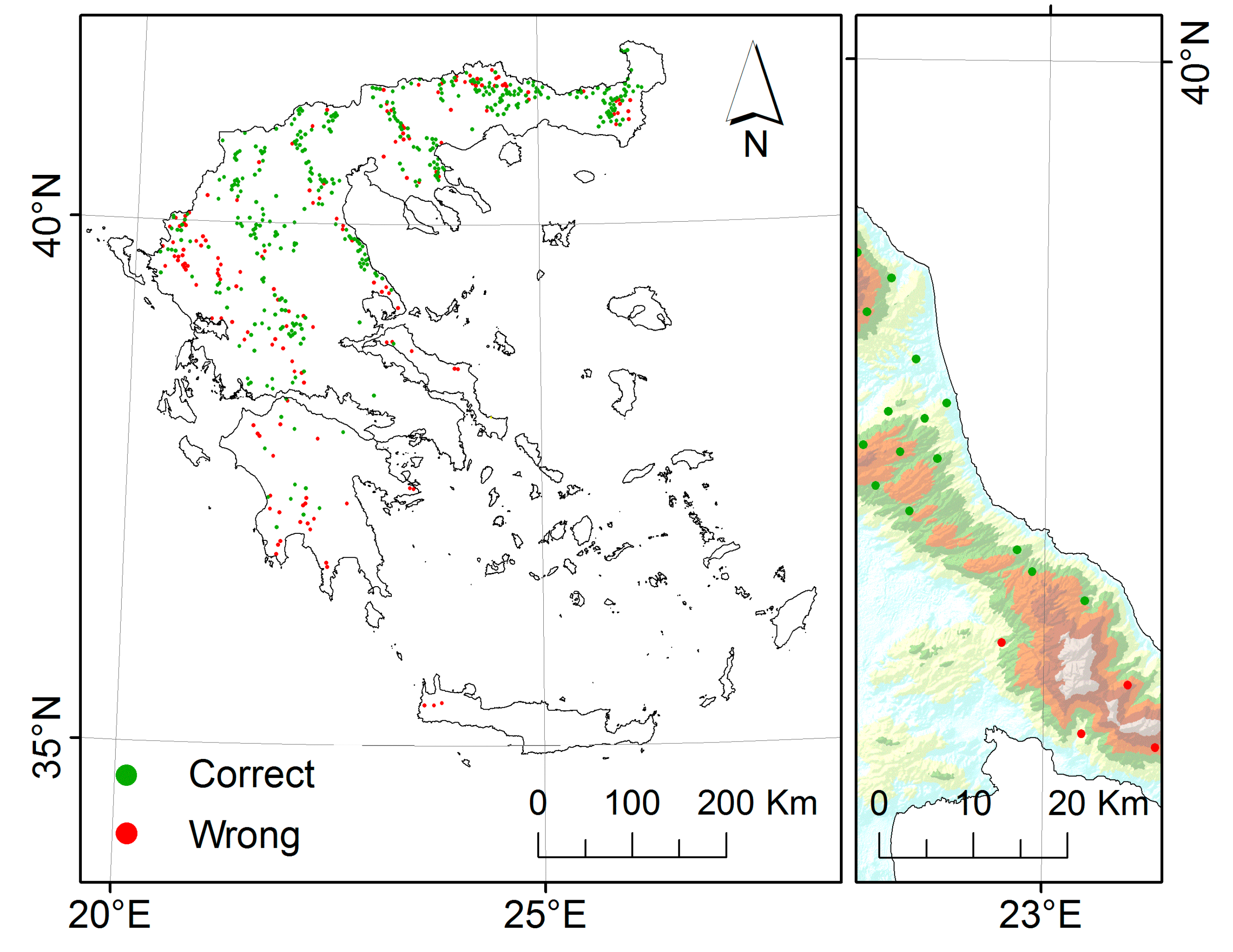
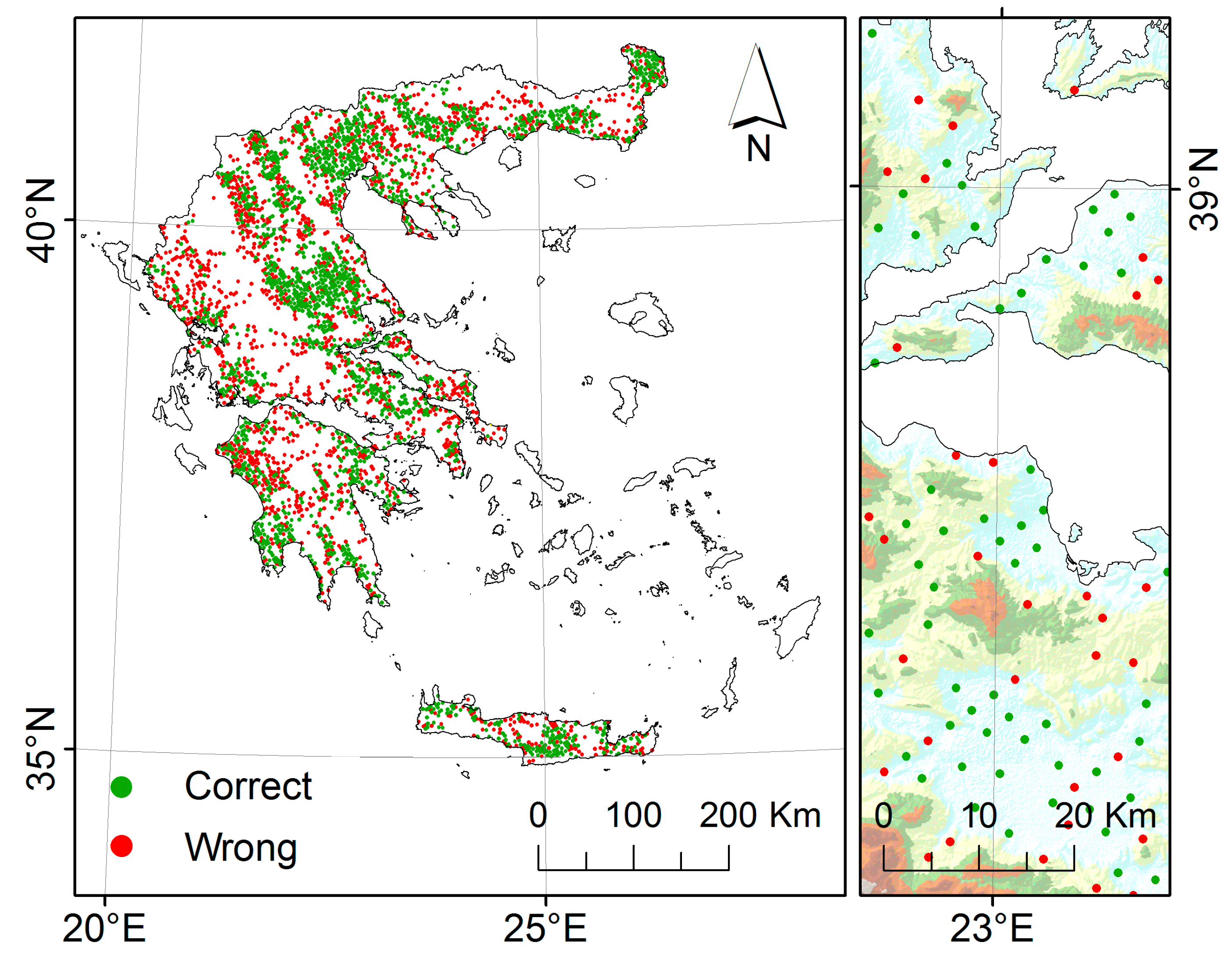
4.1.3. Error Distribution

4.2. Supervised Validation
4.2.1. Generic
4.2.2. Artificial Surfaces, Agricultural Land, and Bare Land


4.2.3. Forest Land

4.2.4. Shrublands and Grasslands
4.2.5. Revised Error Matrix
| LUCAS categories | A: Artificial land except Greenhouses (A13) | A13: Greenhouses | B: Cropland | C10: Broadleaved and evergreen woodland | C20: Coniferous woodland | C30: Mixed woodland | D: Shrubland | E10,E20: Grassland with, without sparse tree/shrub cover | E30: Spontaneously re-vegetated surfaces | F: Bare land | G: Water areas | H: Wetlands | Total points | User's accuracy (%) | |
|---|---|---|---|---|---|---|---|---|---|---|---|---|---|---|---|
| WWF Hellas classes | |||||||||||||||
| 1: Bare land and artificial surfaces | 90 | 0 | 18 | 4 | 3 | 1 | 23 | 39 | 2 | (20) | 6 | 2 | 210 | 52.4 | |
| 2: Agricultural land | (0) | 5 | 1972 | 290 | 43 | 57 | (18) | 430 | (24) | (26) | 17 | 15 | 3658 | 55.9 | |
| 3: Broadleaved forests | 6 | 0 | 6 | 389 | 20 | (10) | 42 | 12 | 0 | 3 | 2 | 1 | 494 | 80.8 | |
| 4: Coniferous forests | 0 | 0 | 2 | 52 | 109 | (6) | 32 | 7 | 1 | 0 | 0 | 0 | 214 | 53.7 | |
| 5: Schlerophyllous vegetation | 1 | 0 | 1 | (24) | 47 | (3) | (54) | 12 | 0 | 2 | 0 | 0 | 157 | 51.6 | |
| 6: Shrublands | 3 | 0 | 6 | 175 | 43 | 38 | (55) | 42 | 2 | 6 | 0 | 0 | 383 | 14.4 | |
| 7: Sparsely vegetated areas | 13 | 0 | 21 | 142 | 63 | 30 | (89) | (27) | (5) | (9) | 2 | 3 | 451 | 10.4 | |
| 8: Burnt areas | 0 | 0 | 0 | (0) | (2) | (0) | (1) | (2) | (0) | (0) | 0 | 0 | 5 | 100.0 | |
| 9: Water bodies | 0 | 0 | 3 | 6 | 0 | 0 | 9 | 5 | 1 | 3 | 72 | 17 | 116 | 76.7 | |
| Total points | 113 | 5 | 2029 | 1082 | 330 | 145 | 323 | 576 | 35 | 69 | 97 | 38 | 5688 | ||
| Producer's accuracy (%) | 79.6 | 100.0 | 97.2 | 38.2 | 33.6 | 13.1 | 50.2 | 5% | 82.9 | 49.5 | 72.7 | 44.7 | 51.8 | ||
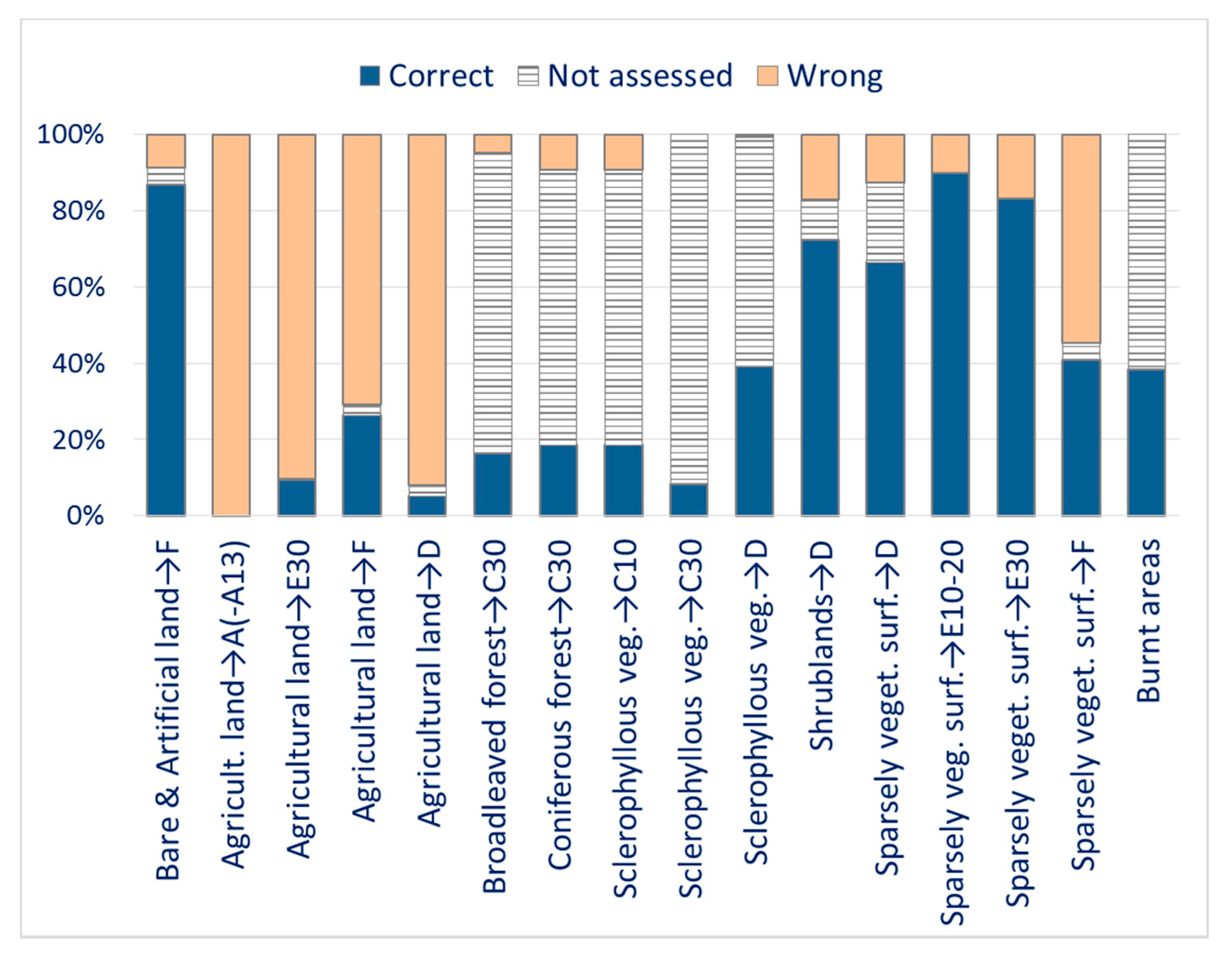
4.2.6. Effectiveness of the Reassessment


5. Conclusions
Acknowledgments
Author Contributions
Conflicts of Interest
References
- Congalton, R.G. A review of assessing the accuracy of classifications of remotely sensed data. Remote Sens. Environ. 1991, 37, 35–46. [Google Scholar] [CrossRef]
- Lu, D.; Weng, Q. A survey of image classification methods and techniques for improving classification performance. Int. J. Remote Sens. 2007, 28, 823–870. [Google Scholar] [CrossRef]
- Kuntz, S. (Ed.) Quality Assurance Approach for the Land FTS, 2007, BOSS4GMES Doc. D324–3, Public Document from the BOSS4GMES Consortium. Available online: http://www.boss4gmes.eu (accessed on 14 January 2015).
- EC EUROSTAT. LUCAS 2009 (Land Use/Cover Area Frame Survey), M3—Non Sampling Error. 2013. Available online: http://ec.europa.eu/eurostat/documents/205002/769457/LUCAS2009-M3-NonSamplingError-20130414.pdf (accessed on 14 January 2015).
- EC EUROSTAT. LUCAS 2009 (Land Use/Cover Area Frame Survey) Technical Reference Document C-3: Land Use and Land Cover: Nomenclature (Version of 16 March 2009). 2009. Available online: http://ec.europa.eu/eurostat/documents/205002/208012/LUCAS2012_C3-Classification_20131004_0.pdf (accessed on 14 January 2015).
- European Environmental Agency (EEA). The Thematic Accuracy of Corine Land Cover 2000 Assessment Using LUCAS (Land Use/Cover Area Frame Statistical Survey. Kopenhagen, 2006. Technical Report 7/2006. Available online: http://www.eea.europa.eu/data-and-maps/figures/corine-land-cover-types-2006 (accessed on 15 January 2015).
- Gallego, F.J.; Bamps, C. Using CORINE land cover and the point survey LUCAS for area estimation. Int. J. Appl. Earth Obs. Geoinf. 2008, 10, 467–475. [Google Scholar] [CrossRef]
- Gallego, F.J. Validation of GIS layers in the EU: Getting adapted to available reference data. Int. J. Digit. Earth 2011, 4, 42–57. [Google Scholar] [CrossRef]
- Fuller, R.M.; Groom, G.B.; Jones, A.R. The Land Cover Map of Great Britain: An automated classification of Landsat Thematic Mapper data. Photogramm. Eng. Remote Sens. 1994, 60, 553–562. [Google Scholar]
- Pekkarinen, A.; Reithmaier, L.; Strobl, P. Pan-European forest/non-forest mapping with Landsat ETM+ and CORINE Land Cover 2000 data. ISPRS J. Photogramm. Remote Sens. 2009, 64, 171–183. [Google Scholar] [CrossRef]
- Fry, J.A.; Xian, G.; Jin, S.; Dewitz, J.A.; Homer, C.G.; Yang, L.; Barnes, C.A.; Herold, N.D.; Wickham, J.D. Completion of the 2006 national land cover database for the conterminous United States. Photogramm. Eng. Remote Sens. 2011, 77, 858–864. [Google Scholar]
- Skinner, L.; Luckman, A. A Introducing a landcover map of Siberia derived from MERIS and MODIS data. In Proceedings of the 2004 IEEE International Conference on Geoscience and Remote Sensing Symposium, Anchorage, AK, USA, 20–24 September 2004.
- Carrao, H.; Sarmento, P.; Araujo, A.; Caetano, M. Retrieving land cover information from MERIS and MODIS Data: A comparative study for landscape characterization in Portugal. In Proceedings of the IEEE International Conference on Geoscience and Remote Sensing Symposium, Barcelona, Spain, 23–28 July 2007; pp. 1271–1274.
- Gitas, I. Greece Then and Now—Diachronic Mapping of Land Cover, 1987–2007. WWF Hellas. 2012. Available online: http://issuu.com/wwf-greece/docs/diahroniki-hartografisi in Greek (accessed on 26 February 2015).
- EC EUROSTAT. LUCAS 2009 (Land Use/Cover Area Frame Survey),Technical Reference Document C-1: General Implementation Land Cover and Use Water Management Soil Transect Photos, Instructions for Surveyors (Version of 20 March 2009). Available online: http://ec.europa.eu/eurostat/documents/205002/208012/LUCAS2012_C1-InstructionsRevised_20130110a.pdf (accessed on 14 January 2015).
- Strahler, A.H.; Boschetti, L.; Foody, G.M.; Friedl, M.A.; Hansen, M.C.; Herold, M.; Mayaux, P.; Morisette, J.T.; Stehman, S.V.; Woodcock, C.E. Global Land Cover Validation: Recommendations For Evaluation And Accuracy Assessment Of Global Land Cover Maps. GOFC-GOLD, Report No. 25; Luxembourg: Office for Official Publications of the European Communities, 2006; Available online: http://nofc.cfs.nrcan.gc.ca/gofc-gold/Report%20Series/GOLD_25.pdf (accessed on 14 January 2015).
- Zhan, Q.; Molenaar, M.; Tempfli, K.; Shi, W. Quality assessment for geo-spatial objects derived from remotely sensed data. Int. J. Remote Sens. 2005, 26, 2953–2974. [Google Scholar] [CrossRef]
- Liu, W.; Gopal, S.; Woodcock, C.E. Uncertainty and Confidence in Land Cover Classification Using a Hybrid Classifier Approach. Photogramm. Eng. Remote Sens. 2004, 70, 963–971. [Google Scholar] [CrossRef]
- Finn, J.T. Use of the average mutual information index in evaluating classification error and consistency. Int. J. Geogr. Inf. Syst. 1993, 7, 349–366. [Google Scholar] [CrossRef]
- Foody, G.M. Status of land cover classification accuracy assessment. Remote Sens. Environ. 2002, 80, 185–201. [Google Scholar] [CrossRef]
- Storey, J. Landsat 7 (L7) Image Assessment System (IAS) Geometric Algorithm Theoretical Basis Document (ATBD); U.S. Geological Survey Report LS-IAS-01 Version 1.0; EROS: South Dakota, SD, USA, 2006. [Google Scholar]
- Gitas, I.Z.; Polychronaki, A.; Katagis, T.; Mallinis, G. Contribution of remote sensing to disaster management activities: A case study of the large fires in the Peloponnese, Greece. Int. J. Remote Sens. 2008, 29, 1847–1853. [Google Scholar] [CrossRef]
- Comber, A.; Fisher, P.; Brunsdon, C.; Khmag, A. Spatial analysis of remote sensing image classification accuracy. Remote Sens. Environ. 2012, 127, 237–246. [Google Scholar] [CrossRef]
- National Cadastral and Mapping, S.A. Available online: http://gis.ktimanet.gr/wms/ktbasemap/default.aspx (accessed on 14 January 2015).
- GEOLAND2 Report Summary—(Geoland2—Towards an Operational GMES Land Monitoring Core Service), Project Reference: 218795, Last Updated on 1-8-2014. Available online: http://cordis.europa.eu/result/rcn/53368_en.html (accessed on 15 January 2015).
© 2015 by the authors; licensee MDPI, Basel, Switzerland. This article is an open access article distributed under the terms and conditions of the Creative Commons Attribution license (http://creativecommons.org/licenses/by/4.0/).
Share and Cite
Karydas, C.G.; Gitas, I.Z.; Kuntz, S.; Minakou, C. Use of LUCAS LC Point Database for Validating Country-Scale Land Cover Maps. Remote Sens. 2015, 7, 5012-5041. https://doi.org/10.3390/rs70505012
Karydas CG, Gitas IZ, Kuntz S, Minakou C. Use of LUCAS LC Point Database for Validating Country-Scale Land Cover Maps. Remote Sensing. 2015; 7(5):5012-5041. https://doi.org/10.3390/rs70505012
Chicago/Turabian StyleKarydas, Christos G., Ioannis Z. Gitas, Steffen Kuntz, and Chara Minakou. 2015. "Use of LUCAS LC Point Database for Validating Country-Scale Land Cover Maps" Remote Sensing 7, no. 5: 5012-5041. https://doi.org/10.3390/rs70505012